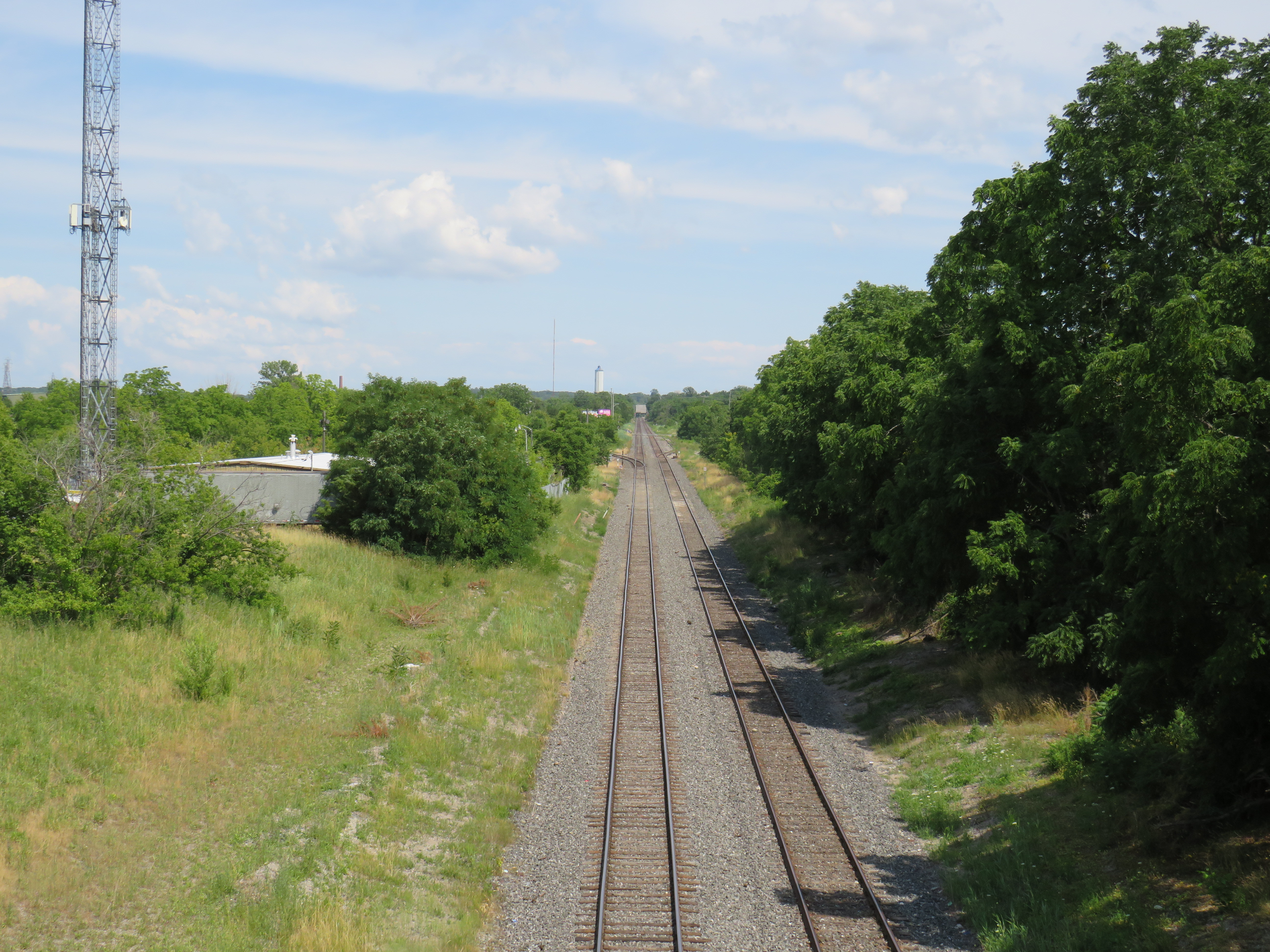
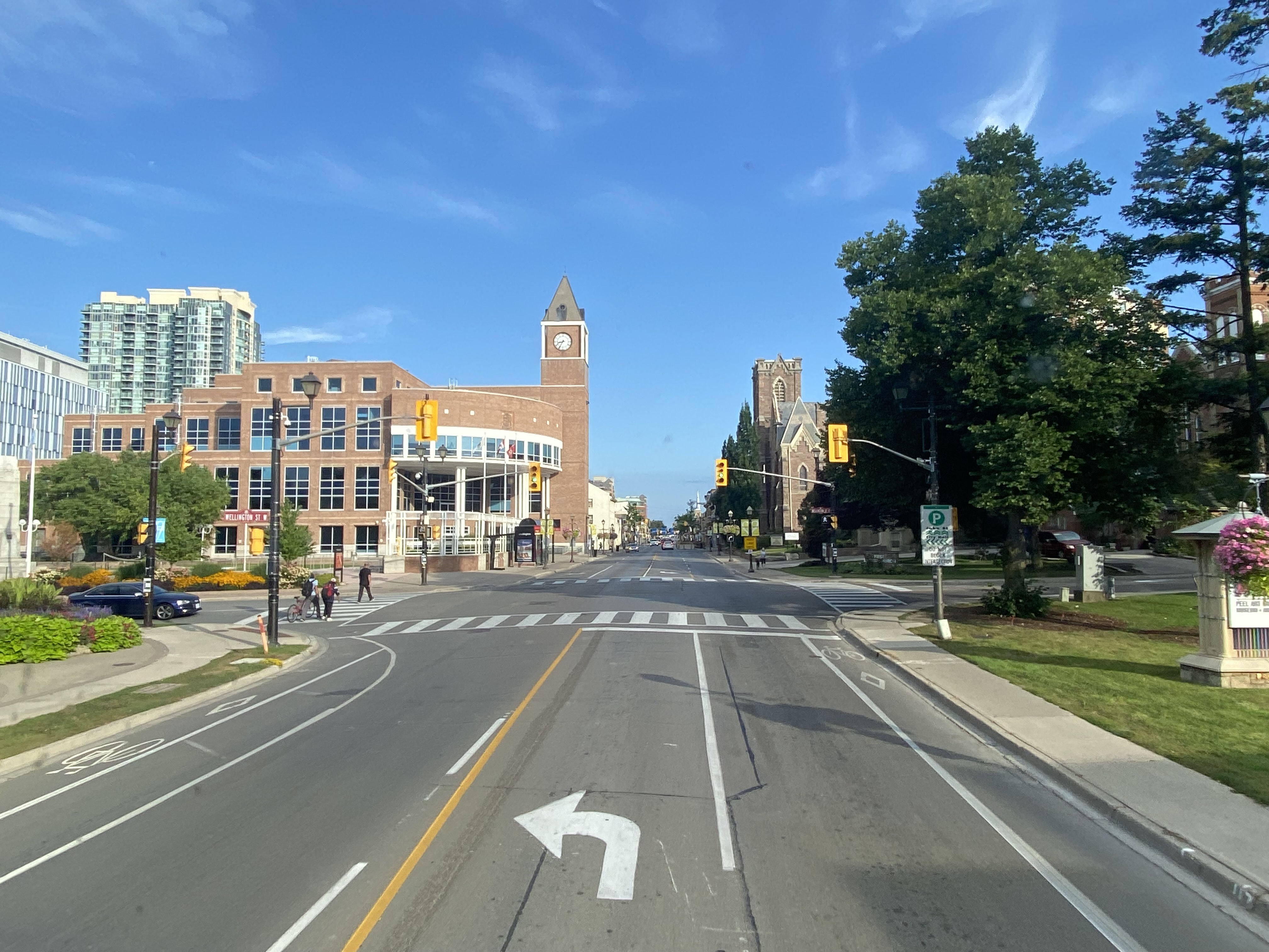
Looking east on the CN mainline from Merritt Street in St. Catharines towards the Welland Canal
The case for reviving Merritton Station
On the morning of Saturday, July 9, a GO Transit train filled with hundreds of passengers heading from Toronto to Niagara Falls, was stuck at St. Catharines when a lift bridge over the Welland Canal was unable to lower the deck to allow trains to pass.
After over an hour of holding at the St. Catharines VIA Station, GO Transit was forced to send the train back to Toronto. In an advisory on Twitter, GO informed customers that they “will need to make their own accommodations” for getting between St. Catharines and Niagara Falls, and would not be sending any shuttle buses.
Until further notice, due to a problem with the Seaway Bridge not coming down, all Niagara Falls train trips must start and finish at St. Catharines GO (VIA station). Any customers looking to make their way to or from Niagara Falls GO, will need to make their own accommodations. pic.twitter.com/E2UmphCy1E
— Lakeshore West Train (@GOtransitLW) July 9, 2022
Needless to say, this left many families disappointed. With GO Transit understandably unable to muster enough buses on a summer weekend to quickly transfer 1500 passengers (which would require at least 25 coaches), the decision not to provide alternate transportation is understandable, if unfortunate.
The summer weekend Toronto-Niagara train service is incredibly popular, especially the Saturday and Sunday morning departures from Union Station, and the evening return trip. Specially-outfitted bicycle coaches allow for dozens of bicycles to be transported by train; Niagara Region is an excellent cycling destination.
Recent fare innovations, including the $10 weekend day pass and a special GO Transit-Niagara Parks package have only contributed to the route’s success. As GO Transit is able to carry 1500 passengers on each train between Toronto and Niagara, it is invaluable not only for supporting the local tourism industry, it provides an alternative to driving on the congested Queen Elizabeth Way.
Unfortunately, the CN Grimsby Subdivision, which runs between Hamilton and Niagara Falls, is hardly ideal for frequent commuter and excursion service. Trains crawl through Hamilton, and much of the line is single-tracked, limiting capacity. Furthermore, trains to and from Niagara must back in to Hamilton’s West Harbour GO Station, which still does not have a direct connecting track to the east.
But the Welland Canal lift bridge is the greatest barrier for providing frequent and reliable rail service to Niagara Falls. During the Great Lakes shipping season, train traffic must yield to the busy St. Lawrence Seaway. Constructing a bridge or a tunnel is difficult and costly as railways are limited to typically no more than a 2% grade, and the freighters require a high clearance (as evident with the nearby QEW Garden City Skyway). Constructing a tunnel is also difficult, as the railway begins climbing the Niagara Escarpment just east of the canal, and would need to climb an even longer distance from canal. (A railway tunnel south of Welland has no such constraints as it is well above the escarpment.)
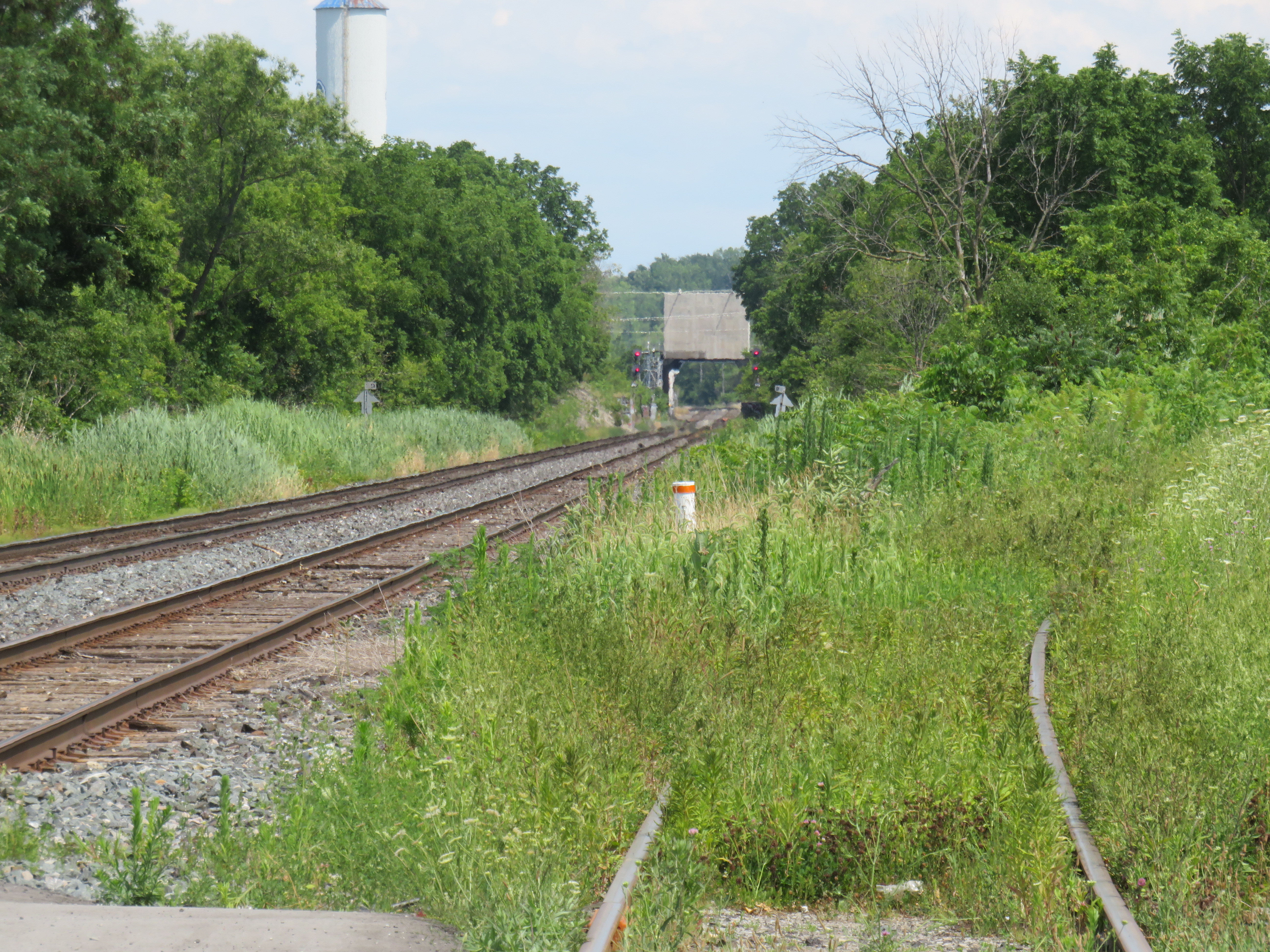
Looking east towards the Welland Canal lift bridge from Glendale Avenue. The disused CN Thorold Spur disappears into the weeds at right.
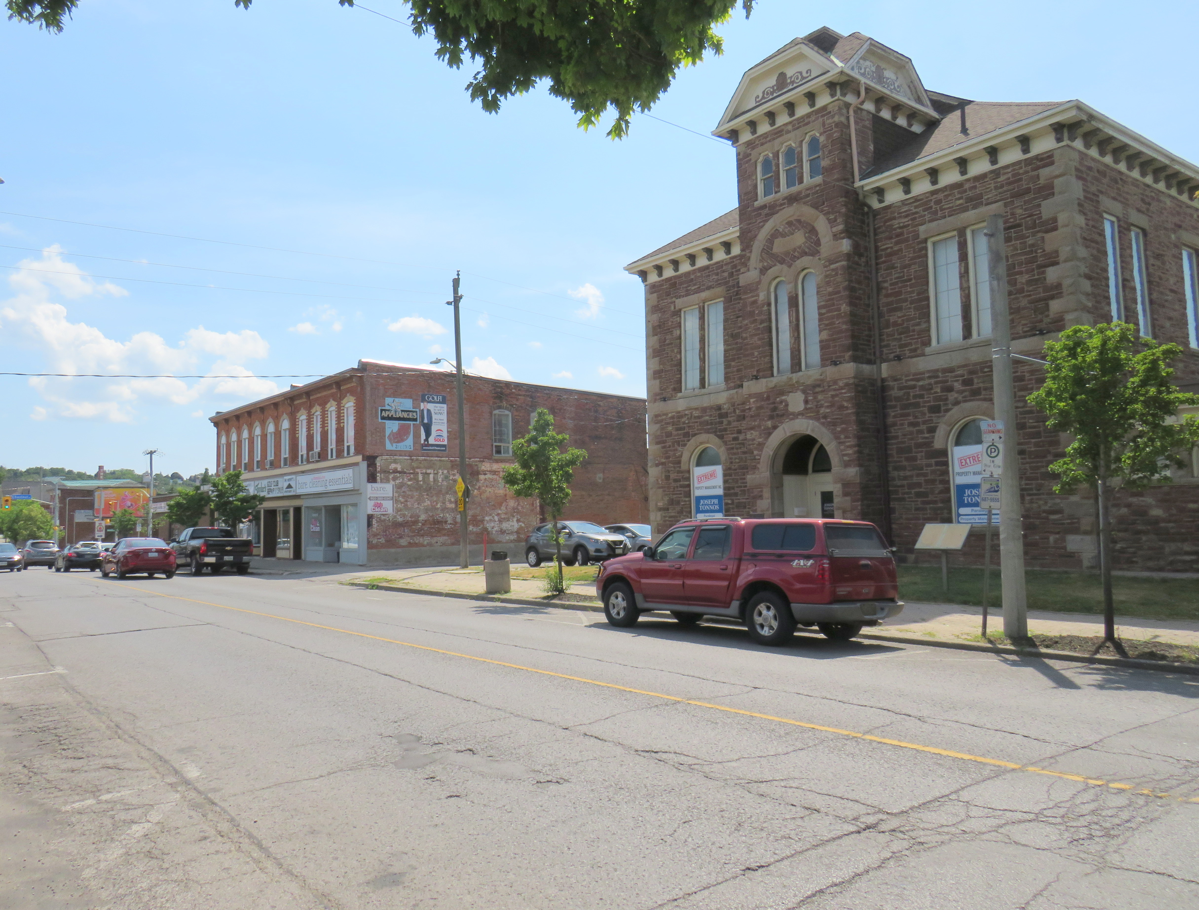
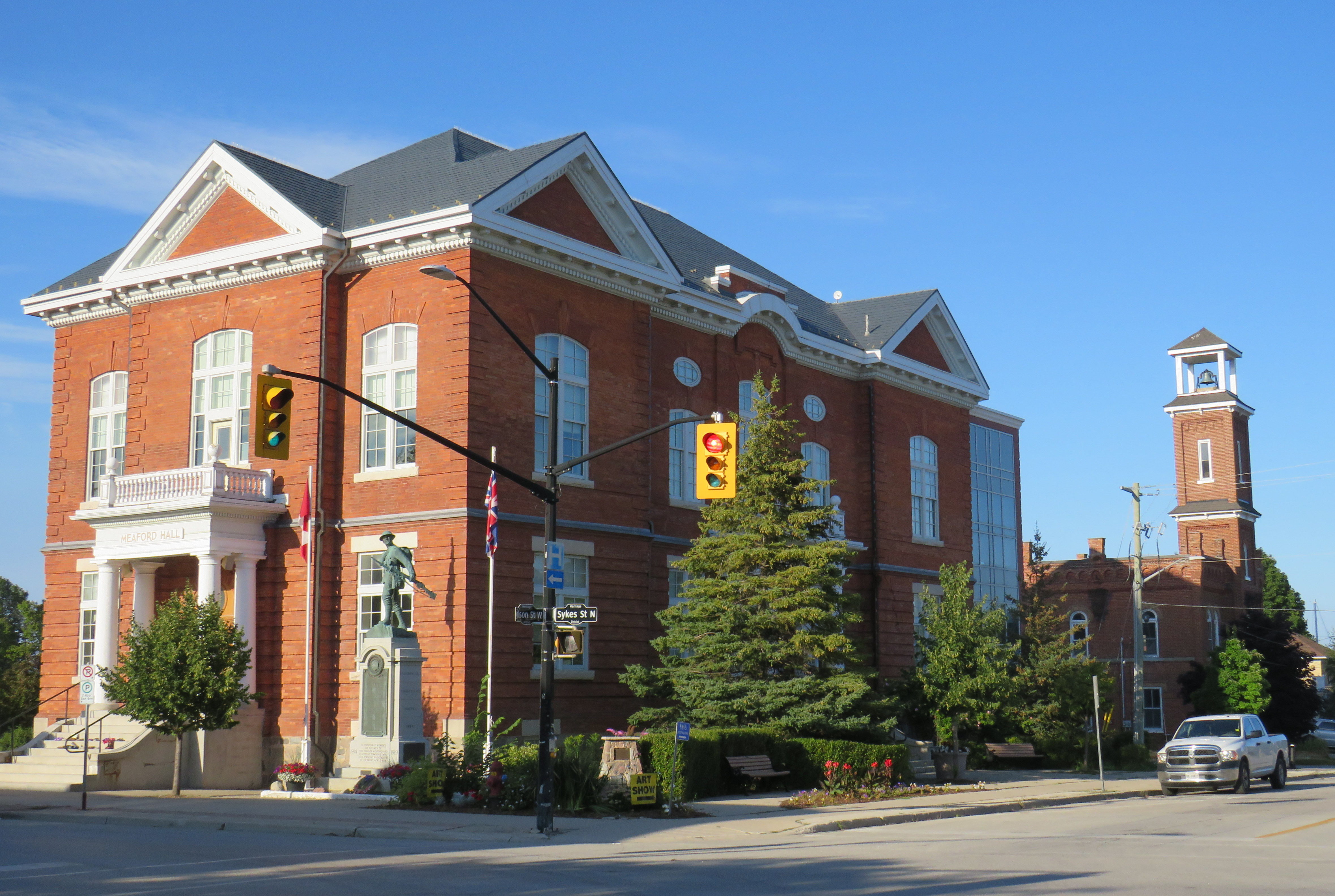
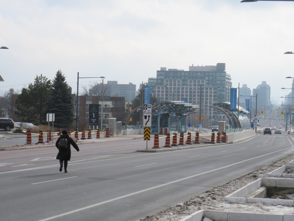
As a short-to-medium term measure, Metrolinx should look at constructing a new station at Merritton, located southeast of Downtown St. Catharines and approximately three kilometres east of St. Catharines Station. Until 1961, Merritton was an independent town, an industrial centre served by both the Grand Trunk/CN and the electric Niagara, St. Catharines and Toronto Railway. With amalgamation with St. Catharines, the closure of the passenger railway stations, and the loss of the historic paper and textile mills, Merritt Street has seen better days.
Merritt Street, just south of the CN Railway. The stone building at right is the former town hall.
Merritton’s CN Station was located on the east side of Merritt Street. Passenger service ended by the 1960s, and industrial switching activity between the former NS&T and CN’s Thorold spur line declined, so the building was eventually abandoned. It burned down in 1994, and there is little trace of its existence.
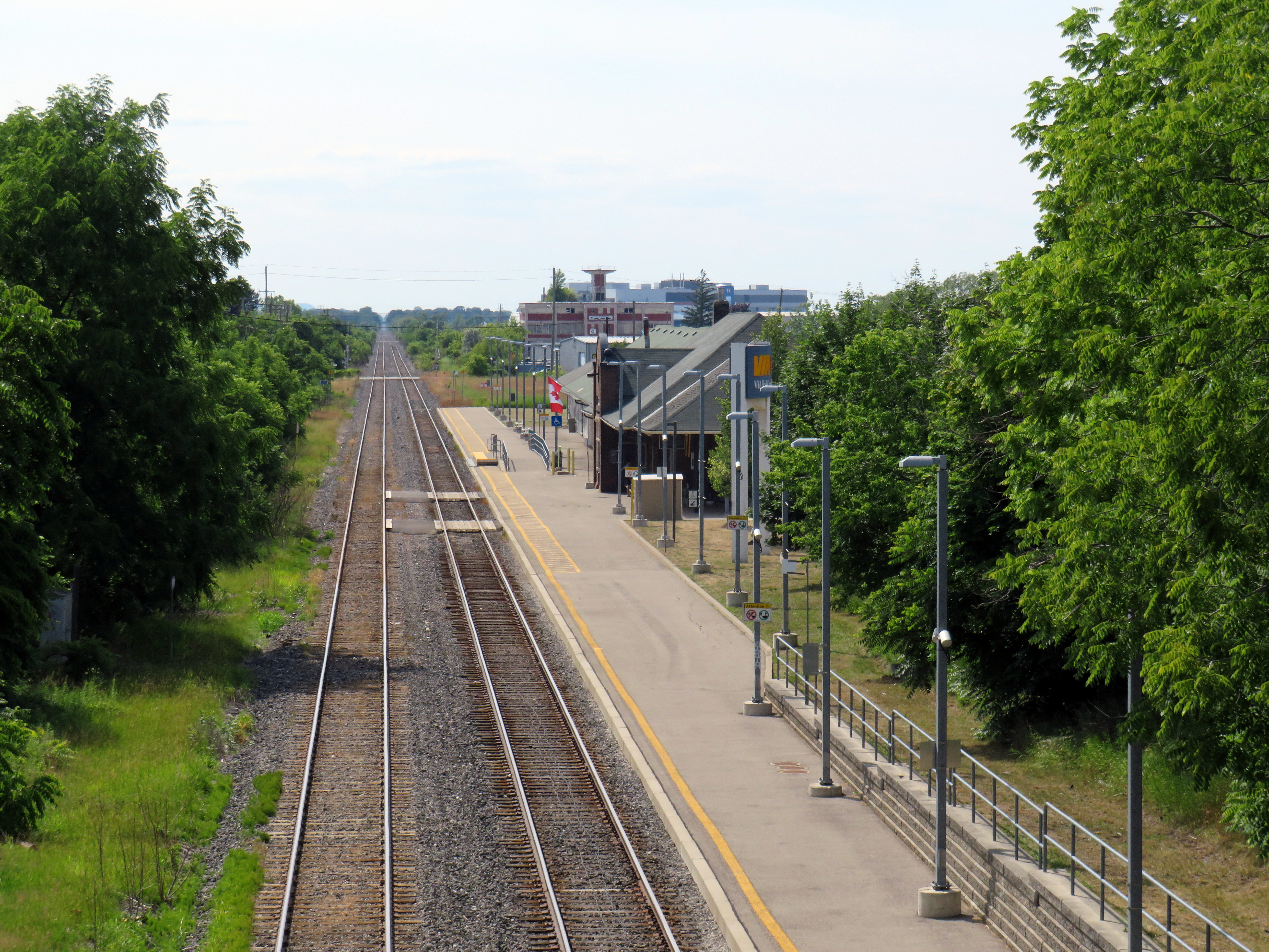
Unlike the active VIA station on the west side of St. Catharines, Merritton is quite close to the Welland Canal and the Niagara Circle Route. Merritt Trail, which follows the original Welland Canal route, is within a short walk from Merritton. It is also much easier for buses arriving from Niagara-On-The-Lake, Thorold, and Niagara Falls to access a station site at Merritton than the awkwardly-located St. Catharines Station, with four to five minutes saved, especially if there were direct access from Glendale Avenue.
St. Catharines VIA/GO Station, off of St. Paul Street West. Awkwardly located for bus access, the station platform is a 25 minute walk to Downtown St. Catharines.
Not too far from Merritton is St. Catharines Museum and Lock 3 Centre, which tells the history of the region and the Welland Canal; a platform provides excellent views of passing ships. Niagara College and the Outlet Collection are also close by, via Glendale Avenue. Whenever there’s a delay or failure at the lift bridge, there are more options at Merritton, especially if a proper bus transfer point is constructed.
Ideally, a grade-separated Welland Canal crossing would become an integral part of a frequent Toronto-Hamilton-Niagara-Bufffalo rail service. In the meantime, a stop at Merritton for GO commuter and excursion trains would provide new transit and cycling connections, while serving passengers in eastern St. Catharines, Niagara-on-the-Lake, and Thorold.
St. Catharines: where the Bruce Trail is at its least Bruce Trail-ish
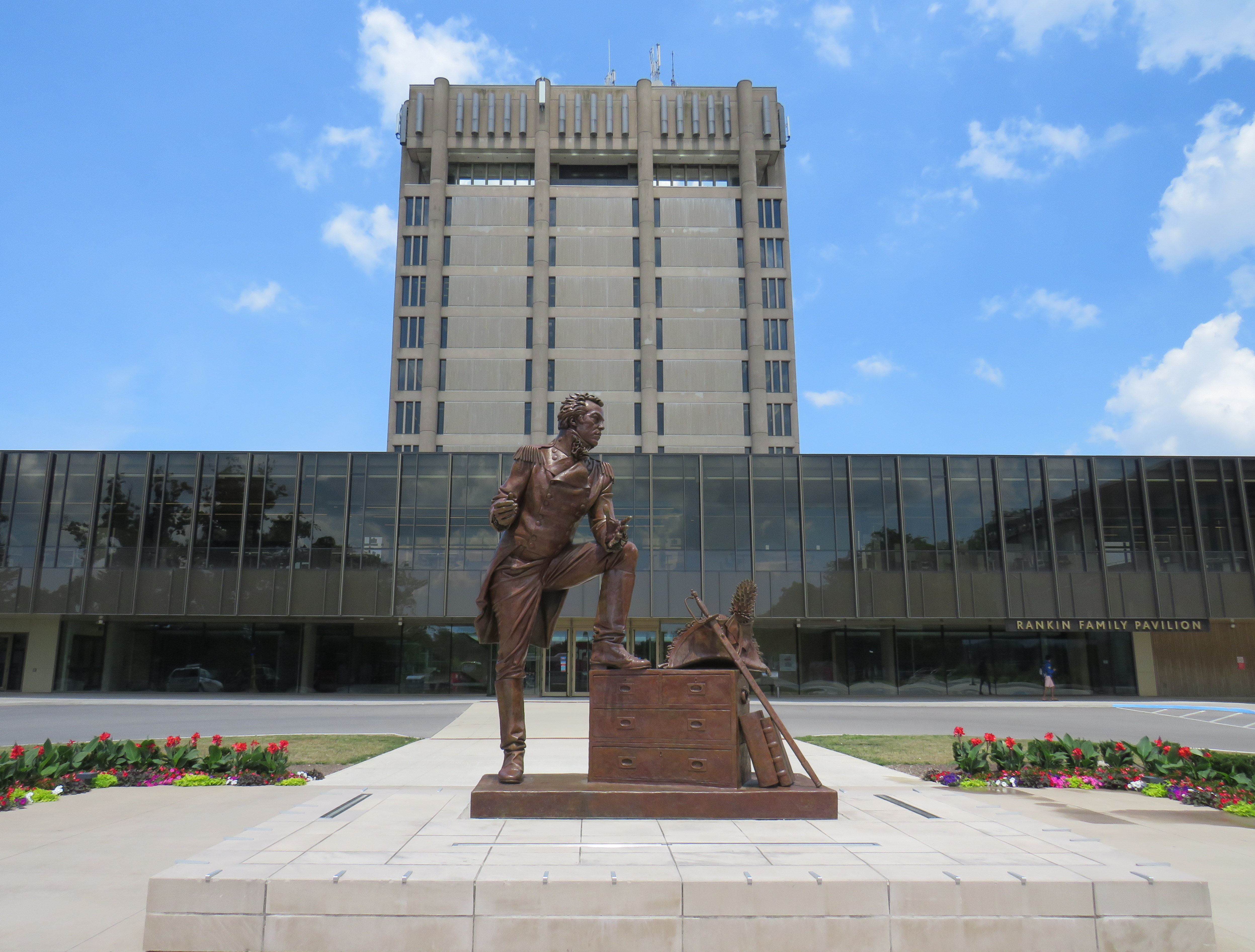
I travelled to St. Catharines on a lovely July Friday, taking GO Transit’s Route 18K bus from Aldershot Station through Hamilton, along the QEW, and to Brock University in St. Catharines. The university campus is at the top of the Niagara Escarpment, boasting direct connections with the Bruce Trail.
Statue of General Brock at the main university entrance
The walk eastwards towards Merritton from Brock University started out promising. The thick tree cover provided welcome shade, and apart from a rather dangerous crossing of Glenridge Avenue, felt little different than anywhere else on the southern part of the famous trail.
A promising startBeing watched by a young red-tailed hawk
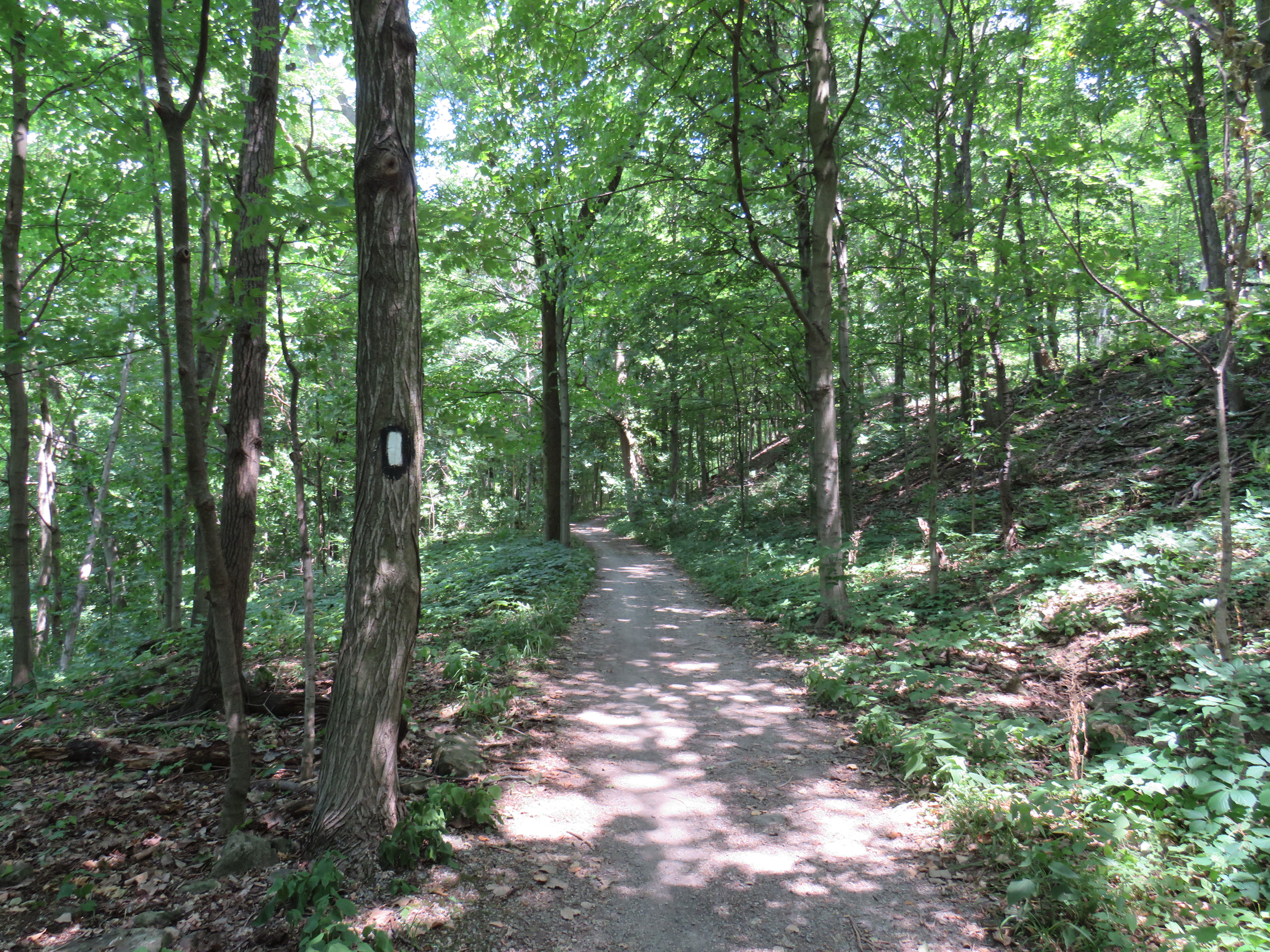
At Tremont Drive, the trail suddenly enters a subdivision, with only the tell-tale white blazers to assure hikers that yes, in fact, this is part of the Bruce Trail.
Bruce Trail blazers are the only hint that this is part of Ontario’s greatest hiking trail
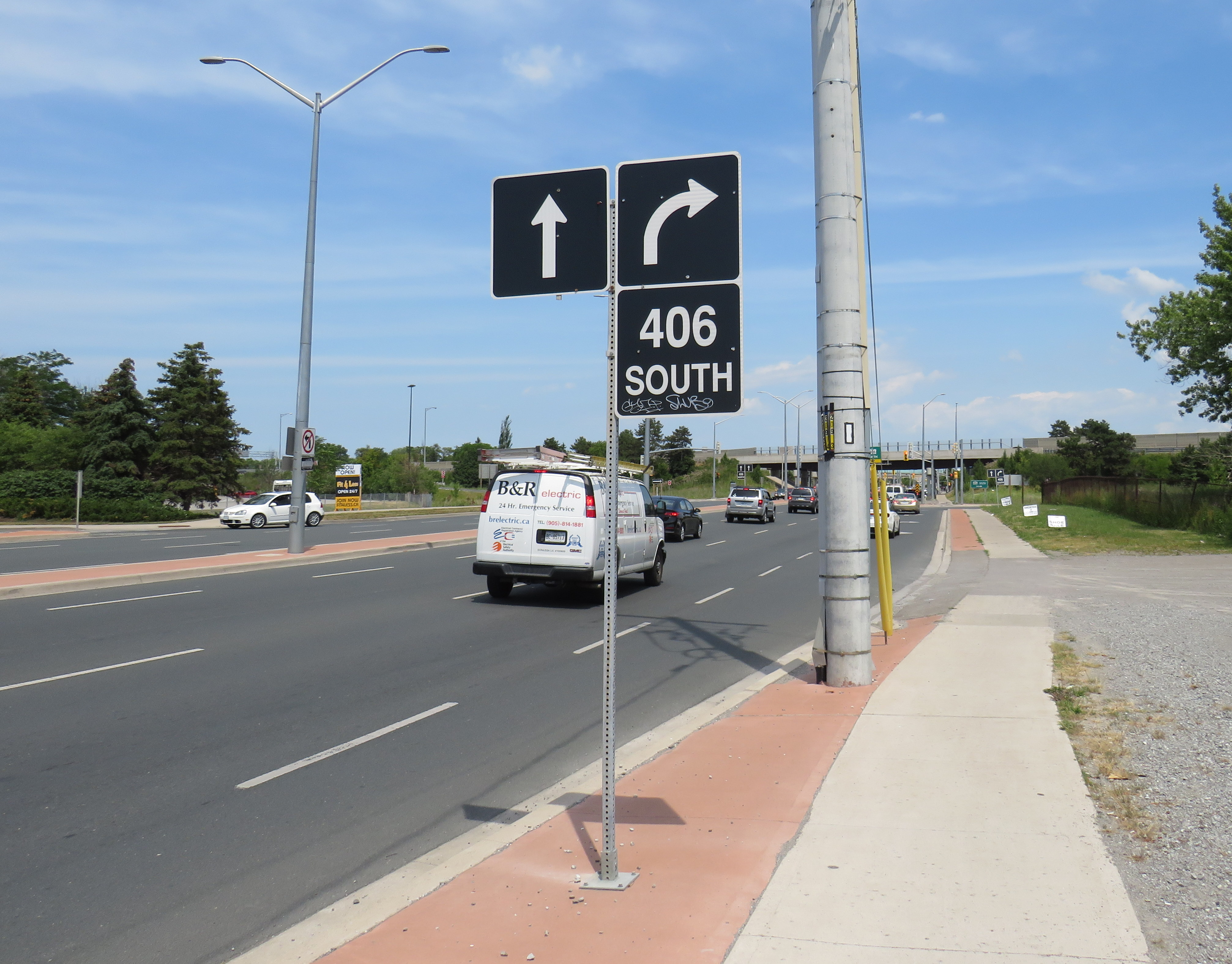
The trail continues to busy Glendale Avenue, and crosses Highway 406 at the interchange. At each traffic light, pedestrians are required to press the “beg button” to get a walk signal, even if one is crossing in the same direction as the through traffic. In most other places, the walk signal comes on automatically in conjunction with the dominant traffic flow.
Though the Bruce Trail also passes through Hamilton, a city nearly four times the size of St. Catharines, the trail there manages to remain separated from traffic and even from the city as a whole, much like Toronto’s ravine park systems.
Glendale Avenue at Highway 406: the lowpoint of the 900 kilometres of Bruce Trail
On Saturday, my spouse and I decided to take advantage of the GO Transit weekend day pass and take the train to Hamilton for a short excursion. We did some shopping on James Street North in Downtown Hamilton and on Ottawa Street in the city’s east end, where there’s a great cluster of fabric, decor, and antique shops, as well as cafes and restaurants.
The new weekend passes, which cost $10 for one day and $15 for two days, have been a major contributor to GO Transit’s ridership recovery. Though weekend ridership has recovered to 90 percent of pre-pandemic levels (despite lower service levels on many routes), weekday ridership is only half of what it was in 2019.
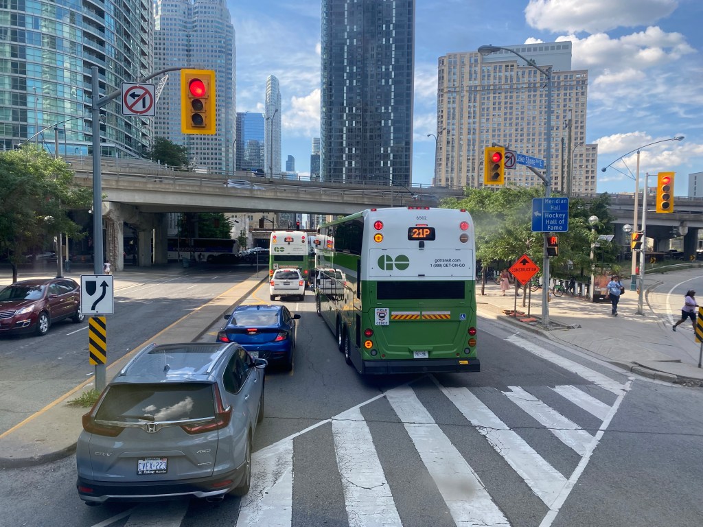
On our return trip to Toronto, we decided to take the Route 16 express bus, departing from Hamilton GO Centre at 3:30. As the train between Union and Hamilton’s West Harbour Stations runs only every hour, it seemed that the express bus to Union Station would be the fastest and most convenient option. How wrong we were.
A line of GO buses attempting to turn left from Lake Shore Boulevard to Yonge Street
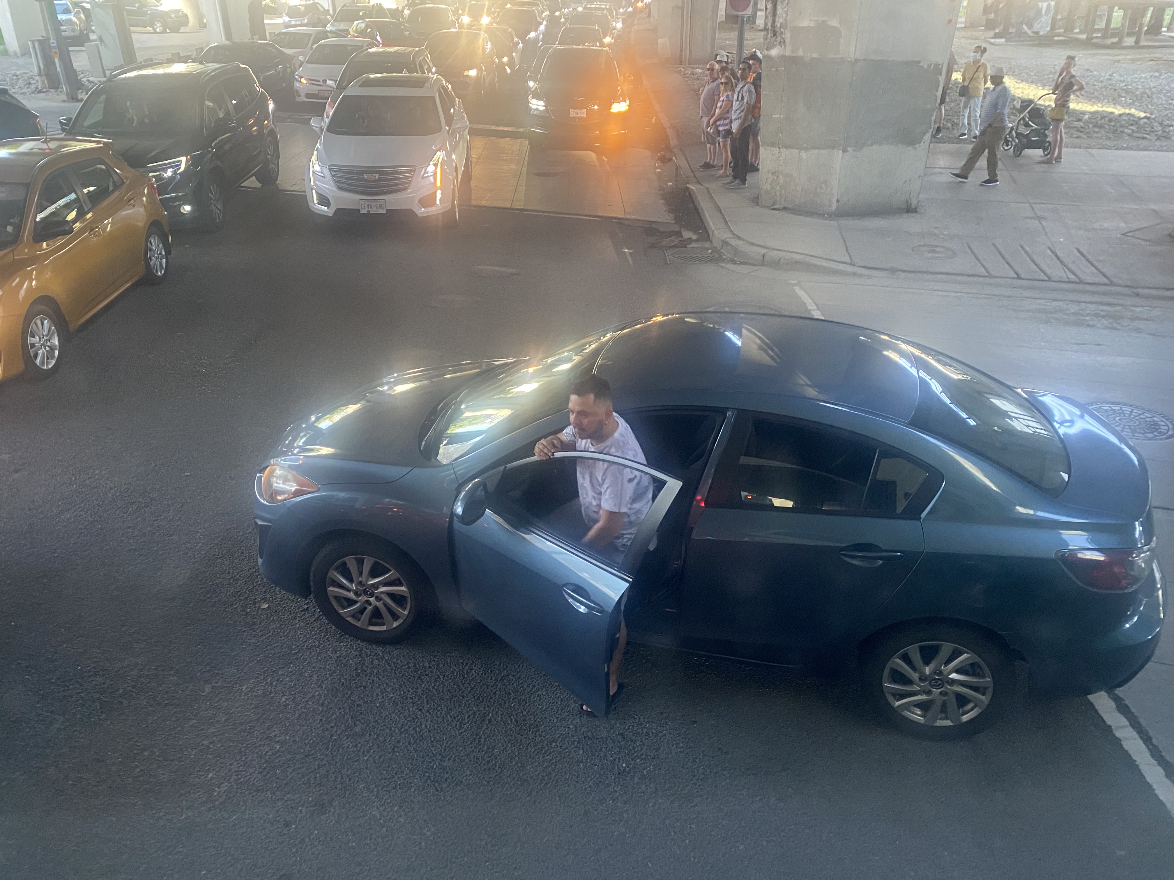
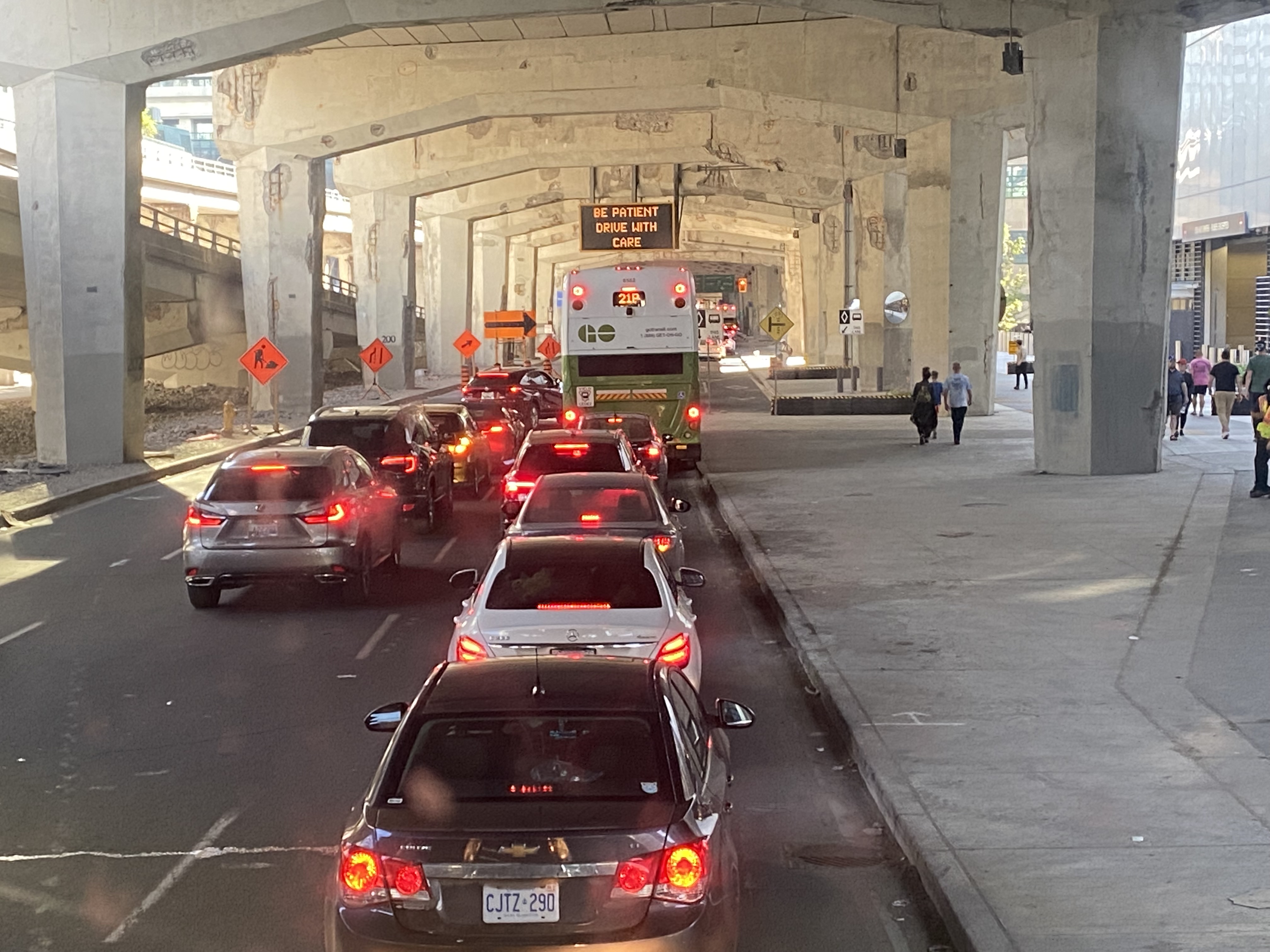
As we were among the first to board the double-decker bus, we had front row seats to Toronto’s Carmageddon.
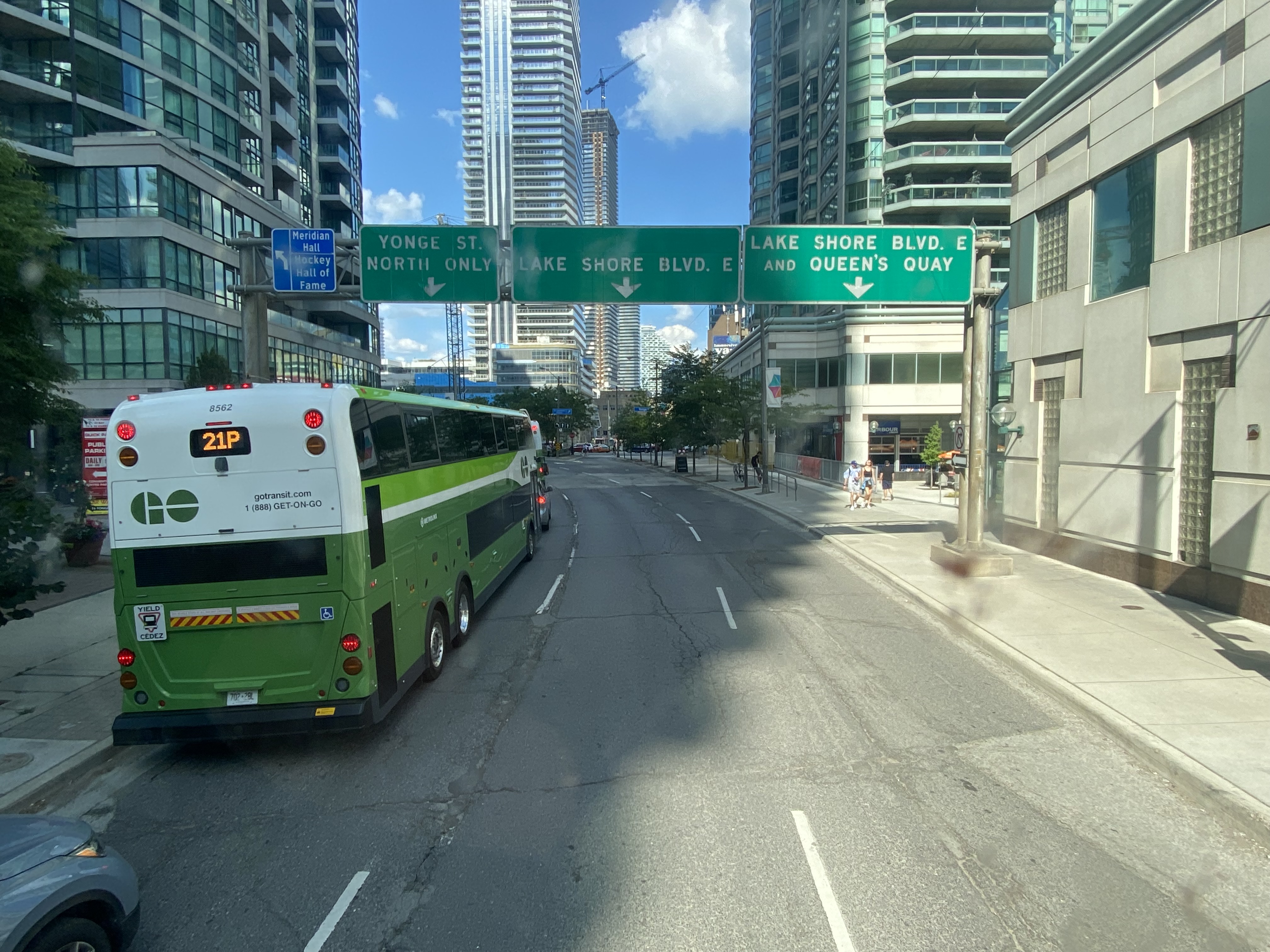
Despite it being a beautiful afternoon on the long weekend, the ride on Highway 403, the Queen Elizabeth Way, and the Gardiner Expressway was uneventful, with only a few spots where traffic moved slowly. Until the bus got off the York-Bay-Yonge ramp, we were making decent time. That is when we were confronted with a long line of cars and trucks, all trying to turn north on York, Bay, and Yonge Streets.
The new Union Station Bus Terminal, located on the north side of the westbound Lake Shore Boulevard lanes, requires buses coming from the west to turn left on to Yonge Street from eastbound Lake Shore, and then turn left again onto westbound Lakeshore before turning right into the terminal itself.
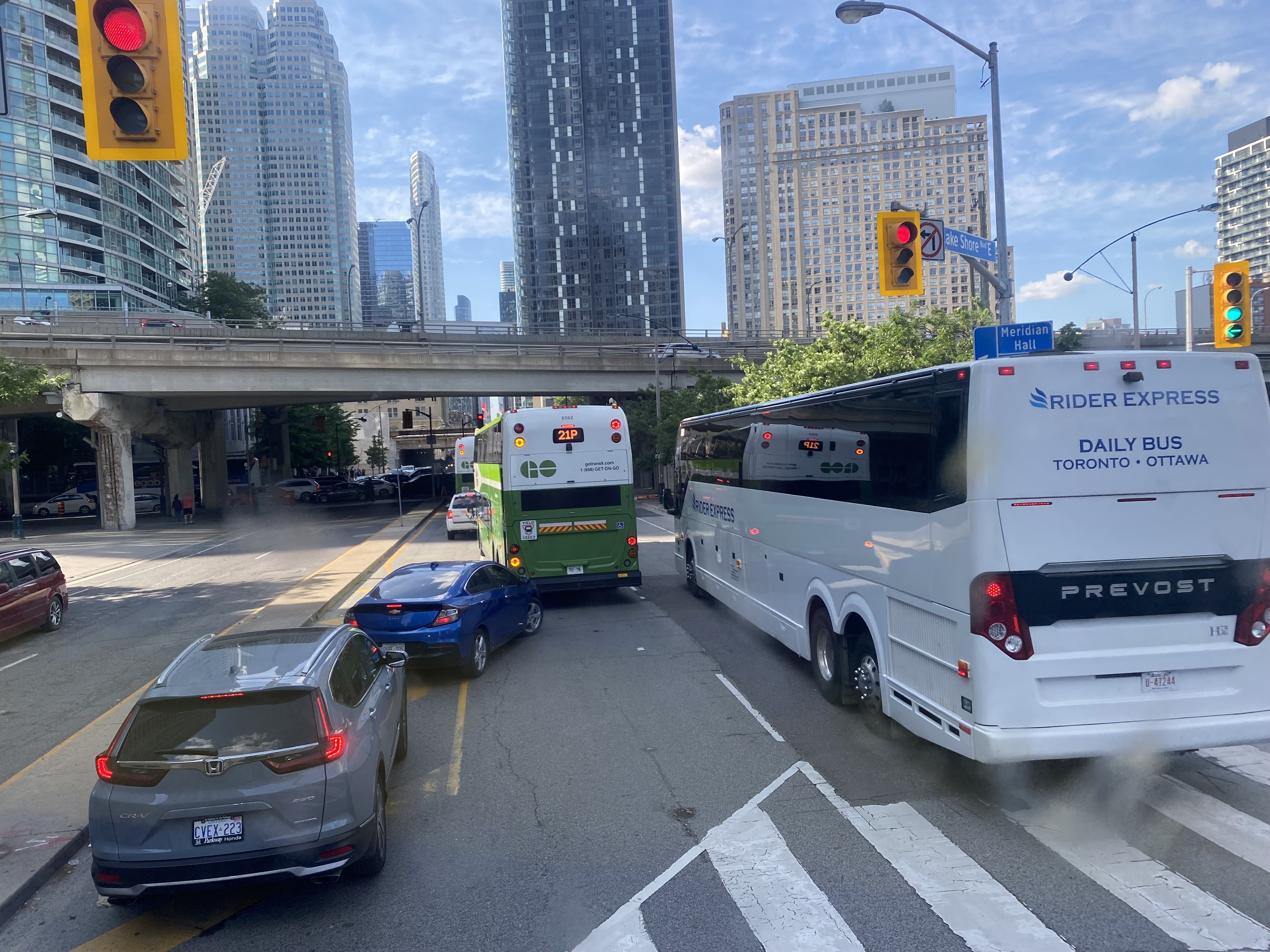
After finally turning north from eastbound Lake Shore Boulevard, private vehicles, a Rider Express bus, and GO Transit buses attempt to turn left onto a gridlocked westbound Lake Shore Boulevard
But with construction obstructing two westbound lanes of Lake Shore at Bay Street, drivers leaving the first of two Blue Jays games that afternoon (a rare doubleheader hosting the Tampa Bay Rays), and other drivers arriving for the evening Jays game, an Eric Church concert at Scotiabank Arena, along with the usual weekend traffic, traffic could not move, creating literal gridlock. Police or traffic wardens that could monitor and manage the gridlock were nowhere to be seen.
Motorists jam the intersection of Lake Shore Boulevard West and Yonge StreetOne driver expresses his frustration with the traffic
At 5:50, 2 hours and 20 minutes after the bus departed Hamilton GO Centre, we were let out on the curb outside the terminal entrance. In response to the backlog of buses attempting to enter and exit the Union Station terminal, GO cut back the Route 16, meeting the half-hourly Lakeshore West train service at Aldershot Station (one stop short of West Harbour). Several Route 16, 21, and 31 trips were cancelled due to the traffic in the downtown core, requiring some customers in places like Milton and Georgetown to wait an entire hour for the next bus.
After similar gridlock conditions on Sunday, July 3, Route 21 (Milton Corridor) and Route 31 (Kitchener Corridor) buses were rerouted to Port Credit GO, requiring a transfer to trains there.
Route 21 and 31 GO buses will begin and end at Port Credit GO due to heavy traffic into Toronto. Regular LSW train service will run between Port Credit and Union. Click https://t.co/QEMf9GRLsf for more into.
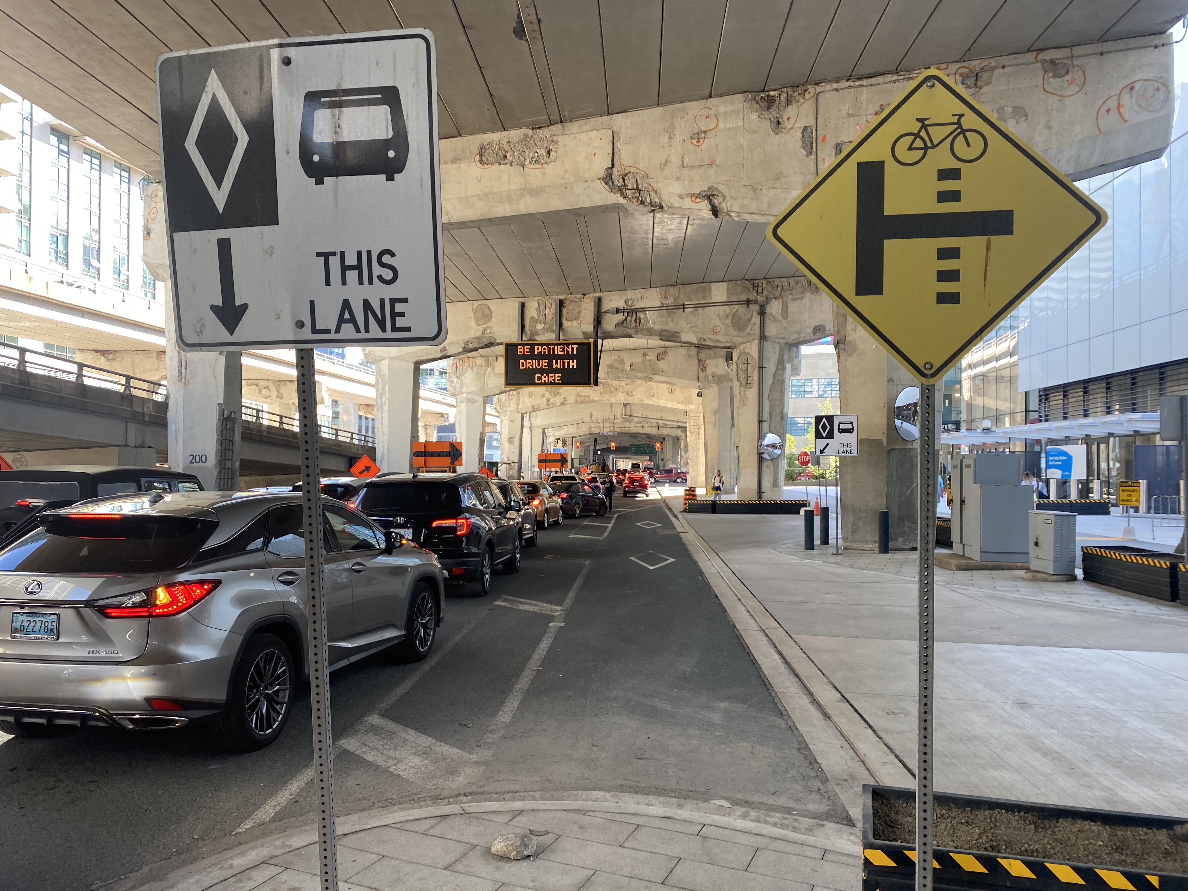
The new terminal’s location is excellent for consolidating all intercity bus and rail services and is much safer than the old Union Station Terminal or the dilapidated Metro Toronto Coach Terminal at Bay and Dundas Streets. Direct, indoor connections can be made with the subway, several hotels, Scotiabank Arena, and to the vast PATH system of underground walkways. Its major failure, however, is the lack of dedicated bus lanes to speed highway coaches in and out of the facility.
On Lake Shore Boulevard. The bus entrance to the Union Station terminal is at right
There is an exceptionally wide sidewalk on the north side of Lake Shore approaching the bus entrance to the terminal, and an extremely short bus lane in front of the terminal’s entrance and exit. It is no wonder why some private coach operators, such as FlixBus and Onex, opt for on-street stops, rather than the terminal used by GO, Megabus, Rider Express, TOK, and Ontario Northland.
Toronto’s shortest and least-effective bus lane, in front of the Union Station Bus Terminal. Note the sign reading “be patient – drive with care” above.
A dedicated bus lane for the entire distance between Yonge and Bay Streets would undoubtedly improve operations. A dedicated left turn lane from Yonge to westbound Lakeshore would also allow easier access to the terminal from the west, where the majority of GO and intercity coach buses arrive from. Similar dedicated left turn lanes at Queen Street and Central Park Drive in Brampton allow Brampton Transit buses to quickly enter and exit the Bramalea Terminal. Better traffic management, including police enforcement, would help ensure a clear path for transit and coach buses.
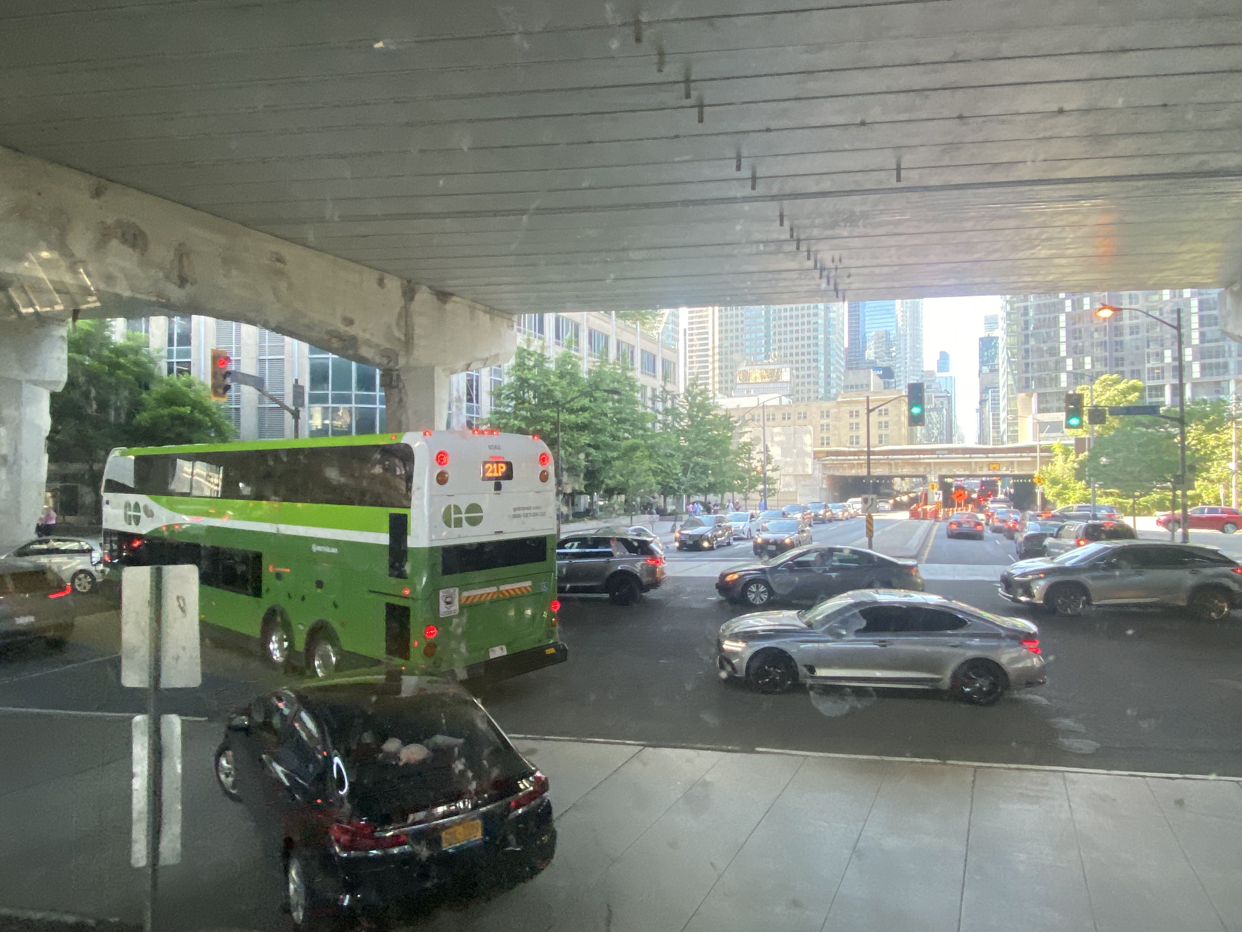
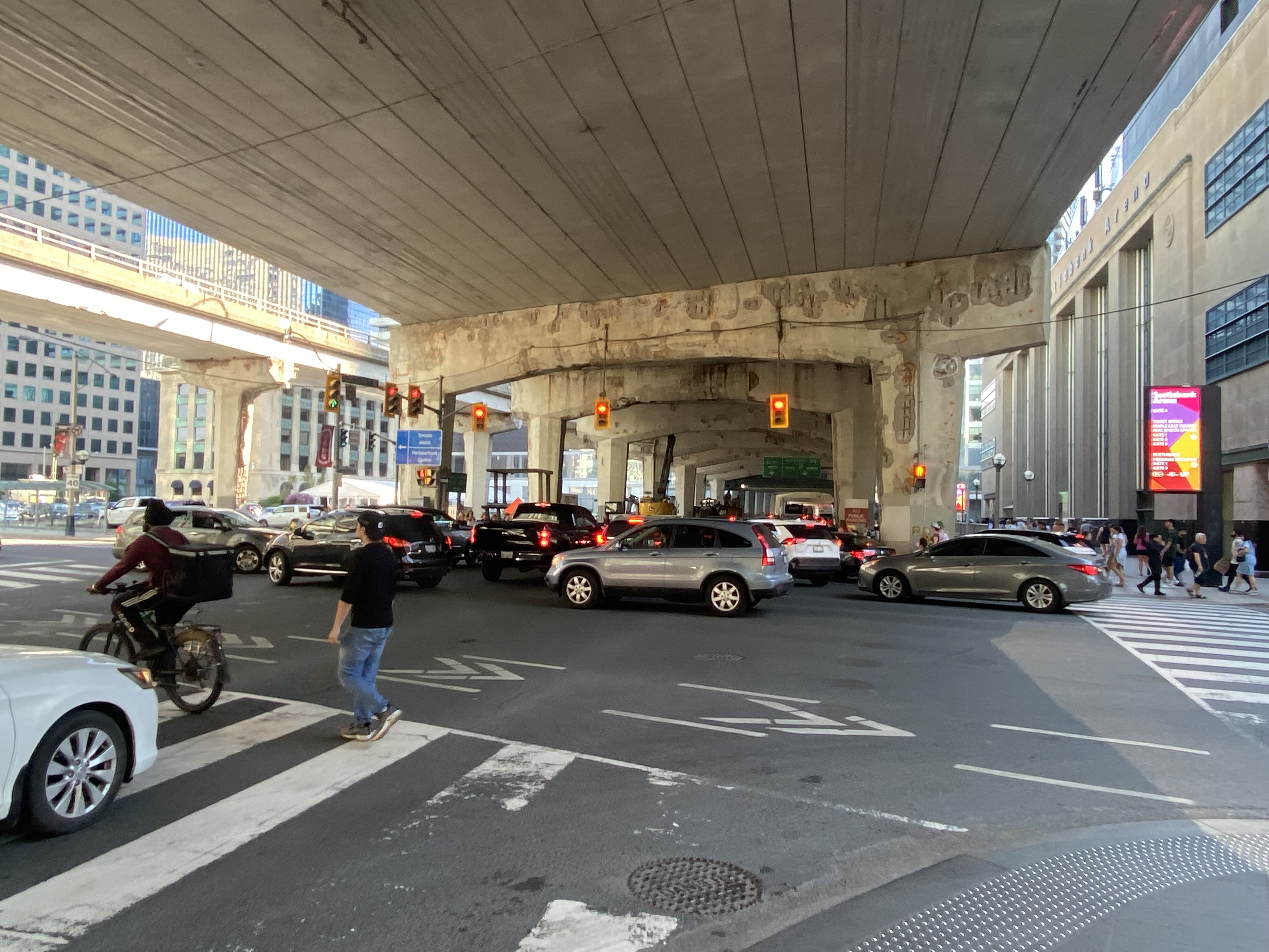
The gridlock continued west of Bay Street, as motorists lined up to get to the Gardiner Expressway or go west on Lake Shore Boulevard
GO Transit’s reaction, to reroute buses to the already-crowded Lakeshore West Train, is not a sustainable solution, though it is the only effective tool it has at the moment. Though Route 16 passengers are not taken far out of their way with a transfer at Aldershot GO, the detour is more onerous for some Route 21 and all Route 31 passengers forced to backtrack to Port Credit GO for a forced transfer there.
Stouffville and Barrie Corridor passengers were spared the hassles with the return of weekend train service earlier this year. Unfortunately, Canadian Pacific’s control of almost the entirety of the Milton Corridor precludes midday, evening, and weekend train service, but there’s an opportunity to finally bring limited weekend train service to the Kitchener Corridor. GO Transit already offers an hourly midday and evening weekday train service to Mount Pleasant Station in Brampton, despite CN’s control of the corridor west of Bramalea Station.
Track improvements completed nearly 20 years ago (an additional track between Bramalea and Mount Pleasant and a second platform at Brampton GO Station) provides the capacity for hourly GO trains and CN’s freight operations. Weekend Route 30 bus service between Kitchener and Bramalea can provide a reasonable and reliable bus link until corridor improvements, such as new passing tracks, are completed between Georgetown and Kitchener.
As I was sitting in traffic for an hour, I found myself aggravated once again by Blue Jays CEO Mark Shapiro lobbying the city to end the Sunday closure of Lake Shore Boulevard West to allow for the city’s (much-diminished) Active TO program. In a letter addressed to Mayor John Tory, General Manager of Transportation Services Barbara Gray, and the city clerk, Shapiro argued that “removing one of the only ways into and out of the downtown core would be extremely challenging to our fans” claiming that “on the days when Active TO has been in effect on Lake Shore, our local fans have experienced significant transit delays because traffic is grinded to a halt on all downtown routes.” (It is worth noting that the Toronto Blue Jays baseball club is a wholly-owned subsidiary of Rogers Communications. The mayor of Toronto, a former Rogers executive, remains involved with the Rogers family trust.)
The Lake Shore closure allowed cyclists and runners to bypass the overcrowded Martin Goodman Trail along Toronto’s Western Beaches, on a section of roadway paralleled by GO Transit’s Lakeshore Corridor. The traffic congestion last weekend was completely unrelated to ActiveTO (which is now suspended on Lake Shore Boulevard, partly due to Shaprio’s lobbying) and transit riders, who make up a large percentage of the Blue Jays’ fanbase, were left in the mess that motorists made.
On Monday, February 14, Premier Doug Ford, Transportation Minister Carolyn Mulroney, and Mississauga Mayor Bonnie Crombie attended a photo-op at Cooksville GO Station to announce a new name for a transit project. With former mayor Hazel McCallion in attendance (who was celebrating her 101th birthday), it was no secret what the new name was going to be.
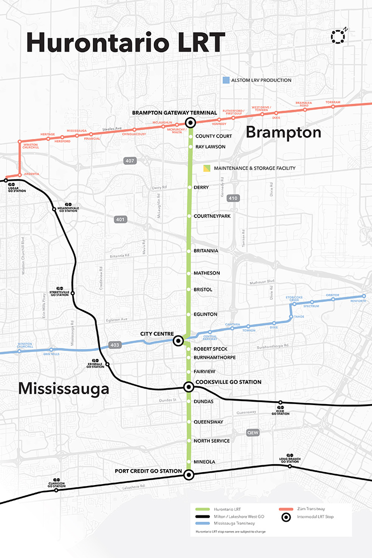
It was disappointing that the Hurontario LRT, a provincially-funded transit project operating within Brampton and Mississauga and intended to be part of a regional transportation network, would be named for a divisive former mayor of only one of the two cities the Hurontario LRT is supposed to directly benefit.
In North America, and around the world, transit lines and stations are named (with a few misguided exceptions) to reflect the geography of the route it represents and to provide optimal wayfinding, especially to visitors and people new to transit. In Greater Toronto, bus, streetcar, commuter rail and subway routes are named based on the major street they run on (the 501 Queen Streetcar or Line 4 Sheppard), the neighbourhood they serve (the 56 Leaside bus) or the destination it runs to (the GO Milton Line or 900 Airport Express).
Even new projects follow these conventions. The Crosstown LRT, which operates under and along Eglinton Avenue, is a crosstown route across the middle of the city. Even the Ontario Line partially gets its name from its two end points (Exhibition Place/Ontario Place and Ontario Science Centre). The Hurontario LRT reflected the name of the main street it operates along, even if it changes its name briefly though central Brampton.
The “Hazel McCallion Line” does not accomplish any of these goals.
Given Peel Region’s diverse population of over 1.4 million residents, it is also disappointing that a major project intended to unite the region is named for an affluent white public figure that already has two libraries, a public school and a college campus already bearing her name.
I suspect Premier Ford wanted to celebrate a political ally a few months before the next provincial election, but naming the Hurontario LRT after Hazel McCallion sends the wrong message.
Post script: The Hurontario Line may not be the only Metrolinx transit facility that will see its name change. In a MERX posting dated February 15, 2022, Metrolinx is looking for Expressions of Interest for station naming rights opportunities for at least four existing GO Transit rail stations. The summary is quoted below:
Expression of Interest
Expression of Interest No. RFI-2021-CCMX-097
Metrolinx is accepting Expressions of Interest for Station Naming Rights Opportunity.
Metrolinx is an agency of the Government of Ontario, overseeing GO Transit, PRESTO, and UP Express. We are embarking on a massive transformation of the GO Rail network – the backbone of regional rapid transit in the region – to give customers a faster, more convenient way to connect with the things that matter.
Metrolinx is seeking proposals from interested parties in any category for the Station Naming Rights Opportunity at the following stations:
Whitby GO Station Exhibition GO Station Clarkson GO Station Oakville GO Station
Metrolinx will consider proposals for other stations not listed here at the request of interested parties.
For more information about the GO Transit network and stations, please visit www.gotransit.com. We are committed to working together to create a partnership that will meet shared objectives, such as increase revenue, increase market share for our partners and provide a positive customer experience on public transit.
All four stations listed are on the Lakeshore Line, the backbone of the GO Transit rail network. Exhibition GO could be especially attractive for renaming, as it will become a major hub with the future connection to the Ontario Line and local TTC services. It is also worth noting that Metrolinx will entertain proposals for additional stations in the bid process.
It is hard to blame Metrolinx for these specific transit naming decisions; it is very likely that the Ford government demanded the McCallion Line and is pushing for the sell-off of naming rights. But it is ironic that after hiring consultants and going though a complex naming process for the Crosstown LRT, that previously held principles are quickly abandoned at the whim of Metrolinx’s superiors.
The Metrolinx parking lot at Elizabeth and Railroad Street is nearly complete
Over the last few years, I have followed the purchase and demolition of over a dozen houses in Downtown Brampton, in the block bounded by George, Nelson, Elizabeth, and Railroad Streets. Metrolinx, the provincial transit planning and operating agency, acquired the block for a new surface parking lot for the neighbouring GO Transit station.
At first, the parking lot was intended to replace parking spaces lost due to construction of a new post-secondary education campus — a joint venture between Ryerson University and Sheridan College — on the main GO Station lands. Though the provincial government pulled funding for the campus in the fall of 2018, Metrolinx continued work on the parking lot, completing the demolition, clearing the land, and building the parking area.
Now, it is possible that the parking lot will never open.
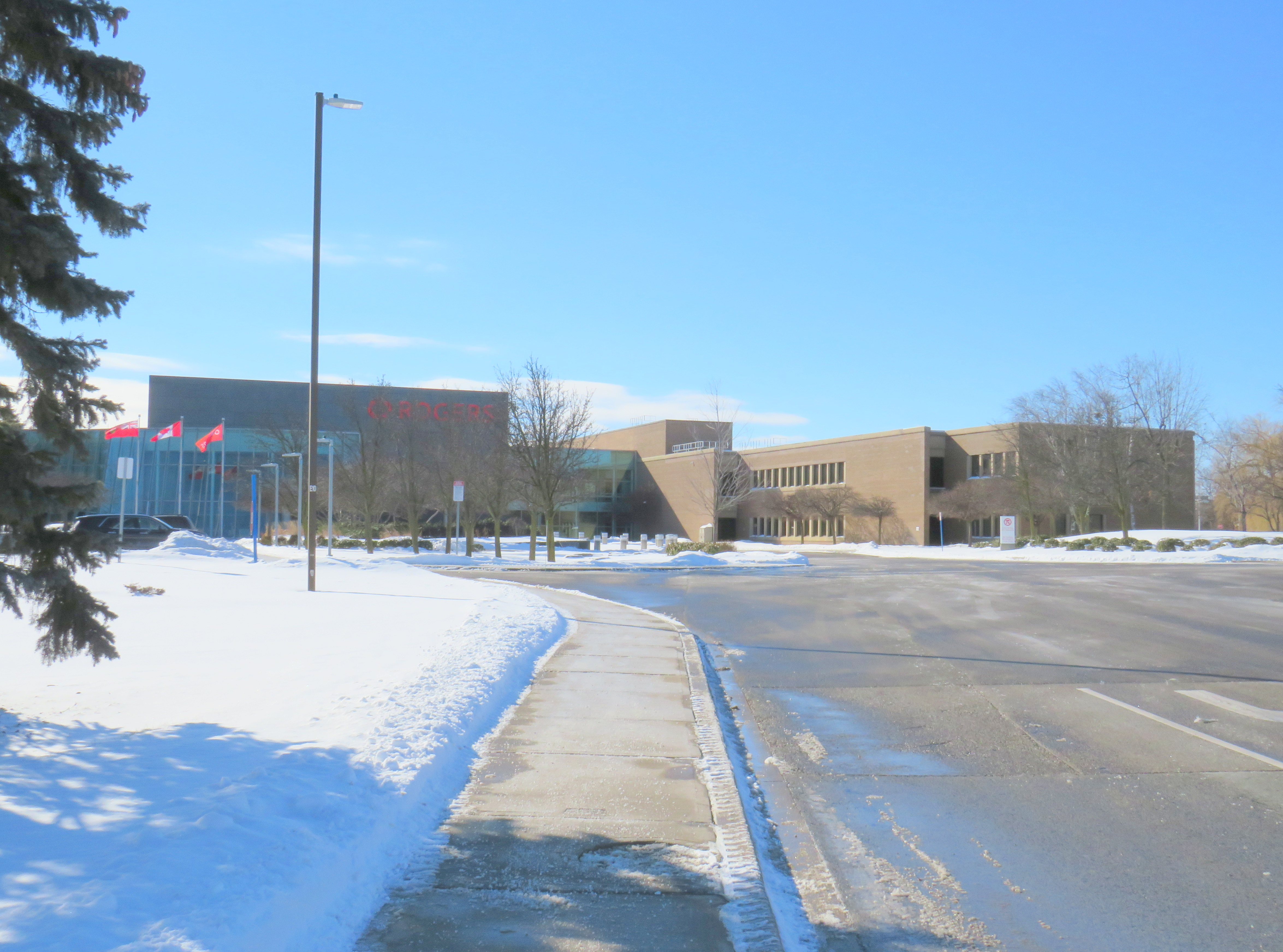
At the Brampton City Council meeting on January 26, 2022, councillors considered a request by Rogers for two Minister’s Zoning Orders (MZOs) in order for it to relocate its existing Brampton offices at 8200 Dixie Road in Bramalea to a new build in Downtown Brampton. The particular property Rogers looks to acquire for its new campus is the same one Metrolinx acquired, cleared, and partly constructed its new parking lot.
Part of the existing Rogers campus at 8200 Dixie Road
The property at 8200 Dixie Road was built in the 1963 as a Northern Electric (later Northern Telecom) plant, which produced switchboards and other telecommunications equipment. In 1995, the plant closed, and the building was refurbished to become the headquarters for Nortel Networks. In 2005, during Nortel’s infamous fall into bankruptcy, the property was sold to Rogers, which uses it today for its business operations and technical offices, with 3,000 workers stationed there.
Rogers is interested in the downtown site for several reasons. The new campus would be adjacent to several transit links, including the GO Transit Kitchener Line, with links to Downtown Toronto (where Rogers has its head office) and the Kitchener-Waterloo technology hub. In its submission to the city, Rogers also notes the proposed LRT extension into Downtown Brampton (now in the design phase, either as a tunnel or a surface route) and planned bus improvements. Though it is served by Brampton Transit, the 8200 Dixie Road site is almost entirely dependent on its employees driving to work.
The new Rogers downtown site would support Brampton’s goals of becoming a cybersecurity centre of excellence and landing a major postsecondary education campus — Ryerson University continues to be interested in expanding in Brampton and the University of Guelph has expressed interest in relocating its Humber College presence to Brampton to better serve its student base.
There are also several development proposals for Downtown Brampton. The City of Brampton is still planning to build a new Centre for Innovation to support education and business development. The new facility, located adjacent to the downtown transit terminal, will include a new central library. New highrise developments will bring thousands of new residential units to downtown Brampton, walkable to local businesses, the GO station, and Rogers’ planned new campus.
Map of Metrolinx/Rogers lands in Downtown Brampton, with surrounding active development plans
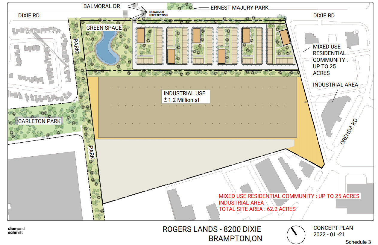
The new office campus — proposed to be 200,000 to 500,000 square feet — would have a smaller footprint than the Dixie Road site. By relocating its offices, Rogers would then be free to sell or redevelop the old Nortel lands for housing and new industrial uses, likely for warehousing and logistics. The development of the old land would certainly finance the new property.
Proposed redevelopment of the Rogers lands at 8200 Dixie Road, with mixed residential development on the east side, towards Balmoral Drive, and new industrial uses on the west side.
Rogers wanted municipal support for the MZOs so it could move quickly towards designing its new office complex. In response to a question from council, Rogers indicated that it had already been talking with Metrolinx about purchasing the land, and that Metrolinx itself was supportive. Mayor Patrick Brown indicated that he has been speaking with Metrolinx CEO Phil Verster, and that Metrolinx would submit its own letter of support.
MZOs have a controversial reputation. In Ontario, the Minister of Municipal Affairs has the authority to issue a zoning order over any property that overrides the normal zoning process. Traditionally, MZOs have been used infrequently, often in an emergency situation (such as after a disaster, such as the collapse of the Algo Centre Mall in Elliot Lake), or to fast track the construction of a major employer or housing development, typically issued at the request of the municipality.
The Doug Ford-led Progressive Conservative government have issued MZOs much more frequently, often for projects with significant opposition. This included the site of a proposed Amazon warehouse on the Pickering/Ajax border, which was strongly opposed by environmentalists and Ajax politicians, yet supported by Pickering officials. Meanwhile, a MZO requested by the City of Toronto, for an affordable housing project in North York, has yet to be issued. (It is worth noting that the project is in a PC-held riding, represented by Associate Minister of Transportation Stan Cho.)
But, in this case, with a unanimous vote of endorsement from Brampton City Council, with support from Metrolinx and local business groups the new Rogers relocation should prove to be less contentious than other recent MZOs.
There are still a few questions that will have to be answered in due time:
Will Metrolinx be able to provide all-day, two-way GO train service to Downtown Brampton by the time Rogers is ready to relocate its Brampton operations? Right now, the Kitchener Line is constrained through Brampton as it uses a busy CN freight corridor. A third track and platform at Downtown Brampton will be needed to support commuters arriving from Toronto in the morning. Though the planned new transit hub at Main and Nelson Streets will support this expansion, work has yet to begin on that project, including a temporary bus facility as the old terminal and office building above is demolished.
Will Brampton agree on the Main Street LRT extension, whether it will be in a tunnel or at-grade in Downtown Brampton? If so, will it be able to secure funding from the province and the federal government? As transit access is key for Rogers’ proposal, and for potential new educational instructions, closure on this long-running matter is important.
How many workers will be on site at Rogers’ new complex? Though 200,000 square feet will be enough space for about 1,000 employees, which is just one-third of its Brampton workforce. Perhaps Rogers is looking towards a hybrid model of work, where employees are on site only part-time.
Finally, it is interesting how Metrolinx, a public agency, was determined to assemble land and build a new parking lot, only to see that land sold to a large private company. However, having major employers located adjacent to regional transit hubs is a good thing, especially as it represents a shift away from GO’s traditional model of transporting commuters to Union Station in the morning and back to the suburbs in the afternoon.
For Downtown Brampton, Rogers’ plans for relocating to the urban core is a badly-needed shot in the arm. Locating a major employer to the core will support existing and new businesses. After many attempts to revitalize downtown, this latest plan might be the catalyst that changes everything.
On the morning of Thursday, August 19, I departed Toronto’s Union Station. My destination: Union Station. I set out to travel the longest distance possible by local and regional transportation services, taking advantage of several new routes set up by local and county governments to fill the gaps left by traditional intercity coach operators.
The round trip from Union Station required two trains and seven buses, operating on five separate transportation agencies. In some cases, the transfers were smooth and reliable; in Owen Sound, I waited several hours between connecting trips. For a casual traveler like myself, this was not a problem, but for more frequent commuters, the patchwork of various schedules and fares is not ideal.
I left Union Station on a westbound Kitchener Line train at 7:34 AM on Thursday, August 19. I returned to Union Station at 9:34 PM Friday evening, staying in Meaford overnight. I made time for short visits to Owen Sound, Meaford, Collingwood, and Barrie, with short stopovers in Guelph and at the Blue Mountain resort.
The following is a travelogue of sorts, concluding with a few conclusions on how parts of this trip can be made better for future passengers.
Thursday: Toronto to Owen Sound and Meaford
Intending to catch the morning GOST (Guelph-Owen Sound Transportation) minibus from downtown Guelph, I boarded the first westbound Kitchener Line train at Union Station at 7:34 AM. The train only goes as far as Bramalea Station, requiring a transfer to a bus to continue westward. Happily, the train arrived at Bramalea on time, so there was no problem taking the connecting bus that departs at 8:18 AM. (I had bad luck on a previous trip through Bramalea.)
The connecting bus from Bramalea to Guelph is a slow, local service, winding its way through Brampton, Georgetown, Acton, and rural Wellington County before arriving at Downtown Guelph at 10:13. Through GO Transit’s buses are comfortable, they lack lavatories, so a two-hour trip may be difficult on some passengers’ bladders. Though the 7:34 train to Bramalea connects to an express bus via Highways 407 and 401 to Kitchener, anyone headed to Guelph gets to ride the scenic route.
Though an express bus would be welcome, I noted the importance of the local GO bus for workers living in Brampton getting to jobs in Halton Hills, and residents in Acton and Rockwood commuting to Guelph. There is a need for both services.
At least I got a spot at the front of the double decker bus and was able to enjoy the ride.
This first leg on GO Transit between Toronto and Guelph cost $14.06, deducted from my Presto card.
Brampton Transit used to operate a double-decker bus. GO Transit has brought them back to the Flower City. Due to a construction project on Highway 7 in Rockwood, the double-decker bus took a scenic, yet unexpected detour on country roads. This must have turned some heads.
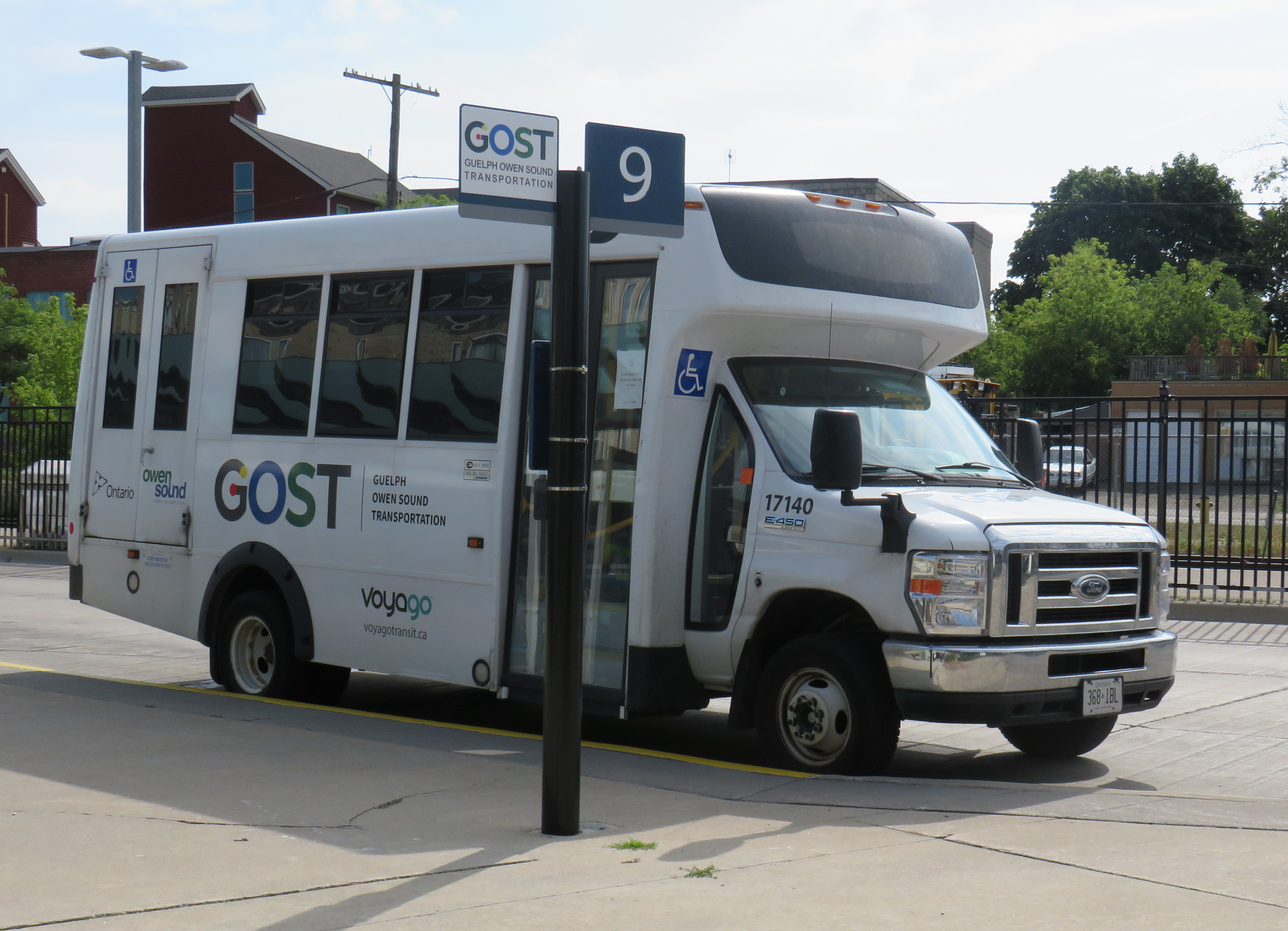
At Downtown Guelph, I had just under 20 minutes to use a washroom and have a quick coffee before switching to the GOST minibus. GOST serves the Guelph Central Station bus terminal, with easy connections to GO buses and trains and most Guelph Transit services.
A GOST minibus waiting for departure at Guelph Central Station
The GOST minibus service operates two round trips, seven days a week, between Guelph and Owen Sound, with stops in Elora, Fergus, Arthur, Mount Forest, Durham, Williamsford, and Chatsworth. Except for Fergus, all stops are located in or near each town’s commercial centre. The service is funded by Owen Sound and a provincial grant, and operated by London-based Voyago (which operates several other rural services in Western Ontario).
Until the mid 2000s, Greyhound ran buses six days a week between Toronto and Owen Sound via Highway 10 through Brampton and Orangeville or via Highway 6 through Guelph and Mount Forest, each route on alternating days. Gray Coach, the TTC-owned predecessor to Greyhound, ran several daily trips. The twice-daily GOST bus is a significant improvement over Greyhound’s schedule in its waning years.
On this Thursday midday northbound trip, there were two passengers going all the way up to Owen Sound, one getting off in Elora, one disembarking at Mount Forest, and one passenger who boarded at Williamsford for Owen Sound. The fare from Guelph to Owen Sound is $20 cash, with cheaper fares to ride shorter distances.
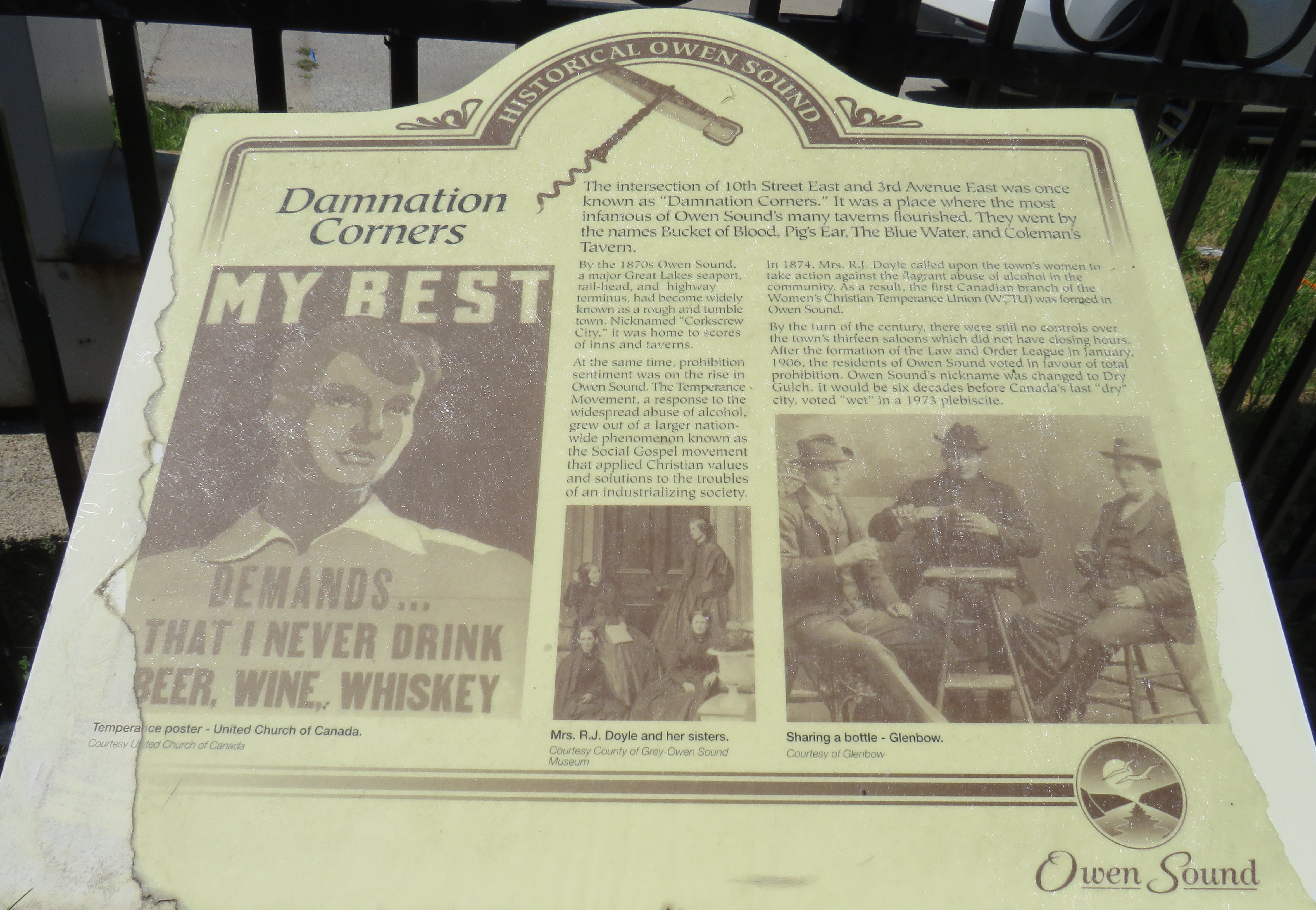
I arrived in Owen Sound a few minutes before 1:00 PM, with several hours to spend before my next ride to Meaford. Owen Sound, population 26,000, has an interesting history as a Great Lakes port and railhead for both the Canadian Pacific and Grand Trunk/Canadian National Railways. The maritime traffic and local industry gave Owen Sound a reputation as a hard drinking town; it became one of the first municipalities in Ontario to go “dry” in 1906. It remained that way until 1973.
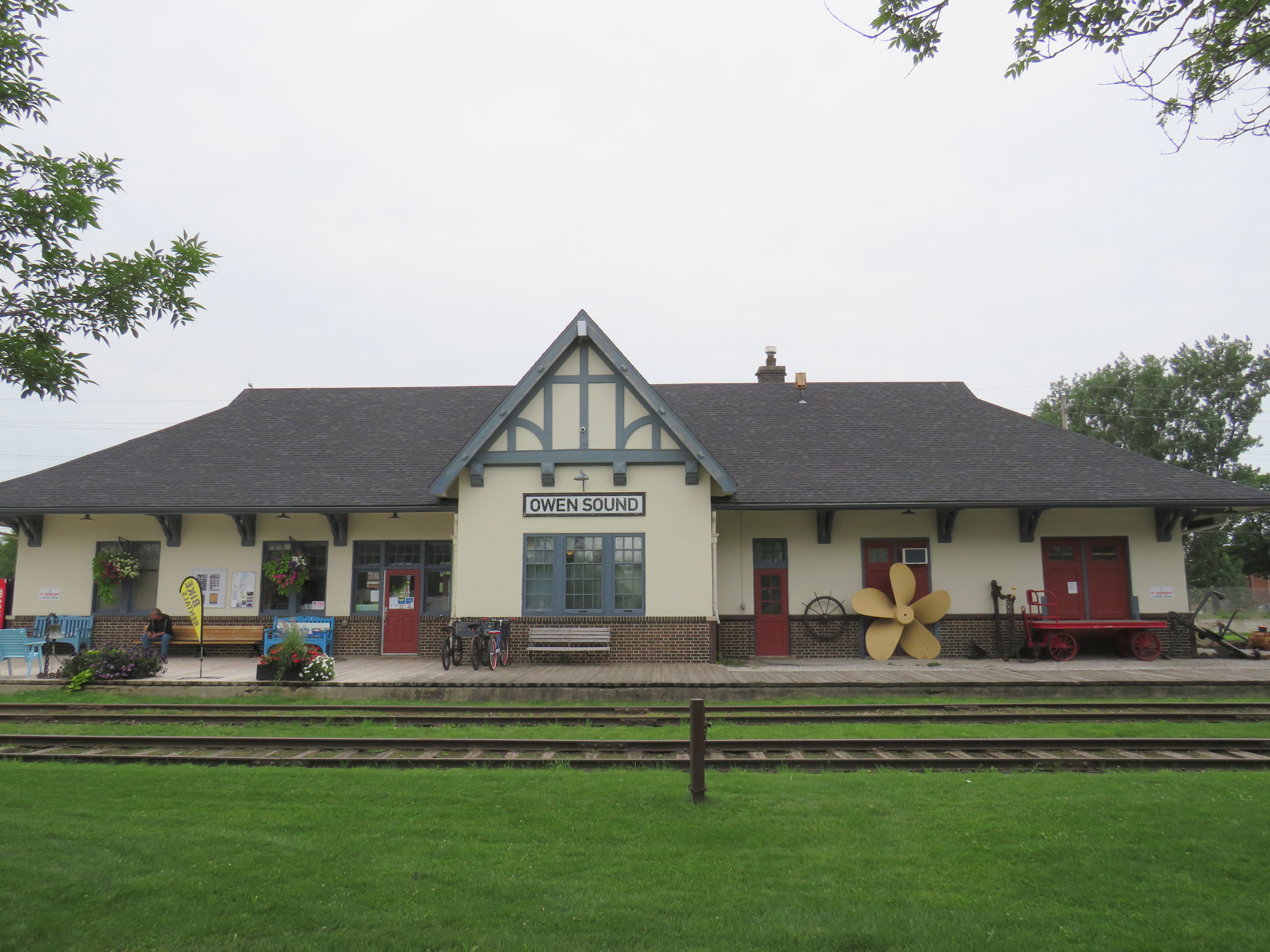
With the construction of the St. Lawrence Seaway and the decline of branch lines across Ontario, the city declined as a port and both railways were torn up in the late 1990s. However, both stations remain standing – the Grand Trunk Station on the west side of the harbour is now a local museum, while the modernist CP station, built after the Second World War, is now a brewpub.
With a lovely downtown, harbour, parks, and heritage neighbourhoods to wander through, Owen Sound was worth a three-and-a-half stopover.
Owen Sound Marine and Rail Museum, the former Grand Trunk/CN StationMudtown Station, the old CP Station in Owen SoundPlaque commemorating “Damnation Corners” where taverns once stood on all four corners. One block to the east was “Salvation Corners” where four Protestant churches still stand.
I decided to stay in Meaford overnight. Though I could get as far east as Wasaga Beach via Grey Transit Route, Colltrans, and Simcoe County Linx, I would not have been able to continue my trip back to Toronto that night, missing the last Linx bus from Wasaga Beach to Barrie by one hour.
Meaford had cheaper accommodations than Owen Sound or Collingwood, and by staying there overnight, it gave me plenty of time in Meaford and Collingwood the next day. Before Greyhound Canada suspended operations in April 2020, there was one daily bus between Toronto, Barrie, Collingwood, and Owen Sound. PMCL, which Greyhound purchased in the 1990s, used to run several buses a day on that route.
I departed Owen Sound on a pre-booked GTR minibus at 4:30 PM, which cost $5 for the trip into Meaford. As I was the only one on that departure, the driver was kind enough to drop me off right by my motel. There are six daily trips between Owen Sound and Meaford, with four of those trips offering a timed connection or direct run to Blue Mountain Resort, GTR’s eastern terminus.
GTR minibus at Owen Sound Terminal (October 2020)
Meaford itself is a charming little town, with several good restaurants, and a lovely harbour. Meaford is the western terminus of the Georgian Trail to Collingwood, one of Ontario’s first rail trails. As GTR minivans and Simcoe Linx and Colltrans buses all have bike racks, Meaford would make for a nice cycling trip.
Meaford Hall, with the old fire station behindTerminus of the Georgian Trail, which continues to Collingwood, with connections beyond
Friday: Meaford to Collingwood and Toronto
The next morning, I departed Meaford on GTR Route 4 at 8:46AM, and arrived at Blue Mountain Village just after 9:30, another $5 pre-booked trip. The popular resort is also served by Colltrans’ Blue Mountain Link route to Downtown Collingwood, with connections to local buses and the Simcoe County Linx Route 4 to Wasaga Beach.
Approaching Blue Mountain, the driver helpfully asked me if I needed to catch the bus to Collingwood. Though the timetables between GTR Route 4 and Colltrans’ bus don’t permit an easy connection, if I got off at Craigleith, at the bottom of the escarpment, I would be sure to get the onward bus. I declined the offer, because I was curious to see Blue Mountain Village itself, and I needed a coffee.
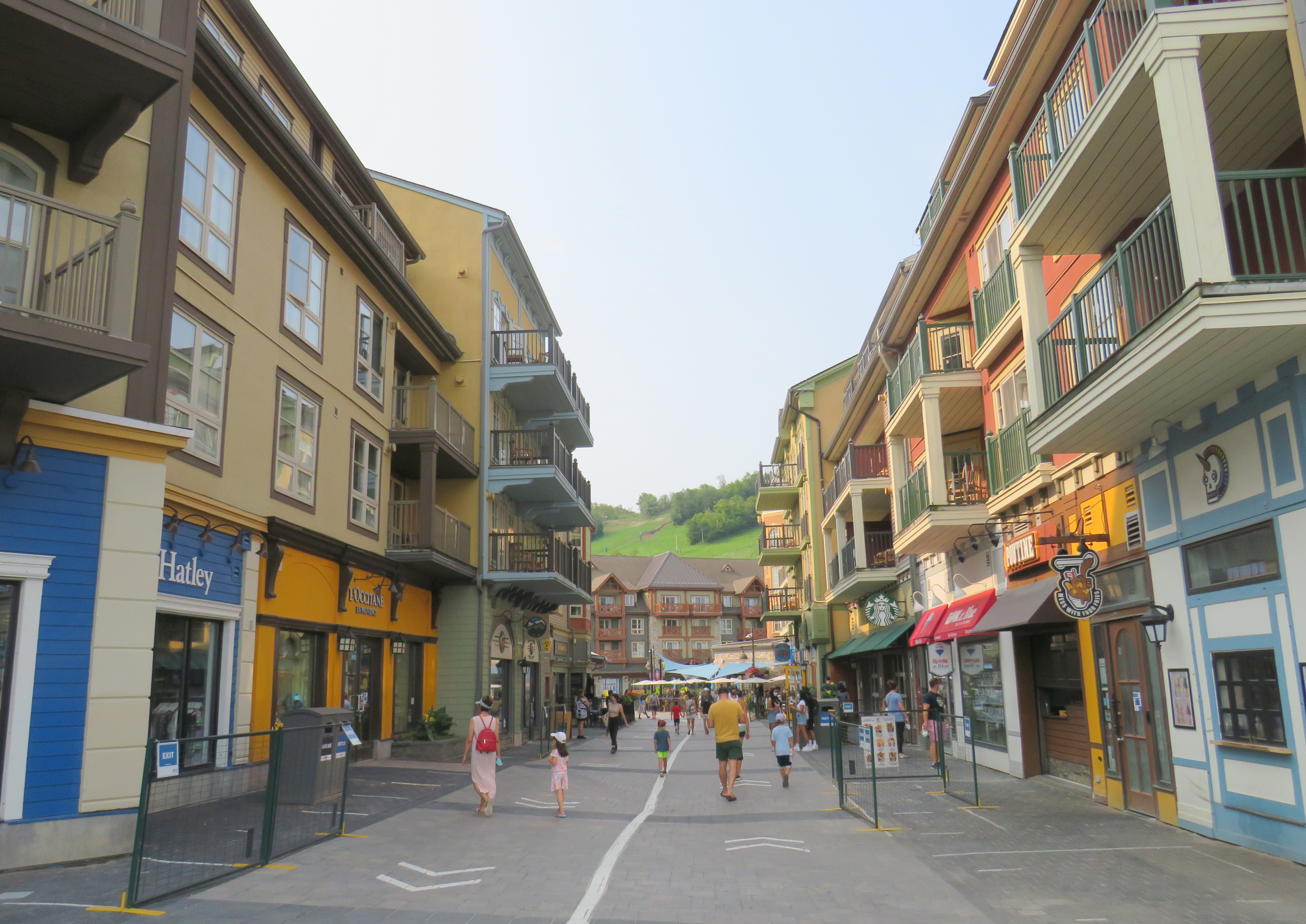
The Disneyland-like urbanity of Blue Mountain Village
Blue Mountain Village, the heart of the sprawling Blue Mountain resort, contains many shops, restaurants and bars, along with three hotels and timeshare apartment complexes with the architecture and walkways meant to invoke a European ski resort. Cars are not permitted in the internal streets, which gives it a somewhat surreal atmosphere. In the summer, tourists and vacationers are attracted by several golf courses, downhill mountain biking trails, rope courses, spas, nearby beaches, and, of course, the shops.
Having gotten my coffee and my morning walk, I paid my $2 fare and got on the 10:20 bus to Downtown Collingwood.
Colltrans and Simcoe County Linx buses at Downtown Collingwood
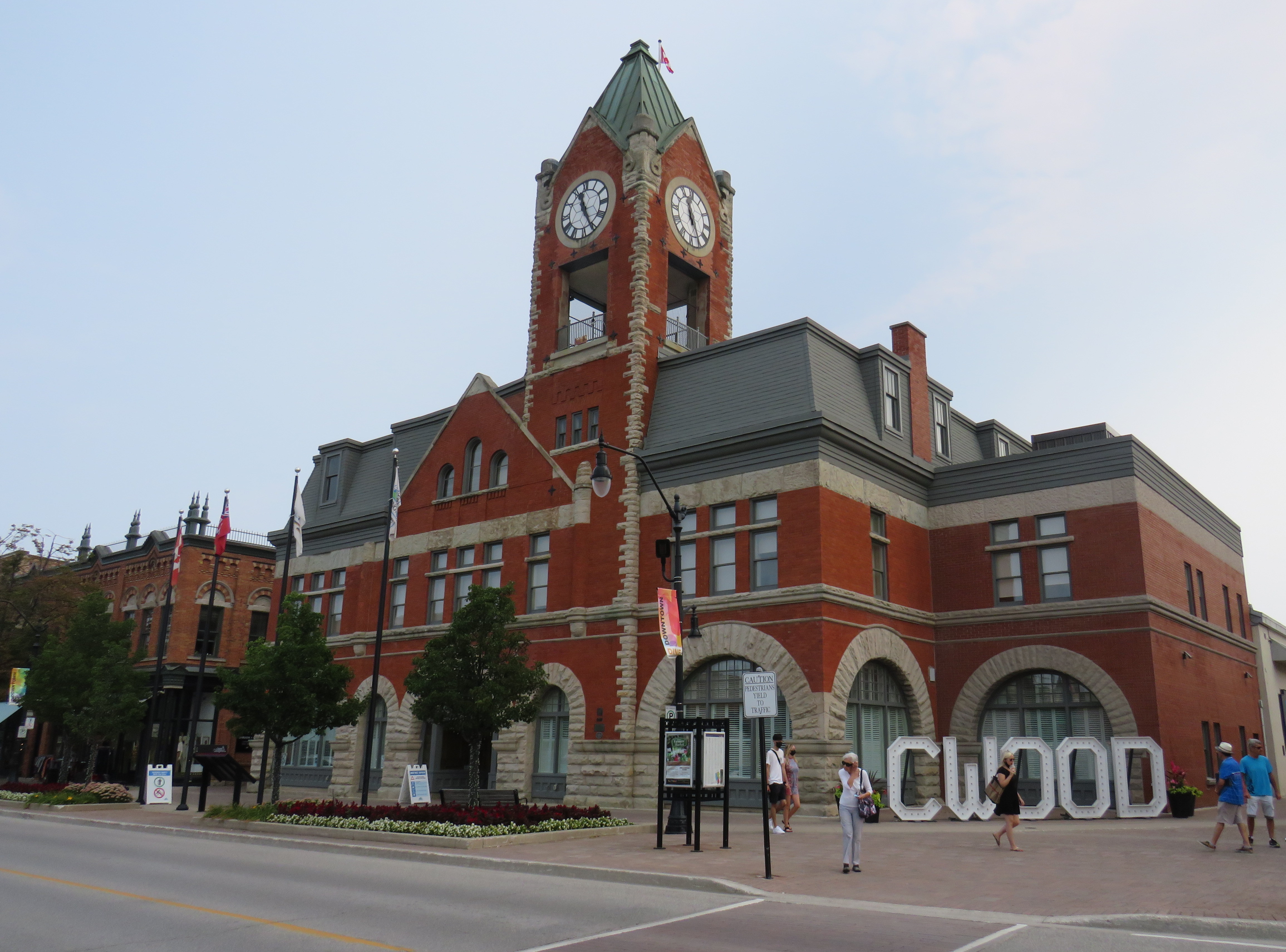
Like Owen Sound, Collingwood has a lovely and vibrant downtown core, with its own proud marine and railway history. Collingwood was the terminus of the Ontario Simcoe & Huron Railway, the province’s first rail connection, built in 1853-1854. The OS&H was built as a shortcut between the Upper Great Lakes and Toronto and prospered before merging with several other railways to become part of the massive Grand Trunk system. Sadly, passenger service to Collingwood ended in 1960, and the railway itself is abandoned and partially removed.
Collingwood Town Hall
After a hearty lunch in Downtown Collingwood and walk through the area, I paid another toonie and boarded Simcoe Linx Route 4 to Wasaga Beach.
In the back parking lot of a Loblaws Superstore in the west end of Wasaga Beach, two Simcoe County Linx buses, a Wasaga Beach Transit bus, and a Clearview Transit minibus meet to exchange passengers. The grocery store is distant from the main tourist area and the downtown commercial centre, but at least transfers between buses are easy. The Wasaga Beach Transit bus does pass by most motels, tourist traps, and beach areas. I changed to another Simcoe County Linx bus (Route 2) that passes through Stayner and Angus for Allandale Waterfront GO Station south of Downtown Barrie. The fare between Wasaga Beach and Allandale was $6.00 cash.
At a grocery store parking lot, Simcoe County Linx, Wasaga Beach Transit, and Clearview Township buses meetArrival at Allandale Waterfront GO Station
Allandale Waterfront GO Station, which hosts GO trains and buses and several Barrie Transit routes, is one of two Barrie terminal points for Simcoe County Linx’s buses. Buses to Orillia and Midland terminate at Georgian College and Royal Victoria Hospital in the northeastern corner of Barrie, with a Barrie Transit fare and a 30-minute local bus ride to get from one Linx route to another.
Kempenfelt Bay, Barrie
The ride back to Union Station, which included a bus to Aurora GO and a change to a train the rest of the way. That final trip cost me $13.76 on my Presto card.
In total, I paid $39.06 on Thursday and $28.76 on Friday to complete the round trip between Toronto and Georgian Bay.
Analysis and Conclusions
It is good to see Owen Sound, Grey County, and Simcoe County develop local solutions to replace and improve upon vanished coach services that ran on Highways 6, 10, and 26, better schedules and improved connections will only make their services better.
With limited schedules, particularly on Grey Transit Route and Simcoe County Linx, I could only do this exact trip by leaving Toronto on a Wednesday or Thursday. GTR’s Routes 3 and 4 between Owen Sound, Meaford, and Blue Mountain operates Wednesdays through Sundays. Though transit between Blue Mountain Village and Wasaga Beach runs 7 days a week, the Simcoe Linx bus between Wasaga Beach and Barrie only runs weekdays, with the last buses leaving Allandale GO and Wasaga Beach Superstore at 6:30 PM.
Later service hours and weekend service between Barrie and Wasaga Beach would allow GTHA residents to get to one of the Great Lakes’ great beaches without a car for a weekend getaway, without more congestion on Highways 400 and 26.
In addition, it would be good to see Simcoe County and municipal systems in Collingwood, Wasaga Beach, Barrie, Orillia, and Midland/Penetanguishene develop a coordinated fare structure, as transfers or fare discounts are not provided between each service, except between Linx and Midland/Penetanguishene. Simcoe County Linx already has its own farecard; if that were upgraded it would at least allow frequent riders to benefit from easy fare payments and transfer discounts.
These are relatively simple changes that can further drive ridership growth and improve mobility throughout fast-growing Simcoe County as well as attract more visitors from Toronto and beyond.
The Toronto-Guelph leg of my trip was unnecessarily slow, and will continue to be so until all-day, two way GO service is introduced on the entire Kitchener Corridor, or if express buses are added to the schedule. While all-day GO train service will take several years with several construction projects underway or necessary in Toronto, Brampton, and Guelph to provide the necessary capacity, improved bus service can provide a stopgap for the time being.
Without an express GO bus or competing services such as Greyhound (which used to operate multiple buses between Guelph and Toronto) or a morning VIA Rail train, it can take nearly three hours to get from Toronto to Guelph without a car.
Though GO Transit will introduce significant service improvements starting Labour Day, including new peak-direction express trains on the Kitchener Corridor. Unfortunately, there are no travel time improvements for getting between Toronto and Guelph weekday mornings. Given that there is currently no alternative access between the two cities, there’s a market that GO Transit is clearly missing right now.
On Thursday, August 12, I rode the train to the very end of the Richmond Hill Line to check out GO Transit’s newest station.
In 2017, I made a similar trip to Gormley Station, just to the south of Bloomington GO, soon after that station opened to the public. Four years ago, I was critical of Metrolinx’s failures to support the urban intensification of the Greater Toronto and Hamilton Area (GTHA) by building new stations on the Greenbelt, on lands that will not support transit-oriented development.
Though I came away from Gormley Station disappointed, I wanted to see Bloomington Station for myself and give it an honest assessment. I came away with mixed feelings.
Most GO Stations outside the old City of Toronto put free car parking ahead of all other considerations. Some stations, such as Unionville, were even moved to sites where large surface lots could easily be built. Hamilton GO Centre, opened in 1996, was an exception: an urban station that combined a restored heritage building with a large bus terminal. A few other newer stations, such as Mount Pleasant in Brampton and Mount Joy in Markham, still had large surface parking lots, but also had easy walking connections to adjacent neighbourhoods. In Guelph and Kitchener, GO Transit used existing downtown stations instead of suburban stations, and Allandale Waterfront Station is located right across the street from Barrie’s gorgeous Kempenfelt Bay.
Gormley and Bloomington Stations represent a return to GO Transit’s old ways of putting parking ahead of all other considerations, despite Bloomington’s modern design.
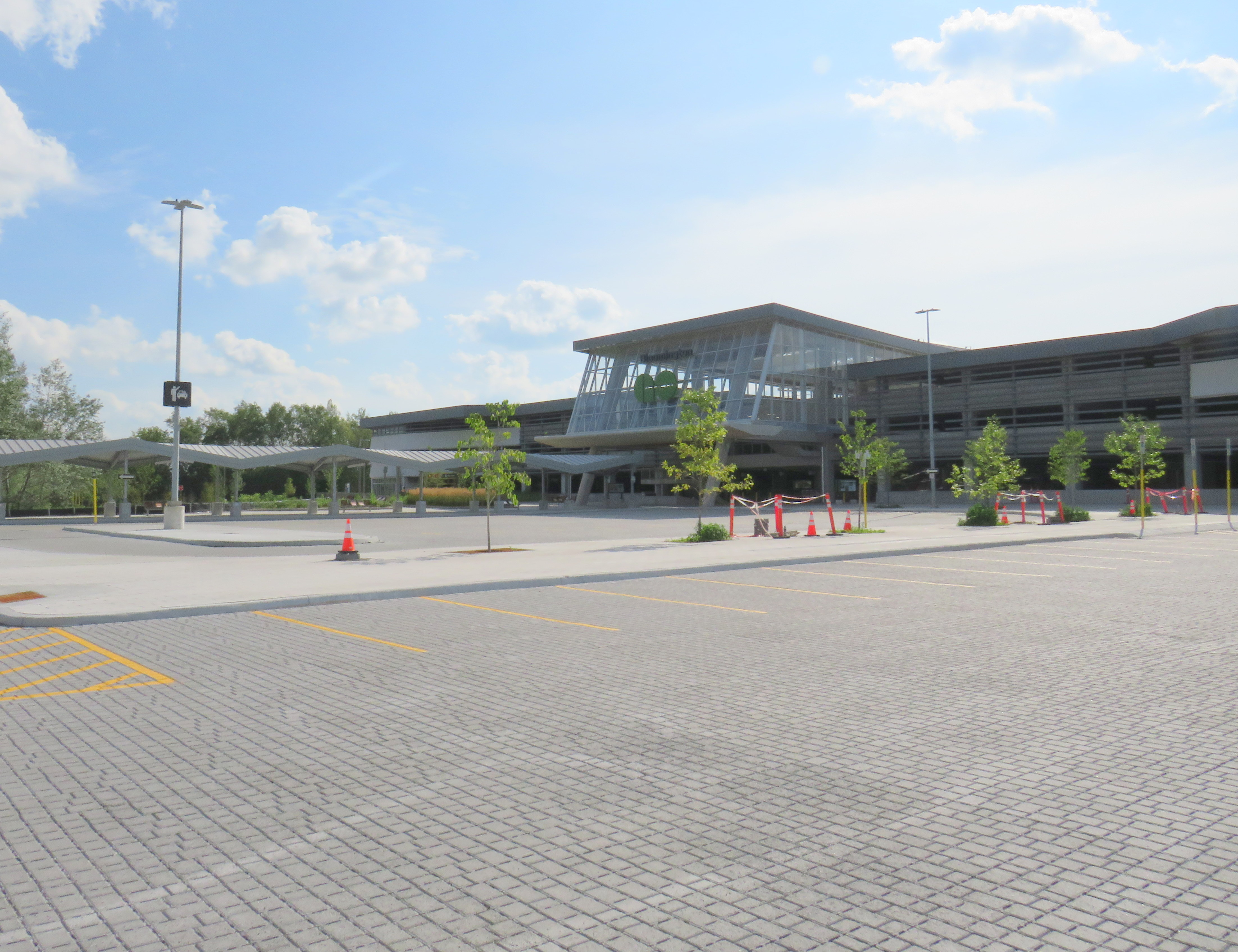
Metrolinx, the provincial agency responsible for planning and constructing transit infrastructure in the GTHA and for operating GO Transit, opened Bloomington Station on June 28, 2021. The station is located on Bloomington Road, adjacent to Highway 404, on the boundary between Richmond Hill and Aurora.
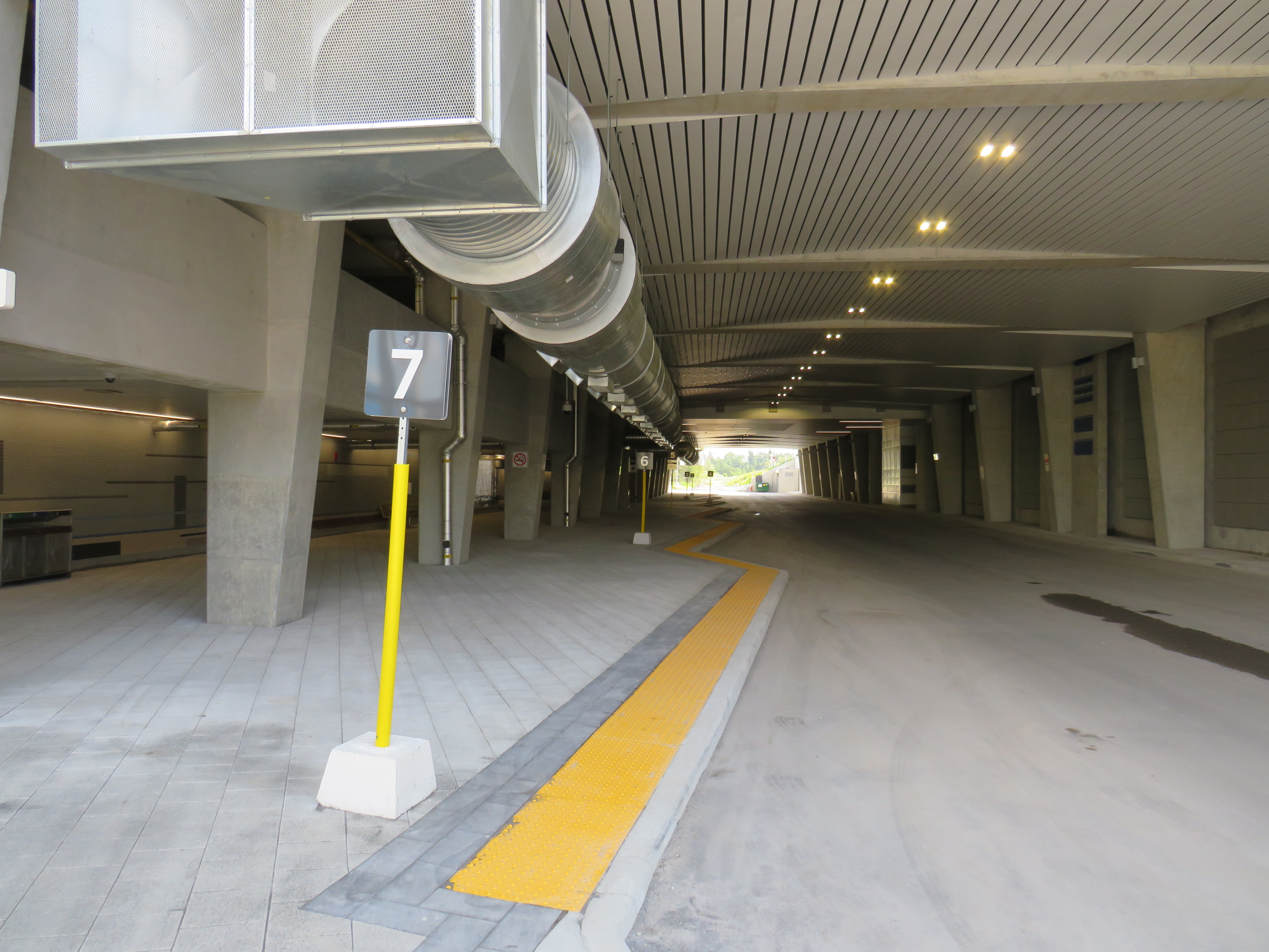
The station is built around a three-storey parking garage tucked into a hill, with the train platform and station amenities (an enclosed waiting room with washrooms and a ticket counter) on the second level. At the lower level, there is a six-bay bus loop almost directly below the rail platform, minimizing the distance between train and bus. Elevators, stairs, and ramps connect the three levels of parking, the bus bays, and the train platform.
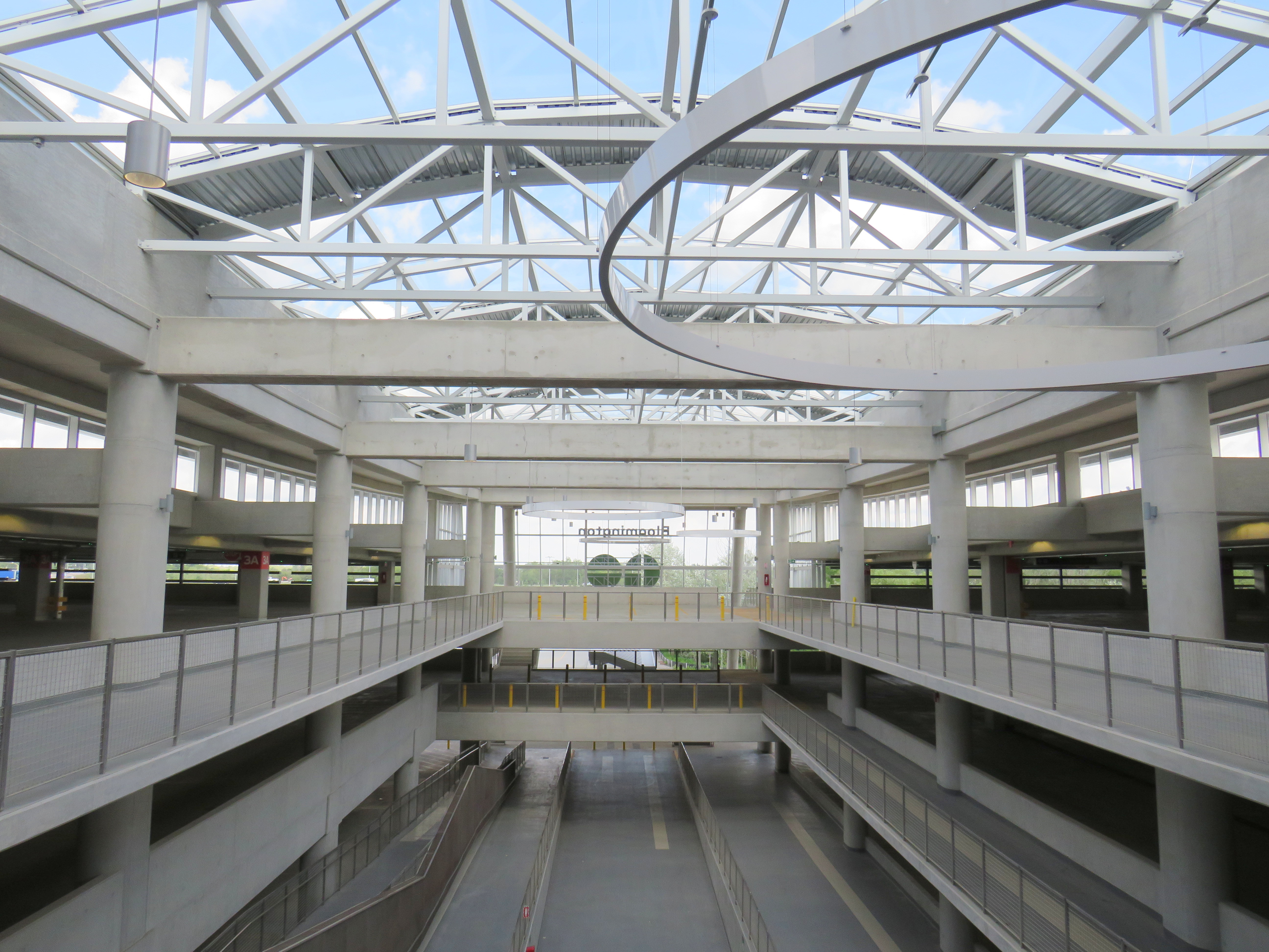
The station’s central atrium, which contains the pedestrian passages between parking levels, station, and platforms, is the architectural highlight. Above the parking areas, solar panels collect some of the energy required to light and heat the station.
Atrium at Bloomington Station, with parking spaces on both sides
In its blog, Metrolinx expressed pride in the new station, noting it was built to achieve LEED Gold certification through features such as energy efficient lighting, a water-permeable surface lot, stormwater management, and a pond for local wildlife with an underground passage to help animals migrate away from the station complex. Like most new GO platforms, Bloomington’s train platform is heated to allow snow and ice to melt, reducing salt usage. Finally, as far as suburban GO stations go, Bloomington’s footprint is quite compact. It cost $82.4 million to build the new station.
Plaque adjacent to wetland at Bloomington GO StationPermeable surface at Bloomington’s outdoor surface lot and passenger pick-up and drop-off area
Despite these innovations, a LEED certification can only go so far when the GTHA’s newest transit station is only accessible by car, with over 1,000 parking spaces. Though transit ridership is down significantly during the ongoing pandemic, especially on GO’s Richmond Hill Line (which operates only in the weekday peak-period direction and currently uses four-car trains), there are no ongoing connections from Bloomington GO Station operated by GO buses or York Region Transit.
Though several GO rail stations do not have any local transit connections only Bloomington and Gormley have no bus connections at all. (In April 2020, YRT discontinued the limited-service Route 15 that ran past Gormley Station). At Acton, Georgetown, and Lincolnville, which also do not have any local transit connections, passengers can still connect to GO buses for points beyond, or make a return trip.
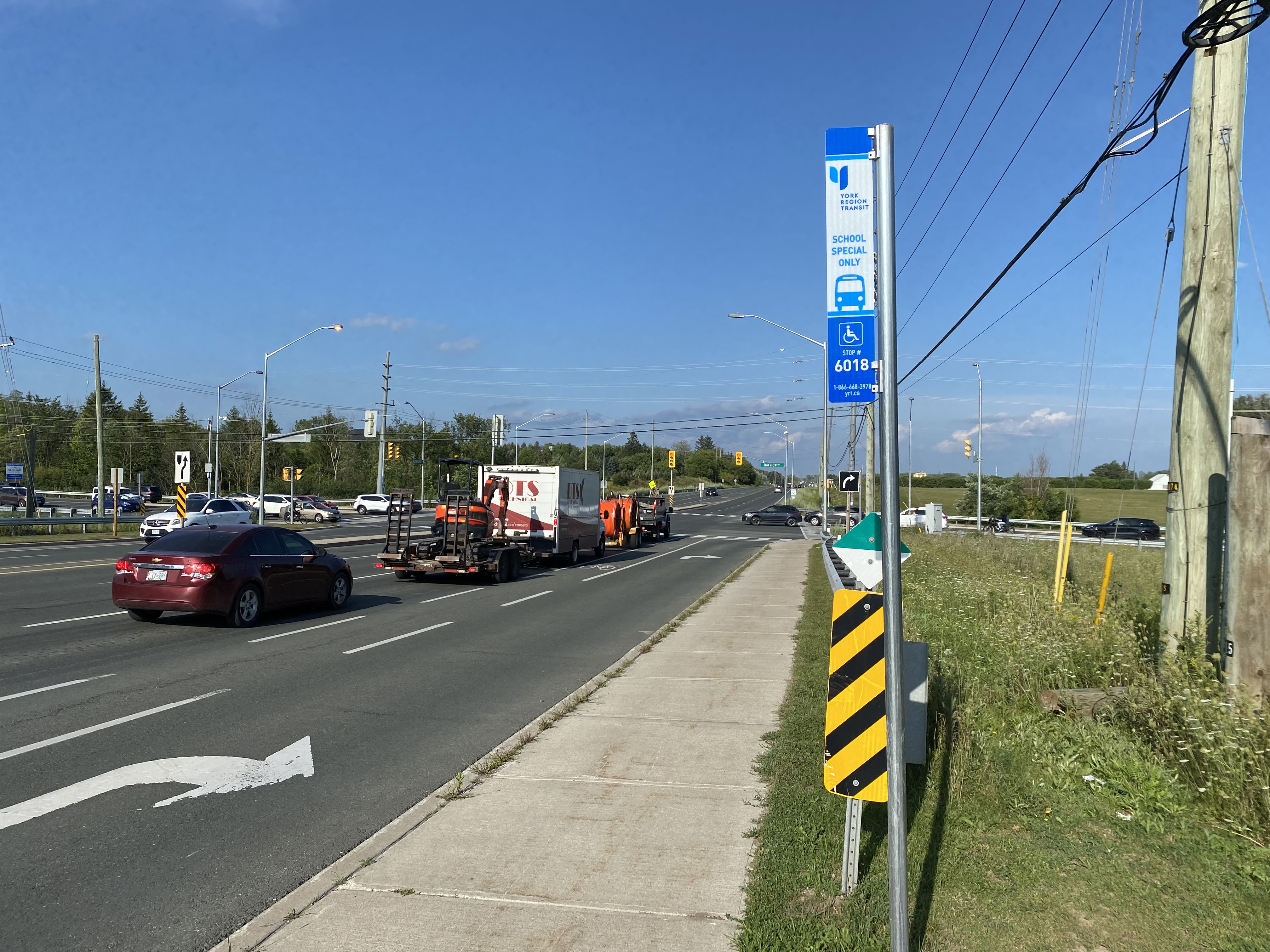
The only bus operating at Bloomington Station’s loop is GO Route 61, which provides supplemental weekday service between Union Station and Bloomington GO. But the last Route 61 bus leaves for Union at 1:55 PM.
There was no bus connection to be found at Bloomington GO Station
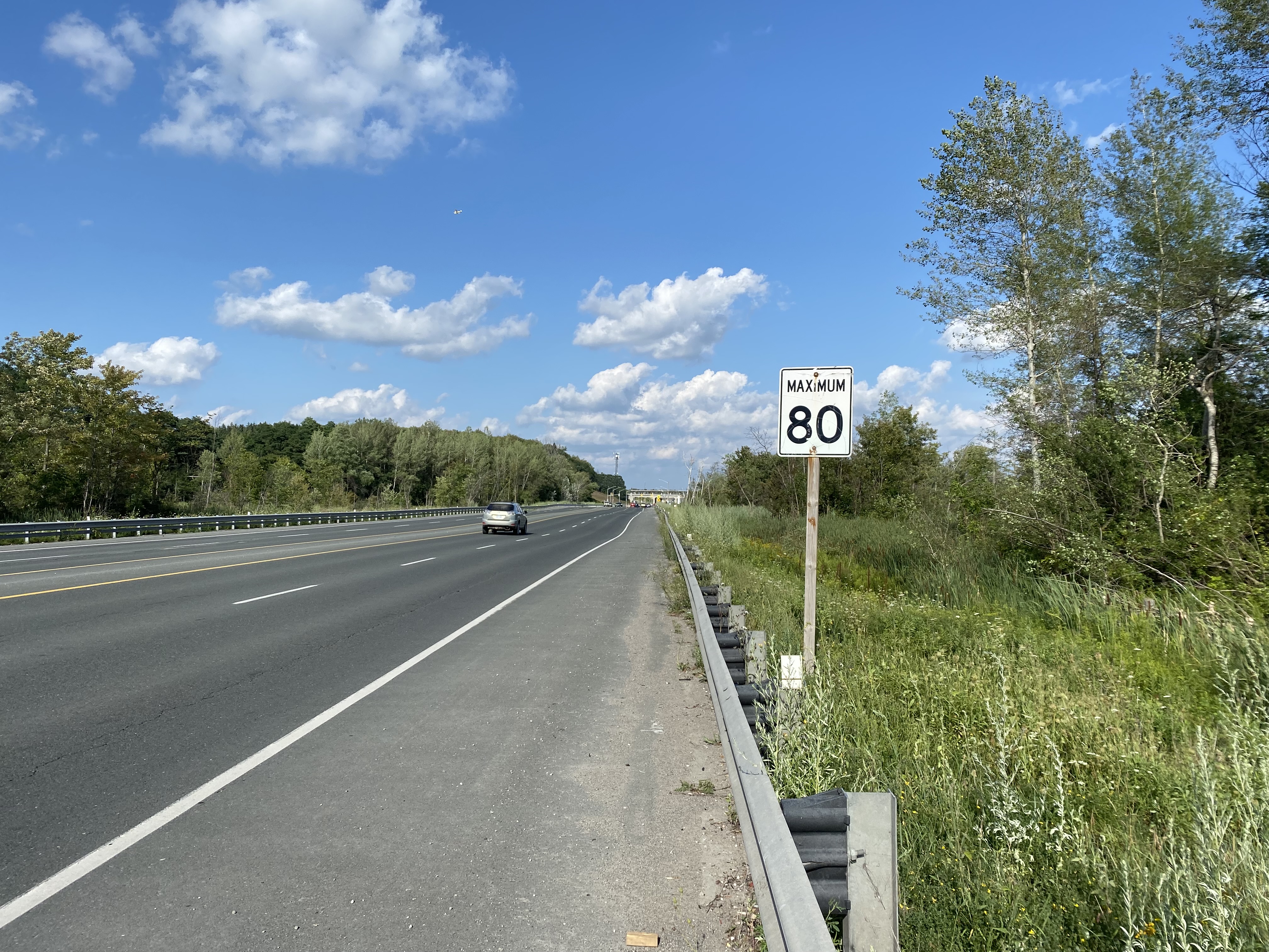
The nearest in-service bus stop is over one hour’s walk away, near Bloomington Road and Yonge Street. At least there was a paved shoulder along the busy five-lane road between the GO station and Bayview Avenue, where motorists were driving well in excess of the 80 km/h speed limit.
Looking east towards Bloomington GO at Leslie Street
At Bayview Avenue, a sidewalk leads westerly to Yonge Street, with new residential subdivisions lining the south side of Bloomington Road. I noted a bus stop as I was walking west towards Bayview Avenue; alas, it was only for a high school special route.
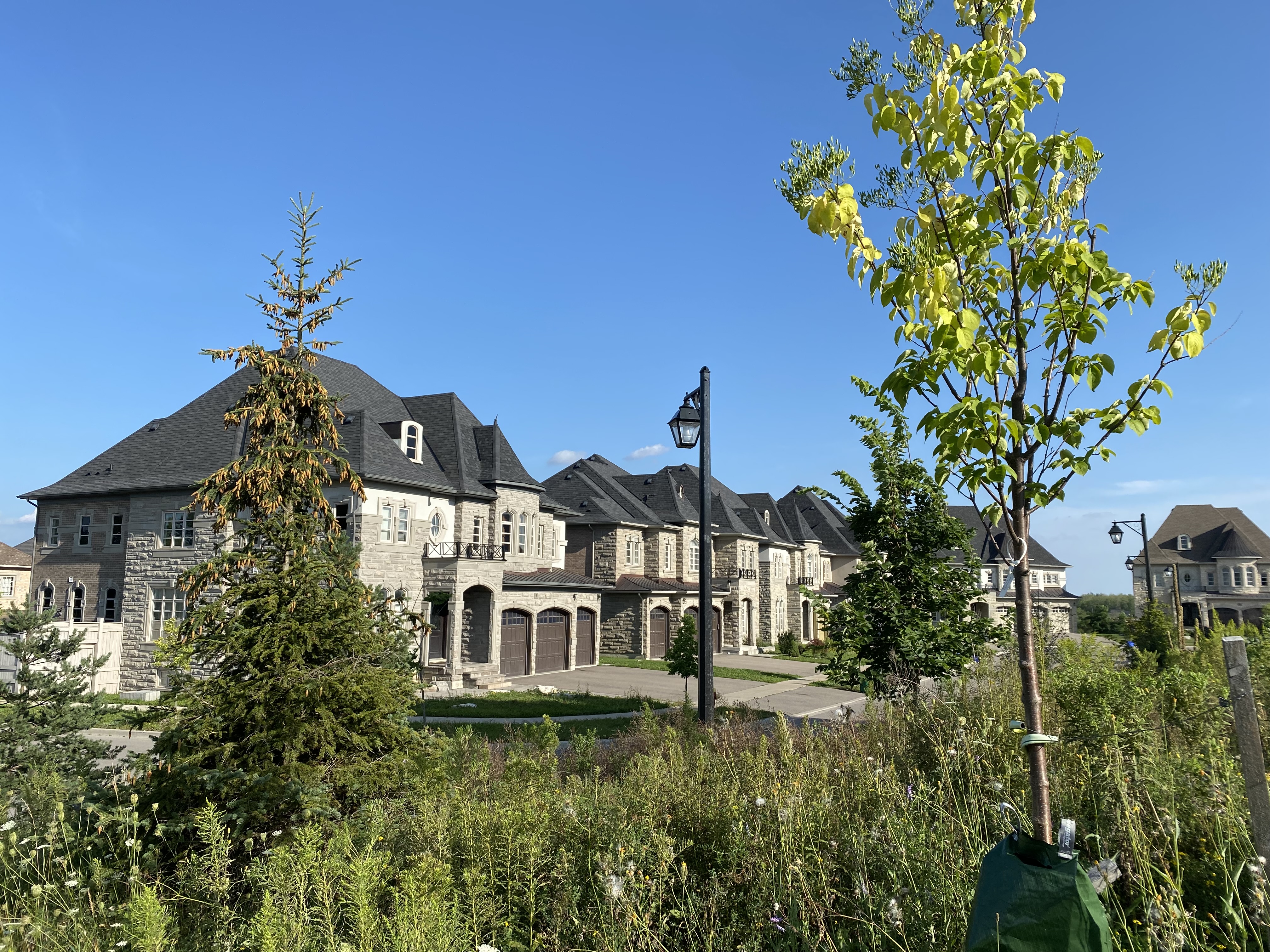
YRT stop at Bloomington Road and Bayview Avenue signed “school special only”New residential development along Bloomington Road featuring large houses with three-car garages was clearly designed for cars, rather than people
As I was nearing Yonge Street, I noted that the new subdivisions were set back far from the road, with many of the houses built with three-car garages. Building enough transit ridership here to support even a limited service bus route is going to be very difficult.
One hour and 8 minutes later, I arrived at the bus stop at Yonge Street, the closest place to Bloomington GO Station where I could get a bus to continue my journey.
The end of a long walk from Bloomington GO Station
Bloomington Station’s small footprint and environmental features might actually make it an ideal basic station design for more urbanized locations in the GTHA, where the compact design and logical layout could support easy bus connections and short walks to residential and employment areas. I liked the simplicity of the bus connections at Bloomington — if only there were any buses to connect to.
But Bloomington’s LEED Gold certification means little when it does not support sustainable development or sustainable access to the station.
Though its location adjacent to Highway 404 may entice some commuters to switch to parking at Bloomington and commuting downtown by train, Gormley, just one station to the south, already achieves a similar purpose.
For now, Bloomington Station is just a Garage Mahal — a grand monument to the old way of doing things at GO Transit.
The intersection of Steeles Avenue and Main and Hurontario Streets
Last year, I wrote about a foreseeable problem coming to the corner of Steeles Avenue and Hurontario and Main Streets in Brampton: the planned Hurontario LRT terminus, to be located on the south side of Steeles Avenue, would require thousands of commuters to transfer to Brampton Transit buses on the north-west corner of the intersection.
This transfer would require crossing ten or eleven lanes of traffic at one of Peel Region’s busiest intersections, with crowding at the street corners, with passengers awaiting a walk signal two separate times to make the necessary connection.
After twice receiving unsatisfactory answers at a Metrolinx online town hall, and hearing no information about how the crossing at this intersection might be mitigated, on March 9, 2021, I took the step of making an Access to Information Request to Metrolinx under the province’s Freedom of Information and Protection of Privacy Act asking for communications between Metrolinx, the Ministry of Transportation, Mobilinx (the consortium awarded the contract to build and operate the LRT), and the City of Brampton.
I received a package with the requested materials from Metrolinx on July 29, 2021. The request cost me $360.00, plus a $5.00 application fee. Communications from Metrolinx’s privacy officer were professional, friendly, and very helpful.
Through my request that covered the dates December 1, 2018 to March 11, 2021, I obtained several letters from Brampton officials, including City Councillor Gurpreet Singh Dhillon, Director of Transportation Special Projects Chris Duyvestyn, Chief Administrative Officer David Barrick, and Mayor Patrick Brown to Metrolinx and Ministry of Transportation Officials requesting restoration of the north side stop at Steeles Avenue/Brampton Gateway Terminal. I also obtained replies from senior Metrolinx staff, including President and CEO Phil Verster and the Deputy Minister and the Minster of Transportation.
What is the communications reveal is that decisions made during the 2014-2018 term of Brampton Council significantly tied the hands of everyone involved — both at the City of Brampton (which reversed its previous decisions when a new council was elected in October 2018) — and at Metrolinx, which was quickly working towards finalizing the contracts to construct the transit project. Unfortunately, important details, such as the final configuration of the Steeles-Hurontario/Main intersection, remain unknown. Neither Metrolinx nor the Ministry of Transportation, which funds Metrolinx, appear to grasp the problems that will be caused when thousands of commuters have to cross two major streets at an especially busy intersection.
Despite Brampton’s work since December 2018 to move the Brampton Gateway stop back north of Steeles Avenue, including formal requests to Metrolinx and the Ontario Ministry of Transportation (MTO), and despite a similar request from RioCan, owner of the massive Shoppers World Mall property at Main Street and Steeles Avenue, Metrolinx and the province have held firm in their decision.
While Metrolinx and the MTO cite the difficulties of reopening a project which was getting underway, and concerned about setting precedents for other changes to the Hurontario LRT or other transit projects, this would still be a minor change, costing just $15 to $20 million according to a 2020 letter from Metrolinx CEO and President Phil Verster to Brampton Mayor Patrick Brown.
Sadly, transit riders in Brampton – who do not have affluence or political might — have been left in the middle of this political back-and-forth between municipal politicians, the province, and Metrolinx. They will be forced to endure a more difficult transfer between LRT and bus than anything proposed to them in public consultations.
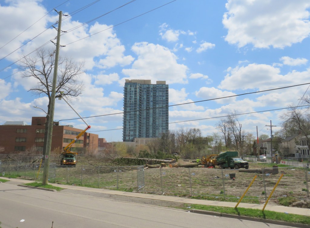
Cutting down trees to make way for a surface parking lot in Downtown Brampton
Earlier this April, contractors hired by Metrolinx cut down trees on its Downtown Brampton property, where twelve houses once stood. The work, originally scheduled for the week of March 22, did not begin until April 12.
The tree removal brings Greater Toronto’s regional transit operating and planning authority one step closer to building a new 200-plus surface parking lot in a city that hopes to renew its downtown core.
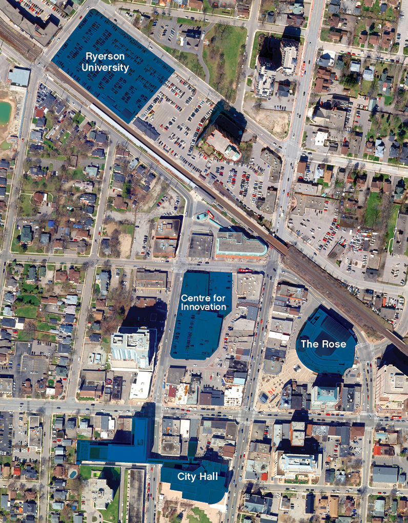
Starting in 2016, Metrolinx purchased over a dozen homes along with two four-storey office towers in an area bounded by Railroad, Nelson, and Elizabeth Streets, immediately south of the Brampton GO Station. It vacated and demolished the houses between 2016 and 2019, and left the two office buildings vacant. Metrolinx’s plan was to build a new surface parking lot to expand parking capacity, though in early 2018, the Liberal provincial government announced a new Ryerson University/Sheridan College campus on the existing main parking lot on the north side of the station. Metrolinx’s acquisition of occupied homes — including heritage-listed buildings and a rooming house — made more sense.
After the election of a new Progressive Conservative government led by Doug Ford, funding for the educational campus was pulled, though the City of Brampton and Ryerson University continued to advance plans for the downtown area. The city bought up more of the downtown core, including the southeast corner of George and Nelson Streets, across from the vacated office buildings, as well as the thirty-year old office building at 2 Nelson Street West, below which is the Brampton Transit downtown terminal. These newly acquired lands would be home to a larger bus terminal that would link to an expanded GO station and a proposed extension of the Hurontario LRT, and an Innovation Centre that would serve the education campus and include a new central library.
The old plans for the Ryerson Unversity/Sheridan College building on the GO Transit parking lot, and a Centre for Innovation on the southeast corner of George and Nelson Streets. The Metrolinx lands are in the block between the Centre for Innovation and the GO Station/proposed Ryerson building
Already, there are several high-rise developments in the downtown area under construction or in the planning phase. More development lands will be unlocked with the Riverwalk project, which will improve flood protection along Etobicoke Creek while providing an improved public space.
A two-tower rental highrise development is progressing on the old Dominion Skate Factory lands, across the tracks from the GO Station, bringing hundreds of new residents to the downtown core and right to the station.
Given Brampton’s urban aspirations for its downtown core, another surface parking lot — adding 200 spots to the existing 861 spaces — is not the right idea.
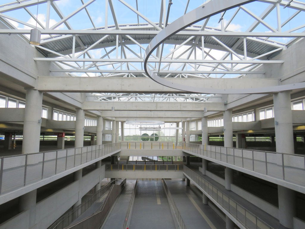
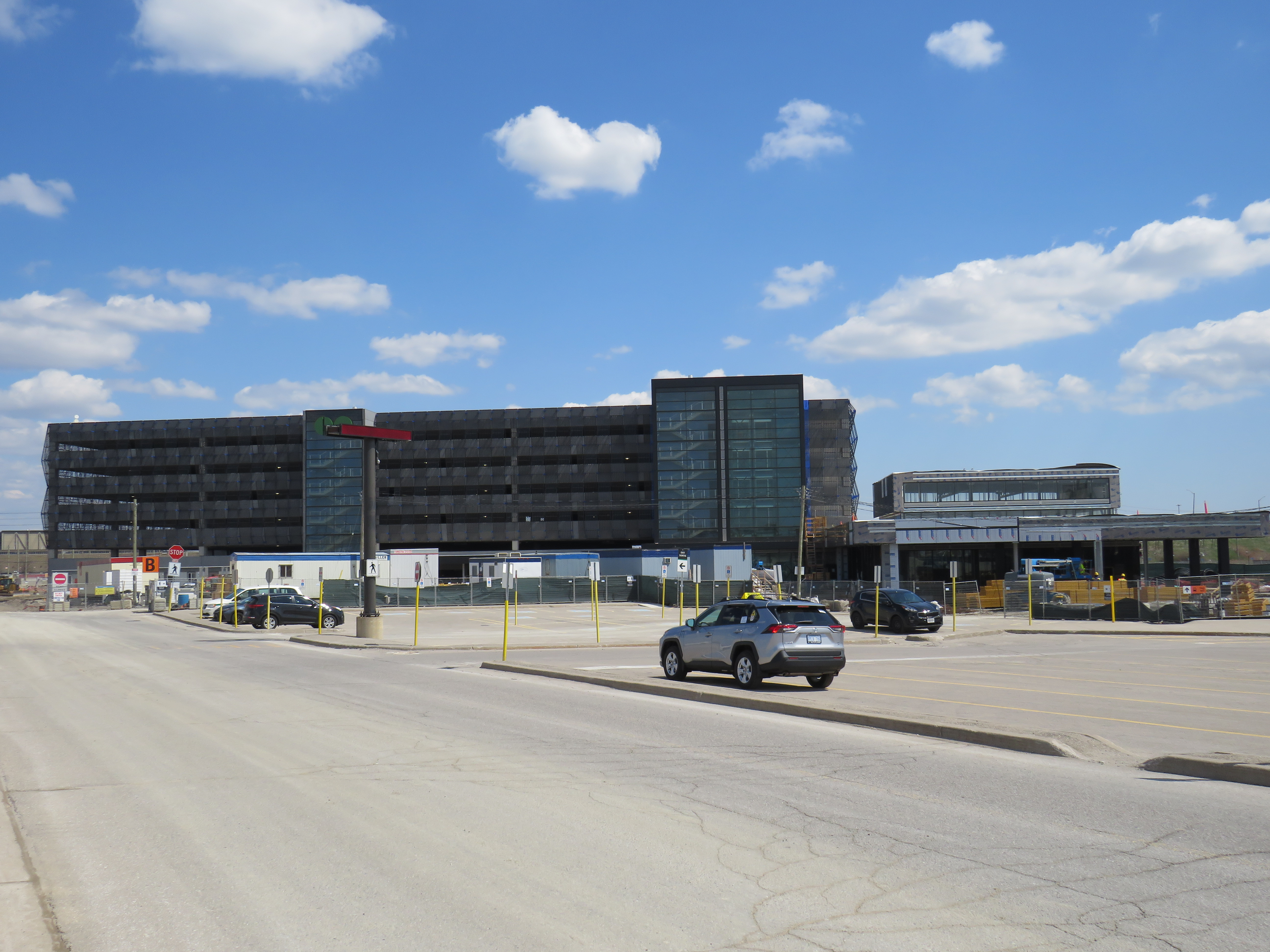
At Bramalea Station, construction has nearly finished on a 1,300 spot parking garage, part of a larger project that also includes a new, larger station building, a larger bus terminal, additional pedestrian tunnels, and improved platforms and security features. Bramalea already has over 2500 parking spaces, but unlike in Downtown Brampton, this is a logical space for parking expansion. The station is surrounded by warehouses and factories, at the intersection of two major truck routes, and close to highways. It is not a place that is easily urbanized. However, improved pedestrian and cycling access is very much warranted.
New garage nearly complete at Bramalea GO Station
With the expansion of parking at Bramalea GO, why is Metrolinx eager to add another parking lot in Downtown Brampton, especially with Ryerson’s downtown plans on hold?
At least the new Yonge Street Rapidway would serve York Region’s busiest transit corridor, supporting new high-density development in Richmond Hill. Unlike on Highway 7 or in Newmarket, there are no two-phase pedestrian crossings on this part of Yonge. Unfortunately, a botched connection between the new Rapidway at Major Mackenzie Drive created a new problem for the YRT/Viva transit network.
This issue — along with the other problems with York Region’s Rapidways that I discussed previously — should be held up as lessons on what not to do when building new transit rights-of-way in street medians, be it on Hurontario Street in Mississauga and Brampton, planned BRT lines on Dundas Street in Mississauga, or Queen Street in Brampton.
The inhospitable temporary bus terminal at Bramalea GO Station
On Tuesday, August 25, I paid a visit to Kitchener.
Greyhound suspended all operations in Eastern Canada on May 13, 2020 due to low ridership during the COIVD-19 pandemic. Meanwhile VIA Rail reduced its operations, including Train 85, which departed Union Station at 10:55 AM for Guelph, Kitchener, Stratford, and London. Therefore, GO Transit became the only way to get between Toronto and Kitchener-Waterloo for a day trip without a car.
From boarding the 11:53 Kitchener Line train from Union Station, it should have taken just under two hours to get to Downtown Kitchener. Instead, because of a minor train delay, and a failure of the connecting bus to hold for transferring passengers, it took me three and a half hours.
If we value transit users, passengers must not be left behind when making these transfers, especially when connecting between posted connections.