Tag: Metrolinx

  • Terminal Gateway: how bad decisions will affect the safety thousands of daily transit riders

    Terminal Gateway: how bad decisions will affect the safety thousands of daily transit riders

    Brampton Gateway Terminal from the southeast corner of Hurontario Street and Steeles Avenue, Brampton

    Last month, Metrolinx held a virtual open house to present information on the progress of the Hurontario LRT project, planned work, and details on some of the stops along the line. For now, roadwork is limited to median removal and utility relocation, but by next year, heavy construction will commence along the 18-kilometre long corridor.

    I was hoping to get some information on the northern terminus, at Steeles Avenue in Brampton, but no details were provided. I took the opportunity to ask specific questions about the transfer between the LRT and local buses, but I was disappointed by the answer.

    If Metrolinx goes ahead with their plans for a minimal station on the south side of the intersection, anyone connecting between modes will be forced to cross two sides of a busy, hazardous intersection at grade, impacting both accessibility and safety. We can thank politicians on the 2014-2018 Brampton City Council for this situation, which provide just one of many examples of how systemic racism manifests in transit decision making.

    (more…)
  • A sudden drop in transit usage across the Toronto Region

    A sudden drop in transit usage across the Toronto Region

    IMG_6299-001Last week, I wrote about how several TTC routes were facing overcrowding, despite the COVID-19 pandemic, and a severe drop in system-wide ridership since early March. I shared this analysis on Spacing’s website, and Ben Spurr at the Toronto Star reported more about the story this week.

    Though detailed ridership data is not freely accessible, I wanted to see how ridership on the TTC, GO Transit, and other Greater Toronto and Hamilton Area transit agencies was faring. Helpfully, the team behind the Transit app, a trip-planning smartphone tool, made their usage data available to transit agencies, journalists, and data nerds to track transit demand during the pandemic. Although there are some limitations to using this data (more on that later), it’s an excellent metric for tracking transit ridership for dozens of major transit authorities across Canada and the United States, representing nearly every major metropolitan region.

    The numbers used to determine transit ridership demand is based on usage of the Transit app. (While Transit is one of several apps that can be used to plan trips, including Metrolinx’s own Triplinx app, Transit is my favourite). Normal usage is defined by Transit as app sessions observed on the same day of the week one year ago, averaged over three weeks and corrected for yearly growth in the corresponding transit agency. Hence, a rapidly-growing system, such as Brampton’s, can be represented accurately by the app.

    Data was available for every transit agency in the Greater Toronto and Hamilton Area, apart from paratransit services (e.g. Wheel-Trans, Transhelp, DARTS, etc.) and Milton and Caledon Transit, the smallest fixed-route services. The graph below shows the how the usage of the Transit app fluctuated based upon the expected value, reflected as a percentage.

    GTHA Transit app usage from Feb 15 2020
    Transit app usage compared to expected for GTHA transit agencies, February 15 to April 6, 2020 (click for larger image)

    Note how the actual Transit app usage dropped by over 40% for every transit agency on Monday, February 17, which was Family Day, a provincial holiday in Ontario. Most transit services were operating on a weekend or holiday service, while students and many workers did not take transit. This was likely compared with normal Mondays, hence the one-day drop.

    It wasn’t until the second week of March that ridership began to decline as the number of COVID-19 cases began to surge in Canada and the United States, and governments began announcing new measures to reduce the rate of infection. On Thursday March 12, Ontario announced that public schools, scheduled to close for March Break, would stay closed for two additional weeks (the shutdown has since been extended). That day, the National Basketball League suspended the season, followed quickly by all other sports leagues. Employers began to implement contingency measures, such as work-from-home arrangements. By Monday the 16th, all restaurants were closed to sit-down clientele, and most entertainment venues closed.

    By the week of March 29, transit demand was down by 75 to 82 percent across the Greater Toronto Area. Although many workers were either laid off or were sent home to work, employees in the healthcare, personal care, logistics, essential retail service (i.e. grocery workers), and food manufacturing industries remained on the job. This is evident in the difference between the demand for the subway (-81%) and the surface network (buses and streetcars, -76%) as they serve very different employment centres. Transit’s numbers are comparable to the TTC’s own ridership estimates.

    GTA_Ridership_COVID
    Map depicting estimated drops in transit demand for GTHA transit agencies compared to expected use for week of March 29 to April 5, 2020. Data from Transit app.

    Brampton Transit had the lowest estimated reduction in demand, at -75%. This could be for the same reasons that several bus routes in Toronto saw crowding despite a system-wide drop in ridership. Brampton’s population is relatively lower-income than many other suburban municipalities in Halton, Peel, and York Regions. Brampton also has many large food processing employers, such as Maple Lodge Farms, and many warehouses and distribution centres, including two major Amazon Fulfillment Centres. Brampton Transit connects to other major manufacturing and logistics employment areas in Mississauga, Vaughan and Toronto, including Pearson Airport.

    Oakville Transit had the greatest drop, which can be explained by two factors. The first is that Oakville, is a relatively more affluent municipality, with fewer logistics and food industry employers. Secondly, its bus network is designed entirely to connect with GO Transit’s Lakeshore Line, which feeds Downtown Toronto. Therefore, the ridership dependent on Oakville Transit is more likely to be working from home than Brampton’s.

    It must be noted that Transit’s figures are not the same as detailed ridership numbers collected by each transit agency. For example, Metrolinx cited a 90% drop in ridership across the GO Transit train and bus network, compared to Transit’s 79% estimate drop. Nonetheless, Transit’s data is a valuable metric.

    With the sudden drop in ridership, there’s also a sudden drop in revenue. While many systems, including Brampton Transit and GO Transit have made service reductions, they have been careful to ensure enough capacity remains to safely meet demand. Every system has also increased vehicle and station cleaning, and most have stopped collecting fares to protect both passengers and operators. Just like laid-off employees, students, and freelance workers, transit too will need a bailout of some kind to rebuild lost ridership and maintain safe and healthy services.

    Transit projects such as the Eglinton-Crosstown LRT, the new relief transit service for central Toronto (be it the Relief Line or Ontario Line), and GO Transit expansion must go on, as does the progress made in building ridership at suburban systems such as Brampton and Durham Region.

  • The consequences of losing the GO-TTC discount

    The consequences of losing the GO-TTC discount

    IMG_7846-001

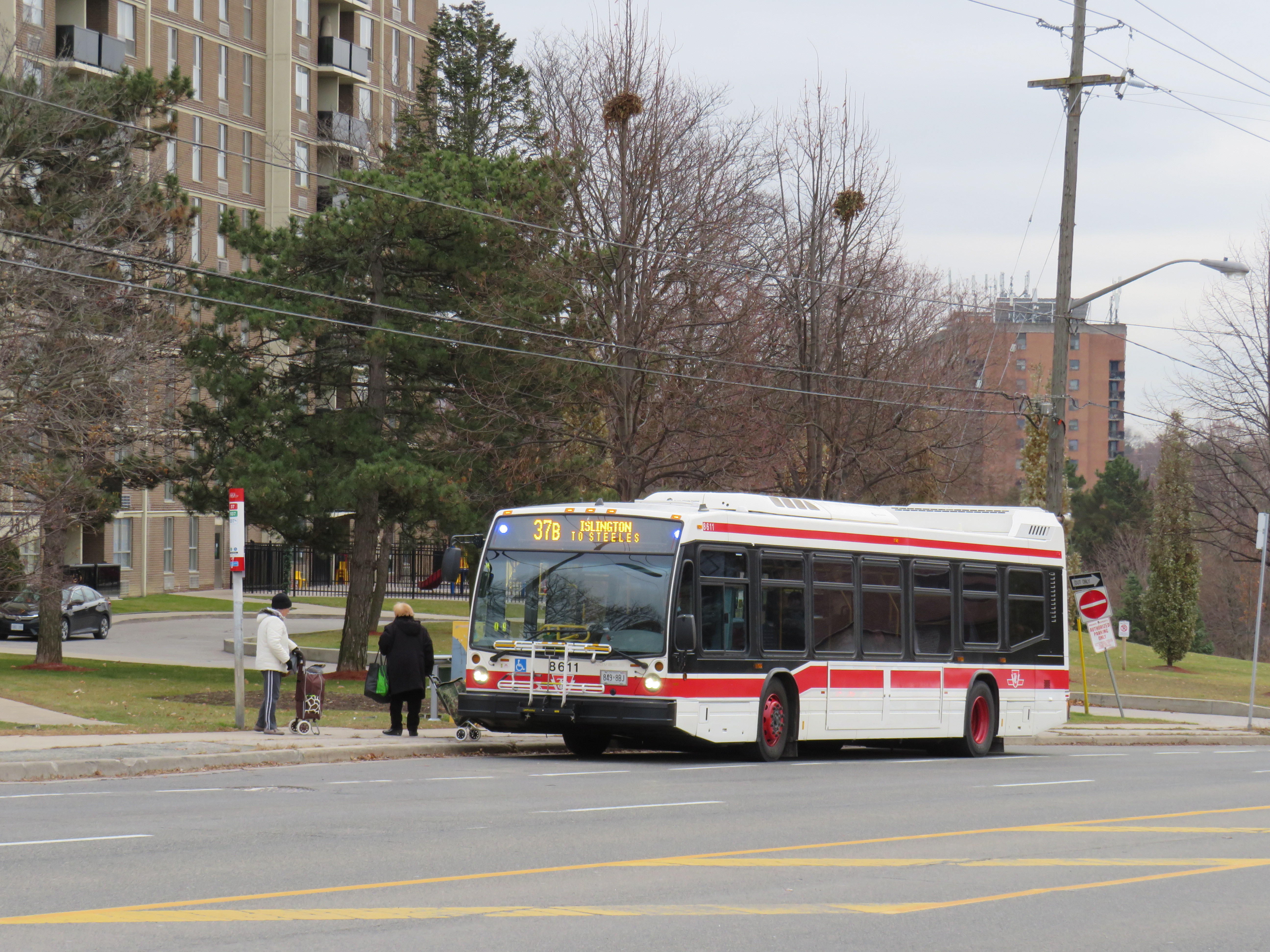
    When the Toronto subway system was extended by six stops to York University and Vaughan, it marked the first time the TTC’s rapid transit system extended beyond the city’s boundaries. But it also exposed a major failing of the Golden Horseshoe’s transit structure: the complete lack of fare integration.

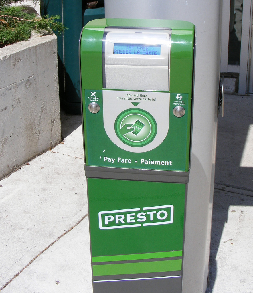
    In 2017, the provincial government announced a new fare discount between the TTC and GO Transit, which operates the region’s commuter rail and bus network. This $1.50 fare discount, available to Presto card users, was funded by the previous Liberal government’s fledgling cap-and-trade carbon pricing scheme, with the promise of further fare adjustments (such as discounts for transferring between the TTC and other suburban transit agencies, such as York Region Transit and Miway) to come.

    With the election of the Progressive Conservatives in 2018, the cap-and-trade scheme was cancelled, and with it, the continued funding for the GO-TTC fare discount. That discount is set to come to an end on March 31, 2020. Neither the cash-strapped TTC or Metrolinx, the provincial agency responsible for GO Transit and transit planning, will step up to make up the difference.

    IMG_7865-001
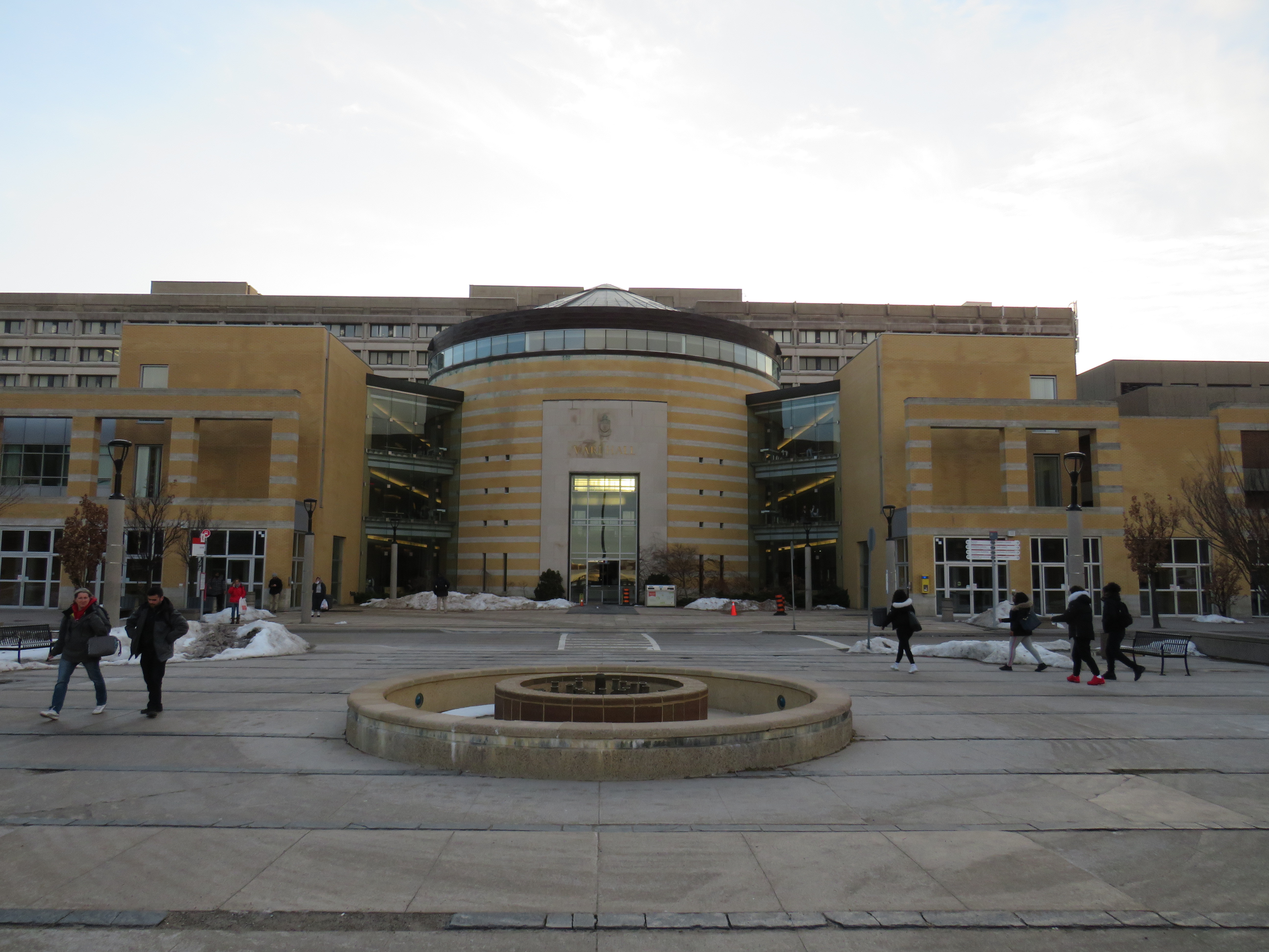
GO Transit buses used to stop right in front of Vari Hall, in the heart of York University’s campus

    Though many regular GO rail commuters will feel the impact of the loss of the fare discount, the impact on York University students and staff will be especially felt. That’s because the new subway extension was planned to remove GO Transit buses from the heart of the campus to a purpose-built terminal at a remote new subway station next to Highway 407. I recently wrote about the problematic fare structure on those GO buses serving Highway 407 Station. Now, those commuters going two more stops will pay $6.40 a day in TTC fares on top of those expensive GO fares.

    Unless they decide to walk to campus.

    On Thursday, March 5, I tried do just that. It was not a pleasant experience.

    https://twitter.com/Sean_YYZ/status/1235681892185206785?s=20

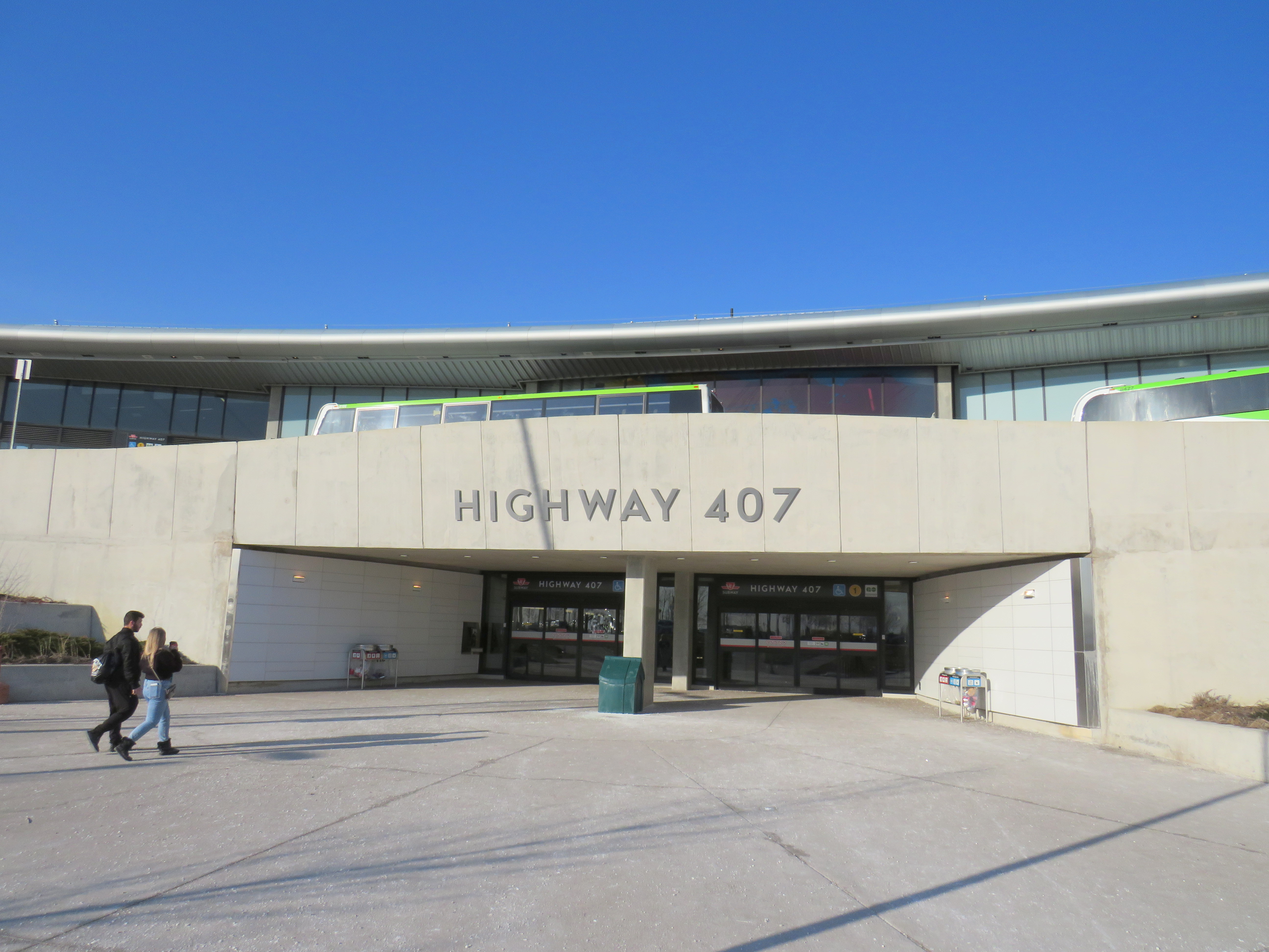
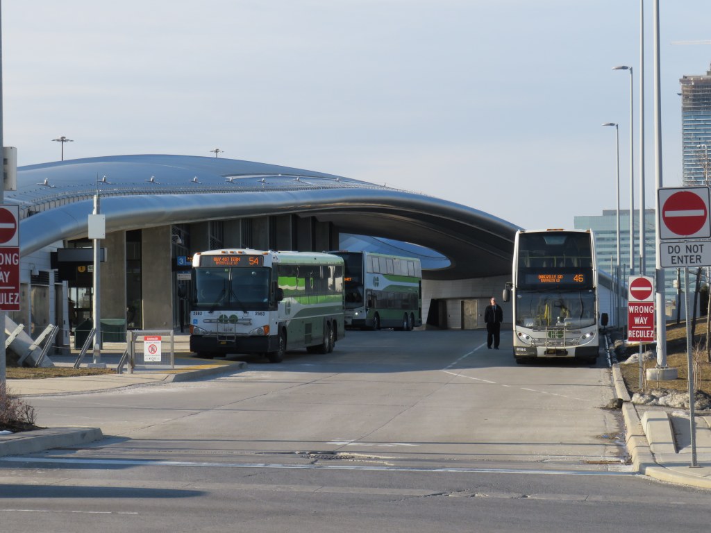
    Highway 407 Station features a large bus terminal for GO Transit and YRT buses, a passenger drop-off and pick-up area, and a commuter lot. But it was not built with pedestrians in mind. That’s understandable. The only places within a few minutes’ walk are Beechwood Cemetery across the street, a warehouse, and the employee entrance to a major UPS parcel centre.

    The main — and only authorized — entrance is on the opposite side of Jane Street, facing the passenger drop-off/pick-up area and the parking lot. It is quite clear in the design that most passengers would be transferring between bus and subway, perhaps with the idea that the fare boundary issue would be resolved by the time the station was open.

    IMG_7830-001
    Jane Street, with the entrance to Highway 407 on the right, and Beechwood Cemetery on the left

    The vertical circulation prioritizes bus-subway connections. At the bus platform level, I spotted a sign that said “to street, subway” leading to a downwards escalator. But it led me past the mezzanine level straight to the subway fare gates. I had to climb halfway up to get to the entrance doors.

    IMG_7848-001
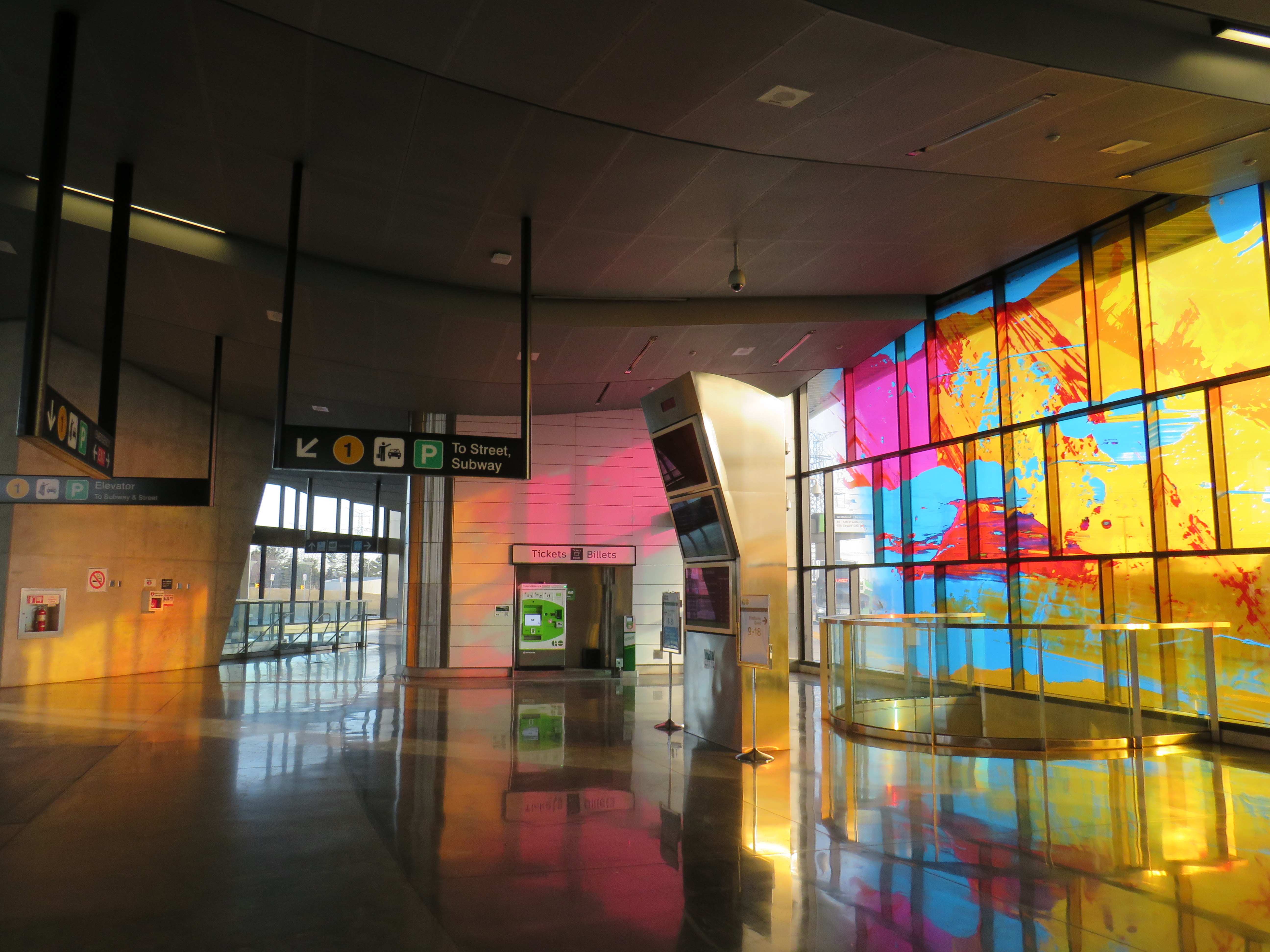
The stained glass at Highway 407 glows in the late afternoon sun. But it doesn’t take away from a poor user experience.

    Once outside, I noted that the pedestrian path between the parking lot and the passenger waiting area was completely covered by a giant dirty snow pile. It’s clear that pedestrians are not welcome here.

    Snow left on the only legal sidewalk leading out of Highway 407 Station

    The circuitous route is designed to keep pedestrians out of the way of the buses entering and exiting the station. But I was left wondering why a shorter, direct, and snow-free route was not designed into the station plan at the beginning. It would have cut a few minutes from my efforts in leaving the station.

    IMG_7835-001
    Pedestrians are barred from the more direct route into the station, even though the bus terminal is not a TTC fare-paid area.

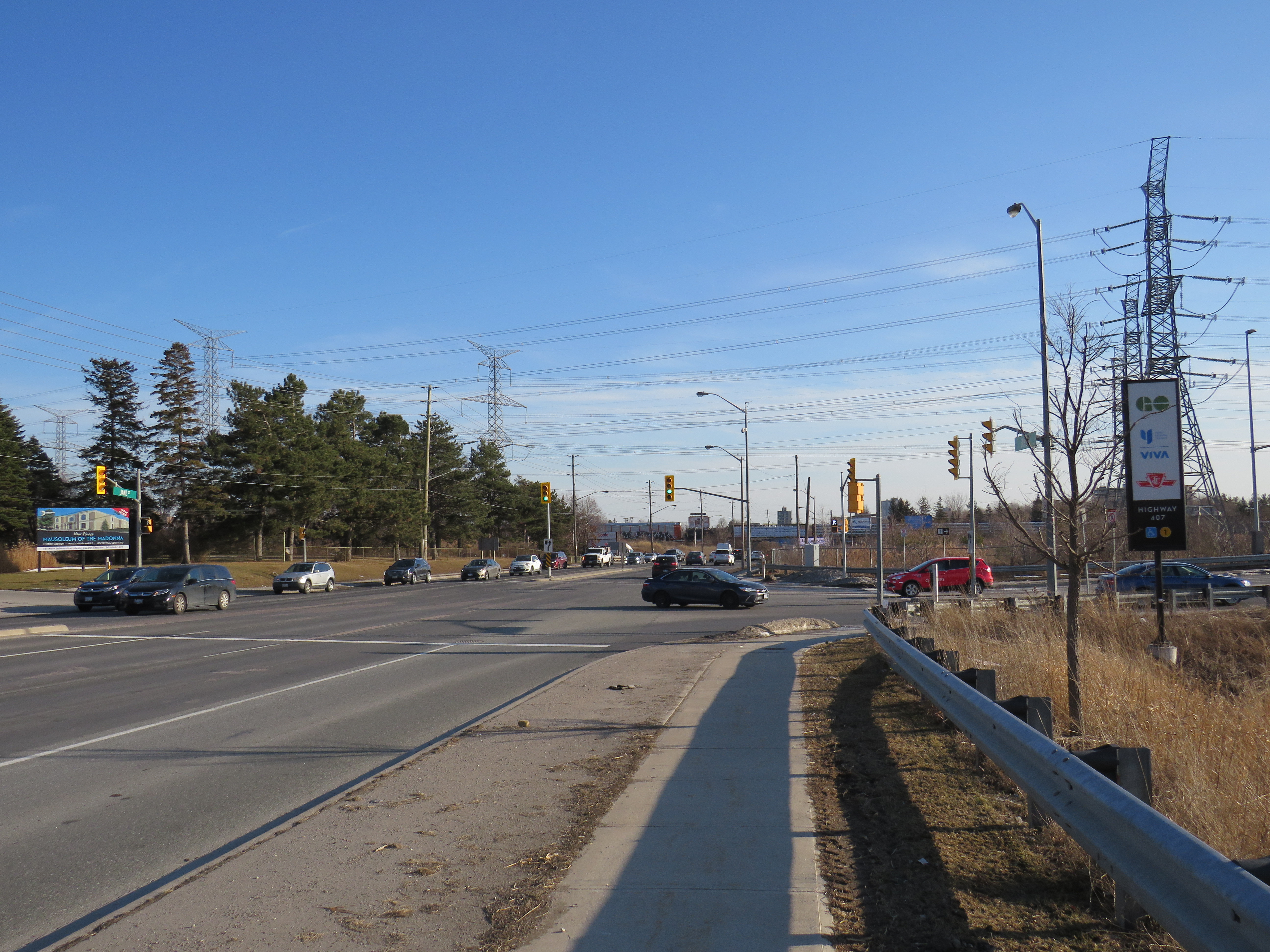
    Eventually, I made it to Jane Street, and began walking south towards Steeles Avenue and campus. The narrow sidewalk hugs Jane Street, and right into a splash zone under the CN Railway underpass.

    IMG_7853-001
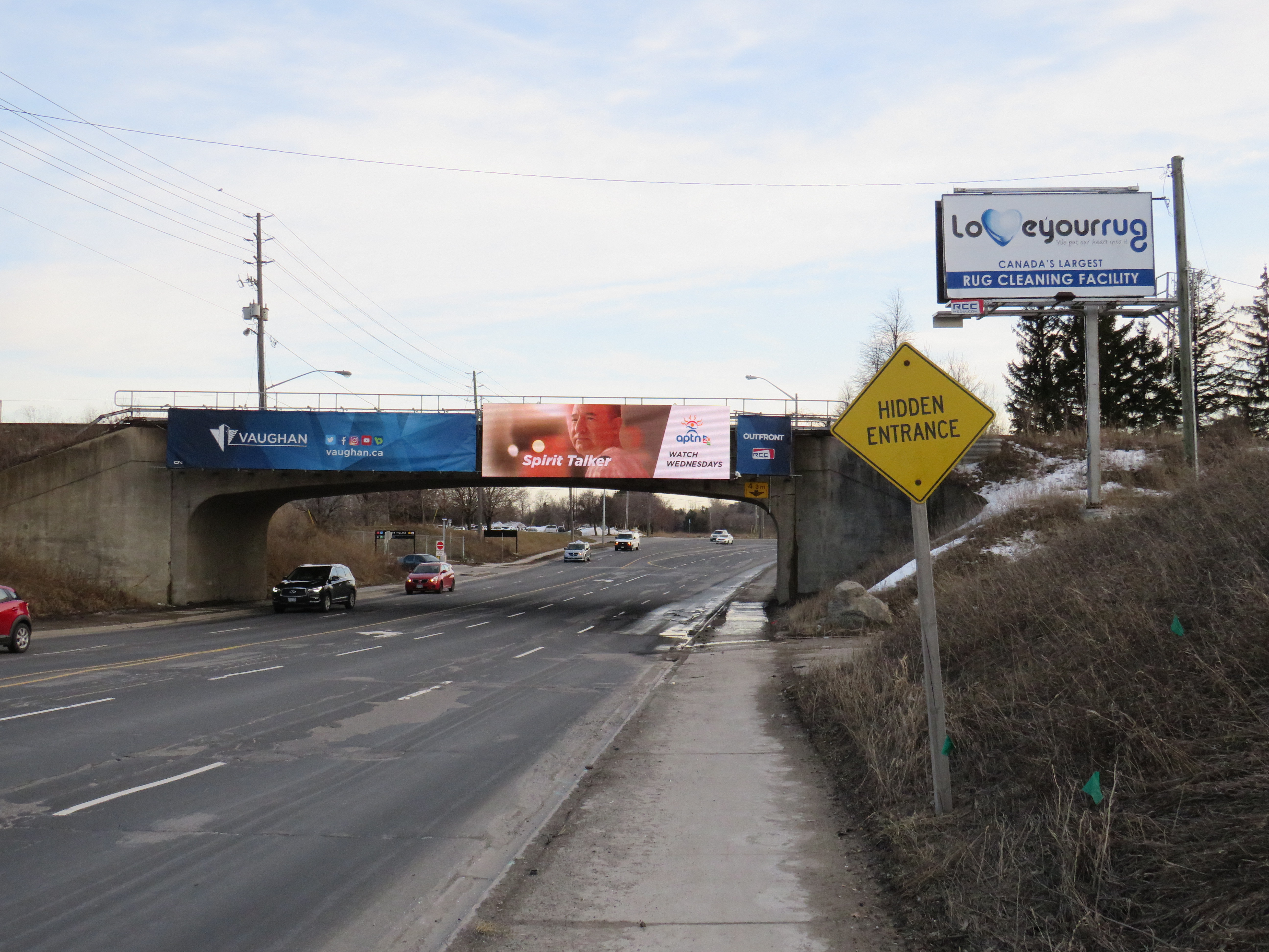
    An unpleasant walk along Jane Street

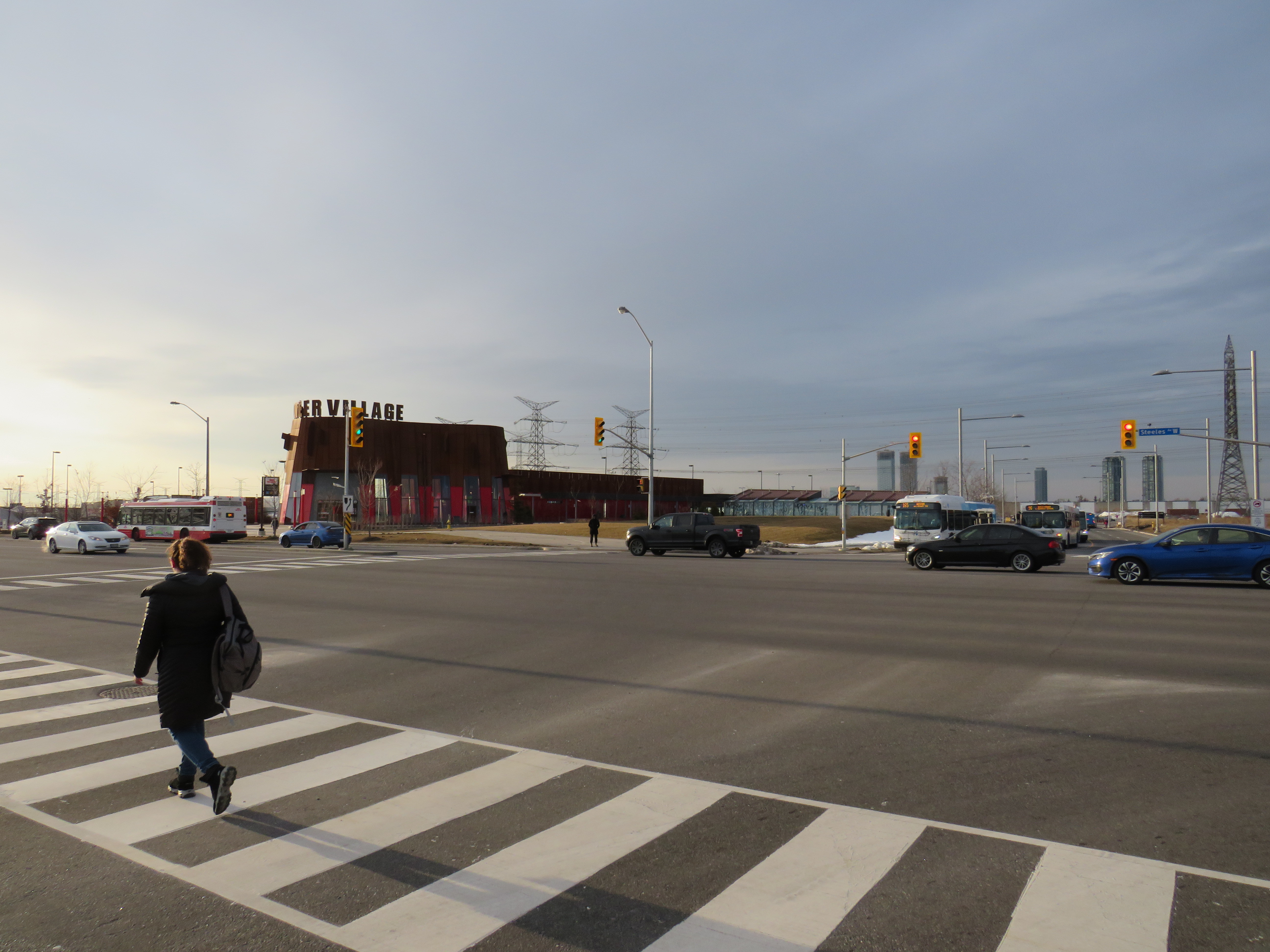
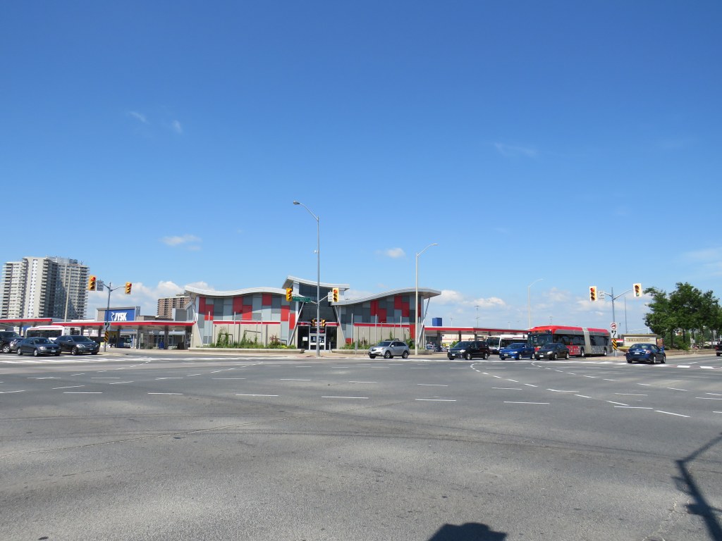
    After twenty-seven minutes, I made it to Pioneer Village Station, which was designed with two separate bus terminals. YRT buses use the smaller bus loop on the north side of Steeles Avenue, outside the fare-paid area. TTC buses use a larger terminal south of Steeles Avenue, on the York University lands. YRT passengers headed to campus must cross Steeles Avenue at grade as the mezzanine level underneath is fully within the TTC fare paid zone. Technically, one could transfer from GO to the YRT 20 Jane bus at Highway 407 Station (with a Presto card, it would cost only $1 each way with the YRT-GO co-fare). But it would still only get you part of the way to campus.

    IMG_7863-001

    After 35 minutes, I made it from the GO bus platform at Highway 407 Station to the Life Sciences Building at York University, on the northwest corner of the central campus, with another 5-10 minutes to major buildings such as Vari Hall or Scott Library. This was at a relatively quick pace (I’m an able-bodied thirty-something man), in quite pleasant weather. A rainy or bitterly cold day would be quite a different matter. Therefore, most will be forced to pay $3.20 each way (the current TTC Presto fare).

    The subway, with the major GO and YRT terminals off campus, was designed for a new fare structure where students and university staff wouldn’t be penalized for having to transfer one or two subway stops to get to the middle of campus. The most we got was a fare discount for GO Transit riders, with nothing for YRT commuters. (Only Brampton Transit continues to directly serve York University.) And now that meagre fare concession is going away, because no one wants to pay for it.

    Sadly, this is just further evidence of how we get transit so wrong in the Golden Horseshoe, despite it being the country’s economic heartland.


    Transit advocacy group TTC Riders, along with allies at York University, have been calling on Queen’s Park to continue to fund the fare discount. You can find out more here.

    I also expect that the opposition New Democrats will submit a motion in the legislature to maintain funding for the discount next week. I’ll update this post as necessary.

  • Disappearing GO-TTC fare discount a major blow to regional transit in Toronto

    4902983182_d89c675230_b

    Updated January 22, 2020

    The TTC-GO fare discount will officially come to an end on Tuesday March 31, 2020, with the TTC and Metrolinx unable to come to agreement to keep the fare subsidy going without provincial support.

    As I argue below, this is a major blow to any hopes for an integrated regional transit system throughout the Greater Toronto and Hamilton Area. Subsidized transfers reduce the need to build expensive parking lots and garages, encourage more passengers to ride transit, especially in off-peak periods, and reduce the potential of major GO Transit expansion projects planned or underway.


    Originally published July 12, 2019:

    Earlier this week, transit riders learned that the fare discount for connecting between GO Transit and the TTC would soon come to an end.

    The provincial Liberal government introduced the discounted double fare in 2017. It reduced the cost of a trip taken on both GO and TTC by $1.50 if the fare was paid on a Presto fare card. For many years, there were discounted transfers between GO and suburban transit agencies, but this was the first time such a discount was offered to TTC passengers.

    The Liberals also planned discounts for transferring between suburban bus systems such as York Region Transit and Miway, subsidies that would have been covered by the provincial carbon pricing scheme. This would have reduced the impact of another fare barrier. (A short bus trip across Steeles Avenue costs nearly $7.)

    When the Doug Ford-led Progressive Conservative government was elected, the provincial climate change plan was scrapped, along with those planned fare changes. Now, the province will not renew the $18.5 million annual subsidy for linked GO-TTC fares, though it did introduce free fares for children on GO Transit.

    This will especially affect commuters to York University, who previously enjoyed a one-seat ride to the heart of the campus on YRT and GO buses. When the subway extension opened, YRT retreated to terminals north of Steeles Avenue, forcing a transfer to the subway or a long walk across six lanes of traffic and campus parking lots. GO Transit, too, moved to a new terminal at Highway 407, two subway stops from campus. While GO commuters at least saved $3.00 a day with the discounted double fare, YRT commuters got nothing. (Of all the suburban agencies, only Brampton Transit continues to serve the campus.)

    This is also a blow to what’s left of SmartTrack, Mayor John Tory’s signature transit plan that was once pitched as “London-style surface rail.” At first, SmartTrack was a 53-kilometre heavy-rail line, mostly piggybacking on existing GO Transit corridors, but including a problematic western branch to the Airport Corporate Centre in Mississauga, all on an integrated TTC fare. Eventually SmartTrack just consisted of more frequent, electric GO service, along with additional station stops and fare integration. This was much more realistic, but it distracted from other needs such as the Relief Line and GO’s own RER regional rail plan.

    Lower GO fares for short trips and the TTC-GO fare discount were all part of this scaled-back version; as late as last year, Tory called additional fare integration a “critical component” of his pitch. Eliminating the fare discounts is yet another blow to SmartTrack.

    As Jonathan English points out in Urban Toronto, the GO rail network represents “tremendous infrastructure that could greatly improve the lives of hundreds of thousands of Torontonians.” But it lies “letting it lie mostly dormant because we won’t make the comparatively small operating funding investments required to improve the service and make the fares fair.”

    The $18.5 million annual cost is a small price to pay for improving transit accessibility and utilization of our existing corridors. Increasing that annual subsidy to reduce the cost of transfers between the TTC , York Region, Brampton, and Mississauga would, too be a worthwhile investment.

    Sadly, the current provincial government does not see the value in promoting fairer fare systems, nor regional transit in general. In response to budget cuts, Metrolinx reduced or eliminated service on five GO bus routes last month, and more may be to come. While there may be enthusiasm for building a new “Ontario Line” and a subway extension to Richmond Hill, there’s little regard for the actual transit rider.

  • Unfair GO fares on the Highway 407 Corridor

    GO bus with bicycle

    Since 1967, GO Transit’s primary focus has been its commuter rail lines radiating from Downtown Toronto, sometimes to the detriment of other transit needs in the Greater Golden Horseshoe, with bus routes complementing and supplementing that rail network. But twenty years ago, the regional transit service launched a new bus route that connected York University with suburban GO stations and bus terminals, filling in a gap and setting a precedent for expansion to other university and college campuses.

    Late last year, I analysed the GO Transit rail fare structure that centres on Toronto Union Station, following up on previous work. GO Transit claims to operate on a fare-by-distance structure, this is not quite the case. Generally, the longer one travels, the less the passenger pays per distance traveled. 

    Though the GO Transit fare structure was recently improved with new lower fares for short trips, there are still significant fare inequities and discrepancies, with Barrie and Richmond Hill Corridor passengers paying the least per kilometre traveled, and Kitchener Corridor passengers paying the most. 

    The fare discrepancies on the Highway 407 corridor — which is made up of eight bus routes that serve the Highway 407 bus terminal and TTC subway station in Vaughan — are even greater than that on the rail network. A passenger going from Markham GO Station, 27 kilometres from Highway 407 Station, will only pay $3.70 with a Presto card. A passenger from Bramalea GO Station, just 18.7 kilometres from Highway 407 Station, will pay over two dollars more. 

    (more…)

  • A review of GO Transit’s fare structure

    IMG_8969-001

    Four years ago, I wrote about GO Transit’s problematic fare structure. Though GO Transit claims to charge passengers based upon a fare-by-distance structure, fares for travelling short distances were disproportionately high compared to long-distance rides from outer suburban stations. In 2015, I also found significant fare differences between corridors, with Kitchener Line passengers paying the most per distance traveled.

    Since my original post, some changes were made to the GO Transit fare system:

    • In 2016, a tiered fare increase was applied, with the lowest fares frozen (for example, Union Station to Mimico, Bloor, or Danforth), with fare increases between  40 and 60 cents per ride dependent on distance traveled. Those fare increases applied to Presto fares, though with a discount (11.15% less than the cash fare).
    • In January 2018, a $1.50 fare discount was introduced for Presto card users transferring between TTC and GO. However, the Ford government announced it would no longer subsidize the TTC-GO fare discount, threatening its continuation.
    • In April 2019, GO fares for trips less than 10 kilometres were reduced, with the minimum cash fare going from $5.30 to $4.40, with the minimum Presto fares reduced from $4.71 to $3.70. A passenger headed from Union Station to Exhibition Place could choose to take a local TTC streetcar fare ($3.10 with a Presto Card) or the direct GO train ride (just 60 cents more). At the same time, the cash fares for trips longer than 10 kilometres were increased by 4%, while Presto fares were increased by 3%. 

    The good news is the eventual reduction of short-distance fares have gone a long way towards flattening the fare/distance curve.

    There were also some major service changes over the last four years. Two new GO stations were opened: Downsview Park (which offers a direct connection to the new TTC subway extension to York University and Vaughan), and Gormley, a station built next to Highway 404 on the Oak Ridges Moraine. Additional trains were added to Kitchener, new peak-period trains to and from Niagara Falls were introduced, evening trains added on the Kitchener Line, and this month, weekend trains were introduced on the Stouffville Line. But connecting bus routes to Cambridge, Bolton, and between Milton and Oakville were eliminated, with other bus trips cancelled across the system. (more…)

  • The future of Downtown Brampton

    IMG_6142-001
    Metrolinx-owned houses on Railroad Street, Brampton

    Over the last three years, I have been following developments in Downtown Brampton, especially lands surrounding the Brampton GO Station. In April 2016, Metrolinx, the provincial agency responsible for GO Transit, began buying properties in the northwest corner of Brampton’s downtown core, including twelve houses and two low-rise office buildings. The land assembly was for a new surface parking lot, an odd choice for a transit agency that was otherwise interested in promoting compatible land use and transit connections in designated urban centres.

    It was later revealed that Metrolinx, Ryerson University, and the City of Brampton were working on a new downtown satellite campus, with the main academic building to be constructed on part of the GO parking lot, north of the rail corridor. While the construction of more surface parking in a downtown core was still a bad idea, at least there was a reason behind the land assembly. The new Ryerson site would make use of other city resources, such as the Rose Theatre and the planned Centre for Innovation (CFI). The CFI would include academic space and a central library, to be built on city-owned land south of the GO station and bus terminal.

    university map
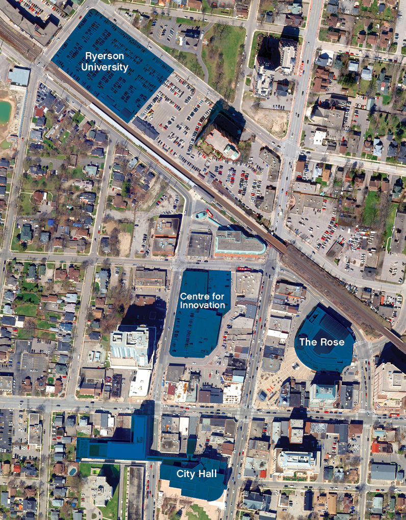
Previous plans for Downtown Brampton, including the Centre for Innovation and the Ryerson campus on the GO Transit lot. Replacement parking would be built on land assembled south of the rail corridor. 

    In October, the newly elected Conservative government cancelled provincial funding for Brampton’s Ryerson campus, as well as other suburban satellite universities planned in Markham and Milton. While Brampton and Ryerson decided to continue working on a scaled-back development including a new centre for cybersecurity, a new plan was developed for downtown revitalization. Details are available in the May 15, 2019 Committee of Council agenda.

    Here’s a simplified summary of the new plan:

    • The CFI will now be built on the north side of Nelson Street West, between Main Street and George Street, on the site of the existing downtown bus terminal, a 6-story office building constructed in 1989, and an older two-storey commercial block. The office building, though only thirty years old, is reported to be in poor condition. The new 15,700 square metre (170,000 square feet) CFI will include the central library, education space, event space, and retail. It may also include additional floors for offices.
    • The bus terminal will be expanded, as the existing facility is too small to accommodate GO and Brampton Transit buses. There will also be room for a new third track through Downtown Brampton, essential for frequent two-way GO service between Toronto, Brampton, and Kitchener.
    • The City of Brampton will likely build a temporary terminal on the south side of Nelson Street to accommodate the demolition of the existing structures and the construction of the CFI and terminal. This land, also owned by the city, is currently occupied by a surface lot and an old commercial building that was originally a Loblaws store. Retail tenants are being evicted from all of the above properties.
    • The city is also interested in using the two office buildings purchased by Metrolinx for short-term academic and administrative purposes as the new CFI is being built.
    • The houses on Nelson, Elizabeth and Railroad Streets acquired by Metrolinx will still be torn down, but without the imminent construction of the Ryerson building, a new parking lot is no longer planned. It is possible that the block will see transit-oriented development in the long term.

    IMG_6155-001
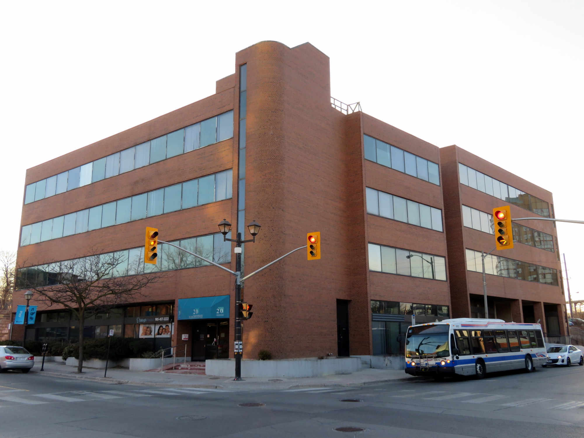
Vacated office buildings at George and Nelson Streets that may see new life under the city’s new plans

    The map below illustrates the revised downtown plans.

    It remains a shame that Metrolinx decided to buy up a whole city block and displace dozens of residents (among the properties it acquired were two heritage houses and a rooming house), especially now that the Brampton Ryerson campus is being scaled back. But the city desperately needs a central library, and happily, Ryerson remains interested in partnering with Brampton. It’s good to see that transit expansion, including a larger bus terminal and GO rail expansion, are part of the plans.

  • What GO Transit service to Brampton might look like without the freight bypass

    IMG_0610-001
    VIA and GO trains meet at Brampton Station

    In 1967, GO Transit launched a new rail service between Pickering and Hamilton. The new commuter train service was made possible as GO just built a new freight bypass so its trains could avoid Downtown Toronto and connect to a new sorting yard in Vaughan. Today, trains on the Lakeshore Line operate as frequently as every fifteen minutes during weekdays, and every half hour on weekends. Unfortunately for Brampton, that freight bypass built in the 1960s runs right through its downtown core, limiting the number of passenger trains that can serve Brampton, Guelph, and Kitchener.

    Last December, the provincial government cancelled plans for a new freight bypass that would have diverted CN trains from a critical section of track in Brampton, allowing for frequent GO and intercity services. Around the same time, a new GO Transit schedule resulted in extreme overcrowding and extended delays on the Kitchener Line. As population and ridership grows, there are few answers and little promise of relief that the freight bypass would have provided.

    In my debut article for Bramptonist, I comment on the future of the Kitchener Line, the only GO line serving Ontario’s fourth largest city and an important commuter link to Guelph and Kitchener-Waterloo. What can Brampton expect now that the freight bypass is dead?

  • How YRT service cuts at York University demonstrate a failure of regional transit

    IMG_4738-002.JPG
    York University Subway Station, opening day

    On Sunday, December 17, 2017, the TTC opened the long-awaited $3.2 billion Toronto-York Spadina Subway Extension to York University and the City of Vaughan. The extension of Line 1, which included six new stations, opened over two years behind schedule largely due to construction-related delays. It was the first subway to extend beyond Toronto’s boundaries; York Region is now pushing for another subway extension up Yonge Street to Richmond Hill.

    Unfortunately, fare integration between the TTC and suburban transit agencies was never completely worked out, despite many years’ notice that this would be an issue once the subway extension was opened. A new GO Transit terminal was built at Highway 407 Station, meant to handle GO Transit’s many buses currently serving York University. York University and York Region Transit (YRT) signed an agreement that YRT would remove its buses from campus after the subway opened. There was an assumption that transit riders destined for York University would simply transfer to the subway, but measures to prevent those riders from paying a second fare were never worked out.

    And now York Region is withdrawing its buses from the campus as of September 2, 2018. While Brampton Transit won’t be withdrawing completely from York University, it will reduce some of its service. For now, GO Transit will not be making any changes to its bus routes serving the campus, and will continue to serve the York University Commons.

    Many YRT passengers will have to pay the whole $3.00 each way, or be required to make a new transfer and/or walk a farther distance from the north terminal at Pioneer Village Station.

    The fact that there’s no fare agreement to allow YRT passengers to ride the subway from Vaughan Centre to York University without paying a full TTC fare is indicative of the failure to fully coordinate regional transportation in the Greater Toronto and Hamilton Area. And York Region’s complete abandonment of what used to be one of its most important hubs is indicative of that region’s lack of commitment to funding transit operations adequately, despite its ambitious capital spending and lobbying for subway extensions.

    (more…)

  • What’s going on in Downtown Brampton?

    IMG_6139-001
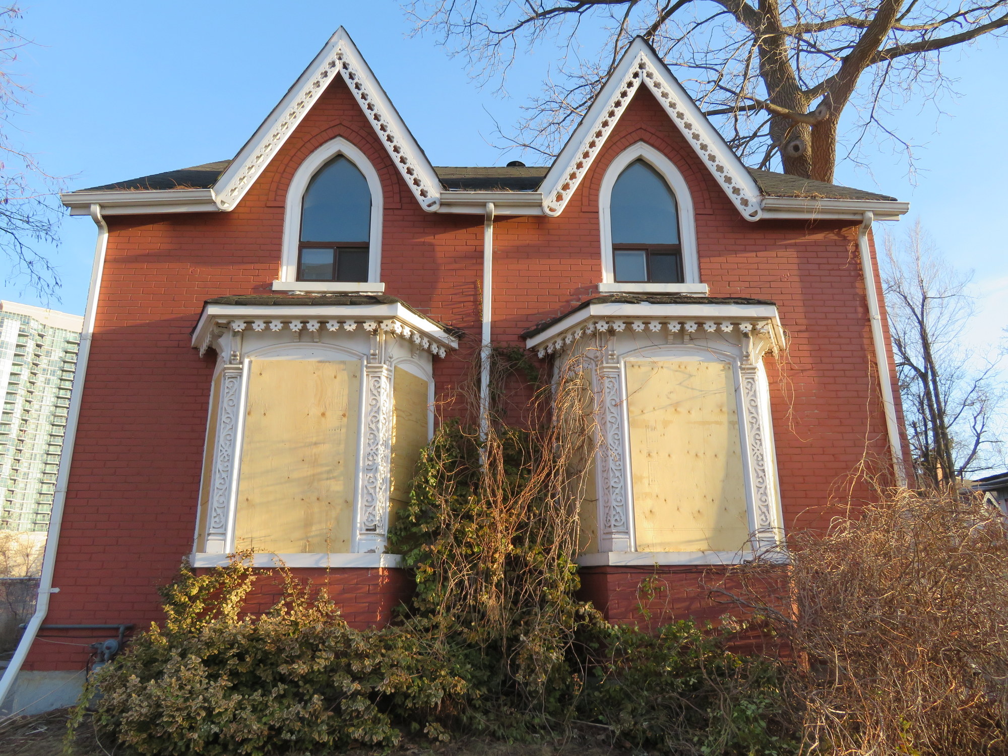
5 Railroad Street, on the City of Brampton’s heritage registrar, is one of several houses recently boarded up in Downtown Brampton

    Update April 19, 2018: the location for Ryerson’s new Brampton campus was announced this morning. The 2000-student campus, which will be a partnership between Ryerson University and Sheridan College, will be built at the corner of Mill and Church Streets, on the GO Transit parking lot. This explains Metrolinx’s (GO Transit’s parent agency) purchase and demolition of properties south of the rail corridor, on Nelson, George, Railroad, and Elizabeth Streets, which I wrote about below.

    While it remains unfortunate that surface parking will replace housing and offices, at least in the short-to-medium term, at least we now know what’s going on in Downtown Brampton. The downtown campus site, with excellent transit links, is the right location.


    Nearly two years ago, I wrote about how Metrolinx, the Province of Ontario’s regional transportation authority, had purchased several houses and two office buildings in Downtown Brampton. The intention at the time was to build a new surface lot to accommodate GO Transit commuters, a symptom of the commuter transit system’s dependence on providing parking.

    Metrolinx is responsible for GO Transit, the UP Express airport rail link, the Presto farecard, and planning and constructing transit infrastructure in the Greater Toronto and Hamilton Area.

    Since my 2016 blog post, three dwellings — 28A and 28B Nelson Street West, a semi-detached house, and 42 Elizabeth Street North — were demolished, but there was little other visible change until this month. Now eight more houses — on Elizabeth Street and Railroad Street have been boarded up and their electricity disconnected, including at least one rooming house that was occupied until very recently. The two office buildings — 29 and 37 George Street — are also emptying out.

    Four of these properties — 30 Nelson Street West, 46 and 50 Elizabeth Street North, and 5 Railroad Street — are listed by the City of Brampton as containing heritage resources.

    IMG_6153-001
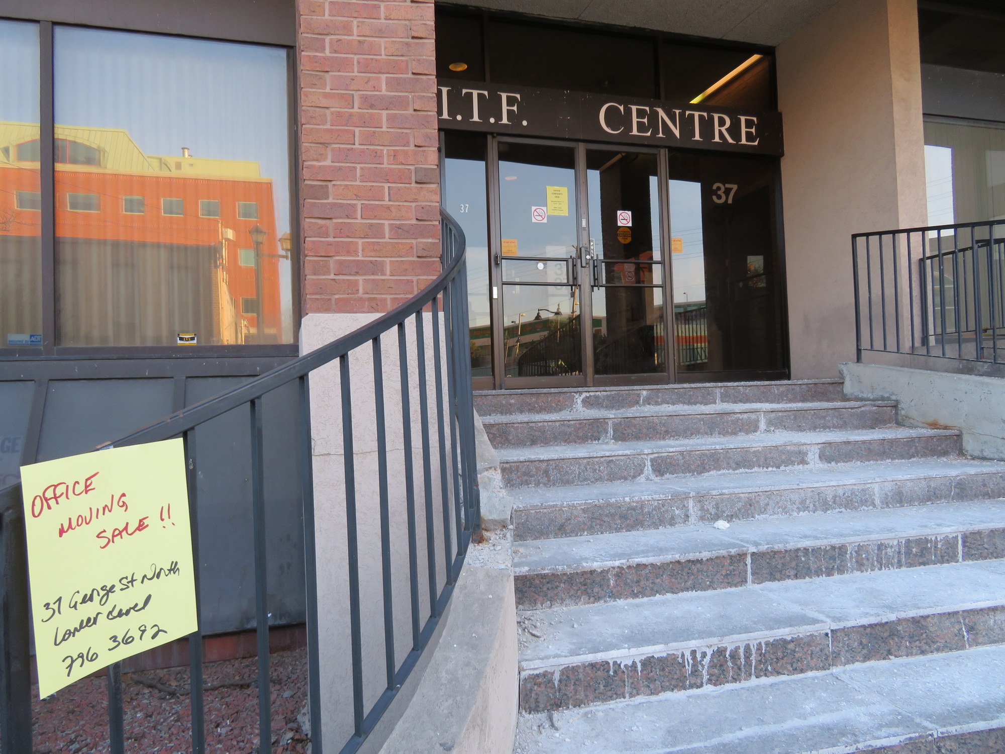
Offices at 37 George Street are moving out

    So what exactly is going on? Why has Metrolinx purchased twelve homes and two offices in Downtown Brampton? Is it for a surface parking lot as previously reported in 2016? Or does this have to do with recent plans for a new Brampton campus of Ryerson University?

    The City of Brampton has been assembling land and buildings nearby, including 8 Nelson Street West, a six-storey office building above the downtown bus terminal. The city also owns the old Loblaws store on the southeast corner of George and Nelson Street. As Bramptonist‘s Divyesh Mistry found, Metrolinx noted “…continued collaboration between Metrolinx staff […] with the City of Brampton and Ryerson University on the Brampton Station redevelopment.”

    IMG_6148-001
    Houses on Elizabeth Street North recently vacated and boarded up. 

    If this land assembly is, in fact, to support a yet unannounced Ryerson University campus site on this block or on the existing Brampton GO Station parking lot, then this is on the whole very good news, though I remain concerned about the loss of downtown housing, particularly rooming houses and affordable apartments that some of older homes in the area have been divided into. A downtown campus with excellent transit links — GO Transit and several Brampton Transit bus routes — makes more sense than Milton’s plans for a greenfield campus for Wilfrid Laurier University distant from GO Transit’s bus and rail lines.

    IMG_6149-001
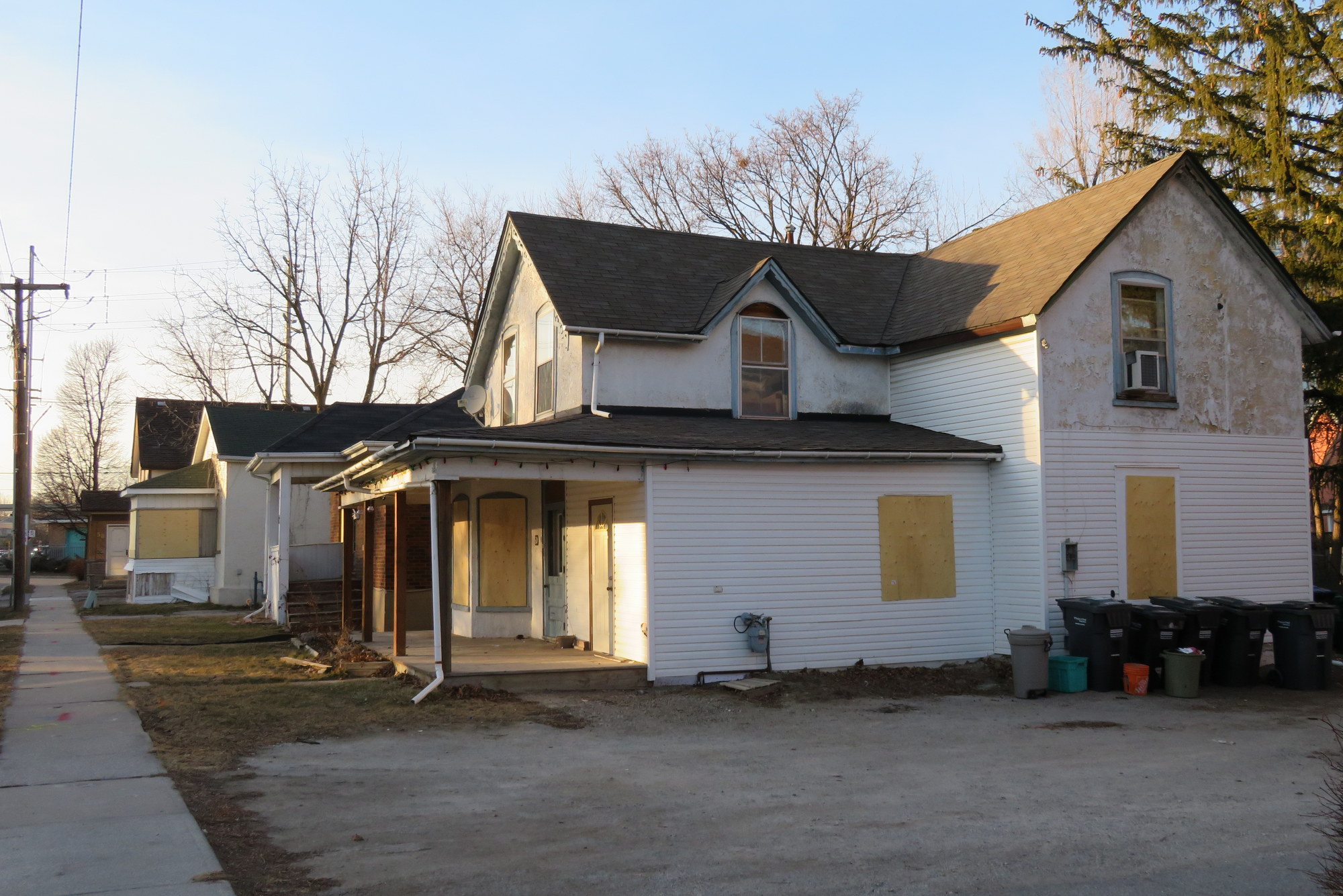
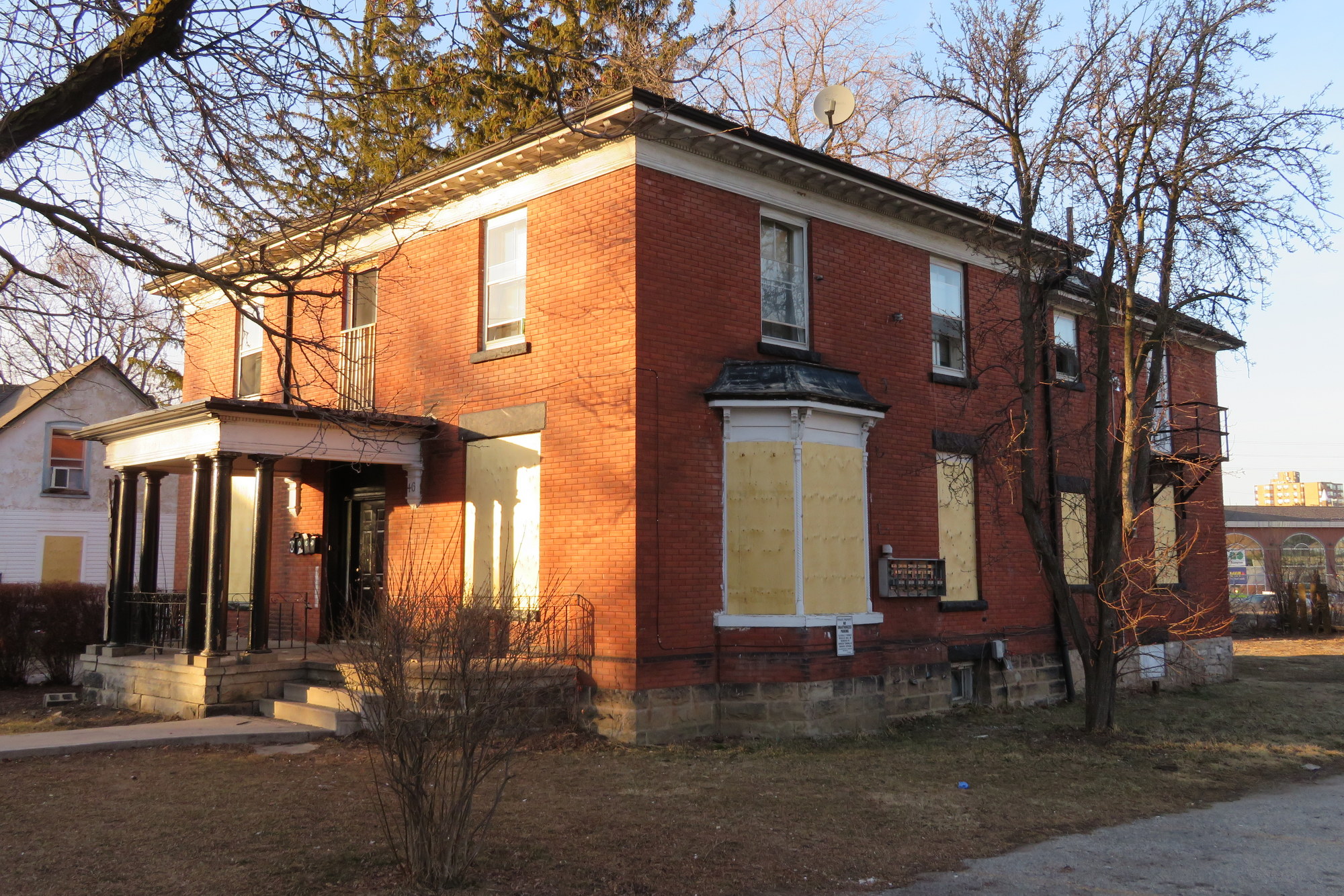
46 Elizabeth Street North, a rooming house with heritage status, is now boarded up, with the electricity disconnected. 

    Unlike a competing university campus site near Etobicoke Creek backed by New Brampton (a politically influential group of local business and landowners who also opposed the Hurontario-Main LRT route), the GO Station and the Nelson/Railroad/Elizabeth Street buildings are outside the historical floodplain and can be built quicker.

    If the existing GO Transit parking lot were to be used for Ryerson’s Brampton campus, then an alternative parking site would be required — hence the recent purchase and the demolition of these homes and offices. The construction of a new surface lot in an designated “anchor hub” — where rapid transit lines meet and urban intensification is encouraged — would be most unfortunate, but I hope that it will not be a long-term solution. On the other hand, a new university campus is exactly the type of land use that should be located at an “anchor hub.”

    So far, local officials have kept very quiet about the land assembly on the block surrounded by George, Nelson, Elizabeth and Railroad Streets, perhaps waiting for approvals from the province and Ryerson University before making a public announcement. But with residents and office tenants displaced and houses boarded up suddenly, confirmation of these plans should come soon.