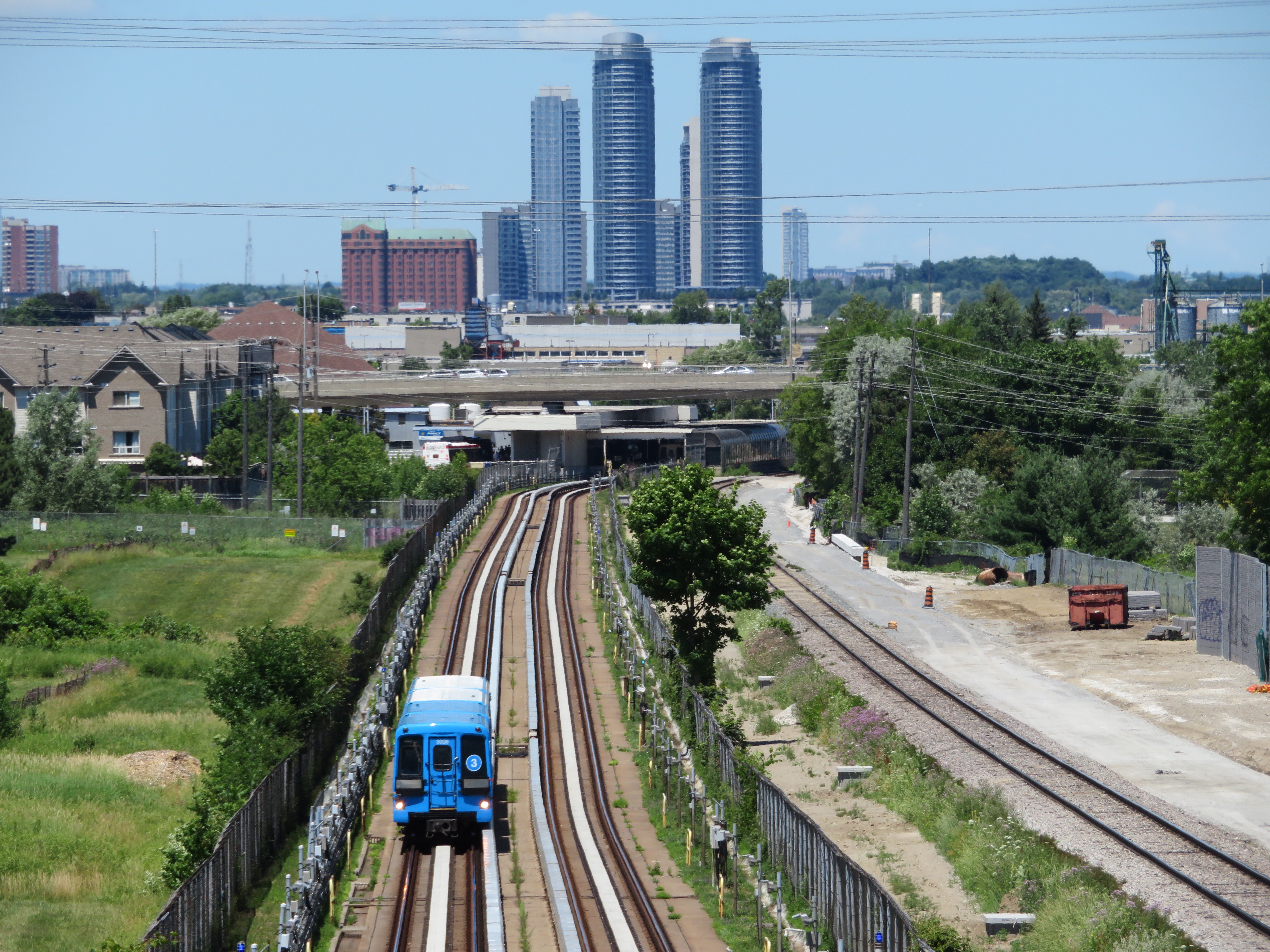
On Monday July 24, at 6:45 AM, a Scarborough RT car on Line 3 derailed soon after departing Ellesmere Station. Forty-five passengers were on board, and five suffered minor injuries. The Scarborough RT, which opened in March 1985, was suspended, and then permanently closed, four months ahead of its planned shutdown on November 18, 2023. For the first time in its history, Toronto’s rapid transit map has shrunk.
Line 3, which was originally designed to be operated with conventional streetcars (but in a light-rail manner, with high-speed operation and grade separation), was opened as the first Intermediate Capacity Transit System (ICTS) line, using technology developed by Urban Transportation Development Corporation, a provincial crown corporation later acquired by Bombardier. ICTS, now marketed as Innovia Metro by Bombardier Transportation successor Alstom, continues to be used successfully by other light metro and airport people mover systems, including Vancouver’s Skytrain.
Over the last two decades, there were lengthy debates on how to renew or replace the ageing technology that found itself orphaned: new ICTS cars developed by Bombardier for clients like Vancouver and Kuala Lumpur were longer and unable to fit through several tight curves; the cost of ordering custom cars for a short, 6-station line was simply uneconomical. Scarborough politicians demanded a subway extension, while David Miller, mayor from 2003 through 2010, proposed converting the line to LRT as part of Transit City, including an extension to Malvern. Rob Ford, elected mayor in 2010, promised “subways, subways, subways,” and was able to get the LRT plans cancelled with council and provincial support. It took another decade for groundbreaking on the Scarborough subway extension, which finally took place in June 2021. By then it was apparent there was going to be several years without rapid transit northeast of Kennedy Station.
In the meantime, the TTC did what it could with a limited budget: it refurbished the RT cars, replacing the seating and covering the cars’ exteriors with a blue vinyl wrap. The TTC also began planning for a long-term bus replacement service, as the subway extension is not expected to open until 2030.
This month, the TTC updated the system maps on its website, removing Line 3 from its materials. A note reads “Line 3 Scarborough permanently closed. Visit ttc.ca/Line3 for information on bus replacement service.”

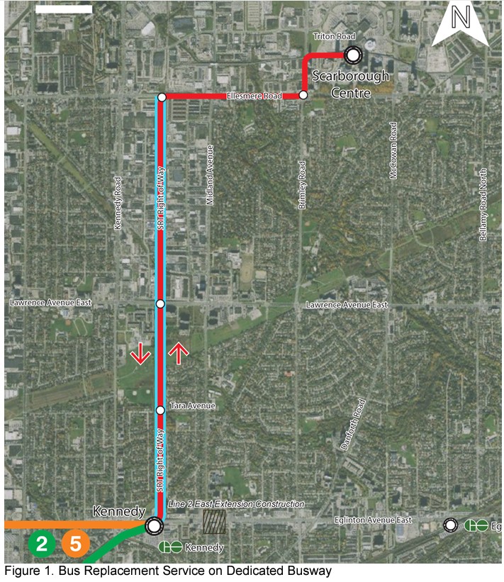
For now, Route 903, an express bus stopping only at Lawrence Avenue East and Ellesmere Avenue is operating; temporary bus lanes have been painted on Midland Avenue (southbound) and Kennedy Road (northbound) to mitigate delays and handle the demand. In the short term, exclusive bus lanes, queue-jump lanes, turn restrictions, signal priority, and other measures on Ellesmere, Brimley, Midland, Kennedy, and Eglinton will help prioritize buses before the southern half of the SRT corridor can be converted to a busway. For her part, newly elected mayor Olivia Chow is backing the accelerated conversion.
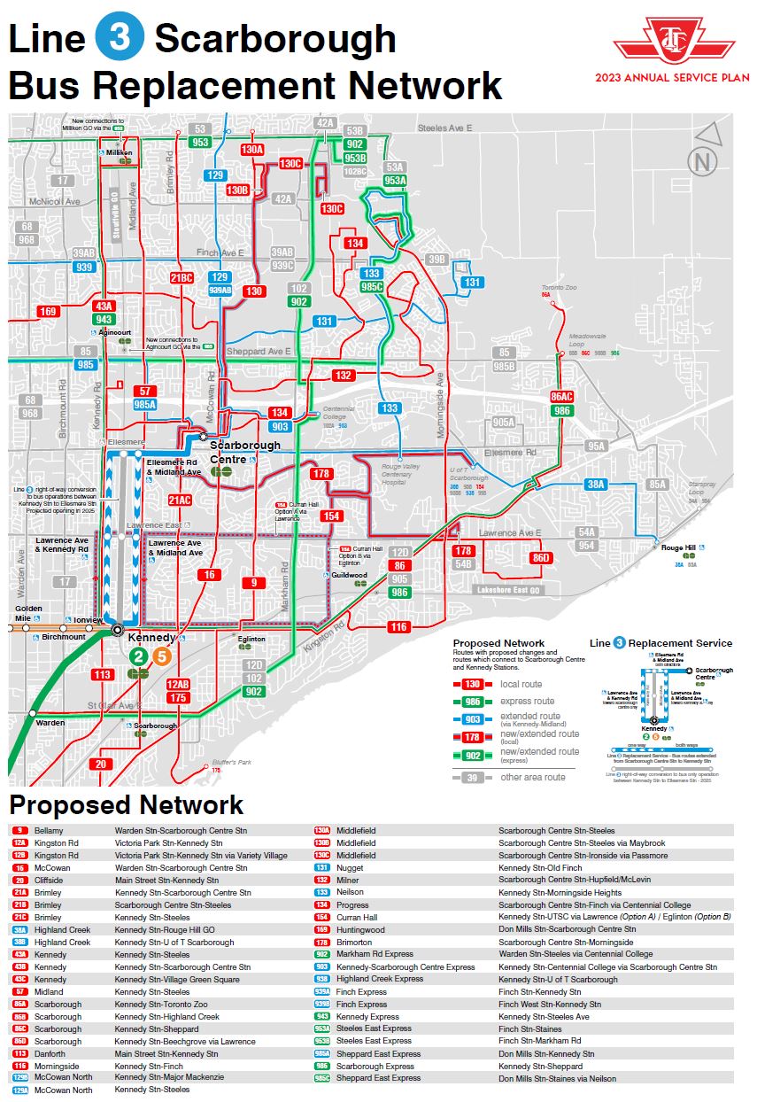
In November, several Scarborough routes will be extended from Scarborough Centre to Kennedy Station to reduce the number of bus transfers. Busy routes such as 38 Highland Creek, 129 McCowan North, 133 Neilson, and 939 Finch East will be extended south to Kennedy via the bus lanes (and later, the busway).
Sadly, years of political bickering has forced a lot of people to put up with the longer ride. But the TTC at least appears to be doing the best it can with the resources it has been given.
Now, about that subway and streetcar map
A few years ago, the TTC began displaying maps in streetcars and subway trains depicting the rapid transit and streetcar networks. (Line 900, the airport express bus route, is also included.) The inclusion of streetcar routes has bothered me somewhat since then, but the current iteration of the map is ridiculous.

Of the depicted streetcar routes, only three are operating in normal operation: 509 Harbourfront, 510 Spadina, and 511 Bathurst.
Route 512 St. Clair will be busitituted until Summer 2024. Routes 504 King and 505 Dundas are currently diverted from Broadview Station because of ongoing water infrastructure and track work. Route 506 Carlton is currently diverted from High Park to Dundas West Station. Route 501 Queen, depicted in the map as diverting via Dundas to avoid long-term Ontario Line work at Yonge Street, is only operating as a streetcar between McCaul Street and Sunnyside Loop.
Given the TTC’s poor operations of its streetcar service, with constant bunching and wide service gaps, slow operations especially over track intersections, and constant diversions and bustitutions, I’m not sure why the TTC bothers to include its slow, unreliable, and inconsistent streetcars in a rapid transit map.

3 replies on “Line 3: struck from the maps”
[Line 3, which was originally designed to be operated with conventional streetcars (but in a light-rail manner, with high-speed operation and grade separation)]
And that divergence from plan in and of itself doomed any possibility of later adaptation and/or expansion.
Since Krauss-Maffei divested themselves of the ‘attractive’ form of mag-lev/linear propulsion, as opposed to the repulsive form, shortly thereafter, one wonders if Davis et al were suckered by lemon juice? The attractive form is forever not self-limiting in terms of distance between stator and (effectively) rotor.
That Line 3 managed to run for as long as it did is the truly surprising aspect.
Sad, incredibly sad…
Hi Sean are there plans in the works to also see Durham Regional Transit route 920 bus that currently operates from the Harmony bus terminal in Oshawa in the east to Scarborough Centre station in Scarborough in the west eventually be extended to end at the TTC Kennedy subway station to easily connect with the TTC subway network as Kennedy is now the easternmost subway stop on the TTC now that TTC Line 3 is no more?
I doubt it. That’s a long distance from Durham Region, and without any additional revenue on their part to make up the extra expense. I suspect too that many 920 riders are headed to points elsewhere in Scarborough, rather than toward downtown Toronto