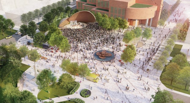
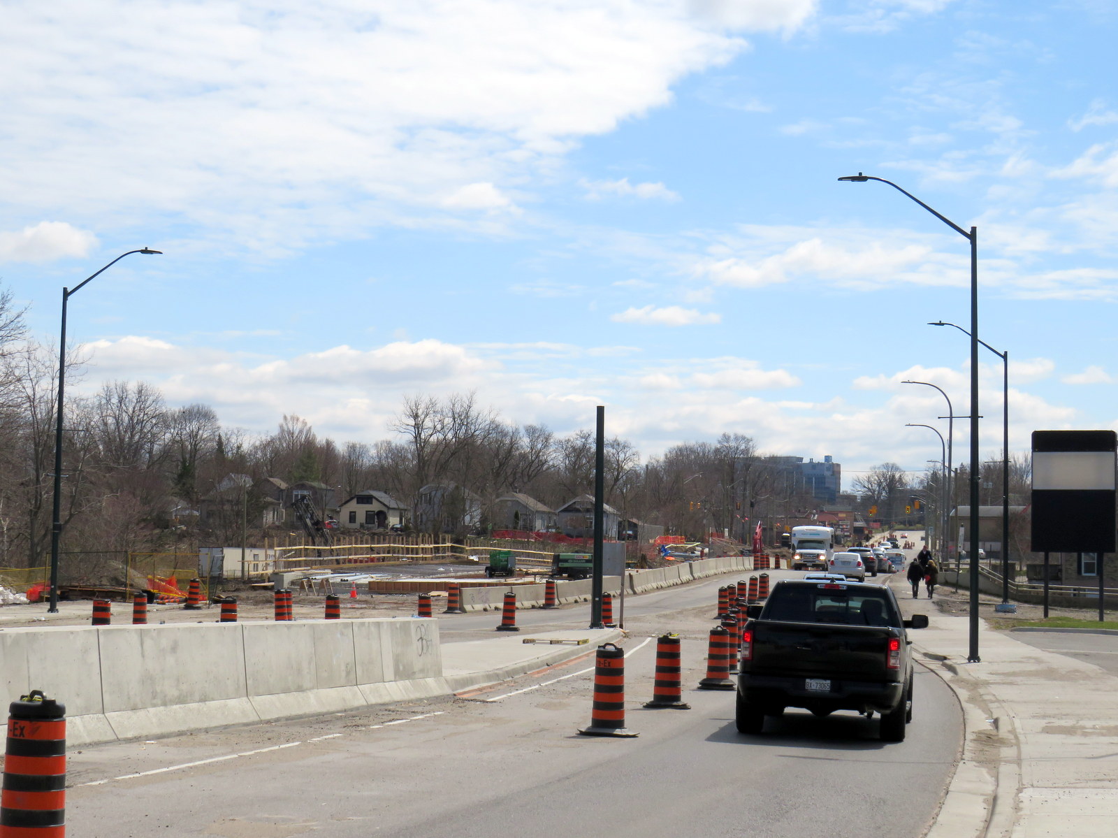
Garden Square, at Main and Queen Streets, will be one of the two public spaces downtown to be rejuvenated
After nearly two decades of little change, Downtown Brampton may finally be turning the corner from being a sleepy town centre to becoming the proper hub for a city of nearly 800,000.
The Riverwalk, an ambitious plan to enhance flood protection from nearby Etobicoke Creek and create new public space, will break ground later this year. The extension of the Hurontario LRT into Downtown Brampton, by way of a deep-mined tunnel, was approved and funded by the provincial and federal governments. There will also be a new transportation hub to accommodate additional tracks at Brampton GO Station and support Brampton Transit ridership growth. City of Brampton is also hoping to get started on a new Centre for Innovation at the corner of Nelson and George Streets; it will contain a new central library as well as space for Toronto Metropolitan University and Rogers.
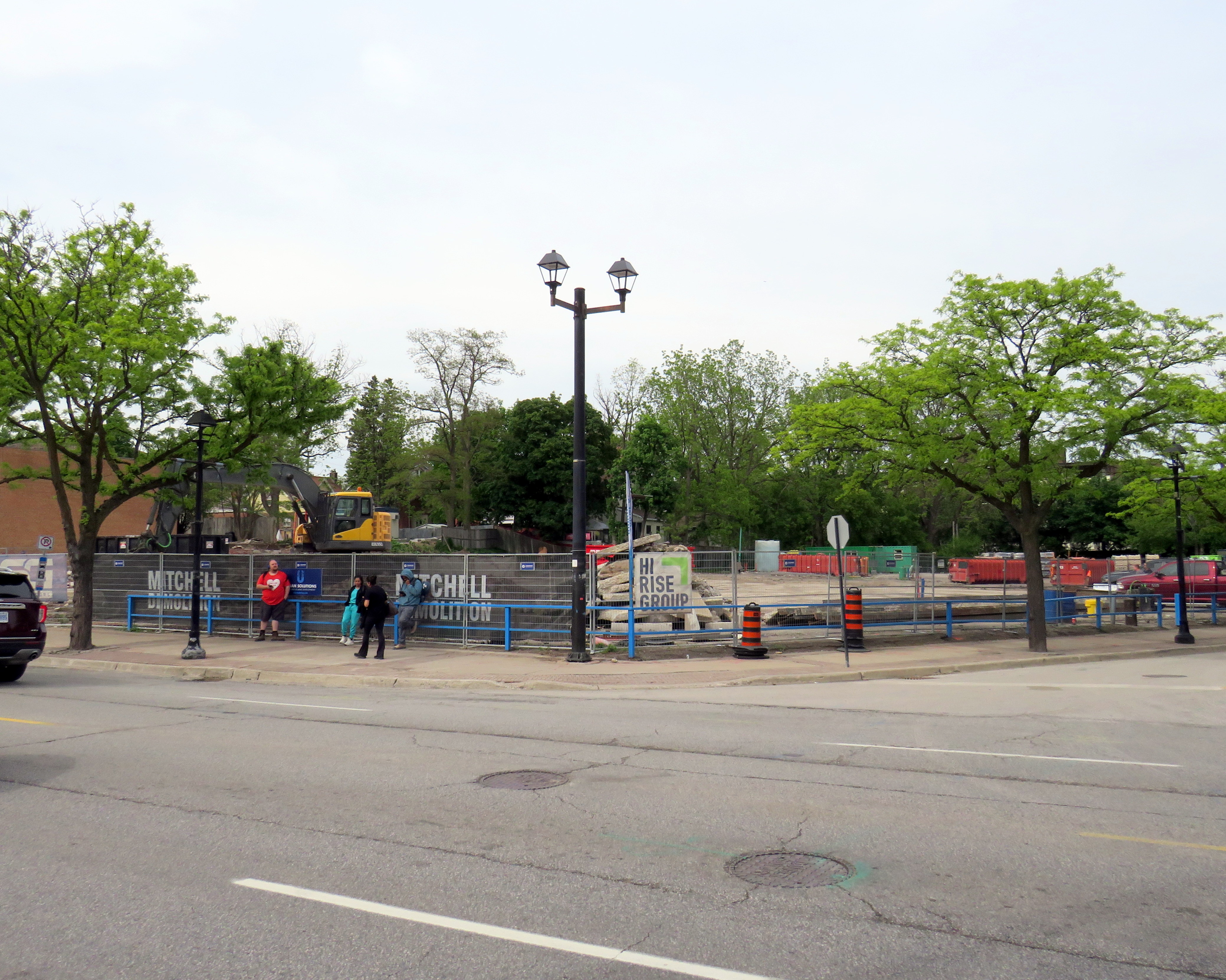
Private sector development is also waking up. The first of a new wave of mixed-use high-rise developments, Rose Garden Residences, has started construction.
Demolition is complete and shoring is starting at Rose Garden Residences
These are exciting times for Brampton. The city, looking to attract more people to the downtown core, is planning to improve both Ken Willians Square, in front of City Hall, and Garden Square, in front of the Rose Theatre. The municipal government is looking for feedback on four proposed designs for the two square.
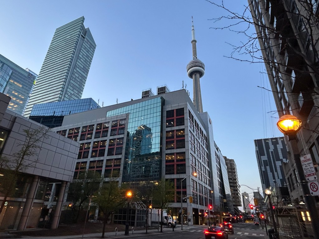
Walking towards the CBC Broadcasting Centre at 6:00 am
Yesterday, on Wednesday, May 7, I had the privilege of appearing on the long-running CBC Radio program Metro Morning. Though I have been interviewed on the radio a few times before – generally about pedestrian safety or transit issues – this was the first time I was asked to come into the studio.
I spoke about the new permanent barriers that have gone up around Union Station in the last few weeks, seven years after temporary Jersey barriers were installed. I take exception to the size and placement of new barriers – which needlessly restrict pedestrian flow around the busy transport hub – as well as their unappealing appearance.
The new barriers are already scuffed up and are not appealing to sit on
I arrived around 6:10 for a short interview at 6:40. After checking in with security, I was let up to the CBC Toronto newsroom, which has a radio studio for local programs including Metro Morning and the afternoon drive time show Here And Now. I met with one of the producers and with host David Common before the segment. They were all great. David is a great interviewer, and it was nice to go see where the magic of radio happens.
BRT median under construction on Wellington Street at South Street, London
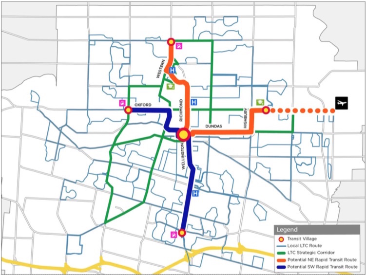
The City of London, Ontario has been quietly constructing a new bus rapid transit (BRT) system over the last few years, which will extend south and east of the downtown core. By the end of April 2025, the first major section of this network will begin operation.
The Wellington Road and Fanshawe College segments are two of the four rapid transit routes originally proposed under London’s SHIFT. At first, a north-to-east line, connecting Masonville Place Mall, Western University, Downtown London, and Fanshawe College, was to be a light rail corridor, featuring a short tunnel under Richmond Street to avoid a busy freight railway crossing. A BRT line would have connected the west end of London, at Oxford Street and Wonderland Road, continued downtown, and head south towards the Victoria Hospital campus and White Oaks Mall near Highway 401. The map below shows the initial proposal.
The original rapid transit proposal called for a light rail (orange route) connecting Western University, downtown, and Fanshawe College and a BRT (blue) corridor to the west and south of downtown
Due to budget constraints, the project was revised to a BRT-only scheme. The Richmond Street leg, leading north to Western University, was cut when the bus tunnel under the CPKC railway and the Oxford Street intersection was deemed to cost $220 million in 2017. Business owners along Richmond Street, a busy restaurant, nightlife, and shopping district known as Richmond Row, were also opposed to the reduction in traffic lanes that the transit tunnel would have required.
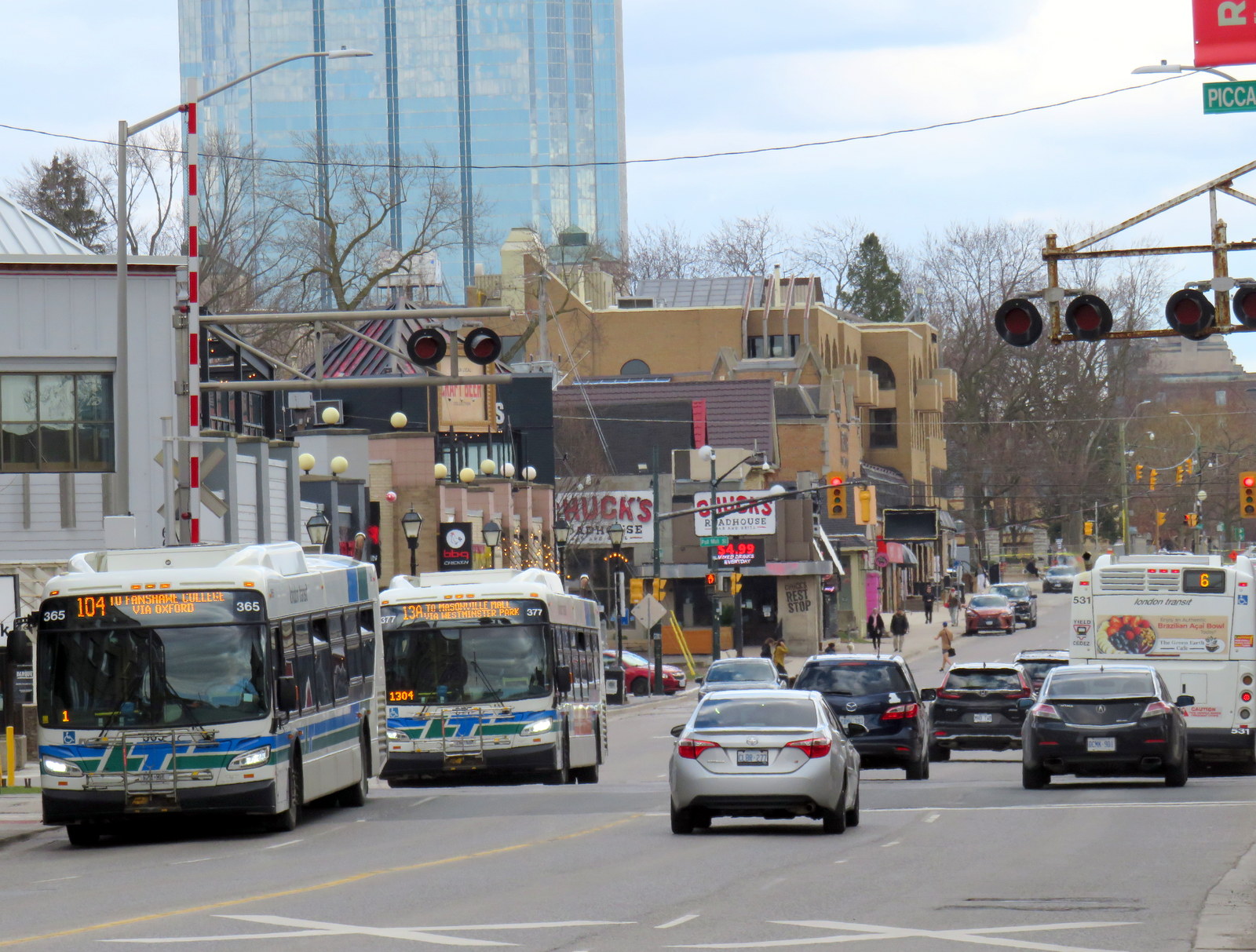
This section of Richmond Street — used by eight London Transit routes — is a severe bottleneck as it is not only a busy traffic corridor, it crosses CPKC’s mainline connecting Toronto, Windsor, and the US Midwest.
Several buses cross the CPKC tracks on Richmond Street north of Downtown London
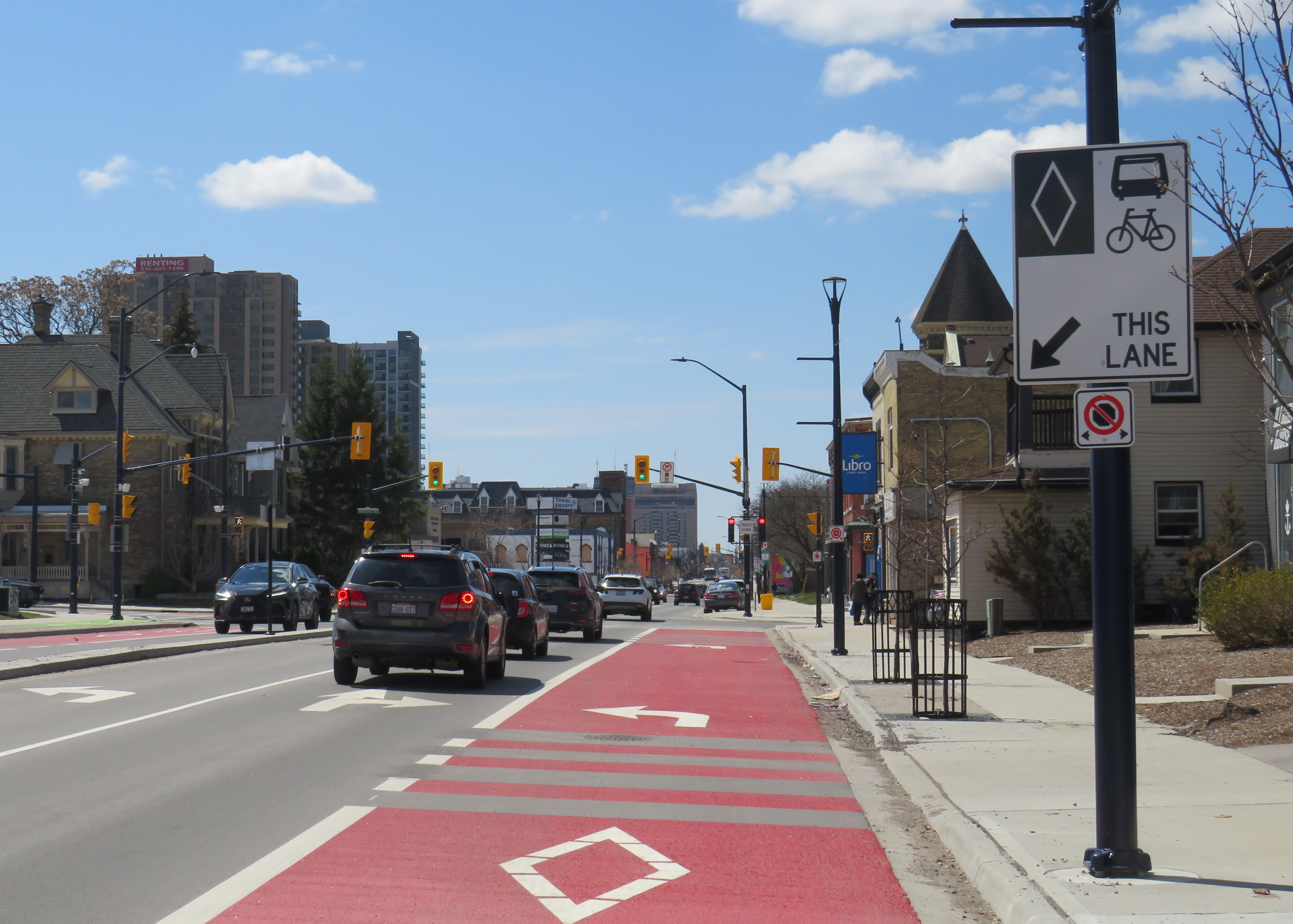
The pared-down BRT project consists of a curbside bus-only lane encircling the downtown core, following King Street, Wellington Street, Queen’s Avenue, and Ridout Street. At each turn, buses must wait for a dedicated signal to make the left turn to continue on the loop. Right now, buses do not have any signal priority, and can wait a full light cycle (up to two minutes) to get the dedicated left turn signal.
Example of a left turn from the right curb lane in London. The dedicated transit signals allow left-turning buses to remain in the right lane without traffic conflicts.
New enlarged shelters and long platforms allow multiple buses to pick up and drop off at each stop; most routes heading through downtown will serve at least one of these new bus stops on their routes. All buses were removed from Dundas Street, which has been re-landscaped to create a more pedestrian-friendly commercial environment called Dundas Place.
New enlarged bus shelters along the BRT corridors; this is at Wellington and King Streets
On April 28, Route 94, a weekday express route between Argyle Mall in London’s east end, Downtown London, and Western University, will begin operating in both directions on King Street, and will be the first route using the bus infrastructure outside the downtown loop. King Street was originally a one-way, two-lane-wide roadway east of Downtown London, but was recently widened to allow for painted bus lanes in both directions.
Contraflow bus lane on King Street, previously a two-lane, one-way street
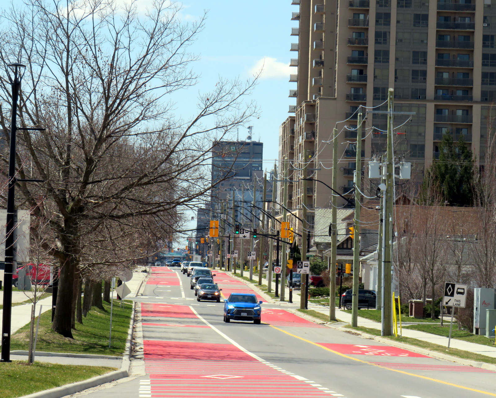
Work is far from complete. Utility work and road reconstruction continues on Dundas east of Ontario Street (at the Western Fairgrounds) and on Highbury Avenue north to Oxford. Construction of the BRT median on Wellington Street/Wellington Road south is also ongoing.
Looking south on Wellington Street at the South Thames River bridge crossing, which is being widened as part of the BRT project
The cost of the BRT project has risen to at least $454 million, and that does not include the north or west segments. Service levels have yet to be determined, along with transit route restructuring once the east and south segments are complete. The new station shelters will not have off-board fare payment equipment, so unless policy changes, all transit riders will still have to enter the bus from the front door.
Concept rendering of Wellington Road with new BRT median lanes near White Oaks Mall
Entering and leaving downtown along Wellington Street, south BRT buses will still have to squeeze through an older four-lane railway underpass in mixed traffic, limiting bus throughput. The lack of a northern segment between Downtown, Western University, and Masonville Place Mall is another major downfall.
Bottlenecks, like Richmond Street North, will limit how fast and how attractive transit will be to prospective riders
Though it is hoped that London’s Rapid Transit project will help shape development — much in the same way Waterloo Region’s Ion LRT has — the cost-cutting will limit this potential. The Wellington Road BRT median might help improve bus reliability along a congested traffic corridor, but the lack of signal priority — plus the railway underpass bottleneck — will not help. Western University students will still have to endure a slow ride north from downtown, reducing the attractiveness of Wellington Street, currently littered with big-box stores and strip plazas, as a place to build up with private mixed-use development. Perhaps the eastern segment on King and Dundas Streets, serving the regenerating Old East Village neighbourhood, will be more successful.
New GO Transit bus stop on Chiefswood Road at Six Nations
As we enter Spring 2025, there are a few significant changes in Ontario’s intercity transportation services. A new daily GO Transit route will now connect Six Nations and the Mississaugas of the Credit First Nation with Brantford, Hamilton, and Greater Toronto. A new seasonal Waterloo-Burlington weekend express could foreshadow more direct service between Kitchener/Waterloo and Hamilton in the future. Flixbus moved its Ottawa terminal stop to the VIA Rail station, joining Ontario Northland and Orleans Express.
However, there are also some cuts, triggered by the end of the Ontario Intercommunity Transportation Grants. Grey County will terminate all GTR services with the exception of Route 1 between Dundalk, Shelburne, and Orangeville. T:GO is ending its intercommunity services outside of Tillsonburg, including routes that connect with Woodstock and London. PC Connect is cutting its rural route that serves places like Mitchell and Milverton (though routes connecting Listowel, Stratford, and St. Marys to Kitchener/Waterloo and London will continue).
Unfortunately, T:GO will end all intercommunity bus routes outside of Tillsonburg, including the link to Woodstock
Recently, I provided my expertise mapping Canada’s intercity transit links to Transport Canada, which allowed me to enhance and update the interactive map. I am also working with Transport Action Canada to support their efforts advocating improved intercity transport across the country.
As always, please contact me with feedback, corrections, or updates. It is a challenge continually maintaining a Canada-wide map given how frequently things change.
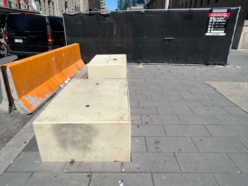
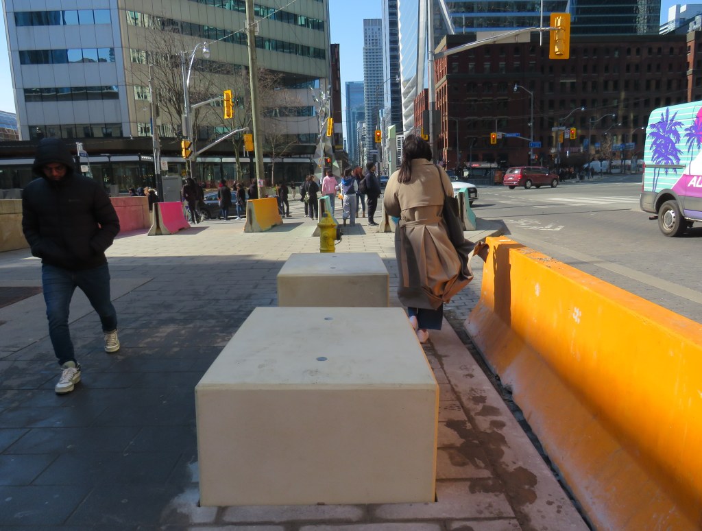
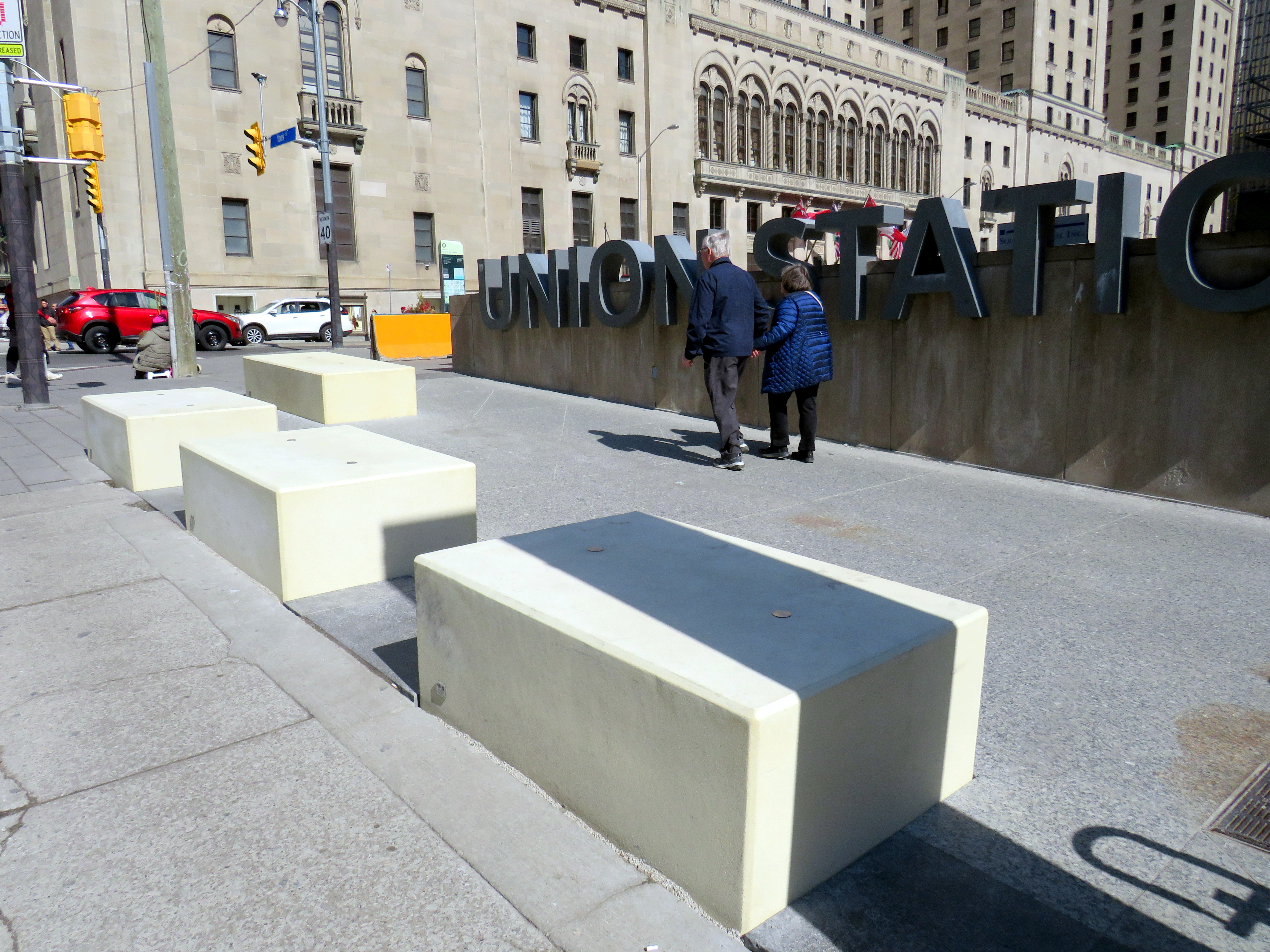
New blocks installed in front of Union Station at Front and York Streets
When I learned that Union Station was finally getting permanent bollards to replace the haphazardly-placed Jersey barriers that have sat in front of the transport hub since 2018, I was relieved. I wrote about these barriers several times on this website, criticizing their appearance and their placement, blocking the way for the thousands of people who cross Front Street every day. But when I went to see them in person, after seeing criticism online, I was dismayed.
The new permanent barriers might even be worse than the temporary obstructions they are meant to replace.
The Jersey barriers were hastily placed after a tragic attack on Yonge Street in North York, where a man intentionally drove a rented van on to the sidewalk, killing ten pedestrians and injuring and traumatizing many more.
Vehicular assaults on crowds of pedestrians are a major concern; tactics used at mass gatherings — such as the winter light show and New Years Eve events at Nathan Phillips Square and major concerts and playoff games at Skydome and Scotiabank Arena — now include blocking closed streets with heavy vehicles such as snow plows, dump trucks, and city buses. However, Union Station is the only place in the city where officials have decided that new permanent barriers were necessary.
Union Station is one of the busiest pedestrian areas in the city
The new permanent barriers are not the sturdy, yet narrow, bollards that are used elsewhere. Instead, they are large, undecorated concrete blocks anchored into the ground and are knee-high. The plain concrete colour does not match the stone sidewalks or plaza. They are placed very close together, impeding access for those using large carts, strollers, or wheeled mobility devices. Despite all the money spent renovating Union Station, these blocks look cheap.
Concrete blocks at the corner of York and Front Street at Union Station
The total cost of installing the “Custom Anti-Terror Concrete Barriers,” as the city described the bid, was $2,438,238, including HST. The lowest bid, by South Central Inc., came over a $1 million cheaper than the other two bids. It is worth noting that there are no public documents that describe the city’s specifications for the contract, nor was there any public consultation before the city solicited bids.
The result? An esthetic failure and an accessibility challenge.
Video showing pedestrians going around the concrete blocks in front of Union Station
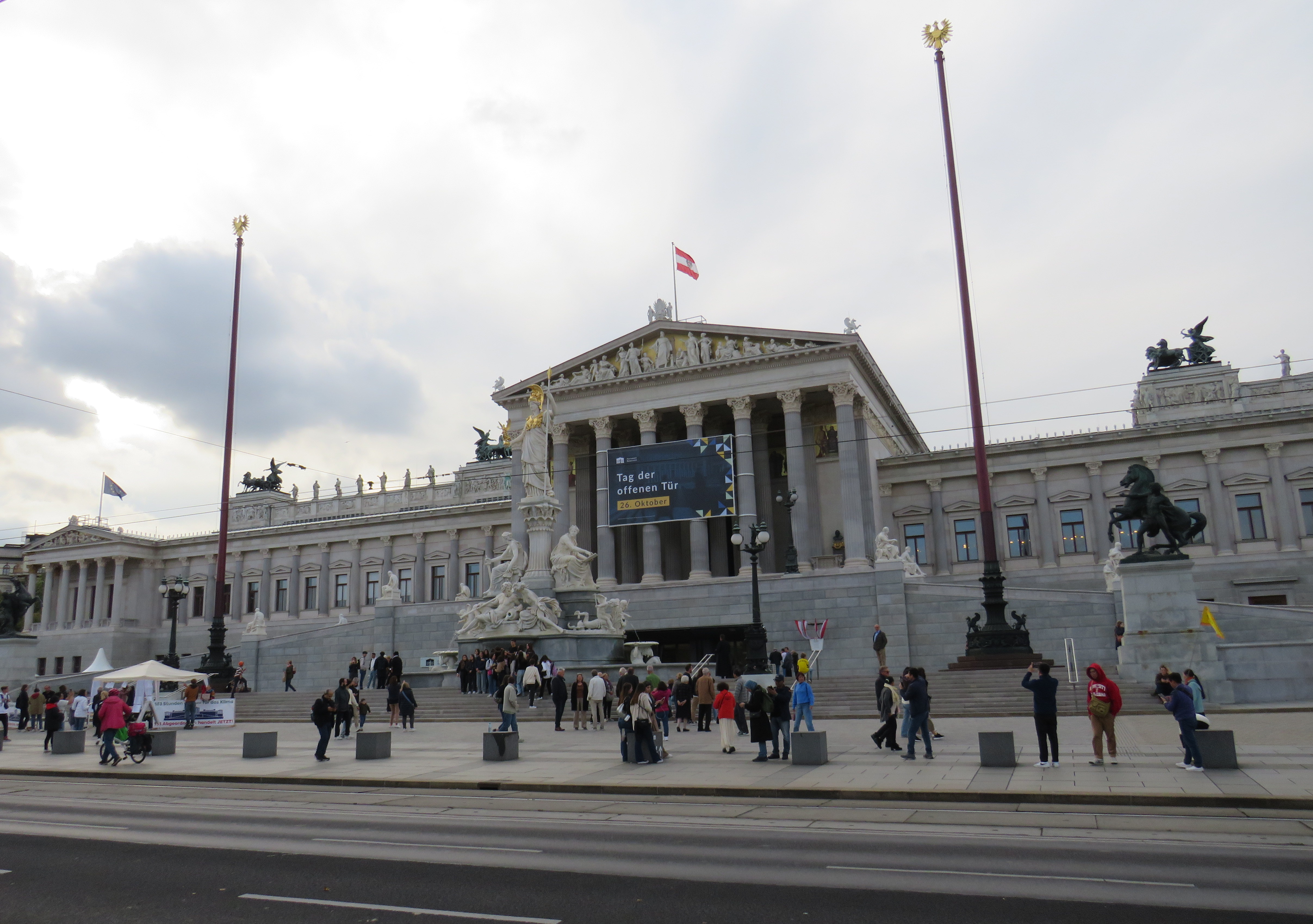
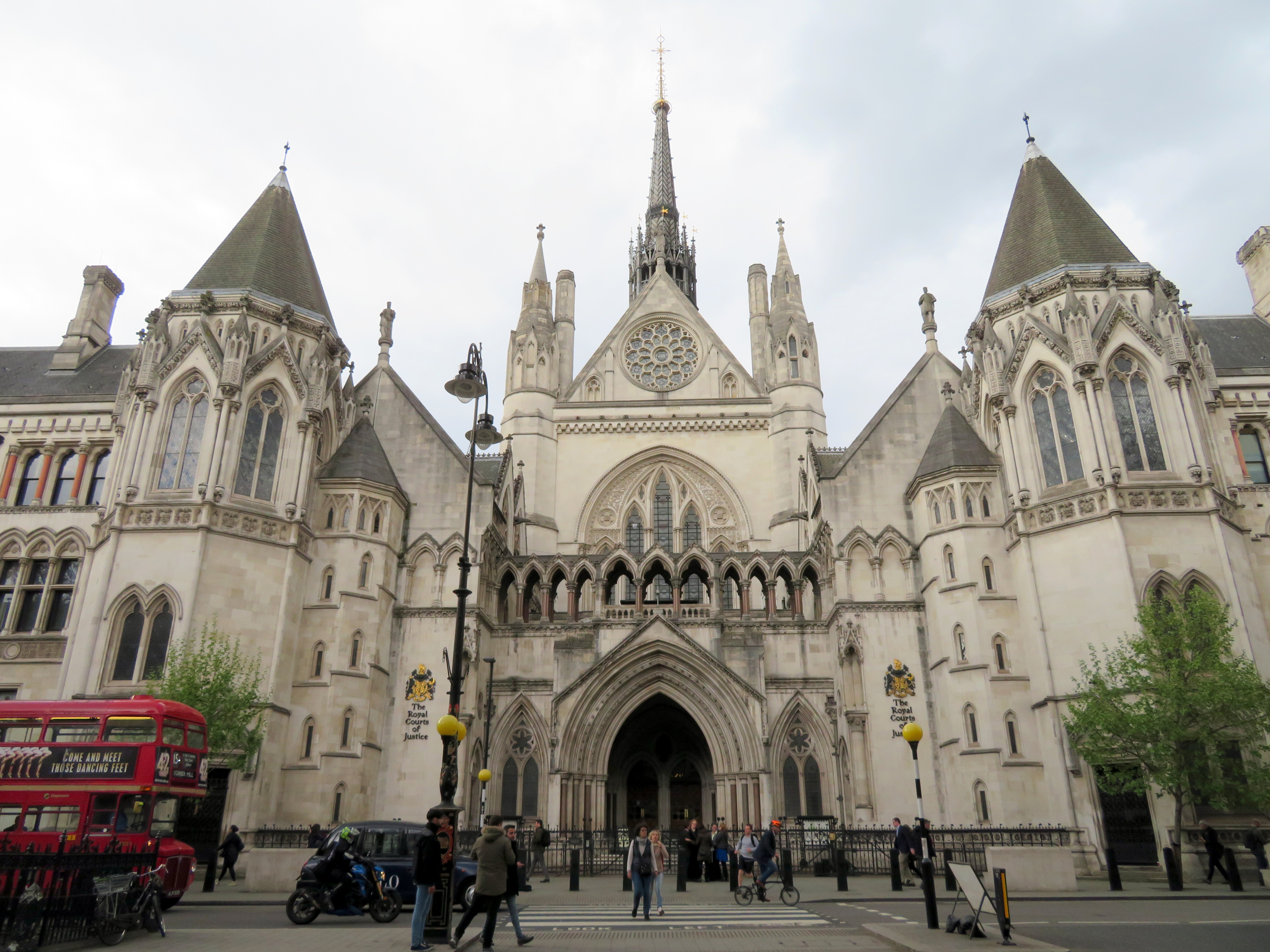
I cannot understand the city’s decision to go with these blocks where more elegant and pedestrian-friendly alternatives are typically used elsewhere. For example, the Austrian Parliament Building in Vienna, which faces the famous and busy Ringstrasse, is protected by smaller concrete bollards, which are also more widely separated, making it much more pleasant for pedestrians to get by. In Great Britain, metal bollards are common on busy commercial streets and in front of important buildings, but they are easy for pedestrians to pass, and generally blend in.
Thick concrete bollards in front of the Austrian Parliament Building, 2023Metal bollards in front of the Royal Courts of Justice in London
In the United States, government buildings are also protected by heavy anti-vehicular barricades (especially since the 1995 Oklahoma City bombing), but they are generally more permeable for pedestrians.
Metal bollards protect the federal courthouse in Downtown Manhattan (Google Streetview)
It is also worth noting that other popular pedestrian areas, such as the Yonge-Dundas intersection, are not protected from a potential vehicular attack — or an unintentional collision. It is beyond comprehension why the city only focused on protecting one pedestrian area, using such a poorly thought-out design. Toronto can — and should — do better.
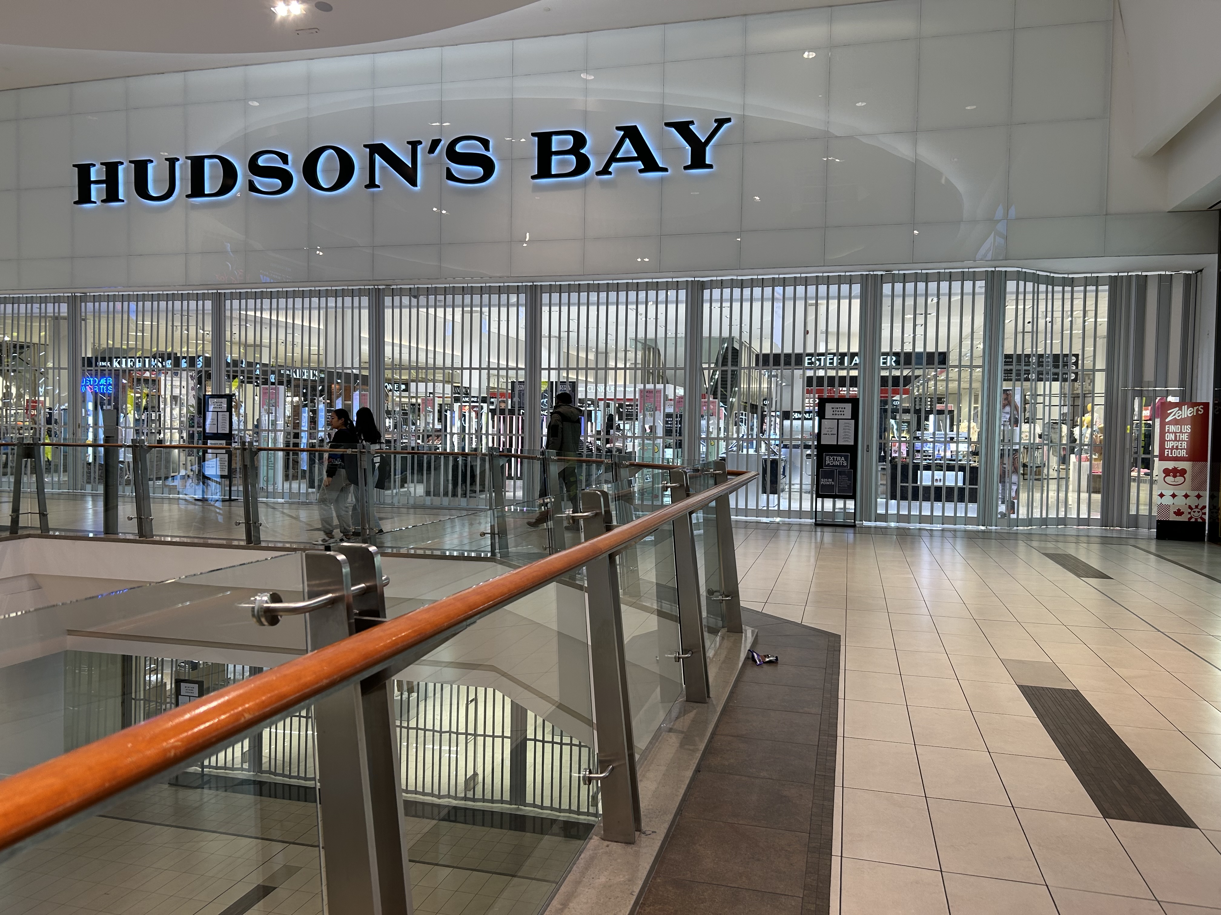
There’s a touch of irony that in the same year Canadian sovereignty is increasingly threatened by an American president, the Hudson’s Bay Company — one of the world’s oldest corporations — has filed for bankruptcy protection. It will likely close at least half of its 80 stores, but with no guarantee it will emerge in a healthy state, able to rebound.
On May 2, 1670, The Governor and Company of Adventurers of England, trading into Hudson’s Bay, was given a royal charter to trade in all lands that drained into Hudson’s Bay, 3.9 million km2 of land in the heart of the North American continent, in order to compete with the lucrative French fur trade in the St. Lawrence basin. The new company had monopolistic commercial control of what was then called Rupert’s Land: the entirety of present-day Manitoba, most of Saskatchewan and Northern Ontario, a significant part of present-day Quebec, Alberta, and Nunavut, and even parts of what eventually became Minnesota and North Dakota.
Of course, this new monopoly, which quickly became known as simply the Hudson’s Bay Company (HBC), was created without consent or consultation with the many First Nations and Inuit communities. In the early days of trade, however, HBC relied on trading with First Nations for the valuable fur trades. It established forts and factories (trading posts) throughout the northwest, establishing places such as Moose Factory and Fort Albany that remain to this day.
In later years, HBC claimed a trading monopoly on lands draining into the Pacific Ocean; it also brought in missionaries to convert Indigenous peoples. (Its monopoly was challenged by new entrants such as the North West Company, which eventually merged with HBC after violent skirmishes over trading territorial rights.)
HBC’s vast networks of forts and trading posts, particularly Fort Garry (now Winnipeg) led towards the full colonization of western and northern Canada. In 1870, with the decline of the fur trade HBC relinquished control of Rupert’s Land to the new Dominion of Canada, which led immediately to the creation of the Northwest Territories, followed quickly by the Red River Rebellion and the creation of the Province of Manitoba.
HBC continued as a fur and goods trading company and it was still the only retailer in remote western and northern communities. In larger cities like Vancouver, Winnipeg, Edmonton, and Calgary, it established new department stores. In smaller communities, especially in the north, it took full advantage of its dominant position, and Northern Stores became notorious for high prices (in 1987, HBC sold off its Northern Stores division). HBC continued to exploit Canada’s natural resources — it even had an oil and gas subsidiary between 1926 and 1982.
In 1960, HBC focused almost entirely on its department store empire, acquiring the Montreal-based Morgan’s chain, competing head-on with Eaton’s and Simpsons-Sears. In the 1970s and 1980s, it also scooped up discount chain Zellers, Simpson’s stores (after its split from Sears Canada), Ottawa-based Freimans, and Hamilton-based Robinson’s, eventually rebranding those stores as “The Bay.” Finally in 1993, it acquired Vancouver-based Woodward’s. During this time, it sold off the Northern stores and the oil company. In the late 1990s, it launched the Home Outfitters big-box chain. The Zellers chain expanded under HBC ownership, first acquiring the competing Towers discount chain in 1991 and K-Mart’s Canadian stores in 1998.
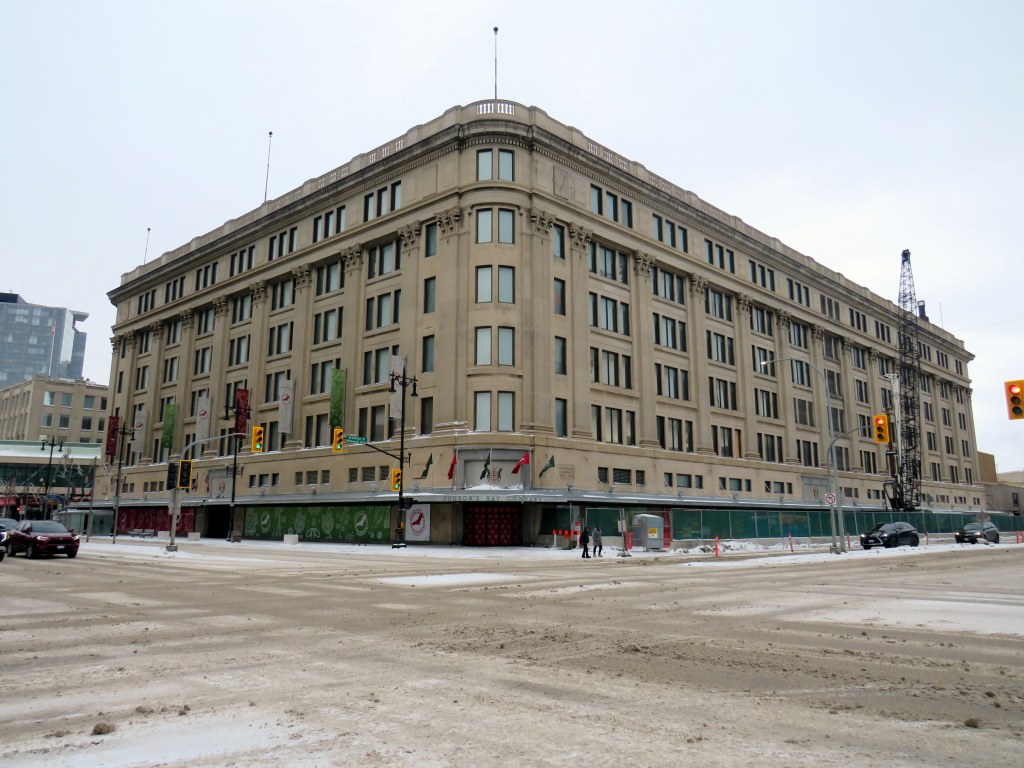
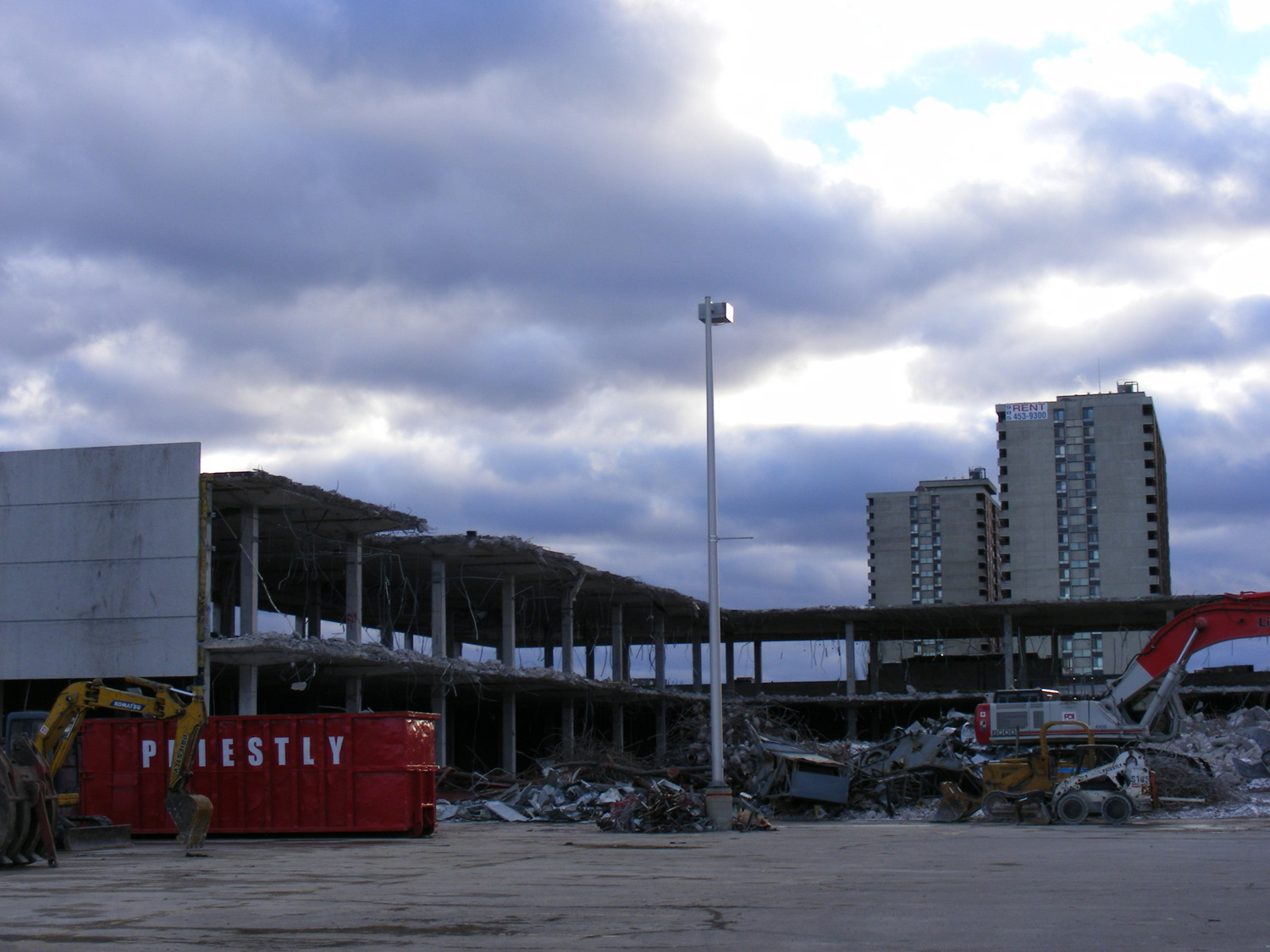
Though the flagship stores still proudly proclaimed the May 2, 1670 incorporation date, few thought about the long and checkered history of the company. My first memories of The Bay’s retail empire were of the Simpson’s store close to where we lived in Brampton. Simpson’s was the flagship anchor of Shoppers World, a once-vibrant mall. I also knew Simpson’s from the flagship Queen Street store in Downtown Toronto, famous for its toy section, Christmas window displays, and of course, the TVO children’s program Today’s Special. (The most memorable episodes for me, a young, budding urbanist, dealt with a fictionalized closure and demolition of the store, before a heritage plaque uncovered during the move out saved the day.)
Opening sequence of “Today’s Special,” set in the downtown Simpson’s Queen Street store
The Shoppers World Simpson’s store, like the rest of the banner, was converted to “The Bay” in 1991. In 2007 the store closed, not long after I moved to my own apartment in Toronto. (I still have some of the chinaware I purchased at that Bay store before I moved to my own place.) But as I worked, and later lived, in Downtown Toronto, I found the Queen Street store very useful for casual clothes shopping and the occasional big-ticket item.
Demolition of the Shoppers World Simpson’s/The Bay department store in 2010
Though HBC was sold to a private equity firm in 2008, under CEO Bonnie Brooks’ leadership, there was still life in the department store, with leading stores like the Queen Street flagship upgraded. The fifth floor was a great place to browse for men’s clothes; the seventh floor had an excellent kitchenware department. HBC persisted through the bankruptcy of Eaton’s in 1997-1999 as well the wind-down of Sears Canada that began in 2012 (when it began selling the leases of its urban flagships, including former Eaton’s stores) and concluded in 2018.
But private equity did what private equity does best: it began selling off the assets and closing down stores, just as Sears did in its last decade. The Zellers discount department store chain was discontinued, with the majority of store leases sold to the ill-fated Target Canada operation in 2011. The Home Outfitters stores were closed in 2019. Real estate was sold off, with HBC leasing back the properties. For example, the Queen Street store was sold to real estate developer Cadillac Fairview — who owns the adjacent Eaton Centre mall — for $650 million in 2014.
In the last few years, it became clear that the department store chain was in decline. Though pandemic restrictions in 2020 and 2021 had a major effect, the downtown stores also lost office worker patronage. Suppliers were having trouble getting paid and were seizing merchandise at several stores; escalators and elevators were put out of service, and store hours were reduced at most locations.
The Hudson’s Bay store at Scarborough Town Centre closed at 7:00 on a weekday evening in March 2024, even though the rest of the mall remained open for another two hours
The loss of Canada’s last department store is unfortunate, but it comes as no surprise given the way private equity sucks once-proud businesses dry. The evidence was impossible to miss. How could customers be lured back when escalators were blocked off, marketing non-existent, and store opening hours scaled back? Not even Sears turned off the escalators in its last years.
I suspect, given the company’s 355-year history, a vestige of HBC will live on, especially in an era of renewed Canadian nationalist. Another business will certainly purchase the name and brand to continue selling the famous point blankets. Though the Queen Street store will certainly be redeveloped by Cadillac Fairview, strict heritage considerations will prevent its complete demolition. The Downtown Winnipeg store, closed in 2020, is already being repurposed into a new hub for Manitoba’s First Nations.
But it will remain a true shame, as I have always felt there was still a place for a full-service department store in Canada. It only needed to be well managed, relevant, and cared for.
VIA Train #1 at Hornepayne, Ontario. Normally this stop would be made overnight.
In late January, I went on a short vacation. Many people, given the short days and cold weather, opt for warmer climes. I, on the other hand, decided to travel to the infamously cold city of Winnipeg, Manitoba. Back in November, VIA Rail offered great deals on winter travel as part of its “Black Friday” sale; a berth in a sleeping car from Toronto to Winnipeg cost $271, with meals included. Winter travel by train can be beautiful, and I had fond memories of my February 2014 trip aboard the Algoma Central Railway between Sault Ste. Marie and Hearst.
I planned to spend two nights in Winnipeg, including taking in my first NHL game since the pandemic. The Jets were playing on Friday night against the original Winnipeg Jets, the Utah Hockey Club (which moved to Salt Lake City from Phoenix in 2024). I would then travel back east by bus, with a stopover in Kenora, flying home from Thunder Bay.
Unfortunately, my train from Toronto was delayed by eleven hours, a new record in my rail travel setbacks. The train from Vancouver faced several setbacks due to extreme cold conditions in the Prairies and Northern Ontario, arriving in Toronto over 15 hours late, around 8AM on Wednesday morning. (VIA Rail’s communications were subpar, and though I got two emails advising of a 5:00 PM departure on Wednesday, we did not actually leave until 8:00 PM, about 10 hours late from Toronto.)
Despite the delays, it was a very pleasant train ride across Northern Ontario in the snow. The cooked-to-order meals served aboard the Canadian, as always, were very good, and service was friendly. The lights in the dome car for our section were turned off, allowing passengers to gaze into the wilderness, even at night.
As it turned out, I was able to cancel my first night’s stay in Winnipeg without penalty, which was fortunate as the train arrived at 7AM Friday, nearly 12 hours late. But for me, it was fortunate, as by then, coffee shops were opening up in Downtown Winnipeg. An earlier arrival, had the train made up time, would have forced me to find a 24-hour restaurant to wait at, and there aren’t any in the downtown area.
The monument to the 1919 Winnipeg General Strike; a Corten steel replica of a toppled streetcar across the street from Winnipeg City Hall. It was especially compelling partially buried in snow.
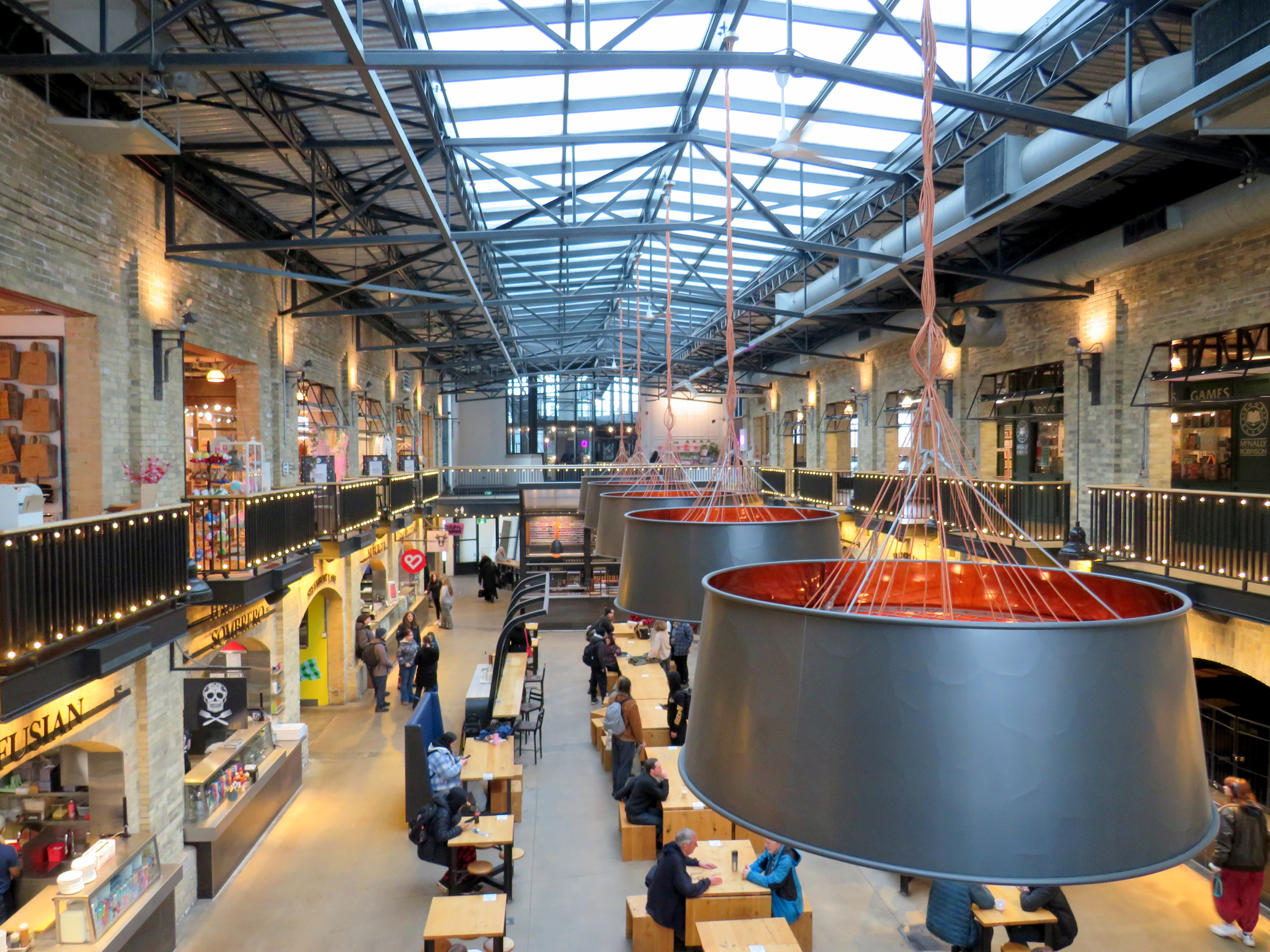
Though I have been to Winnipeg several times before, this was my first time visiting the city in winter. I was pleased to see how the city embraced the short, dark, cold days. Out at The Forks, where the Assiniboine River joins the Red River, there is a lively marketplace located in former railway maintenance and freight buildings behind Union Station. The complex includes a branch of the local McNally-Robinson bookstore chain, restaurants, cafes, art shops, and other local businesses. There are plenty of tables and seating, with water dispensers and plenty of public washrooms. It is one of Canada’s great public spaces.
Inside one of the market buildings in the Forks, a former railway maintenance building
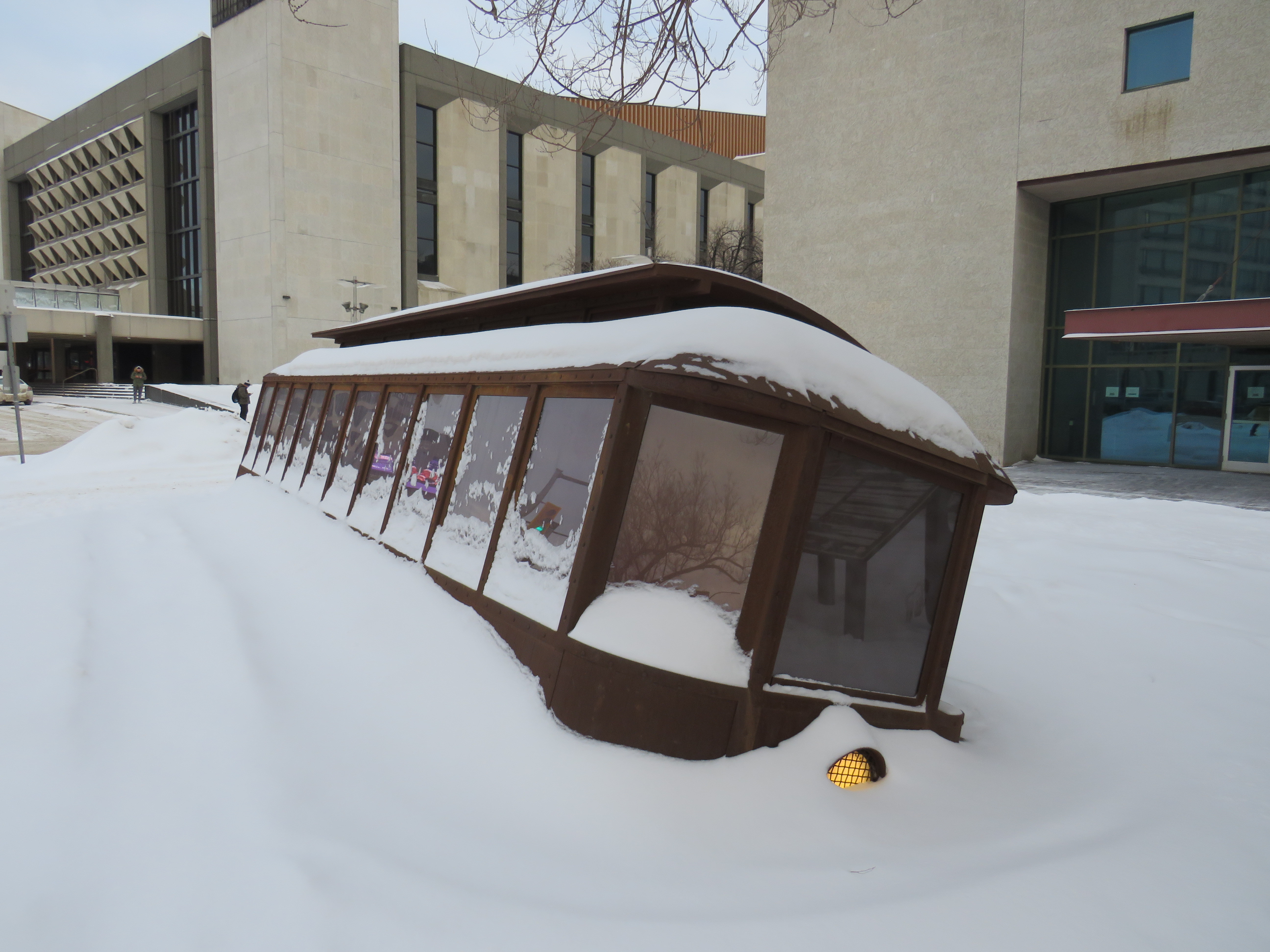
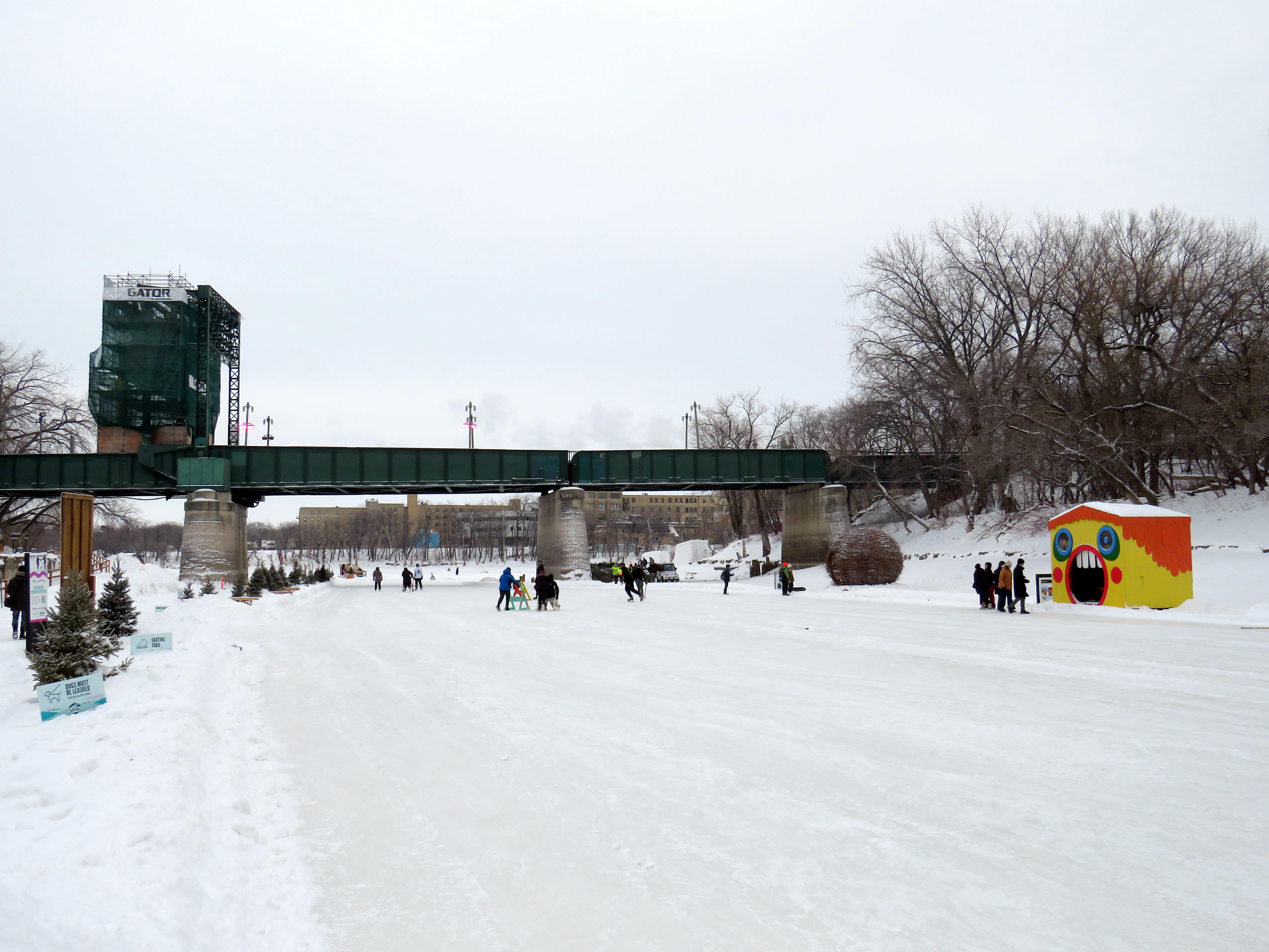
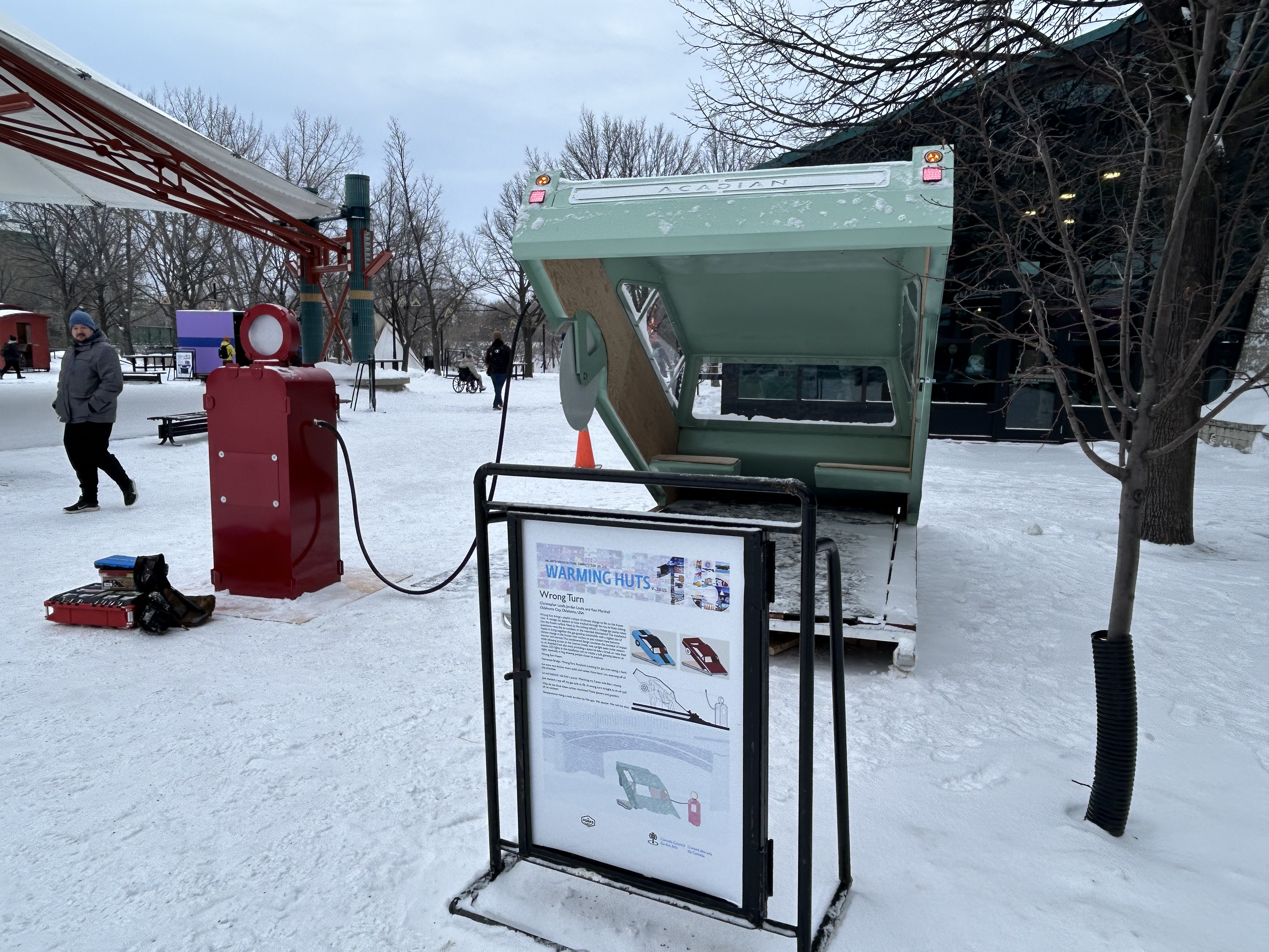
Outside, there were Warming Huts art stations, many of which were very compelling. Ice skaters have a choice of an artificial ice rink, covered by a tent-like canopy, or getting out on to a cleared natural path along the Assiniboine River.
Skaters on the Assiniboine River; warming huts along the ice give skaters a place to sitOne of the Warming Huts, titled “Wrong Turn,” representing a car sinking into an icy river
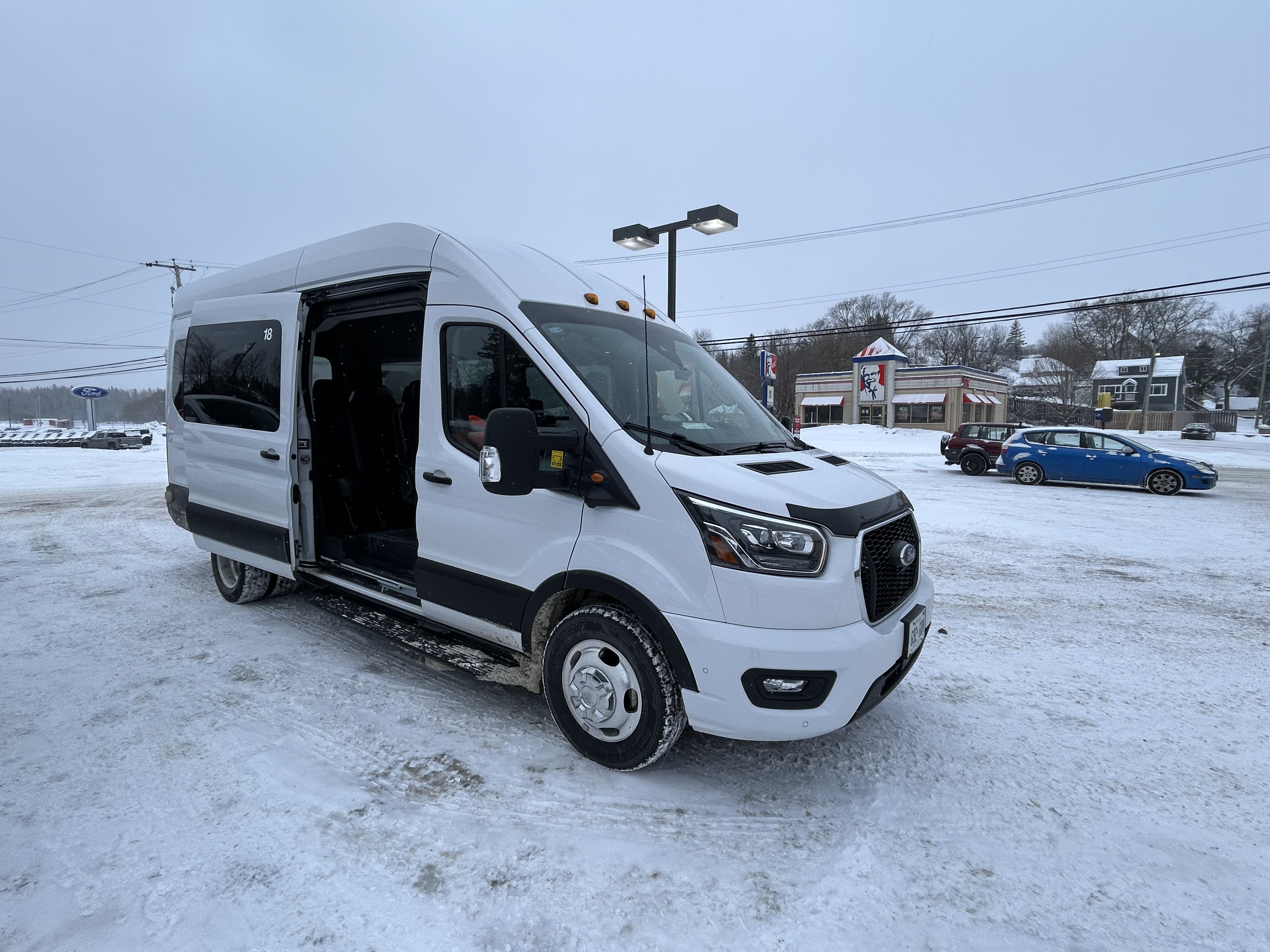
After 24 hours in Winnipeg, capped by a great hockey game in a lively arena, I made my way west towards Kenora and Thunder Bay. Kasper, which I last rode in 2019, has an early morning departure from Downtown Winnipeg, at the Balmoral bus terminal, stopping at Kenora, Dryden, and Sioux Lookout. Among the six passengers were a First Nations woman and her companion, returning home from a medical visit. Intercity buses are a lifeline. The Kasper bus was a 12-passenger van, and despite the poor winter weather conditions, it was a safe, comfortable, and friendly service.
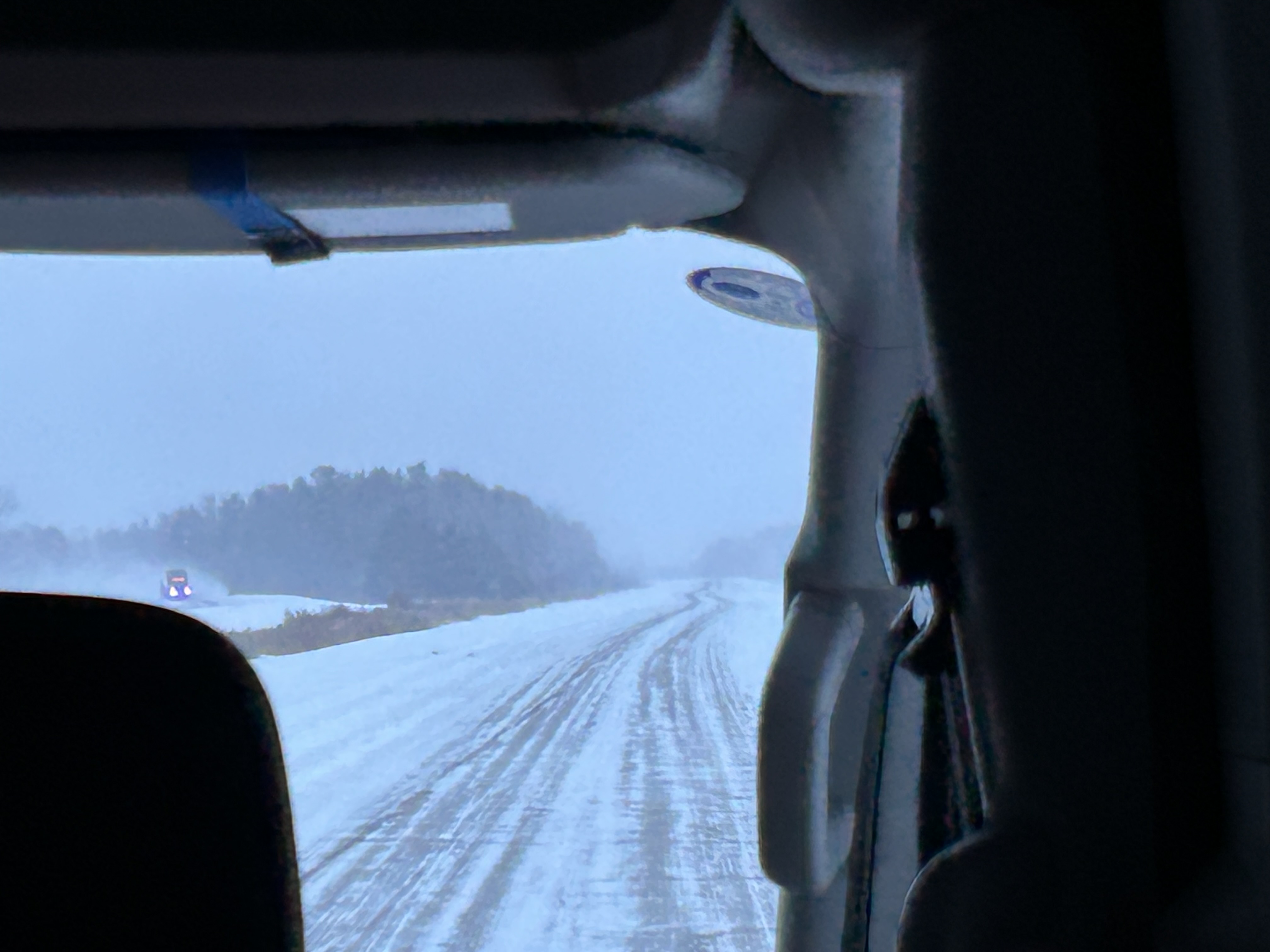
Snowy conditions on the Trans-Canada Highway headed east from Winnipeg
Taking the morning Kasper trip allowed me to spend a few hours in Kenora, population 15,000. The community on the Lake of the Woods is a popular summer vacation spot; this was my first time visiting Ontario’s most westerly city. Kasper’s Kenora stop is at a McDonalds just east of downtown; this gives passengers a chance to stretch, use the washroom, and grab food.
Kasper Minibus at the Kenora McDonald’s
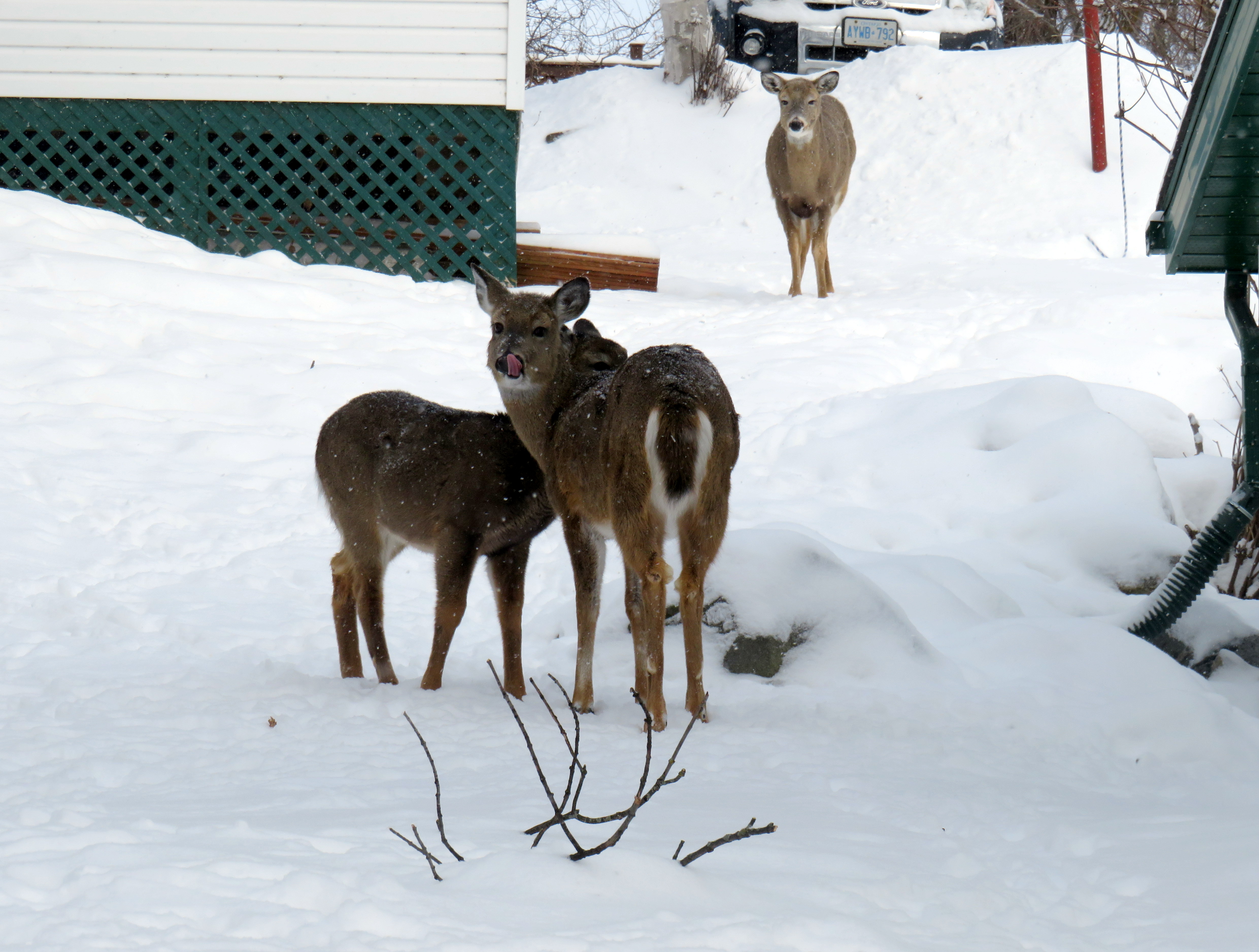
The walk from the McDonald’s back towards downtown was pleasant. I was greeted by several deer, in their winter coats, comfortable wandering in a residential neighbourhood.
Northern white-tailed deer in their heavy winter coats
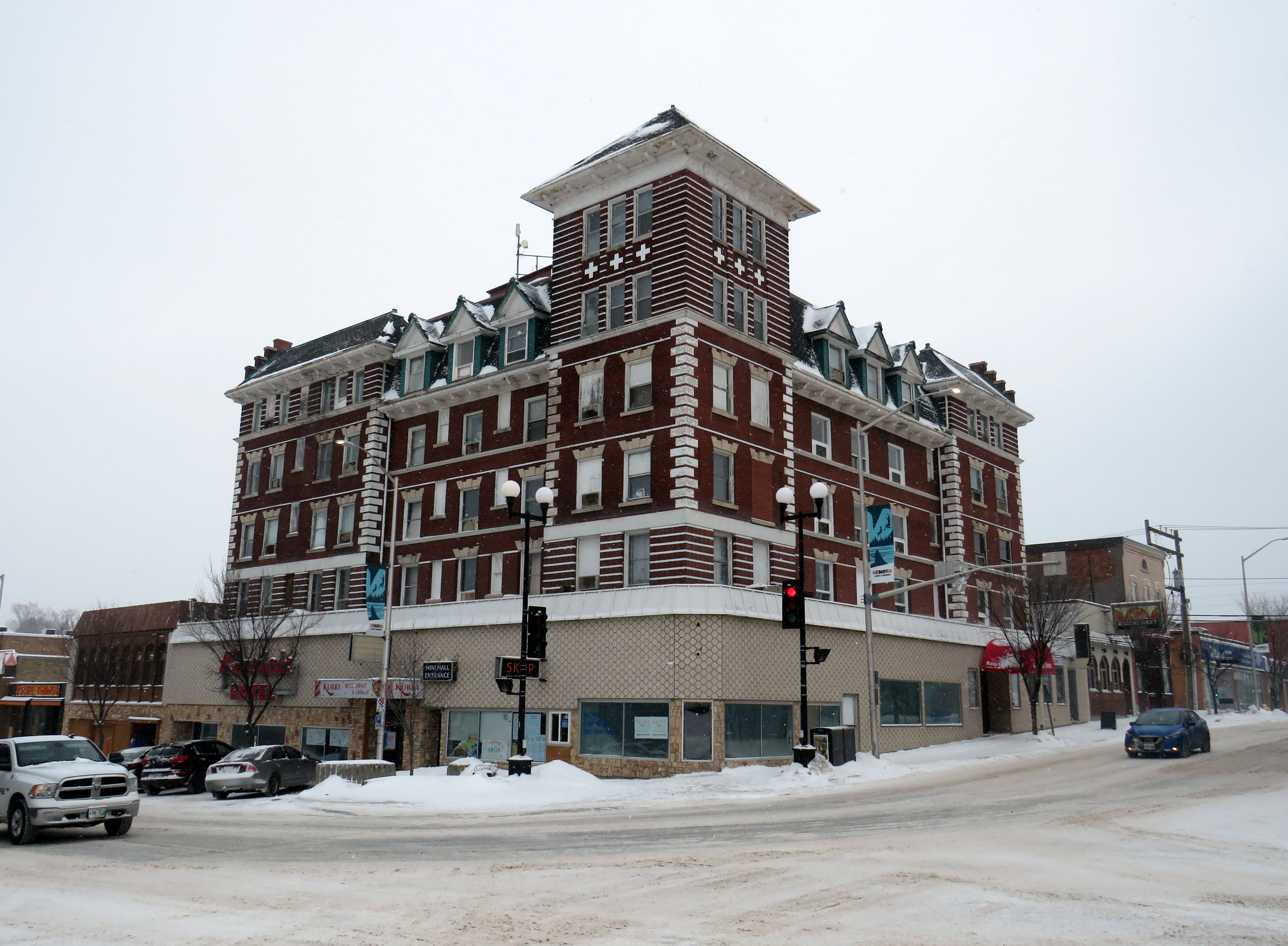
Kenora’s downtown is small, but blessed with a solid collection of historic buildings, including the old post office (now city hall), the district courthouse, a two-storey Canadian Pacific railway station (which served VIA until 1990), and the five-story Kenrica Hotel. The hotel has seen better days — the ground floor defaced by an unfortunate 1950s-era streetfront — but it still has good bones.
Kenrica Hotel, on the main corner in Downtown Kenora
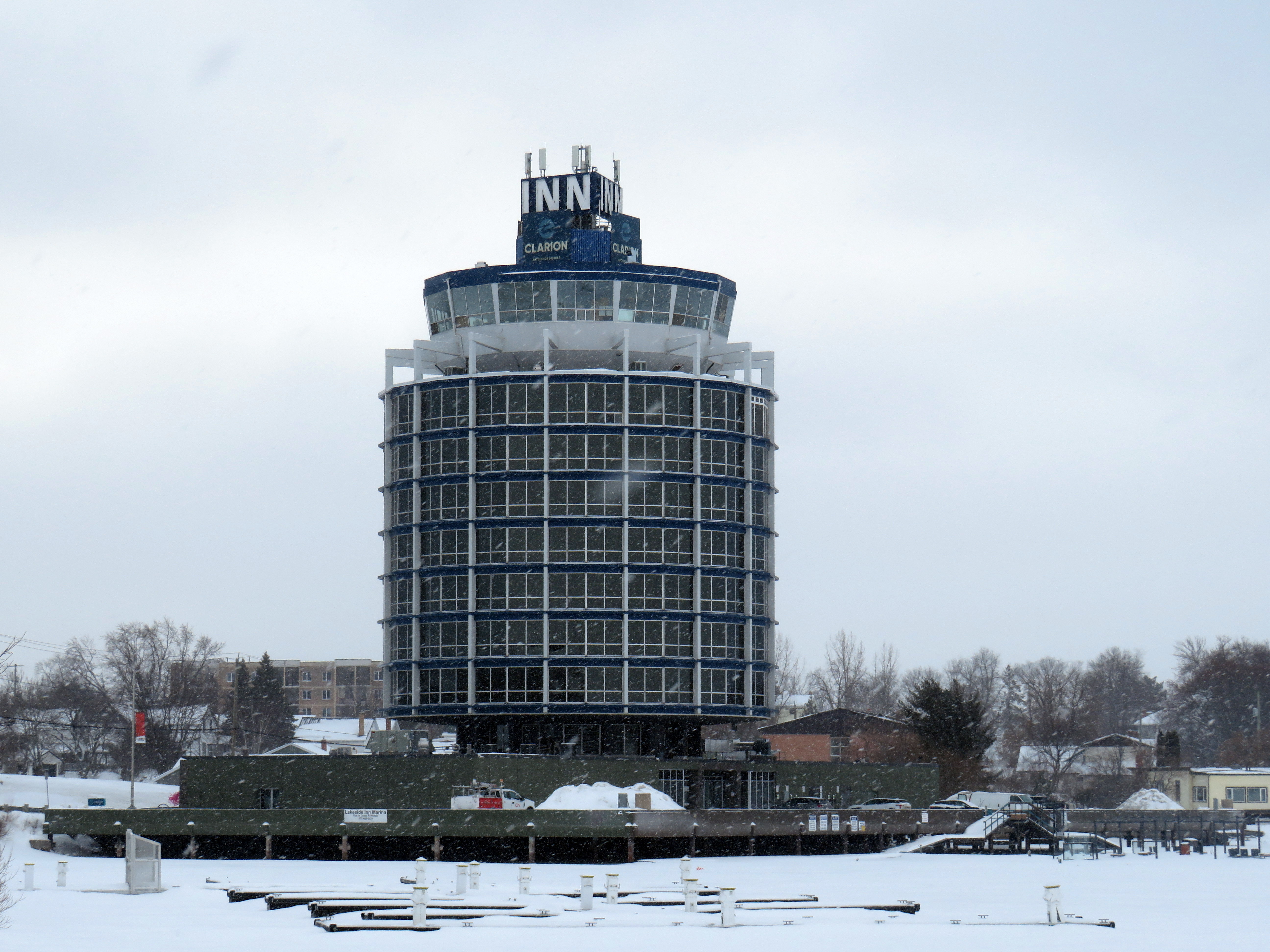
South of Downtown Kenora, on the lakefront, a cylindrical hotel, ten storeys high, overlooks Lake of the Woods, with a marina at its base. The hotel’s mid-century modernist form is unusual for Ontario, which makes it stand out even more.
The Clarion Inn on Lake of the Woods
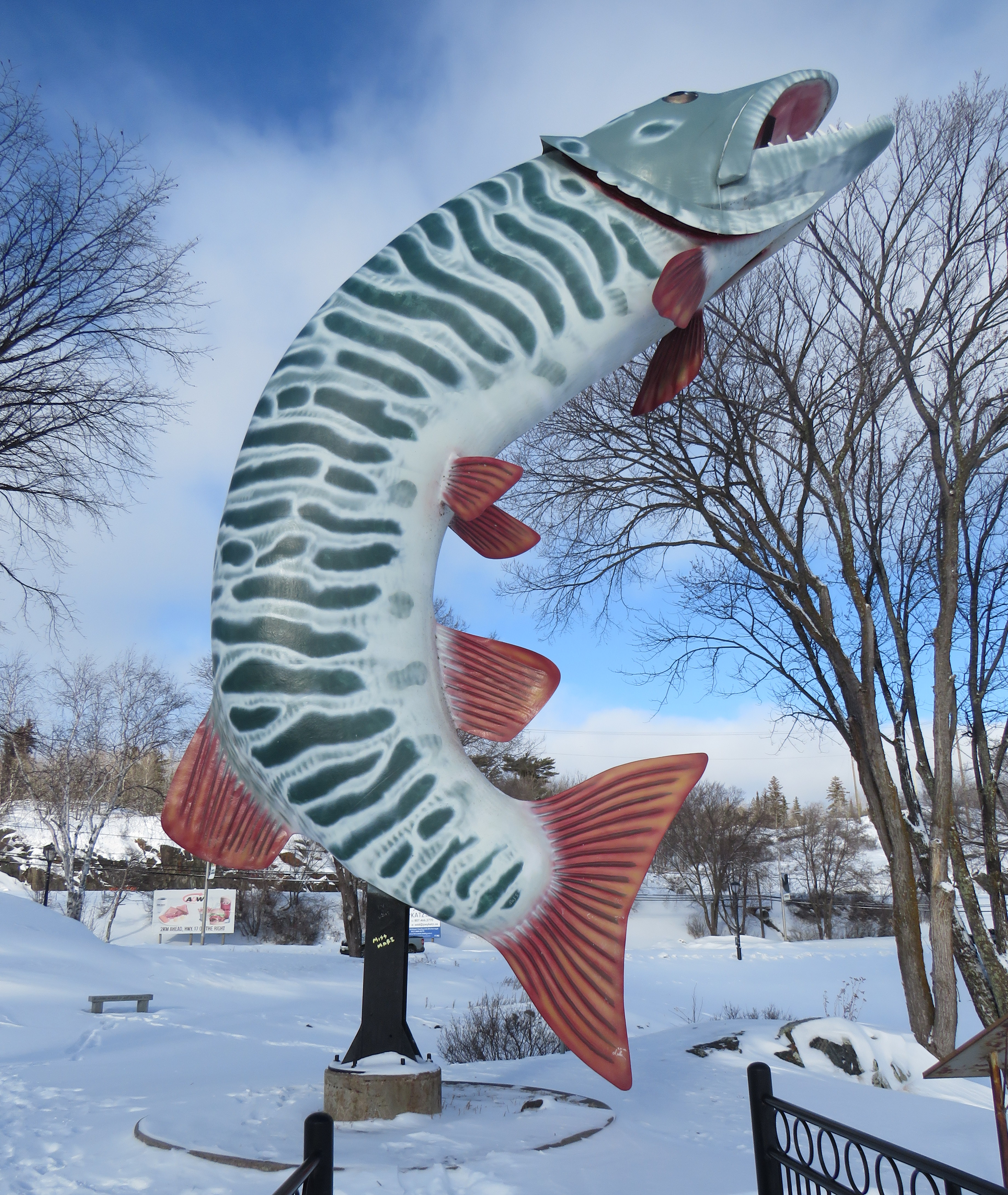
Many towns and cities in Northern Ontario feature a roadside attraction. Sudbury has the Big Nickel, Wawa has a giant goose, and White River has Winnie-the-Pooh. Kenora’s is a giant sculpture of a muskie fish, called “Husky.”
“Husky the Muskie” – Kenora’s roadside attraction
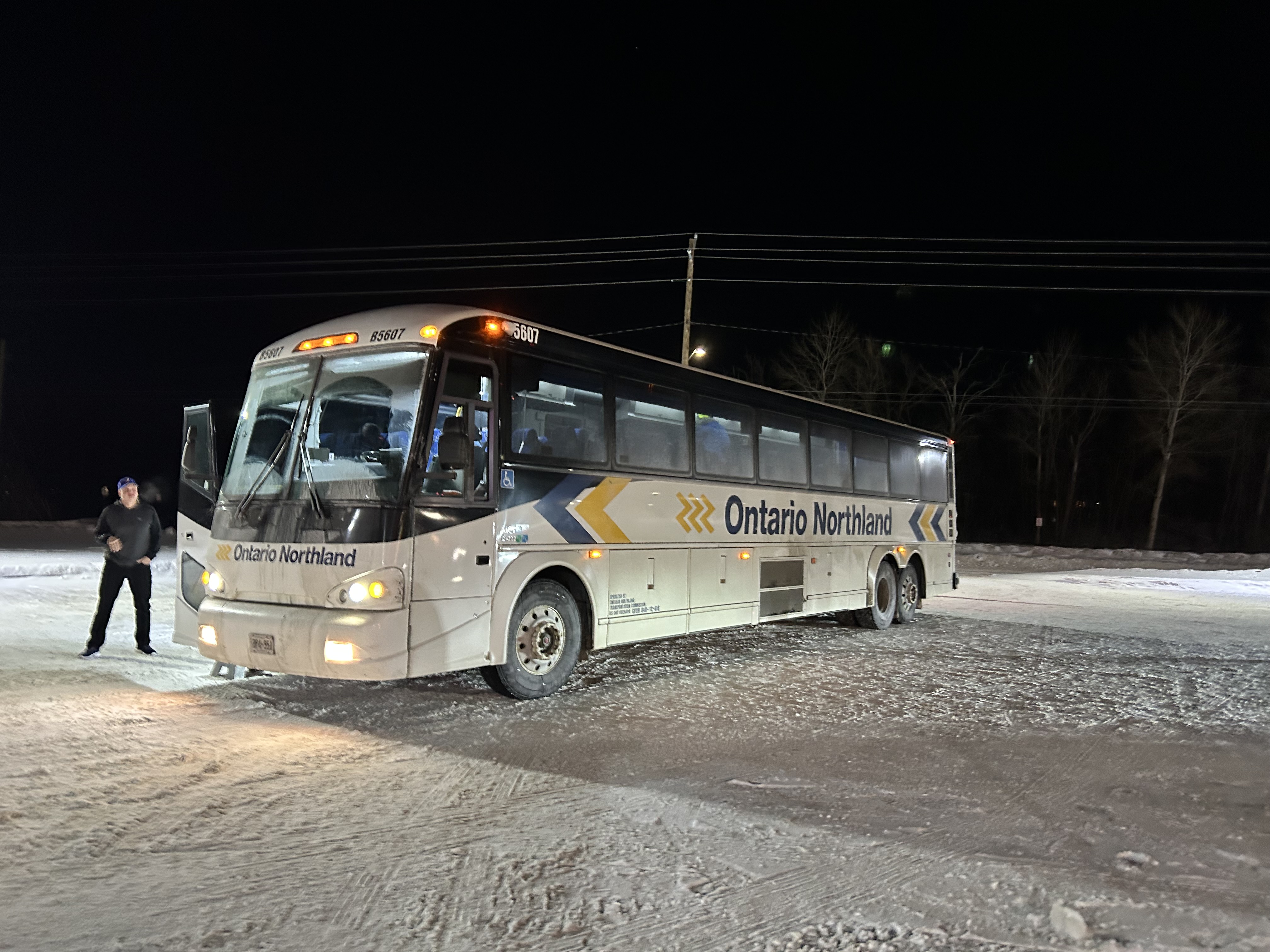
Ontario Northland operates a bus six days a week between Winnipeg, Thunder Bay, Sault Ste. Marie, and Sudbury, with operator changes at Thunder Bay and Sault Ste. Marie. Between Kenora and Thunder Bay, the route alternates, with service to Fort Frances and Atikokan three days a week and to Dryden and Ignace the other three days. Passing through Fort Frances (where the bus stopped at a McDonald’s there for a rest break), I finally visited every county, district, and region in Ontario, with Rainy River District being the final one.
Ontario Northland bus in a snow-covered McDonald’s in Fort Frances, Ontario
The Ontario Northland bus driver that day was exceptional; because of a winter storm, Highway 17 was closed near Batchewana Bay; as such, the bus would not continue past Thunder Bay. Though we were nearly an hour late arriving into Thunder Bay due to road conditions, the operator was willing to continue past the Thunder Bay Ontario Northland depot to drop anyone off continuing to the hospital campus. I was also able to get off the bus by my hotel.
The Ontario Northland depot at Thunder Bay is not in a very good location, in an industrial area off Highway 61 near the Thunder Bay airport, without direct local transit connections or adjacent amenities. At least a stop at Thunder Bay Regional Health Sciences Centre (which has local transit and is near Lakehead University) is also provided.
Ontario Northland Thunder Bay depot, located in an industrial area on a road without sidewalks(Google Streetview)
Difficult winter road conditions make travel across the North a challenge; this is why professional and safe bus and train operators are so important for getting around.
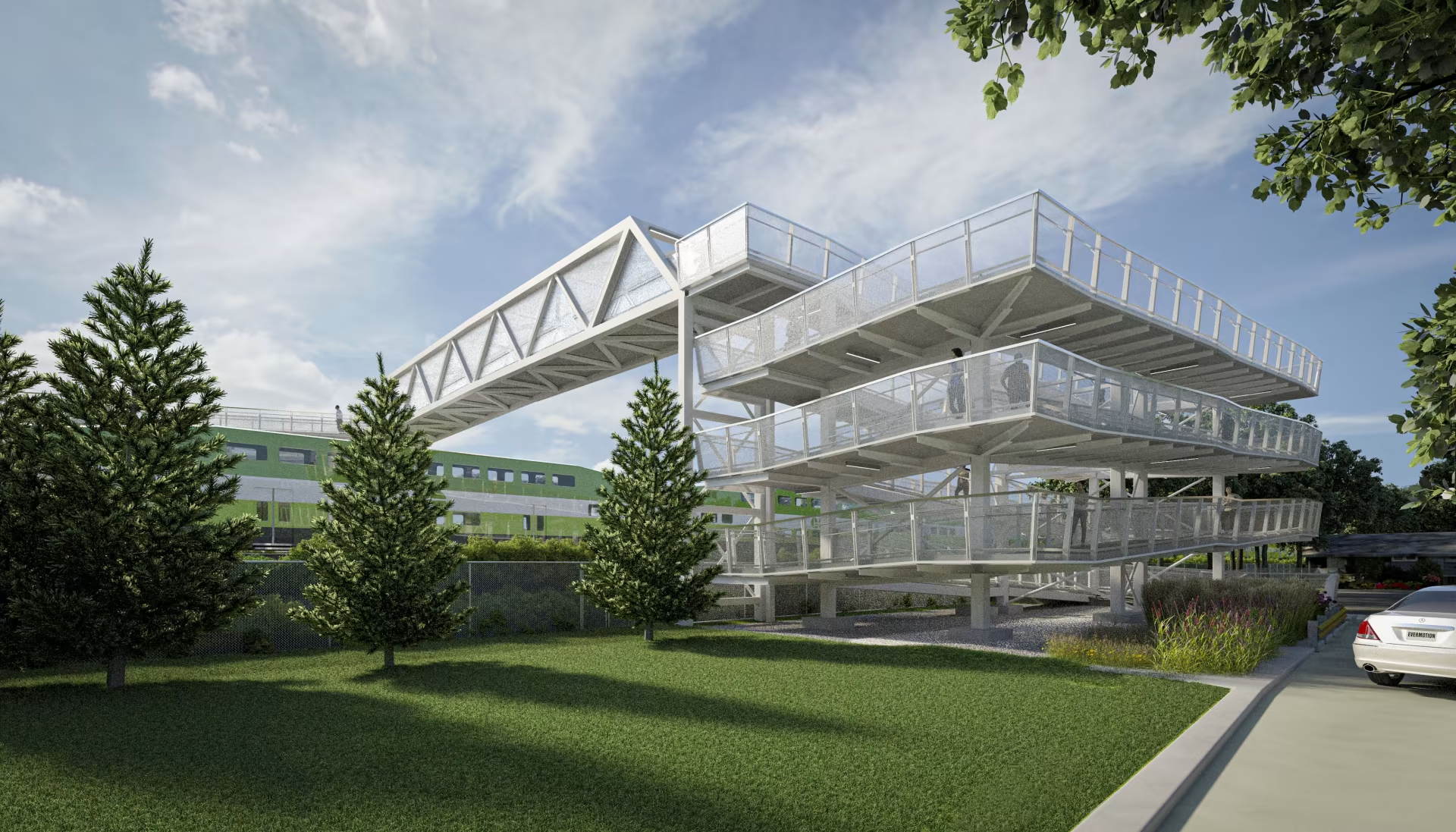
Metrolinx rendering of the planned new Drury Lane pedestrian overpassin Burlington
On the home page of Metrolinx, the provincial agency tasked with building and operating regional transit in the Greater Toronto and Hamilton Area and beyond, there is a statement under the heading “Connecting Communities.”
The Greater Golden Horseshoe is growing, and you need to get places. Our transit projects will connect new, established and emerging communities across the Greater Golden Horseshoe. – Metrolinx
Unfortunately, the very same transit projects and rail corridor upgrades can serve to disconnect, rather than connect, communities. Too often, GO Transit lines are secured without regard to the neighbourhoods they run through, without simple and convenient crossings for pedestrians and cyclists. Where overpasses are provided, they are built in such a way that makes them more difficult than necessary to cross.
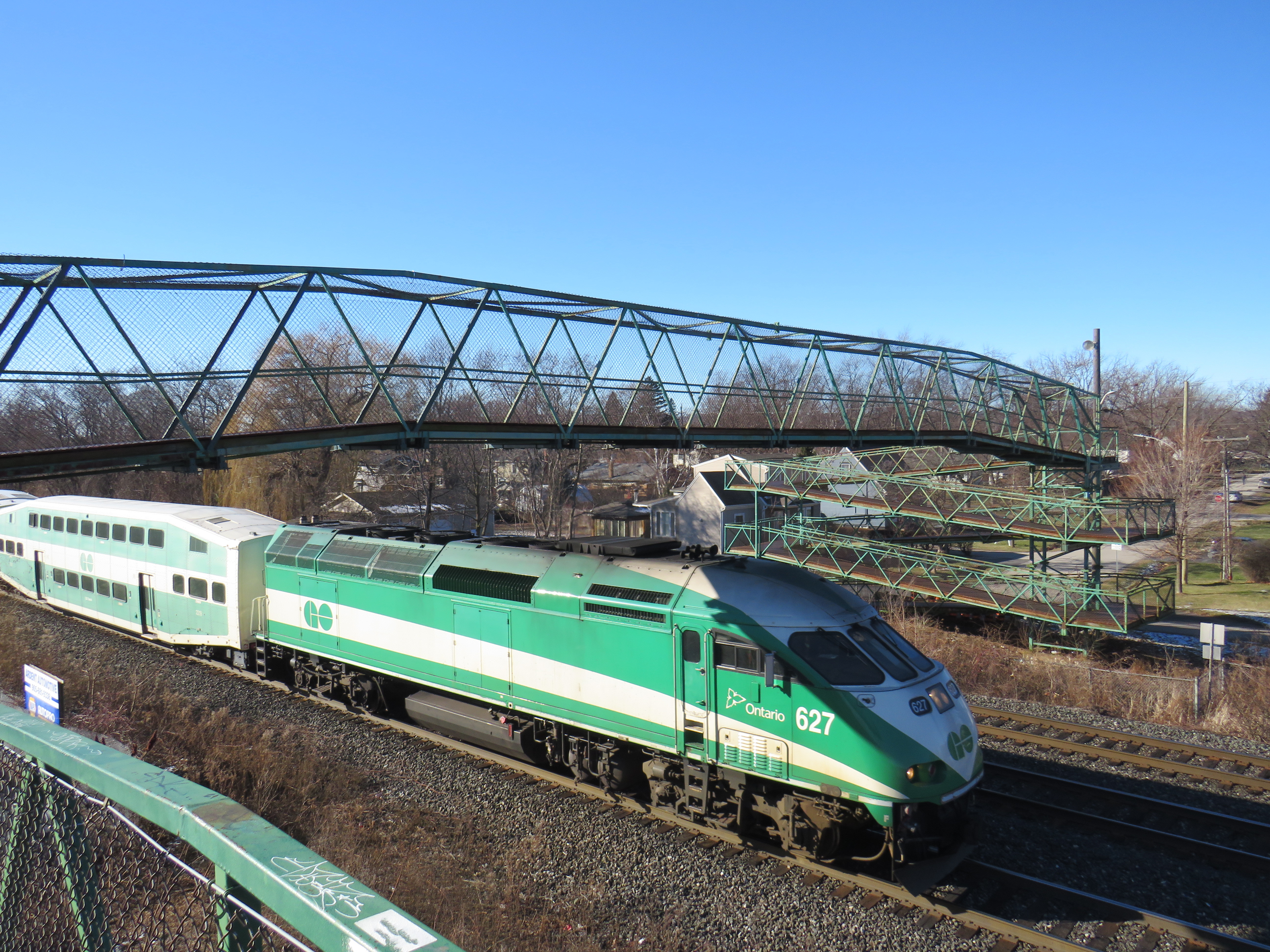
A GO Transit train passes under the existing Drury Lane pedestrian overpass
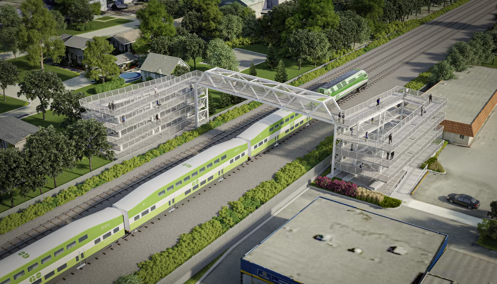
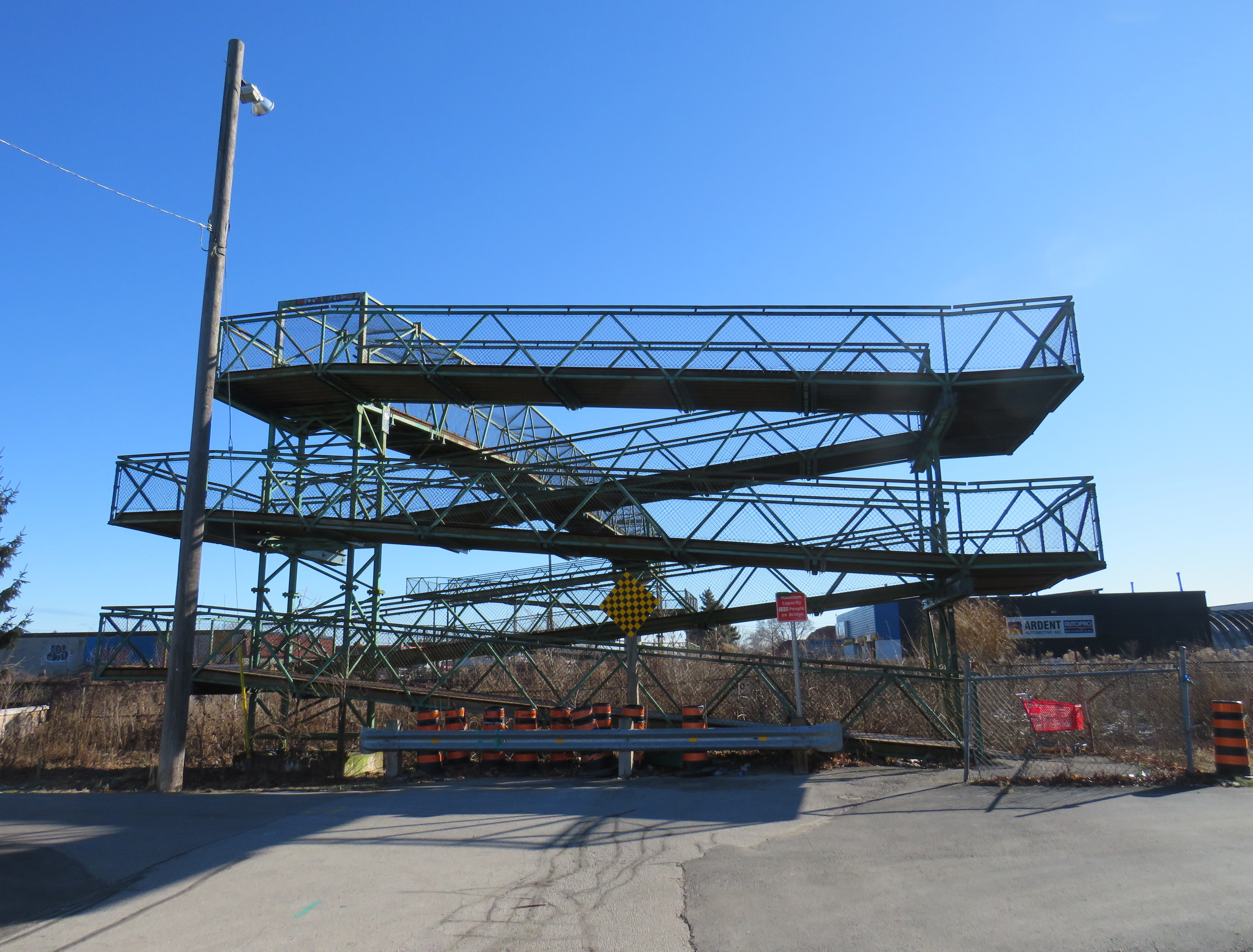
Take the example of the planned replacement of the Drury Lane pedestrian overpass in Burlington, which connects Fairview Avenue to the south and Orpha Street and a postwar residential neighbourhood to the north. With Burlington GO Station only 500 metres to the west, the pedestrian overpass provides a useful connection to GO and Burlington Transit services as well as (the station’s north end is poorly connected to the Orpha Street area, it is primarily a motor vehicle access to a large parking structure). Drury Lane continues south of Fairview Street towards Burlington’s Central Park, the city’s main library branch, and leads towards the waterfront and downtown core. Unlike Brant Street, Fairview Street, or Guelph Line, Drury Lane is relatively quiet, with painted cycle lanes.
The planned new Drury Lane pedestrian overpassin Burlingtonwith lengthy access ramps
The new overpass, replacing the existing 50-year-old structure, will be taller, with longer approach ramps. Metrolinx touts the improved accessibility of the new bridge, even though it will add more time to travel times with an extra ramp segment on each end. No stairs are provided to provide a short-cut for those able to navigate steps.
The new bridge’s increased height will provide additional clearance for the planned electrification of the Lakeshore West rail corridor.
Existing ramps at the north (Orpha Street) end, which requires three full turns to reach the top
A simpler solution would have to build an underpass, which would require a much shorter vertical route for pedestrians and cyclists. Indeed, the rails are on a slight embankment above street level already. A wide, well-lit underpass would improve accessibility; in fact, pedestrian underpasses are provided at nearly all GO rail station where grade separations are required as they provide quicker and easier access between platforms and the station building, parking and bus stops.
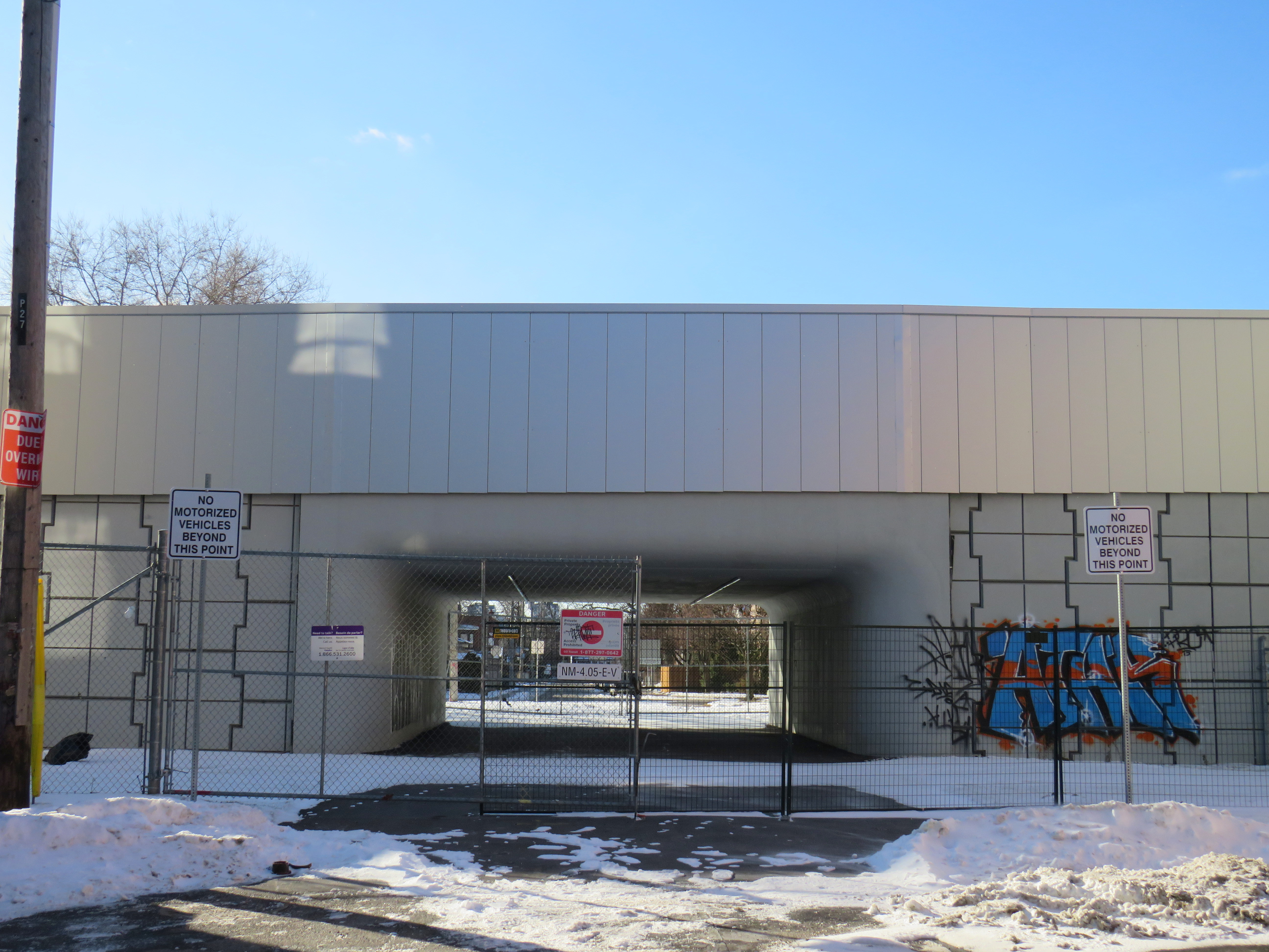
Though it has yet to open, the Paton Road connection under the GO Barrie Line in Toronto shows how a wide pedestrian underpass could look.
There are many other opportunities for safe and accessible pedestrian and cycling infrastructure along GO Transit corridors. The best example might be in North York, where the combination of a Metrolinx rail corridor and a twelve-lane Highway 401 make pedestrian and cyclist movement especially difficult and unsafe. At one time, it was easy (though still illegal) to cross the tracks between Floral Parkway, a residential street running east-west from Keele Street to the GO Barrie Line, to Bridgeland Road, an industrial street connecting to Caledonia Road and leading towards Yorkdale Mall.
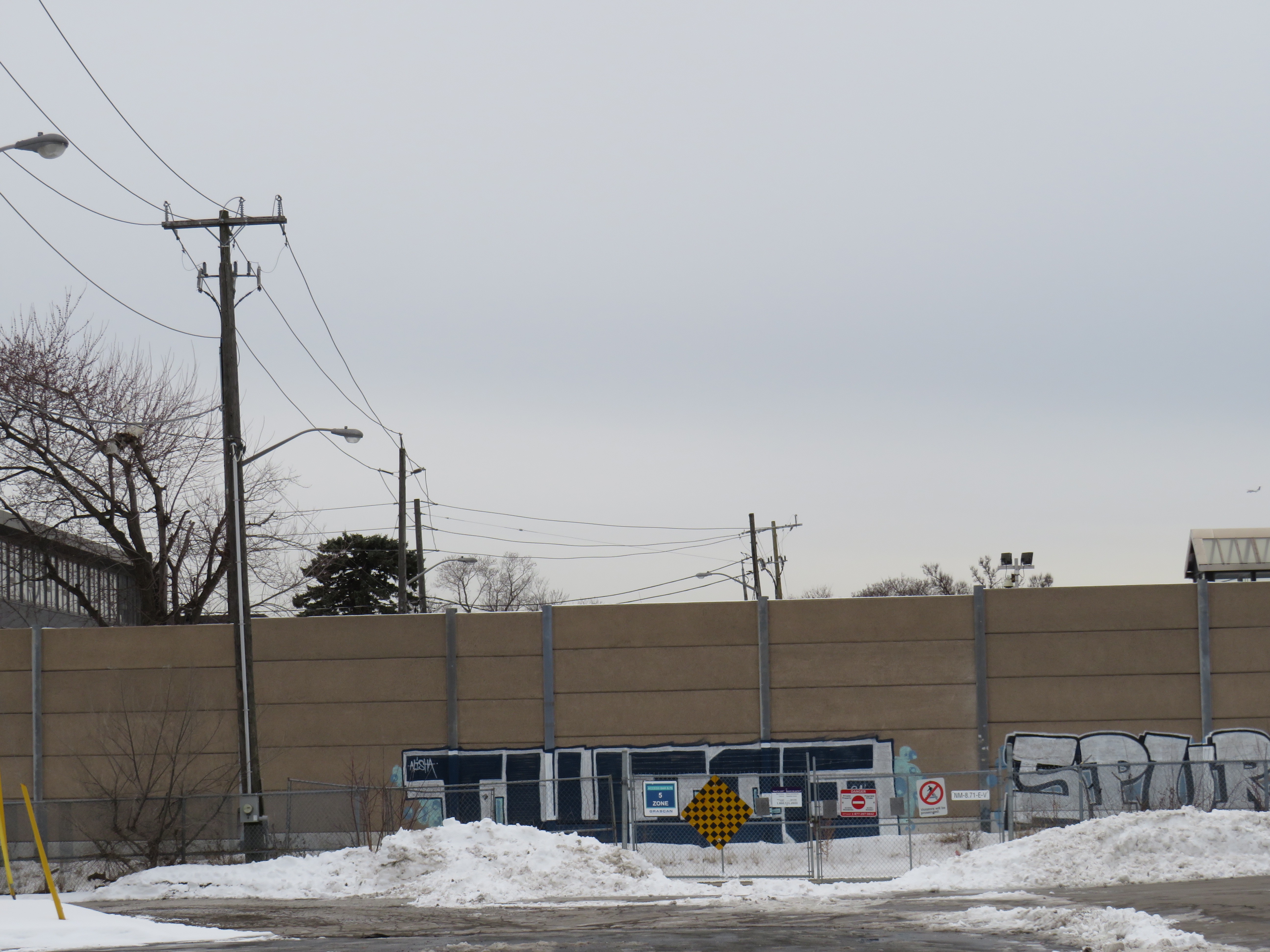
By the late 2000s, new fencing was put up to prevent pedestrian crossings here; this was further upgraded with reinforced chainlink fences, and more recently, a noise wall. Metrolinx knew this was a popular place to cross, but instead of providing a safe route (either a signalized and gated at-grade crossing, an overpass, or an underpass), it worked only to harden its property.
The highly-secured Bridgeland Road/Floral Parkway crossing in 2013The Bridgeland/Floral crossing in January 2025, with a noise barrier completely blocking Floral Parkway from the tracks
As new high-density residential development is nearing completion at Dufferin and Bridgeland on the site of an old Holiday Inn, as well as mixed-use development planned at Yorkdale Mall and a major hospital at Keele and Highway 401, there is even more of a need for sustainable, safe, active transport. The walk between Floral Parkway and Bridgeland Road is 49 minutes; the Highway 401 interchanges at Keele and Dufferin are also unsafe to navigate by foot or bicycle; fast moving traffic and narrow sidewalks make them unpleasant as well.
We need local and provincial officials to push for safe and accessible access across transit corridors and major highways for all users, but especially pedestrians and cyclists who are typically overlooked when these projects are planned and built.
Though transit construction is very beneficial for the region’s growth, it is still frustrating when an agency tasked with “[connecting] new, established and emerging communities across the Greater Golden Horseshoe” fails to connect the communities its transit projects run through.
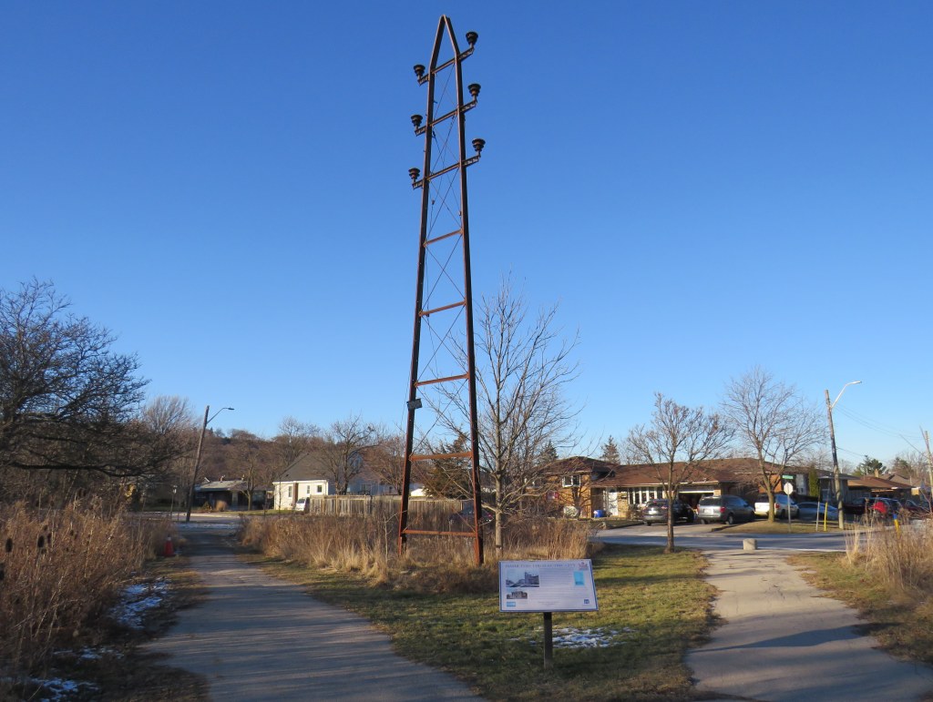
A modern electric tower looms over an early hydro pole
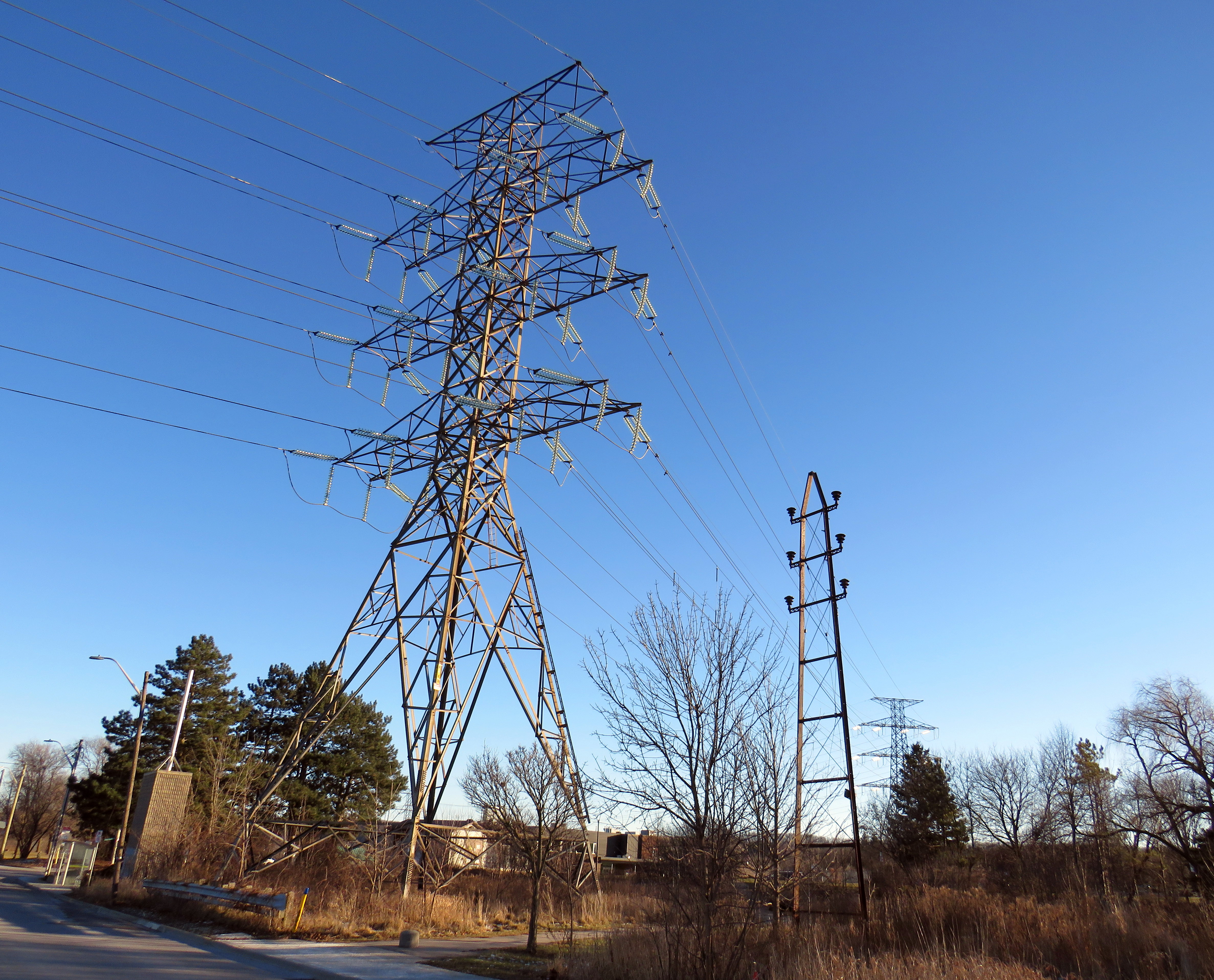
On the edge of a quiet postwar neighbourhood in Hamilton, Ontario, there is a remarkable remnant of a time gone by, preserved in situ, accompanied by an interpretive plaque. A small steel hydro-electric transmission tower stands in a park, once part of a pioneering 43-kilometre corridor that connected Hamilton with a new hydro-electric generating station at DeCew Falls, near St. Catharines. Next to the old pylon stands a much taller tower carrying electric lines along the same corridor.
Looking south, with the old tower facing the Rosedale neighbourhood
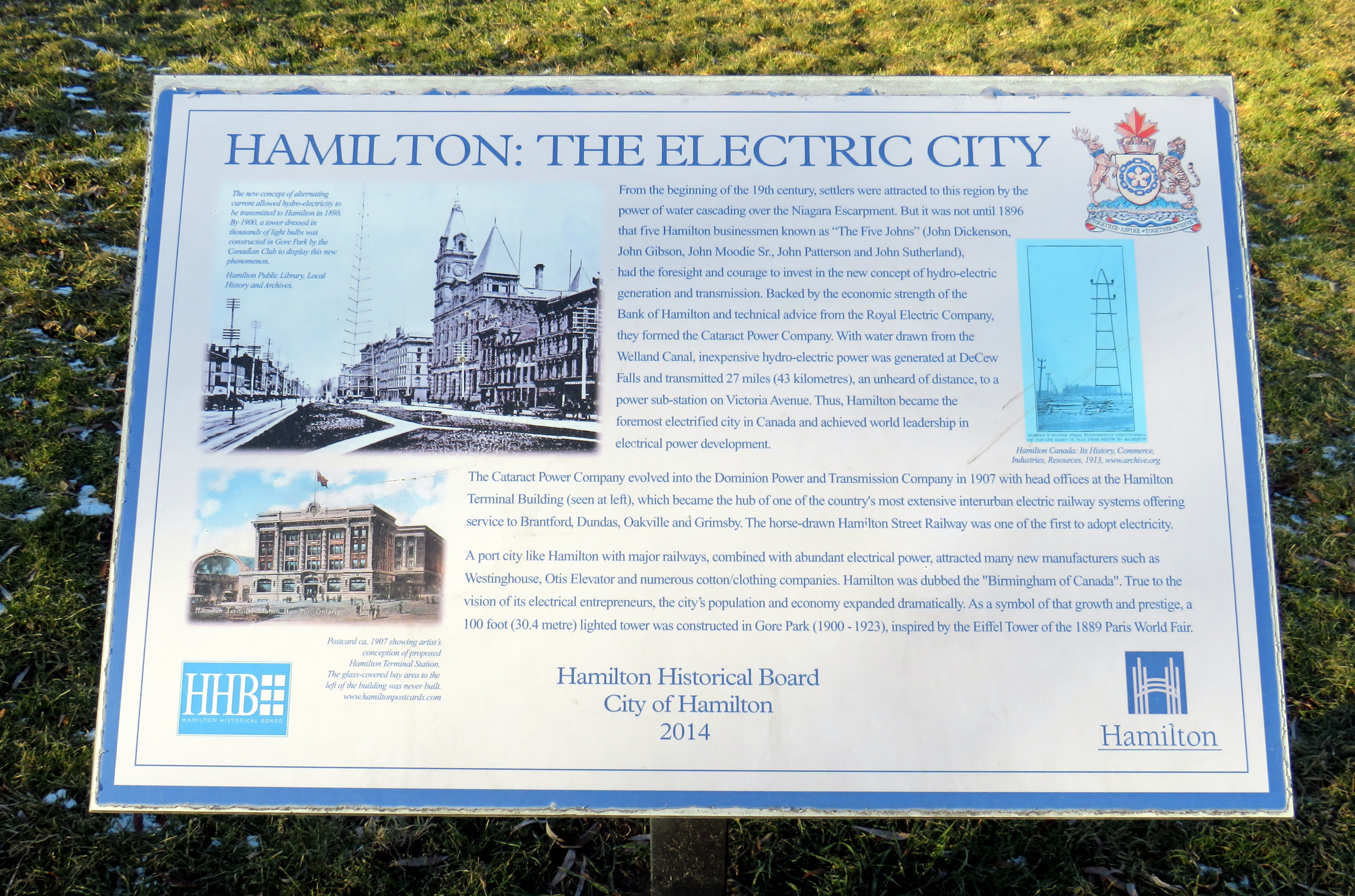
Both the DeCew Falls plant and the transmission corridor were constructed by the Cataract Power Company, an organization founded by five Hamilton businessmen, who all had the first name John. “The Five Johns” took control of the city’s power generation and distribution, electric lighting, as well as the Hamilton Street Railway (HSR) and electric interurban railways (known as radials) to nearby cities and towns including Dundas, Oakville, Brantford, and Beamsville. The HSR began electrified streetcar service on June 29, 1892, several months before the first electric streetcar operated in Toronto.
The tower was erected by the Dominion Power Company (the successor company that absorbed the Cataract) in 1913, as part of an upgrade of the corridor between Hamilton and DeCew Falls, and it is the only one of its vintage to survive. Beside the old tower, a modern hydro-electric corridor follows the same route south, up the Niagara Escarpment.
Access to cheap, reliable hydro-electric power was one reason why Hamilton was able to thrive as a major industrial centre, attracting steel producers, tire and auto manufacturers, textile mills, and electrical equipment suppliers. That, along with excellent water, rail, and road access helped to make the “Golden Horseshoe” at the western end of Lake Ontario shine.
Plaque installed by the Hamilton Historical Board in 2014 titled Hamilton: The Electric City
Eventually the hydro dam, the transmission corridor, the HSR, and the radials were taken over by the Hydro-Electric Power Commission of Ontario, which consolidated the many private power companies throughout the province and putting them under public control. Adam Beck, who headed the commission, was also an advocate for interurban railways, so control of the HSR and the radials was a natural fit. Unfortunately, Ontario’s radial railways were never fully consolidated, and most disappeared by the early 1930s. Hydro, however, kept control of the HSR until 1946, when it was sold to Canada Coach Lines, a Hamilton-based intercity carrier whose routes followed several of the old radial lines. Under private CCL ownership, the last streetcar lines were replaced with diesel and electric trolley buses by 1951.
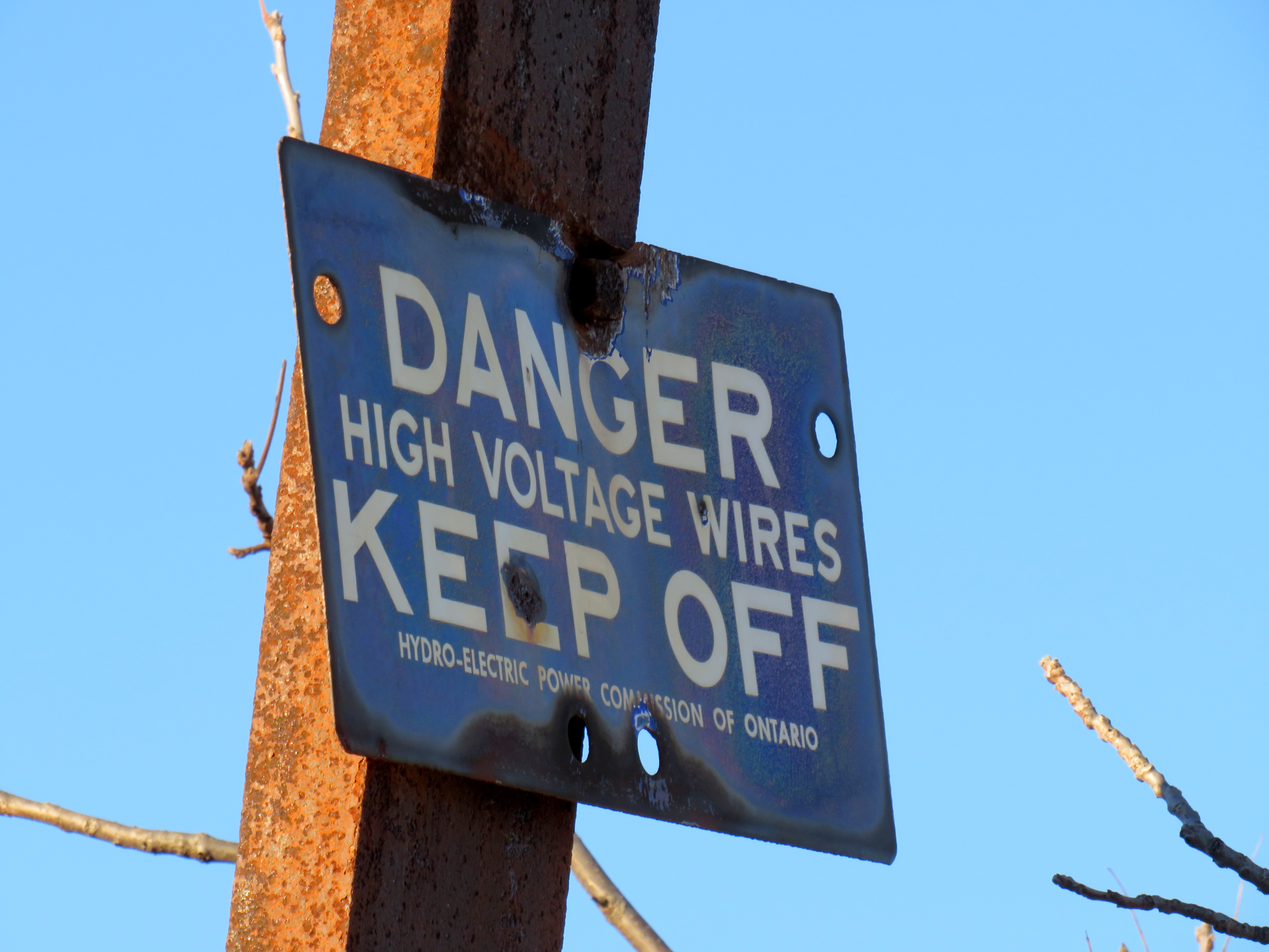
The “danger – high voltage wires” sign on the old tower bears the Hydro-Electric Power Commission of Ontario name. HPEC, later known as Ontario Hydro, took over the corridor from the private Dominion Power Company.
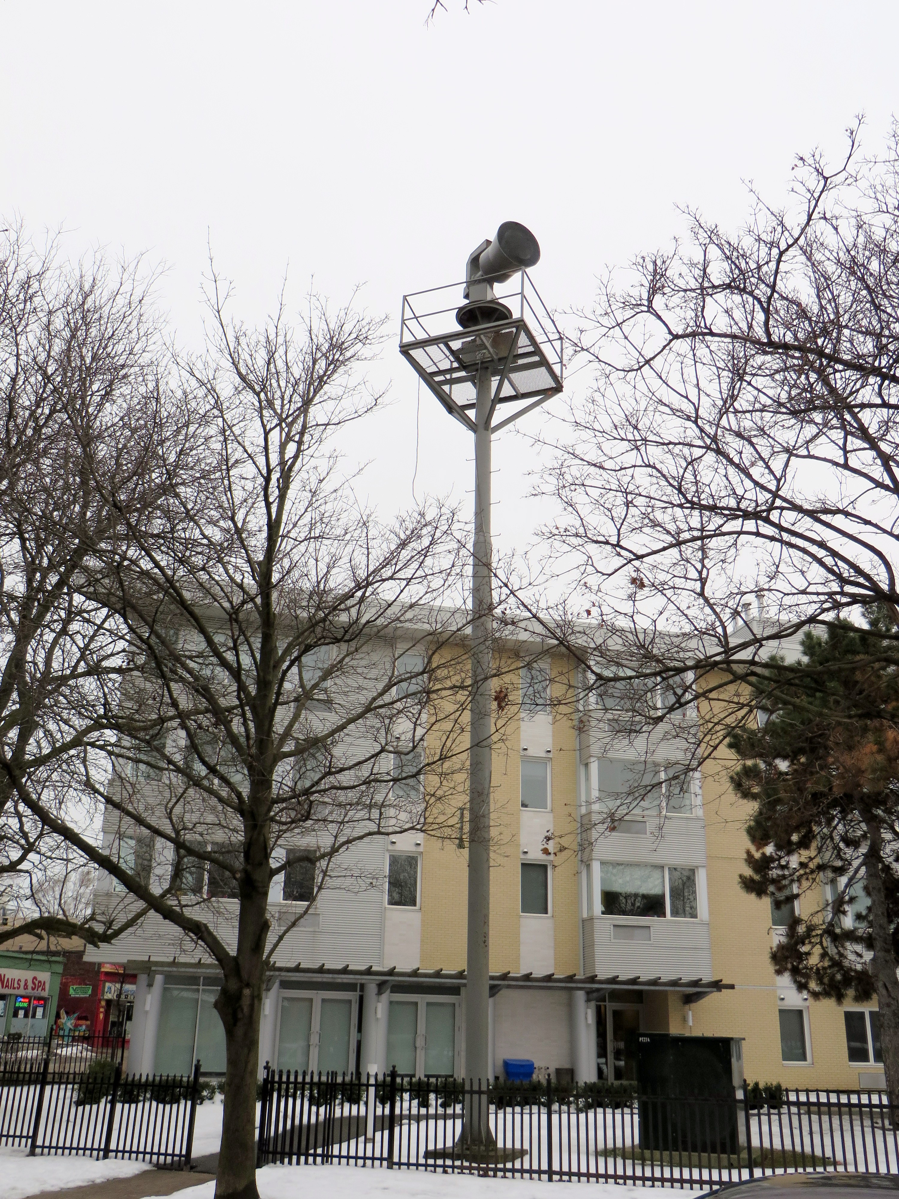
Heritage preservation need not be concerned only with major landmarks and grand buildings. Sometimes the seemingly mundane details matter too, and tell us about the history of our built environment. In Toronto, at Dundas Street West and Shaw Street, an old air raid siren still stands at the top of a long metal tower. These sirens were common place from the 1950s to 1980s, but they were mostly taken down as they became redundant due to modern missile technology (rendering evacuation and “duck and cover” measures useless) and the eventual end of the Cold War.
Today, the remaining siren tower is also a reminder of those times.
Disused air raid siren still stands at Dundas and Shaw
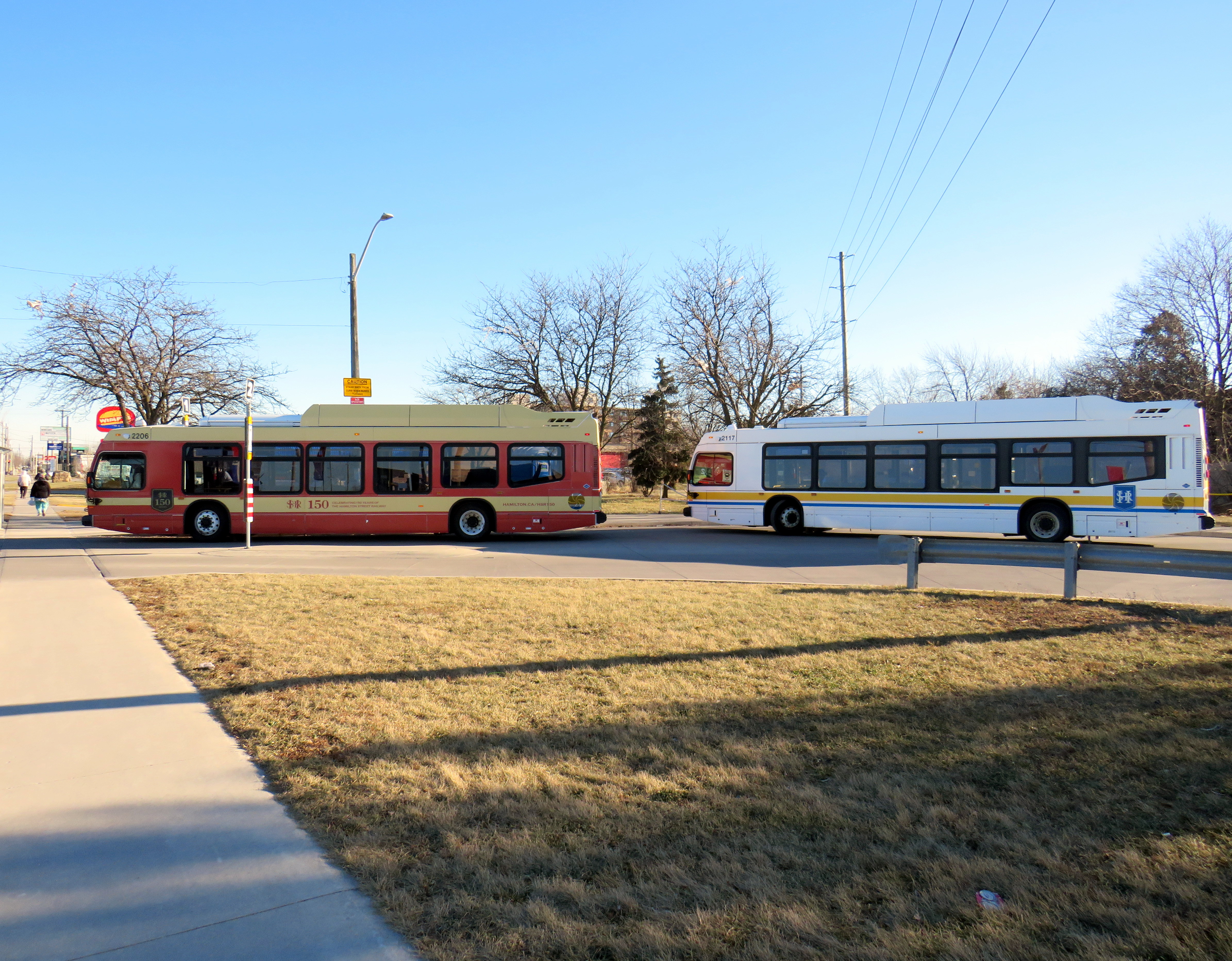
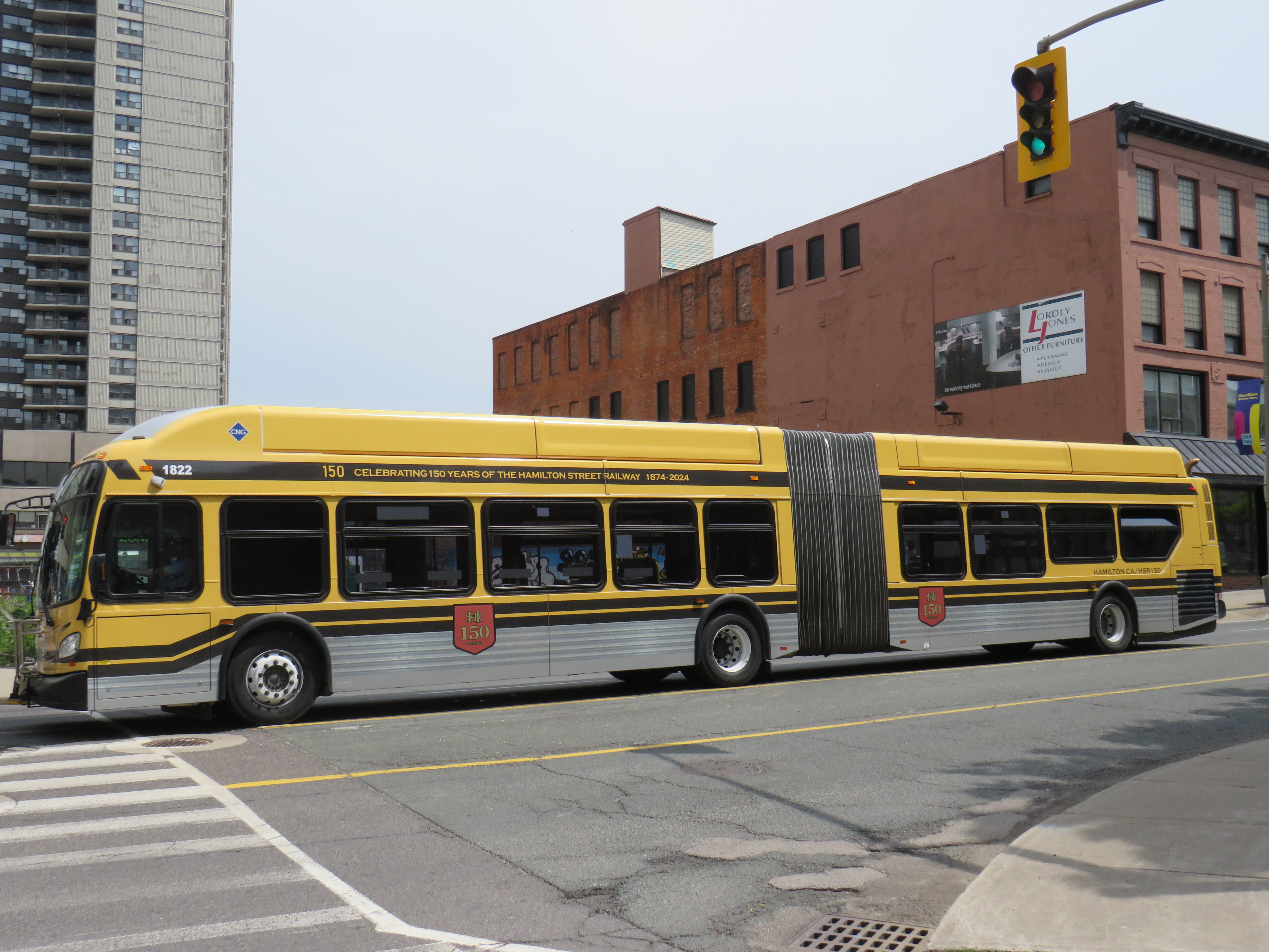
One more thing that the City of Hamilton has done in the last year is paint two of its buses in retro liveries, celebrating the 150th year of the Hamilton Street Railway Company. Though the HSR hasn’t actually operated streetcars since 1951 (and abandoned trolleybus service in 1992), the name persists through multiple ownership changes, even after municipal ownership starting in 1960.
One bus sports the 1950s-1960s-era colour scheme of burnt red and cream, while a second bus has the classic yellow and black “Ti-Cats” look used in the 1970s and 1980s. Though modern buses still have a prominent yellow stripe and the long-running interlaced HSR letters-in-a-shield logo, there’s nothing quite as says “Hamilton” quite like classic yellow and black scheme.
Two modern Nova low-floor buses layover at the end of the Barton Street route, with one in the 1950s-era red-and cream colours, and the other in the current colour schemeA New Flyer articulated bus in the prominent “Ti-Cats” colours of black and yellow, which match the colours of the venerable CFL franchise (as well as the traffic signals used in Hamilton)
It would be great for other agencies, such as the TTC, GO, and Brampton Transit to bring out their old colours. I would like to see a modern low-floor bus or Flexity streetcar in the classic maroon and cream colours, or a GO bus with the 1970s GO Transit wordmark. I would love to see a Brampton Transit bus sporting the old pink stripe and “b” logo.
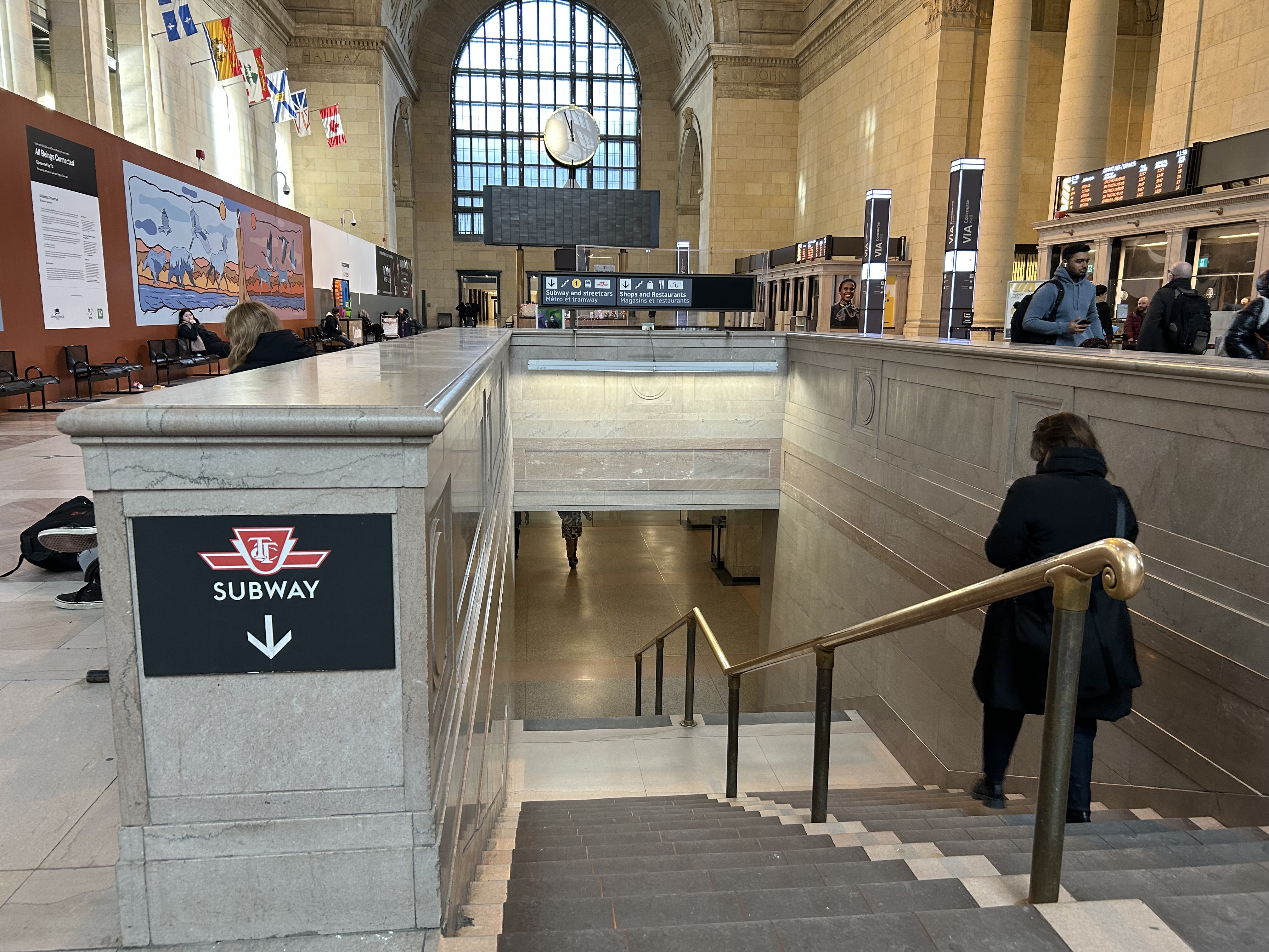
Last month, I wrote about the challenges getting around Toronto’s Union Station, Canada’s busiest transportation hub, particularly for passengers using mobility devices or carrying luggage. Only one poorly-marked elevator directly links the Great Hall and the UP Express platform with the subway station/PATH level, which is located two floors down.
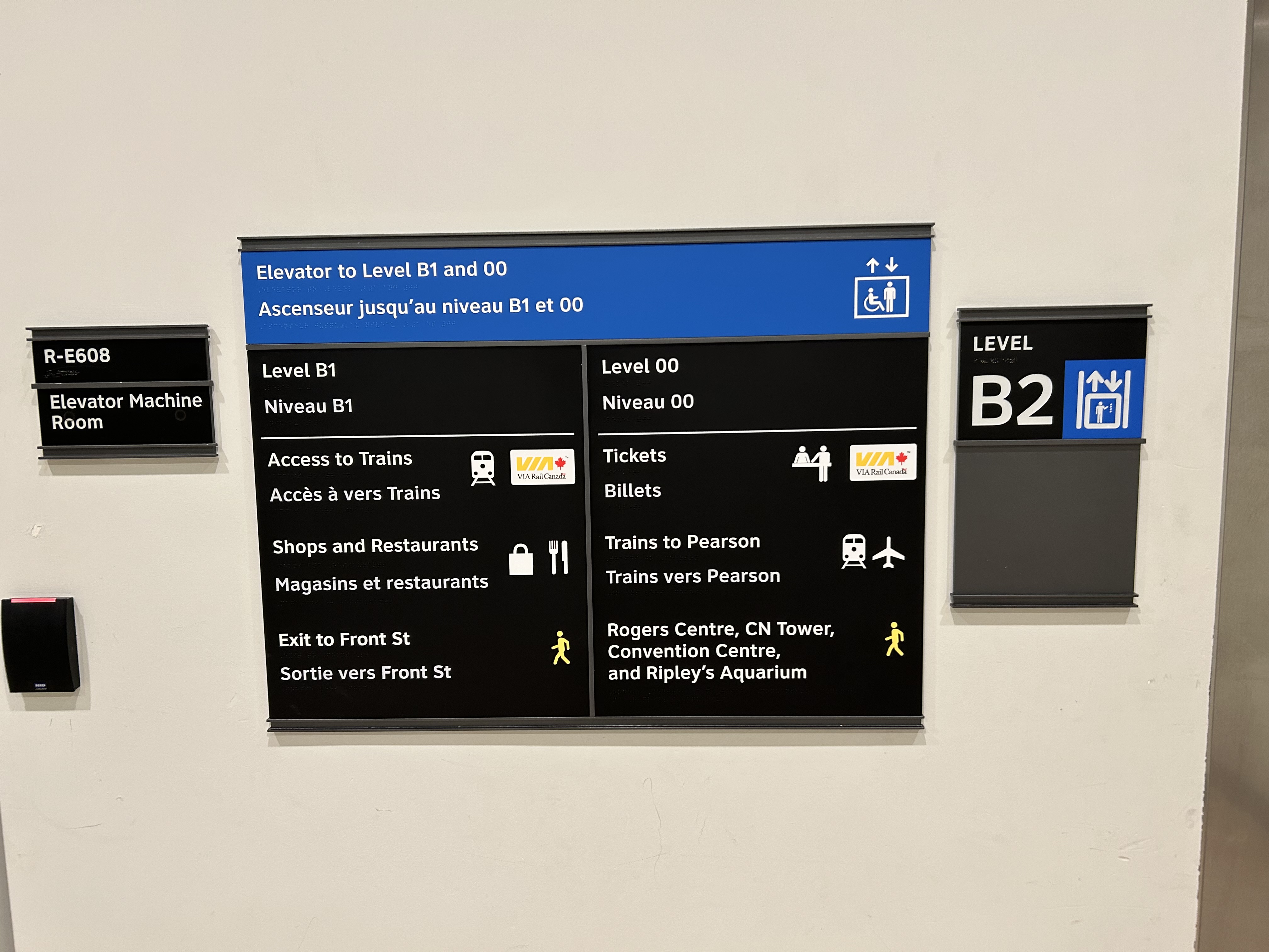
I returned to Union Station on Tuesday, January 7, to see if any improvements were made since I wrote my initial post. Somewhat surprisingly, new signs were installed beside the elevators, indicating which floor goes where.
Elevator signage at B2 level (subway concourse/PATH level by Bay Street) that indicates where the other floors lead to: Level B1 for VIA trains, shops and restaurants, and exit to Front Street, and Level 00 for VIA ticketing, UP Express trains, and access to the Skywalk to Rogers Centre, CN Tower et al.In the GO York Concourse, the elevator leads to Level 00 (The Great Hall) only.
These signs are a notable improvement, but there is still no signage inside the elevator cars themselves, so the traveler must note the directory signage before entering the elevator. Furthermore, the Great Hall, the historic centrepiece of the Union Station complex, is not noted, even though it is a logical meeting place from where access to all GO, VIA, and UP Express train services can be made, or where taxis can be found right outside.
Unfortunately, the elevators themselves are still difficult to locate, and the decision to have just one slow elevator connect the Great Hall/UP Express floor with the subway station entrance remains unfortunate. There is still so much more to be done.
In the Great Hall, there are clear signs directing passengers towards the subway, but there are no indications on where a barrier-free passage can be found. A supplementary sign pointing towards the one elevator, located at the far end of the Great Hall, could be useful here.


