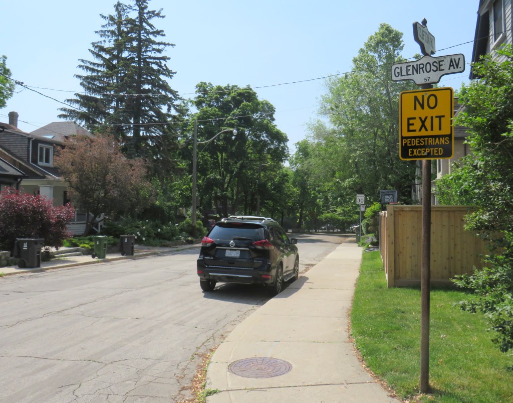
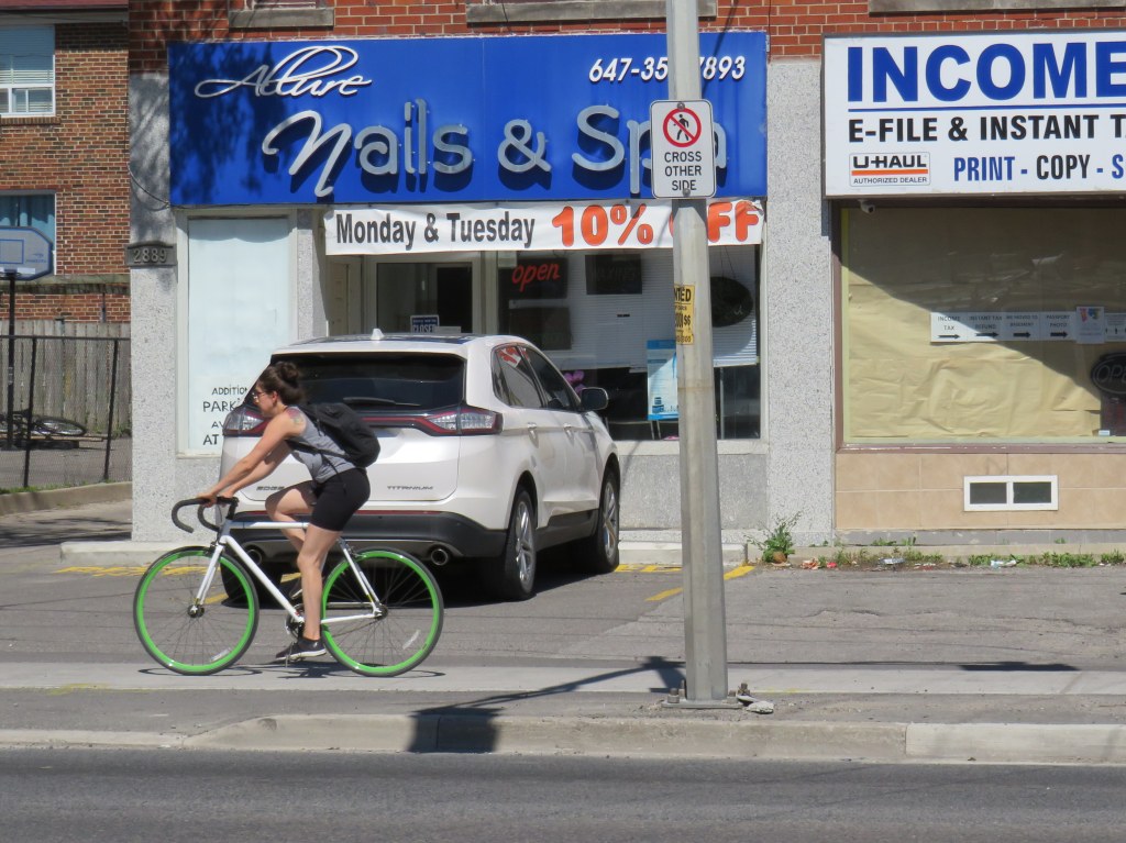
On April 8, Toronto City Council approved a motion brought forward by Councillor Paula Fletcher to change that. Councillor Fletcher’s motion was titled “I’m Walking Here.” Only two months later, new signs are already appearing across Toronto — in Scarborough, Monarch Park, and Swansea. For a city that often takes years to adopt what may seem like simple, easy solutions, this was implemented impressively quickly. The new signs look like standard yellow “no exit” signs, but with a “pedestrians excepted” note at the bottom.
My hope is that these signs will entice Torontonians to get outside, go for a walk, and check out some new streets and parks, enticed by these signs inviting through passage.
In related news, this week Toronto Council approved the expansion of sidewalk slow clearance to all of Toronto’s streets, a service that was previously provided only to suburban areas, where unobstructed sidewalks made municipal slow clearance easy to do. With new snow equipment able to navigate narrow urban sidewalks, Toronto is now finally able to provide universal snow clearance services, a boon for full accessibility.
As public health restrictions ease and stores and restaurant patios reopen this Friday (supported by the city’s willingness to reallocate road space on streets like Yonge and Danforth), there’s never been a better time to for a walk.
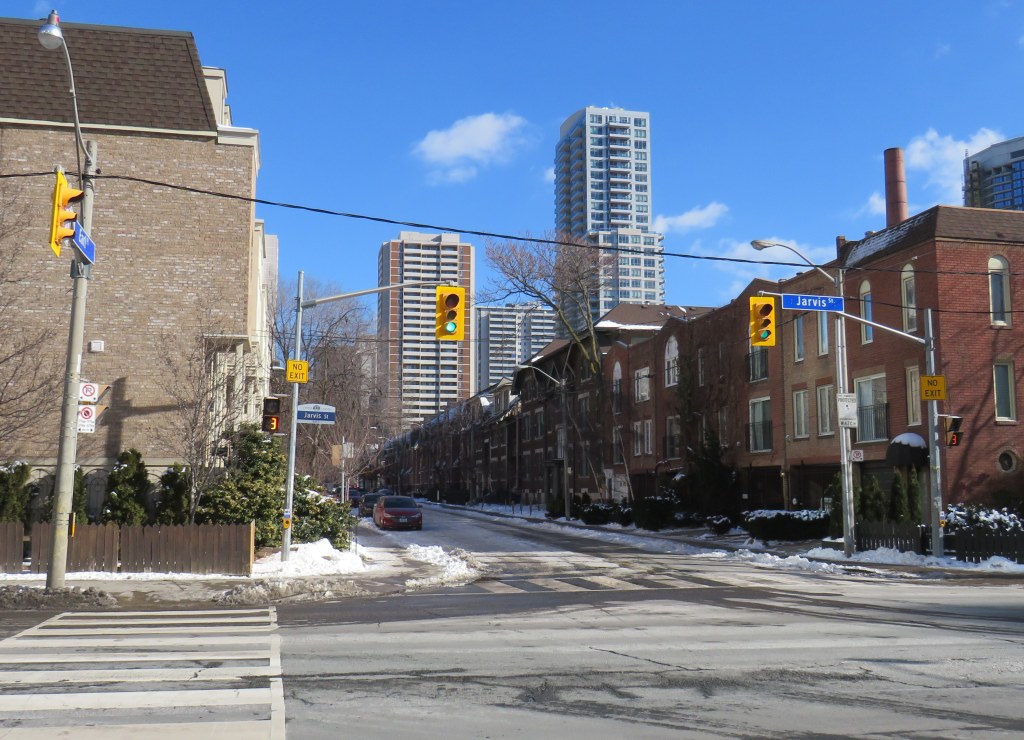
Misleading “no exit” signs, like these on Maitland Place at Jarvis Street, will soon be changed by the City of Toronto to indicate that indeed, pedestrians can continue through
Though these signs are required under traffic codes and regulations, they do not reflect that in many cases, there is an exit for pedestrians.
I quickly created a Google map of all locations in the City of Toronto marking such locations. Through a social media campaign led by Walk Toronto, we were quickly able to map over 450 locations where a pathway, sidewalk, or staircase allows a pedestrian to continue their way where motor vehicles are forced to turn around.
The motion, which was amended to strengthen the wording, requests city staff to develop a new signage standard to indicate where “no exit” signage betrays a pedestrian passage, and to begin installing these new signs this year.
Councillor Paula Fletcher’s motion (inspired by @Walk_TO) to have staff modify “No Exit” signage in places where there are, in fact, exits for pedestrians carries via show of hands, with some amended wording. https://t.co/owNfqtPgNUpic.twitter.com/eevn2bMwkN
The map that I created based on Dylan’s initial suggestion will be used to help identify these locations.
Given the ongoing pandemic, where we are all subjected to yet another lockdown, walking is one of the few permitted ways for each of us to get outside, enjoy the fresh spring air, and get much needed exercise. Knowing where one can walk, especially away from heavy traffic or busy sidewalks and paths, will only help unlock the city for more Torontonians.
I want to thank everyone who submitted locations for the map to Walk Toronto or to myself via Twitter or directly to me on this website. This couldn’t have happened without the help of fellow Torontonians.
The starting wage for an Amazon fulfillment centre employee is $17.00 an hour, despite notoriously tough working conditions. With most professional and office workers at home, and with ongoing pandemic restrictions, Amazon has enjoyed significant sales increases. But those workers picking and packing orders are not able to work from home – and workplace spread has been a significant factor in COVID-19 transmission in Ontario.
Brampton, home to two of the GTA’s fulfilment centres, and close to Amazon’s Mississauga, Milton and Bolton warehouses, has been a COVID-19 hotspot. Like Toronto, Peel Region has been under lockdown and stay-at-home orders since November.
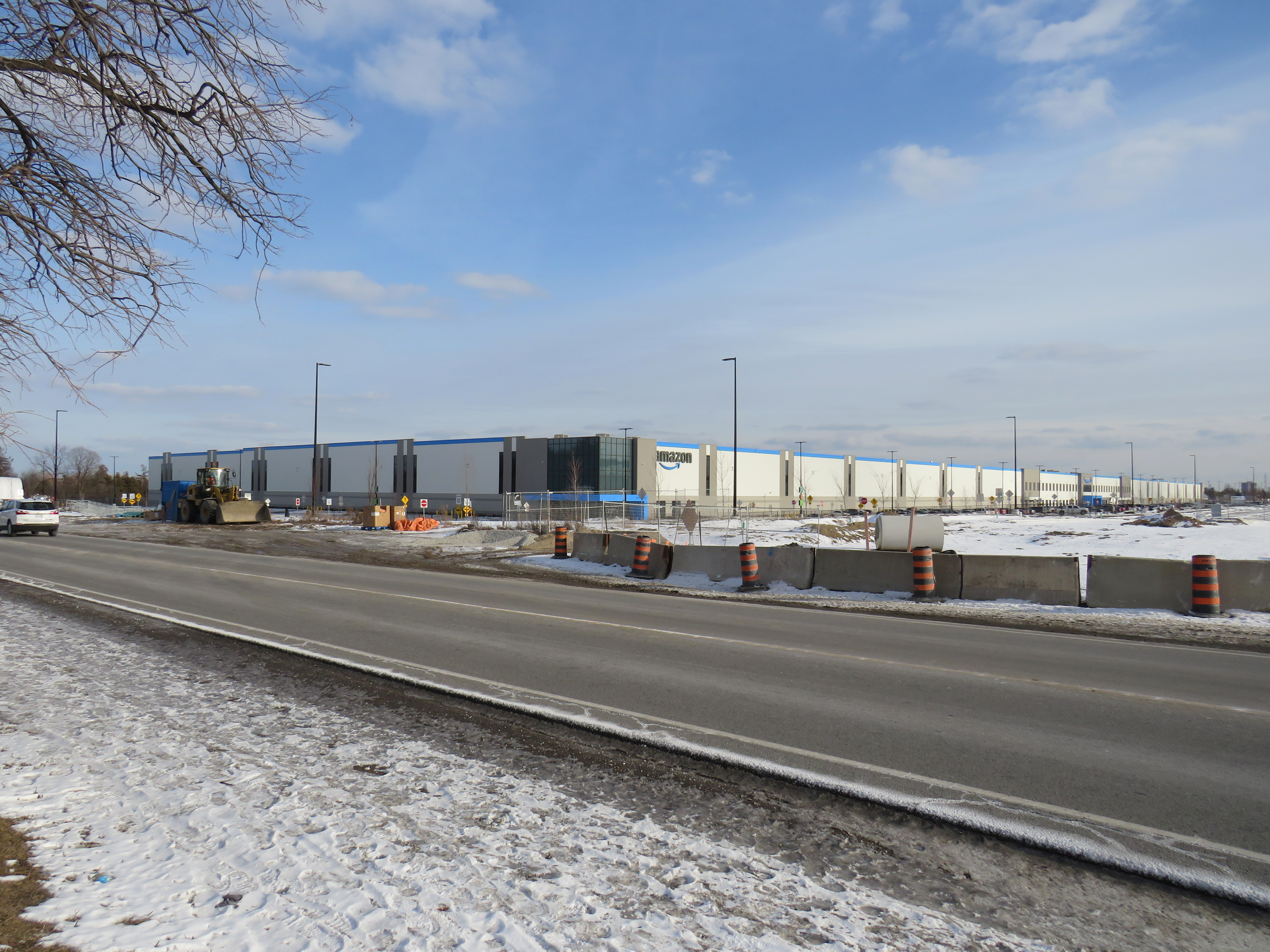
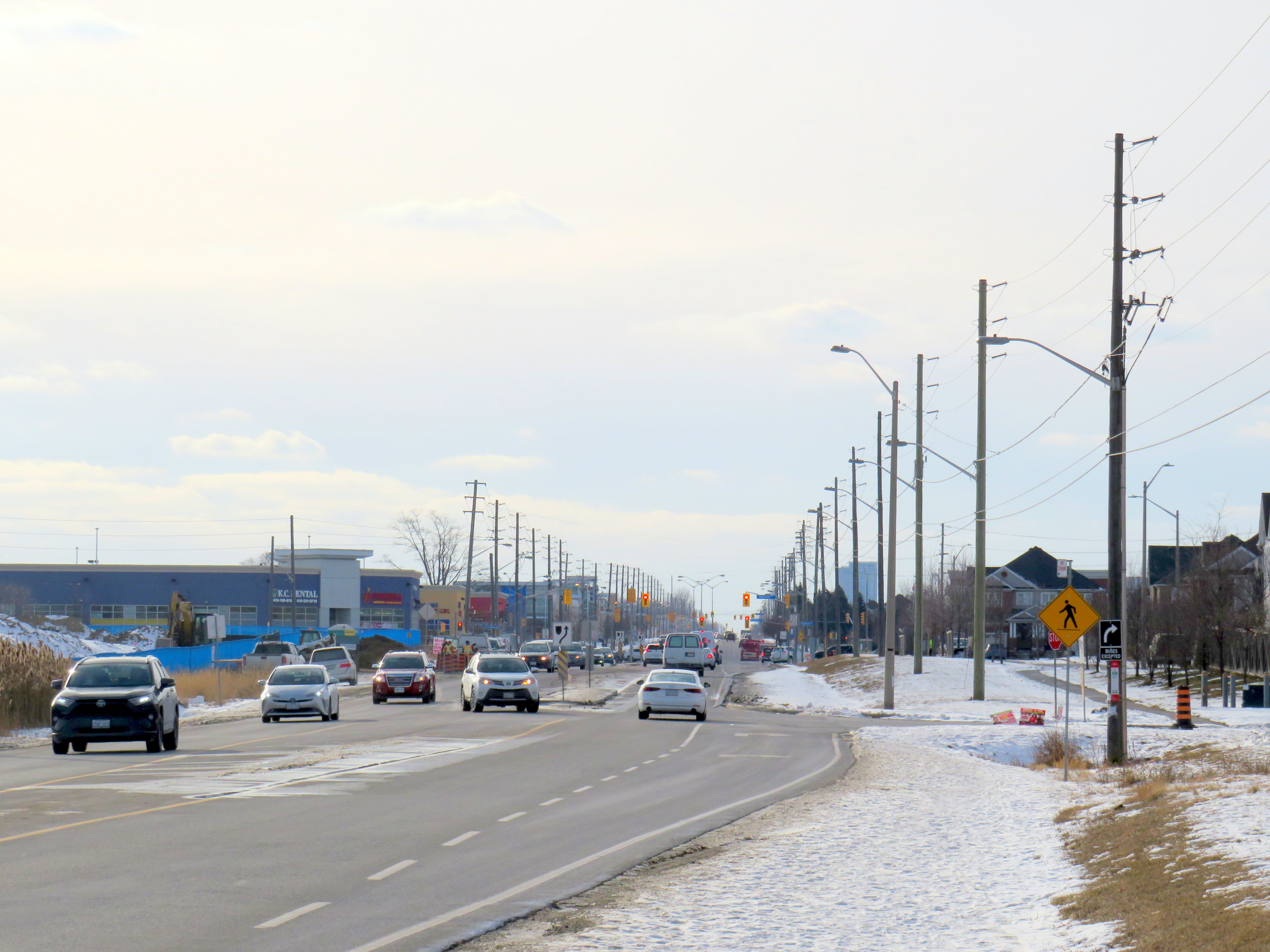
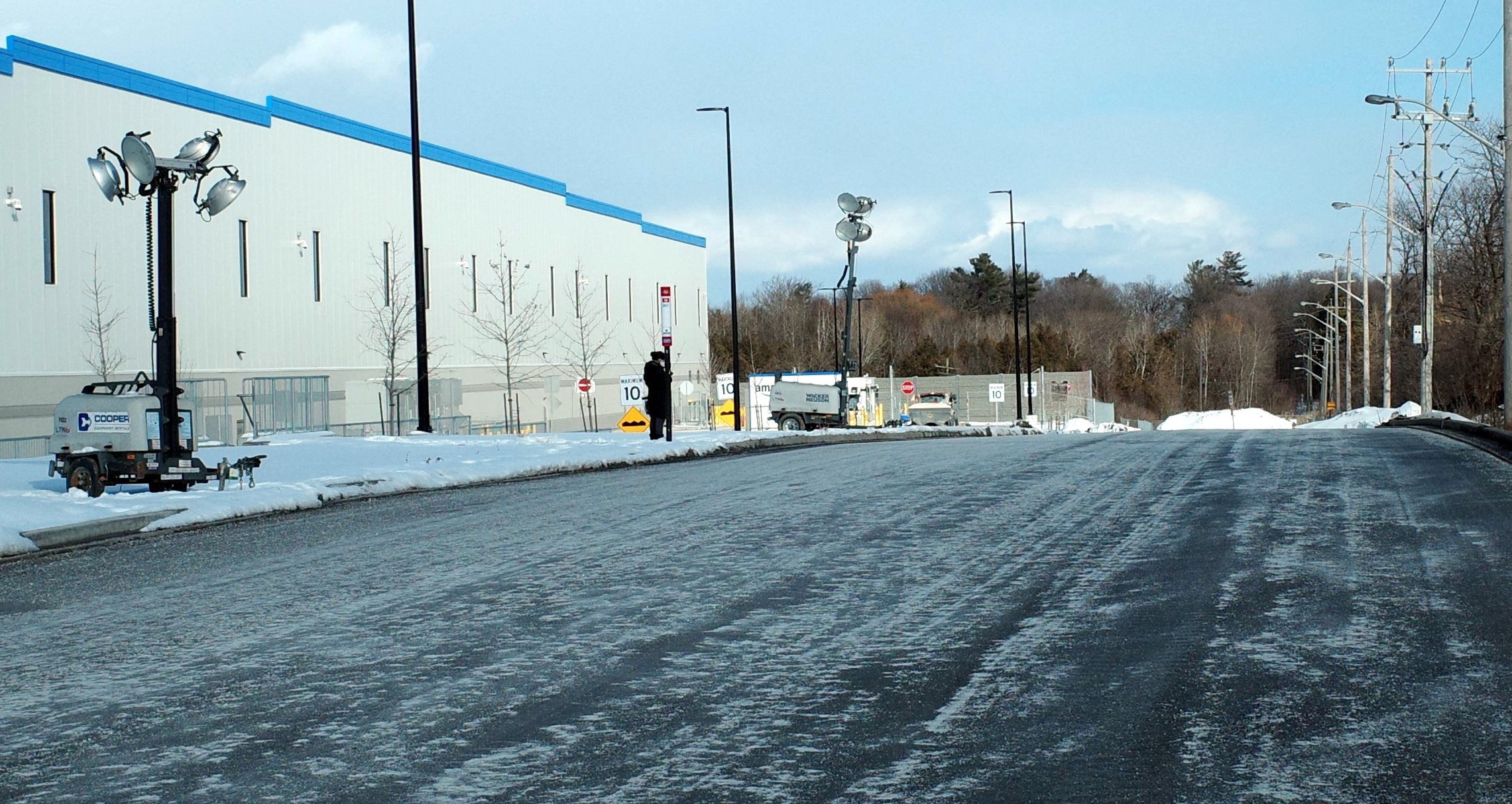
Like most new logistics facilities, the new Scarborough warehouse, like the other five GTA Amazon fulfillment centres, is in an industrial area on the city’s outskirts, where land is plentiful, but transit and pedestrian access is lacking. East of Tapscott Road, Steeles Avenue narrows from four lanes to two, and there are no designated pedestrian crossings at the intersection with Eastvale Drive. The eastbound TTC stop at Eastvale Avenue was removed in 2018 after a passenger was struck and killed trying to cross the street after disembarking from a 53 Steeles East bus. The next nearest stop, at Tapscott Road, is 300 metres west.
Steeles Avenue, looking west towards Eastvale Drive and the signalized intersection beyond, at Tapscott Road
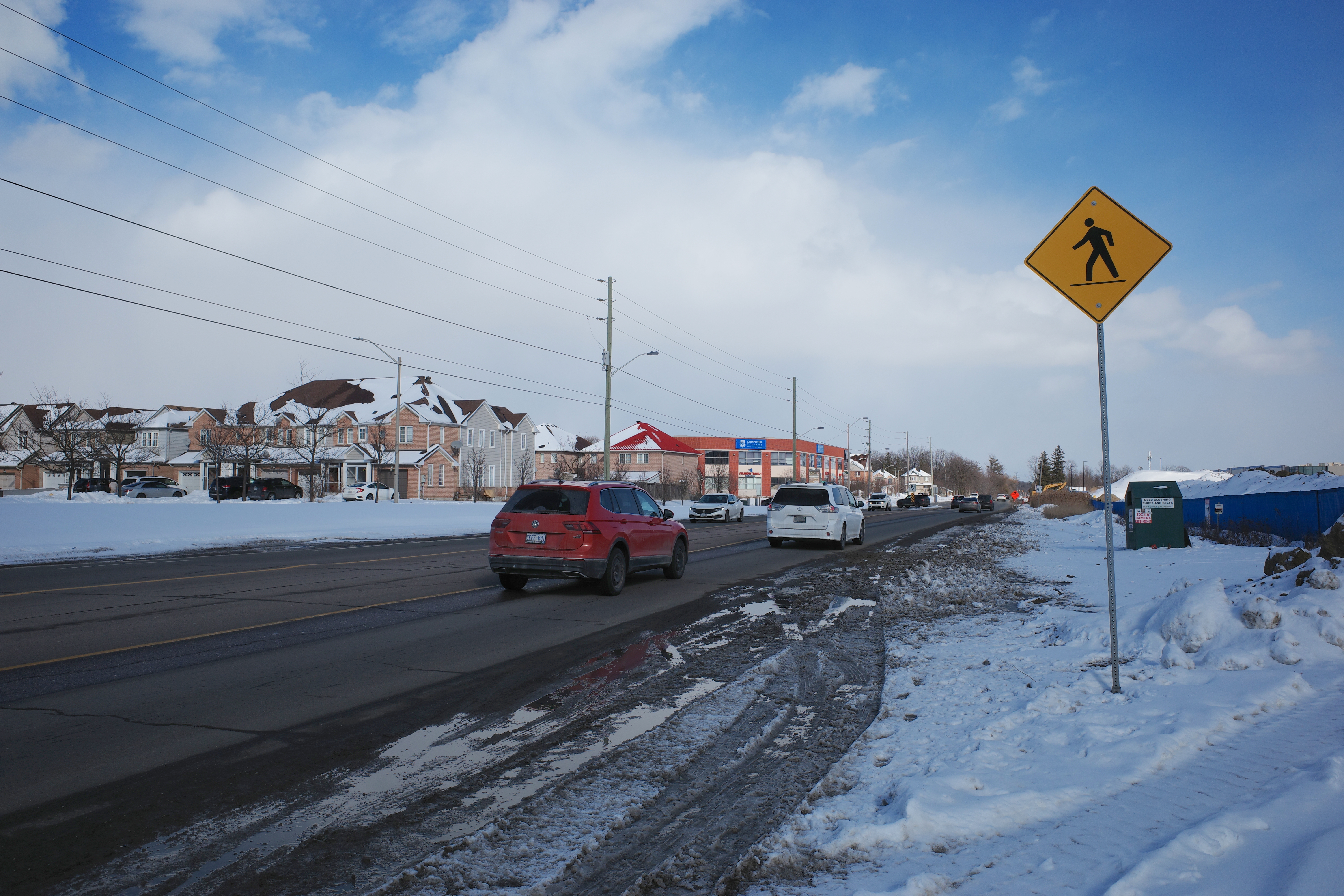
The sidewalk on the south side of Steeles Avenue ends at Tapscott, a few hundred metres west of the Amazon fulfilment centre. On the north side, the sidewalk ends at Ferncliffe Crescent in Markham. Despite a new residential area in Morningside Heights, to the east, there is no sidewalk along Steeles to connect to it. Pedestrians heading to Amazon or towards Staines Road must choose whether to walk in the mud, or on the busy roadway. Though the posted speed limit is 50 km/h, motorists regularly travel at 60 km/h or faster.
Looking east on Steeles from Tapscott Road – despite the sign advising motorists of pedestrian activity, there are no sidewalks leading east towards the new Amazon fulfillment centre (Sonali Praharaj)
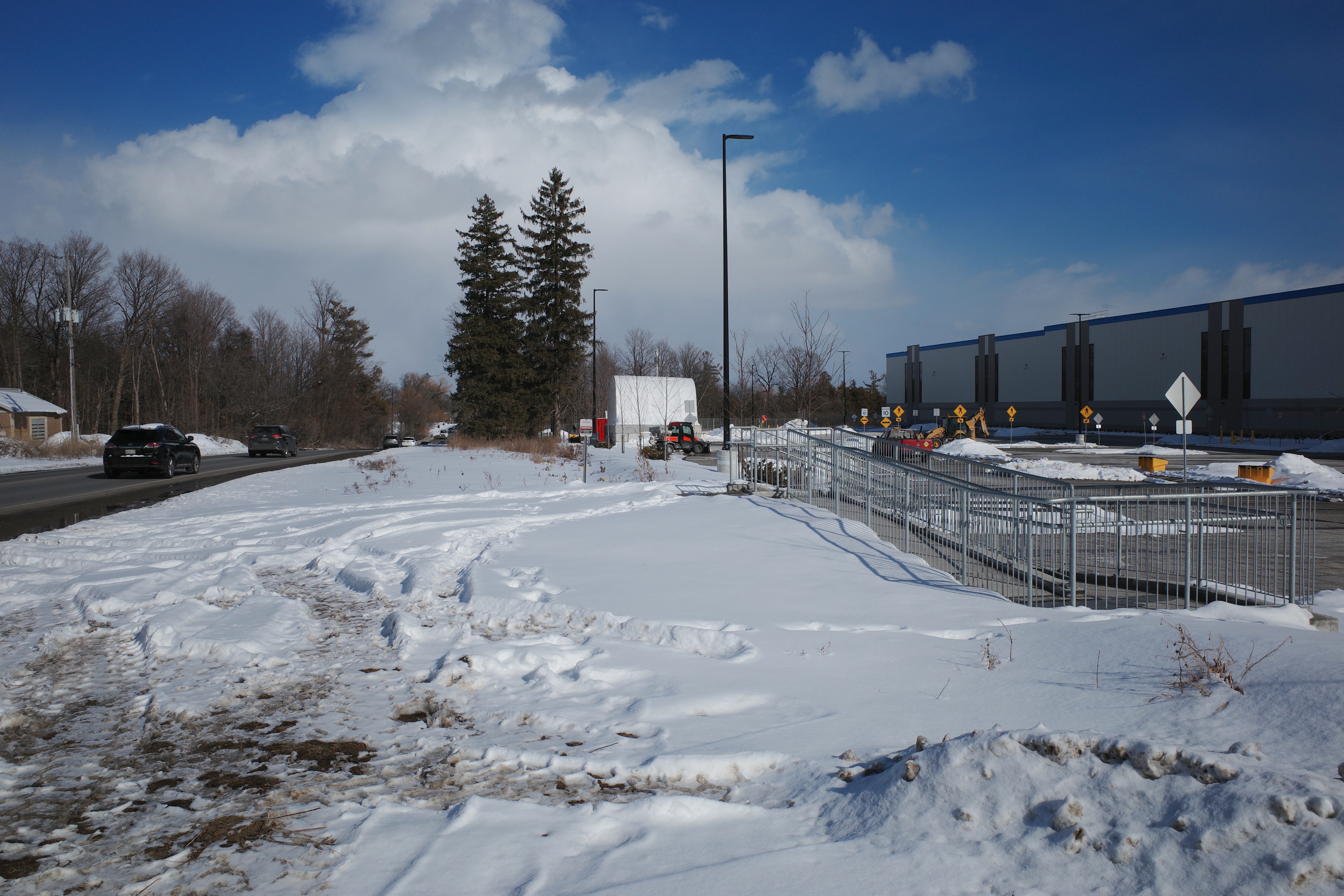
A stairway and ramp were built on the north end of the Amazon property, likely with the expectation that a sidewalk on the south side of Streeles Avenue would soon be installed. This would provide improved pedestrian access to the fulfillment centre. But without a safe and logical way to get to it from the street, it remains largely unused.
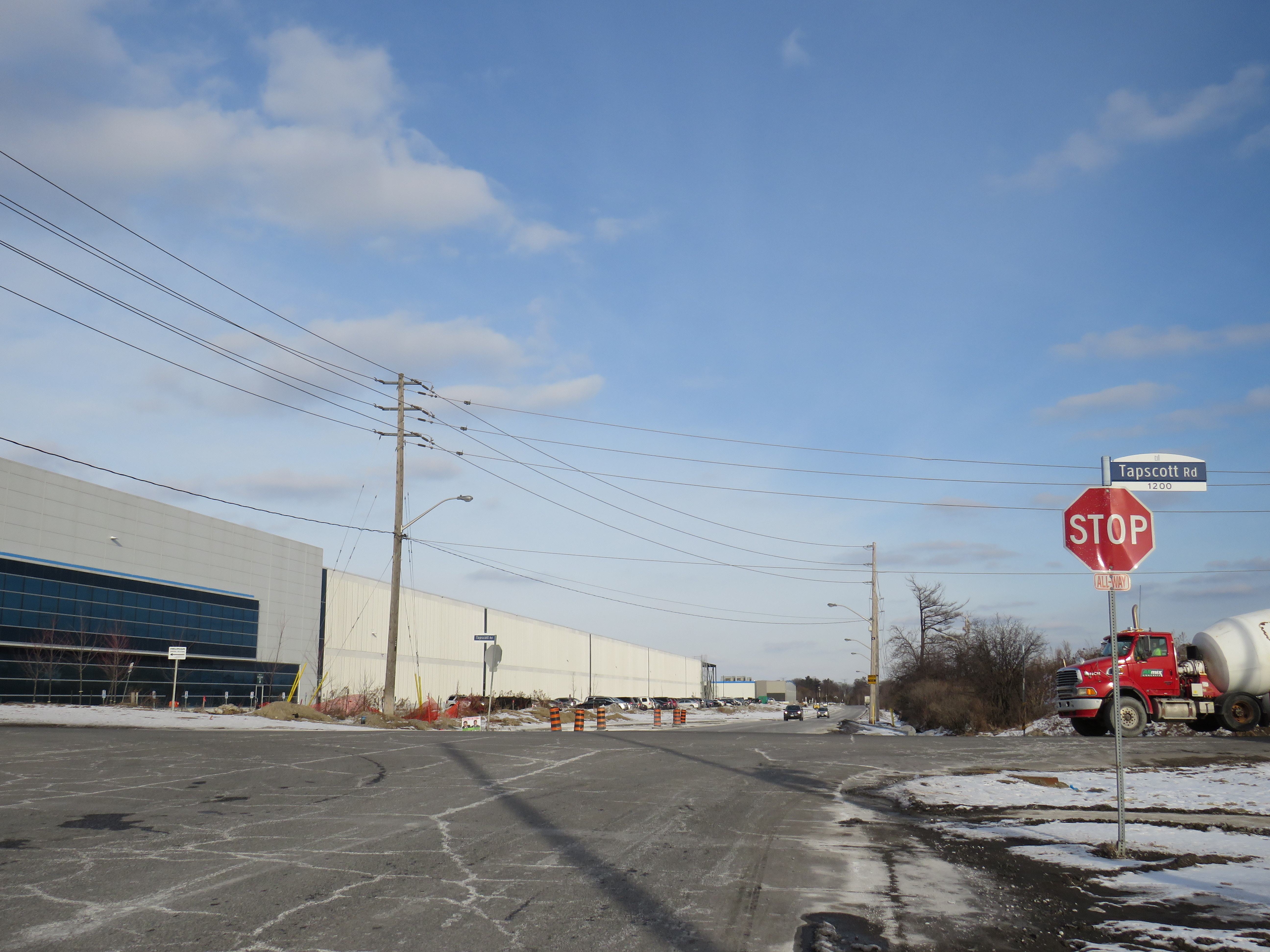
Passmore Avenue, on the south side of the fulfillment centre, was rebuilt with a sidewalk in the late fall of 2020, months after Amazon opened. However, it requires a lengthy walk north to Steeles Avenue up Tapscott, and there are no sidewalks on Tapscott from Passmore south, towards McNicoll Avenue. The intersection of Passmore and Tapscott itself – controlled by an all-way stop – still does not feature proper crosswalks.
Looking east on Steeles from Tapscott Road – despite the sign advising motorists of pedestrian activity, there are no sidewalks leading east towards the new Amazon fulfillment centre (Sonali Praharaj)
Though there are two TTC bus routes that operate to the corner of Tapscott Road and Passmore Avenue – 53B/953B Steeles East and 102B/C Markham Road – for months, workers had to walk on the roadway, through a construction site to access those buses. Anyone looking to go east, towards Morningside Heights, or southeast, towards Malvern, still face a long, dangerous walk or a lengthy bus commute.
The corner of Tapscott Road and Passmore Avenue
The TTC, starting January 11, 2021, began diverting the 53B Steeles East bus to directly serve the Amazon fulfillment centre, finally serving a major industrial trip generator and reducing essential workers’ travel times. Even still, the new sidewalk on Passmore ends at the warehouse entrance – anyone waiting for a bus must still walk and wait in the snow or mud.
Eventually, Steeles Avenue will be widened, with new sidewalks and bike lanes, and Morningside Avenue will be extended north to Steeles Avenue. However, these improvements have been planned for years and completion is still several years away. Though new warehouses have opened here, civic infrastructure has not caught up.
New TTC bus stop serving the Amazon Fulfillment Centre on Passmore Road (Sonali Praharaj)
The TTC’s service change, adding a new bus stop on Passmore Avenue, was a welcome – yet overdue – acknowledgement that essential workers, especially racialized and lower-paid workers, deserve better. It is inexcusable that new employment uses are planned, approved, and constructed before the appropriate pedestrian infrastructure and transit services are in place. It is also inexcusable that after a TTC customer was killed that a nearby bus stop was removed, rather than safety improvements added instead. This is not just a matter of ensuring a basic level of safety for pedestrians – this is a matter of justice for those we consider essential workers.
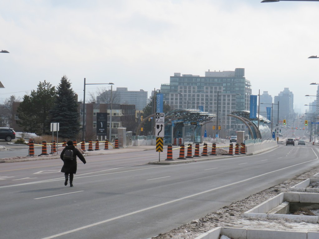
At least the new Yonge Street Rapidway would serve York Region’s busiest transit corridor, supporting new high-density development in Richmond Hill. Unlike on Highway 7 or in Newmarket, there are no two-phase pedestrian crossings on this part of Yonge. Unfortunately, a botched connection between the new Rapidway at Major Mackenzie Drive created a new problem for the YRT/Viva transit network.
This issue — along with the other problems with York Region’s Rapidways that I discussed previously — should be held up as lessons on what not to do when building new transit rights-of-way in street medians, be it on Hurontario Street in Mississauga and Brampton, planned BRT lines on Dundas Street in Mississauga, or Queen Street in Brampton.
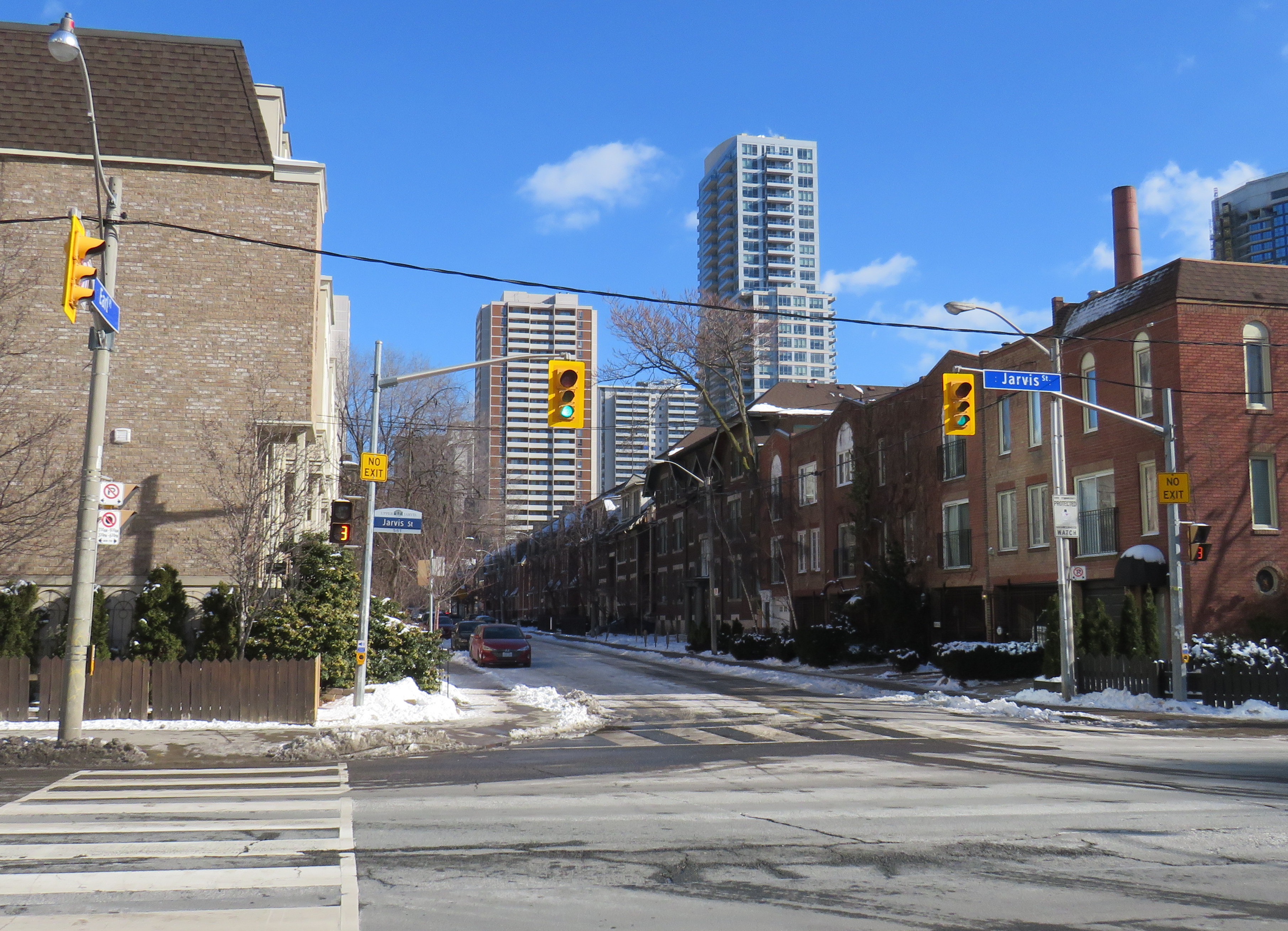
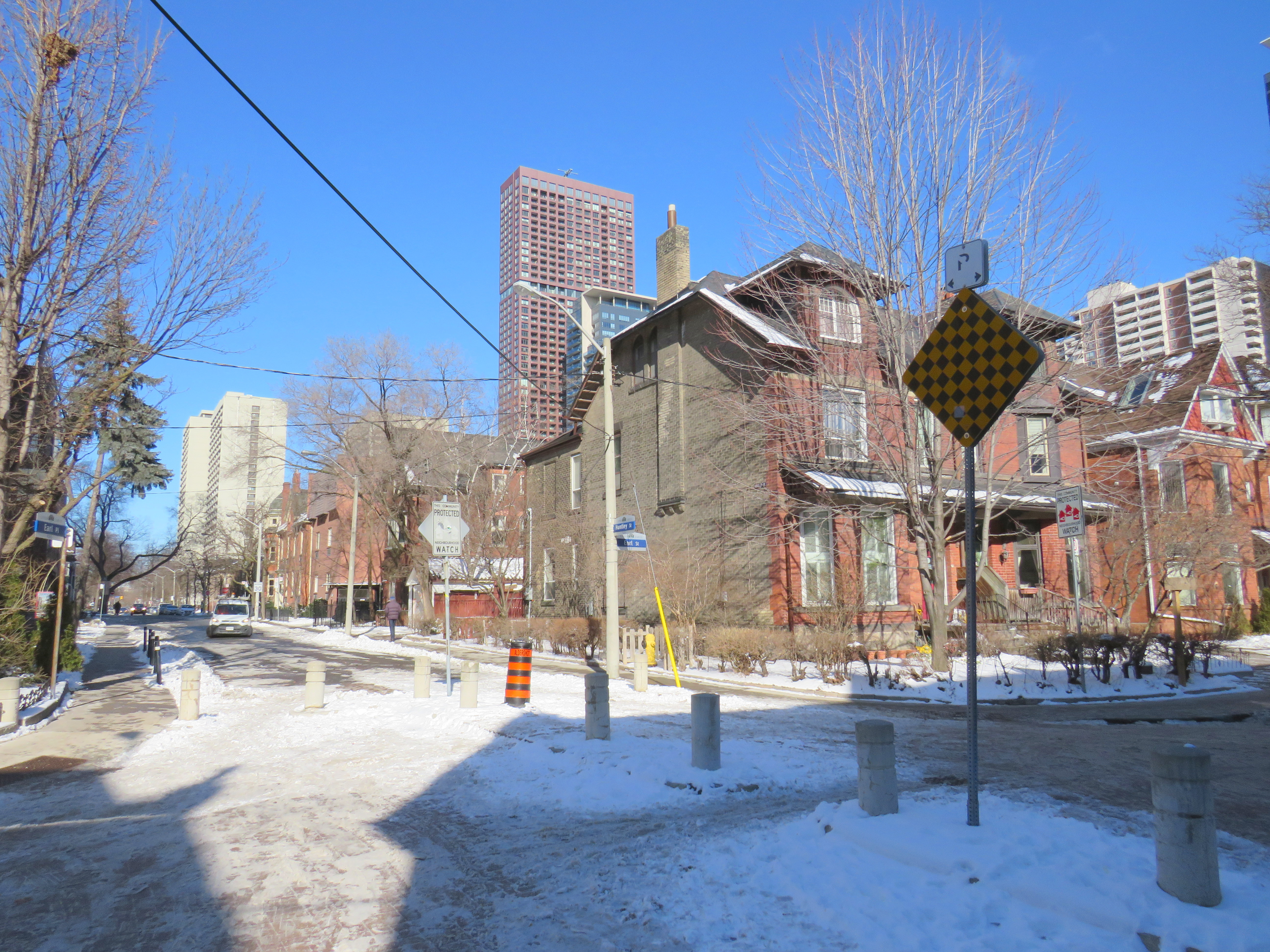
Earl Place, where “No Exit” signs betray through access for pedestrians and cyclists
Last week, Dylan Reid and I, both co-founders of Walk Toronto, decided to create an inventory of all instances in the city where “No Exit” signs do not apply to all road users. Though these signs are required under traffic codes and regulations, they do not reflect that in many cases, there is an exit for pedestrians. Some of those offer through passage for cyclists as well. We were inspired by a Twitter thread that expressed the frustration of getting around the city by foot, where signage is designed entirely for motorists.
Instances where pedestrians or cyclists may continue past a “No Exit” sign include traffic calming measures meant to keep out through motor vehicles on once-continuous roads. The intersection of Earl Place, Earl Street, and Huntley Street is just one example: curbs and bollards restrict motorists from continuing through, though a narrow passage allows cyclists to continue past; sidewalks also allow through pedestrian movement.
Earl Place and Huntley Street
In many other cases, suburban street designs, such as cul-de-sacs, limit vehicular movement though residential subdivisions, but narrow public walkways allow pedestrians access to parklands and neighbouring streets. In other cases, changes in grade between streets allow for a staircase, but not a through roadway down a steep hill. These are common in the Swansea, Baby Point, Silverthorn, and East Toronto neighbourhoods.
As of January 30, 2021, I have mapped over 250 misleading “No Exit” signs throughout the City of Toronto, though I know there are many more. Please send them to me via Twitter or via a direct message, and I will be sure to add your submission.
Our goal is to convince the City of Toronto to add signage recognizing where pedestrians and cyclists do have an exit. Perhaps too, this might inspire you to get outside, and walk around the neighbourhood, checking out passageways you might have not known about.
Update December 14, 2020: With outdoor skating rinks fully opened for the season, I have added the washrooms located at each of these facilities open this winter. Though many rinks will have to be pre-booked to use (to limit crowds during the pandemic) the city has provided access to adjacent indoor washrooms. I also noted the addition of a portable toilet at Guild Park, something I commented on previously.
Please note, though, that many portable toilets have not been kept in good service. I suggest bringing hand sanitizer on your walks in case you need to use one of these temporary facilities.
Update November 28, 2020: I have added the list of 51 temporary portable toilets that the city has or will be adding to its parks this winter as part of an effort to encourage Torontonians to get outside for winter walks. Many of these locations are along the major ravine paths, including the Don and Humber Rivers. Most location descriptions were easy to locate, though others were quite vague. I did the best I could with the information given. I also added the toilet locations at Tommy Thompson Park, which is operated by the Toronto and Region Conservation Authority.
There remain some critical gaps, including the absence of Guild Park in Scarborough and along the waterfront between Humber Bay Shores and Marie Curtis Park, but on the whole, this is a positive development. The city also announced new winter maintenance of additional park paths, though ideally, this service would be extended along the entire ravine network.
As of Monday, November 23, Toronto and Peel Region will be in another lockdown. Non-essential businesses and services will close or be open only for take-out and curbside pickup. Gyms, patios, and salons will all be closed. Though we may not be able to socialize with friends and extended family, we can still go for walks, runs, and bike rides to maintain our physical and mental heath.
But with indoor dining prohibited since October in Toronto, and most malls closing down, finding a washroom has become much more difficult. Many outdoor park washrooms are not winterized, so they must close as well. For many of us, having access to open and accessible washrooms is a necessary when leaving the home for long periods of time.
Though there is a list of washrooms open (or soon to open) on the city’s website, they are listed in alphabetical order, without easily-accessible location information. I took the liberty of mapping each park washroom location, as well as selected other city-owned public washrooms accessible seven days a week.
Though winterized public washrooms can be found across the city, there are a few areas left unserved, including the Etobicoke waterfront between Humber Bay Shores and Long Branch, the eastern Scarborough waterfront parks, including Guild Park and the Port Union/Rouge Beach area, and northwestern Etobicoke. Ideally, every Torontonian should live within walking distance of a four-season park.
Even with the impending lockdown, there are some other washrooms that will remain available when necessary. GO Transit has kept washrooms at its stations accessible even during the Spring 2020 lockdown. On the Lakeshore Line, stations are open seven days a week, including Guildwood and Rouge Hill. Many supermarkets have public washrooms as well.
I hope that there will be improved four-season access to public washrooms this year, and every year going forward. Simple outdoor activity, including long walks, are one of the safest and easiest things we can do to keep ourselves happy and busy.
I will update the map as more washroom facilities open.
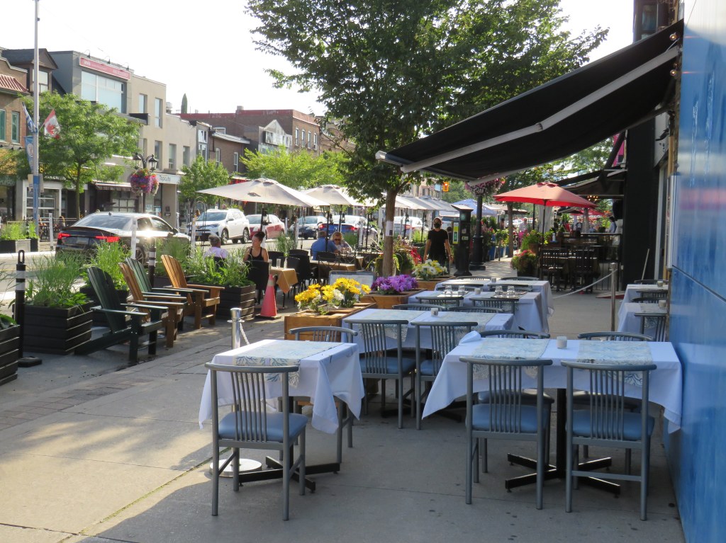
Toronto’s Danforth Avenue has been transformed with new protected bike lanes and patio spaces
In the last few days, I visited Toronto’s Danforth Avenue and Downtown Guelph to see how municipalities can support local businesses during the ongoing COVID-19 pandemic.
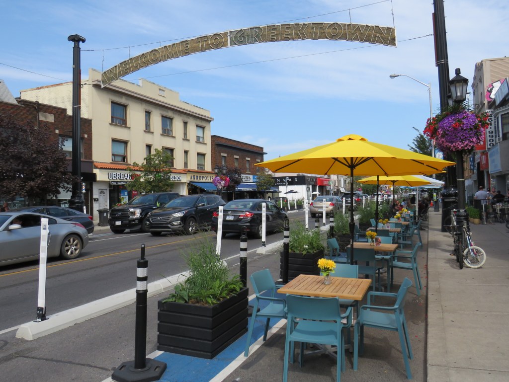
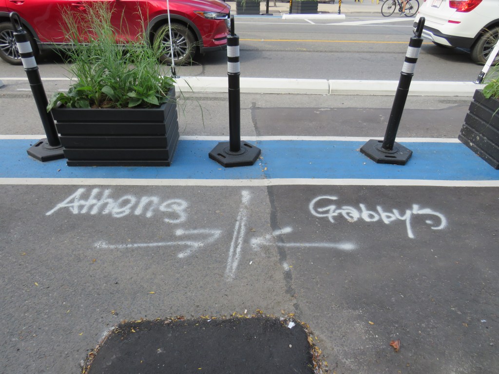
On Danforth Avenue, new interim bicycle lanes were installed between Broadview Avenue and Dawes Road, spanning three business improvement areas (Broadview Danforth, Greektown, and Danforth Mosaic). With the new bike lanes, dedicated spaces for restaurant patios were installed in the curb lanes. The new patios extended beyond restaurant storefronts, with spray-painted demarcations to mark each business’ territory. This gave businesses with limited or no indoor seating plenty of room to serve customers and recoup some of the lost business due to the pandemic.
Where one patio space begins and where another ends: Greektown on the Danforth
Though most curbside patio space was allocated to businesses, Muskoka chairs placed within the Destination Danforth area are free for anyone to sit, no purchase required. This helped make the setup perfect for pedestrians out for a stroll or headed to nearby businesses.
While cyclists are thrilled to get the new bike lanes (the Bloor-Danforth lanes will soon extend as far west as Runnymede Road once construction is complete on Bloor Street West), walking along the Danforth was the best way to see the changes.
Muskoka chairs on the left are may be used by anyone, while tables on the right allows a local restaurant to seat customers while maintaining physical distancing
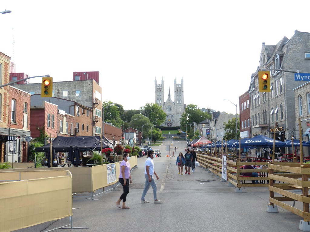
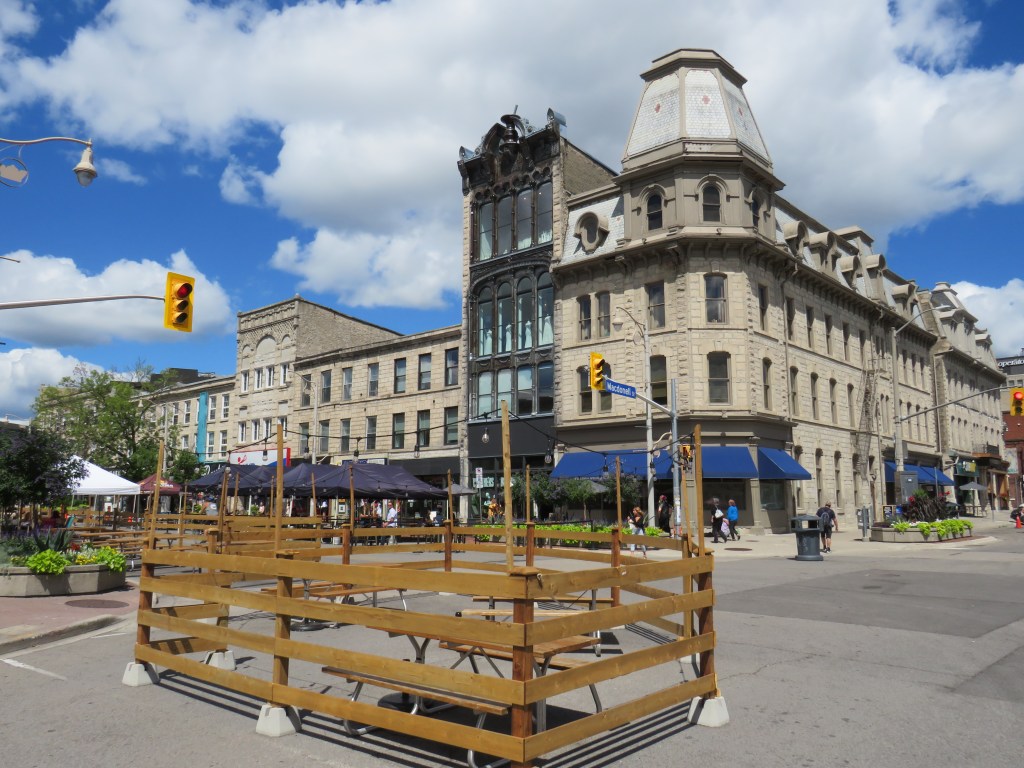
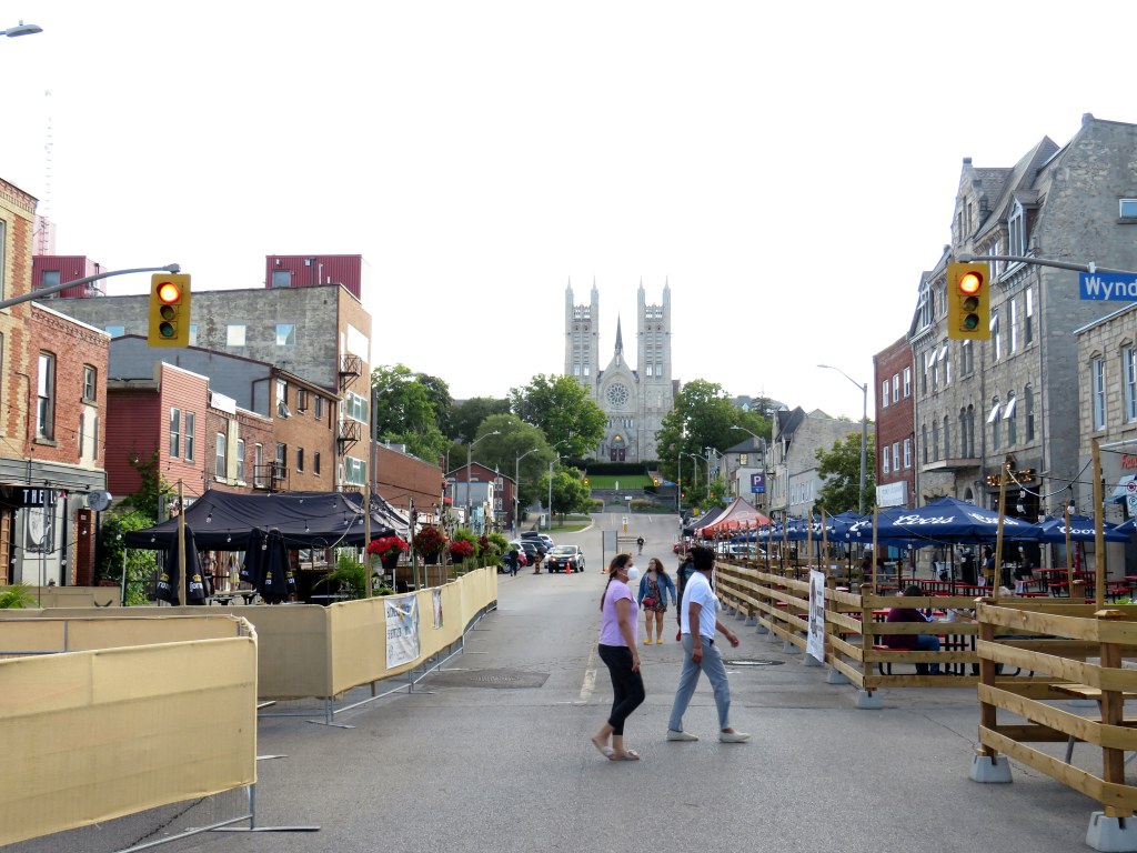
In Downtown Guelph, the intersection of Wyndham and Macdonell Streets was closed to allow restaurants, bars, and breweries to operate large open air dining areas, in what is called the Downtown Dining District. Unlike The Danforth, patio areas allocated to local businesses in Guelph are enclosed with fences or ropes, but the centre of the street is free to walk or bike through.
The corner of Wyndham and Macdonell Streets, Guelph
Though the Downtown Dining District will only continue through Labour Day, the area was busy on a Wednesday afternoon and early evening. Most restaurants have been able to operate entirely with outdoor seating — thanks to generous canopies and umbrellas to provide protection from the sun and rain. This provides additional protection for restaurant staff and patrons. Though Phase 3 is in effect across the province (allowing for limited indoor dining), the fresh air is preferable.
Macdonell Street looking towards the Basilica Church of Our Lady Immaculate
Though it took a pandemic to rethink how we use our streets, it is nice to see these changes. Perhaps Guelph could make the Downtown Dining District an annual tradition, attracting visitors from nearby cities, like Toronto, Hamilton, and Kitchener-Waterloo. Perhaps the Destination Danforth changes also become permanent as well – after all, Torontonians love open streets and festivals.
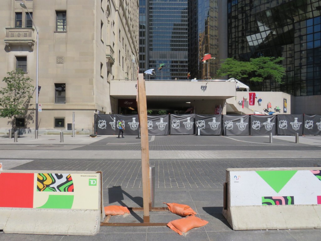
Over two years later, concrete Jersey barriers continue to disrupt pedestrians in front of Union Station
A year ago, I wrote about the unsightly Jersey barriers that were plopped down in front of Toronto’s Union Station in April 2018, creating bottlenecks at two of Toronto’s busiest pedestrian intersections. Though the city promised improvements in 2018and in 2019, the only changes were the application of decals to the existing Jersey barriers.
Though the front of Union Station looks slightly better, and the bottlenecks have been lessened by the ongoing COVID-19 pandemic, this is not a satisfactory solution, especially for Toronto’s busiest and most important transportation hub.
The Jersey barriers were hastily plopped down on Front Street after the April 23, 2018 van attack, where one man steered a rented cargo van onto busy sidewalks in North York, killing 10 and injuring 16 more before he was apprehended by police. As an iconic and crowded pedestrian area, it was felt that special protection was necessary. At the time, the assumption was that the van attack was an act of terrorism, requiring such drastic measures. (It was soon found the motives were not terrorist related.)
In 2018, city councillor John Campbell likened the front of Union Station to “a war zone” while a city spokesperson said that a broader security plan was “in the works,” including for protecting the station has been in the works for some time, including interim measures that would fit into the streetscape.
In March 2019, nearly a year after Jersey barriers were added, the Toronto Star’s Jack Lakey dismissed complaints about their awkwardness and appearance, calling them “effective in stopping a driver bent on another deadly attack.” However, Lakey noted that another city spokesperson said that “city is finalizing the design of permanent vehicle barriers around Union Station”, that would “be smaller, more aesthetically pleasing and easier to navigate for pedestrians.” Those barriers would be installed later in 2019.
Afternoon rush hour crowds navigate around the Jersey barriers at Front and Bay Streets, August 2019
It is now August 2020, and the concrete barriers are still there, creating a mess for anyone using a wheeled mobility device, or for anyone in a hurry.
Bay and Front Streets, August 2020
The only thing that has changed are new artistic vinyl stickers covering the bare concrete, with messages saying that “artwork is donated by TD [Bank].”
TD is the “premier sponsor and exclusive financial services partner” of Union Station, most of which is owned and operated by the City of Toronto. (Some sections used by GO Transit are owned by Metrolinx.) TD enjoys exclusive branding rights, ATM locations, and sponsors Union Station’s wifi and charging stations.
“Artwork is donated by TD”
Perhaps TD was embarrassed by the Jersey barriers (after all, it has its headquarters just up Bay Street). Or perhaps the city decided that something needed to happen here., after two years of unfilled promises.
While examining the barriers, I noticed construction signage wedged within the gaps, creating a trip hazard. I also saw the original metal bollards installed when Front Street was rebuilt for a more pedestrian-friendly streetscape in 2014-2015.
Construction signage creates a trip hazard in the gaps between Jersey barriers. Note the original metal bollard behind.
Though the inconvenience caused by the lingering “temporary” concrete barriers has been lessened as there are fewer pedestrians entering and leaving Union Station right now, it also makes it a good time to finally make the necessary renovations by installing permanent sturdy bollards.
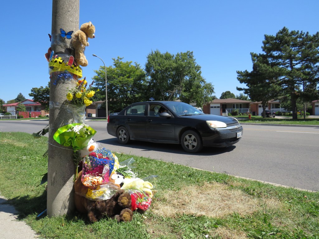
Roadside memorial to a three year old boy at The East Mall and Montebello Gardens, near Burnhamthorpe Road, Etobicoke
On Tuesday, August 11, just after 11AM, a father and his two children were attempting to cross The East Mall north of Burnhamthorpe Road. They were crossing from the west side of the minor arterial street, where there is the main entrance to a long term care home, to the corner of Montebello Gardens, a short residential street on the east side.
As the three pedestrians were crossing, an 81-year-old woman driving a black SUV turned left from Montebello Gardens to go south on The East Mall, crashing directly into the family.
All three pedestrians were rushed to hospital. A three-year-old boy was soon pronounced dead, while a seven-year-old girl was taken to a trauma centre. The driver remained on scene. It is not certain if charges will be laid.
The three-year-old’s death came only a day after the Toronto Star’s Ben Spurr reported that 2020 has been the safest year for pedestrians and cyclists since at least 2007. There were 63 collisions resulting in serious injury or death in the period from January 1 through July 1, down from an average of 99. The decline can be explained by considerably reduced traffic since COVID-19 lockdowns began in mid March, and by fewer pedestrians on city streets.
As traffic picks up with the loosening of restrictions and as people go out for strolls and exercise for physical and mental health, the need for improved road safety and a commitment for real Vision Zero implementation, especially in Toronto’s suburbs, remains crucial. The area near where the young boy was killed last week just shows how much further we need to go.
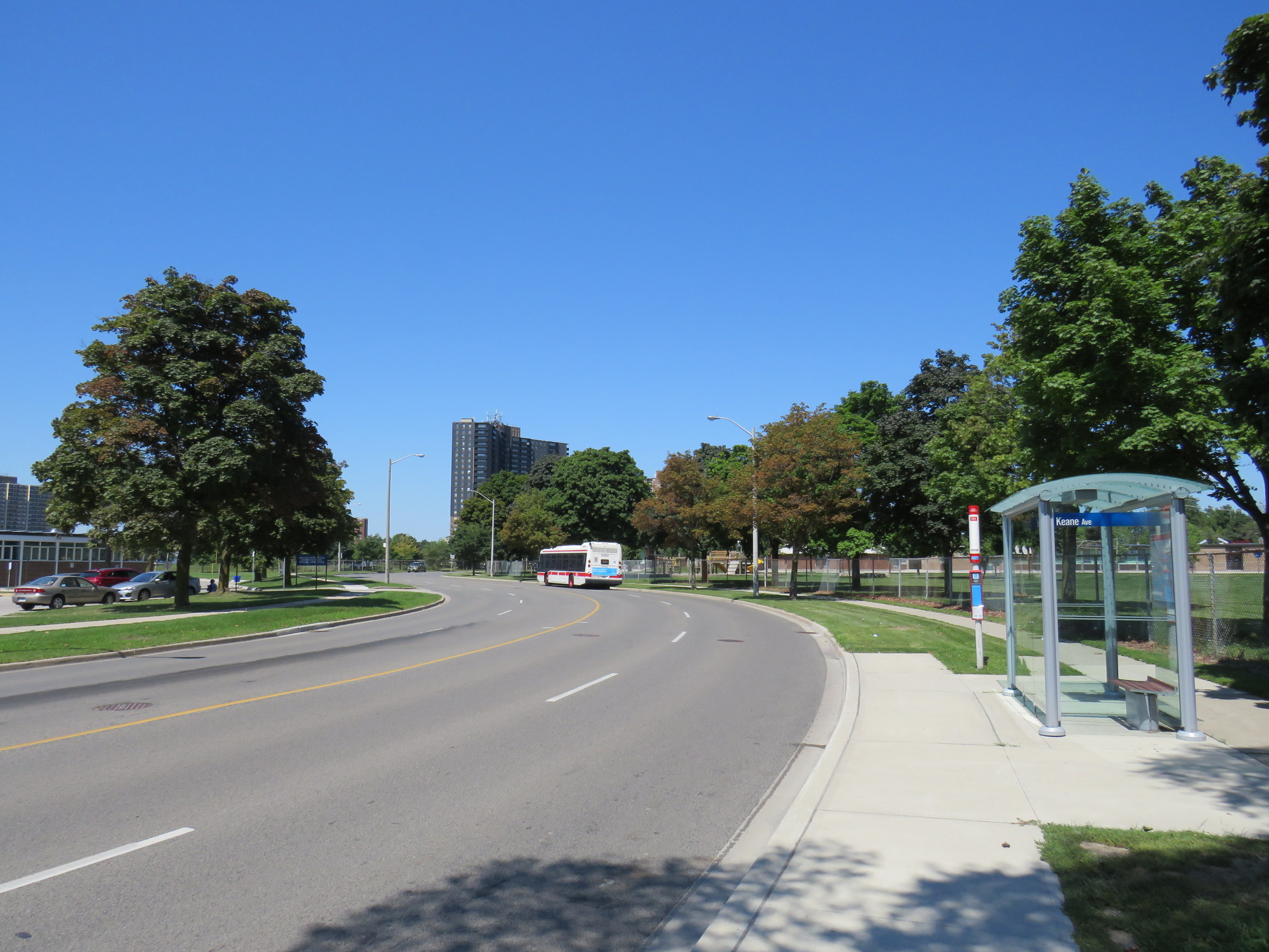
TTC bus stop on The East Mall, north of Keene Avenue
I visited The East Mall on a sunny Friday afternoon. I took the 111 East Mall bus from Kipling Station to Keane Avenue, the first stop north of Burnhamthorpe Road. The bus stop has a nice, clean shelter and a large concrete pad, but no where safe to cross the street. On the other side, there is a southbound stop for buses heading towards Cloverdale Mall and the subway, and Burnhamthorpe Collegiate Institute, a high school specializing in programs for mature students and adult learners.
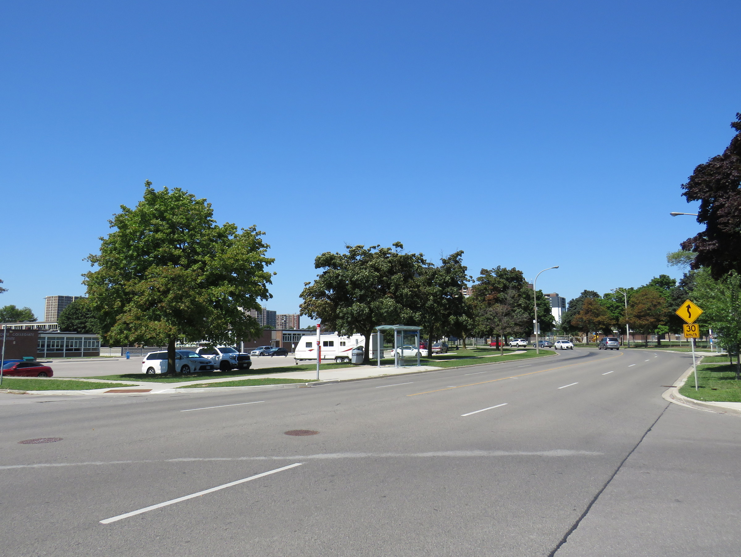
The intersection of The East Mall and Keene Avenue, looking north. Burnhamthorpe CI is behind the southbound bus stop A sign warns drivers of a winding road, with an advisory speed of 30 km/h.
A signalized pedestrian crossover exists further north, in front of West Glen Junior Public School, but the next TTC stop, at Capri Road, is at yet another unsignalized intersection. The distance between Burnhamthorpe Road to the south, and the pedestrian crossover is over 550 metres, and neither designated crossing is visible from Keene Avenue nor Montebello Gardens due to the winding nature of The East Mall.
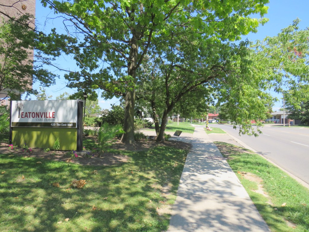
This part of Toronto has seen plenty of tragedy this year. The Eatonville Care Centre was one of several long term care homes where the Canadian Armed Forces were deployed due to deadly outbreaks of COVID-19 amidst poor working and sanitary conditions documented by CAF medical staff. Forty-two residents died during that outbreak.
Eatonville Care Centre, with the roadside memorial in the background
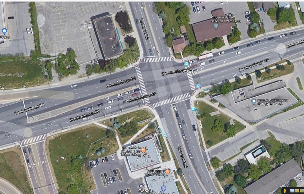
The presence of a long term care home, a library branch at the southeast corner of The East Mall and Burnhamthorpe Road, two nearby schools, and a large Loblaws supermarket and pharmacy on the southwest corner should have made this area a priority for improved, safer road infrastructure. Speeds along The East Mall are much higher than the posted 40 km/h limit, while the winding, roadway limits both drivers’ and pedestrians’ fields of vision. There should be no excuse for such long distances between safe pedestrian crossings, especially with the vulnerable populations living in this area.
Though the driver who killed the three-year-old boy was carelessly turning from a side street, and not speeding along The East Mall, another tragedy is inevitable without significant changes. Meanwhile, The East Mall is similarly laid out south of Burnhamthorpe, where there are older rental towers and townhomes and new condominium towers going in, yet nothing is done to calm traffic along a winding, busy street.
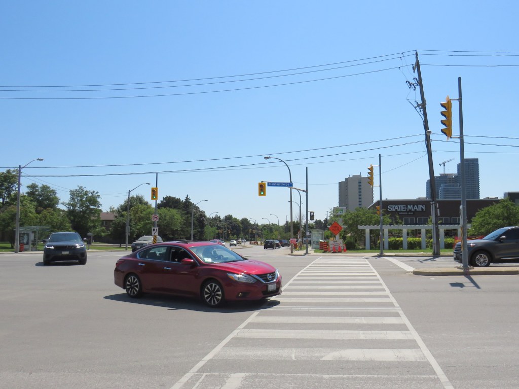
Though the intersection of The East Mall and Burnhamthorpe Road is signalized, it is also a dangerous intersection to cross. Burnhampthorpe Road widens to four westbound lanes leading towards Highway 427, while wide turning radii make it easy for motorists to turn right at all four corners. Drivers, rushing on and off Highway 427 take little notice or care for pedestrians, as I experienced trying to cross the street.
An Uber/Lyft driver in a red Nissan sedan and a Land Rover SUV driver turn left from The East Mall to Burnhamthorpe Road towards Highway 427 after the advance green signal disappears and the walk signal turns on, with me starting my crossing
While motorists are treated to generous geometries and easy turns, pedestrians are only an afterthought, despite the library, supermarket, offices, and several bus stops used by TTC and Mississauga bus routes. Meanwhile, a new townhouse complex on the northwest corner will add even more pedestrians to this area.
The intersection of Burnhamthorpe and The East Mall encourages high speeds, with pedestrians only an afterthought
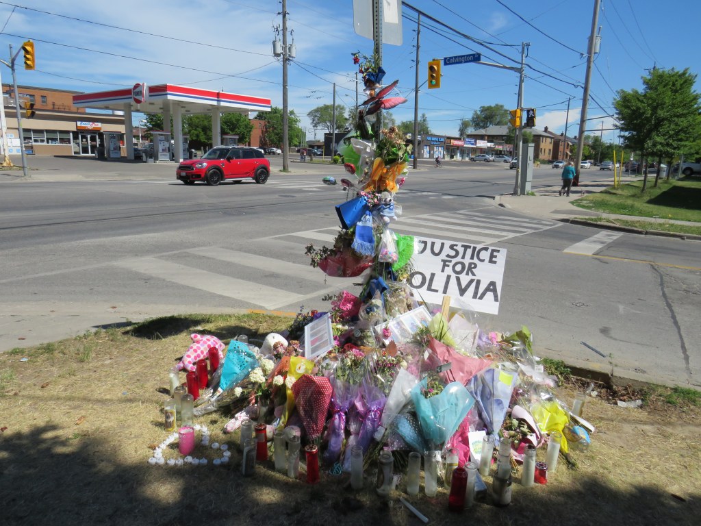
On Sunday, June 7, Olivia and Julia Sarracini were crossing Calvington Drive at Keele Street. It was 12:15 in the morning. The walk sign turned on, and the two sisters, aged 17 and 19, entered the crosswalk, walking north. Behind them, the driver of a black SUV waited for southbound traffic to clear the intersection before turning left, directly into the two young women, who were already halfway across the intersection.
Julia suffered leg injuries and was sent to hospital. Olivia, who was just finishing Grade 12, was pronounced dead at the scene. The driver of the SUV did not stop, but fled westbound on Calvington Drive.
Two days later, Toronto Police arrested 46-year-old Shawn Ramsey. He was charged with two criminal offences: fail to stop at the scene of an accident causing death and fail to stop at the scene of an accident causing bodily harm.
The driver was definitely at fault for striking the two women, who were walking with the right of way and all due care necessary. But it remains quite possible that if the motorist remained at the scene that night might only be facing minor Highway Traffic Act charges. (Without a vulnerable road users’ law, justice for pedestrians and cyclists injured or killed on Ontario’s streets is terribly inadequate.) Yet road design and a poor transportation network in Toronto’s inner suburbs played a significant role here.
Memorial for Olivia Sarracini
This section of Keele Street provides a link between Highway 401 and Humber River Regional Hospital to the south, and Finch Avenue, York University, and several industrial areas to the north. Downsview Park is just to the north of Calvington Avenue, and along with the large parkspace, new residential development is well underway, with more planned.
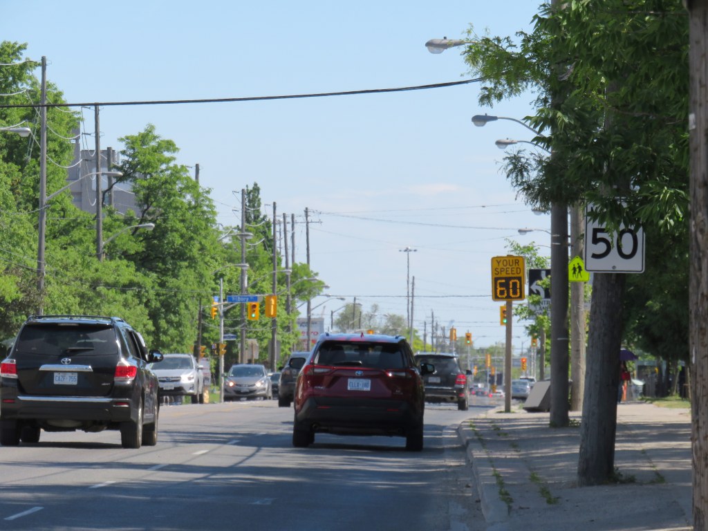
The area around Keele and Calvington was developed in the 1950s and 1960s, though visages of the old village of Downsview can be found close by, towards Wilson Avenue to the south. Between Wilson and Sheppard, Keele Street is five lanes wide, with a centre left-turn lane. Traffic is heavy throughout the day and evening, with many trucks headed to and from industrial lands and nearby construction sites. Even in heavy traffic, motorists regularly exceed the 50 km/h speed limit.
Pedestrians are provided only with narrow sidewalks, close to the road. These sidewalks are not separated from strip plaza parking spaces. Despite a major hospital, nearby elementary and secondary schools, a library, Downsview Park, and urban intensification taking place in the area, there are no cycling facilities. Cyclists, therefore, usually take the sidewalk. While cyclists avoid heavy traffic on Keele’s narrow lanes, they infringe on the little bit of space given to pedestrians.
Strip plaza across Keele Street from Calvington Avenue
Calvington runs west from Keele, with a strip plaza and gas station on the east side of the intersection. Though most traffic off Calvington turns south, pedestrians are prohibited from crossing at the north side, lest they slow down left-turning motorists off of Calvington. Furthermore, an advance left turn signal gives priority to northbound motorists turning on to Calvington from Keele, though the advance signal is only triggered by a queue of several left-turning vehicles.
Though neither the advance signal nor the crossing restriction were factors in the collision on June 7, they are just further reminders of who the streetscape was designed for.
Pedestrians are prohibited from crossing at the north side of the Keele and Calvington intersection. Note the sidewalk cyclist, likely headed to nearby Downsview Park.
Soon after Olivia Sarracini’s death, Councillor James Pasternak moved to request a traffic safety review of the Keele and Calvington intersection at the June 16 meeting of North York Community Council. Pasternak suggested that street lighting, traffic signal synchronization, traffic signage, and “the feasibility of installing advance green traffic lights” be included in the review.
The trouble with that motion is that it too narrow. There are dozens of similar intersections in Toronto’s post-war suburbs. The intersection already has an advance green traffic signal. I would suggest that a review of the whole district is necessary in the the context of new and upcoming urban development, poor access to Downsview Park from the south and west, and inadequate and unsafe active transportation infrastructure. Nearby Highway 401 and the GO Transit Barrie Line both create significant barriers to pedestrians and cyclists in the area.
Olivia Sarracini was killed and Julia Sarracini was injured by a dangerous and callous driver who did not have the humanity to stay and offer assistance and take responsibility. This tragedy shouldn’t warrant a narrow safety review. Without changing the built environment, tragedies like these will continue.