Tag: Toronto

  • Leadership, John Tory style (updated)

    Updated May 29

    I was frustrated this week by Mayor John Tory’s pronouncement that he’s “not in favour of adding any more politicians here,” referring to the proposed new ward boundaries released last week that would increase the number of city councillors from 44 to 47. This is despite a rigorous and solid process, with plenty of public and stakeholder consultation sessions. But to Tory, “politician” is a dirty word. Never mind that the boundaries were created in 2000, from even older federal/provincial boundaries that based on the 1991 census, Tory doesn’t like the solution developed after three years of work.

    2014 Election - 2018 Ward Projections
    The discrepancy between each ward’s population and the city-wide average in 2018

    Instead, Mayor Tory wants staff to back to the drawing board and come up with a plan that he likes, following the fine tradition in municipal politics of ignoring the advice and hard work of staff and outside experts because you don’t like the answer they give. Tory’s hand-picked Executive Committee agreed with his motion to defer the debate until the fall. 

    This is a problem. It’s necessary for aspiring candidates to be organizing right now if they want even a slight chance of knocking off an incumbent councillor. For that reason, the boundaries need to be decided as soon as possible. And adding three new councillors really shouldn’t be a big ask — it would cost $870,000 a year, including the costs of hiring additional assistants.

    One reason why Calgary’s Naheed Nenshi is a great mayor is because he trusts his staff and praises their hard work. I was at a lecture in which Mayor Nenshi took very little credit for that city’s response to the 2013 floods. Instead, he spoke about how he. along with senior city staff responded in a coordinated manner, involving all city employees and citizen volunteers in the effort to minimize the flood’s impact and clean up the damage.

    John Tory, on the other hand, shames city staff and local councillor Kristyn Wong-Tam in a crass stunt for Jack Lakey, author of “The Fixer” column in the Toronto Star. This reminds me very much of Rob Ford’s modus operandi.

    In the article, Mayor Tory is photographed cleaning up a planter on Alexander Street, as he explained that he was frustrated by the city bureaucracy who couldn’t get the planter repaired and looking good. Rob Ford was famous for this kind of stunt — filling in potholes, attending to residents’ complaints — often going over the head of councillors or city staffers. Urban forestry manager Dean Hart is named and shamed, but that department does not have responsibility for planters — that’s Transportation Services, which Lakey glosses over. To quote a friend: “so a city division which gets annual budget reductions declines to do work that’s out of scope, and in turn gets this response?” That’s not leadership.

    Leadership means addressing the real problems. Perhaps there is a problem with buck-passing. Maybe there’s a way to improve communications between city departments. A good leader involves the parties responsible and encourages them to find a solution, not publicly shame them. Maybe a leader doesn’t demand annual budget cuts in all areas (except, of course, the police), then blames staff when the effects of the budget cuts become visible. Meanwhile, Ward 27 is the most populated in the city, and Councillor Wong-Tam one of the hardest-working on council. Yet Tory doesn’t want to implement a sensible ward boundary plan.

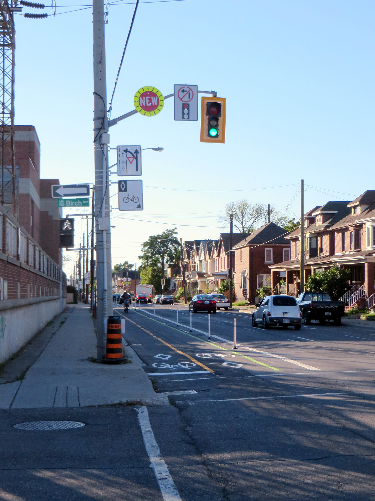
    Running for election, John Tory liked using the word “bold” a lot, especially when he was touting his signature transit plan, SmartTrack. He promised leadership, but has instead dithered on or deep-sixed important initiatives, like a city-wide cycling network (He won’t back crucial sections of a new city-wide cycling network, saying only that he supports “sensible” bike lanes.

    On police reform, Tory dithered on eliminating the racist practice of carding until forced to take a position when a group of prominent citizens spoke out against it.

    As for social programs and revenue tools to fund essential city services and infrastructure, Tory would rather keep property taxes below inflation, despite the warnings of top bureaucrats. As Desmond Cole points out, Tory is pretty much carrying out Rob Ford’s agenda of low taxes, weak leadership on issues like police reform, and ignoring the plight of Toronto’s poor and lower-income residents. Car owners and homeowners (particularly the owners of single-family dwellings) rule in John Tory’s Toronto.

    Yet, we’ll keep up a needless section of elevated highway. But, at the same time, we can’t build a new streetcar line in the East Waterfront.

    As one person on Twitter pointed out, had we given central Toronto the representation it deserved, Council might have decided to go with the least-expensive Boulevard Option for the eastern section of the Gardiner Expressway. And committees like Public Works and Infrastructure, which has control over items such as cycling infrastructure, are dominated by suburban councillors.


    Bike Routes and Wards
    Cycling infrastructure and Public Works and Infrastructure Committee membership by ward.

    Sure, John Tory won’t embarrass us. He won’t smoke crack, he won’t be caught uttering blatantly racist remarks and he’ll march in the Pride Parade. But he’ll continue the Ford agenda of low taxes and reduced city spending, except for things like the Gardiner East. And it now appears that he will continue Ford’s legacy of crass photo-ops, pretending to care about “customer service.”

    But the city will continue to grow, and we’ll see some progress on important issues, such as inclusionary zoning to build some new affordable housing. There are lots of good people — prominent advocates and people working behind the scenes, staffers and councillors at City Hall, community leaders and great organizations pushing for better — that desire a better city and continue to make Toronto great. There’s plenty of bold leadership for a city that needs it, but you’re not going to find it inside the mayor’s office.

  • Mapping Toronto’s proposed new ward boundaries

    18506683800_6c96dcc66b_k

    Toronto is way overdue for ward boundary reform. Finally, in time for the 2018 election, Toronto will have reshaped ward boundaries — and probably three new wards. This will give quickly-growing Downtown Toronto and North York Centre more representation at City Council.

    Consultants retained by the City of Toronto have been tasked with reviewing the size and shape of Toronto’s wards, and providing a recommendation for new ward boundaries. Back in August 2015, an options report was released with five distinct options. After further consultation, the final report was released yesterday, May 16.

    The final report’s recommendation is similar to the “Minimal Change” option in last August’s options report, but there have been some minor tweaks to the ward boundaries. If the recommendations are approved by City Council, there will be 47 wards, up from 44. Each new ward will have an average population of 61,000, with a range between 51,800 and 72,000 (+/- 15%). These new wards are designed to last for four election cycles, and will be re-drawn again in time for the 2034 election.

    The report will be considered by the Executive Committee on May 24, 2016, which will vote on a recommendation to take to City Council on June 7, 2016. If there are no further hiccups, this gives just over two years for aspiring council candidates and city staff to prepare for the next election, which will be held on Monday, October 22, 2018.

    The recommendation brought forward is a compromise that improves representation in high-growth areas, while minimizing the loss of council representation elsewhere. It increases the number of councillors, but by a minimal amount. (Had Toronto maintained the practice of having two wards per provincial/federal riding, there would be 50 councillors.) Happily, proposals to cut the number of representatives at City Council were not a very popular idea. In terms of staffing and associated costs, each councillor costs approximately $290,000; it would therefore cost about $870,000 to add three new wards, which in my opinion, is a bargain.

    While Downtown Toronto will gain three new seats, and North York gaining one, one seat is lost in Toronto’s west end, in current wards 14, 17, 18. This probably squeezes out Cesar Palacio, a rather poor city councillor who remains in office despite strong competition in the last few elections. Otherwise, despite ward boundary shifts across most of the city, every incumbent councillor should easily find a home that’s mostly made up of their current turf.

    I created the CartoDB interactive map, linked below, for Torontoist; my full article is available there.

    I mapped the results of the 2014 election for every ward in the city — that was the primary reason why I started this blog in November 2014. That previous work should be helpful for predicting the results of the 2018 election with the new boundaries.

    https://seanmarshall1.cartodb.com/viz/5c5c1540-1b21-11e6-8cfa-0ecd1babdde5/map


  • On Toronto’s newest ten-year cycling plan

    The newly completed Finch Hydro Corridor
    The Finch Hydro Corridor

    The City of Toronto has released a new proposed Ten Year Cycling Network Plan, which establishes a minimum grid of cycling infrastructure across the entire city. It will be presented to the Public Works and Infrastructure Committee next week; city staff, who have worked long and hard on this project, consulting many stakeholders and members of the public, recommend its adoption by City Council. It will create over 500 kilometres of safer cycling routes, while connecting existing bike lanes and trails to each other. The plan would cost just over $150 million over ten years, a bargain.

    Of course, we’ve been down this road before. Only a fraction of the cycling infrastructure approved in previous plans has been built. And many new trails that were built — following hydro corridors and abandoned railways in suburban parts of the city — don’t connect to nearby ravines and parks. And railways and highways remain major barriers; there are only three places where the city’s designated cycling network crosses Highway 401.

    Last week’s Council approval of the Bloor Street bike lanes between Shaw Street and Avenue Road — a simple pilot project — didn’t look like a sure thing, even though it ended up voting 38-3 in favour.

    Deputy Mayor Denzil Minnan-Wong warned of “bike lane creep,” afraid that a safe bike route would extend to Danforth Avenue (which it should). And Councillor Stephen Holyday (Ward 3, Etobicoke Centre) ridiculously claimed cycling advocates were “trying to build a wall” around the downtown core, ignoring the fact that there’s a subway along the same corridor, which moves many times more people than two lanes of Bloor Street, and there are other options — such as the Gardiner Expressway, which we are needlessly committed to keeping up — for getting downtown with a car.

    Some of the highlights of the new plan:

    • Long distance cycling corridors, such as Bloor/Danforth from Etobicoke to Kingston Road in Scarborough, Kingston Road from the Beaches to West Hill, and Yonge Street from Downtown to Steeles Avenue.
    • New connections across railways, ravines and highways.
    • Extensions to popular off-road trails, such as the West Toronto Railpath.

    Highways are very dangerous for pedestrians and cyclists to cross: high-speed ramps are marked with signs telling pedestrians to wait for gaps. Cyclists must navigate cars quickly changing lanes and exiting freeways. And railways can create long, impenetrable barriers unless pedestrians trespass on railway property. I wrote about it at more length in Spacing.

    The worst example might be where Bridgeland Road ends on one side of the Metrolinx-owned Newmarket Subdivision (GO Transit’s Barrie Line) and Floral Parkway ends on the other side. Highway 401 conspires to make this an exceptionally bad case. Happily, this is one of the places where the city seeks to build a new bridge or tunnel to allow cyclists and pedestrians to cross safely, and I am glad to see other gaps addressed in this latest plan.


    An example of how railways and highways create barriers to active transporation

    There are four large maps (large PDF files) that show the existing cycling network and the proposed new routes. They correspond to the four community council boundaries.

    Toronto and East York
    North York
    Etobicoke-York
    Scarborough

    It’s not only important that City Council approve this new plan, it’s also crucial that proponents of active transportation keep on top of the city to actually build the new cycling infrastructure and multi-use paths and bridges. We’ve seen this play out before: council approves a great plan for cycling, for transit, for urban development, and then rests on its laurels. Let’s do better this time around.

  • Where the sidewalk ends in Toronto (Updated)


    IMG_3357
    McNicoll Avenue at Boxdene Avenue. There’s no sidewalk on the south side of this busy Scarborough road.

    Update: I posted a revised and updated version of the map and article on Spacing Toronto. There, I mention a new absurdity in the war on sidewalks: on Glen Scarlett Road, near the old Stockyards in Toronto’s Junction neighbourhood, the city is proposing  a new sidewalk for 2016 as part of a road reconstruction project.

    The local councillor, Frances Nunziata, is siding with local industry in opposing a sidewalk. Local industries — including slaughterhouses and warehouses — oppose a sidewalk as it would cross their loading docks; Nunziata’s office claims that since the street “is unsafe for pedestrians to be walking on due to heavy traffic, [the City] should not be encouraging pedestrians to use this road by installing a sidewalk.”

    This logic is completely counter-intuitive. It ignores the needs of workers walking to work, and local residents walking to the streetcar loop at St. Clair Avenue and Gunns Road, or to nearby shopping and residential areas.


    There was a very interesting interview on CBC Radio’s Metro Morning on Tuesday, February 16). Host Matt Galloway spoke with Fiona Chapman, the City of Toronto’s manager of pedestrian projects, on missing sidewalks. Nearly one-quarter of all local streets in Toronto don’t have a sidewalk; many more only have a sidewalk on one side of the street. Chapman was discussing a presentation to the City’s Disability, Access, Inclusion and Advisory Committee on staff recommendations that would seek to fix this problem.

    CityData - SidewalksStatic map showing the City of Toronto’s sidewalk inventory as of 2011.

    Most local streets that don’t have sidewalks are found outside the old Cities of Toronto, East York and York, particularly in parts of Etobicoke, North York and Scarborough built in the 1950s and 1960s. Some of these residential and industrial streets were built with ditches instead of storm drains; others were laid out without sidewalks in mind. In the master-planned Don Mills development, there are many walkways connecting parks, major roads, and schools; it was likely intended that these would be used for getting around on foot rather than sidewalks. In other post-war subdivisions, particularly affluent areas like those in central Etobicoke, it was probably assumed that everyone would get around by car.

    The City of Toronto is hoping to change this. As roads come up for reconstruction, the new policy, recommended by staff, is to install a sidewalk where there isn’t one already, even despite local opposition. The current policy, in place since 2002, is that a new sidewalk could only be installed on an existing local street after the local councillor completed a consult of the neighbourhood and there was a consensus supporting the installation.

    In Toronto, the installation of new sidewalks has been surprisingly controversial. But the city’s presentation lists some of the reasons why sidewalks are often opposed. Sidewalks have to be cleared by the adjoining landowner. Residents can’t park their cars in the driveway if they block the sidewalk. They might result in the removal of landscaping or trees. And there is a minority who just want to keep outsiders out of their neighbourhoods. You could call this NIMBY-ism, even though sidewalks are technically is in the front yards, not the backyards, of local opponents.

    Sidewalks provide safe, accessible routes for pedestrians, especially important for people using strollers or mobility devices. They promote the city’s initiatives encouraging children to walk to school, for all persons to engage in physical activity, and for seniors to age at home. City policy, including the Toronto Pedestrian Charter, supports sidewalks.

    On Chine Drive, in an affluent part of Scarborough near the Bluffs, local residents opposed the construction of a sidewalk, even though it would provide a safe path to a nearby school. Since 2004, some residents opposed the sidewalk, claiming that they were afraid it would “take away from the rustic look of the neighbourhood.” Supporters, including parents with young children, wanted a safe route to the local school. It took ten years, but in 2014, the sidewalk was installed.

    Last year, on nearby Midland Avenue South, there was a similar fight to keep sidewalks off of that street. This is despite the fact this section of Midland Avenue is designated as a collector road, and is part of the Waterfront Trail’s route in the Scarborough Bluffs area. The city owns the land, known as a boulevard, where the sidewalks would go, but without the consent of local homeowners, the city was left in a bind. This new city policy will hopefully solve this problem.

    Below, I created an interactive map of the City of Toronto’s sidewalk inventory, created with data from the City of Toronto’s Open Data Initiative. It shows each public street in the city of Toronto (excluding private roads and laneways), as of 2011. I made a few edits, such as including the new Chine Drive sidewalk, and correcting a few errors that I was aware of.

    Almost every arterial and collector road in Toronto has a sidewalk on at least one side of the street. Exceptions include Highway 27 and Black Creek Drive, where, like expressways, pedestrians and cyclists are prohibited, the Bayview Drive Extension though the Don Valley, and in the far northeastern part of Scarborough, in Rouge Park. But it’s the local streets, marked in orange and red that are most apparent.

    https://seanmarshall1.cartodb.com/viz/3f206014-d4f2-11e5-b47b-0e787de82d45/public_map


    Providing safe, accessible, and consistent pedestrian infrastructure is simply the right thing to do. The city owns the land on which sidewalks can be put down, if they aren’t already. There are legitimate concerns that need to be taken into account when new sidewalks are proposed — trees and landscaping especially — but at the end of the day, the needs of vulnerable road users need to be addressed first and foremost.

  • Welcome to Toronto, we guess

    Welcome sign when entering the City of Toronto

    Last weekend, I was out exploring the Toronto-Mississauga border. I have a few thoughts about suburban transit projects like the Mississauga Transitway and as I have time, I’ll post those here.

    But where Eglinton Avenue crosses Etobicoke Creek, motorists (and the few brave cyclists and pedestrians), are greeted with a sign that said, simply, “Welcome to TORONTO” and underneath, “Ontario’s Capital.”

    Yes, Toronto is the capital of Ontario; that’s what they teach childen in Grade 2, along with the other provincial and territorial capitals of Canada. But surely, a city of three million people that’s known for its talent, creativity, and diversity can come up with something better than this uninspired sign, which is found at many, if not most, entrance points to the city. The welcome sign would even better off without the “Ontario’s Capital” tab.

    But while I was walking on the Etobicoke Creek bridge — a hostile environment as any for a humble pedestrian — I noticed this plaque, marking the border between the City of Mississauga and what was then the City of Etobicoke. The bridge was built in 1978, but is being widened to support a new bus rapid transit project. This section of Eglinton is built for cars, but it is only as a pedestrian that you can spot this sort of detail.

    IMG_0312-001

    In 1978, Etobicoke’s motto was simply “Tradition and Progress” while Mississauga’s crest didn’t sport a motto. Today, signs welcoming you to Mississauga say “Leading today for tomorrow, a rather boastful, yet meaningless slogan.

  • Two buildings that truly define Toronto

    City of Toronto Archives, Fonds 1526, File 46, Item 12. Creator, Harvey R. Naylor
    City of Toronto Archives, Fonds 1526, File 46, Item 12

    The first tower of the Toronto-Dominion Centre, from Front and Church Streets, 1967

    Back in May and June of 2015, the Guardian newspaper ran an intriguing series on its Cities page entitled “A history of cities in fifty buildings.” The list is quite interesting: it includes several buildings no longer standing, such as the infamous Pruitt-Igoe housing complex in Saint Louis, Missouri, and the World Trade Center in New York, and some iconic, transformative landmarks such as the Guggenheim Museum in Bilbao, Spain, and even the first Starbucks location in Pike Place Market, Seattle.

    In Toronto, the Guardian chose Honest Ed’s as Toronto’s entry on the list. Of course, the Guardian’s list wasn’t meant to include the world’s most famous or iconic buildings, but chose an assortment of structures, standing, demolished — or in Honest Ed’s case, imperiled — meant to “tell unique stories of our urban history.”

    [Disclosure: I contributed to the Guardian Cities site in February, 2015, discussing new streetcar systems in American cities.]

    Over six months later, the Toronto Star finally noticed the Guardian’s inclusion of Honest Ed’s in its list of fifty buildings. The Star sought the opinion of two local architecture professors, Vincent Hui, of Ryerson University, and David Lieberman, of the University of Toronto. Hui agrees with Honest Ed’s inclusion, while Lieberman says that “at first glance, [the Guardian’s series] is a really dumb list.”

    In some ways, Honest Ed’s — that kitschy emporium of bargains, bad puns, and faded memorabilia, fits the criteria of the Guardian’s list. The store was innovative (it was one of the first stores to feature “loss leaders” and store greeters), it served the needs of Toronto’s growing post-war immigrant communities, and was the starting point for a larger empire that included theatres in Toronto and London. The store’s replacement by a new mixed use development proposed by Westbank, is also part of Toronto’s story, as it becomes an increasingly high-rise city. So I agree with its inclusion in the Guardian’s list, based on the newspaper’s interesting (and provocative) criteria.

    But if you were to ask me, I’d select two different buildings that would best represent Toronto’s modern history: the Toronto-Dominion Centre and City Hall.

    f0124_fl0002_id0009
    City of Toronto Archives, Fonds 124, File 2, Item 9

    (more…)

  • GO Transit plans to raise fares in 2016. How about a better fare system?

    Note: Updated in February 2016 due to a conflicting chart.

    At Thursday’s Metrolinx Board Meeting, the Board of Directors will be voting on a GO Transit fare increase effective February 1, 2016. As has become common, Greg Percy, the President of GO Transit, will be recommending a tiered fare increase, and we should expect that the Metrolinx Board will rubber stamp this proposed fare hike, as it usually does.

    Recently, I wrote about the many problems with GO Transit’s fare structure. It penalizes short trips, it does not allow for any fare integration with the Toronto Transit Commission, and many trip pairs (particularly the Barrie, Richmond Hill, and Stouffville Corridors) are priced lower than they should be compared to other stations. In another post, I suggested that GO Transit should seriously consider charging for parking at its lots, as constructing and maintaining parking lots is a major expense that all GO Transit users are paying for, whether they use them or not.

    I was somewhat surprised to see that the fare increase will not apply to short trips, those currently costing between $5.30 (the lowest fare possible) and $5.69. This would freeze the one-way ticket price for trips such as between Danforth, Union, and Exhibition Stations. With a slight increase in the “loyalty discount” offered tot Presto Card users when they pay a GO fare,  from 10% to 11.15%, this results in a very slight fare decrease for short trips.

    You can read the GO Transit report recommending a fare increase here.

    (more…)

  • More thoughts on cycling infrastructure

    In Torontoist last week, I mapped the new and improved bike lanes proposed for 2016. There are some great new additions – more contraflow lanes in the east end and through Kensington Market allow cyclists to take direct routes along quieter residential streets. There will finally be a pilot of the long-demanded Bloor Street bikeway; at least between Shaw Street and Avenue Road. And, as I write this post, work is being completed on separated bike lanes along Adelaide and Richmond Streets east to Parliament Street. The popularity of the lanes added last year (University Avenue to Bathurst) pretty much guarantees that these new bike corridors, still officially pilots, are permanent.

    But the map below – created for the Torontoist post – shows many gaps, even with the new 2015 and 2016 additions. Note the long north-south lane in the top centre of the map. That’s Willowdale Avenue, the longest planned addition. It ends at Sheppard, just before Highway 401; there’s no easy and safe way for cyclists to cross North America’s widest and busiest auto route anywhere near where the new Willowdale bike lane ends. Freeways and railways remain nearly impenetrable barriers for pedestrians and cyclists; this prevents the true implementation of a minimum grid.

    Bike Routes - Sept17

    But even bike lanes are only good if they aren’t blocked by ignorant or ill-intended motorists. Simple barriers like knock-down bollards or curbs are helpful, but they aren’t always effective.

    Last Sunday, I cycled from my home in east Downtown Toronto to Downtown Hamilton, following the Martin Goodman Trail, Lakeshore Road, and the Hamilton Beach trail for an 84-kilometre ride. Through Oakville and Burlington, the Waterfront Trail is nearly non-existent, so I ride on Lakeshore Road itself, which has bike lanes in only a few sections. But motorists are, almost without exception, courteous and patient; it’s the one place in the suburbs where I really enjoy cycling.

    In Hamilton, after crossing the Queen Elizabeth Way on a spectacular bridge that also spans the Red Hill Creek, I again take minor streets to make my way west towards downtown, where I usually visit a favourite pub on Augusta Street before loading my bike on a GO Transit bus rack and returning to Toronto.

    6164718675_1ac3950080_o

    Hamilton, like Toronto, has started to add some great new cycling infrastructure. It has a bike share program, called SoBi Hamilton, it has great trails leading out to Brantford and Caledonia (as well as the Waterfront Trail), and some new bike lanes and cycletracks. The most impressive is Cannon Street, where a lane on a one-way arterial was transformed into a two-way separated cycletrack last year.

    14988034160_c541a52410_k

    But even green paint, knock-down bollards, and plenty of signage wasn’t enough on Sunday, when I encountered this:

    IMG_9624

    IMG_9625

    The woman in the red shirt and grey trackpants started screaming at me as I took these photos, claiming she had the right to stop here as she was moving out of the house. She threatened to call the cops on me (!) for taking photos of her stuff, saying I could be looking to steal it. (On my bike, of course.) Cyclists encountering this from the west would be forced into oncoming traffic; in any event it’s dangerous and illegal. (Taking photos of this type, on public property, certainly is not.)

    https://twitter.com/Sean_YYZ/status/645726388310396928


    There’s still a lot of ignorance out there; not by the woman with the U-Haul that I mentioned; but by at least one reaction:

    Sidewalk riding is itself illegal and dangerous (sidewalk riding cyclists are a pet peeve of mine). Happily, there were plenty of others willing to correct that user about the safety of vulnerable road users and the various laws and by-laws applicable in this case.

    But this is all a long and winding way to say that more cycling infrastructure is great. And places like Toronto and Hamilton are doing great work on that front. But the infrastructure is only as strong as its connectivity, and as long as they’re not blocked by ignorant and/or hostile motorists. Education and enforcement need to go along with the buckets of green paint, signage, and barriers now being added in our cities.


  • Mapping Toronto’s Legal Rooming Houses

    unnamed

    Rooming houses are often-overlooked in Toronto, but they provide an essential form of affordable housing in a city that struggles with the issue. In Torontoist, I looked a little more closely at this issue and created a map of all licensed rooming houses located in the City of Toronto. (The list from which the map was created can be found here.)

    There are many, many more illegal rooming houses across Toronto that I didn’t map; currently they only legal in certain parts of the city  – the old City of Toronto and parts of the old cities of York and Etobicoke. These outdated laws predate amalgamation, and ignore the need for this form of affordable housing, as well as the variety of rooming arrangements. Illegal, undocumented rooming houses have the potential to be firetraps, licencing and inspections protect tenants from unsafe and unhealthy living conditions.

    It’s time for updated regulations that cover all of Toronto; landlords should be able to rent out rooms right across the city. Happily, the city is conducting a city-wide review of rooming houses; one of the goals is to modernize the city’s by-laws; another is to improve the conditions in existing rooming houses.

  • Exploring Toronto by bike: A circle tour around the city

    IMG_4182-001A friendly deer passes me as I make my up the Humber River trail

    One of my favourite things to during the summer s taking long weekend bicycle rides. A few of these rides have been multi-day trips, such as the Niagara Region Circle Route tour I took on Victoria Day weekend, or my ride from Hamilton to Port Dover and return last summer, but many have been day trips. Hamilton is one of my favourite destinations; it’s about 85 kilometres from my home to Downtown Hamilton via the Waterfront Trail, Burlington Beach and the Cannon Street cycletrack. I’m not a terribly fit cyclist, and I take many breaks (for a late lunch, to take photos, or for rest) but if I leave home by 11 AM, I’ll be in Hamilton around 6 or 7 PM. For me, it’s all about enjoying the ride; when I ride alone, I find that it’s great alone time.

    But you can stay in the city and enjoy a long, leisurely ride. There are many reasons why you might want to stay in Toronto: there’s no need to carry a repair kit; you’re never too far from a TTC bus route (all buses are equipped with bike racks) if you need to end the ride early for any reason. And it’s a great way to explore the city.

    I recently spent a Sunday afternoon going for a nearly five-hour ride, a circle route from my downtown apartment back downtown, following the Humber River, the new Finch Hydro Corridor path, and the Don River, a 73-kilometre ride in total. I stayed away from Lake Ontario, avoiding the PanAm Games-related detour and general chaos near Exhbition Place.

    I passed by historical landmarks, made multiple crossings of the Humber and Don Rivers, rode through dozens of parks and swallowed at least a few flies. The Humber Trail even makes use of the long-abandoned Toronto Suburban Railway; it makes use of the piers that once supported that electric railway’s trestle over the Humber River.

    The map below illustrates the route that I took, which brought me through five of the six former municipalities that were joined to create the City of Toronto (sorry, Scarborough).

    I often see wildlife when I ride outside Toronto, but I did not expect come so close to it on this trip. But along the Humber River Trail, north of Highway 401 and Albion Road, a youngish deer was wandering down the path, grazing. I stopped my bicycle and just watched, the deer kept coming closer, cautiously walking right past me. Only a few hundred metres north at one of many trail crossings of the river, I spotted a doe and a fawn crossing.

    IMG_4187-002Deer fording the Humber River

    With the completion of the Martin Goodman Trail on Queen’s Quay, it’s almost possible to complete this circle route without riding on city streets. But there are several minor gaps (such as the Lower Humber Trail at Stephen Avenue in Etobicoke) and some very aggravating gaps.

    One of the worst gaps in Toronto’s recreational cycling network is between the Humber River trail and the Finch Hydro trail, where there is simply no safe cycling route to bridge this 3.5 kilometre distance. I survived cycling under Highway 401 on Finch Avenue, but it is not an experience that I advise doing on your own. However, the newly-constructed connection between the Finch corridor and the East Don River trail was seamless and pleasant.  There’s a gap on the East Don trail between Duncan Mill Road and Don Mills, but it is well signed; happily, this will be partially fixed with an extension of the Don Mills trail to York Mills Road.

    The Humber Trail-Finch Hydro Corridor Trail gap in North York

    IMG_6836
    One of the scariest places that I have ever cycled. 

    Happily, these gaps that I mention are on the City of Toronto’s radar. The city is in the process of updating its cycling network plan; city staff, along with consultants IBI group and Vélo Québec, are looking for comments on the new draft cycling project map. There are many other opportunities to improve cycling connections for recreational and utilitarian cycling; I encourage you to have your say.

    Below, a few more photos on my ride around Toronto.