Tag: TTC

  • Why pedestrian safety is a matter of justice for essential workers

    The new YYZ9 Fulfillment Centre in Northeast Scarborough, looking across Steeles Avenue

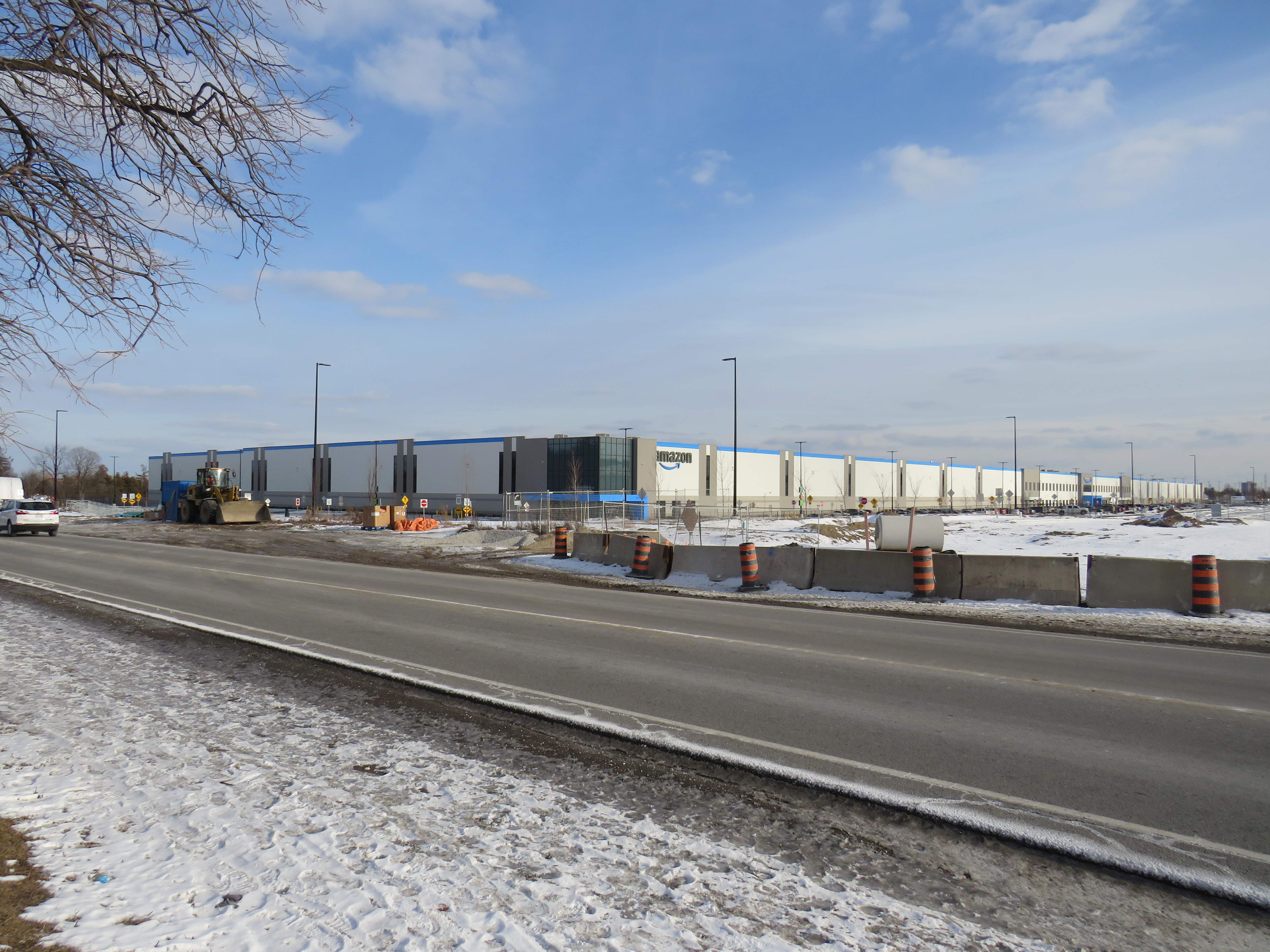
    In August 2020, in the midst of an ongoing COVID-19 pandemic, Amazon opened its sixth fulfillment centre in the Greater Toronto Area near Steeles and Tapscott Road in northeast Scarborough. Upon opening, the new warehouse, where consumer orders are packed for delivery, employed 700 workers, 100 more than Amazon initially planned due to high order volumes.

    The starting wage for an Amazon fulfillment centre employee is $17.00 an hour, despite notoriously tough working conditions. With most professional and office workers at home, and with ongoing pandemic restrictions, Amazon has enjoyed significant sales increases. But those workers picking and packing orders are not able to work from home – and workplace spread has been a significant factor in COVID-19 transmission in Ontario.

    Brampton, home to two of the GTA’s fulfilment centres, and close to Amazon’s Mississauga, Milton and Bolton warehouses, has been a COVID-19 hotspot. Like Toronto, Peel Region has been under lockdown and stay-at-home orders since November.

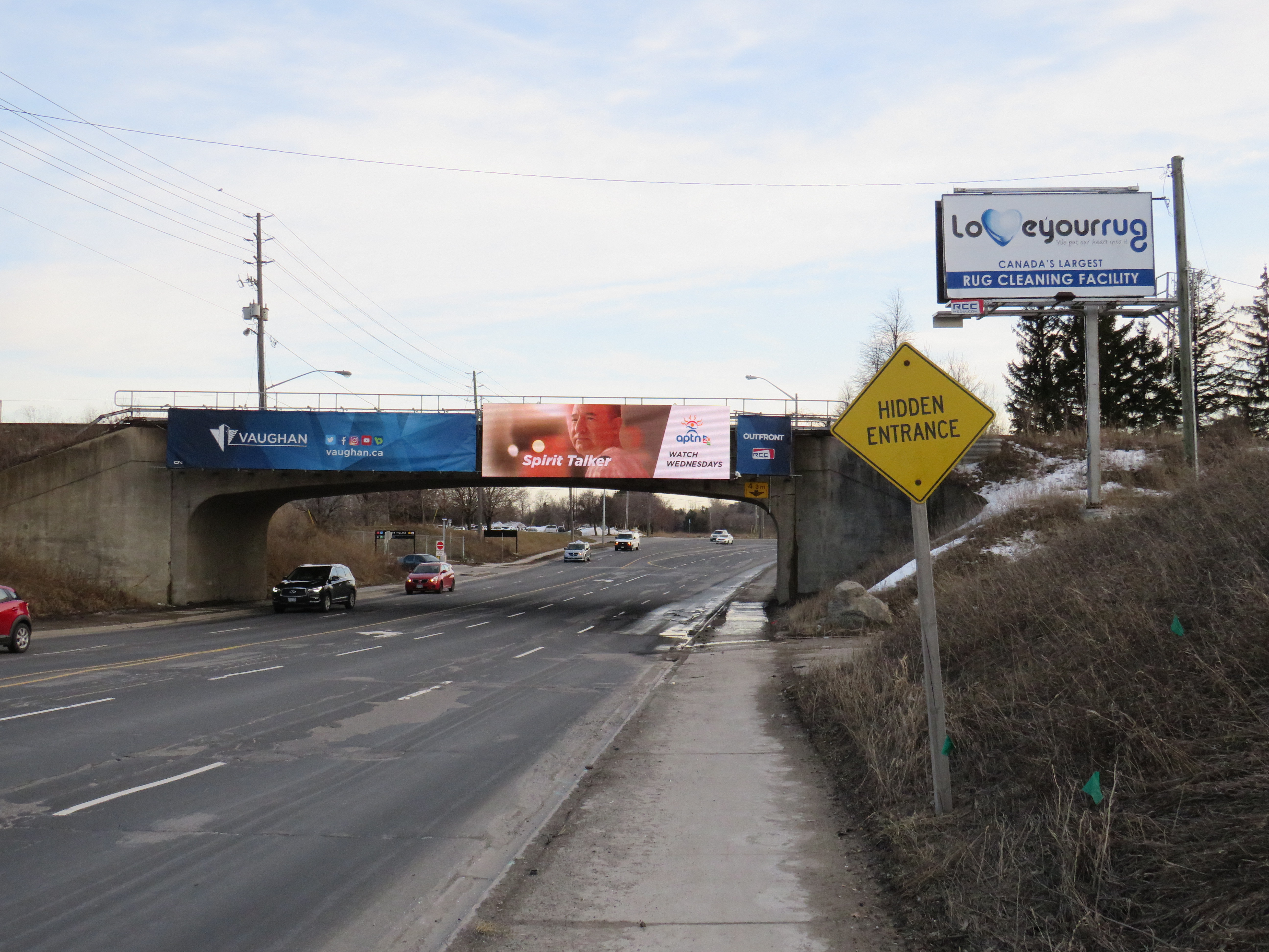
    Like most new logistics facilities, the new Scarborough warehouse, like the other five GTA Amazon fulfillment centres, is in an industrial area on the city’s outskirts, where land is plentiful, but transit and pedestrian access is lacking. East of Tapscott Road, Steeles Avenue narrows from four lanes to two, and there are no designated pedestrian crossings at the intersection with Eastvale Drive. The eastbound TTC stop at Eastvale Avenue was removed in 2018 after a passenger was struck and killed trying to cross the street after disembarking from a 53 Steeles East bus. The next nearest stop, at Tapscott Road, is 300 metres west.

    Steeles Avenue, looking west towards Eastvale Drive and the signalized intersection beyond, at Tapscott Road

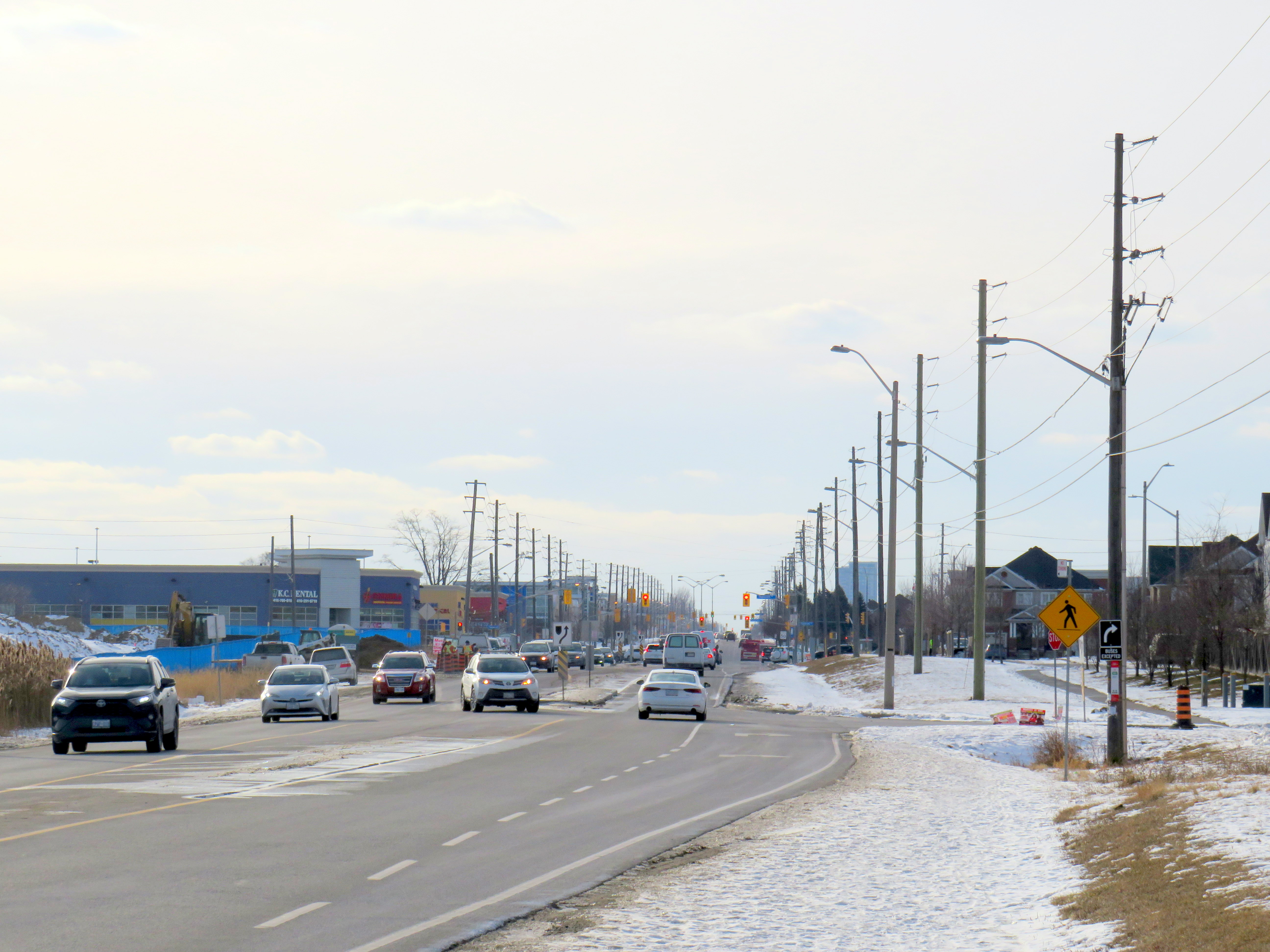
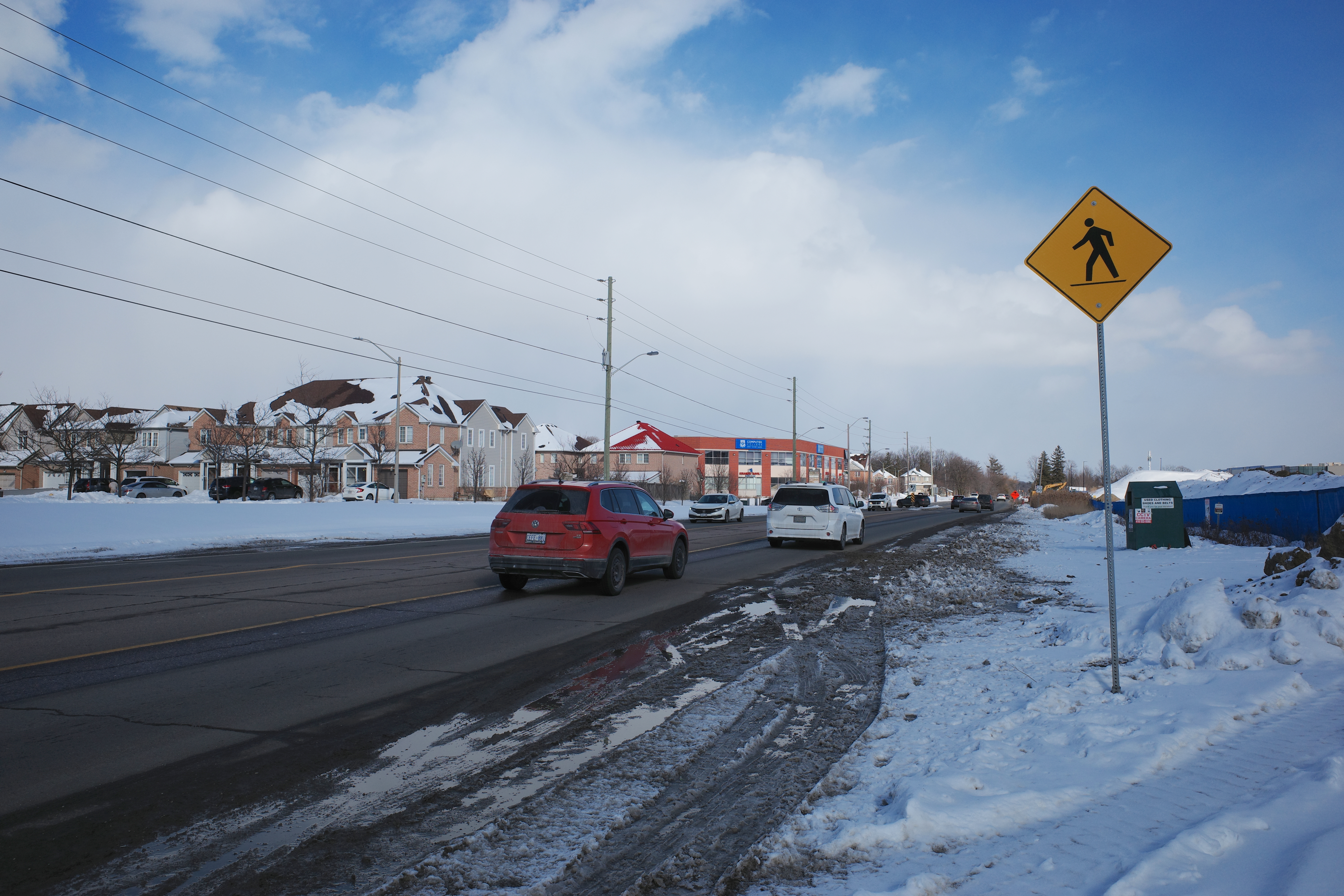
    The sidewalk on the south side of Steeles Avenue ends at Tapscott, a few hundred metres west of the Amazon fulfilment centre. On the north side, the sidewalk ends at Ferncliffe Crescent in Markham. Despite a new residential area in Morningside Heights, to the east, there is no sidewalk along Steeles to connect to it. Pedestrians heading to Amazon or towards Staines Road must choose whether to walk in the mud, or on the busy roadway. Though the posted speed limit is 50 km/h, motorists regularly travel at 60 km/h or faster.

    Looking east on Steeles from Tapscott Road – despite the sign advising motorists of pedestrian activity, there are no sidewalks leading east towards the new Amazon fulfillment centre (Sonali Praharaj)

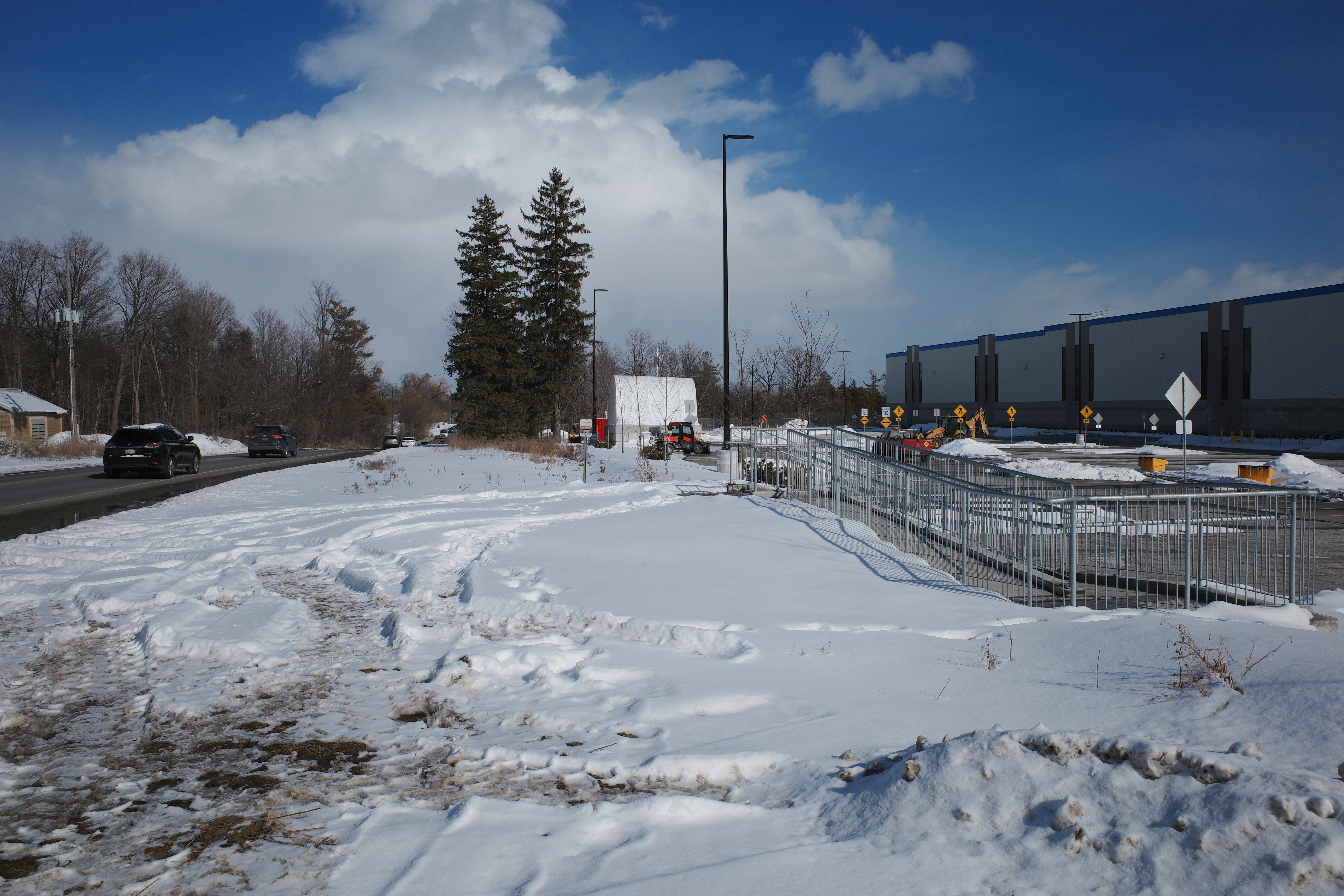
    A stairway and ramp were built on the north end of the Amazon property, likely with the expectation that a sidewalk on the south side of Streeles Avenue would soon be installed. This would provide improved pedestrian access to the fulfillment centre. But without a safe and logical way to get to it from the street, it remains largely unused.

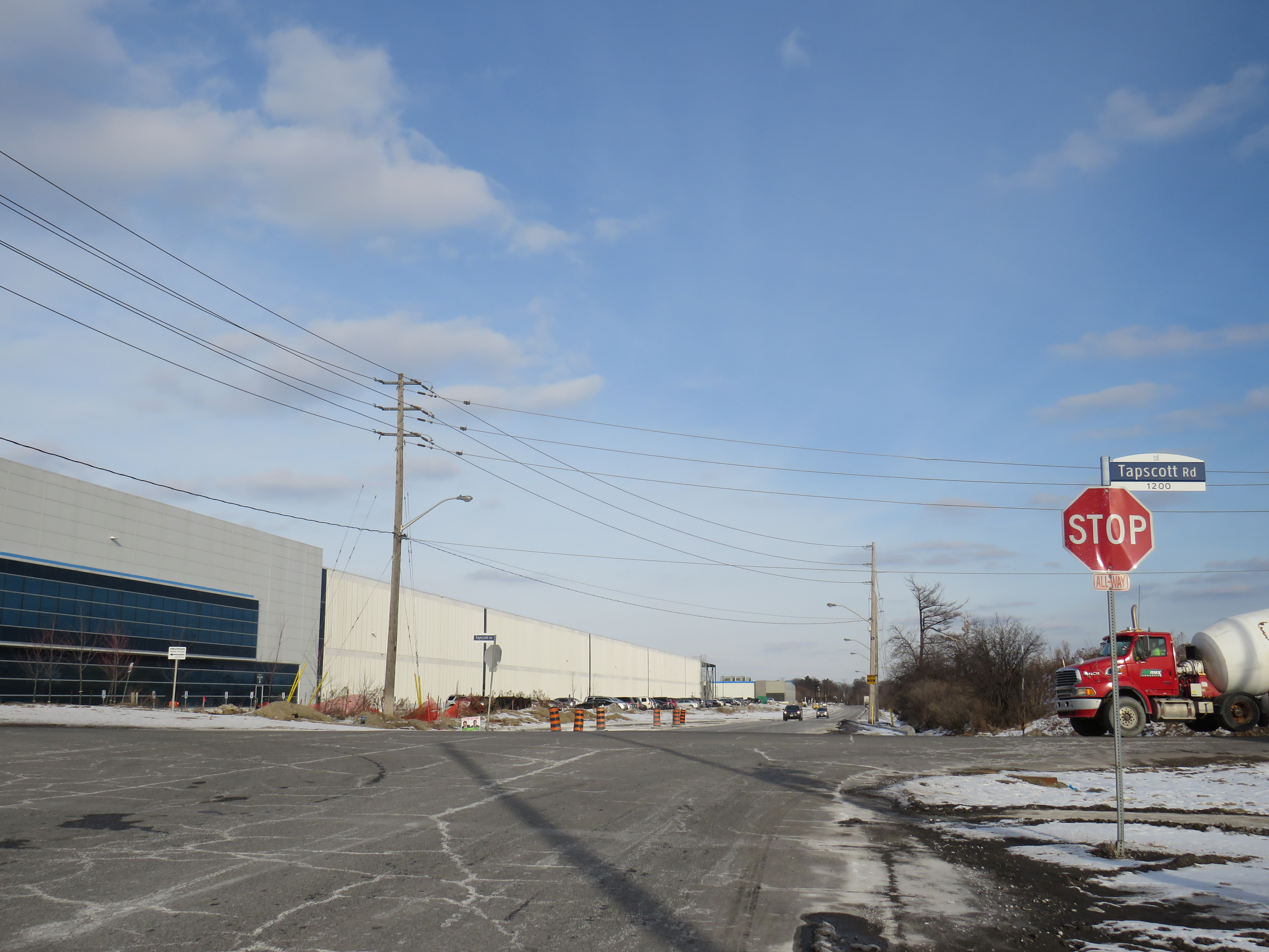
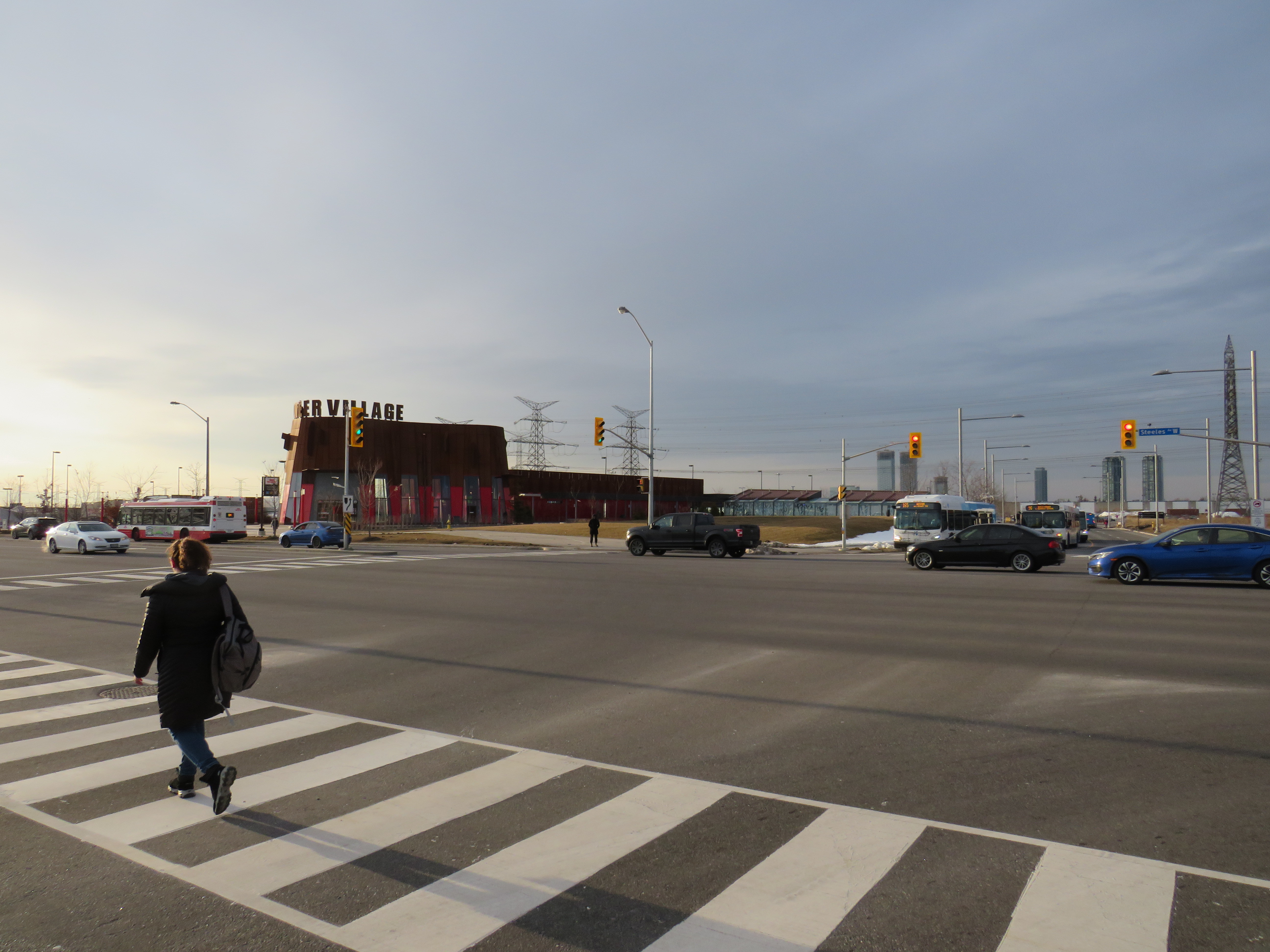
    Passmore Avenue, on the south side of the fulfillment centre, was rebuilt with a sidewalk in the late fall of 2020, months after Amazon opened. However, it requires a lengthy walk north to Steeles Avenue up Tapscott, and there are no sidewalks on Tapscott from Passmore south, towards McNicoll Avenue. The intersection of Passmore and Tapscott itself – controlled by an all-way stop – still does not feature proper crosswalks.  

    Looking east on Steeles from Tapscott Road – despite the sign advising motorists of pedestrian activity, there are no sidewalks leading east towards the new Amazon fulfillment centre (Sonali Praharaj)

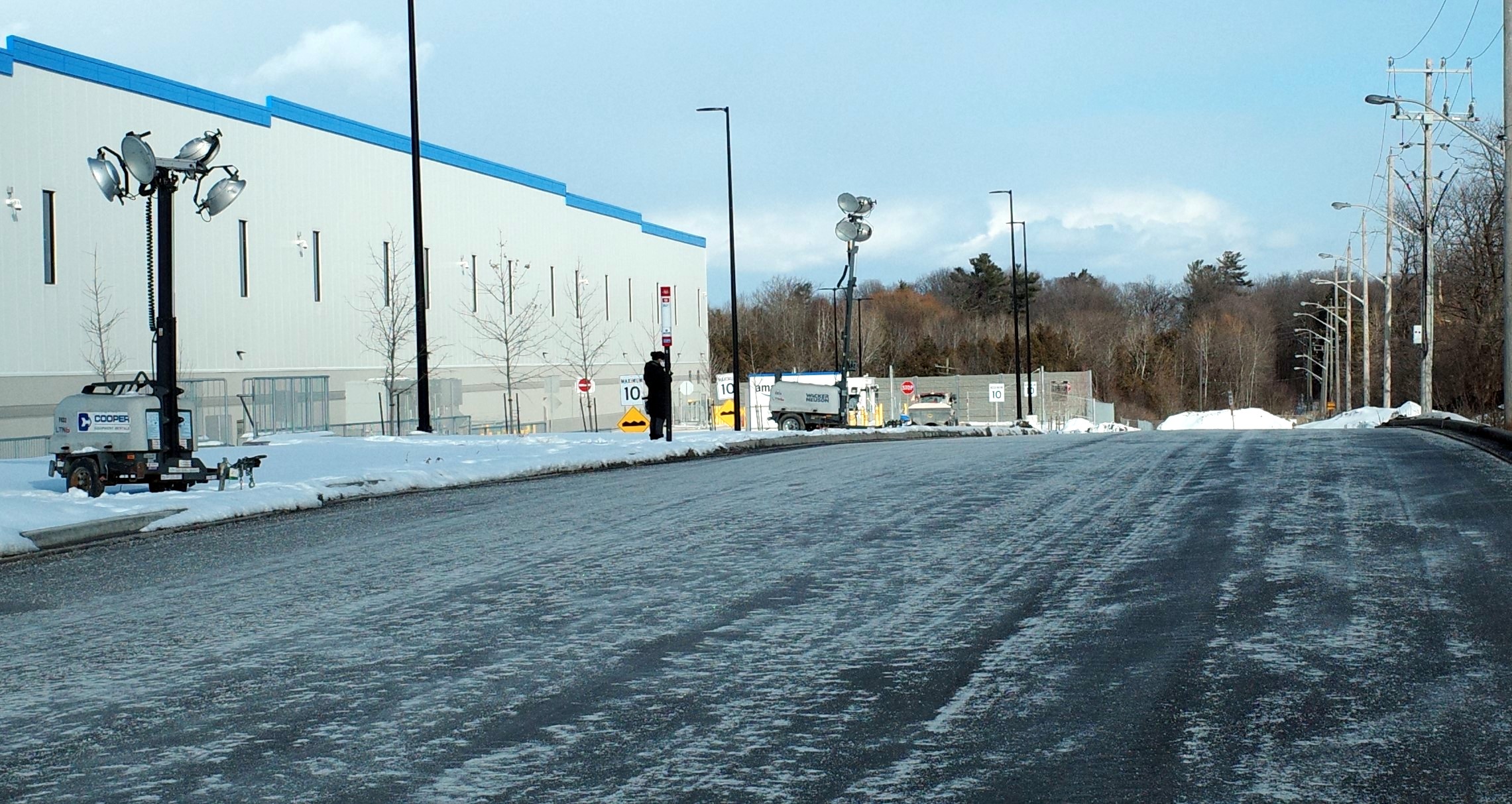
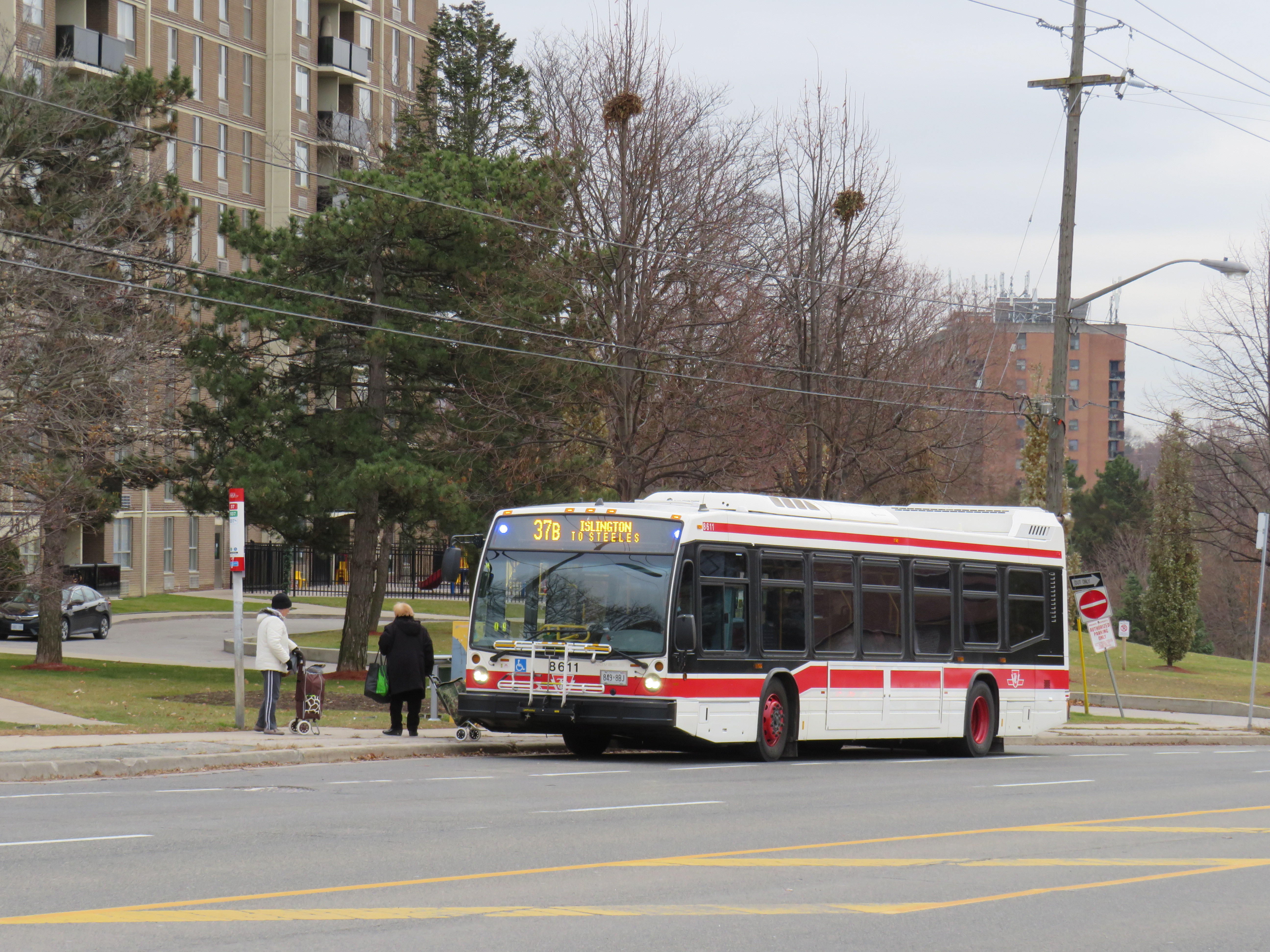
    Though there are two TTC bus routes that operate to the corner of Tapscott Road and Passmore Avenue – 53B/953B Steeles East and 102B/C Markham Road – for months, workers had to walk on the roadway, through a construction site to access those buses. Anyone looking to go east, towards Morningside Heights, or southeast, towards Malvern, still face a long, dangerous walk or a lengthy bus commute.

    The corner of Tapscott Road and Passmore Avenue

    The TTC, starting January 11, 2021, began diverting the 53B Steeles East bus to directly serve the Amazon fulfillment centre, finally serving a major industrial trip generator and reducing essential workers’ travel times. Even still, the new sidewalk on Passmore ends at the warehouse entrance – anyone waiting for a bus must still walk and wait in the snow or mud.

    Eventually, Steeles Avenue will be widened, with new sidewalks and bike lanes, and Morningside Avenue will be extended north to Steeles Avenue. However, these improvements have been planned for years and completion is still several years away. Though new warehouses have opened here, civic infrastructure has not caught up.

    New TTC bus stop serving the Amazon Fulfillment Centre on Passmore Road (Sonali Praharaj)

    The TTC’s service change, adding a new bus stop on Passmore Avenue, was a welcome – yet overdue – acknowledgement that essential workers, especially racialized and lower-paid workers, deserve better. It is inexcusable that new employment uses are planned, approved, and constructed before the appropriate pedestrian infrastructure and transit services are in place. It is also inexcusable that after a TTC customer was killed that a nearby bus stop was removed, rather than safety improvements added instead. This is not just a matter of ensuring a basic level of safety for pedestrians – this is a matter of justice for those we consider essential workers.
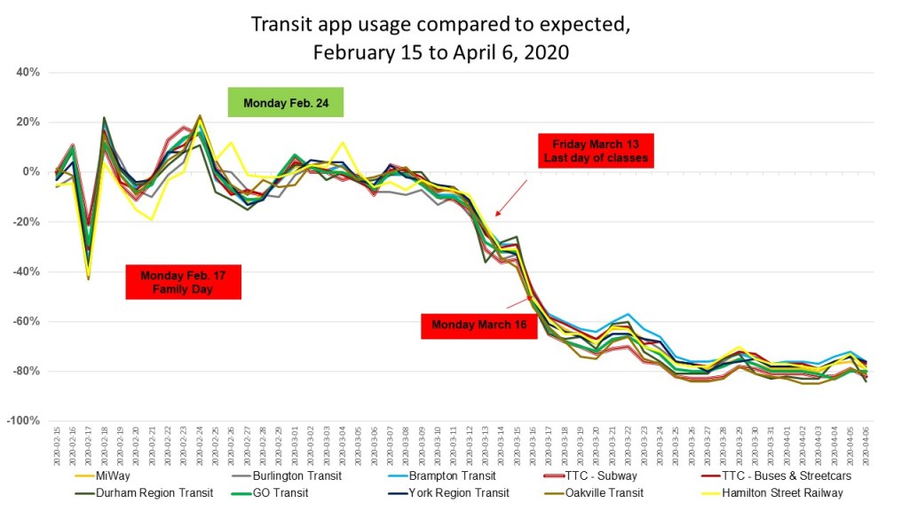
  • The story of Stop 17

    The story of Stop 17

    IMG_8086-001
    Stop 17 Variety, 2835 Kingston Road

    Kingston Road is one of Toronto’s oldest and most important thoroughfares. Sections of the road were first laid out by Asa Danforth in 1799, though a straighter, more direct route was established by the early 1800s. By the 1830s, it was a busy stagecoach route, connecting Toronto with Cobourg, Belleville, and Kingston.

    As Toronto grew into a major city, Kingston Road was an obvious route for a radial railway line serving Scarborough Township; by 1906, radial cars extended as far east as West Hill, near Morningside Avenue. The radial line’s stops were numbered from the beginning of the line, first at Queen Street and Kingston Road, then at Kingston and Victoria Park Avenue after the TTC took over city operations.

    Kingston Road, east of Bellamy Road, 1918: a rural scene. This siding, Mason’s Switch, was Stop 22. The house on the far left of the photograph still stands at the corner of Kingston and Mason Roads.
    From Toronto Archives, Fonds 1568, Item 148.

    Stop 0 was at the city limits at Victoria Park (with connections to TTC streetcars). Stop 14 was Halfway House at Midland Avenue. Stop 26 was the Scarborough Post Office, near today’s Scarborough Golf Club Road, and Stop 35 was the end of the line, at West Hill.

    With increasing automobile ownership and new intercity bus lines in the 1920s, Kingston Road was busier than ever, becoming part of the new provincial highway system, but ridership on the radials declined, especially after the TTC extended city streetcars east to Birchmount Avenue in 1928, leaving behind a mostly-rural service. Radial service was cut back to Stop 26 in 1931, and completely replaced by buses in 1936 (the 86 Scarborough bus route is the modern legacy).

    Stop 14, in front of Halfway House in 1955.
    Photo by James V. Salmon, from the Toronto Public Library collection.

    Despite the switch to buses, the stop numbers carried on for many years, listed in TTC timetables through the 1950s. Locals would often refer to stop numbers instead of street intersections. Stop 17, at Kingston Road and St. Clair Avenue East, is one example that has lingered on. A mural on the side of Stop 17 variety depicts a green radial car in front of the Scarborough High School), with a cow blocking the way of a truck looking to pass.

    Mural at Stop 17 Variety

    Scarborough High School, on the opposite corner of the variety store, was built in 1922, expanded several times, and later renamed R. H. King Academy. The original building was torn down in 1976, but the entrance way, depicted in the mural, was retained.

    Arched entrance way to the demolished original section of Scarborough High School

    Nearby, towards Brimley Road, several older motels date from the motoring era, when Highway 2 was the main route into the city. Though Highway 401 drew some of the traffic away in the 1950s, it wasn’t until the completion of the Don Valley Parkway (which provided a direct route downtown) and the rise of chain hotels saw a decline in independent motels along Kingston Road and Lake Shore Boulevard. Some have been repurposed as shelters, while others, like the Hav-A-Nap, diversified by offering paid parking for nearby Bluffers Park.

    Hav-a-Nap Motel, with the Americana Hotel just behind
  • Sorry, bus full: riding transit during a pandemic

    Sorry, bus full: riding transit during a pandemic

    Brampton Transit bus on route 502 Zum with “bus full” displayed

    On Thursday, I took the subway for the first time since Ontario declared a state of emergency in March. I entered Queen Station at 9:45 that morning, and rode to Wilson Station. The subway ride north was noticeably quiet, and I had a good choice of seats, even though most were marked as restricted for physical distancing.

    Empty subway train northbound on Line 1, June 11, 2020

    On my return home, at 4:00 PM, the subway was busier, but still quiet enough to take a seat in the middle of the train, while just about everyone had a non-restricted seat through the downtown core. That never happened prior to March 13.

    As I am used to crowded subway trains — even on Sunday mornings — my first subway rides in months proved to be a surreal experience. Though as most passengers were wearing face coverings and keeping distance, it felt safer and more comfortable than many of my recent supermarket trips.

    Platform edge marker, Queen Station

    Though subways are mostly empty, and streetcars pass through downtown with only twenty percent of their normal ridership, things are very different on the buses. In Toronto, Brampton and Mississauga, vehicles regularly bypass crowds of waiting passengers while displaying a “sorry bus full” sign.

    Miway bus full on Hurontario Street, on the same corridor as the Zum bus pictured above

    Back in March, I mapped the TTC’s most crowded early morning routes. These ten routes were generally located in Toronto’s suburbs, serving employment lands and neighbourhoods with lower incomes and higher proportions of racialized persons. Brampton and Mississauga, which also have large food production and warehousing industries and significant immigrant and racialized populations, are experiencing similar problems with crowding.

    All buses only allow passengers to enter through the rear doors, with many seats marked restricted with paper signs similar to those on the subway. The area behind the driver is closed off as well. While the TTC expect riders to tap their Presto cards at the rear or pay by cash or ticket at a subway station, Brampton, Mississauga, and other systems are permitting free rides for now.

    A typical TTC bus contains only 33-36 passenger seats; an articulated (“bendy”) bus has 46. The TTC operators’ union instructed its members to allow only 10 customers aboard a standard bus (though the operator has discretion), and 15 aboard an articulated bus. Transporting that few people on each bus is unsustainable, and with tens of thousands of essential workers relying on the TTC to get to work — many of those jobs difficult and poorly-paying — it’s yet another inequity laid bare by this pandemic.

    Crowding on ten TTC bus routes in late March 2020

    With loosening restrictions, the demand for transit has already begun to increase. By early July, local transit agencies will require all passengers to wear masks or face coverings. At the same time, passengers will be directed to enter buses through the front doors, while reinstating mandatory fare payment.

    Meanwhile, Brampton Transit — which was operating on a modified weekend schedule since March — is restoring some of its weekday service on Monday June 15 to meet re-surging demand, while Mississauga increased service levels on June 1. Brampton, Mississauga and Toronto will require masks or face coverings on transit starting July 2.

    While Brampton plans to hand out 100,000 free non-medical masks to its transit users, the TTC plans to give out one million disposable masks, specifically targeting lower-income neighbourhoods where transit demand remains high.

    Poster in the TTC subway with instructions on how to make a no-sew fabric face covering.

    Front-door boarding and mandatory mask use will help with some of the capacity issues on buses. Offering free masks is a welcome acknowledgement that many who have taken transit may not have money or time to purchase or make their own face coverings. (The TTC has instructions on how to make rudimentary masks posted in subway stations.)

    Even then, bus capacity will continue to be limited to ensure physical distancing, and buses will likely still pass by crowds of waiting customers.

    While central Toronto benefits from walkable neighbourhoods, existing and new cycling infrastructure, and subways and streetcars with more capacity to spare, suburban residents will still have to rely on buses. Though I see mandatory mask use as a necessary step towards mitigating the risk of viral transmission, I fear it may not be enough for those who work at hospitals and clinics, food plants and warehouses, and grocery stores, restaurants, nursing homes, and daycares.

    Bus riders deserve better.

  • A sudden drop in transit usage across the Toronto Region

    A sudden drop in transit usage across the Toronto Region

    IMG_6299-001Last week, I wrote about how several TTC routes were facing overcrowding, despite the COVID-19 pandemic, and a severe drop in system-wide ridership since early March. I shared this analysis on Spacing’s website, and Ben Spurr at the Toronto Star reported more about the story this week.

    Though detailed ridership data is not freely accessible, I wanted to see how ridership on the TTC, GO Transit, and other Greater Toronto and Hamilton Area transit agencies was faring. Helpfully, the team behind the Transit app, a trip-planning smartphone tool, made their usage data available to transit agencies, journalists, and data nerds to track transit demand during the pandemic. Although there are some limitations to using this data (more on that later), it’s an excellent metric for tracking transit ridership for dozens of major transit authorities across Canada and the United States, representing nearly every major metropolitan region.

    The numbers used to determine transit ridership demand is based on usage of the Transit app. (While Transit is one of several apps that can be used to plan trips, including Metrolinx’s own Triplinx app, Transit is my favourite). Normal usage is defined by Transit as app sessions observed on the same day of the week one year ago, averaged over three weeks and corrected for yearly growth in the corresponding transit agency. Hence, a rapidly-growing system, such as Brampton’s, can be represented accurately by the app.

    Data was available for every transit agency in the Greater Toronto and Hamilton Area, apart from paratransit services (e.g. Wheel-Trans, Transhelp, DARTS, etc.) and Milton and Caledon Transit, the smallest fixed-route services. The graph below shows the how the usage of the Transit app fluctuated based upon the expected value, reflected as a percentage.

    GTHA Transit app usage from Feb 15 2020
    Transit app usage compared to expected for GTHA transit agencies, February 15 to April 6, 2020 (click for larger image)

    Note how the actual Transit app usage dropped by over 40% for every transit agency on Monday, February 17, which was Family Day, a provincial holiday in Ontario. Most transit services were operating on a weekend or holiday service, while students and many workers did not take transit. This was likely compared with normal Mondays, hence the one-day drop.

    It wasn’t until the second week of March that ridership began to decline as the number of COVID-19 cases began to surge in Canada and the United States, and governments began announcing new measures to reduce the rate of infection. On Thursday March 12, Ontario announced that public schools, scheduled to close for March Break, would stay closed for two additional weeks (the shutdown has since been extended). That day, the National Basketball League suspended the season, followed quickly by all other sports leagues. Employers began to implement contingency measures, such as work-from-home arrangements. By Monday the 16th, all restaurants were closed to sit-down clientele, and most entertainment venues closed.

    By the week of March 29, transit demand was down by 75 to 82 percent across the Greater Toronto Area. Although many workers were either laid off or were sent home to work, employees in the healthcare, personal care, logistics, essential retail service (i.e. grocery workers), and food manufacturing industries remained on the job. This is evident in the difference between the demand for the subway (-81%) and the surface network (buses and streetcars, -76%) as they serve very different employment centres. Transit’s numbers are comparable to the TTC’s own ridership estimates.

    GTA_Ridership_COVID
    Map depicting estimated drops in transit demand for GTHA transit agencies compared to expected use for week of March 29 to April 5, 2020. Data from Transit app.

    Brampton Transit had the lowest estimated reduction in demand, at -75%. This could be for the same reasons that several bus routes in Toronto saw crowding despite a system-wide drop in ridership. Brampton’s population is relatively lower-income than many other suburban municipalities in Halton, Peel, and York Regions. Brampton also has many large food processing employers, such as Maple Lodge Farms, and many warehouses and distribution centres, including two major Amazon Fulfillment Centres. Brampton Transit connects to other major manufacturing and logistics employment areas in Mississauga, Vaughan and Toronto, including Pearson Airport.

    Oakville Transit had the greatest drop, which can be explained by two factors. The first is that Oakville, is a relatively more affluent municipality, with fewer logistics and food industry employers. Secondly, its bus network is designed entirely to connect with GO Transit’s Lakeshore Line, which feeds Downtown Toronto. Therefore, the ridership dependent on Oakville Transit is more likely to be working from home than Brampton’s.

    It must be noted that Transit’s figures are not the same as detailed ridership numbers collected by each transit agency. For example, Metrolinx cited a 90% drop in ridership across the GO Transit train and bus network, compared to Transit’s 79% estimate drop. Nonetheless, Transit’s data is a valuable metric.

    With the sudden drop in ridership, there’s also a sudden drop in revenue. While many systems, including Brampton Transit and GO Transit have made service reductions, they have been careful to ensure enough capacity remains to safely meet demand. Every system has also increased vehicle and station cleaning, and most have stopped collecting fares to protect both passengers and operators. Just like laid-off employees, students, and freelance workers, transit too will need a bailout of some kind to rebuild lost ridership and maintain safe and healthy services.

    Transit projects such as the Eglinton-Crosstown LRT, the new relief transit service for central Toronto (be it the Relief Line or Ontario Line), and GO Transit expansion must go on, as does the progress made in building ridership at suburban systems such as Brampton and Durham Region.

  • Mapping TTC crowding during a pandemic

    Mapping TTC crowding during a pandemic

    IMG_6314
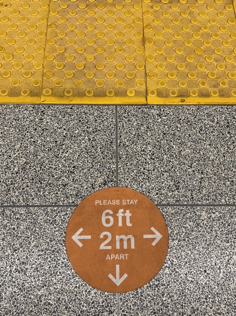
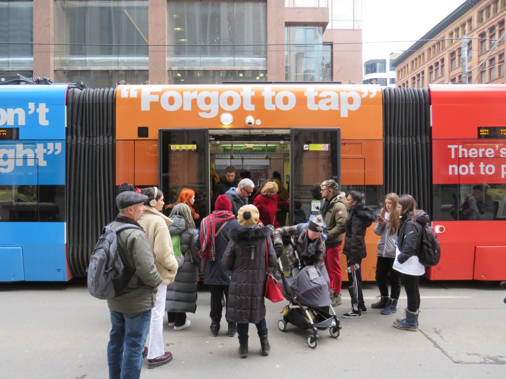
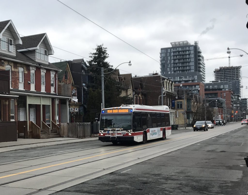
Rear door boarding on TTC buses is just one measure the TTC has taken to address the COVID-19 crisis

    Note to readers: I have since written an updated version article (with a revised map) on Spacing’s website.


    While most people are urged to stay home as much as possible during the ongoing COVID-19 pandemic, there are those who must carry on. These include health care workers, staff at grocery stores, pharmacies, and other essential businesses, and others who can not work from home. There are also those who continue to require transit to undertake essential errands, such as medical appointments.

    Thankfully, most transit systems have carried on. Through GO Transit has experienced an 80% drop in ridership since the beginning of March, it continues to operate all rail lines and most bus routes, providing fewer trips, but maintaining the same span of service hours. The TTC discontinued most express routes, but it maintains a grid of frequent bus and streetcar services.

    However, the TTC and Brampton Transit continue to struggle with crowding on certain routes. Brampton Transit — which has resorted to an “enhanced Saturday service” level –will only carry half a bus’s seated capacity to enforce social distancing, which has resulted in “closed-door” situations where buses won’t stop for waiting passengers. As a result, several routes are now discontinued during peak periods so that buses are sent to address crowding elsewhere. Brampton Transit serves many shipping warehouses, including two Amazon fulfillment centres, which remain busy during this time.

    Meanwhile, the TTC is struggling with morning rush hour crowding on ten bus routes:

    • 29 Dufferin
    • 35 Jane
    • 41 Keele
    • 44 Kipling South
    • 96 Wilson
    • 102 Markham Road
    • 117 Alness-Chesswood
    • 119 Torbarrie
    • 123 Sherway
    • 165 Weston Rd North

    These routes, mostly clustered in the city’s northwest, are illustrated below.

    TTC_COVID_CROWDS
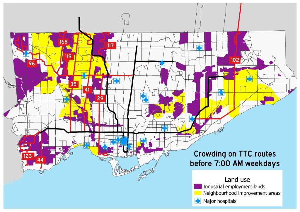
Map of overcrowded early morning TTC routes during the COVID-19 pandemic
    (click for larger version)

    Routes 117 and 119 are industrial services, connecting warehouses and food service plants. These industries — like the infamous Fiera Foods plants served by Route 119 — rely on low-paid, often temporary workers, with early morning starts. Certain warehouses and many food-service plants also have very early starts to the day. It would be tough for workers to accommodate the TTC’s request to travel at later times. Routes 96, 102, and 165 also extend into major industrial areas. Route 123 serves the Metro supermarket chain’s distribution centres on Dundas Street and The West Mall.

    Many of these routes run through Toronto’s neighbourhood improvement areas, which are identified by the city as those requiring additional investment due to issues such as poor access to services and higher concentrations of low-income families. In addition, routes 41, 96, 119, and 165 serve the Humber River Regional Hospital, one of Toronto’s largest health care facilities, while the 96 Wilson also directly serves Etobicoke General Hospital.

    Though it would be best for private essential employers to stagger shifts during this unprecedented time, there may be a need for the TTC to redirect some resources towards these parts of the city.

  • The consequences of losing the GO-TTC discount

    The consequences of losing the GO-TTC discount

    IMG_7846-001

    When the Toronto subway system was extended by six stops to York University and Vaughan, it marked the first time the TTC’s rapid transit system extended beyond the city’s boundaries. But it also exposed a major failing of the Golden Horseshoe’s transit structure: the complete lack of fare integration.

    In 2017, the provincial government announced a new fare discount between the TTC and GO Transit, which operates the region’s commuter rail and bus network. This $1.50 fare discount, available to Presto card users, was funded by the previous Liberal government’s fledgling cap-and-trade carbon pricing scheme, with the promise of further fare adjustments (such as discounts for transferring between the TTC and other suburban transit agencies, such as York Region Transit and Miway) to come.

    With the election of the Progressive Conservatives in 2018, the cap-and-trade scheme was cancelled, and with it, the continued funding for the GO-TTC fare discount. That discount is set to come to an end on March 31, 2020. Neither the cash-strapped TTC or Metrolinx, the provincial agency responsible for GO Transit and transit planning, will step up to make up the difference.

    IMG_7865-001
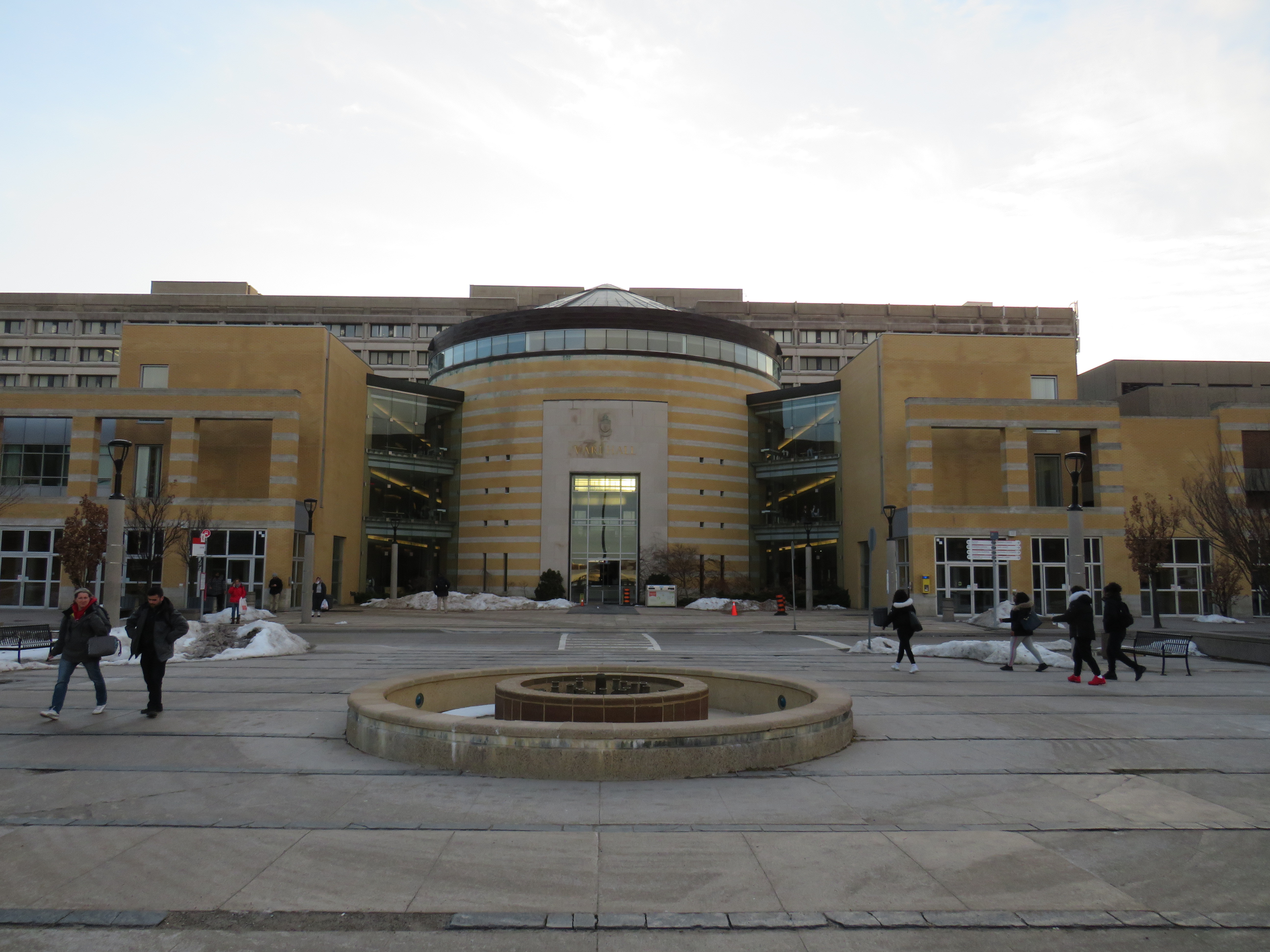
GO Transit buses used to stop right in front of Vari Hall, in the heart of York University’s campus

    Though many regular GO rail commuters will feel the impact of the loss of the fare discount, the impact on York University students and staff will be especially felt. That’s because the new subway extension was planned to remove GO Transit buses from the heart of the campus to a purpose-built terminal at a remote new subway station next to Highway 407. I recently wrote about the problematic fare structure on those GO buses serving Highway 407 Station. Now, those commuters going two more stops will pay $6.40 a day in TTC fares on top of those expensive GO fares.

    Unless they decide to walk to campus.

    On Thursday, March 5, I tried do just that. It was not a pleasant experience.

    https://twitter.com/Sean_YYZ/status/1235681892185206785?s=20

    Highway 407 Station features a large bus terminal for GO Transit and YRT buses, a passenger drop-off and pick-up area, and a commuter lot. But it was not built with pedestrians in mind. That’s understandable. The only places within a few minutes’ walk are Beechwood Cemetery across the street, a warehouse, and the employee entrance to a major UPS parcel centre.

    The main — and only authorized — entrance is on the opposite side of Jane Street, facing the passenger drop-off/pick-up area and the parking lot. It is quite clear in the design that most passengers would be transferring between bus and subway, perhaps with the idea that the fare boundary issue would be resolved by the time the station was open.

    IMG_7830-001
    Jane Street, with the entrance to Highway 407 on the right, and Beechwood Cemetery on the left

    The vertical circulation prioritizes bus-subway connections. At the bus platform level, I spotted a sign that said “to street, subway” leading to a downwards escalator. But it led me past the mezzanine level straight to the subway fare gates. I had to climb halfway up to get to the entrance doors.

    IMG_7848-001
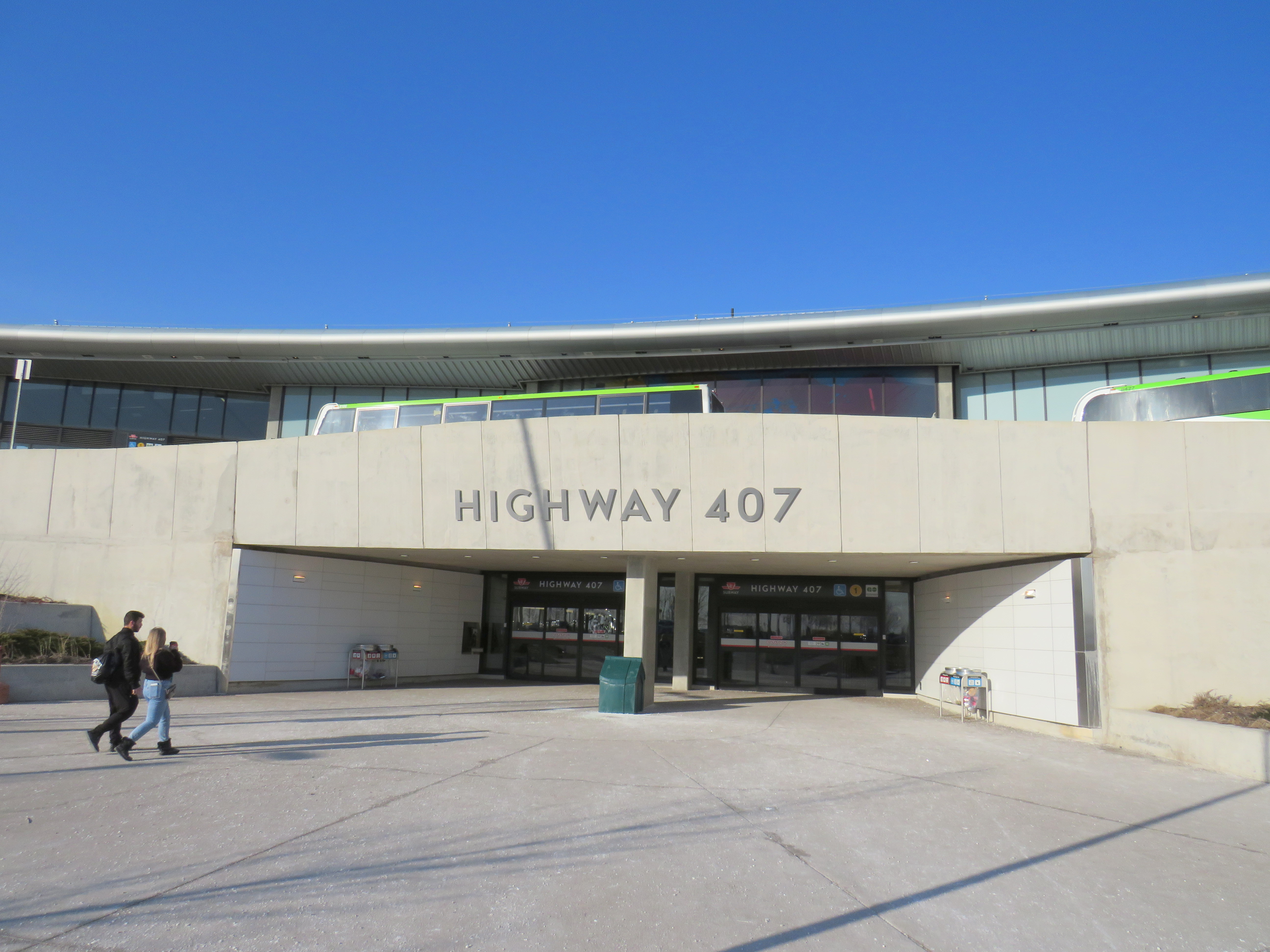
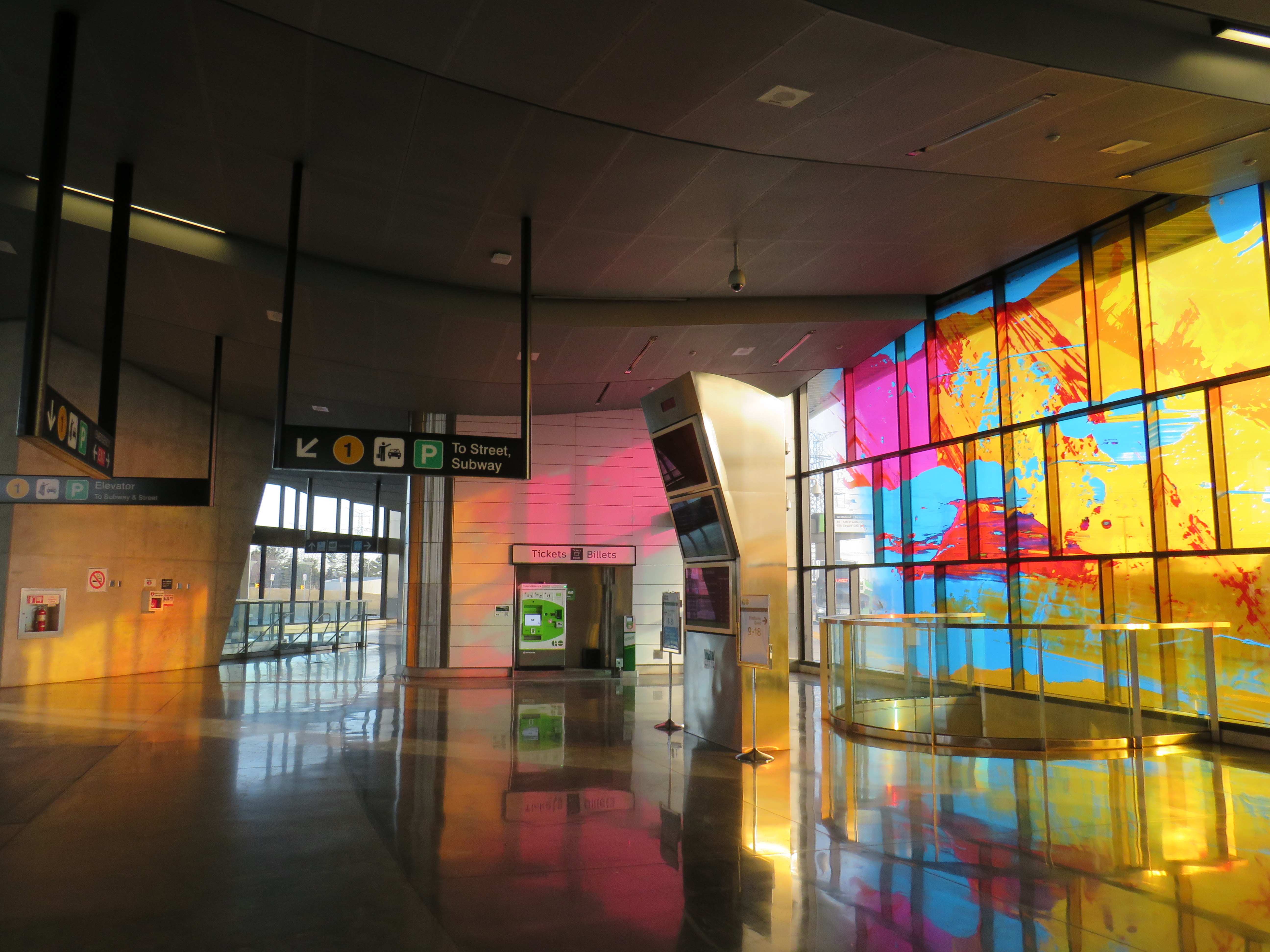
The stained glass at Highway 407 glows in the late afternoon sun. But it doesn’t take away from a poor user experience.
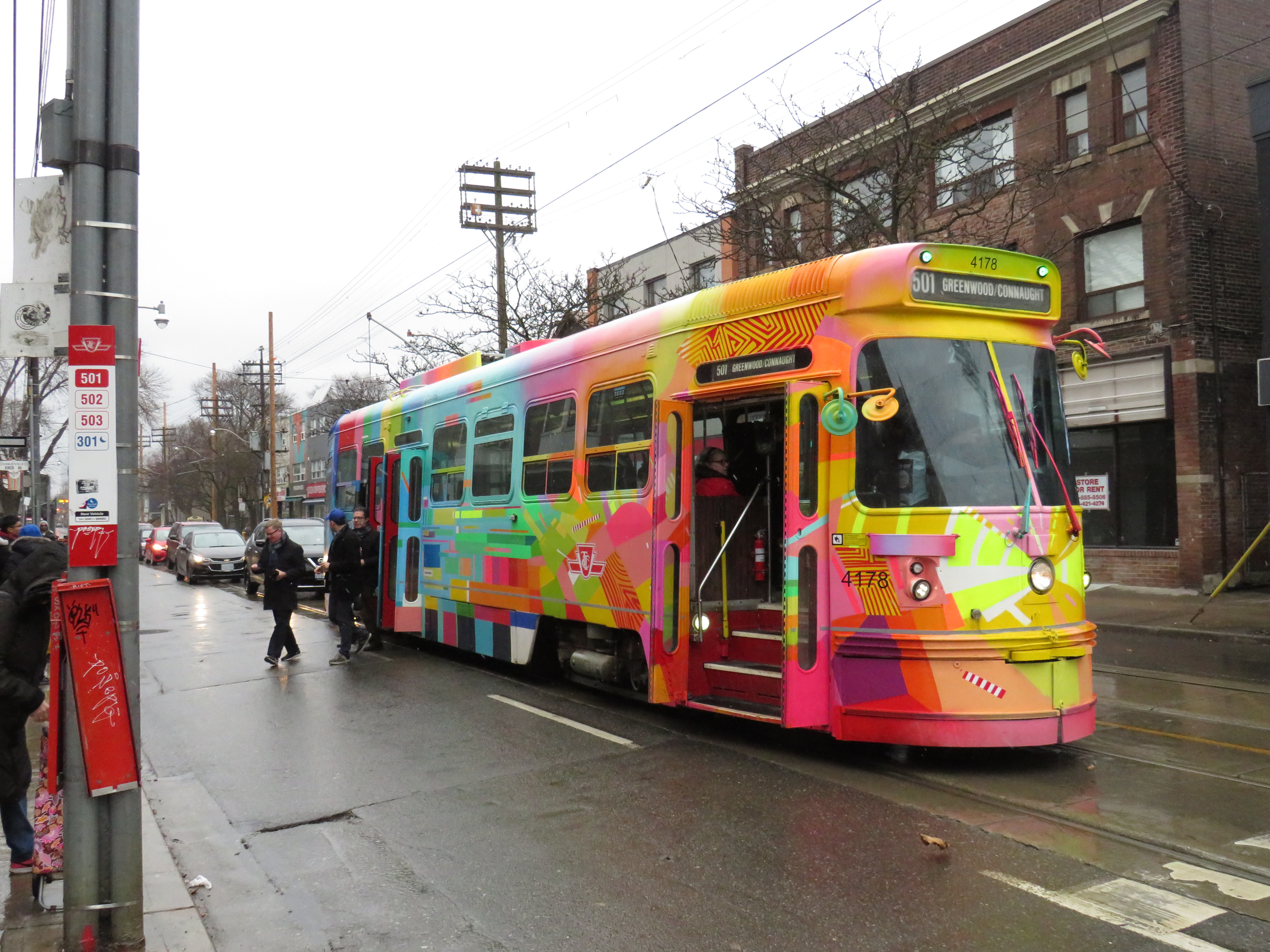
    Once outside, I noted that the pedestrian path between the parking lot and the passenger waiting area was completely covered by a giant dirty snow pile. It’s clear that pedestrians are not welcome here.

    Snow left on the only legal sidewalk leading out of Highway 407 Station

    The circuitous route is designed to keep pedestrians out of the way of the buses entering and exiting the station. But I was left wondering why a shorter, direct, and snow-free route was not designed into the station plan at the beginning. It would have cut a few minutes from my efforts in leaving the station.

    IMG_7835-001
    Pedestrians are barred from the more direct route into the station, even though the bus terminal is not a TTC fare-paid area.

    Eventually, I made it to Jane Street, and began walking south towards Steeles Avenue and campus. The narrow sidewalk hugs Jane Street, and right into a splash zone under the CN Railway underpass.

    IMG_7853-001
    An unpleasant walk along Jane Street

    After twenty-seven minutes, I made it to Pioneer Village Station, which was designed with two separate bus terminals. YRT buses use the smaller bus loop on the north side of Steeles Avenue, outside the fare-paid area. TTC buses use a larger terminal south of Steeles Avenue, on the York University lands. YRT passengers headed to campus must cross Steeles Avenue at grade as the mezzanine level underneath is fully within the TTC fare paid zone. Technically, one could transfer from GO to the YRT 20 Jane bus at Highway 407 Station (with a Presto card, it would cost only $1 each way with the YRT-GO co-fare). But it would still only get you part of the way to campus.

    IMG_7863-001

    After 35 minutes, I made it from the GO bus platform at Highway 407 Station to the Life Sciences Building at York University, on the northwest corner of the central campus, with another 5-10 minutes to major buildings such as Vari Hall or Scott Library. This was at a relatively quick pace (I’m an able-bodied thirty-something man), in quite pleasant weather. A rainy or bitterly cold day would be quite a different matter. Therefore, most will be forced to pay $3.20 each way (the current TTC Presto fare).

    The subway, with the major GO and YRT terminals off campus, was designed for a new fare structure where students and university staff wouldn’t be penalized for having to transfer one or two subway stops to get to the middle of campus. The most we got was a fare discount for GO Transit riders, with nothing for YRT commuters. (Only Brampton Transit continues to directly serve York University.) And now that meagre fare concession is going away, because no one wants to pay for it.

    Sadly, this is just further evidence of how we get transit so wrong in the Golden Horseshoe, despite it being the country’s economic heartland.


    Transit advocacy group TTC Riders, along with allies at York University, have been calling on Queen’s Park to continue to fund the fare discount. You can find out more here.

    I also expect that the opposition New Democrats will submit a motion in the legislature to maintain funding for the discount next week. I’ll update this post as necessary.

  • The TTC needs customer buy-in, not a campaign of scolding its passengers

    The TTC needs customer buy-in, not a campaign of scolding its passengers

    “Forgot to tap”

    Imagine any retail store welcoming its customers the way the Toronto Transit Commission does these days.

    This week, at least two TTC streetcars were wrapped with messages promoting the transit agency’s new aggressive anti-fare evasion campaign. Any passenger caught by fare inspectors or special constables without a valid fare is subject to a fine of up to $425.

    As a regular, fare-paying passenger, I am sympathetic to the TTC’s need to balance its books — it relies on transit fares for 68 percent of its $2.14 billion operating budget — but the more aggressive fare enforcement program — including advertisements inside vehicles and stations and hiring 50 more fare inspectors in 2020 — is insulting to its customers.

    Typically, businesses and public services strive to welcome their clientele and promote themselves to potential new customers. At one time, the TTC even ran television commercials, with a particular focus on promoting off-peak ridership.

    Not anymore.

    Customer notices on posters and on the PA system are restricted to subway closure notices, reminders about etiquette, and now warnings of $425 fines for not tapping a Presto card. Riders are no longer thanked for using the TTC. Instead, we’re subjected to poor and inconsistent service, streetcar shortages, regular weekend subway closures, fare hikes, and repeals of recent fare integration measures, along with lectures on fare payment.

    Other transit and municipal politics writers, including Steve MunroMatt Elliott, and Ben Spurr have written about the TTC’s push for stricter fare enforcement as well as the problems passengers have when paying, including malfunctioning Presto readers and fare payment machines, and overcrowded vehicles. Fare payment machines do not accept bank notes, debit, or credit cards. Though the TTC estimates that 5.7 percent of all riders engage in fare evasion, the rate on streetcars, where passengers board from all doors and tap or pay on board, is 15.9 percent.

    There has been an inconsistent approach to fare enforcement, with inspectors commonly found at streetcar terminals at subway stations. There are reports and credible accusations of racial profiling by fare enforcement officers.

    A friendlier and more wholesome approach would be addressing the technical problems, including the reliability of fare machines, and replacing generic Presto cards being used for child fares that other passengers — such as York University Station — are illegitimately using. There should also be a friendlier education campaign, enforcement discretion, and less aggressive behaviour towards customers, would make far more sense. If the TTC is truly interested in “disrupting” negative behaviour, it should adopt a customer service model, and address the distrust towards its officers from racialized and economically marginalized communities.

    Putting aside the bad optics of the crackdown on fare evasion, transit ad wraps are an insult to transit riders. Furthermore, they are a detriment to the brand. Toronto’s streetcars are an icon of this great city; this is cheapened by gigantic ads for Starbucks, Sephora, or Scotiabank.

    Inside, the large panoramic windows are obscured by perforated vinyl sheeting that is difficult to see out of. Though the vinyl wraps leave a sliver at seat level, the view is obstructed for anyone standing on a crowded vehicle.

    A typical streetcar advertising wrap

    The current 12-year, $324-million contract with Pattison Outdoor brings in a total of $27 million a year. The contract includes interior and exterior transit advertising (traditional placards, posters in stations and vehicles, and wraps). In total, advertising in all forms represents 1.1 percent of the entire TTC budget, with wraps representing a small portion of that. These wraps, commissioned by the TTC itself, are part of the contact.

    The streetcar wraps that scold, rather than welcome, riders are even more of an insult. What message do they send to visitors to Toronto? And what message do they send to potential riders?

    Customer buy-in is about so much more than just paying one’s fare. The TTC should realize that.

  • Disappearing GO-TTC fare discount a major blow to regional transit in Toronto

    4902983182_d89c675230_b

    Updated January 22, 2020

    The TTC-GO fare discount will officially come to an end on Tuesday March 31, 2020, with the TTC and Metrolinx unable to come to agreement to keep the fare subsidy going without provincial support.

    As I argue below, this is a major blow to any hopes for an integrated regional transit system throughout the Greater Toronto and Hamilton Area. Subsidized transfers reduce the need to build expensive parking lots and garages, encourage more passengers to ride transit, especially in off-peak periods, and reduce the potential of major GO Transit expansion projects planned or underway.


    Originally published July 12, 2019:

    Earlier this week, transit riders learned that the fare discount for connecting between GO Transit and the TTC would soon come to an end.

    The provincial Liberal government introduced the discounted double fare in 2017. It reduced the cost of a trip taken on both GO and TTC by $1.50 if the fare was paid on a Presto fare card. For many years, there were discounted transfers between GO and suburban transit agencies, but this was the first time such a discount was offered to TTC passengers.

    The Liberals also planned discounts for transferring between suburban bus systems such as York Region Transit and Miway, subsidies that would have been covered by the provincial carbon pricing scheme. This would have reduced the impact of another fare barrier. (A short bus trip across Steeles Avenue costs nearly $7.)

    When the Doug Ford-led Progressive Conservative government was elected, the provincial climate change plan was scrapped, along with those planned fare changes. Now, the province will not renew the $18.5 million annual subsidy for linked GO-TTC fares, though it did introduce free fares for children on GO Transit.

    This will especially affect commuters to York University, who previously enjoyed a one-seat ride to the heart of the campus on YRT and GO buses. When the subway extension opened, YRT retreated to terminals north of Steeles Avenue, forcing a transfer to the subway or a long walk across six lanes of traffic and campus parking lots. GO Transit, too, moved to a new terminal at Highway 407, two subway stops from campus. While GO commuters at least saved $3.00 a day with the discounted double fare, YRT commuters got nothing. (Of all the suburban agencies, only Brampton Transit continues to serve the campus.)

    This is also a blow to what’s left of SmartTrack, Mayor John Tory’s signature transit plan that was once pitched as “London-style surface rail.” At first, SmartTrack was a 53-kilometre heavy-rail line, mostly piggybacking on existing GO Transit corridors, but including a problematic western branch to the Airport Corporate Centre in Mississauga, all on an integrated TTC fare. Eventually SmartTrack just consisted of more frequent, electric GO service, along with additional station stops and fare integration. This was much more realistic, but it distracted from other needs such as the Relief Line and GO’s own RER regional rail plan.

    Lower GO fares for short trips and the TTC-GO fare discount were all part of this scaled-back version; as late as last year, Tory called additional fare integration a “critical component” of his pitch. Eliminating the fare discounts is yet another blow to SmartTrack.

    As Jonathan English points out in Urban Toronto, the GO rail network represents “tremendous infrastructure that could greatly improve the lives of hundreds of thousands of Torontonians.” But it lies “letting it lie mostly dormant because we won’t make the comparatively small operating funding investments required to improve the service and make the fares fair.”

    The $18.5 million annual cost is a small price to pay for improving transit accessibility and utilization of our existing corridors. Increasing that annual subsidy to reduce the cost of transfers between the TTC , York Region, Brampton, and Mississauga would, too be a worthwhile investment.

    Sadly, the current provincial government does not see the value in promoting fairer fare systems, nor regional transit in general. In response to budget cuts, Metrolinx reduced or eliminated service on five GO bus routes last month, and more may be to come. While there may be enthusiasm for building a new “Ontario Line” and a subway extension to Richmond Hill, there’s little regard for the actual transit rider.

  • A farewell to Toronto’s CLRV streetcars

    IMG_6892-001.JPG

    On December 29, 2019, the Toronto Transit Commission’s venerable Canadian Light Rail Vehicles disappeared from the city’s streets. To mark the occasion, six CLRVs, offering free rides, were put into service on Queen Street between 10:00 AM and 2:00 PM before a ceremonial last run to Russell Carhouse in Toronto’s east end.

    The first six CLRVs, 4000-4005, were built by SIG in Switzerland, and entered service on the 507 Long Branch route on September 30, 1979. An additional 190 streetcars were built by Hawker-Siddeley in Thunder Bay, with the last cars arriving in 1981. Those were followed by 52 articulated ALRV streetcars, which were delivered between 1987 and 1989, and retired earlier this year.

    The CLRVs were unique to Toronto, designed by and for the TTC. Other North American cities that still operated streetcars in the 1970s opted for different designs to replace their ageing PCCs, though Boston have the CLRVs a try.

    Several CLRV and ALRV streetcars will be preserved at transit museums, including the Halton County Radial Railway near Rockwood, Ontario; two CLRVs will remain on TTC property for special events.

    With the arrival of the last of the 204 Bombardier Flexity low floor streetcars this month and the retirement of the CLRVs, the entire TTC fleet is now 100% wheelchair accessible and fully air-conditioned. Gone, too, with the CLRVs are back-lit vinyl destination signs, treadle rear doors that open by stepping on the stairs, and windows that open at face level and the warnings to keep arms inside.

    Streetcar 4124 on December 29, 2019Streetcar 4124 picks up passengers at Yonge Street, December 29, 2019

    Though the accessibility and the capacity of the new Flexity streetcars represent major improvements, I will miss the old CLRVs, and not just because they’re the last transit vehicle in Toronto that are older than I am. I was fascinated by Toronto’s streetcars at an early age. As a child growing up in Brampton, I would lobby hard to ride Toronto’s subways and streetcars whenever we went downtown as a family. My parents took me on a ride on the 501 Streetcar between downtown and Parkdale (with lunch at Harry’s Charbroiled Burgers when it was across from the Gladstone Hotel) when I was seven.

    IMG_6907-001Streetcar 4178, A Streetcar Named Toronto, at Greenwood Avenue, December 29, 2019

    Once I was old enough, at age thirteen, I was making my own trips to Toronto, taking GO Transit trains from Downtown Brampton or Mississauga Transit buses from Shoppers World and Square One to the subway, buying a day pass, and then spending a day wandering the city. The high floor CLRV and ALRV streetcars with their open windows offered great views of the city rolling by.

    I continued to ride the rocket regularly when I attended university, taking advantage of breaks between classes to ride further out into the suburbs, eventually riding nearly every bus route in the city. Even after I moved to Toronto, a streetcar ride was an affordable delight (as long as I wasn’t in a rush).

    IMG_6927-001.JPG
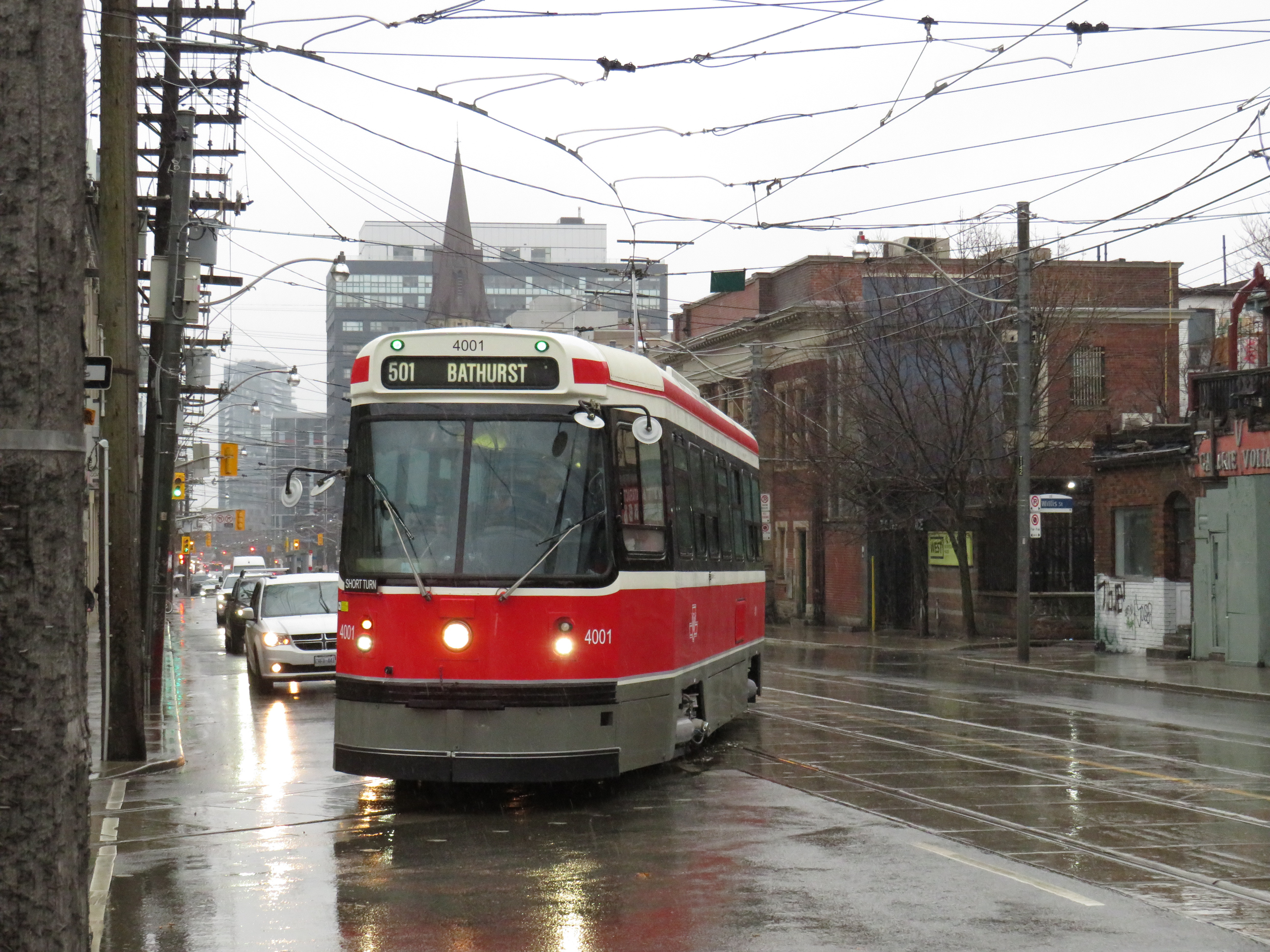
Short turn: Swiss-built CLRV 4001 turns into Wolesley Loop at Bathurst and Queen

    My favourite seats were right at the back, with the curved rear with great views on three sides, similar to the bullet lounge at the end of VIA Rail’s Canadian and Ocean trains. The single seats on the operator’s side of the streetcar were also favourites.

    Though the last of Bombardier’s 204 new Flexities have finally arrived, there is still a streetcar shortage in Toronto. The 505 Dundas and 502/503 Kingston Road routes continue to be operated with buses. Many of the new vehicles planned for Dundas and Kingston have been reallocated to King Street, where the transit priority project resulted in a significant increase in ridership. The TTC wishes to purchase 60 more streetcars to fully furnish the existing demand and support expansion on the waterfront, but funding isn’t yet available.

    Unfortunately, buses will have to fill in those gaps as the CLRVs disappear.

    IMG_6936.JPG
    Retired streetcars at Russell Carhouse await their fates

    Thanks for the memories!

  • Suburban Toronto’s transit past and future on north Yonge Street

    IMG_4846-001
    Stop 17 shelter in Thornhill

    On Yonge Street in Thornhill, a small green hut sits beside the busy roadway at the entrance to Cricklewood Park. On the side of the small building, a wood sign says “Stop 17.” Hundreds of buses and thousands of cars pass by this hut daily, yet few may know about the transit history it represents.

    Stop 17 was a stop on the Toronto & York Radial Railway line that extended north from a terminal at Toronto’s city limits at Yonge Street and Glen Echo Avenue (now the location of a Loblaws supermarket) all the way to Sutton, via Richmond Hill and Newmarket. Electric radial service to Thornhill and Richmond Hill began in 1897. By 1908, radial service reached Lake Simcoe.

    Stop 17 was one of two stops in Thornhill, located at the present-day intersection of Yonge Street and Royal Orchard Boulevard. The TTC, the eventual owner of most of Toronto’s radial lines, closed the Lake Simcoe route in 1930. Soon afterwards, the wooden shelter was moved to a nearby golf club, where it served as a snack bar and rain shelter. (The radial line was resurrected in late 1930 as a suburban streetcar service to Richmond Hill until 1948.)

    f1568_it0441
    Yonge Street looking south in Thornhill, September 1931. City of Toronto Archives, Fonds 1568, Item 441.

    In November 2000, the Stop 17 shelter was moved back to Yonge Street and restored. It stands as a historical building in Thornhill, and as a monument to early suburban transit in Greater Toronto. Only a few other structures exist from the radial railway era including the Newmarket Radial Arch, the footings of a Toronto Suburban Railway trestle over the Humber River, and a radial power station in Guelph.

    There was another Stop 17, on the Scarboro Radial Line between Toronto and West Hill.  By coincidence, it is also memorialized in the name of a variety store (Stop 17 Variety), which also sports a mural depicting a T&Y radial car stopped in front of the Scarborough High School (now R.H. King Academy).

    Stop 17 Variety
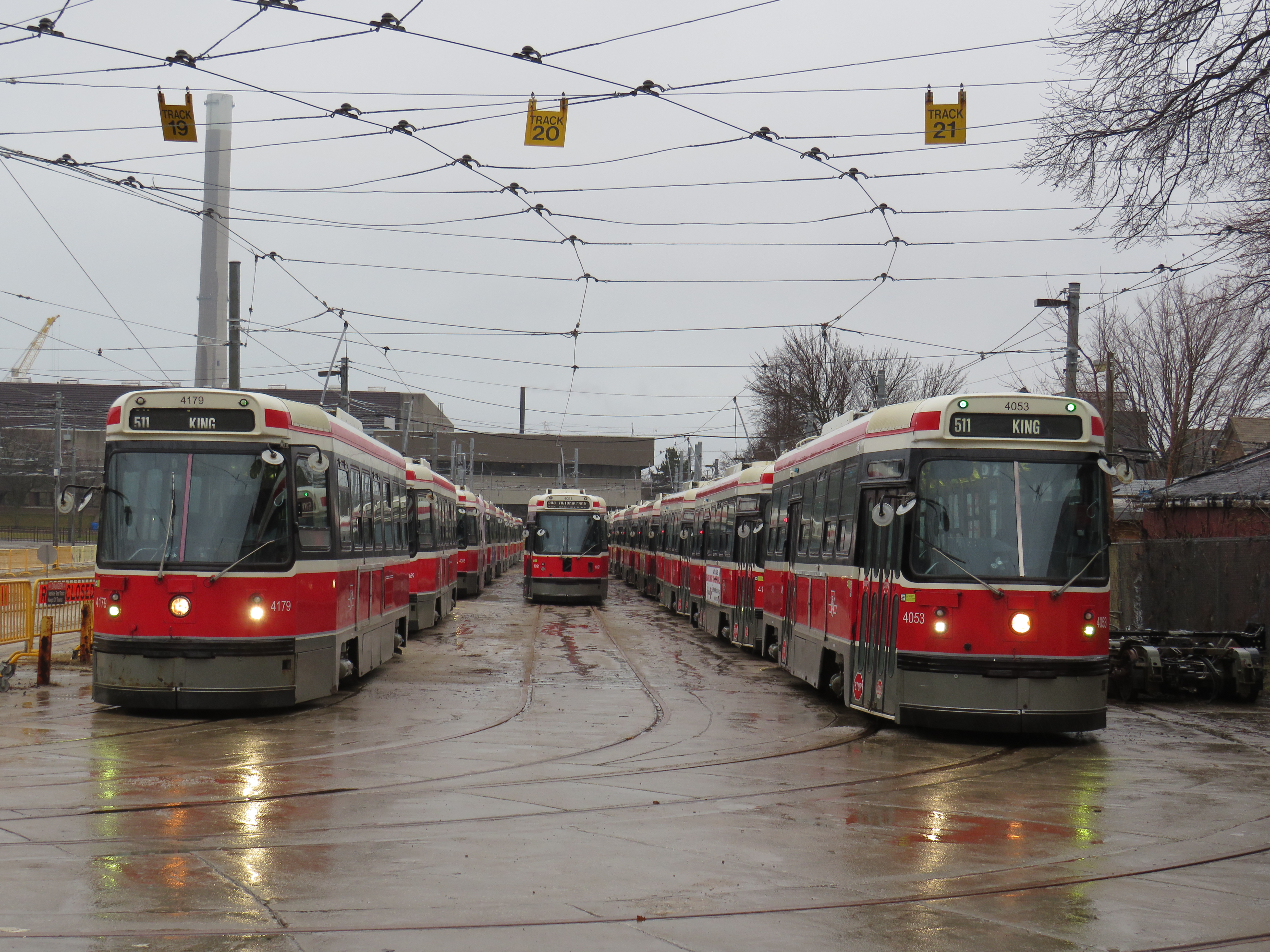
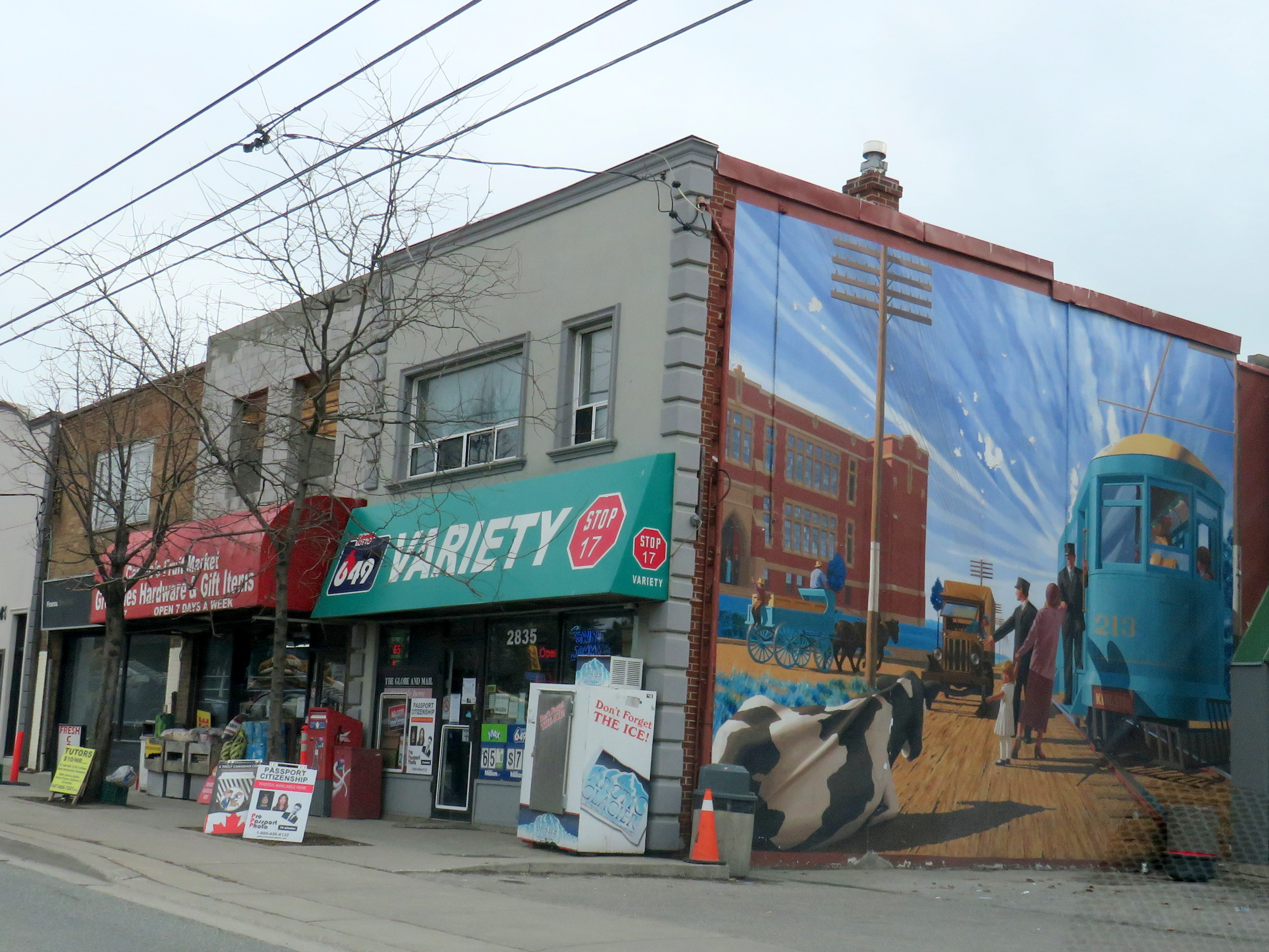
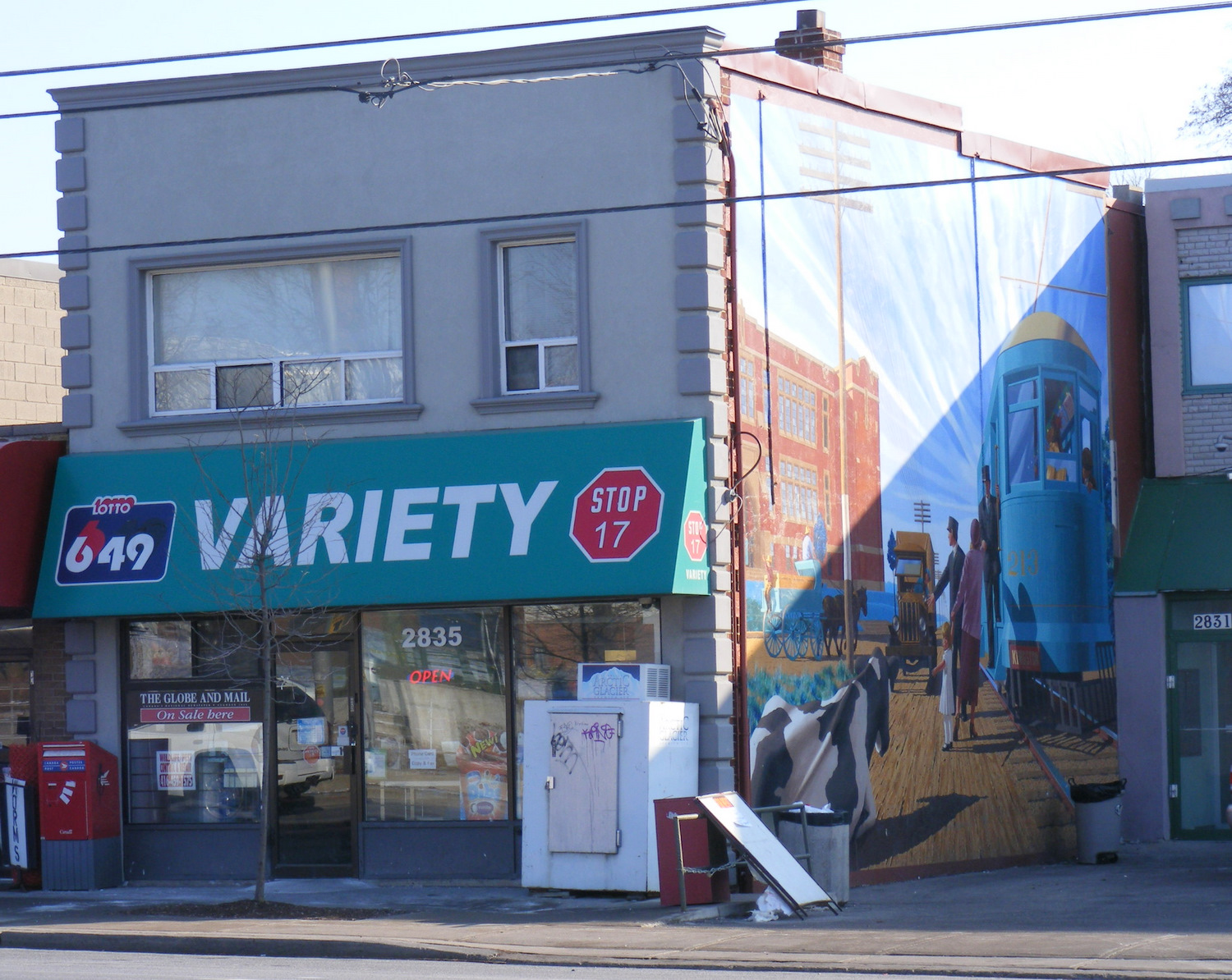
Stop 17 Variety on Kingston Road at St. Clair Avenue in Scarborough

    Nearby the Stop 17 shelter in Thornhill, I noticed several markings in the sidewalk. After a closer look, I noticed that they were survey markers, indicating a location where holes were drilled for preliminary core samples for the planned Yonge North Subway Extension from Finch Station to Richmond Hill.

    One day, the subway will be extended north into York Region, a sensible project given the ridership potential, especially as Yonge Street sees urban intensification through Thornhill and Richmond Hill. The City of Toronto has been resistant to the extension, as the Yonge Subway is already operating over capacity, with a relief subway required to handle the loads.

    The politics of subway building aside, it is fascinating to find the history and future of Toronto’s suburban transit in such close proximity.

    IMG_4848-001
    Sidewalk markings on Yonge Street

    IMG_4848-002
    “TTC YSE” marker