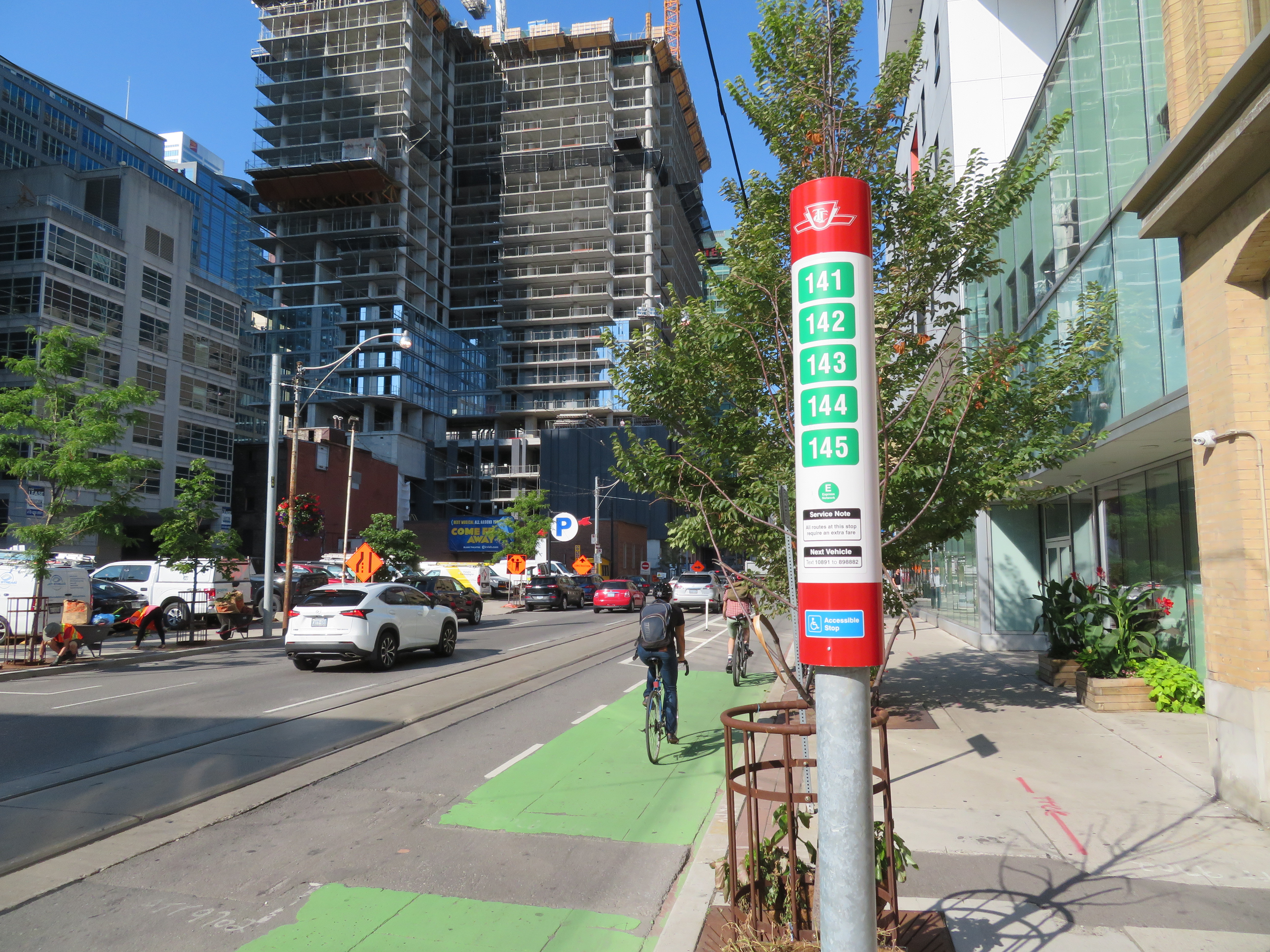
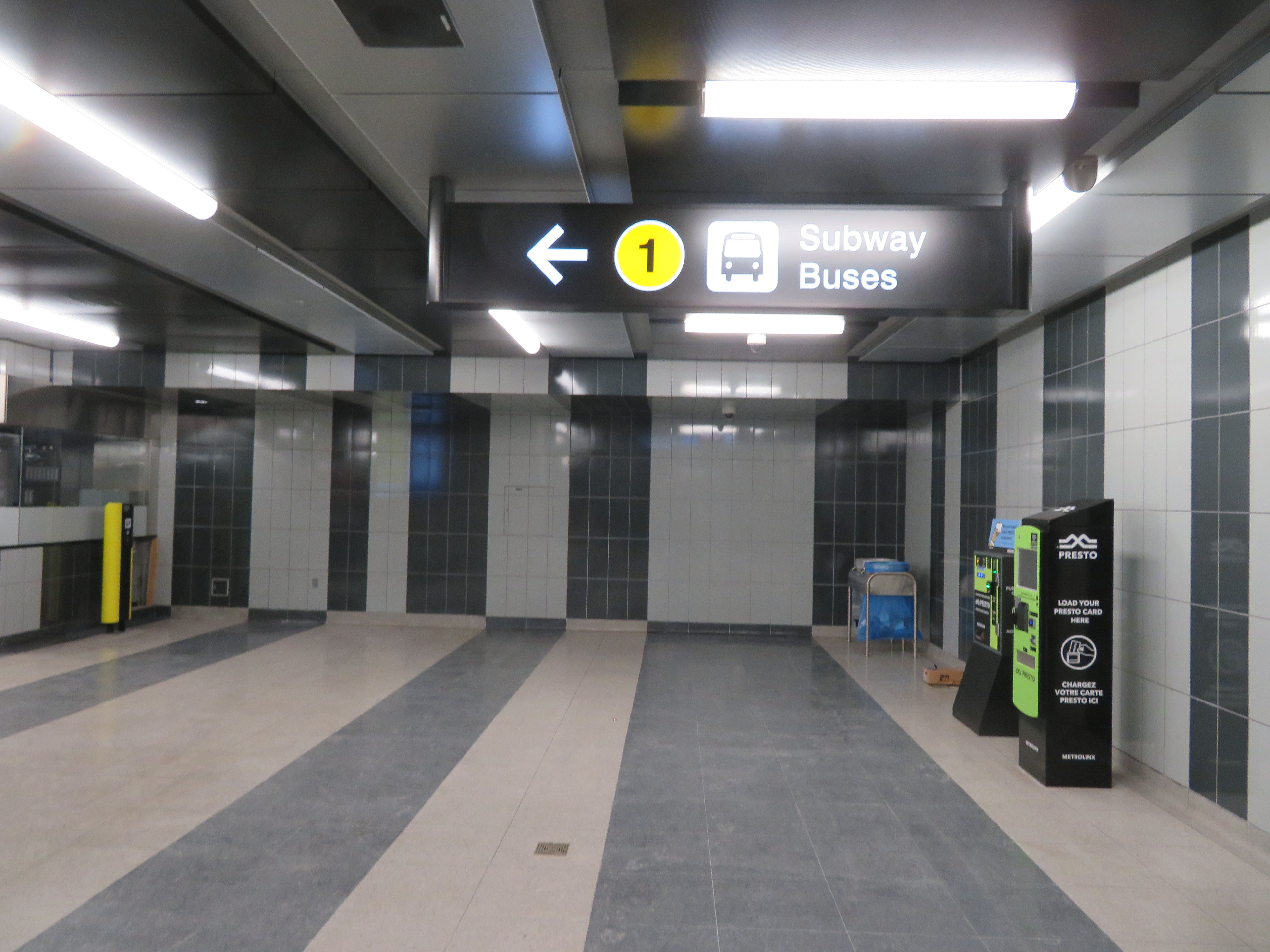
TTC stops have improved with the addition of route numbers, but this bus stop is deceiving
In the last few years, the TTC has made significant improvements in its maps, signage, and wayfinding standards. It also introduced new streetcar and subway fleets, retrofitted elevators into older stations (all but one streetcar line and a majority of subway stations are now fully accessible), and opened a new subway extension. Though overcrowding, bunching, and weekend closures continue to be aggravations, it is important to recognize where the TTC has improved.
Specific changes to TTC wayfinding include a new simplified system map, better signage at subway stations, introducing standard signage for diversions, scheduled closures and construction notifications, and revising the classic TTC bus stop.
However, two recent changes represent an unfortunate departure from these improvements. (more…)
504 King Streetcar diverting onto Spadina on Thursday, September 5
For the sixth year in a row, King Street between University and Spadina Avenues was closed for four straight days. This closure was for the Toronto International Film Festival (TIFF) “Festival Street,” which took place between Thursday September 5 and Sunday September 8. In addition, King Street was closed during the afternoon rush hours the following Monday and Tuesday for “Red Carpet Events.”
TIFF has been recognized among the world’s most important film festivals, and one where the public has the opportunity to take part (albeit at increasingly inaccessible prices for many screenings). It offers tremendous economic and cultural value to Toronto. It compliments and helps to support many other annual film festivals, such as Hot Docs and Inside Out.
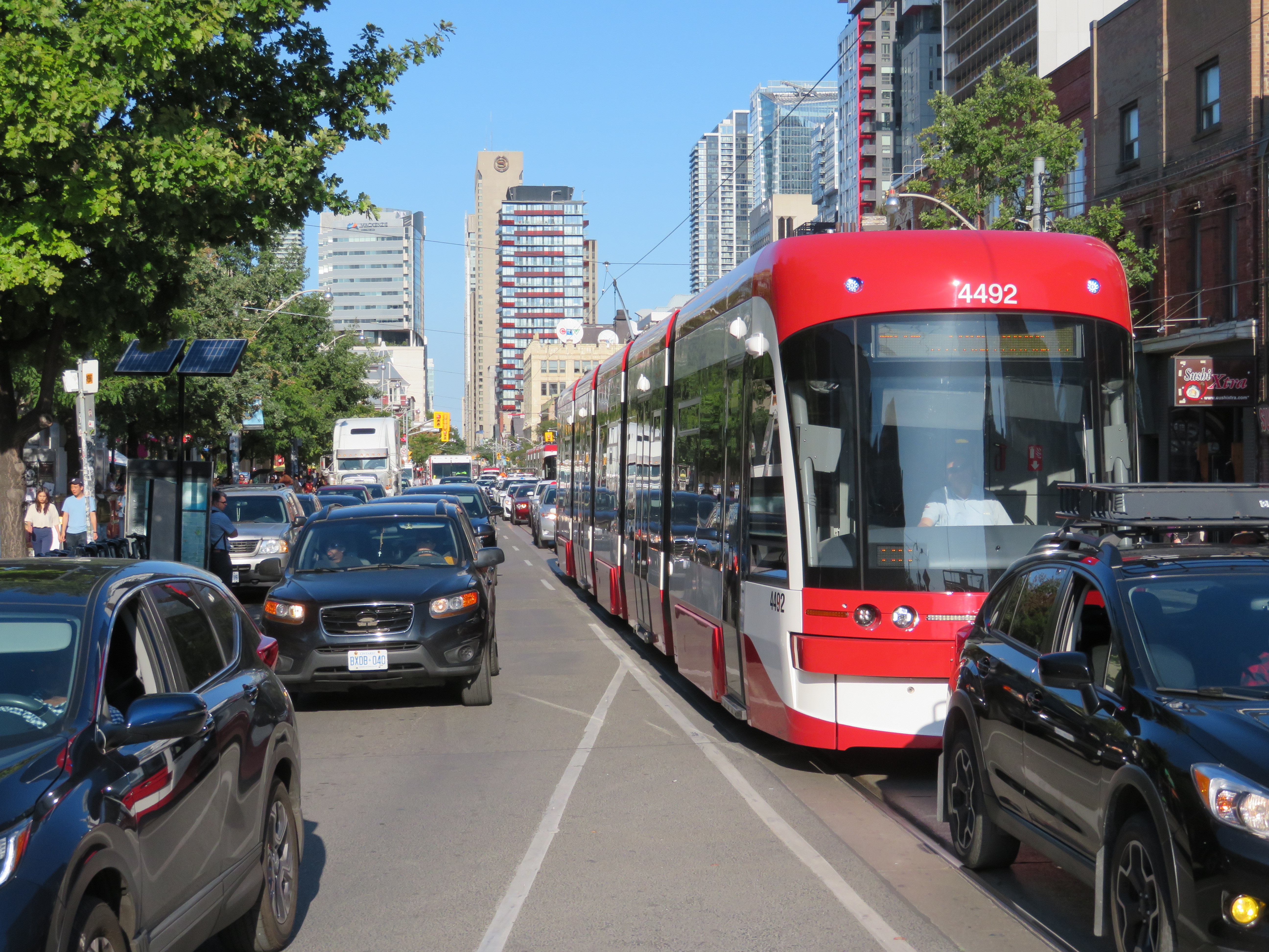
But TIFF’s clout and influence has also led to entitlement, with “Festival Street” being the most disruptive result. While King Street is closed off to traffic during the film festival, it has severe effects for the 84,000 daily riders of the 504 King Street, as well as riders on the busy 501 Queen and 510 Spadina cars.
501 Queen and 504 King Streetcars stuck in traffic westbound at Queen and Spadina
Several major TIFF screening locations are located on or near King Street West, including Roy Thomson Hall, the Princess of Wales Theatre, the TIFF Bell Lightbox, and two blocks north, the Scotiabank Cinemas. Industry parties and galas are held at nearby hotels and restaurants. It’s natural that King Street would be a hub of activity for the film festival. But it is also the third busiest transit route in Toronto, after the Yonge-University and Bloor-Danforth subways.
The King Street Pilot, which began in late 2017, prohibits through motor vehicle traffic on King Street between Jarvis and Bathurst Streets through the downtown core, though all vehicles are permitted to use King Street for short segments. Despite spotty enforcement, the pilot project allowed the TTC to operate much more reliably through the busy corridor, with an increase of capacity and ridership. In early 2017, daily ridership on the 504 King was 72,000. By March 2018, it grew to 84,000. In April, council voted to make the pilot permanent. This will allow for streetscape improvements along the corridor and wider sidewalks, with improved physical measures to further restrict through traffic.
Westbound Rogers Road Streetcar at Old Weston Road, 1972. Photograph from Toronto Archives – Fonds 1526, File 72, Item 61
Forty-five years ago today, on Friday, July 19, 1974, the Rogers Road Streetcar made its last run. The route ran from a loop at St. Clair and Oakwood Avenue to Bicknell Loop, located on Rogers Road just west of Keele Street.
The Toronto Transit Commission (TTC) had only recently abandoned its policy of eliminating the streetcar network in favour of buses and the planned Queen Street Subway. By the early 1970s, there were still nine streetcar lines in Toronto, along with two extra rush hour services.
The TTC had to maintain a core fleet of streetcars to continue service until a new fleet could be delivered, and there was a shortage of streetcars in good condition. Despite the new commitment to continue operating a street railway, one more line would have to go. Rogers Road, the last of four streetcars operated for the Township (later Borough) of York, would be sacrificed. (It would not be the last streetcar route to disappear, however.)
For nearly thirty years, service on Rogers Road was provided by trolley buses, a branch of the 63 Ossington route. While the TTC promised to extend the trolley bus to Jane Street (which was one of the reasons why York politicians supported the streetcar abandonment), it never happened. Instead, a shuttle bus route provided service along Alliance Avenue to Jane. Once the trolley bus network was scrapped in 1993, the TTC restructured several west-end routes. In 1994, the 161 Rogers Road bus finally provided the through service York had demanded for twenty years.
In July 2014, before I started this blog, I wrote an article about the Rogers Road Streetcar for Spacing’s website, with the assistance of Steve Munro and author John F. Bromley. Five years later, it remains one of my favourite writing assignments.
On the CBC radio program Metro Morning on March 28, Toronto Mayor John Tory spoke about his concerns regarding Premier Doug Ford’s plans to upload the city’s subway system, as well as Ford’s intentions to build new subway extensions to Richmond Hill and Scarborough Centre, bury the Eglinton West LRT, and start the long-planned Relief Line. Instead of a conventional subway, the Relief Line envisioned by the province would use a “new technology,” despite planning and engineering underway for a subway, using an existing subway yard for Relief Line train storage.
But Tory, who has been passive so far about the province’s plans, was hopeful that the unspecified new technology proposed for the Relief Line would be a “fantastic bonanza” for Toronto, but he added that he didn’t know for sure what would come of the new plan.
Mayor Tory tells @metromorning he's prepared to hold out hope that the province's unspecified new tech for the Relief Line is a "fantastic bonanza for us. But I don't know."
It is curious that Tory called this hostile takeover a “fantastic bonanza.” Bonanza was a long-running Western television show, starring Lorne Greene as the patriarch of the Cartwright family, owners of a vast ranch on Lake Tahoe. Bonanza was famous for its theme music and opening credits, which featured a burning map of the Cartwrights’ Ponderosa ranch before introducing the cast.
Opening theme for Bonanza
Bonanza’s burning map is a great metaphor for Toronto’s transit planning. Newly elected mayors and premiers burn the maps left behind by their predecessors, and time is wasted on new feasibility studies and engineering reports, ready just in time for someone else to get elected with yet another idea. Plans come and go, but hardly anything ever gets built.
There’s plenty of blame to go around. After a prolonged spurt of subway construction in the 1950s, 1960s and 1970s, momentum was lost. In the 1980s, Bill Davis’ Progressive Conservatives insisted on a novel linear-induction rail system for Scarborough, rather than the light rail project already underway. The Liberals, under David Peterson, proposed several subway lines, though it was scaled back under NDP Premier Bob Rae. In 1994, work started on the first phases of the Eglinton and Sheppard subways. When Mike Harris’ government was elected in 1995, they cancelled Eglinton, filling in a hole already dug for the tunnel boring machines.
There was new hope in 2003, when a new Liberal provincial government was elected, and David Miller, an urban progressive, became mayor of Toronto. While the province’s top priority was the extension of the Spadina Subway to York University and Vaughan, it was willing to help fund major improvements to GO Transit, along with new light rail systems in Ottawa, Kitchener-Waterloo, Hamilton, and Mississauga-Brampton. It also committed to Miller’s proposed Transit City LRT network, including a fully grade-separated replacement of the ageing Scarborough RT.
There were valid criticisms of Transit City — there were too many transfers to get around the top of the city, there was no Relief Line, and a few of the proposed lines, like parts of the Jane and Don Mills LRTs, were too difficult to build as surface rail projects. But because of Miller, the Eglinton-Crosstown LRT is well underway, and preliminary work continues on Finch Avenue West.
Work would have also started on the Scarborough RT replacement and expansion and the Sheppard East LRT, had Rob Ford not been elected in 2010, promising “subways, subways, subways” and burning the transit maps for which new projects were planned and being built. Seven funded LRT stops in Scarborough became three unfunded subway stops. Overestimating Rob Ford, and hoping to keep seats in Scarborough, the Liberal government folded to his demands, and work stopped on the LRT replacement.
Rob Ford’s disastrous term was followed by John Tory’s twin obsessions of SmartTrack and an austerity agenda, at a time when the Yonge and Bloor-Danforth subways were overwhelmed by demand caused by a growing population and a booming economy — hardly the conditions that demanded low spending on civic services and infrastructure and yet another half-baked transit plan.
SmartTrack map from the 2014 John Tory campaign
Tory promised that it would only take seven years to build SmartTrack, which would mostly use existing railway infrastructure, along with a new section of track in Etobicoke, on land already sold off for development. Tory’s insistence on SmartTrack further delayed momentum on the Relief Line. Though Tory remained committed to the Scarborough subway extension over the approved and funded LRT, it was reduced to a single stop as costs ballooned, while the subway and SmartTrack threatened to cannibalize each other. We don’t hear much about SmartTrack anymore, but at least Tory has come around on the Relief Line.
But Doug Ford’s latest musings make it clear why the planned subway upload is so dangerous.
Canada Line in Richmond, British Columbia
So what now for the Relief Line?
Despite the inevitable Simpsons monorail jokes (Doug Ford did promise a monorail on Toronto’s waterfront when he was a city councillor in 2011), the new technology the province is considering is likely an automated light metro line, similar to the Canada Line in Vancouver. The Canada Line links Vancouver’s city centre with the international airport and the suburb of Richmond. It was built as a private-public partnership (P3) project, in which a private company was contracted to design, build, and operate the line. It’s an attractive option for a conservative government: P3s promise to be cheaper to build and operate than a conventional public project.
But the Canada Line has problems. Though trains are frequent, it was built too small to accommodate growth. The outer terminals at Vancouver airport and Richmond-Brighouse are both single track/single platform. Station platforms are too short — only 40 metres long — to increase train sizes. And as many stations are underground, it’s too expensive to extending platforms to fit larger trains. Some relief is coming, but even then, the maximum capacity of the Canada line is 15,000 persons per direction per hour, far less than Vancouver’s SkyTrain lines or Toronto’s subway. If this is the route Toronto takes, it won’t be long before the Relief Line itself will need relief.
Once again, I fear that Toronto will continue to spin its wheels thanks to the Ford circus. And it’s a shame — though sadly not surprising — that Mayor Tory isn’t fighting back.
Replica of Toronto Railway Company streetcar #327 operates at the Halton County Radial Railway museum, with the unique glass bulbs visible below the metal “Belt Line” sign. Photo taken June 2012
In 1891, the Toronto Railway Company (TRC) was created, taking over the city’s streetcar system from its predecessor, the Toronto Street Railway. The TRC quickly began electrifying Toronto’s transit network, operating fifteen routes across the city. Electric streetcars were faster than horse-drawn trams, and passengers had difficulties figuring out which streetcar was theirs at night.
This was a problem as many streetcar routes overlapped. For example, Dupont and Avenue Road streetcars operated on Yonge Street south of Bloor, and Belt Line and Yonge streetcars both ran on Front Street. While the TRC had metal signs on the top and sides of each streetcar to denote the route, they weren’t illuminated. With electric light still in its infancy — arc lamps were too intense while early incandescent lamps were too dull to adequately illuminate route signs — the TRC developed an ingenious solution: uniquely coloured glass bulbs mounted on the roof, lit by interior lights. These lights became known as “bull’s eyes.”
Under this scheme, the Yonge Streetcar could be identified by one blue light, while the Broadview Streetcar could be identified with red and green lights. This system required passengers to memorize their route’s colours, and as new routes were introduced, changed, or withdrawn, it became cumbersome. Eventually, lighting technology caught up: while back-lit destination signs were possible by 1910, the TRC became hesitant to spend any capital funds to modernize its fleet or expand the streetcar railway network. The City of Toronto was forced to start its own streetcar system, the Toronto Civic Railway, to serve outlying neighbourhoods.
Though the Ontario Railway Board (predecessor to the Ontario Municipal Board) refused to force the TRC to expand the street railway network beyond the 1891 boundaries, it ordered the TRC to install backlit route signs. These new signs were introduced in February 1913, and those unique coloured bulbs disappeared by 1915. Six years later, the TRC’s franchise was up, and the city-owned Toronto Transportation Commission came into being.
In 1935, the TTC re-introduced “bull’s eyes” to its streetcar fleet. Officially known as an advance light, a single roof-mounted light, which gave off a blue-green hue, was designed to let waiting passengers know a streetcar was on its way. At the same time, the TTC installed dash lights, which both illuminated advertising cards and provided additional lighting, a useful safety feature.
TTC PCC Streetcar #4549 on Queen Street West in September 2018
New PCC streetcars, which began arriving in 1938, were built with the advance lights already installed. By 1940, all streetcars, including the remaining wooden cars acquired from the Toronto Railway Company, were equipped with advance lights. After the Second World War, PCC streetcars purchased from cities such as Cincinnati, St. Louis, and Kansas City, were similarly fitted with the roof-mounted lamps.
CLRV streetcar on Queen Street East, with two blue-green advance lights above the back-lit destination sign.
By the 1970s, the TTC decided to maintain its street railway fleet after planning for their eventual replacement with buses and subways, and sought a replacement fleet for its ageing PCCs. The new Canadian Light Rail Vehicles (CLRVs) and Articulated Light Rail Vehicles (ALRVs) were designed with dual advance lamps, mounted within the streetcar body, immediately above the destination sign.
Advance lights were introduced to TTC buses starting in the mid-1990s, as new wheelchair-accessible vehicles were added to the fleet, starting with high-floor Orion V and Nova RTS buses, and continuing with newer low-floor vehicles. Blue lights indicated that the bus was accessible. As a bonus, when combined with new digital orange LED destination signs, the bus advance lights served to further improve the visibility of approaching transit vehicles.
Nova articulated bus with orange LED destination sign and blue LED advance lights indicating it is an accessible vehicle
The new Bombardier Flexity streetcars are similarly equipped with new blue LED lights, as they too are fully accessible vehicles. While blue advance lights are unique to TTC buses, the new light rail vehicles for Waterloo Region’s ION LRT, also built by Bombardier, sport similar blue lights.
ION LRT vehicle undergoing testing in Kitchener, February 2019
Sources:
John F. Bromley and Jack May: Fifty Years of Progressive Transit (Electric Railroaders’ Association, 1973)
Mike Filey: Not a One-Horse Town: 125 years of Toronto and its Streetcars (Firefly Press, 1990)
At its board meeting on July 10, the Toronto Transit Commission finally approved two hour transfers for passengers paying by Presto. This is great news that has been a long time coming.
The TTC expects that the new policy will cost $21 million a year by 2020, but it will also boost ridership by 5 million passengers. The new two-hour transfer policy will allow a passenger using a Presto card to board any vehicle or enter any subway station within two hours of the first tap without paying a second fare. This will allow anyone to make a short return trip on one fare, or make a stopover before transferring to another route. Customers of most suburban transit systems such as MiWay, Brampton Transit, and YRT have enjoyed the same privileges for over a decade.
The policy takes effect Sunday, August 26.
I’ve argued here before why two-hour transfers are necessary. If a passenger taps onto another vehicle on the same route, a common occurrence due to delays, short-turns, and diversions/shuttles, the Presto Card will deduct a second fare. That has happened to me several times, even when making a valid transfer between a bus and Union subway station. It’s often confusing when the TTC tells its passengers to take a paper transfer when a diversion takes place, or tells its customers not to tap again on a bus or streetcar when they’re short-turned. The new policy finally fixes those errors for good.
However, the transfer policy does not apply to customers paying by cash, tickets, or tokens, so the old archaic paper transfer rules will still apply to many TTC customers.
The TTC is slowly phasing out paper media and passes, but still has yet to implement daily, weekly or monthly caps that will effectively replace day, weekly and Metropasses. There will also need to be a paper Presto card equivalent developed for occasional and one-time customers, such as tourists or anyone who doesn’t want to pay the $6 fee for a plastic card. Hopefully the details of how these will be implemented will be decided and communicated in the near future.
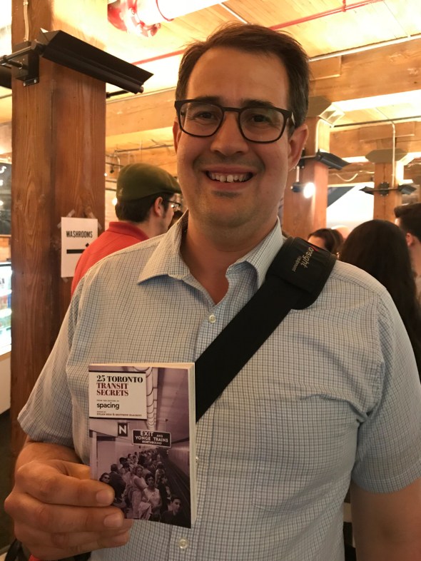
Earlier this week, I attended a book launch at the Spacing Store at 401 Richmond Street West here in Toronto. While I have been to numerous book launches, often to support friends and colleagues, it was the first time it was for a book that I contributed to.
As some of you may know, I am an occasional contributor to Spacing Magazine and Spacing’s website. My writing has allowed me to think and learn more about Toronto, and meet fellow engaged Torontonians. Spacing’s latest book, 25 Toronto Transit Secrets, contains stories, photographs, and maps that detail both the history and the operations of the TTC. For my part, I wrote about the ghostly reminders of abandoned streetcar routes, the history of the convoluted Harbord Streetcar, and what happens to the TTC’s streetcars when they’ve reached the end of the line.
There are many other great stories as well. Read about the TTC’s safety mascot, Barney the Beaver, Toronto’s two ghost stations (Lower Bay and the lesser-known Lower Queen) and a history of the ferry service to Toronto Islands.
25 Toronto Transit Secrets is edited by Dylan Reid and Matthew Blackett, who both deserve a lot of credit. Any writer knows that their work is dependent on editors not only proof-reading their work, but also providing guidance and support. I am always grateful for their encouragement and providing the opportunity to be published.
On Friday, CBC Toronto ran a story on several King Street West businesses that have claimed that the new King Street Pilot have caused them to lose customers in December. The three business owners mentioned in the article were Laleh Larijani of Forno Cultura, a bakery on King east of Bathurst, and two Restaurant Row restaurateurs: Jesse Warfield, whose family owns the Gabby’s chain of restaurants, and Fred Luk, owner of Fred’s Not Here and The Red Tomato.
The King Street Pilot was launched by the City of Toronto on November 12, 2017. At many intersections between Bathurst and Jarvis Streets, cars and trucks are required to turn right off of King Street, prioritizing streetcar traffic. Most on-street parking spots were removed from King Street through this section, but designated areas allow for deliveries, passenger pick-ups and drop-offs, and access to local properties, including parking garages. Despite some [predictable] hyperbole from suburban politicians and reactionary journalists, cars are not in fact banned from any section of King Street. And there are many public and privately-owned garages adjacent to the pilot corridor for motorists to park at.
For transit riders, the King Street Pilot is working. In December, the TTC reported travel time reductions for the busy 504 King and 514 Cherry Streetcars of up to 24 percent. However, it still struggles to keep up with demand. The continuing delays in the new streetcar deliveries from Bombardier have not helped matters; and streetcars still often run overcrowded, leaving some passengers behind at streetcar stops. There are some necessary tweaks to be made: TTC schedules should take advantage of improved travel times, and transit signal priority is also necessary with the new far-side stop locations at intersections. Signal priority will help to ensure streetcars don’t have to stop at a red light at the near side of the intersection and again to load passengers at the far side.
But since it’s a year-long pilot project, these tweaks can be made.
Unfortunately the CBC article was weak in that it presented only the business owners’ complaints about the King Street Pilot, without hard data to back up the claims of lost business. Only one Toronto city councillor was quoted, John Campbell, who represents Ward 4, Etobicoke Centre. Ward 4 is an affluent, suburban part of the city that does not have any streetcar lines. Councillor Campbell, who also sits on the Toronto Transit Commission, would like to see street parking permitted during evenings and weekends:
“I would like to see people able to park here in the evening, park here on the weekends, because listen, when it’s –15 C people don’t want to walk a block-and-a-half to get to a restaurant. They want to park within 100 metres. I think that would bring more vibrancy back,” [Campbell] explained.
It’s worth pointing out that motorists will walk much further than 100 metres when parking at busy suburban malls like Sherway Gardens or Yorkdale; it’s also the distance from many GO Transit parking spots to the train platform. The walk between the front doors of the Royal Alexandra Theatre and Princess of Wales Theatre on King Street is nearly 200 metres.
Watering down the King Street Pilot would doom it to failure: as any King Street transit rider knows, traffic congestion didn’t suddenly disappear at 6:30 PM. It’s an unreasonable expectation to find ample parking 100 metres from many downtown businesses and institutions.
It’s worth noting that a suburban councillor has taken so much interest in watering down a downtown initiative championed by downtown councillors, and that as a member of the TTC board, Campbell wishes to reduce the benefit to many of the transit agency’s customers.
Fred Luk, profiled in the CBC article, has a long history of complaining to Toronto media, as pointed out by urbanist and writer Shawn Micallef on Twitter. In the last few years, Luk has complained about the increase in the minimum wage, higher energy costs, the effects of the 2003 SARS outbreak and the 2010 G20 Summit, even the 1999 municipal indoor smoking ban. Yet Luk’s King Street restaurants persisted.
Here's restaurateur Fred Luk complaining about the King Street pilot. His biz is suffering. This is going to be a thread. https://t.co/7qsSi9qZP2
There are many factors that can influence the success of restaurant businesses. Obviously, the quality of food and service should be examined. It’s worth noting that Toronto is bearing with unseasonably cold temperatures, it’s the low season for tourism, and there aren’t any blockbuster musicals currently playing at the Royal Alex or Princess of Wales. Motorists still have to get used to the new arrangements and change their habits; it’s only been seven weeks so far. Once the weather improves, the curb lane in front of Restaurant Row can be used for wider sidewalks, even enlarged front patios.
The smart thing for a business owner concerned about a decline in patronage would be to use the free publicity to promote the restaurants, rather than complain about a loss of business. Businesses in the Entertainment District are largely driven by walk-up traffic; there’s a reason why menus are posted by the doors and in the summertime, you can’t walk past Restaurant Row without having a representative out front trying to get you to look at their menu.
Locating a restaurant on King Street West has lots of advantages: the proximity to thousands of residents, many nearby offices, hotels, entertainment and sports venues, and excellent transit access and ever increasing pedestrian activity. It is not realistic to expect ample street parking to be one those advantages.
If access to parking were the chief concern, it would be wise to set up in a suburban plaza somewhere else, like in John Campbell’s Etobicoke. Complaining about a major improvement to the travel times of thousands of commuters, without offering any incentives for potential customers to visit your restaurants isn’t productive. Instead, doom and gloom messaging may only damage business further, resulting in a self-fulfilling prophecy.
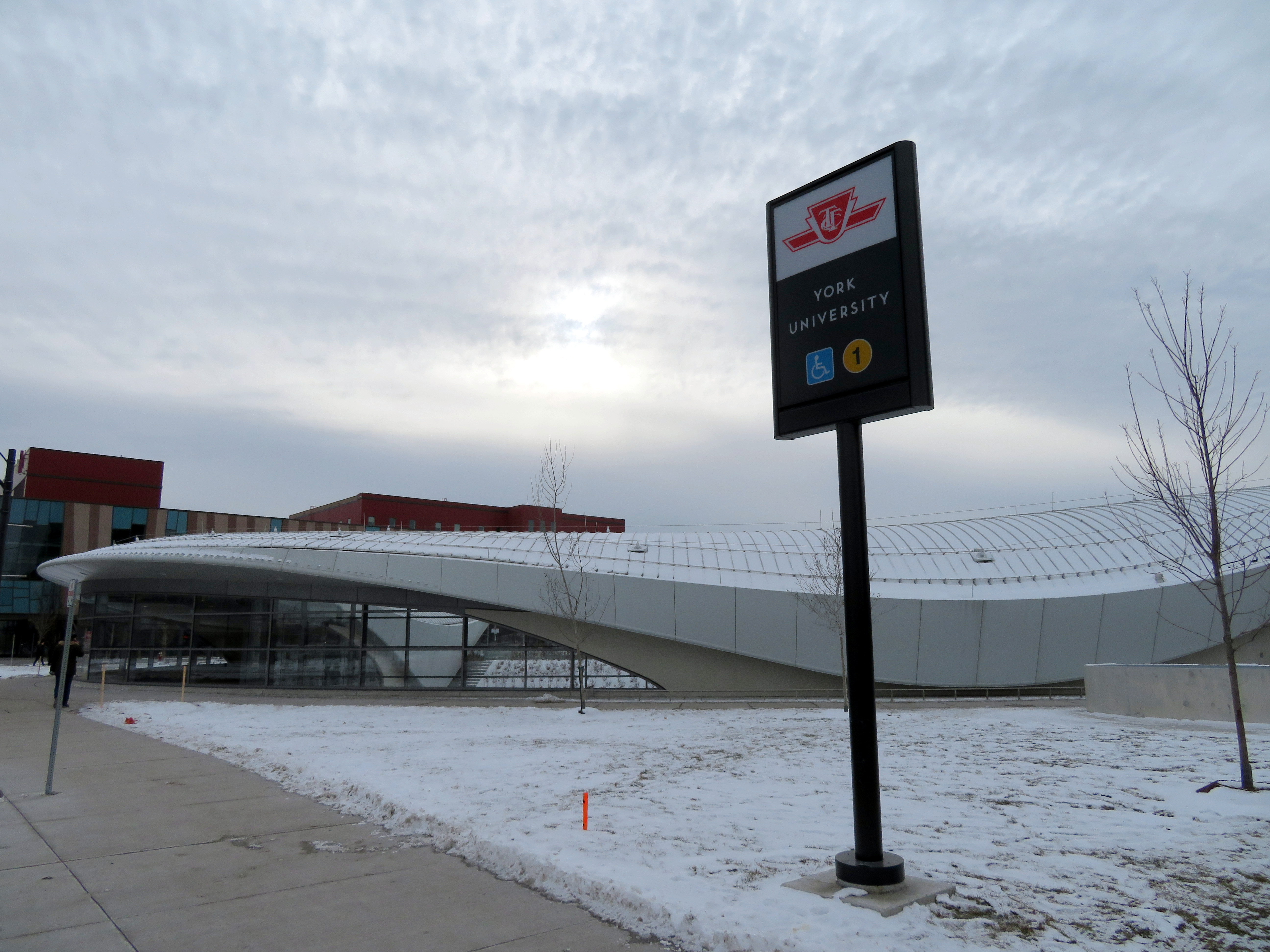
The dream is finally a reality for thousands of York University students
On Sunday, December 17, six new TTC subway stations opened, and tens of thousands of excited people crowded the new extension to York University and Vaughan (the free TTC fares, courtesy of the provincial government, might also have had something to do with it). I also took the opportunity to explore the new subway stations, and get a second sense of their layout and their ridership potential.
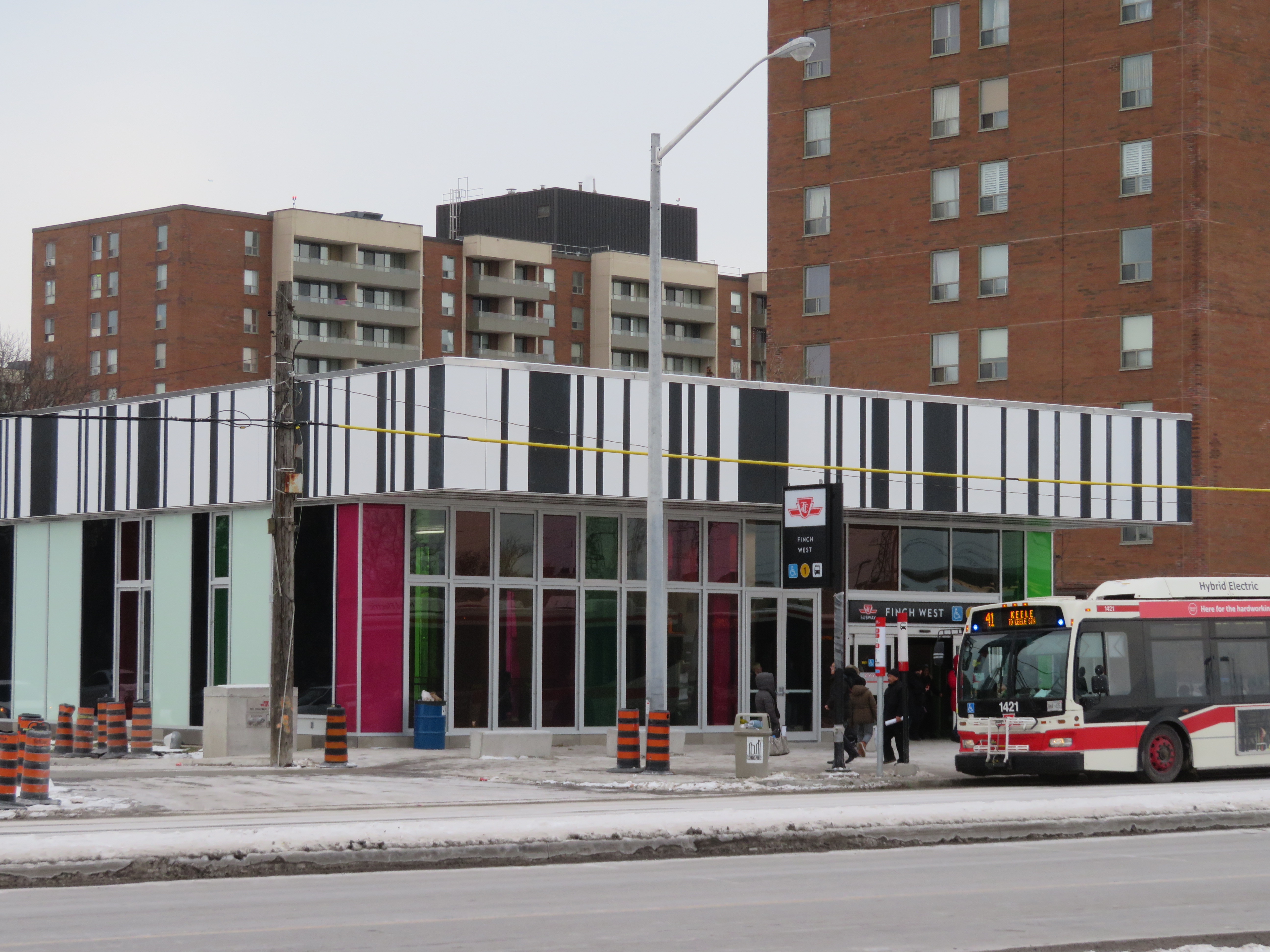
While Pioneer Village Station remains my favourite architecturally, I have found myself liking the simplicity of Finch West Station.
As I have argued here before, I expect that Finch West and Pioneer Village Station will be well used – mostly due to the TTC surface route connections. York University Station will do well during the academic term, and Vaughan Metropolitan Centre has potential — but only if York Region commits to operating a decent transit system with convenient and frequent service to the new subway. I also suggested that the main GO Transit connections — Downsview Park and Highway 407 — will see very little usage. Both stations rely on GO Transit connections, and at the time, GO did not make their plans public.
We now know that GO Transit service to Downsview Park Station will begin December 30. The Barrie Line will see new midday and evening service, and all trains will call at the new stop. Existing rush hour trains will also continue to stop at York University Station. All GO Transit buses on Highway 407 that terminate on the York University campus will also continue to do so, instead of taking full use of the new bus terminal at Highway 407 Station. (Only GO bus routes 25F, 46, 47, 47F, 48, 48B and 48F, along with route 40, will call at the fancy new terminal, adding up to 10 minutes to existing travel times.)
I predict that GO Transit will abandon York University Station and direct all its bus services to Highway 407 Station after the end of the 2017-2018 academic year, and after the provincial election is over. It would not be the first time that GO Transit abandoned one of its railway stations, either. In 1969, train service at Lorne Park was abandoned, in favour of nearby Clarkson.
The province announced a $1.50 TTC fare discount for Presto card transfers to and from GO Transit and UP Express in October, to take effect January 7, 2018. But without further fare integration for transfers to and from York University, students and staff who currently arrive on campus directly might have to get used to paying an additional $3.00 a day. But at least Highway 407 Station will be useful.
In a previous post, I also explained that Pioneer Village Station was architecturally my favourite of the six new stations. That is still true. But in terms of functionality, my favourite is now Finch West.
Southbound 41 Keele bus loads in front of the new Finch West Station. Note the nearby apartment buildings.
Finch West Station, like Pioneer Village, was designed by aLL Design, a global firm led by Will Alsop. The various tile patterns used in the design are a bit jarring, but to me, they recall those used in older TTC stations in North York.
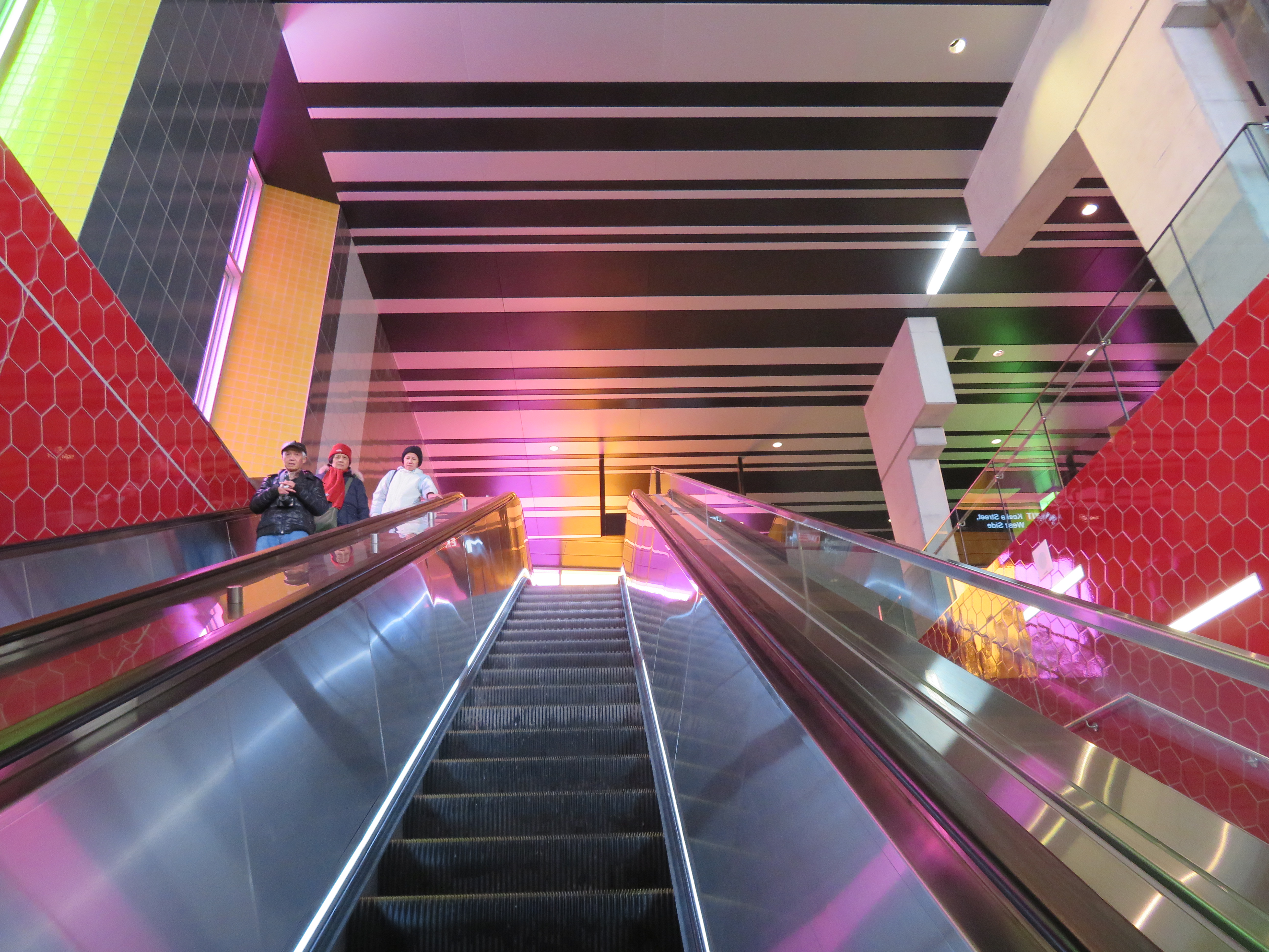
Ascending the escalator at Finch West
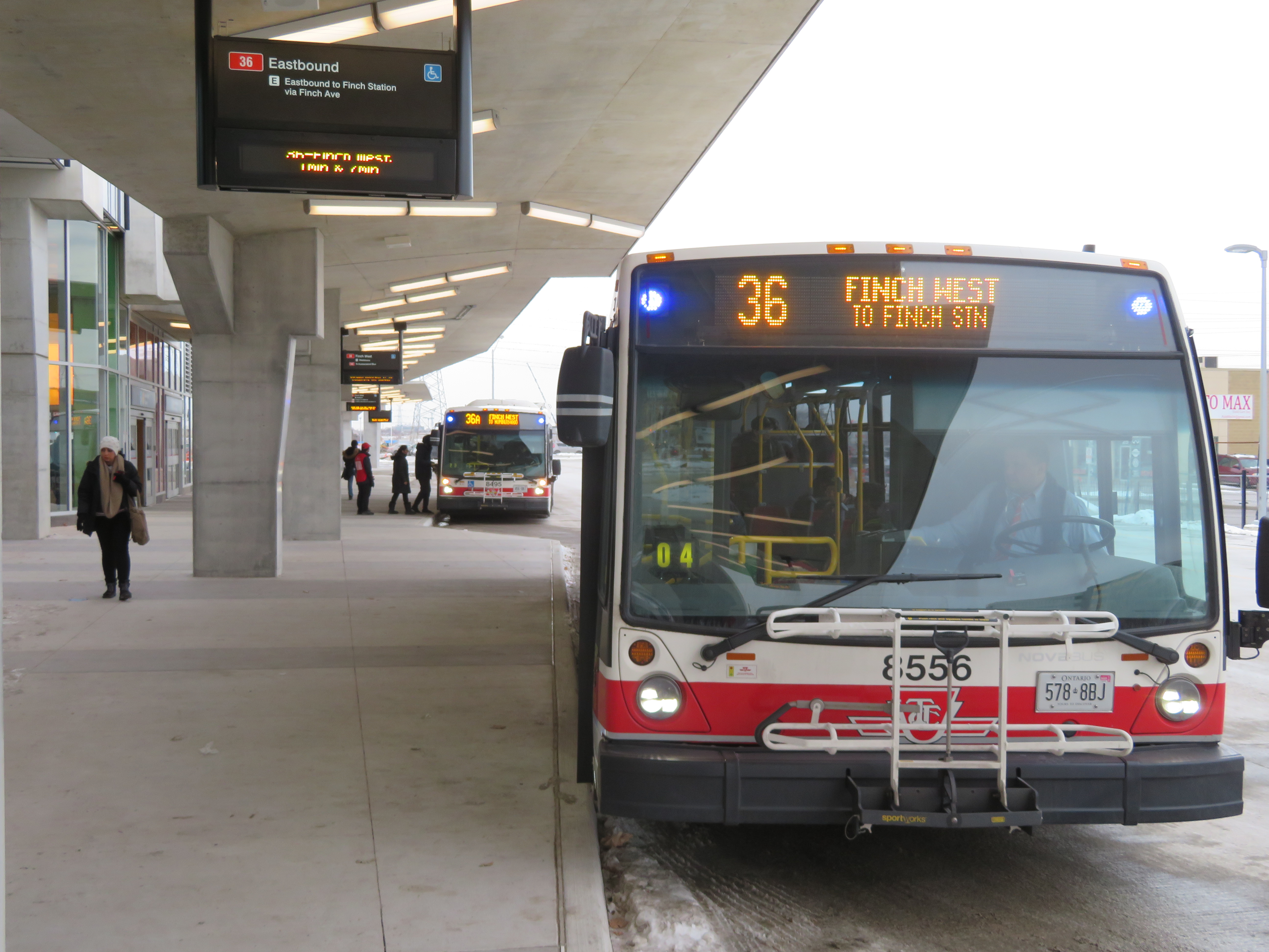
The station serves buses on routes 36 Finch West — the TTC’s third busiest surface route in 2016 — along with Route 41 Keele, 107 St. Regis, and 199B Finch Rocket. Only Routes 36 and 199B enter the 3-bay bus terminal, all others (along with the 36 bus) stop on the street. This simplicity is in contrast to the Highway 407 Station terminal, which will be little-used for quite some time.
Route 36 serves neighbourhoods such as Jane-Finch and Rexdale. These large, lower-income communities of Toronto will benefit from a much shorter ride to the subway.
Simple new TTC bus terminal at Finch West Station
In 2022, the Finch West LRT is scheduled to open, connecting Finch West Station with Humber College. On the mezzanine level, a temporary wall, as seen in the photo below, can be knocked out for a passage to a yet-to-be-built underground LRT station. Major construction is scheduled to begin in 2018.
Looking towards the temporary wall that will lead to the Finch West LRT
Finch West might not be the most stunning of all the new stations that opened on the Line 1 extension, but it might be the most useful and the most functional. In design, and in function, Finch West is a throwback, recalling a simpler time in TTC subway construction.
On Saturday, October 28, the Toronto Transit Commission (TTC) held open houses at three of the six new subway stations set to open on December 17, 2017 when the Line 1 subway is extended to York University and Vaughan. It was a fun afternoon with friends, checking out the architecture and the layout of Vaughan Metropolitan Centre,* Highway 407, and Pioneer Village Stations.
Some of the station architecture was stunning, and I came away feeling much less skeptical about Vaughan’s commitment to building a new urban district around its station. Most stations along the subway corridor will be well-used. However, I remain critical about the issue of transfers between transit agencies, and the usefulness of at least one station.


 SmartTrack map from the 2014 John Tory campaign
 Canada Line in Richmond, British Columbia
 Replica of Toronto Railway Company streetcar #327 operates at the Halton County Radial Railway museum, with the unique glass bulbs visible below the metal “Belt Line” sign. Photo taken June 2012
 TTC PCC Streetcar #4549 on Queen Street West in September 2018
 CLRV streetcar on Queen Street East, with two blue-green advance lights above the back-lit destination sign.
  Nova articulated bus with orange LED destination sign and blue LED advance lights indicating it is an accessible vehicle
 ION LRT vehicle undergoing testing in Kitchener, February 2019
 Vaughan Metropolitan Centre Station