Author: Sean Marshall

  • Trekking across Northern Ontario

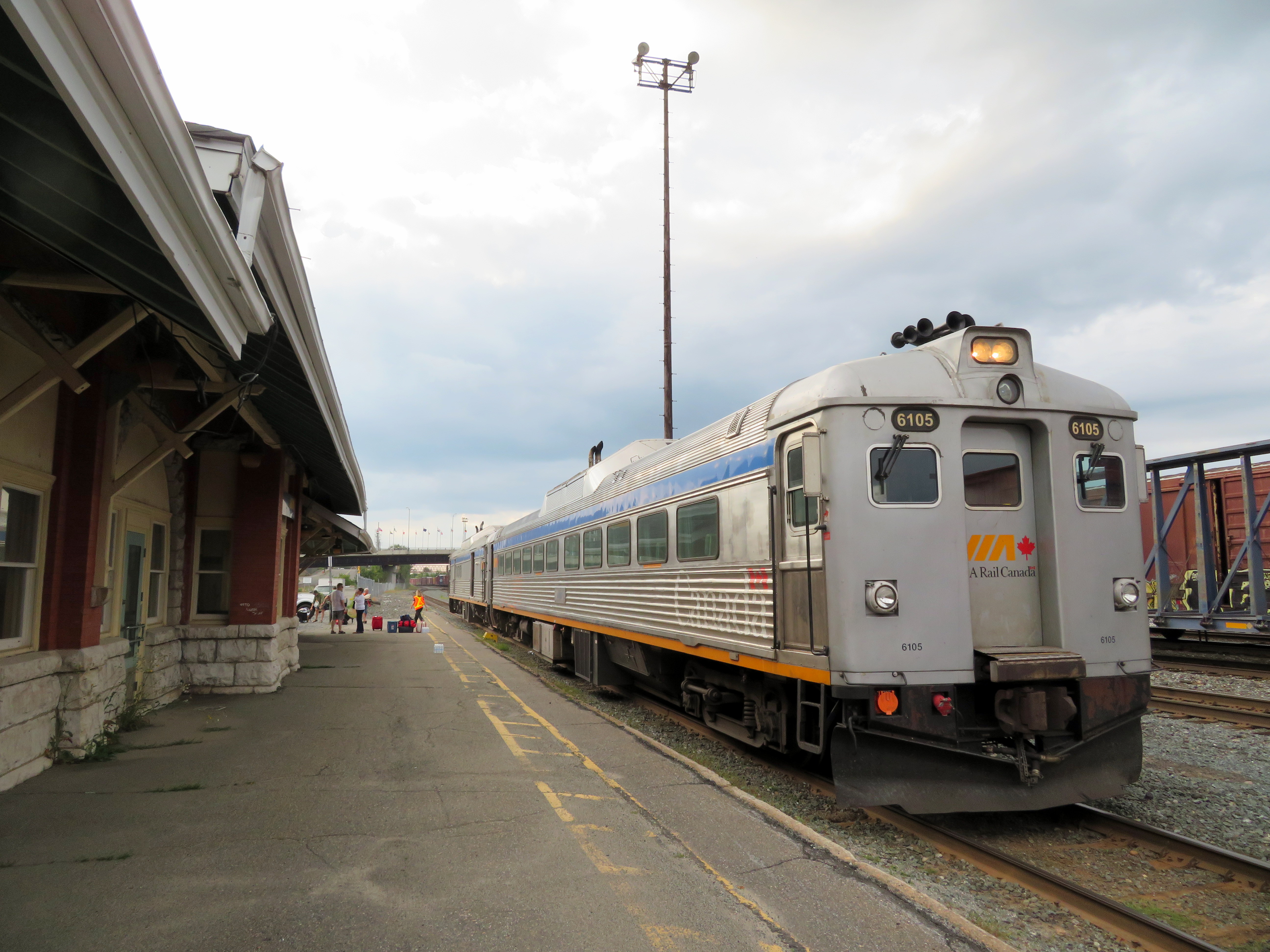
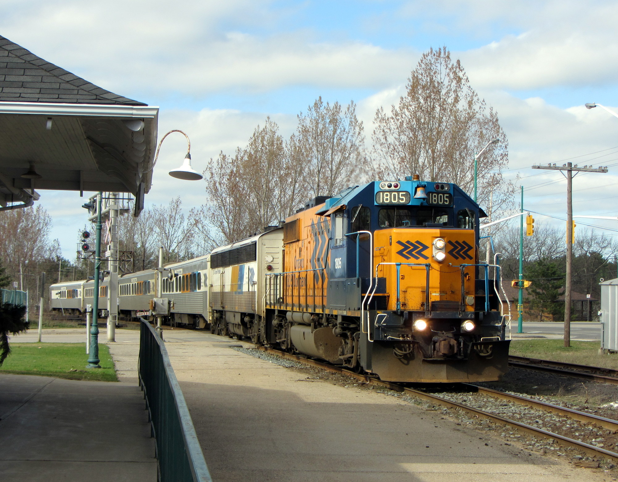
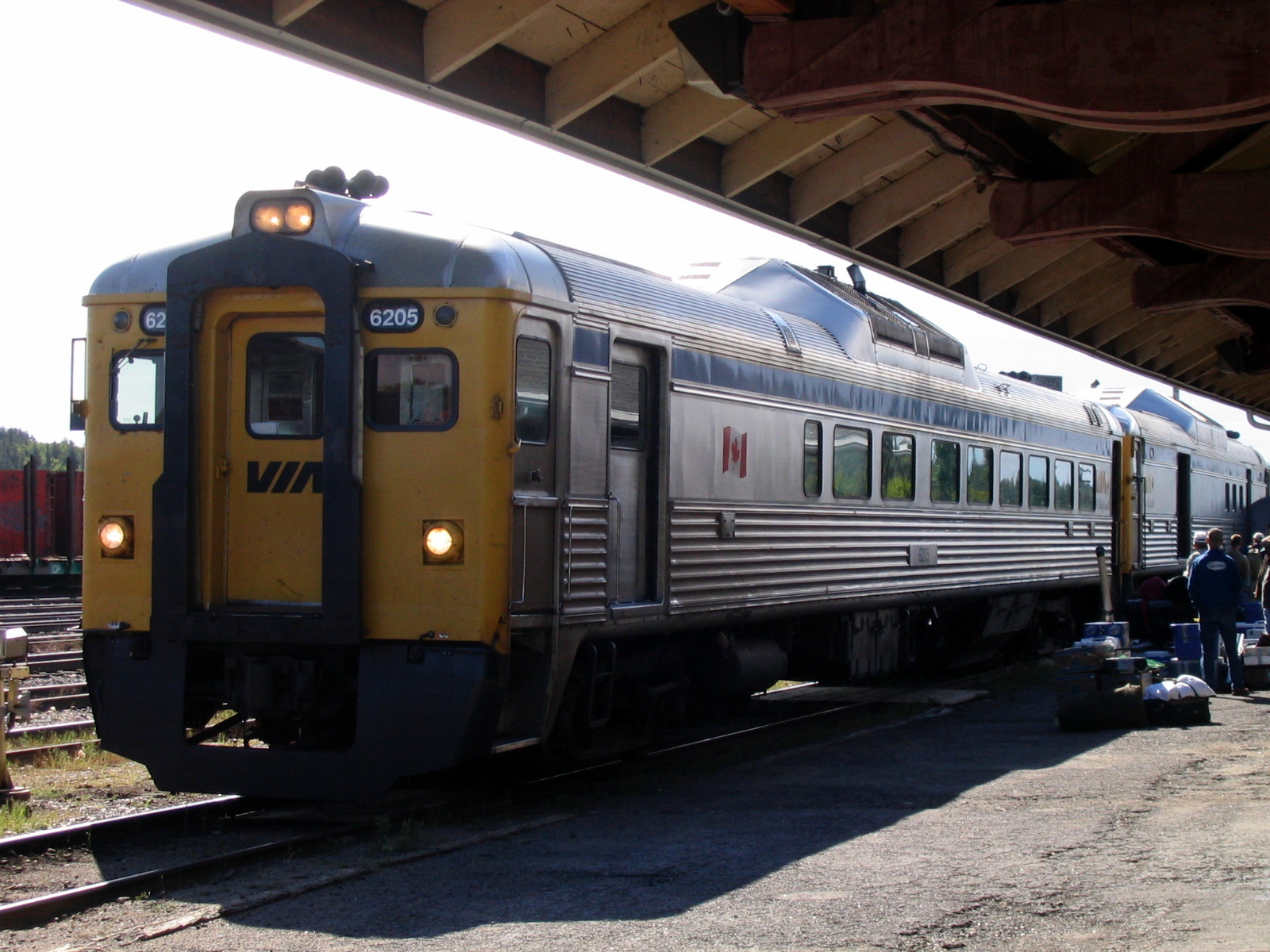
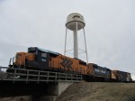
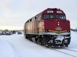
    IMG_2761-001.JPGVIA RDC train about to depart Sudbury for White River

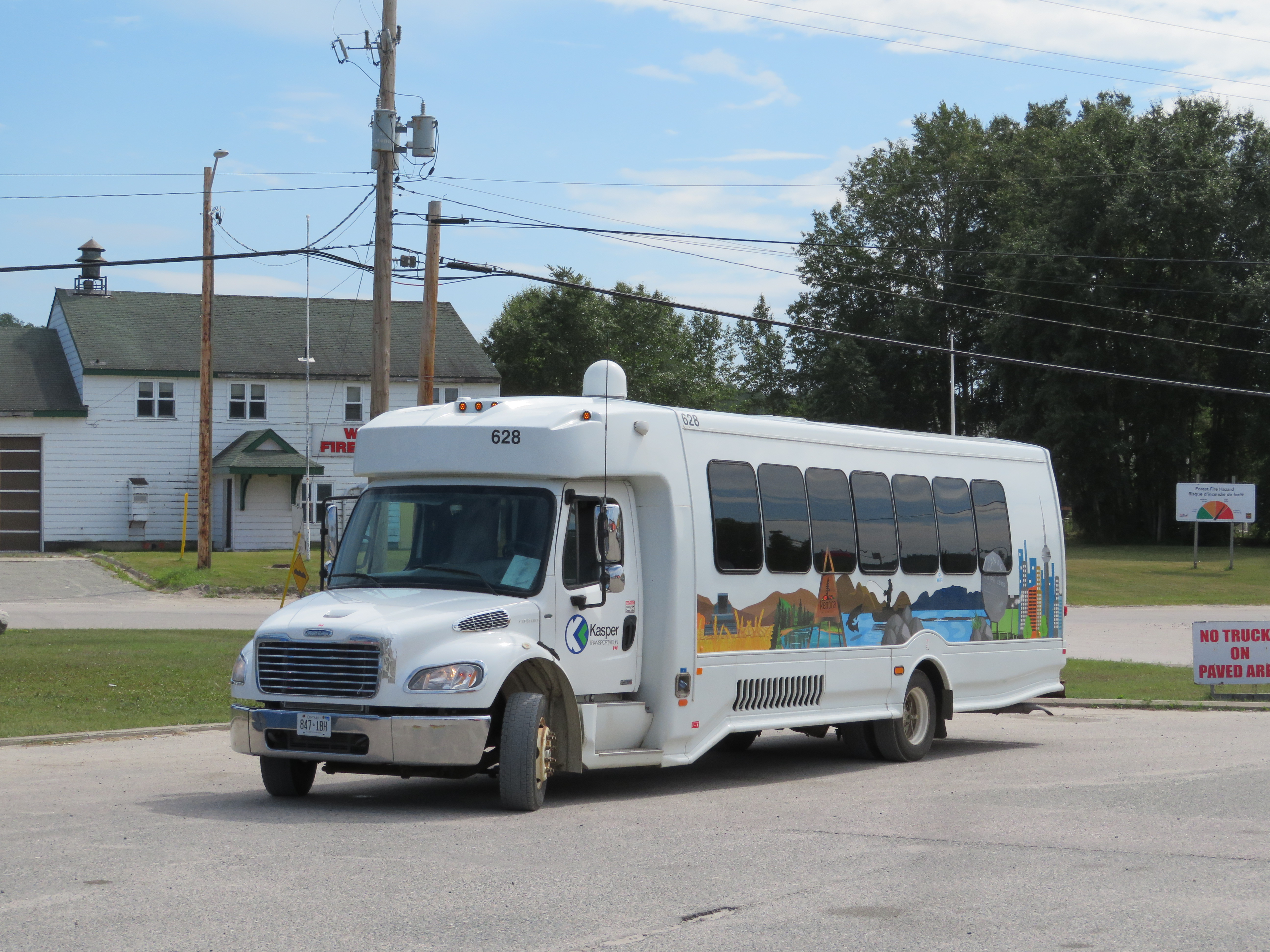
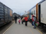
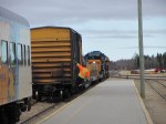
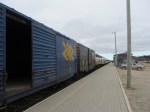
    Last month, I embarked on a journey from Toronto to Thunder Bay, a distance of over 1,300 kilometres. My journey took me nearly three days as I opted to travel by bus and rail, rather than by car or by air. Though I had to take three separate trips to accomplish it (an Ontario Northland bus, a VIA Rail RDC train, and a Kasper Transportation mini-bus), it was a very interesting trip.

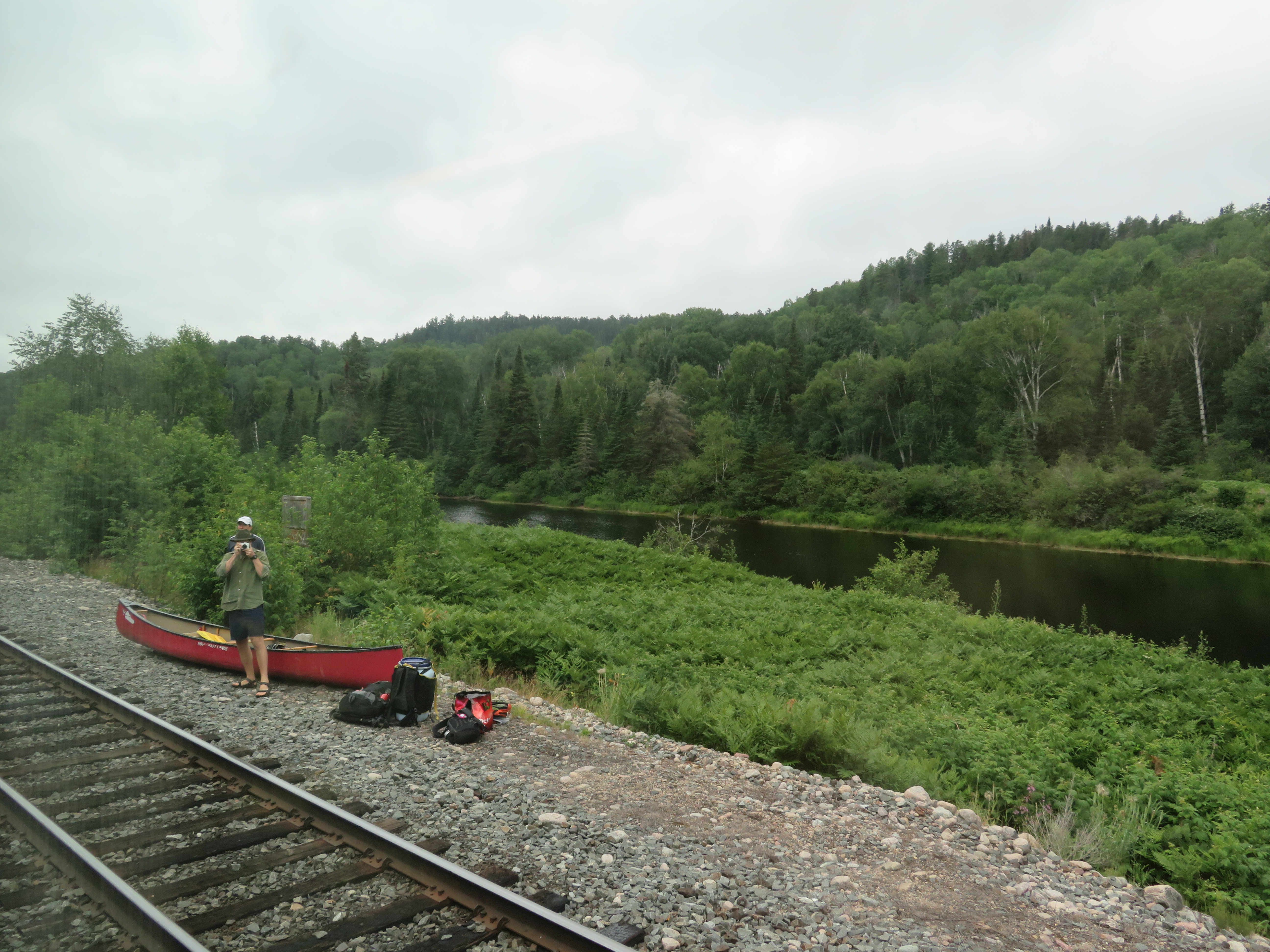
    IMG_2768.JPGUnloading a canoe from the RDC on the Spanish River, northwest of Sudbury

    Once I arrived in Thunder Bay, I rented a car. Though I know Northeastern Ontario quite well, I had yet to visit Northwestern Ontario (a brief stop in Sioux Lookout on VIA’s Canadian notwithstanding). There are several beautiful provincial parks within a short drive of Thunder Bay, and the city itself has a few interesting sights. Highway 17 along the Lake Superior shoreline is probably Ontario’s most scenic drive.

    Travelling without a car has its challenges, especially as the traveler is at the mercy of sudden schedule changes, traffic delays, and other hiccups, but it is still possible to get across Northern Ontario even after Greyhound’s withdrawal from Western Canada and Northern Ontario last year.

    I wrote about my experience for TVO.

    KasperBusWhiteRiver.JPGKasper Transporation bus at White River – filling the gap left by Greyhound

  • The dangers of Don Mills Road

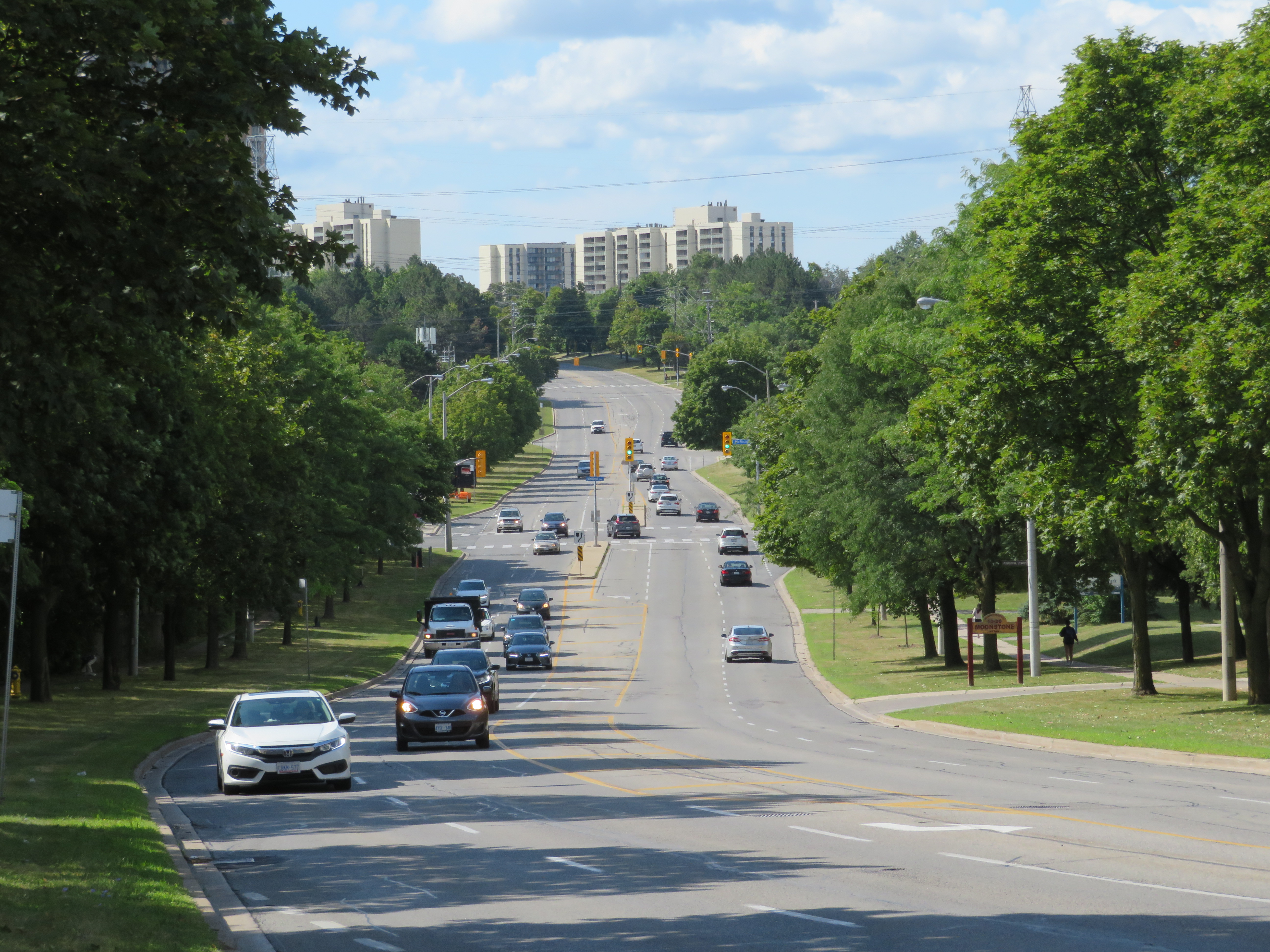
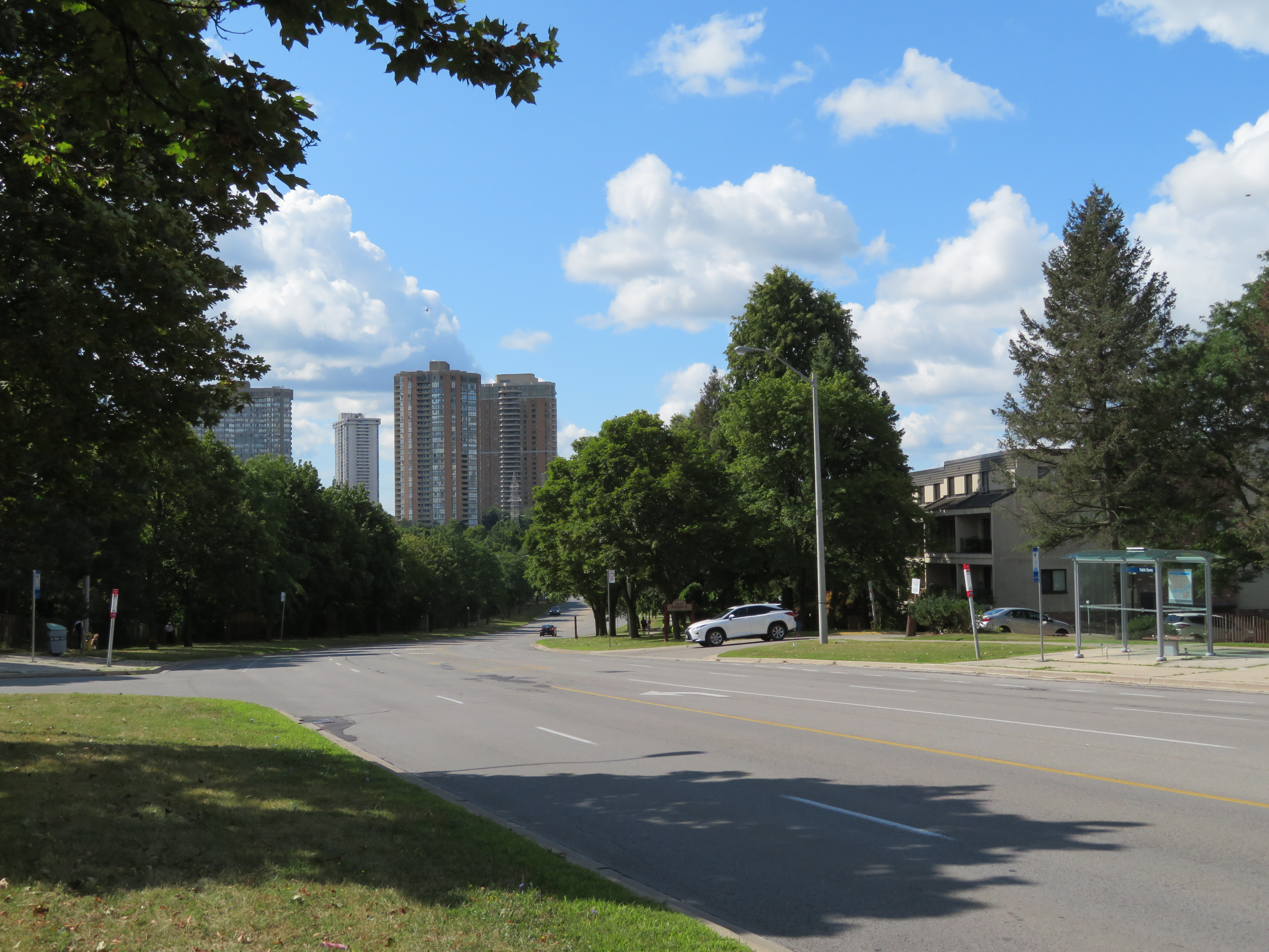
    IMG_3664.JPGDon Mills Road looking south towards McNicoll Avenue, North York

    On the afternoon of Tuesday July 16, a woman was struck and killed by the driver of a left-turning waste collection truck as she was crossing the street. The tragedy happened at the corner of Cliffwood Road and Barkwood Crescent, in a quiet North York residential neighbourhood. The 68-year old was the eighteenth pedestrian killed on Toronto’s streets in 2019. 

    Cliffwood Road is a typical suburban residential street in northeast North York, just south of the municipal boundary at Steeles Avenue. It meets Don Mills Road twice; at the north end, there are traffic signals, with a middle school and a plaza on the east side of the four-way intersection. On the south side, Cliffwood meets Don Mills at a three-way intersection, protected only by a a stop sign facing Cliffwood. As Cliffwood loops back on itself and has no direct connections to Steeles Avenue, it is not a useful short-cut for speeding motorists unlike many other suburban streets.

    What, in particular, contributed to this deadly crash? I paid a visit to the area to find out.

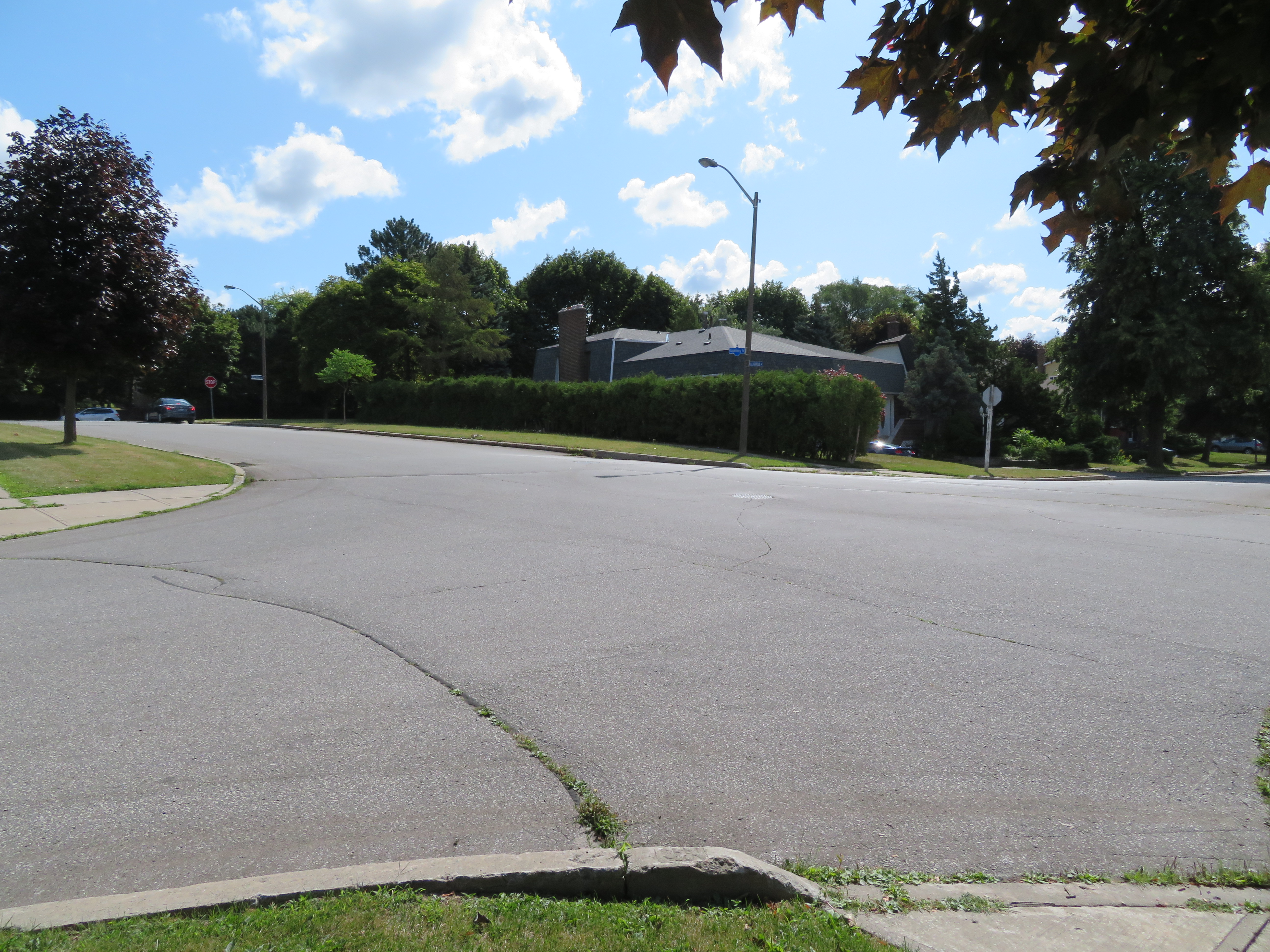
    IMG_3647.JPGThe intersection of Cliffwood Road and Barkwood Crescent, looking southeast

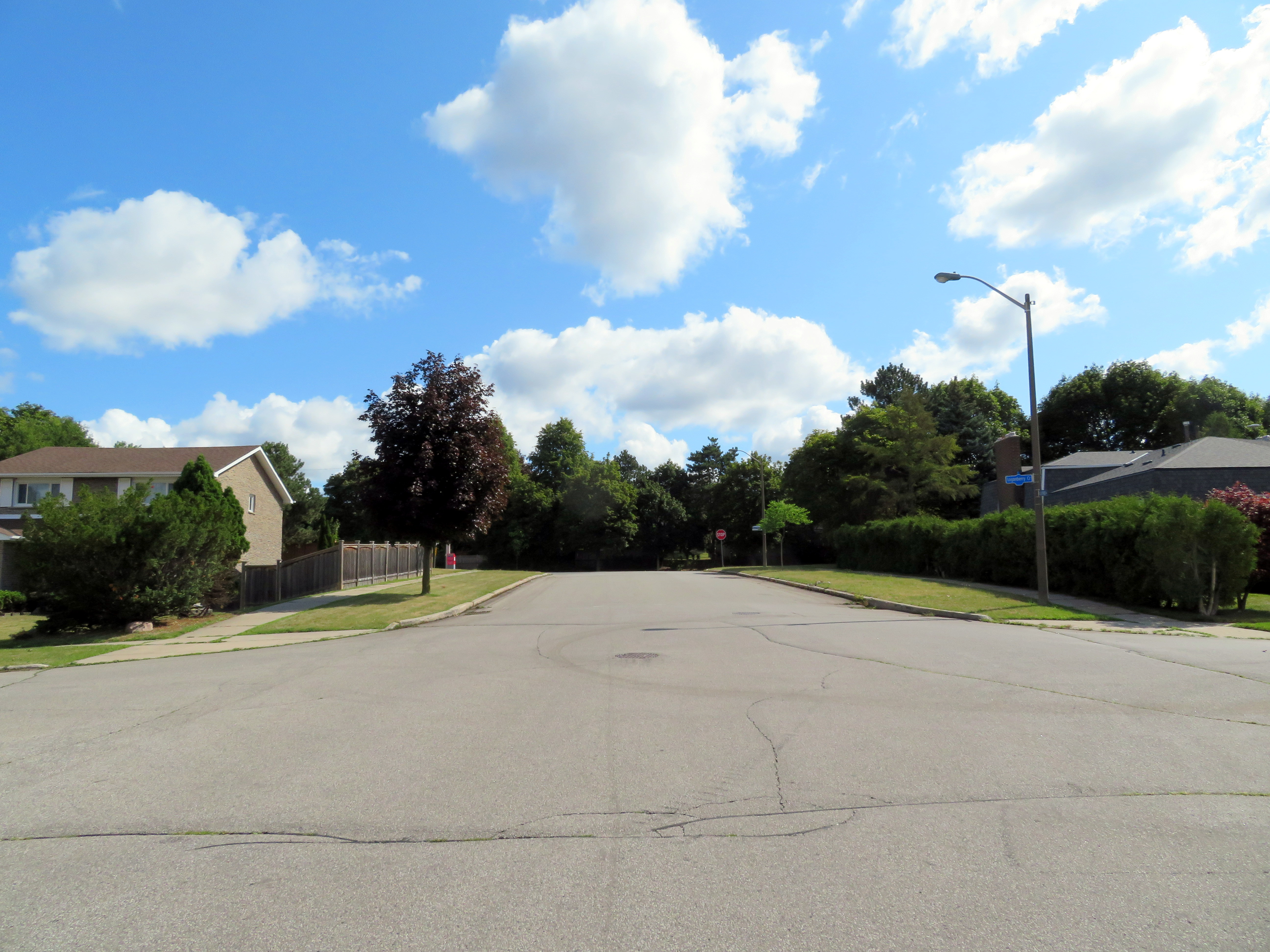
    Between Don Mills Road and Barkwood Crescent, Cliffwood Road is 12 metres wide without any lane markings or medians to separate traffic or slow vehicles turning off of busy Don Mills Road. West of Barkwood Crescent, Cliffwood Road narrows to 8.5 metres. Twelve metres is a lot of road space: Beverley Street in Downtown Toronto is the same width, but it has two driving lanes, a parking lane, and two unprotected bike lanes. The wide street width here only encourages motorists to drive fast after coming off Don Mills Road, while wide curb radii at the corners at Don Mills and at Barkwood Crescent also encourage motorists to take turns quickly.

    At Barkwood Crescent, Cliffwood Road has a speed limit of 50 km/h, the default speed limit in the City of Toronto. Closer to the schools to the north, a 40 km/h speed limit is posted, but there are no physical measures to slow down cars and trucks. Cliffwood Road, like so many other suburban streets, was built for speed, and not for local residents on foot.

    IMG_3648-001An unnecessarily large intersection at Cliffwood Road and Barkwood Crescent, and a wide approach to Don Mills Road

    I also noted the condition of nearby Don Mills Road, a busy thoroughfare connecting office parks in Richmond Hill and Markham with Fairview Mall to the south. Don Mills is a busy bus corridor, with both TTC and YRT buses providing frequent weekday service.

    Despite the frequent bus service, Don Mills Road is hostile to pedestrians and transit users. At the southern intersection of Don Mills and Cliffwood Roads, the nearest crosswalk is nearly 300 metres to the north, or 600 metres to the south. Understandably, most transit users will choose to cross at the nearest TTC stop, rather than walk an extra five or ten minutes twice a day, especially in inclement weather.

    In late August, a pedestrian was crossing Sheppard Avenue East in Scarborough to get to a nearby TTC bus stop when she was fatally struck by a motorist who then fled the scene. That stretch of Sheppard Avenue is flat and straight.

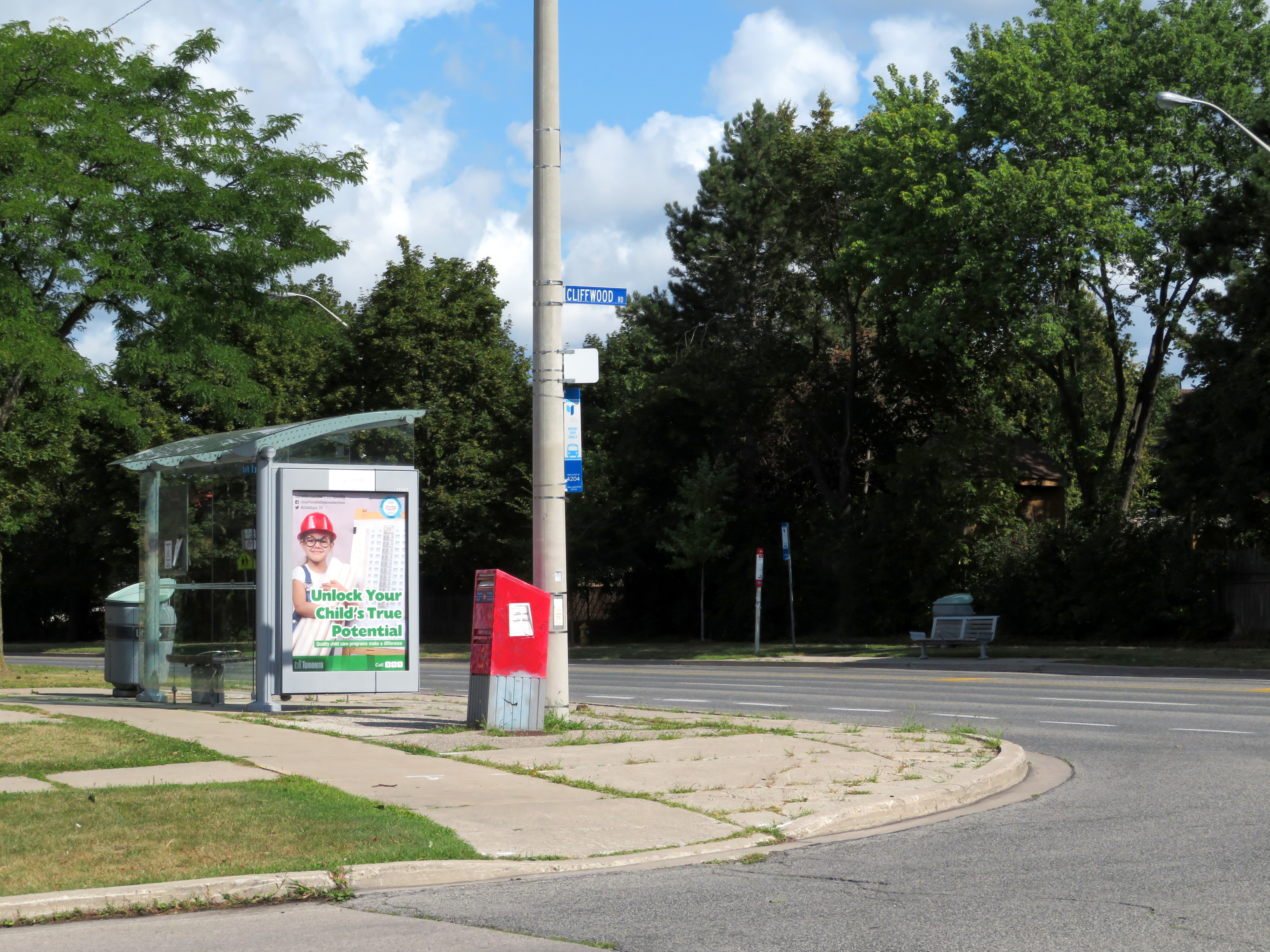
    IMG_3652-001The corner of Cliffwood and Don Mills Roads with bus stops

    Most area bus stops are adjacent to bus bays. Bus bays are designed to get buses out of the way of traffic while they are dropping off and picking up passengers. Once the bus is ready to leave the bus stop, it must then merge back into traffic. In addition, many of these bus bays double as right-turn lanes, increasing the distance a pedestrian must cross the street.

    Furthermore, Don Mills has several hills and curves north of Finch Avenue that makes this especially dangerous because of low visibility, making it difficult to judge how far or how fast traffic may be coming. There are five lanes plus bus bays/right turn lanes; the centre lane alternates between serving as a left turn lane or a striped buffer space between northbound and southbound traffic, which further encourages high speeds.

    IMG_3663-001.JPGBus stop at Don Mills Road and Mogul Drive, illustrating the high-speed curves

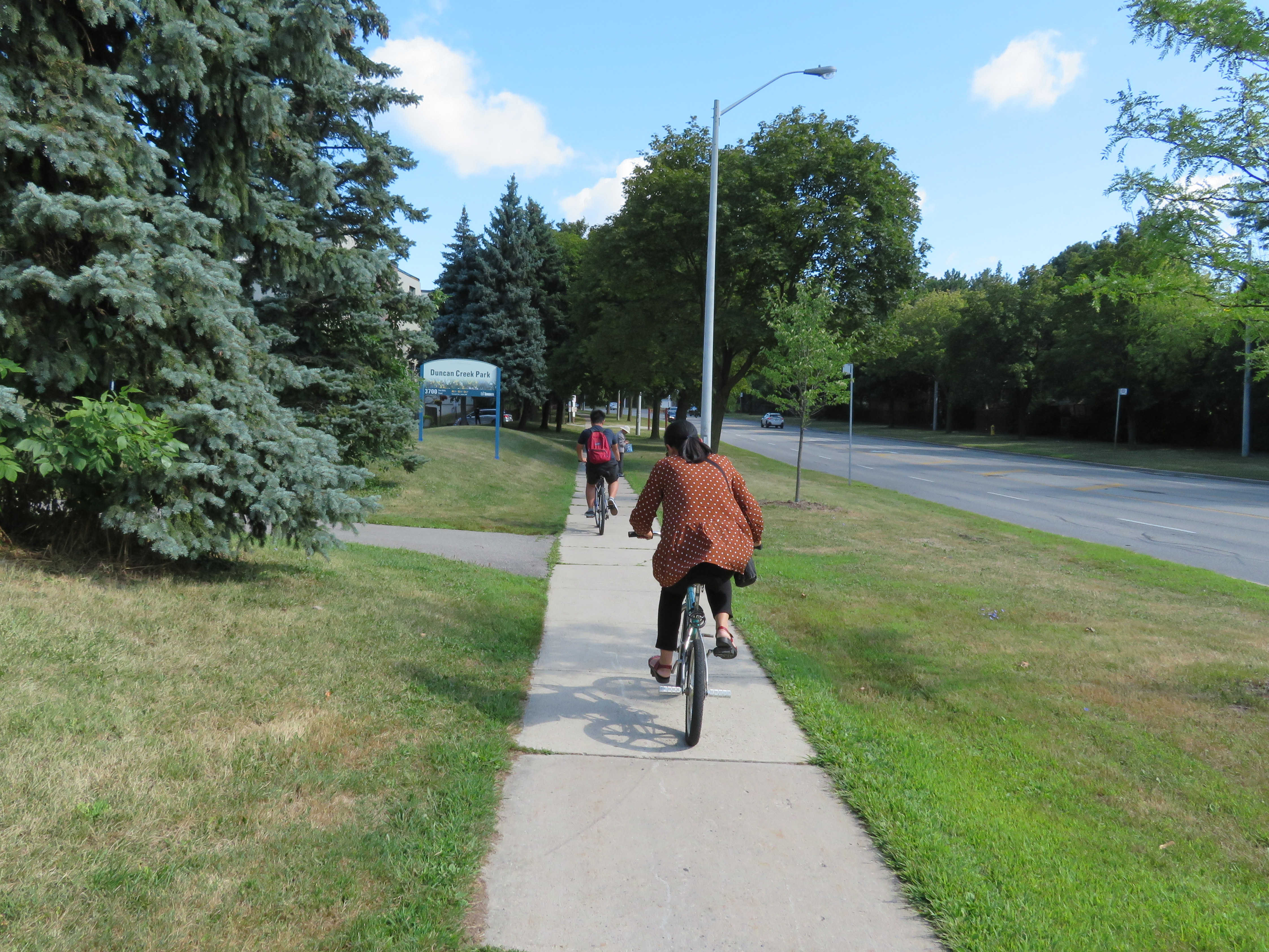
    It is no wonder too that cyclists choose the sidewalks. Despite the wide right-of-way with generous boulevards between the backyard fences and the curbs, no though has been made to improve cycling infrastructure in this part of Toronto. Separated bike lanes or a multi-use path, similar to those on Eglinton Avenue in Etobicoke, or in Peel Region, would make sense here, and along other suburban arterials.

    Cross-ride marking and signals at intersections would improve the safety for suburban cyclists and legitimize a common practice.

    IMG_3630-001Cyclists take the sidewalk on Don Mills Road

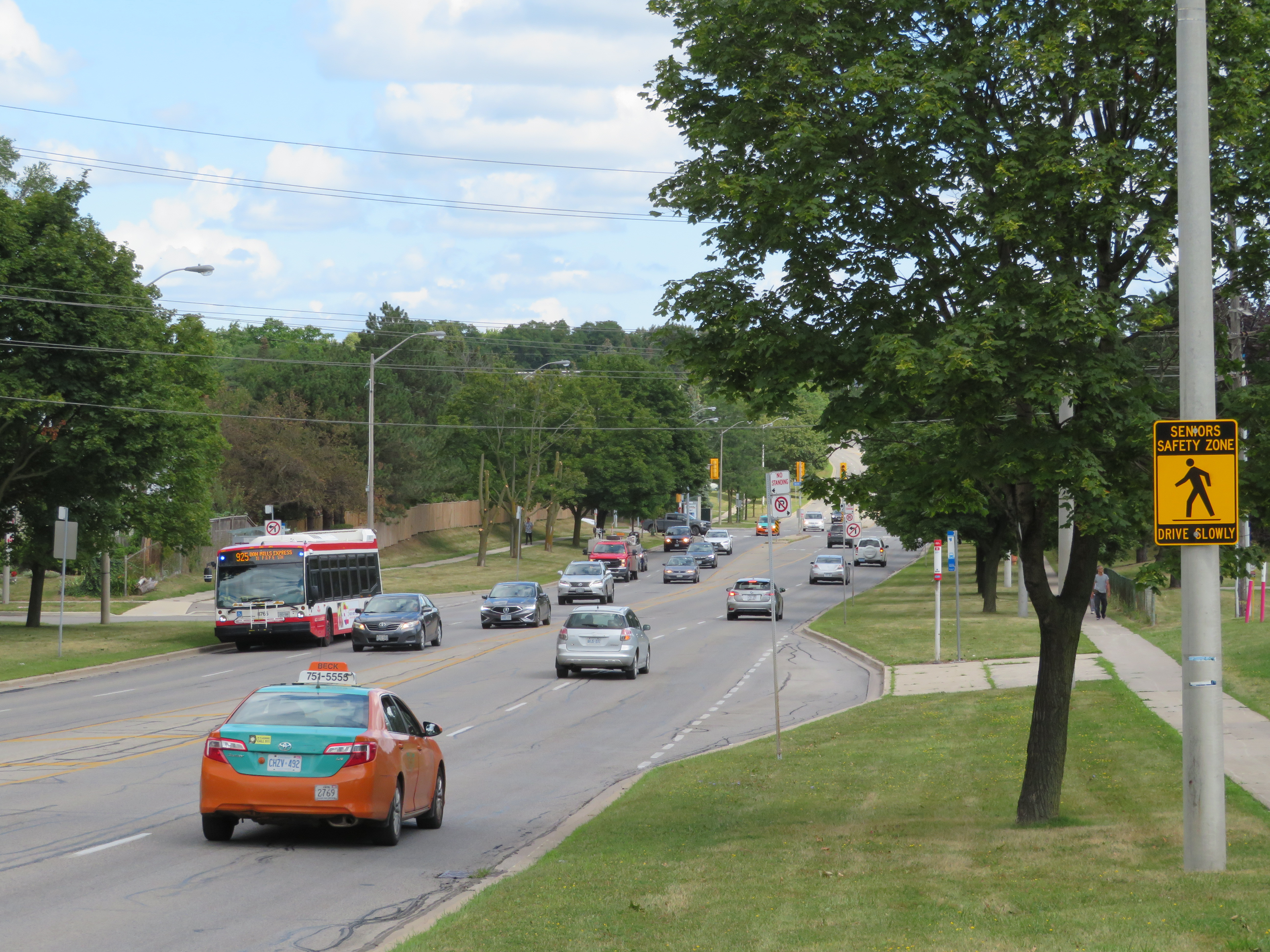
    At the end of my tour of upper Don Mills Road, I could not help but notice I was walking in a signed “Seniors Safety Zone.” As with Eglinton Avenue East in Scarborough, signs were put up but no measures were put in place to slow motorists down, and there was no sign of police enforcement of the posted limit either.

    IMG_3684-001.JPG“Seniors Safety Zone” – note the bus bay behind the sign

    There are a few things that can be done in Toronto’s suburbs to improve the safety of vulnerable road users (pedestrians and cyclists) and reduce the incidence and severity of crashes when they do happen. The installation of safer pedestrian crossings, such as traffic signals would reduce the distance required to get to a TTC stop safely. Bus bays should be eliminated with every road reconstruction project, as they do not benefit transit riders and encourage fast-moving traffic. Finally, residential streets should be narrowed, especially at intersections to slow motorists down, reduce the time a pedestrian is in the street while crossing, and improve their visibility.

    Finally, wide multi-use paths along suburban corridors like Don Mills Road would help promote active transportation and reduce conflicts between pedestrians and cyclists.

  • Dysfunction junction: the Union Station malfunction

    IMG_3583-001.JPG
    Looking west to Union Station, August 2019

    Last year, the City of Toronto hastily installed Jersey barriers in front of Union Station. This was a response to a tragic criminal act on Yonge Street in North York on April 23, 2018. A single individual drove a rented cargo van down the busy sidewalk, killing 10 and injuring 16 more before he was apprehended by police. As one of Toronto’s busiest pedestrian areas, city officials decided that the plaza in front of Union Station required special protection in the wake of the attack in North York.

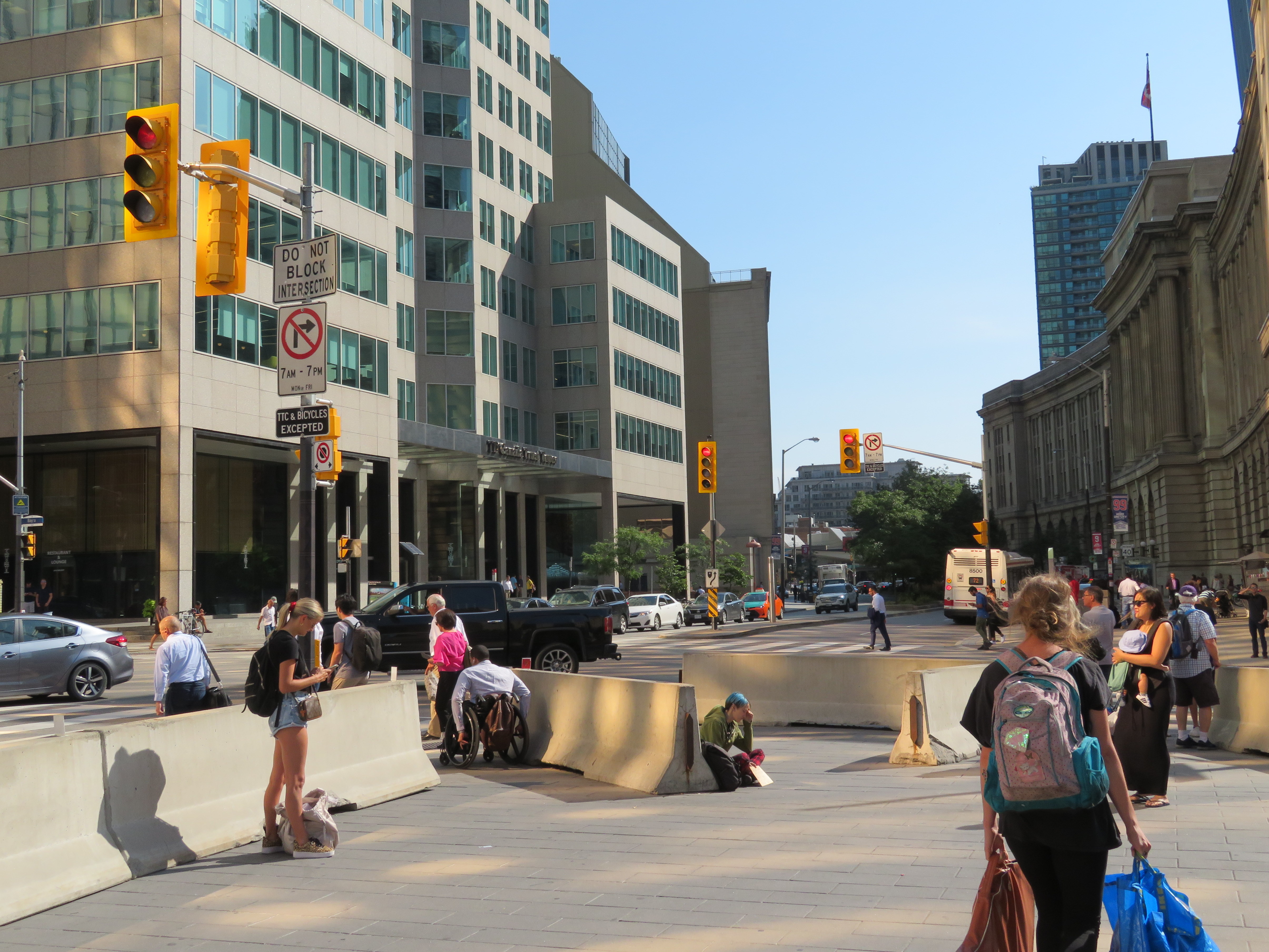
    Sixteen months later, the temporary barriers remain, needlessly restricting pedestrian flows. Temporary Jersey barriers, normally used on roadways to protect construction sites, are long and awkward for pedestrians, making it even more difficult to access some of the city’s busiest crosswalks. During peak periods, these become pinch points, making it especially difficult for anyone crossing against the flow to get through safely. Pedestrians using mobility devices, strollers, or carrying wheeled bags are especially affected.

    Afternoon rush hour crowds navigate around the Jersey barriers at Front and Bay Streets

    Union Station is adjacent to four of the ten busiest intersections in the city where pedestrian traffic was measured: Bay and King, Bay and Wellington, Front and Simcoe, and York and Wellington (traffic counts are not available for Front and Bay or Front and York/University). At Bay and Wellington, one block north of Union Station, 32,319 pedestrians crossed in an eight-hour period in 2009, compared to 16,188 cars, trucks, and buses. At York and Wellington, 32,338 pedestrians crossed in an eight-hour time period in 2017 compared to just 5,575 vehicles.

    Employment at the financial district with commuters headed to and from GO trains and the subway at Union Station, tourists, residents, and fans headed to and from games and concerts at Scotiabank Arena all contribute to the high pedestrian activity in this part of Downtown Toronto.

    IMG_3585-001.JPGJersey barriers at the southwest corner of Front and Bay Streets at Union Station

    Since the April 2018 attack, drivers have continued to mount sidewalks and crashing into bus shelters, buildings, and pedestrians. Early this morning, the driver of a stolen Range Rover crashed into a parked car on College Street, entered the sidewalk, hit a guidepost and then a transit shelter, injuring a pedestrian waiting for a streetcar. The driver then fled on foot. Other pedestrians have been injured and killed this year even when they are using signalized crosswalks correctly, and with all due care.

    At Bay and Front, despite the huge crowds of pedestrians, traffic signals favour motorists. Left turn signals make pedestrians wait longer at crossings before having to navigate around vehicles illegally blocking the crosswalk in addition to navigating the haphazardly placed Jersey barriers. The video below shows the danger of crossing this intersection.

    Motorists block the crosswalk with impunity while the left turn signal doesn’t help

    In his March 25 column in the Toronto Star, Jack “The Fixer” Lakey was not very sympathetic to complaints about the barriers, writing that “they are clearly a pain for people when foot traffic is heaviest, but we couldn’t help but think they would be effective in stopping a driver bent on another deadly attack.”

    Lakey then writes that the city is working on permanent barriers that will be “smaller, more aesthetically pleasing and easier to navigate for pedestrians,” with installation this year. It is now almost September, and nothing has been done.

    It is hard to argue against barriers in certain places to better protect pedestrians from dangerous motorists. But the Jersey barriers at Union Station are not a sufficient response. Permanent bollard-style barriers would be a definite improvement, and it is disappointing to see the city drag its heels on this.

    Meanwhile, the priority afforded to motorists at this downtown intersection, and the lack of enforcement of traffic laws makes it clear that little thought has been afforded to ensuring the safety of all road users. Dropping some road barriers on a sidewalk and calling it a day is unacceptable in a city that is supposedly committed to a Vision Zero action plan.

  • The province’s attack on conservation authorities

    34020903341_962c56e8c9_o.jpg
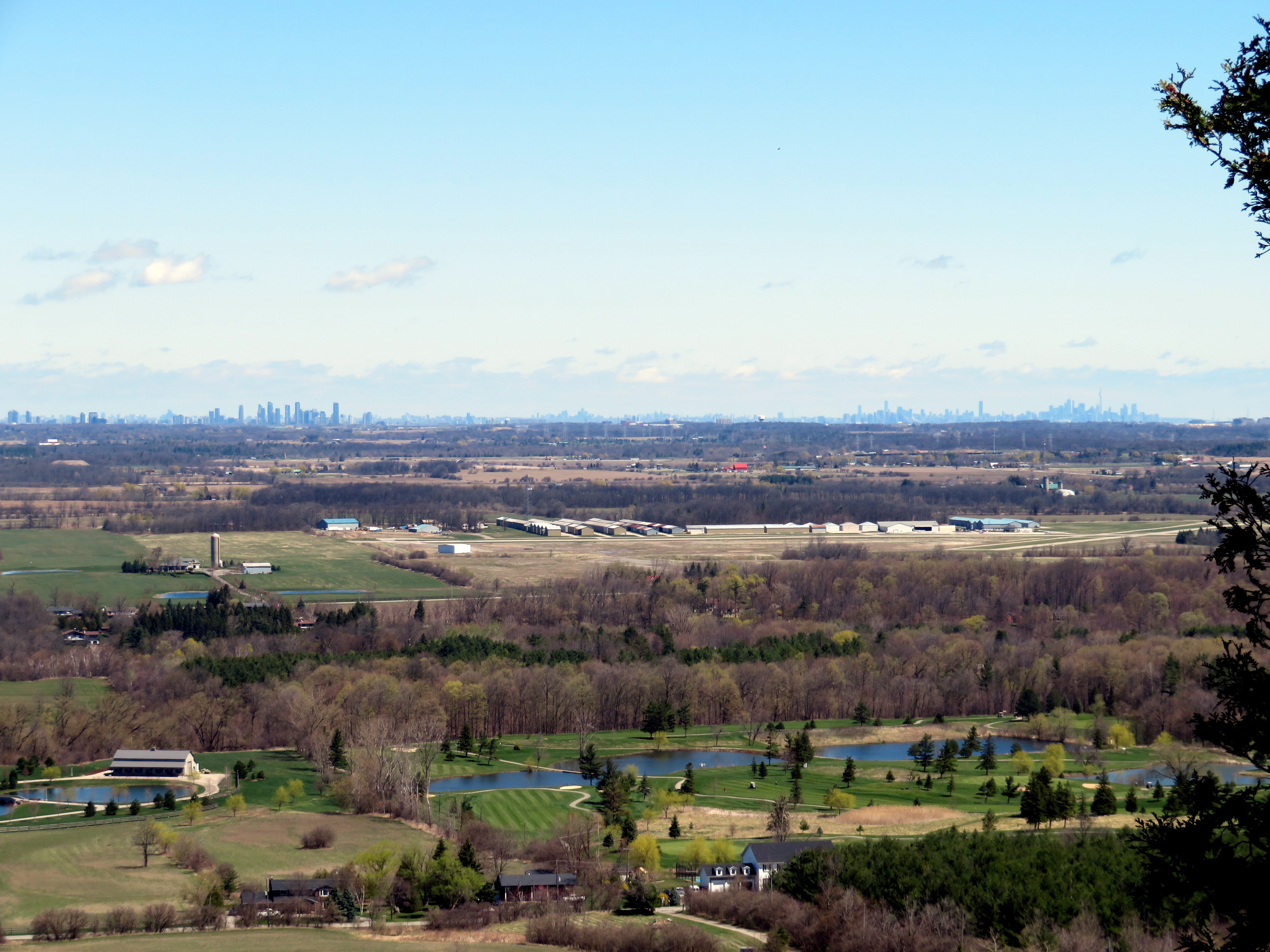
    View from the Niagara Escarpment at Mount Nemo Conservation Area towards Mississauga and Toronto

    One of Ontario’s greatest success stories has been the development of conservation authorities (CAs). The provincial Conservation Authorities Act was introduced in 1946 to provide for new joint provincial-municipal bodies protect farmland and natural features from deforestation, flooding, and erosion, organized not by political boundaries, but by watersheds. In 1954, south-central Ontario was hit by Hurricane Hazel, which caused extreme and deadly flooding. This highlighted the need for strong local authorities to coordinate flood protection strategies, including dams, floodways and reservoirs, but also land use planning, the protection of headwaters, and the naturalization of important landscapes, such as the Niagara Escarpment and Toronto’s ravines. Planners at CAs help to ensure that any new development is protected from flooding or erosion and will not negatively impact other properties or the watershed as a whole.

    Most of Ontario’s 36 CAs also operate conservation areas, open to the public as parklands. These may contain hiking trails, wildlife sanctuaries, campgrounds, lakes and reservoirs for swimming, boating, or fishing, as well as waterfalls, caves, scenic lookouts, or other unique natural features. A few conservation authorities also operate historic sites, including old mills, or even entire pioneer villages, such as Black Creek. Many CAs also hold special events, such as festivals, school tours, and even concerts.

    Many of these programs and services are incredibly important, but all are beneficial to the public. And they are under attack by the provincial government.

    Earlier this year, the province cut funding for natural hazards planning by 50 percent. Late last week, the minister for Minister of Environment, Conservation and Parks, Jeff
    Yurek, sent a letter to all CAs and their partner municipalities to begin to wind down any programs not directly related to their “core mandate.”

    Yurek commented that “over the years, conservation authorities have expanded past their core mandate into activities such as zip-lining, maple syrup festivals and photography and wedding permits.”

    One such CA, Conservation Halton, operates several conservation areas in Halton Region and the City of Hamilton.

    Kelso Conservation Area includes a ski hill, a reservoir that provides for paddle boating, fishing, and a swimming beach, and a campground. There are also outdoor movie nights. At Mountsberg Conservation Area, Conservation Halton operates a Raptor Centre, where injured birds of prey are treated and shown to the public. It also has one of those maple syrup festivals in its sugar bush.

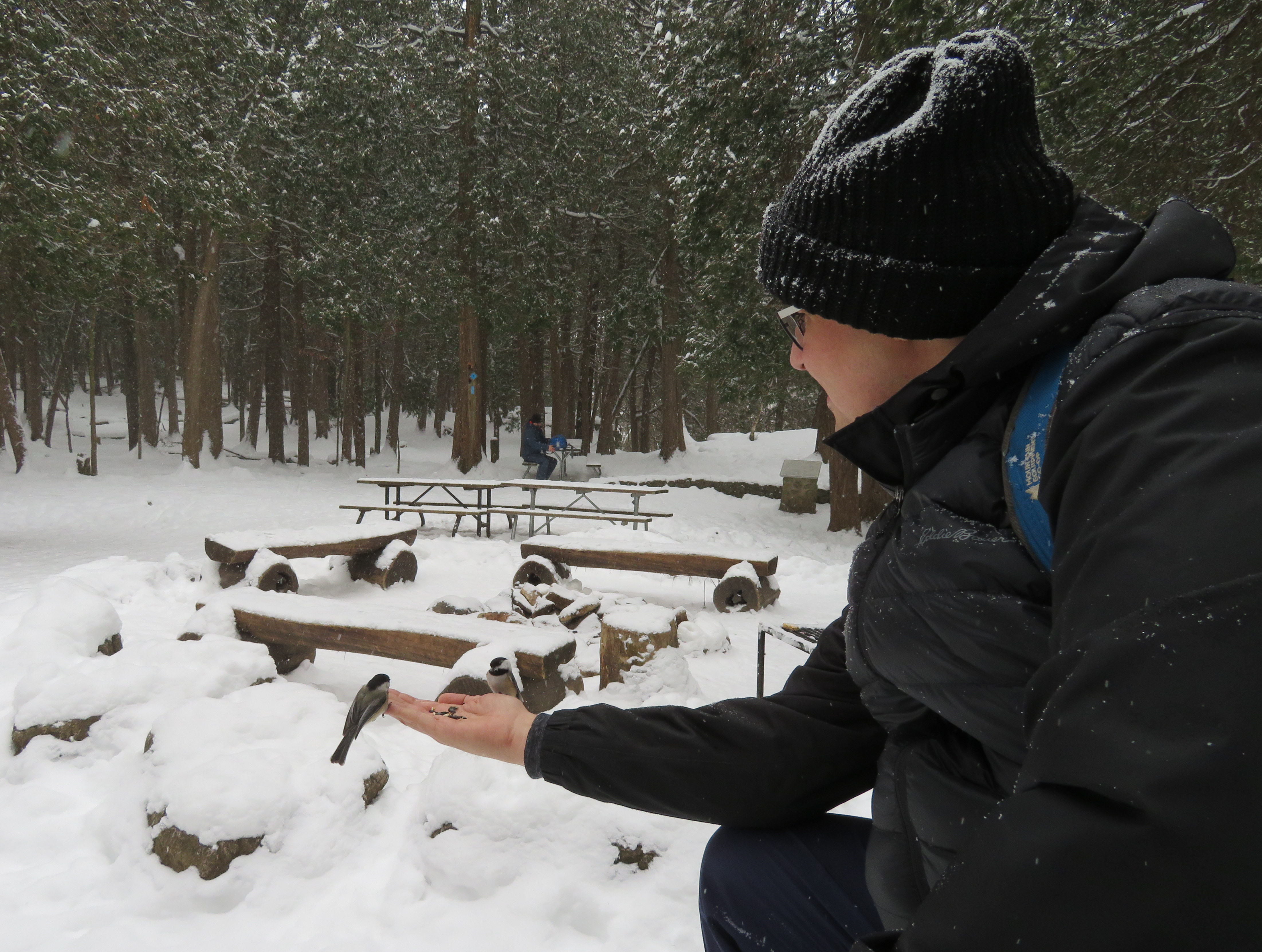
    26437885398_1405516057_o.jpgFeeding chickadees at Hilton Falls Conservation Area

    Conservation Halton has a $30 million annual budget, but it only gets $145,000 from the province for core programs. The rest of its funds come from municipalities and from park user fees, rentals, and sales. The festivals, event bookings and wedding permits help fund the important conservation work. Offering festivals and other special events also help engage the public, especially children.

    Of course, the Doug Ford-led Progressive Conservative government’s attack on conservation authorities isn’t about saving money. Instead it’s about restricting their mandate, reducing their ability to raise funds and engage the public.

    Perhaps this all has to do with the influence of the development industry. Ontario Proud, a third-party advertiser connected with the Progressive Conservatives, ran attack ads on social media and on outdoor billboards against the last Liberal government in 2016 and 2017. It was funded by the development and construction industry, with Mattamy Homes being its largest contributor. The province also weakened planning legislation and municipal power to restrict new development through Bill 108, the so-called More Homes, More Choice Act.

    If the Ford government gets its way, conservation authorities will have fewer resources to protect watersheds and natural lands and reduce the risk of the effects of climate change. Without maple syrup festivals and other “non-core” programming, there will also be less fun and reduced awareness of Ontario’s wonderful natural landscape. This isn’t about fiscal responsibility. It’s about ideology and payback.

    27035683581_ff87c274c6_o.jpgThere are plenty of developers who’d love to pave over the Greenbelt

  • Passenger trains of Northern Ontario

    6876541686_61533293ef_o.jpg
    Southbound Northlander train arriving at Gravenhurst, March 2012

    In a few weeks, I will travel from Toronto to Thunder Bay by bus and by train, stopping at cities and towns like Sudbury, Chapleau, White River, Marathon, and Schreiber. I expect to write about the experience and the challenges of getting around Northern Ontario without a car. At one time, it was possible to take just one bus or train from Toronto or Ottawa to Thunder Bay. Now, the same trip can only be done in three separate segments.

    Greyhound Canada, which once ran four daily bus trips between Toronto and Winnipeg, reduced service to just two daily trips in 2009, and then to just one trip in 2015. Greyhound pulled out completely from Western and Northern Canada in October 2018, cutting all its bus routes between Whitehorse, Vancouver, and Sudbury.

    According to the joint Canadian National/Canadian Pacific railway schedule of 1976, there were daily passenger trains connecting Montreal, Ottawa, and Toronto with North Bay, Sudbury, Thunder Bay, Timmins, and Kapuskasing. There was also a daily train between Sudbury and Sault Ste. Marie, and there were trains to Fort Frances, and several trains a week through the wilderness in Algoma District.

    Most of those trains are now gone. The CP Sudbury-Sault Ste. Marie train lasted just one more year, before being eliminated in 1977. The 1990 cuts to VIA Rail resulted in the loss of the daily Canadian through Thunder Bay, Sudbury, and North Bay, and the end of direct rail service to Timmins and Kapuskasing. The Canadian, now operating on the less scenic and less-populated CN mainline, ran just three times a week, with only a shuttle service on the most remote section of the CP route between Sudbury and White River.

    21589509683_e1c3df65b0_o
    VIA Rail RDC stopped at Cartier, Ontario on its way to White River

    In 2012, the Liberal provincial government announced the elimination of the Northlander, a daily train operated by Ontario Northland between Toronto, North Bay, and Cochrane. This decision was made with the intention of “modernizing” Ontario Northland, the provincial Crown corporation that operates freight and passenger rail and coach buses in northeastern Ontario. In 2014, the federal Conservative government cancelled the subsidy to run thrice-weekly Algoma Central Railway’s passenger train between Sault Ste. Marie and Hearst. (A popular excursion train still operates to Agawa Canyon.)

    Though I was too young to travel on my own when the devastating 1990 VIA Rail cuts were made, I was able ride the Northlander and the Algoma Central Railway passenger trains while they were still operating.

    With a friend from Calgary, I rode the Northlander from to Toronto to Cochrane and back, in May 2012. We continued to Moosonee near the shores of James Bay coast on the Polar Bear Express, which continues to operate. I made a second trip on the Northlander from Cochrane to Toronto in September 2012.

    Ontario Northland continues to operate a freight railway, scheduled coach buses, and the Polar Bear Express, a mixed train between Cochrane and Moosonee. There are no all-season roads to Moosonee, so the train remains a lifeline for the James Bay community. We also took that train in May 2012.

    In February 2014, after learning that Canadian National (owner of Algoma Central) was planning on discontinuing the local ACR passenger service, a friend and I made the trip to Sault Ste. Marie to ride the train all the way to Hearst and back. It was an especially memorable ride because of the deep snow, as well as the opportunity to take photographs from the vestibules between the rail cars. We traveled with a group of snowmobilers from Wisconsin (their Ski-Doos were in a baggage car) as well as local residents heading to their cabins.

  • The last run of the Rogers Road Streetcar

    f1526_fl0072_it0061-600x418.jpg
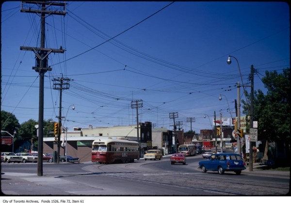
    Westbound Rogers Road Streetcar at Old Weston Road, 1972. Photograph from Toronto Archives – Fonds 1526, File 72, Item 61

    Forty-five years ago today, on Friday, July 19, 1974, the Rogers Road Streetcar made its last run. The route ran from a loop at St. Clair and Oakwood Avenue to Bicknell Loop, located on Rogers Road just west of Keele Street.

    The Toronto Transit Commission (TTC) had only recently abandoned its policy of eliminating the streetcar network in favour of buses and the planned Queen Street Subway. By the early 1970s, there were still nine streetcar lines in Toronto, along with two extra rush hour services.

    The TTC had to maintain a core fleet of streetcars to continue service until a new fleet could be delivered, and there was a shortage of streetcars in good condition. Despite the new commitment to continue operating a street railway, one more line would have to go. Rogers Road, the last of four streetcars operated for the Township (later Borough) of York, would be sacrificed. (It would not be the last streetcar route to disappear, however.)

    For nearly thirty years, service on Rogers Road was provided by trolley buses, a branch of the 63 Ossington route. While the TTC promised to extend the trolley bus to Jane Street (which was one of the reasons why York politicians supported the streetcar abandonment), it never happened. Instead, a shuttle bus route provided service along Alliance Avenue to Jane. Once the trolley bus network was scrapped in 1993, the TTC restructured several west-end routes. In 1994, the 161 Rogers Road bus finally provided the through service York had demanded for twenty years.

    In July 2014, before I started this blog, I wrote an article about the Rogers Road Streetcar for Spacing’s website, with the assistance of Steve Munro and author John F. Bromley. Five years later, it remains one of my favourite writing assignments.

    You can read the Spacing full article on here.

  • Ontario’s new ride: ION LRT opens in Kitchener-Waterloo

    1-IMG_2377.JPG

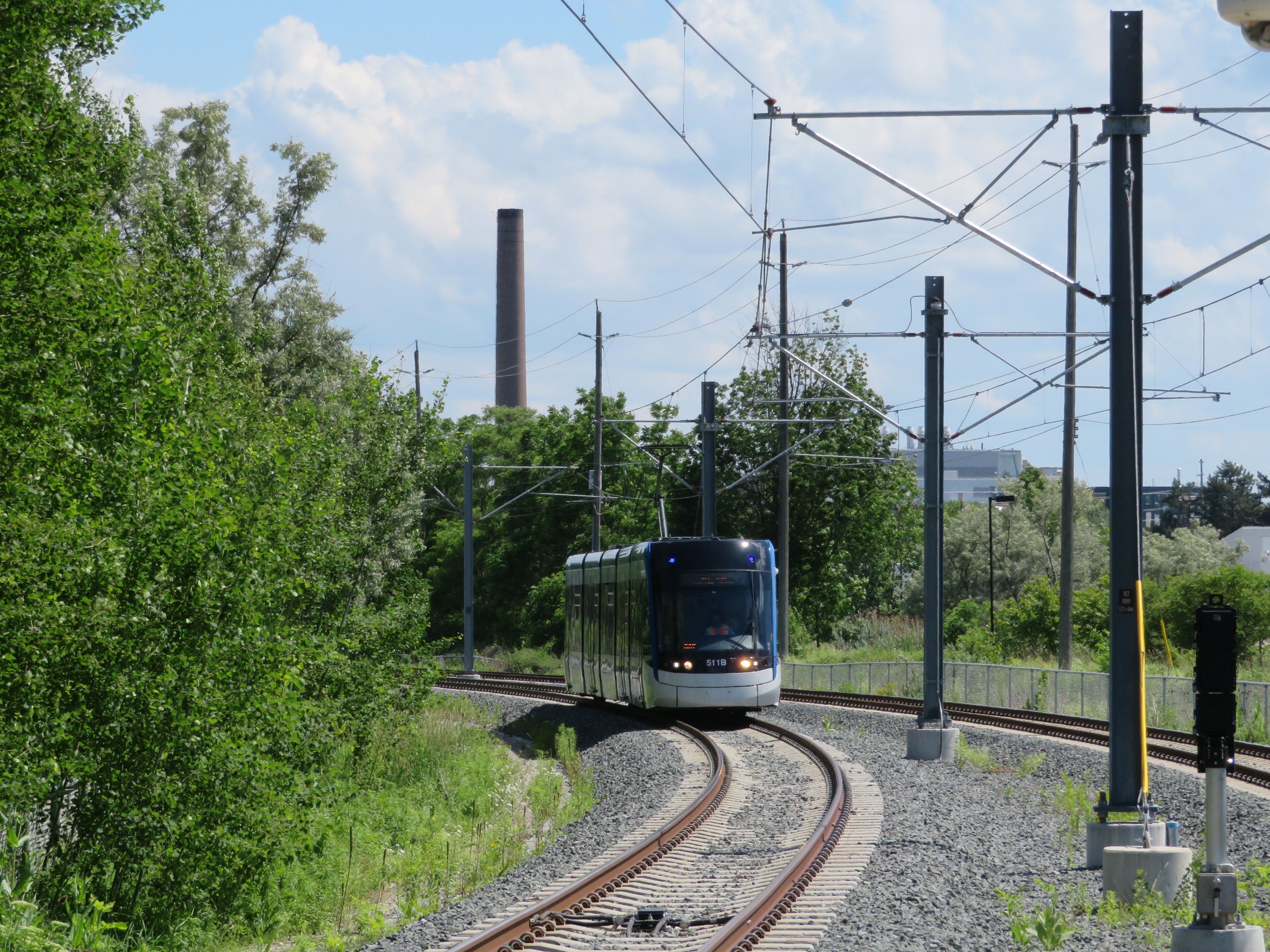
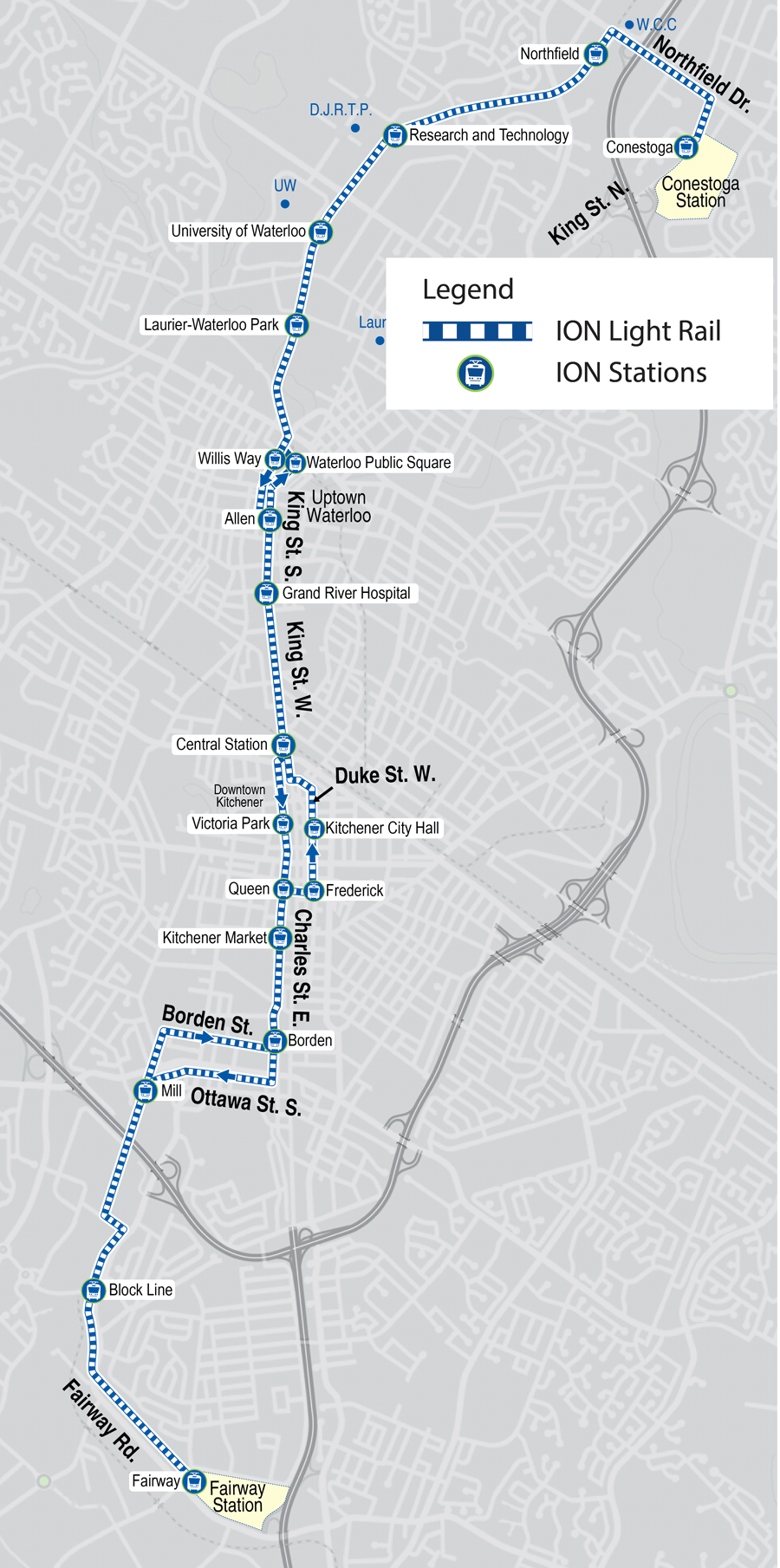
    On June 21, 2019, Ontario’s first modern light rail transit (LRT) system opened to the public. The launch of ION in Kitchener-Waterloo represents an important milestone for both the region and for the province as a whole: additional light rail systems in Ottawa and Toronto will open in the next few years, while other systems are planned for Hamilton and Mississauga-Brampton.

    There are several things that make ION particularly remarkable.

    Kitchener-Waterloo’s population is much smaller than other cities that have adopted rail transit in Canada and the United States. In 2016, the combined population of the cities of Kitchener and Waterloo was less than 350,000, making Kitchener-Waterloo the smallest urban area in North America to boast such a system (Waterloo Region, which also includes the City of Cambridge and three rural townships, has a population of nearly 550,000). Kitchener and Waterloo were connected by streetcar until 1946, then by a trolley bus until 1973. Kitchener Transit, then Grand River Transit (GRT) continued to serve the two cities.

    Despite the small population, LRT makes sense here, as many of the region’s trip generators line up along a single corridor, including Downtown Kitchener, Uptown Waterloo, the University of Waterloo, several high schools, and the main hospital. It is also within walking distance of Wilfrid Laurier University. ION is also fully integrated with the connecting bus system, which was re-organized in conjunction with the opening of the new LRT to provide more direct routing and better connect with the rail service.

    By operating on dedicated corridors and alongside regular traffic, the ION route also demonstrates the flexibility unique to light rail systems. Where it runs on private rights of way, crossings are protected by railway-style lights, bells, and gates. Where it operates in reserved lanes at street level, there are dedicated signals and transit priority at most intersections. This isn’t just a streetcar.

    2018-route-ION-LRT-map
    ION LRT route map, from the GRT website

    Torontonians may be forgiven for confusing LRT with traditional streetcars; ION uses Bombardier-built light rail vehicles similar to Toronto’s new low-floor streetcars, and the TTC has marketed streetcars on Spadina Avenue, Queen’s Quay, and St. Clair Avenue as “streetcar rapid transit” before. The difference, though, is that ION LRT stops are spaced further apart than local streetcar stops in Toronto, they take advantage of signal priority, and they partially run off-street.

    LRT, of course, fills a wide spectrum. At its slowest and simplest is the typical streetcar, such as Toronto’s legacy street railway, or some of the new streetcars being built in the United States, such as Detroit’s QLine or the Atlanta Streetcar. Streetcars in private right-of-ways, such as on Spadina or St. Clair Avenues in Toronto, provide additional reliability and speed. On the other end are metro-style LRT systems completely separated from traffic, often featuring tunnels or elevated structures. Ottawa’s Confederation Line, once it finally opens, will be an example of LRT built to the highest standards. The Ctrain in Calgary comes close to this standard as well, though trains are forced to crawl through downtown on a congested Seventh Avenue transit mall.

    I had the opportunity to ride ION twice in the opening week: the first time, on Monday June 24 (on the way home from a weekend in Stratford) and again with a few friends on Saturday June 29. Trains were consistently packed; GRT reported that over 73,000 passengers rode the LRT during opening weekend.

    1-IMG_2411-001
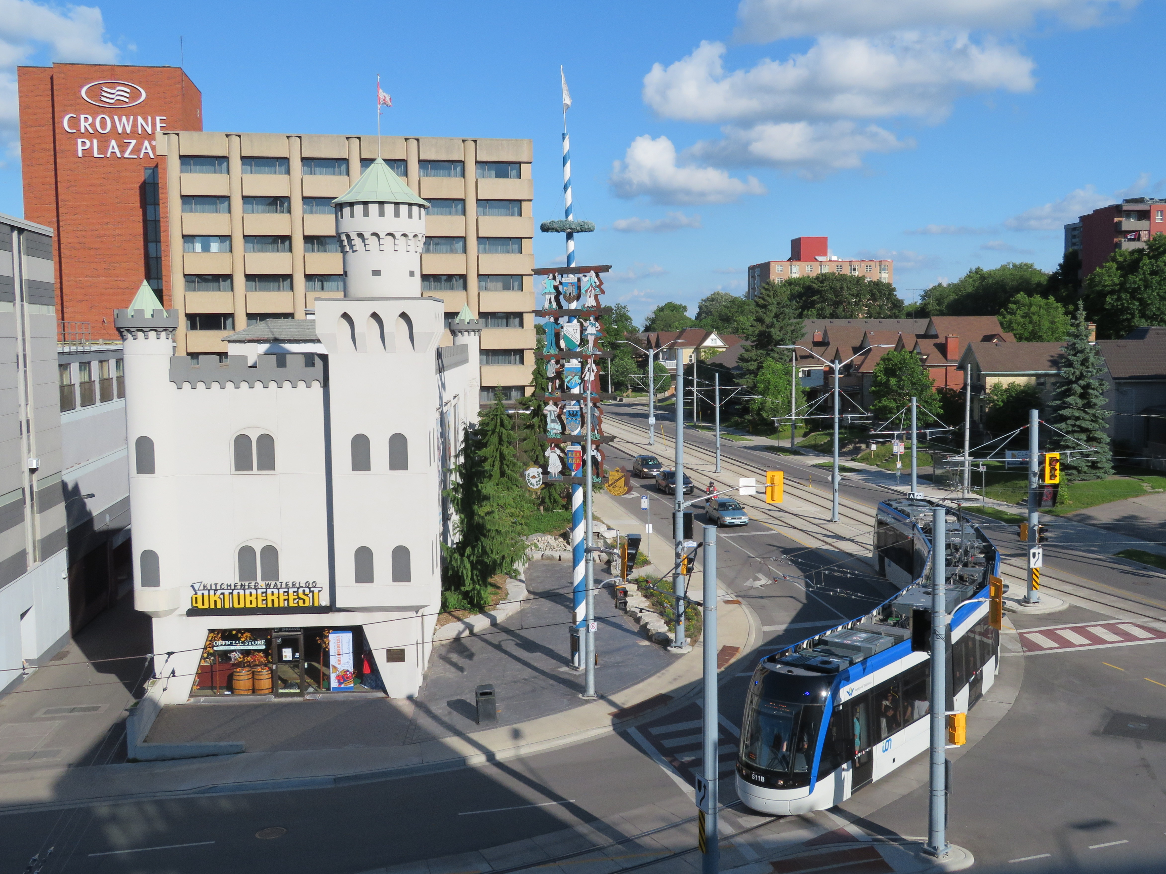
    ION train at Charles and Benson Streets, wrapping around Oktoberfest headquarters

    Operations were not yet perfected. On Saturday June 29, there were noticeable gaps in service, with workers doing switch repairs at the northern terminal at Conestoga Mall. This caused long waits at the northern end of the line. The automatic train control system was disabled, reducing speeds along sections of track where operators had to operate by line-of-sight.

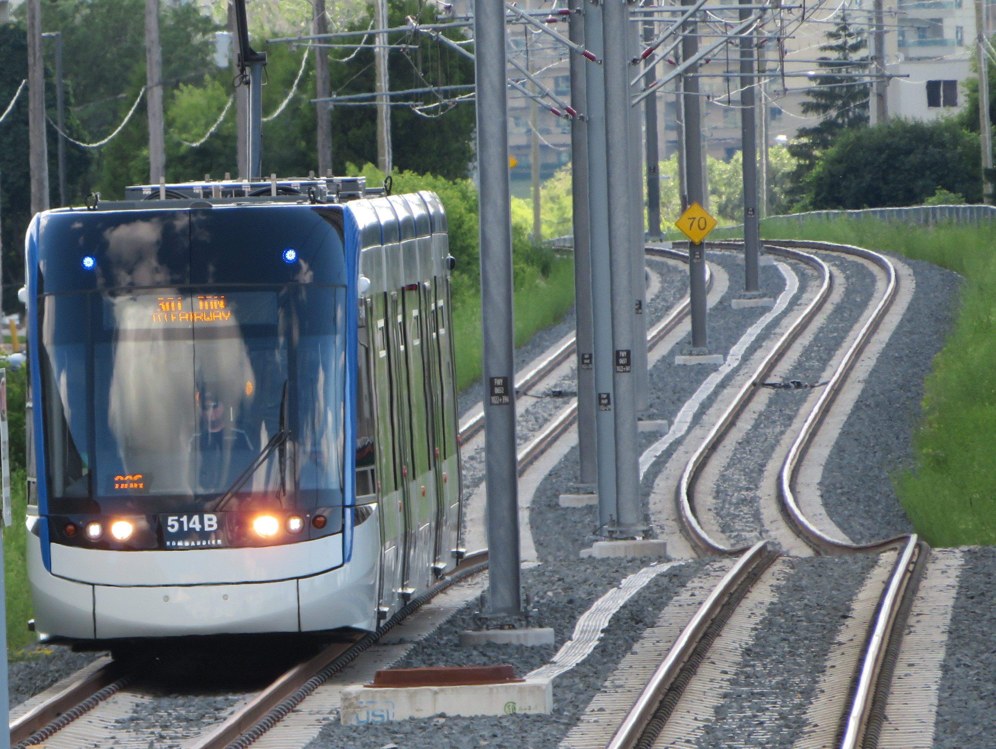
    The schedules could also be a little faster, with reduced station dwell times. Trains must also crawl through tight corners in Downtown Kitchener, Uptown Waterloo, and at Haywood Avenue. But it was nice to see transit priority working: trains ran through many intersections without having to stop, and speeds were impressive (up to 70 kilometres per hour) on the off-road sections of track.

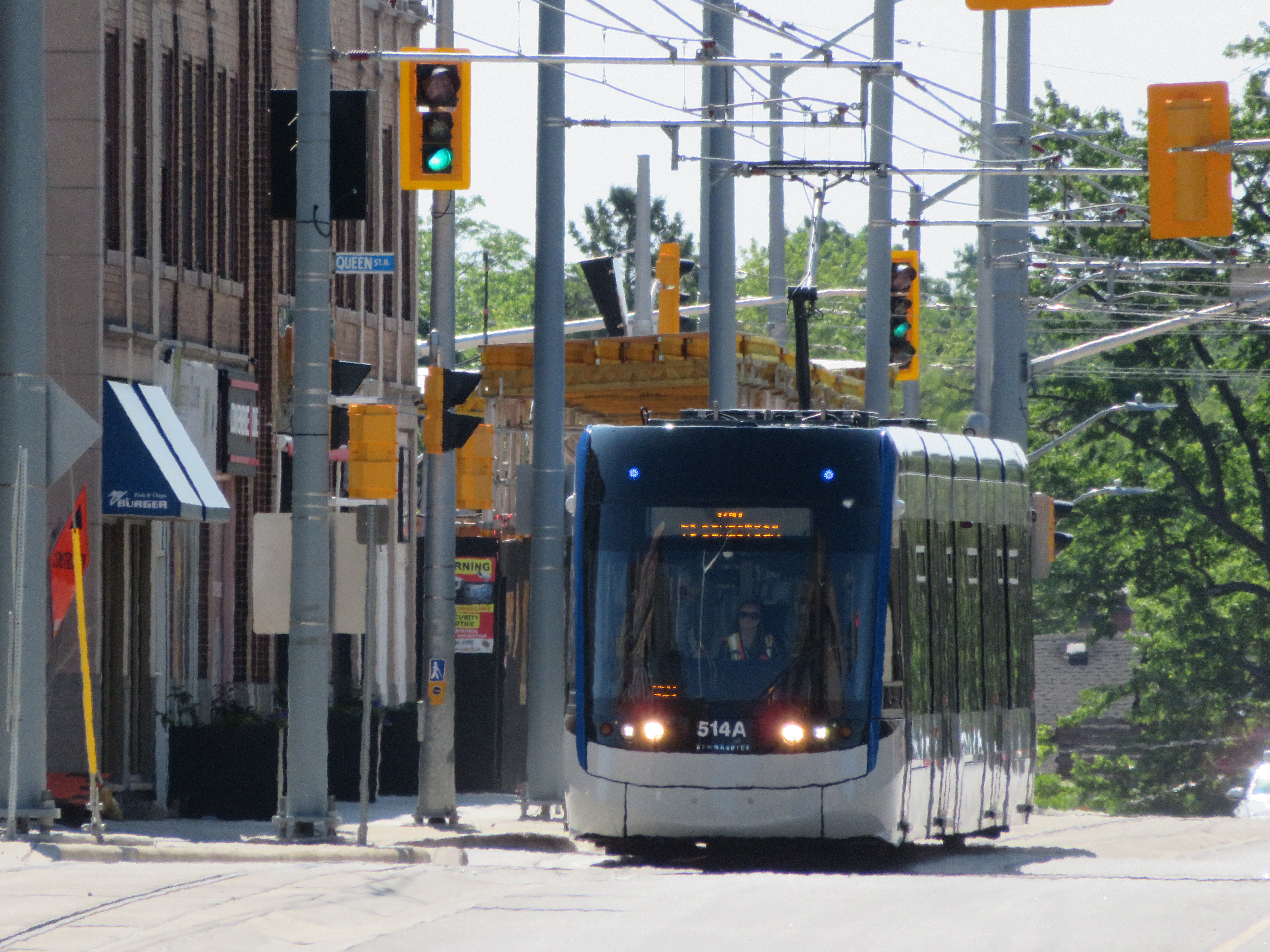
    1-IMG_2199ION train on Duke Street in Downtown Kitchener

    Along the entire corridor, travel times have improved only slightly over the old express bus, the Route 200 iXpress. Between Conestoga and Fairview Park terminals, the scheduled bus time ranged from 45 to 59 minutes, depending on the time of day. The LRT has a consistent 43-minute scheduled travel time between the two terminals. But it still promises to be more reliable.

    The greatest improvements in travel time are between University of Waterloo and Conestoga Mall, Uptown Waterloo, and Downtown Kitchener, where travel times have been reduced by 5-7 minutes.

    A promised second phase will extend ION LRT south to Cambridge. For now, an express bus serves the planned corridor.

    There is certainly room for improvement,  though these at least can be made slowly and incrementally. Hopefully, as passengers and drivers get more used to LRT operations, travel times can be tightened up a bit. But the system will be successful if it attracts more riders (without turning away existing passengers with overcrowding or longer travel times due to transfers from buses), and encourages higher-density, transit-oriented development along the route.

    I will return to Kitchener-Waterloo later this summer once ION is “broken in” and the novelty wears out. Offering free fares during the opening week was a nice way to encourage residents to check out the new service, but overcrowding and inexperience were problems.

    I am hopeful that ION helps to change local attitudes towards light rail and encourages other mid-sized cities and suburban municipalities to follow Waterloo Region’s example.

    1-IMG_2391-001ION train approaching Fairway Terminal. The speed limit on this section of track is 70 km/h.

  • Biking off to Buffalo

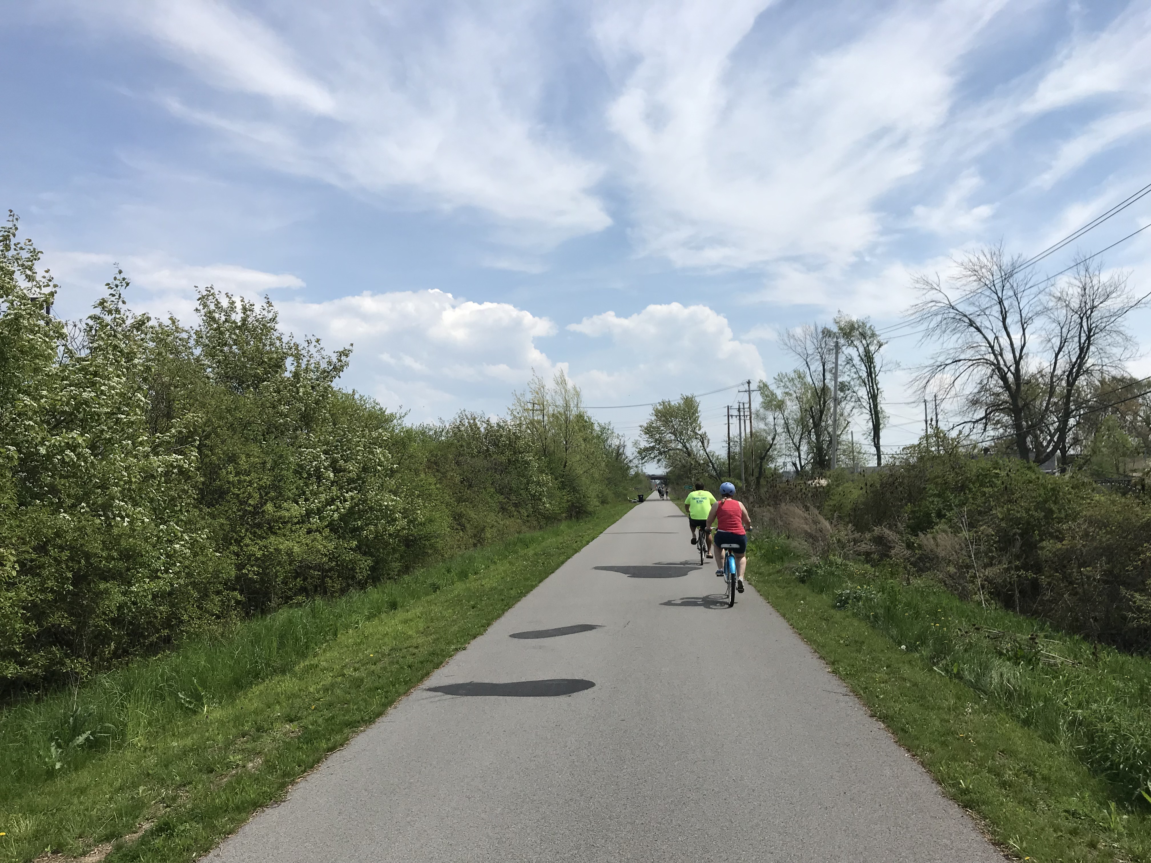
    IMG_6241Tonawanda Rail Trail

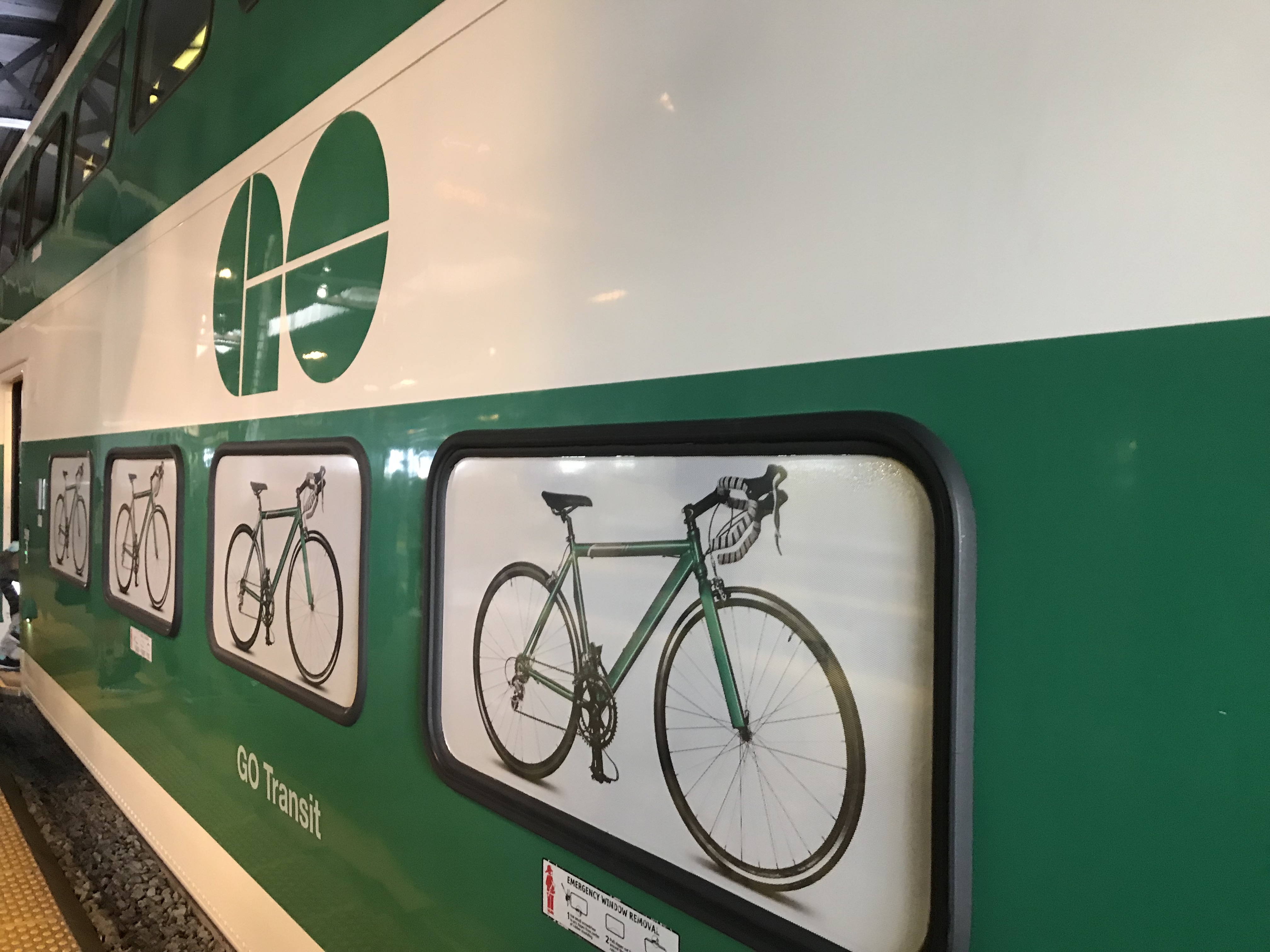
    Back on Victoria Day weekend, I biked down to Toronto’s Union Station, loaded by wheels onto a GO train, and headed for Niagara. I have biked through Niagara before, and it is a very pleasant place for cycling, with many paved paths, quiet roads, and paved shoulders and bike lanes along many busier roads. Charming towns such as Niagara-on-the-Lake and Port Colborne offer many places for cyclists to eat, drink, and stay. If you haven’t yet done so, GO Transit’s bike train is worth checking out this year.

    It is also possible to cross the border by bike as well, where there are many great bike routes and parks worth exploring. On my last trip, this is exactly what I did.
    IMG_6143.jpg
    GO Transit’s bike train at Union Station

    Officially, cyclists may cross at three of the four bridges over the Niagara River. To the north, cyclists may cross at the Queenston-Lewiston Bridge, which connects Ontario Highway 405 with Interstate 190. However, cyclists must cross with traffic (there’s no sidewalk, and pedestrians are prohibited), an unappealing option.

    The Rainbow Bridge allows both pedestrians and cyclists, though cyclists can not use the sidewalk (which offers great view of the nearby falls),but must also ride with traffic. But the Rainbow Bridge prohibits trucks; it is easy to access from city streets in both Niagara Falls, Ontario, and Niagara Falls, New York.

    The Peace Bridge, at the end of the Queen Elizabeth Way in Fort Erie, also permits pedestrians and cyclists, though cyclists must walk their bikes on the sidewalk. A multi-year rehabilitation project closed the sidewalk, but work was recently completed and the sidewalk will open shortly. In the meantime, the Peace Bridge offers a shuttle van (I called on July 1 2019 to confirm its operation, the representative I spoke to advises to call the Peace Bridge office to request a pick up). The Peace Bridge’s website offers detailed instructions on how to access the crossing on both sides.

    The Peace Bridge is free to pedestrians and cyclists in both directions, though cyclists on the Rainbow Bridge are charged $1 (US or Canadian) to travel to Canada.

    I chose to take the Rainbow Bridge both ways. It being a long weekend, I had to wait in traffic both ways, but at least the views are decent, and it’s a flat bridge deck.
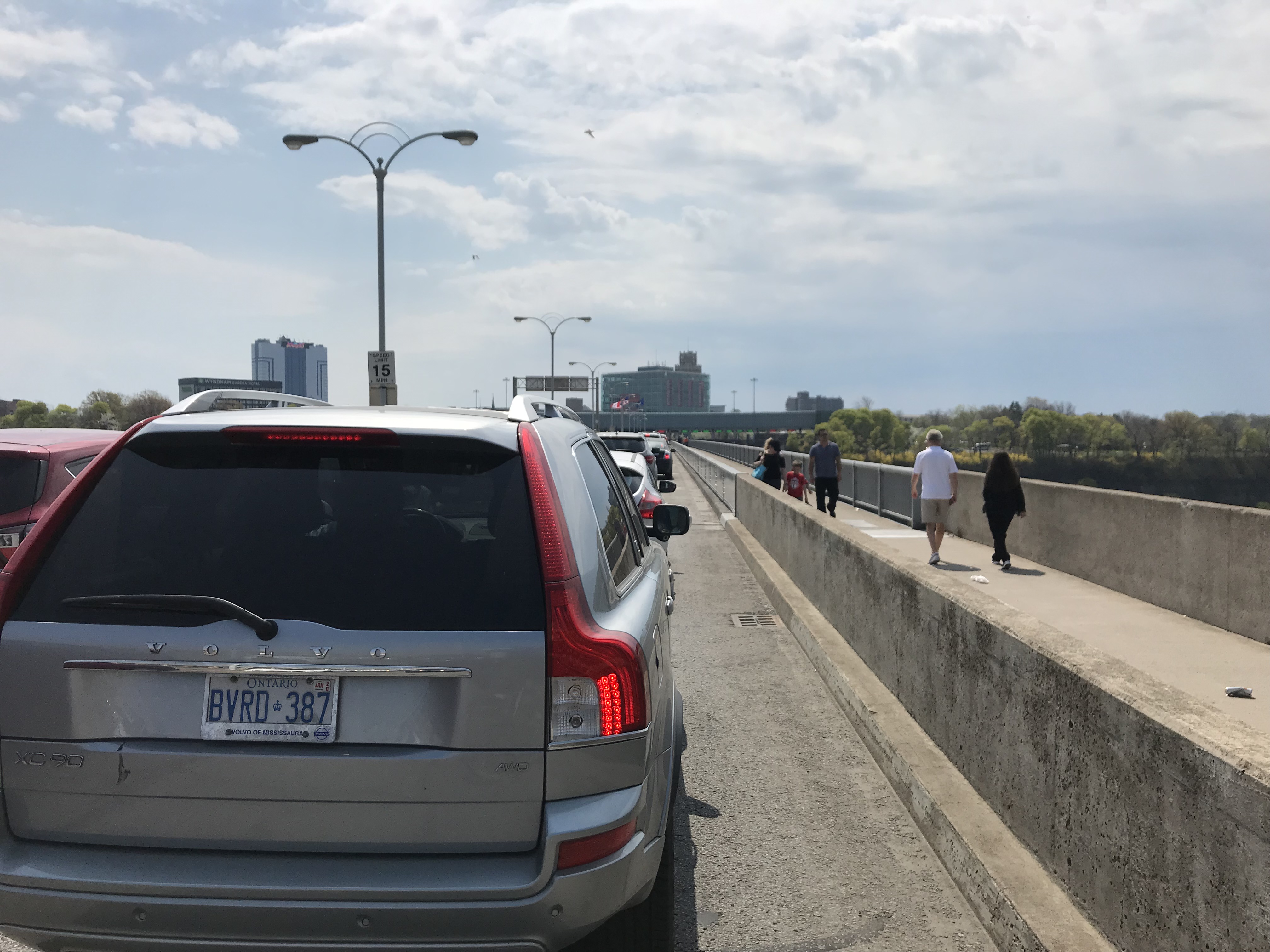
    IMG_6166Crossing the Rainbow Bridge by bike means waiting in traffic…
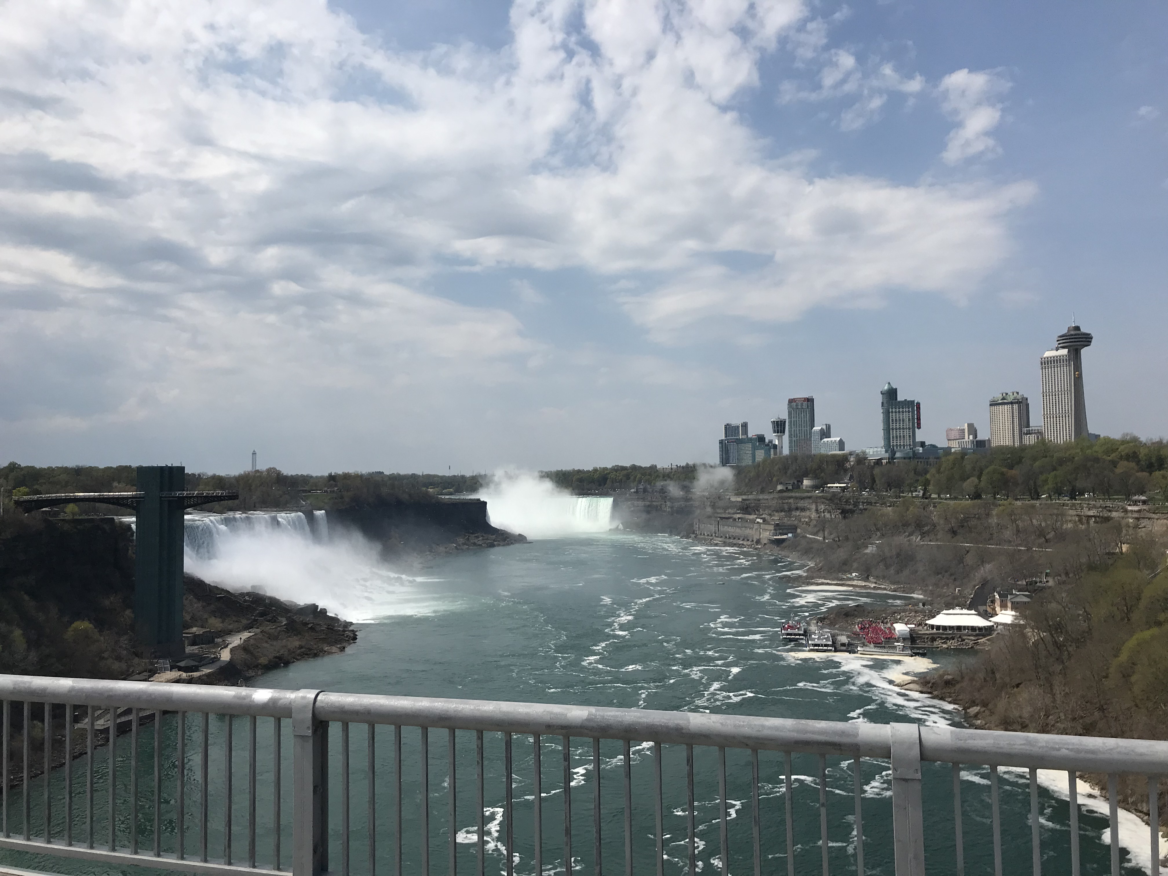
    IMG_6169…though at least the view is nice

    Once across in Niagara Falls, New York, it is easy to access Niagara Falls State Park, which offers great views of the Falls, and is free to enter (though there are charges for parking and for accessing the viewing tower and lower gorge trails). Cyclists are asked to dismount and walk in sections of the park, though it is a reasonable request due to the crowds.

    I then biked along the Niagara Scenic Parkway upriver towards Tonawanda. The parkway was formerly named the Robert Moses State Parkway, but it has since been tamed to improve pedestrian and cycling facilities along the Niagara River, with the road closed completely at the Rainbow Bridge, and narrowed elsewhere. I doubt the Power Broker would have approved.
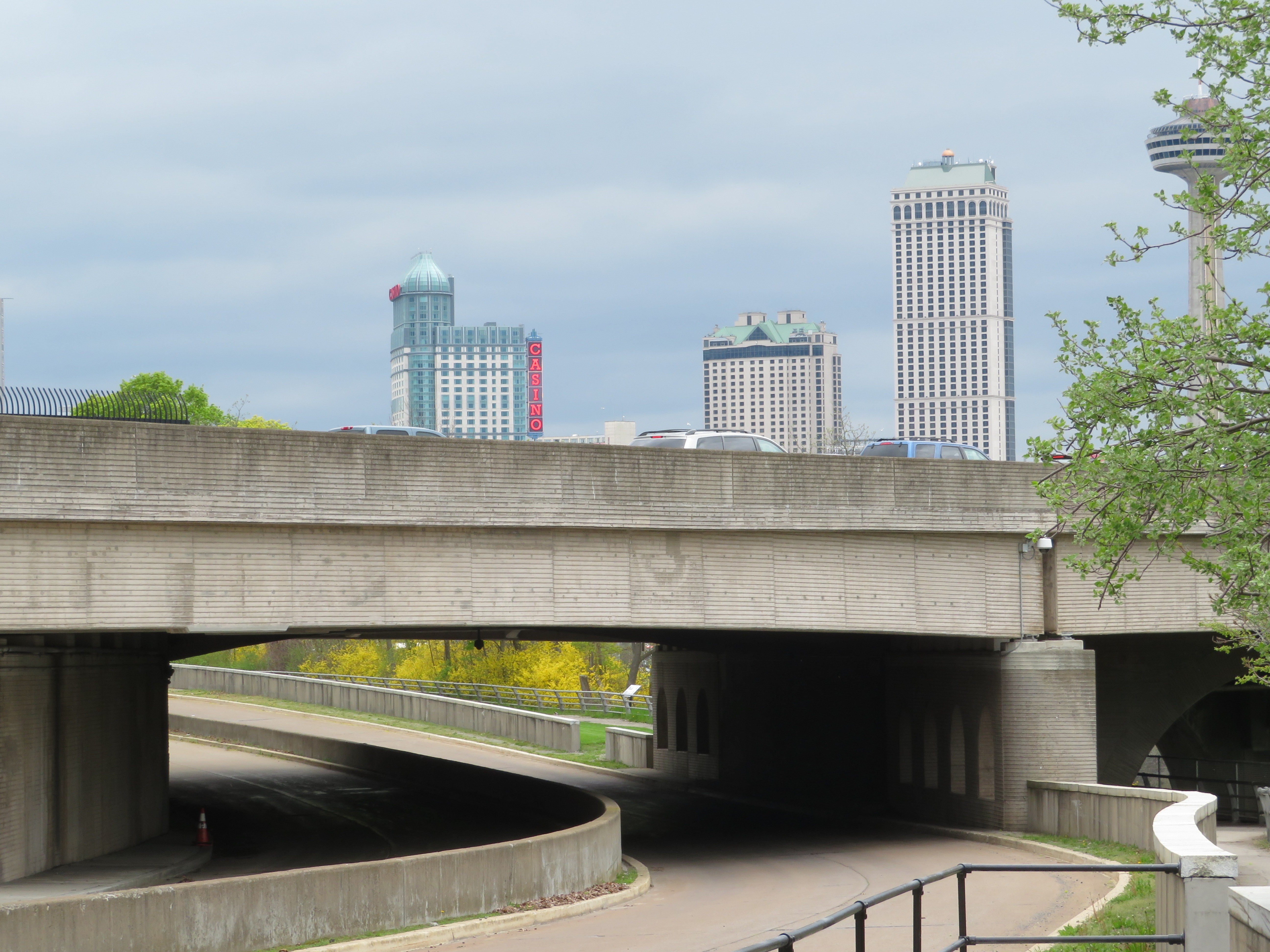
    1-IMG_1624.JPGAbandoned section of the Robert Moses State Parkway under the Rainbow Bridge

    South of Tonawanda, I chose to follow a new rail trail that followed an old interurban line that connected Buffalo with Tonawanda and Niagara Falls. The International Railway Company once operated a large network of street railways in Buffalo and Niagara Falls, as well as rural lines leading as far as Hamburg and Lockport. It also once operated a tourist trolley along both sides of the Niagara River, making it a truly international operation. Interurban service ended in 1937, while the last streetcars ran in 1950.
    IMG_6244
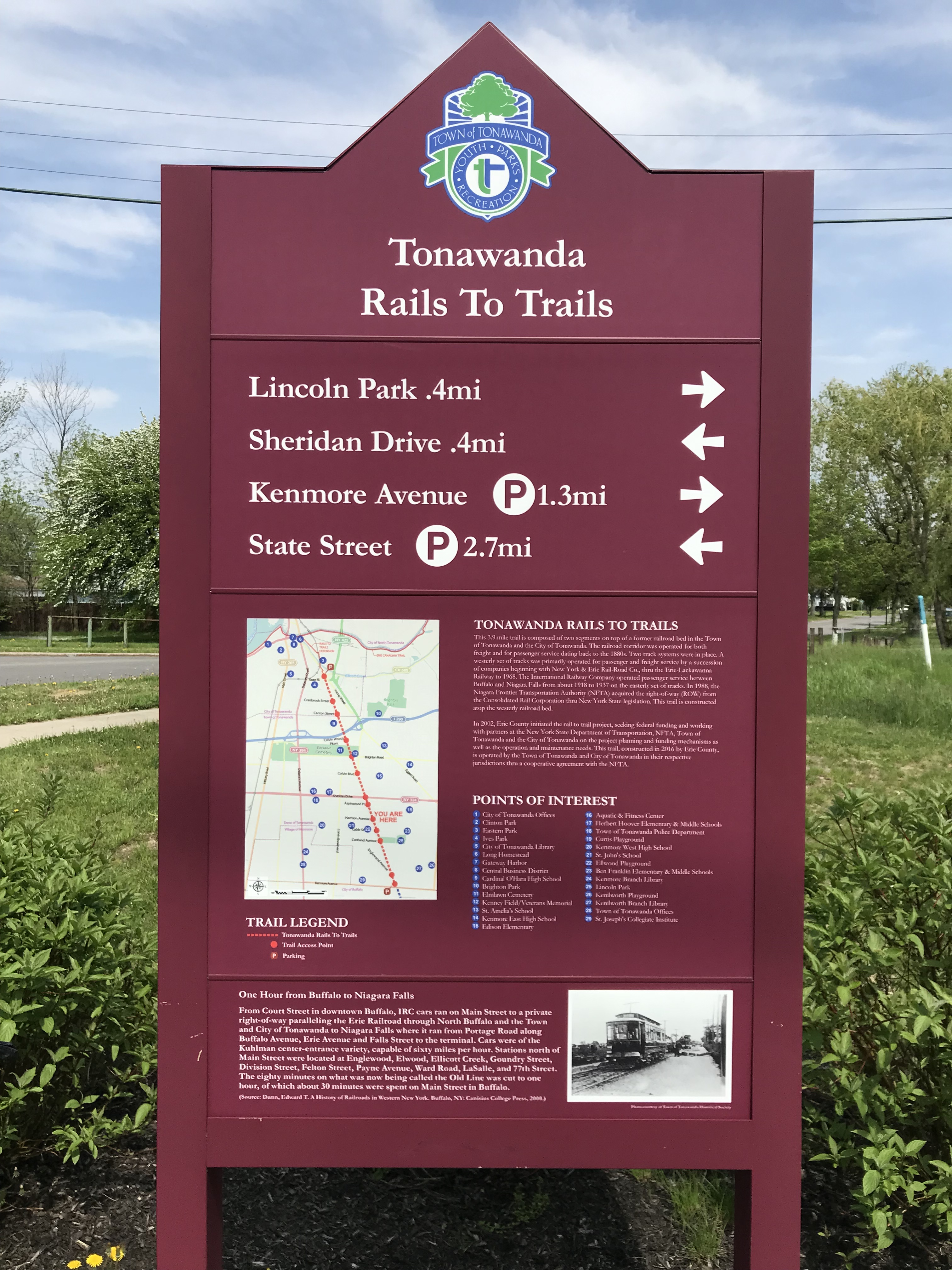
    Tonawanda Rail Trail guide sign

    The Niagara Frontier Transportation Authority, the public successor to the IRC, retained ownership of the Tonawanda corridor, planning a spur line of the new Buffalo Metro LRT. But local opposition and a lack of funds derailed those plans; happily, it is now a wonderful trail with safe, signalized crossings at every major cross street.

    Once in Buffalo, there are many bike lanes, and lower levels of traffic. Not once was I honked at or felt threatened by motorists. The city is mostly flat, and there are many neighbourhoods and landmarks worth checking out, with great restaurants, bars, and breweries. There are many hotels and bed and breakfasts in Downtown Buffalo and in the Allentown area.
    1-IMG_1528
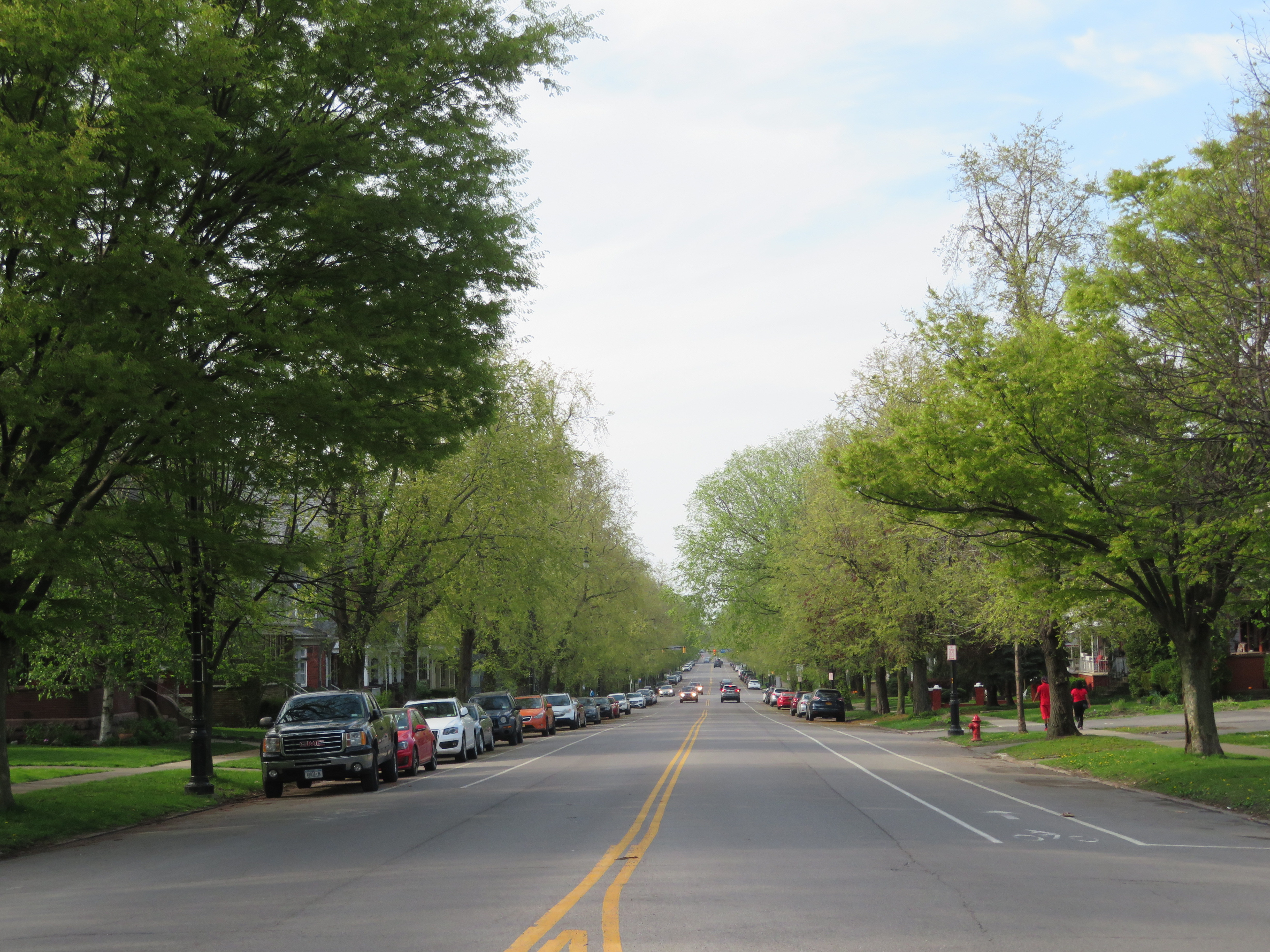
    Bike Lanes on tree-lined Richmond Avenue
    1-IMG_1525-001
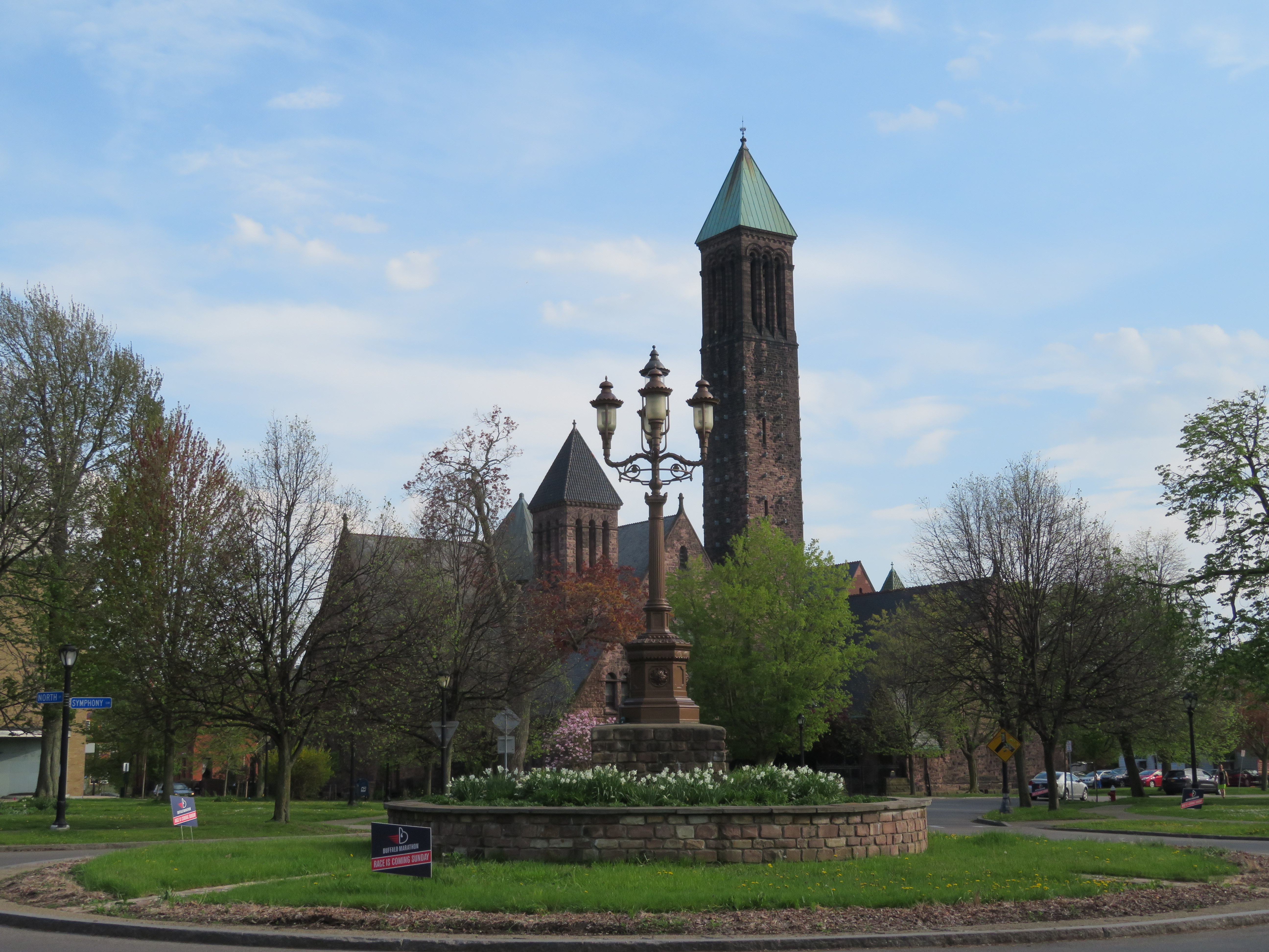
    Symphony Circle, one of many traffic circles as part of Fredrick Law Olmsted’s parkway system developed for Buffalo

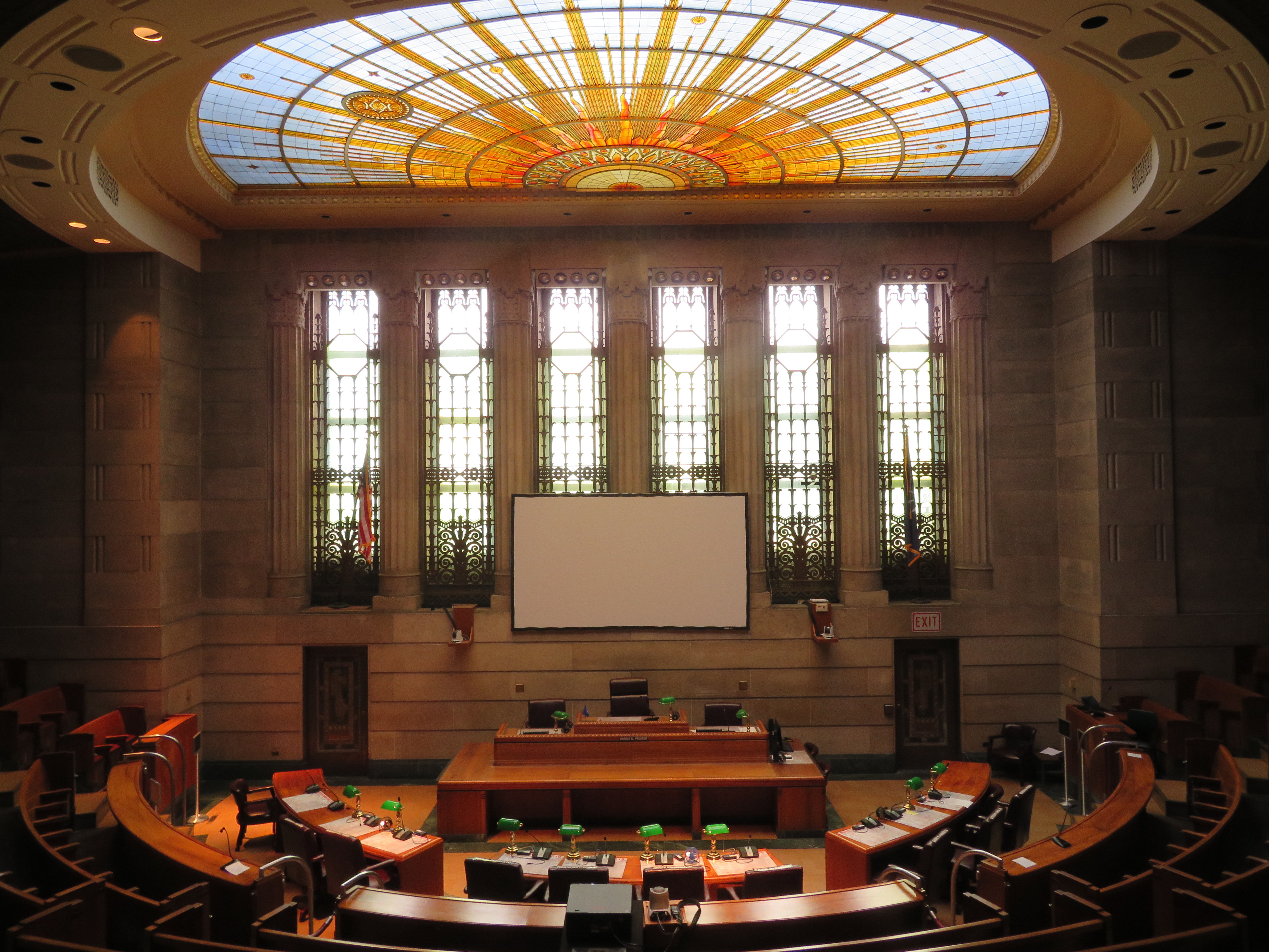
    Visiting Buffalo on a Sunday/Monday of a Canadian long weekend also meant being in town on normal working day on Monday, where commercial and institutional buildings are open to the public. The view from the observation deck at Buffalo City Hall is fantastic, while the Council Chamber is an art deco masterpiece.
    1-IMG_1594
    I had lunch in the Ellicott Square Building, which, when completed in 1896, was the largest office building in the world. The building was designed by Charles Atwood of Chicago’s D.H. Burham & Company, and its interior courtyard is spectacular. Several food vendors operate weekdays.
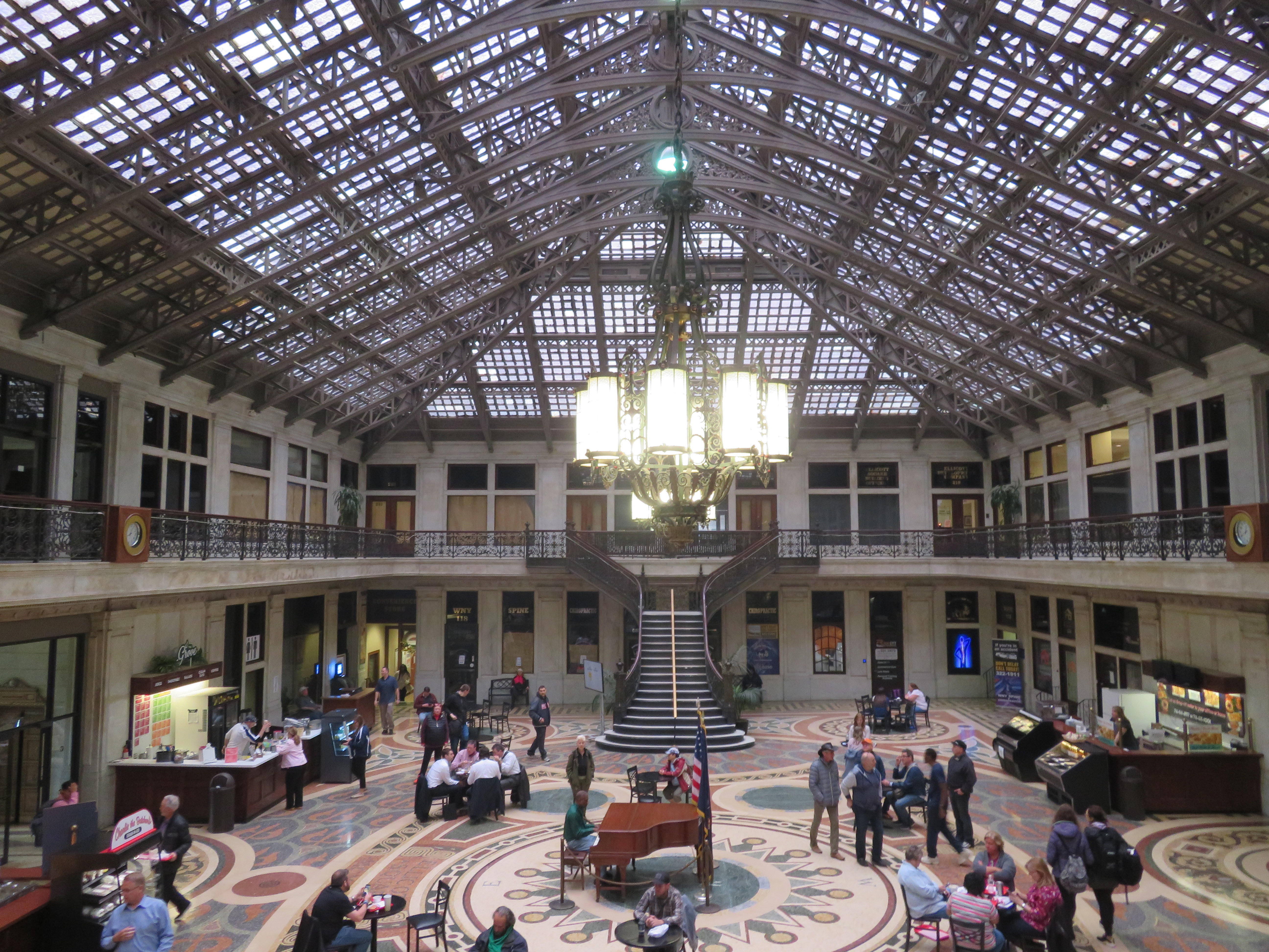
    1-IMG_1570-001Courtyard, Ellicott Square Building

    Buffalo is an attractive cycling destination because a back-up option exists. The NFTA buses are all equipped with bike racks; the Route 40 bus runs direct from Downtown Buffalo to Downtown Niagara Falls, New York. The Monday was cool, wet, and windy, and I was tired (I later found out I was coming down with a bad cold), so I opted to spend the extra time cycling around downtown and the Erie Canal Harbour area and take advantage of the bus service back.

    The GO Niagara bike train operates every weekend until Labour Day, and again during Canadian Thanksgiving Weekend. The Buffalo-Niagara region has a lot to offer cyclists, and it is worth your consideration.
  • How the QEW made way for Ontario’s transportation innovation

    IMG_1263.JPGQueen Elizabeth Way looking east towards Dixie Road in Mississauga

    Eighty years ago, the Queen Elizabeth Way was officially dedicated by King George VI and Queen Elizabeth (for whom it was named). The QEW, which connected Toronto with Hamilton and Niagara Falls, was not only Canada’s first superhighway, it was also the longest divided highway in North America. When it opened on June 7, 1939, it featured such innovations as continuous lighting, extensive landscaping, and Canada’s first cloverleaf interchange.

    But the QEW was not built to modern freeway standards. Despite boasting interchanges and traffic circles, it also had many signalized intersections, private driveways, as well as two lift bridges. As traffic increased after the Second World War, the QEW became known as a notorious “death trap.” Luckily, safety innovations developed by Ontario’s Ministry of Transportation and its predecessors have since made Ontario’s highways among the safest on the continent. Interestingly, the QEW is also indirectly responsible for the creation of one of North America’s most successful commuter rail systems.

    I wrote more on the history of the QEW and Ontario’s record of highway safety innovation for TVO.

  • Punkeydoodle’s Corners and the world’s highest numbered address

    Punkeydoodles_Corners.JPG

    Last weekend, I went for a ride in Waterloo Region, particularly in Wilmot Township, to the west of Kitchener-Waterloo. Despite some deceptively difficult hills and a strong headwind going back east, it was a very pleasant ride. Outside of Toronto, motorists seem to be quite courteous towards cyclists, with most giving me plenty of room. It helped too that many of Waterloo Region’s rural roads have paved shoulders.

    I made several stops along the way, including Castle Kilbride in Baden, a wonderfully preserved Victorian home. It was built by the Livingston family, who made their fortune in flax and linseed oil. The house, a national historic site, is now a museum operated by Wilmot Township.

    Castle Kilbride.JPGCastle Kilbride

    I biked as far west as the interestingly named hamlet of Punkeydoodle’s Corners, located at the point where Waterloo Region, Perth County, and Oxford County meet.

    Though the origin of the crossroads’ name is not known for sure, the most common theory is that a local innkeeper on the old Huron Road (an early colonization road that connected Guelph with Goderich on Lake Huron) like to sing “Yankee Doodle,” but it sounded more like “Punkey Doodle” to his patrons. The hamlet is now bypassed by Highways 7 and 8, and local business migrated to nearby New Hamburg, located on the railway.

    The Punkeydoodle’s Corners signs are commonly stolen, and one of the signs was obviously missing when I visited. But there’s one more claim to fame: the world’s highest street address number: 986039 Oxford-Perth Road.

    986039.jpg986039 Oxford-Perth Road, a private residence with what is probably the highest numbered address in the world. Road markers for Oxford County Road 24 and Perth County Road 101 are in the background. 

    In many parts of Ontario, rural addresses have a six-digit number, often known as 911 or fire numbers. In Dufferin County, for example, the first two digits refer to the road itself, with each rural road assigned an unique number. Each road is then broken down into sections, represented by the third digit. The last three digits indicate the distance — in decametres — from the beginning of the road section to the property’s entrance, with even numbers on the west or south side of the road.

    Before 911 numbers were introduced, addresses might only consist of a family or business name, rural route number and the name of the village or town with the nearest post office, or by the property’s lot and concession numbers.

    For example, 795112 3rd Line East, Mono, is the address of Mono Cliffs Provincial Park. The number 79, an odd number, has been assigned to the 3rd Line East of Hurontario Street (which runs north-south), while the third digit, 5, represents the section of 3rd Line East north of Mono Centre Road. The entrance to the park is 1.12 kilometres north of Mono Centre Road, on the west side of the road.

    This system allows emergency responders to pinpoint an address quickly and accurately. This is especially important in rural areas, where emergency personnel may be volunteers arriving in their own vehicles. In many parts of southern Ontario, rural roads may simply go by a name, or they may also have a highway or county road number, or still be known by their concession or line numbers. Urban areas, like Orangeville and Shelburne in Dufferin County, have their own numbering systems, separate from the rural 911 addresses.

    Each county may have a slightly different system, but they all have the same purpose. 986039 Oxford-Perth Road just happens to be in the far southeast corner of Perth County, hence its high number. The lowest address numbers in rural Perth County can be found in the northwest corner, near Molesworth.

    It’s worth noting that not all rural areas developed similar numbering systems. In Toronto and York Region, road addresses are based on their origin point. For east-west streets that cross Yonge Street, street numbers start on other side. For example, Yonge Street’s numbering starts at 1 Yonge Street, the Toronto Star Building, and ends at 21137 Yonge Street, where it unceremoniously disappears into the Holland Marsh.