Tag: GO Transit

  • A new twist in the story of a downtown parking lot

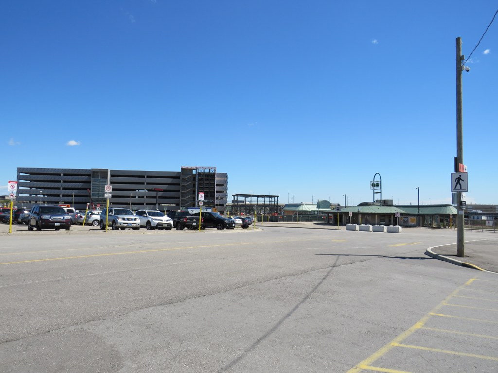
    The Metrolinx parking lot at Elizabeth and Railroad Street is nearly complete

    Over the last few years, I have followed the purchase and demolition of over a dozen houses in Downtown Brampton, in the block bounded by George, Nelson, Elizabeth, and Railroad Streets. Metrolinx, the provincial transit planning and operating agency, acquired the block for a new surface parking lot for the neighbouring GO Transit station.

    At first, the parking lot was intended to replace parking spaces lost due to construction of a new post-secondary education campus — a joint venture between Ryerson University and Sheridan College — on the main GO Station lands. Though the provincial government pulled funding for the campus in the fall of 2018, Metrolinx continued work on the parking lot, completing the demolition, clearing the land, and building the parking area.

    Now, it is possible that the parking lot will never open.

    At the Brampton City Council meeting on January 26, 2022, councillors considered a request by Rogers for two Minister’s Zoning Orders (MZOs) in order for it to relocate its existing Brampton offices at 8200 Dixie Road in Bramalea to a new build in Downtown Brampton. The particular property Rogers looks to acquire for its new campus is the same one Metrolinx acquired, cleared, and partly constructed its new parking lot.
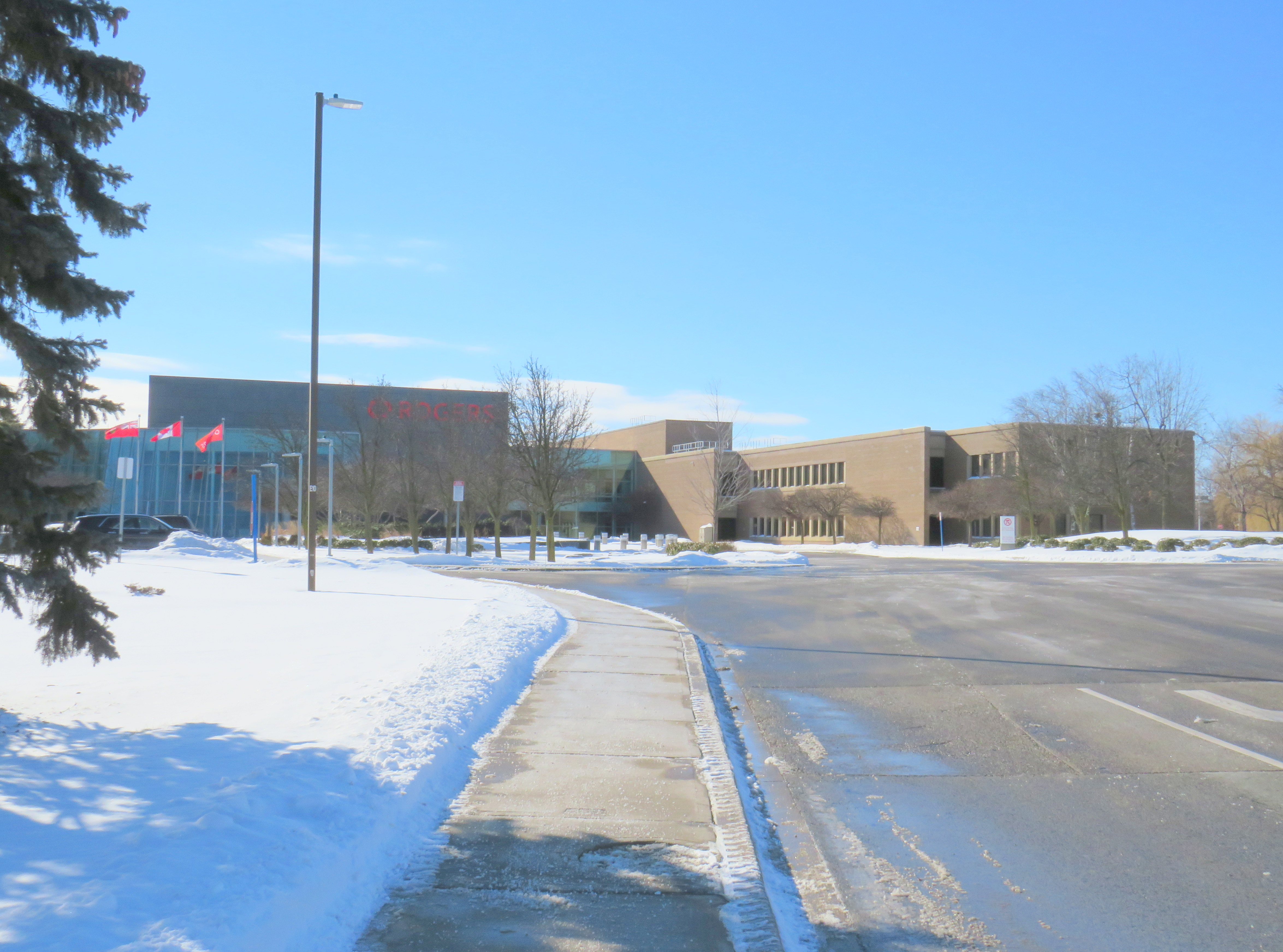
    Part of the existing Rogers campus at 8200 Dixie Road

    The property at 8200 Dixie Road was built in the 1963 as a Northern Electric (later Northern Telecom) plant, which produced switchboards and other telecommunications equipment. In 1995, the plant closed, and the building was refurbished to become the headquarters for Nortel Networks. In 2005, during Nortel’s infamous fall into bankruptcy, the property was sold to Rogers, which uses it today for its business operations and technical offices, with 3,000 workers stationed there.

    Rogers is interested in the downtown site for several reasons. The new campus would be adjacent to several transit links, including the GO Transit Kitchener Line, with links to Downtown Toronto (where Rogers has its head office) and the Kitchener-Waterloo technology hub. In its submission to the city, Rogers also notes the proposed LRT extension into Downtown Brampton (now in the design phase, either as a tunnel or a surface route) and planned bus improvements. Though it is served by Brampton Transit, the 8200 Dixie Road site is almost entirely dependent on its employees driving to work.

    The new Rogers downtown site would support Brampton’s goals of becoming a cybersecurity centre of excellence and landing a major postsecondary education campus — Ryerson University continues to be interested in expanding in Brampton and the University of Guelph has expressed interest in relocating its Humber College presence to Brampton to better serve its student base.

    There are also several development proposals for Downtown Brampton. The City of Brampton is still planning to build a new Centre for Innovation to support education and business development. The new facility, located adjacent to the downtown transit terminal, will include a new central library. New highrise developments will bring thousands of new residential units to downtown Brampton, walkable to local businesses, the GO station, and Rogers’ planned new campus.

    Map of Metrolinx/Rogers lands in Downtown Brampton, with surrounding active development plans

    The new office campus — proposed to be 200,000 to 500,000 square feet — would have a smaller footprint than the Dixie Road site. By relocating its offices, Rogers would then be free to sell or redevelop the old Nortel lands for housing and new industrial uses, likely for warehousing and logistics. The development of the old land would certainly finance the new property.
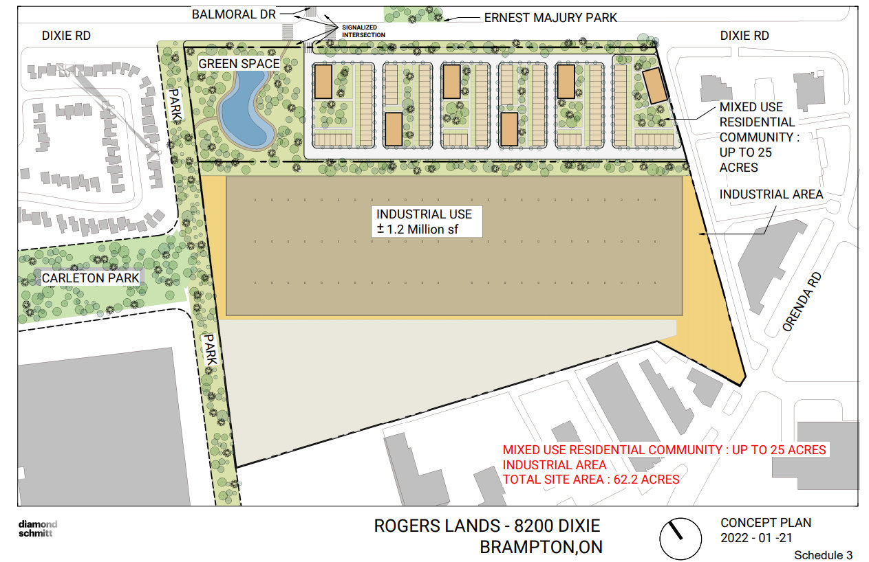
    Proposed redevelopment of the Rogers lands at 8200 Dixie Road, with mixed residential development on the east side, towards Balmoral Drive, and new industrial uses on the west side.

    Rogers wanted municipal support for the MZOs so it could move quickly towards designing its new office complex. In response to a question from council, Rogers indicated that it had already been talking with Metrolinx about purchasing the land, and that Metrolinx itself was supportive. Mayor Patrick Brown indicated that he has been speaking with Metrolinx CEO Phil Verster, and that Metrolinx would submit its own letter of support.

    MZOs have a controversial reputation. In Ontario, the Minister of Municipal Affairs has the authority to issue a zoning order over any property that overrides the normal zoning process. Traditionally, MZOs have been used infrequently, often in an emergency situation (such as after a disaster, such as the collapse of the Algo Centre Mall in Elliot Lake), or to fast track the construction of a major employer or housing development, typically issued at the request of the municipality.

    The Doug Ford-led Progressive Conservative government have issued MZOs much more frequently, often for projects with significant opposition. This included the site of a proposed Amazon warehouse on the Pickering/Ajax border, which was strongly opposed by environmentalists and Ajax politicians, yet supported by Pickering officials. Meanwhile, a MZO requested by the City of Toronto, for an affordable housing project in North York, has yet to be issued. (It is worth noting that the project is in a PC-held riding, represented by Associate Minister of Transportation Stan Cho.)

    But, in this case, with a unanimous vote of endorsement from Brampton City Council, with support from Metrolinx and local business groups the new Rogers relocation should prove to be less contentious than other recent MZOs.

    There are still a few questions that will have to be answered in due time:

    • Will Metrolinx be able to provide all-day, two-way GO train service to Downtown Brampton by the time Rogers is ready to relocate its Brampton operations? Right now, the Kitchener Line is constrained through Brampton as it uses a busy CN freight corridor. A third track and platform at Downtown Brampton will be needed to support commuters arriving from Toronto in the morning. Though the planned new transit hub at Main and Nelson Streets will support this expansion, work has yet to begin on that project, including a temporary bus facility as the old terminal and office building above is demolished.
    • Will Brampton agree on the Main Street LRT extension, whether it will be in a tunnel or at-grade in Downtown Brampton? If so, will it be able to secure funding from the province and the federal government? As transit access is key for Rogers’ proposal, and for potential new educational instructions, closure on this long-running matter is important.
    • How many workers will be on site at Rogers’ new complex? Though 200,000 square feet will be enough space for about 1,000 employees, which is just one-third of its Brampton workforce. Perhaps Rogers is looking towards a hybrid model of work, where employees are on site only part-time.

    Finally, it is interesting how Metrolinx, a public agency, was determined to assemble land and build a new parking lot, only to see that land sold to a large private company. However, having major employers located adjacent to regional transit hubs is a good thing, especially as it represents a shift away from GO’s traditional model of transporting commuters to Union Station in the morning and back to the suburbs in the afternoon.

    For Downtown Brampton, Rogers’ plans for relocating to the urban core is a badly-needed shot in the arm. Locating a major employer to the core will support existing and new businesses. After many attempts to revitalize downtown, this latest plan might be the catalyst that changes everything.
  • A transit tour of central Ontario

    A transit tour of central Ontario

    On the morning of Thursday, August 19, I departed Toronto’s Union Station. My destination: Union Station. I set out to travel the longest distance possible by local and regional transportation services, taking advantage of several new routes set up by local and county governments to fill the gaps left by traditional intercity coach operators.

    The round trip from Union Station required two trains and seven buses, operating on five separate transportation agencies. In some cases, the transfers were smooth and reliable; in Owen Sound, I waited several hours between connecting trips. For a casual traveler like myself, this was not a problem, but for more frequent commuters, the patchwork of various schedules and fares is not ideal.

    I left Union Station on a westbound Kitchener Line train at 7:34 AM on Thursday, August 19. I returned to Union Station at 9:34 PM Friday evening, staying in Meaford overnight. I made time for short visits to Owen Sound, Meaford, Collingwood, and Barrie, with short stopovers in Guelph and at the Blue Mountain resort.

    The following is a travelogue of sorts, concluding with a few conclusions on how parts of this trip can be made better for future passengers.

    Thursday: Toronto to Owen Sound and Meaford

    Intending to catch the morning GOST (Guelph-Owen Sound Transportation) minibus from downtown Guelph, I boarded the first westbound Kitchener Line train at Union Station at 7:34 AM. The train only goes as far as Bramalea Station, requiring a transfer to a bus to continue westward. Happily, the train arrived at Bramalea on time, so there was no problem taking the connecting bus that departs at 8:18 AM. (I had bad luck on a previous trip through Bramalea.)

    The connecting bus from Bramalea to Guelph is a slow, local service, winding its way through Brampton, Georgetown, Acton, and rural Wellington County before arriving at Downtown Guelph at 10:13. Through GO Transit’s buses are comfortable, they lack lavatories, so a two-hour trip may be difficult on some passengers’ bladders. Though the 7:34 train to Bramalea connects to an express bus via Highways 407 and 401 to Kitchener, anyone headed to Guelph gets to ride the scenic route.

    Though an express bus would be welcome, I noted the importance of the local GO bus for workers living in Brampton getting to jobs in Halton Hills, and residents in Acton and Rockwood commuting to Guelph. There is a need for both services.

    At least I got a spot at the front of the double decker bus and was able to enjoy the ride.

    This first leg on GO Transit between Toronto and Guelph cost $14.06, deducted from my Presto card.

    Brampton Transit used to operate a double-decker bus. GO Transit has brought them back to the Flower City.
    Due to a construction project on Highway 7 in Rockwood, the double-decker bus took a scenic, yet unexpected detour on country roads. This must have turned some heads.

    At Downtown Guelph, I had just under 20 minutes to use a washroom and have a quick coffee before switching to the GOST minibus. GOST serves the Guelph Central Station bus terminal, with easy connections to GO buses and trains and most Guelph Transit services.

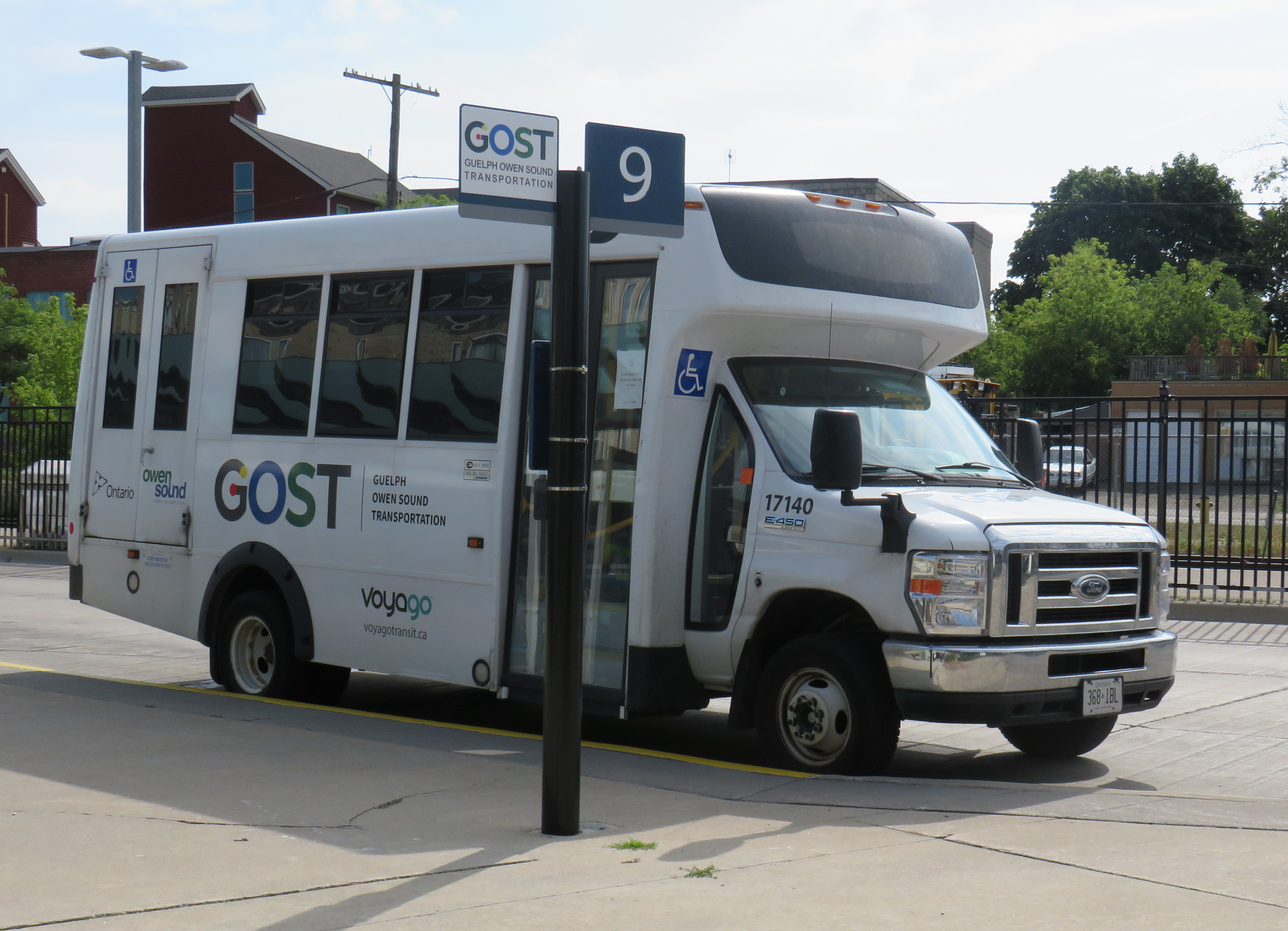
    A GOST minibus waiting for departure at Guelph Central Station

    The GOST minibus service operates two round trips, seven days a week, between Guelph and Owen Sound, with stops in Elora, Fergus, Arthur, Mount Forest, Durham, Williamsford, and Chatsworth. Except for Fergus, all stops are located in or near each town’s commercial centre. The service is funded by Owen Sound and a provincial grant, and operated by London-based Voyago (which operates several other rural services in Western Ontario).

    Until the mid 2000s, Greyhound ran buses six days a week between Toronto and Owen Sound via Highway 10 through Brampton and Orangeville or via Highway 6 through Guelph and Mount Forest, each route on alternating days. Gray Coach, the TTC-owned predecessor to Greyhound, ran several daily trips. The twice-daily GOST bus is a significant improvement over Greyhound’s schedule in its waning years.

    On this Thursday midday northbound trip, there were two passengers going all the way up to Owen Sound, one getting off in Elora, one disembarking at Mount Forest, and one passenger who boarded at Williamsford for Owen Sound. The fare from Guelph to Owen Sound is $20 cash, with cheaper fares to ride shorter distances.

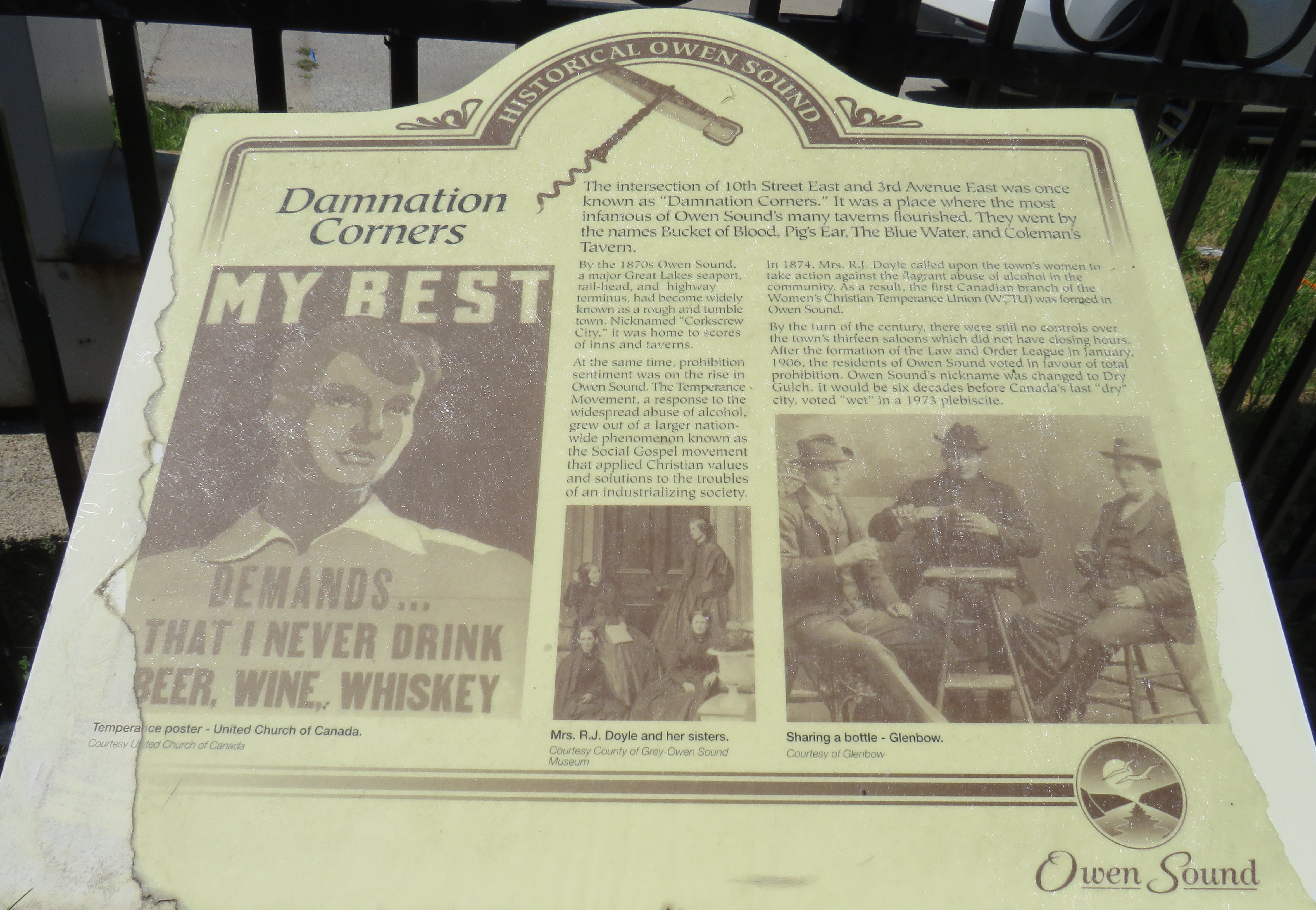
    I arrived in Owen Sound a few minutes before 1:00 PM, with several hours to spend before my next ride to Meaford. Owen Sound, population 26,000, has an interesting history as a Great Lakes port and railhead for both the Canadian Pacific and Grand Trunk/Canadian National Railways. The maritime traffic and local industry gave Owen Sound a reputation as a hard drinking town; it became one of the first municipalities in Ontario to go “dry” in 1906. It remained that way until 1973.

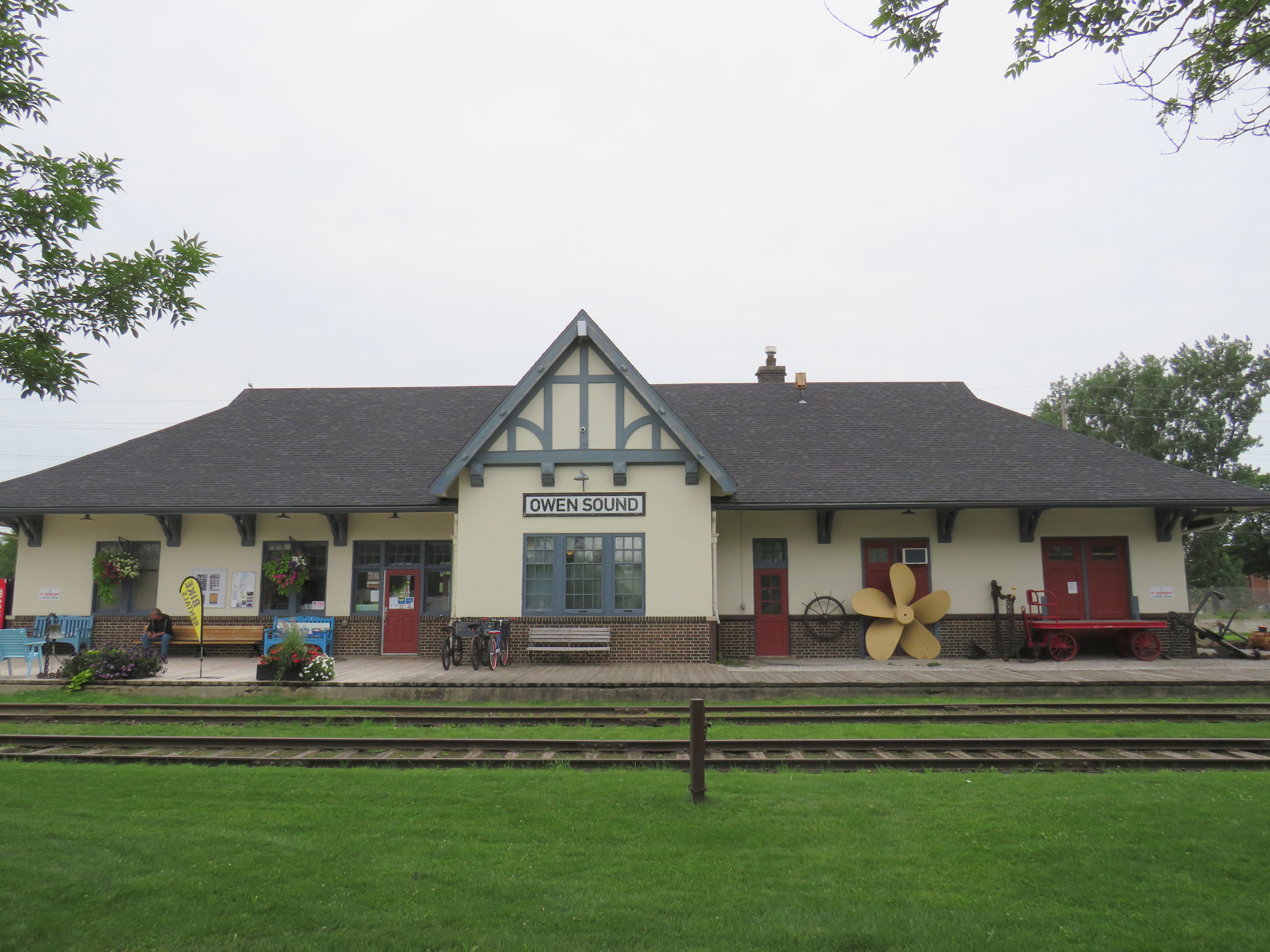
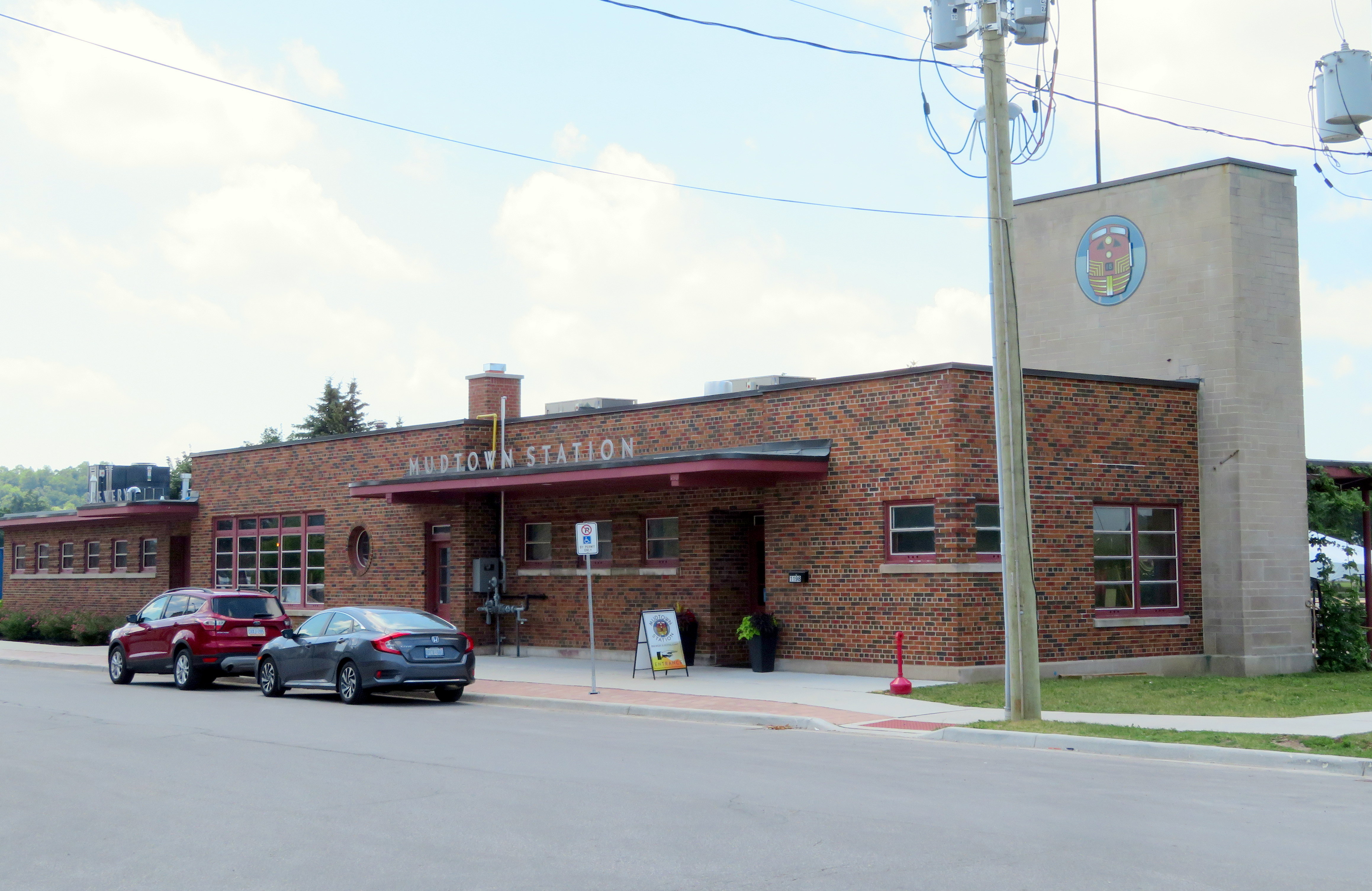
    With the construction of the St. Lawrence Seaway and the decline of branch lines across Ontario, the city declined as a port and both railways were torn up in the late 1990s. However, both stations remain standing – the Grand Trunk Station on the west side of the harbour is now a local museum, while the modernist CP station, built after the Second World War, is now a brewpub.

    With a lovely downtown, harbour, parks, and heritage neighbourhoods to wander through, Owen Sound was worth a three-and-a-half stopover.

    Owen Sound Marine and Rail Museum, the former Grand Trunk/CN Station
    Mudtown Station, the old CP Station in Owen Sound
    Plaque commemorating “Damnation Corners” where taverns once stood on all four corners. One block to the east was “Salvation Corners” where four Protestant churches still stand.

    I decided to stay in Meaford overnight. Though I could get as far east as Wasaga Beach via Grey Transit Route, Colltrans, and Simcoe County Linx, I would not have been able to continue my trip back to Toronto that night, missing the last Linx bus from Wasaga Beach to Barrie by one hour.

    Meaford had cheaper accommodations than Owen Sound or Collingwood, and by staying there overnight, it gave me plenty of time in Meaford and Collingwood the next day. Before Greyhound Canada suspended operations in April 2020, there was one daily bus between Toronto, Barrie, Collingwood, and Owen Sound. PMCL, which Greyhound purchased in the 1990s, used to run several buses a day on that route.

    I departed Owen Sound on a pre-booked GTR minibus at 4:30 PM, which cost $5 for the trip into Meaford. As I was the only one on that departure, the driver was kind enough to drop me off right by my motel. There are six daily trips between Owen Sound and Meaford, with four of those trips offering a timed connection or direct run to Blue Mountain Resort, GTR’s eastern terminus.

    GTR minibus at Owen Sound Terminal (October 2020)

    Meaford itself is a charming little town, with several good restaurants, and a lovely harbour. Meaford is the western terminus of the Georgian Trail to Collingwood, one of Ontario’s first rail trails. As GTR minivans and Simcoe Linx and Colltrans buses all have bike racks, Meaford would make for a nice cycling trip.

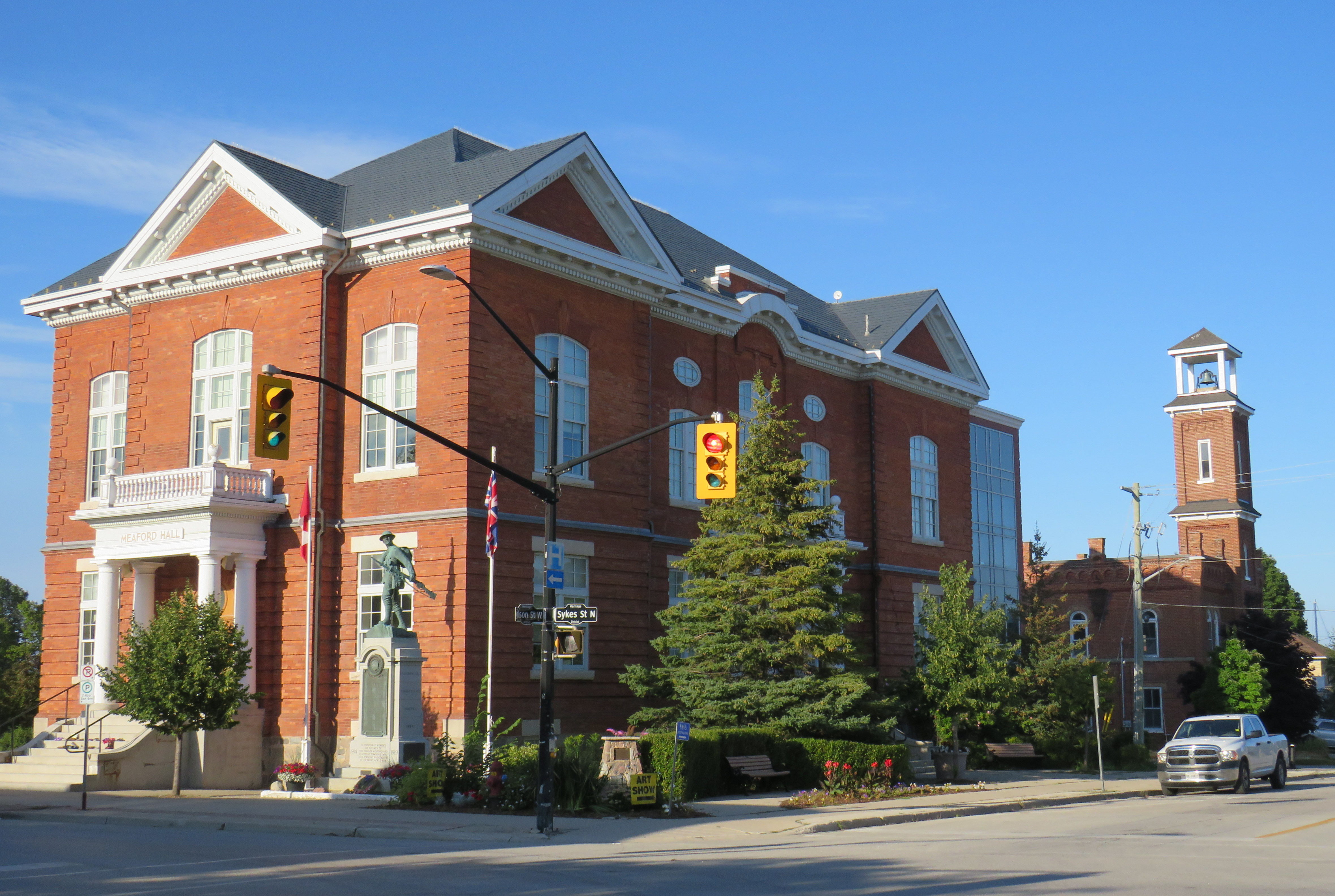
    Meaford Hall, with the old fire station behind
    Terminus of the Georgian Trail, which continues to Collingwood, with connections beyond

    Friday: Meaford to Collingwood and Toronto

    The next morning, I departed Meaford on GTR Route 4 at 8:46AM, and arrived at Blue Mountain Village just after 9:30, another $5 pre-booked trip. The popular resort is also served by Colltrans’ Blue Mountain Link route to Downtown Collingwood, with connections to local buses and the Simcoe County Linx Route 4 to Wasaga Beach.

    Approaching Blue Mountain, the driver helpfully asked me if I needed to catch the bus to Collingwood. Though the timetables between GTR Route 4 and Colltrans’ bus don’t permit an easy connection, if I got off at Craigleith, at the bottom of the escarpment, I would be sure to get the onward bus. I declined the offer, because I was curious to see Blue Mountain Village itself, and I needed a coffee.

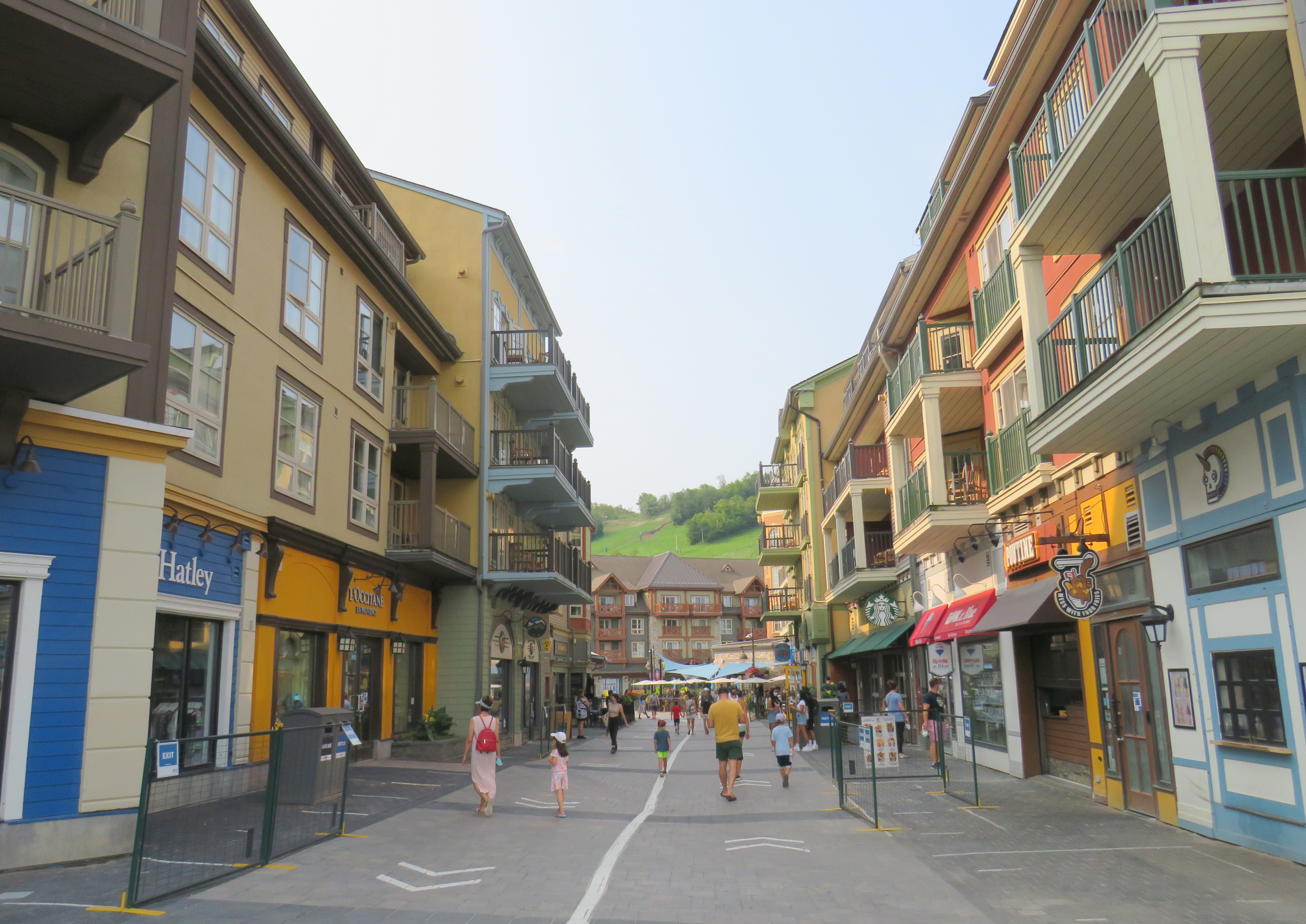
    The Disneyland-like urbanity of Blue Mountain Village

    Blue Mountain Village, the heart of the sprawling Blue Mountain resort, contains many shops, restaurants and bars, along with three hotels and timeshare apartment complexes with the architecture and walkways meant to invoke a European ski resort. Cars are not permitted in the internal streets, which gives it a somewhat surreal atmosphere. In the summer, tourists and vacationers are attracted by several golf courses, downhill mountain biking trails, rope courses, spas, nearby beaches, and, of course, the shops.

    Having gotten my coffee and my morning walk, I paid my $2 fare and got on the 10:20 bus to Downtown Collingwood.

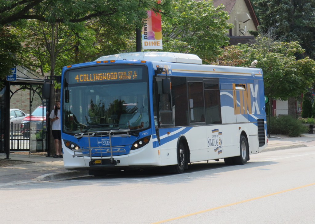
    Colltrans and Simcoe County Linx buses at Downtown Collingwood

    Like Owen Sound, Collingwood has a lovely and vibrant downtown core, with its own proud marine and railway history. Collingwood was the terminus of the Ontario Simcoe & Huron Railway, the province’s first rail connection, built in 1853-1854. The OS&H was built as a shortcut between the Upper Great Lakes and Toronto and prospered before merging with several other railways to become part of the massive Grand Trunk system. Sadly, passenger service to Collingwood ended in 1960, and the railway itself is abandoned and partially removed.

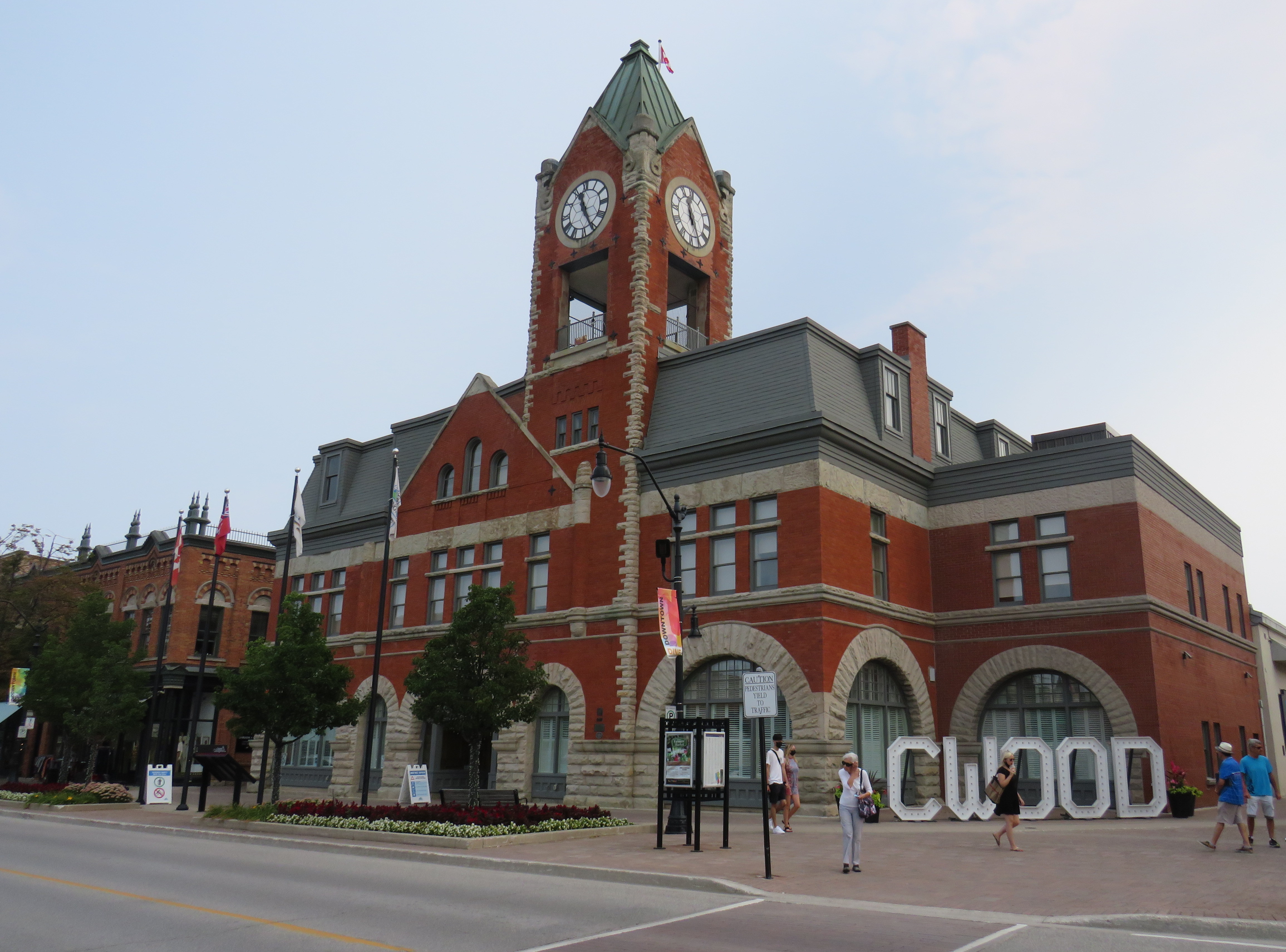
    Collingwood Town Hall

    After a hearty lunch in Downtown Collingwood and walk through the area, I paid another toonie and boarded Simcoe Linx Route 4 to Wasaga Beach.

    In the back parking lot of a Loblaws Superstore in the west end of Wasaga Beach, two Simcoe County Linx buses, a Wasaga Beach Transit bus, and a Clearview Transit minibus meet to exchange passengers. The grocery store is distant from the main tourist area and the downtown commercial centre, but at least transfers between buses are easy. The Wasaga Beach Transit bus does pass by most motels, tourist traps, and beach areas. I changed to another Simcoe County Linx bus (Route 2) that passes through Stayner and Angus for Allandale Waterfront GO Station south of Downtown Barrie. The fare between Wasaga Beach and Allandale was $6.00 cash.

    At a grocery store parking lot, Simcoe County Linx, Wasaga Beach Transit, and Clearview Township buses meet
    Arrival at Allandale Waterfront GO Station

    Allandale Waterfront GO Station, which hosts GO trains and buses and several Barrie Transit routes, is one of two Barrie terminal points for Simcoe County Linx’s buses. Buses to Orillia and Midland terminate at Georgian College and Royal Victoria Hospital in the northeastern corner of Barrie, with a Barrie Transit fare and a 30-minute local bus ride to get from one Linx route to another.

    Kempenfelt Bay, Barrie

    The ride back to Union Station, which included a bus to Aurora GO and a change to a train the rest of the way. That final trip cost me $13.76 on my Presto card.

    In total, I paid $39.06 on Thursday and $28.76 on Friday to complete the round trip between Toronto and Georgian Bay.

    Analysis and Conclusions

    It is good to see Owen Sound, Grey County, and Simcoe County develop local solutions to replace and improve upon vanished coach services that ran on Highways 6, 10, and 26, better schedules and improved connections will only make their services better.

    With limited schedules, particularly on Grey Transit Route and Simcoe County Linx, I could only do this exact trip by leaving Toronto on a Wednesday or Thursday. GTR’s Routes 3 and 4 between Owen Sound, Meaford, and Blue Mountain operates Wednesdays through Sundays. Though transit between Blue Mountain Village and Wasaga Beach runs 7 days a week, the Simcoe Linx bus between Wasaga Beach and Barrie only runs weekdays, with the last buses leaving Allandale GO and Wasaga Beach Superstore at 6:30 PM.

    Later service hours and weekend service between Barrie and Wasaga Beach would allow GTHA residents to get to one of the Great Lakes’ great beaches without a car for a weekend getaway, without more congestion on Highways 400 and 26.

    Grey County at least gets this, with its council committed to additional funding for GTR, allowing for daily service on most routes in 2022.

    In addition, it would be good to see Simcoe County and municipal systems in Collingwood, Wasaga Beach, Barrie, Orillia, and Midland/Penetanguishene develop a coordinated fare structure, as transfers or fare discounts are not provided between each service, except between Linx and Midland/Penetanguishene. Simcoe County Linx already has its own farecard; if that were upgraded it would at least allow frequent riders to benefit from easy fare payments and transfer discounts.

    These are relatively simple changes that can further drive ridership growth and improve mobility throughout fast-growing Simcoe County as well as attract more visitors from Toronto and beyond.

    The Toronto-Guelph leg of my trip was unnecessarily slow, and will continue to be so until all-day, two way GO service is introduced on the entire Kitchener Corridor, or if express buses are added to the schedule. While all-day GO train service will take several years with several construction projects underway or necessary in Toronto, Brampton, and Guelph to provide the necessary capacity, improved bus service can provide a stopgap for the time being.

    Without an express GO bus or competing services such as Greyhound (which used to operate multiple buses between Guelph and Toronto) or a morning VIA Rail train, it can take nearly three hours to get from Toronto to Guelph without a car.

    Though GO Transit will introduce significant service improvements starting Labour Day, including new peak-direction express trains on the Kitchener Corridor. Unfortunately, there are no travel time improvements for getting between Toronto and Guelph weekday mornings. Given that there is currently no alternative access between the two cities, there’s a market that GO Transit is clearly missing right now.

  • A visit to GO Transit’s new Garage Mahal

    A visit to GO Transit’s new Garage Mahal

    Bloomington GO Station

    On Thursday, August 12, I rode the train to the very end of the Richmond Hill Line to check out GO Transit’s newest station.

    In 2017, I made a similar trip to Gormley Station, just to the south of Bloomington GO, soon after that station opened to the public. Four years ago, I was critical of Metrolinx’s failures to support the urban intensification of the Greater Toronto and Hamilton Area (GTHA) by building new stations on the Greenbelt, on lands that will not support transit-oriented development.

    Though I came away from Gormley Station disappointed, I wanted to see Bloomington Station for myself and give it an honest assessment. I came away with mixed feelings.

    Most GO Stations outside the old City of Toronto put free car parking ahead of all other considerations. Some stations, such as Unionville, were even moved to sites where large surface lots could easily be built. Hamilton GO Centre, opened in 1996, was an exception: an urban station that combined a restored heritage building with a large bus terminal. A few other newer stations, such as Mount Pleasant in Brampton and Mount Joy in Markham, still had large surface parking lots, but also had easy walking connections to adjacent neighbourhoods. In Guelph and Kitchener, GO Transit used existing downtown stations instead of suburban stations, and Allandale Waterfront Station is located right across the street from Barrie’s gorgeous Kempenfelt Bay.

    Gormley and Bloomington Stations represent a return to GO Transit’s old ways of putting parking ahead of all other considerations, despite Bloomington’s modern design.

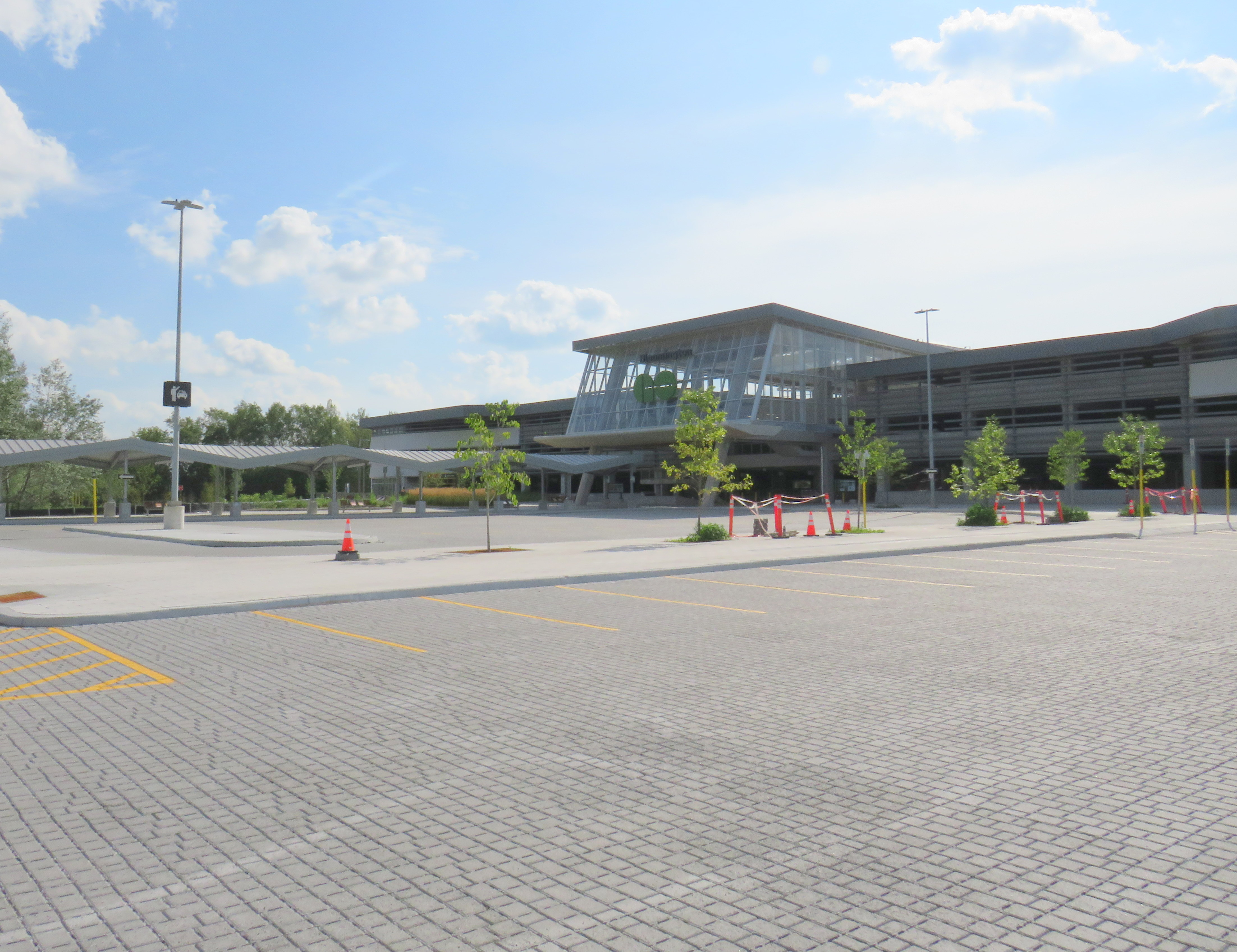
    Metrolinx, the provincial agency responsible for planning and constructing transit infrastructure in the GTHA and for operating GO Transit, opened Bloomington Station on June 28, 2021. The station is located on Bloomington Road, adjacent to Highway 404, on the boundary between Richmond Hill and Aurora.

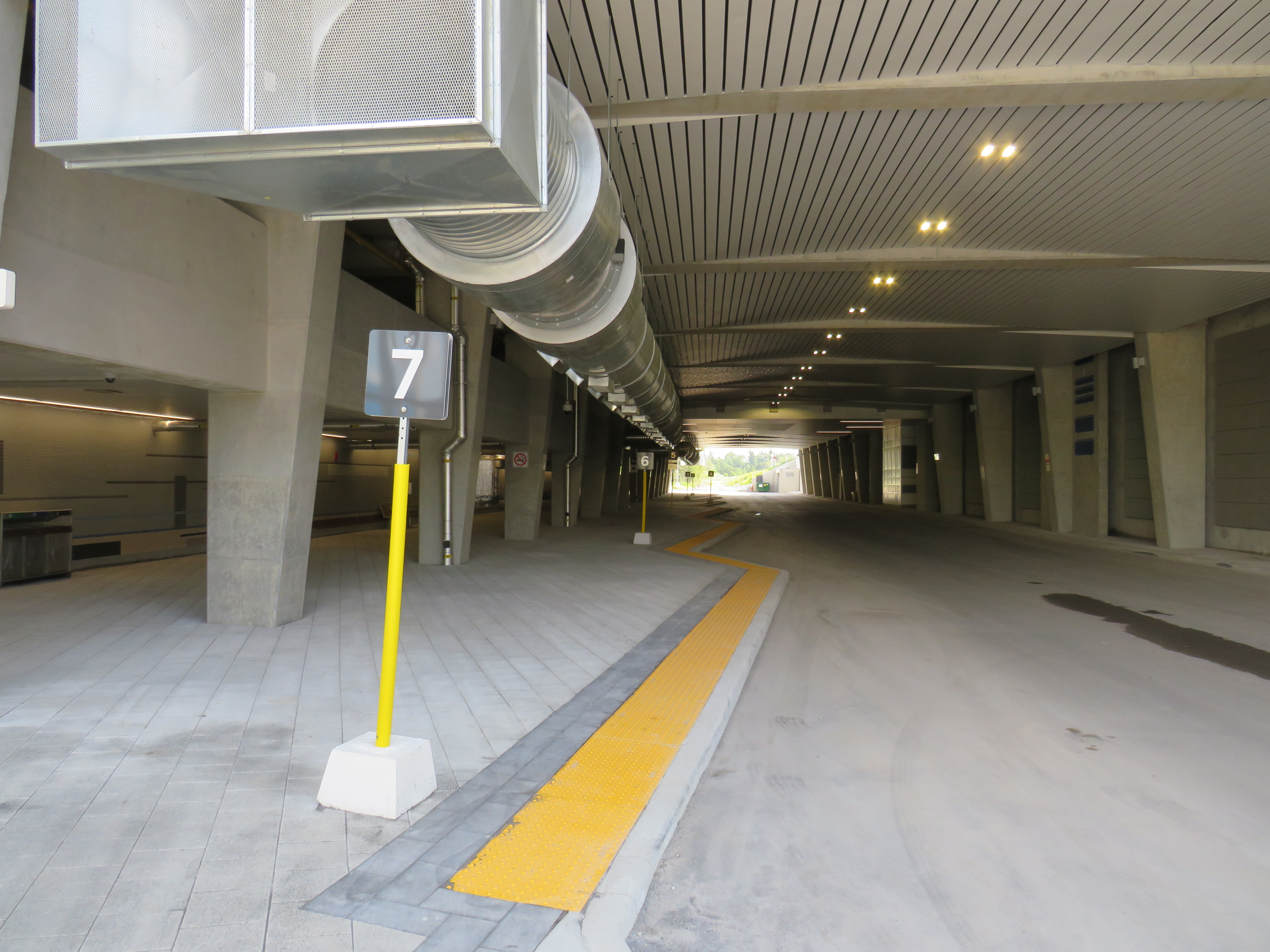
    The station is built around a three-storey parking garage tucked into a hill, with the train platform and station amenities (an enclosed waiting room with washrooms and a ticket counter) on the second level. At the lower level, there is a six-bay bus loop almost directly below the rail platform, minimizing the distance between train and bus. Elevators, stairs, and ramps connect the three levels of parking, the bus bays, and the train platform.

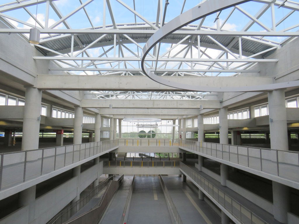
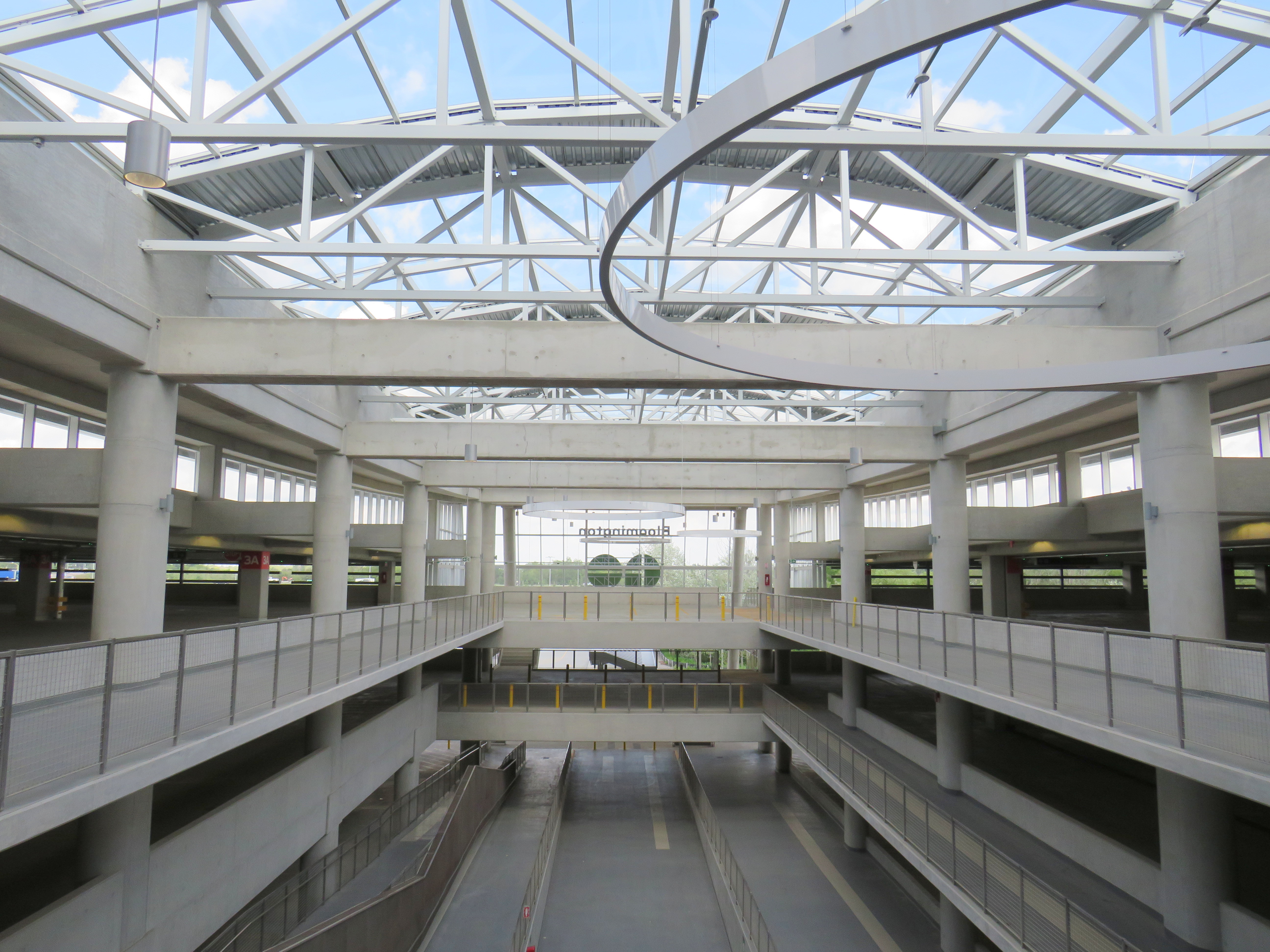
    The station’s central atrium, which contains the pedestrian passages between parking levels, station, and platforms, is the architectural highlight. Above the parking areas, solar panels collect some of the energy required to light and heat the station.

    Atrium at Bloomington Station, with parking spaces on both sides

    In its blog, Metrolinx expressed pride in the new station, noting it was built to achieve LEED Gold certification through features such as energy efficient lighting, a water-permeable surface lot, stormwater management, and a pond for local wildlife with an underground passage to help animals migrate away from the station complex. Like most new GO platforms, Bloomington’s train platform is heated to allow snow and ice to melt, reducing salt usage. Finally, as far as suburban GO stations go, Bloomington’s footprint is quite compact. It cost $82.4 million to build the new station.

    Plaque adjacent to wetland at Bloomington GO Station
    Permeable surface at Bloomington’s outdoor surface lot and passenger pick-up and drop-off area

    Despite these innovations, a LEED certification can only go so far when the GTHA’s newest transit station is only accessible by car, with over 1,000 parking spaces. Though transit ridership is down significantly during the ongoing pandemic, especially on GO’s Richmond Hill Line (which operates only in the weekday peak-period direction and currently uses four-car trains), there are no ongoing connections from Bloomington GO Station operated by GO buses or York Region Transit.

    Though several GO rail stations do not have any local transit connections only Bloomington and Gormley have no bus connections at all. (In April 2020, YRT discontinued the limited-service Route 15 that ran past Gormley Station). At Acton, Georgetown, and Lincolnville, which also do not have any local transit connections, passengers can still connect to GO buses for points beyond, or make a return trip.

    The only bus operating at Bloomington Station’s loop is GO Route 61, which provides supplemental weekday service between Union Station and Bloomington GO. But the last Route 61 bus leaves for Union at 1:55 PM.

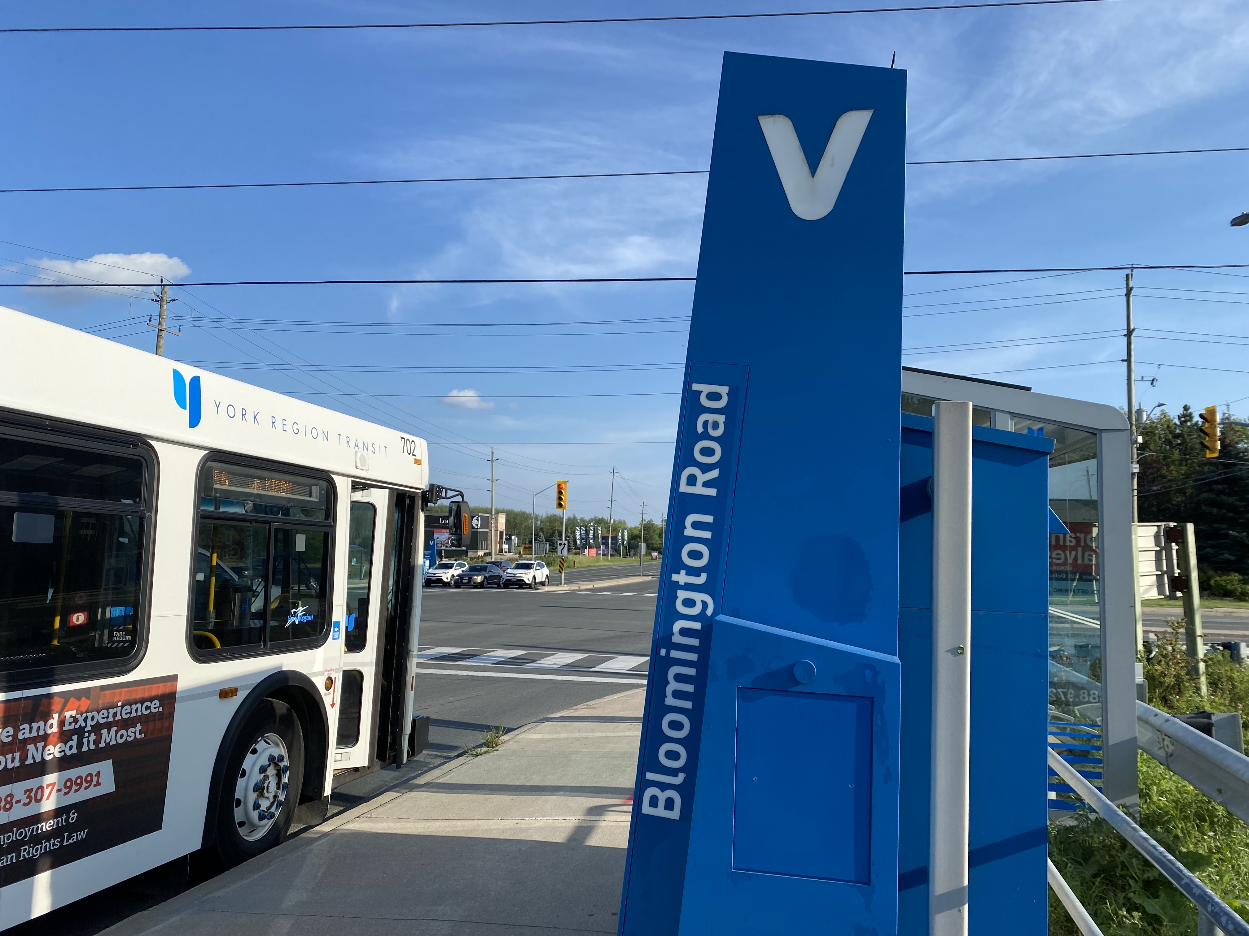
    There was no bus connection to be found at Bloomington GO Station

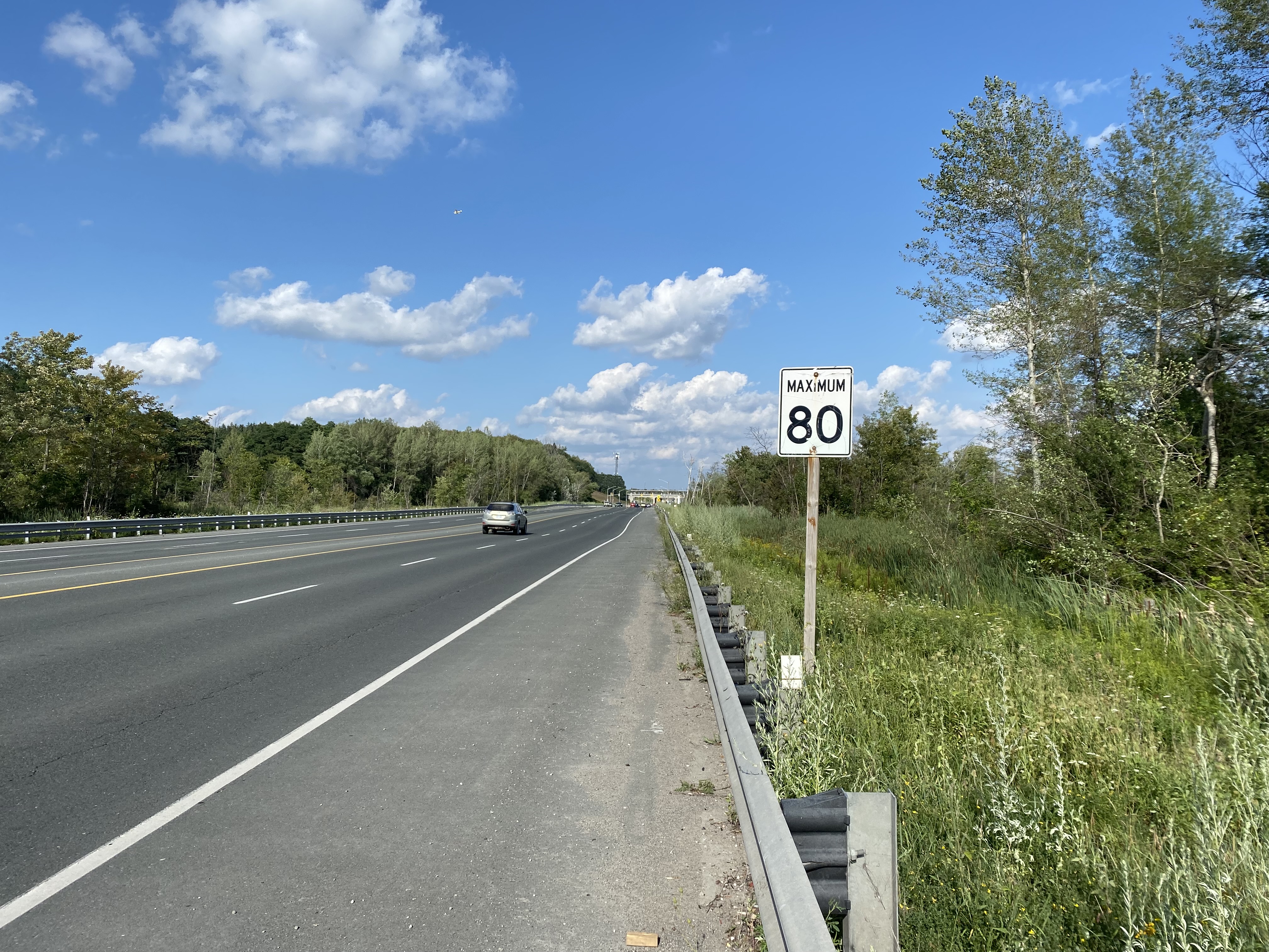
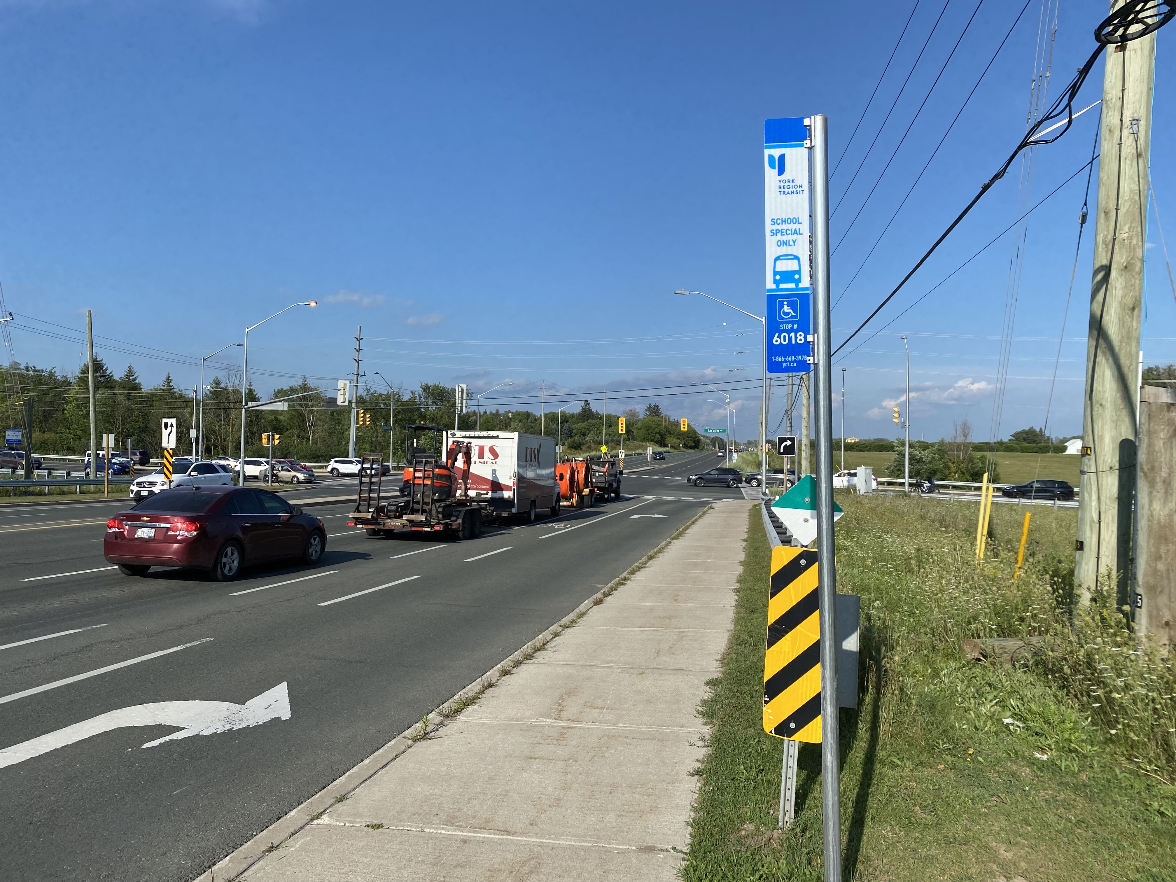
    The nearest in-service bus stop is over one hour’s walk away, near Bloomington Road and Yonge Street. At least there was a paved shoulder along the busy five-lane road between the GO station and Bayview Avenue, where motorists were driving well in excess of the 80 km/h speed limit.

    Looking east towards Bloomington GO at Leslie Street

    At Bayview Avenue, a sidewalk leads westerly to Yonge Street, with new residential subdivisions lining the south side of Bloomington Road. I noted a bus stop as I was walking west towards Bayview Avenue; alas, it was only for a high school special route.

    YRT stop at Bloomington Road and Bayview Avenue signed “school special only”
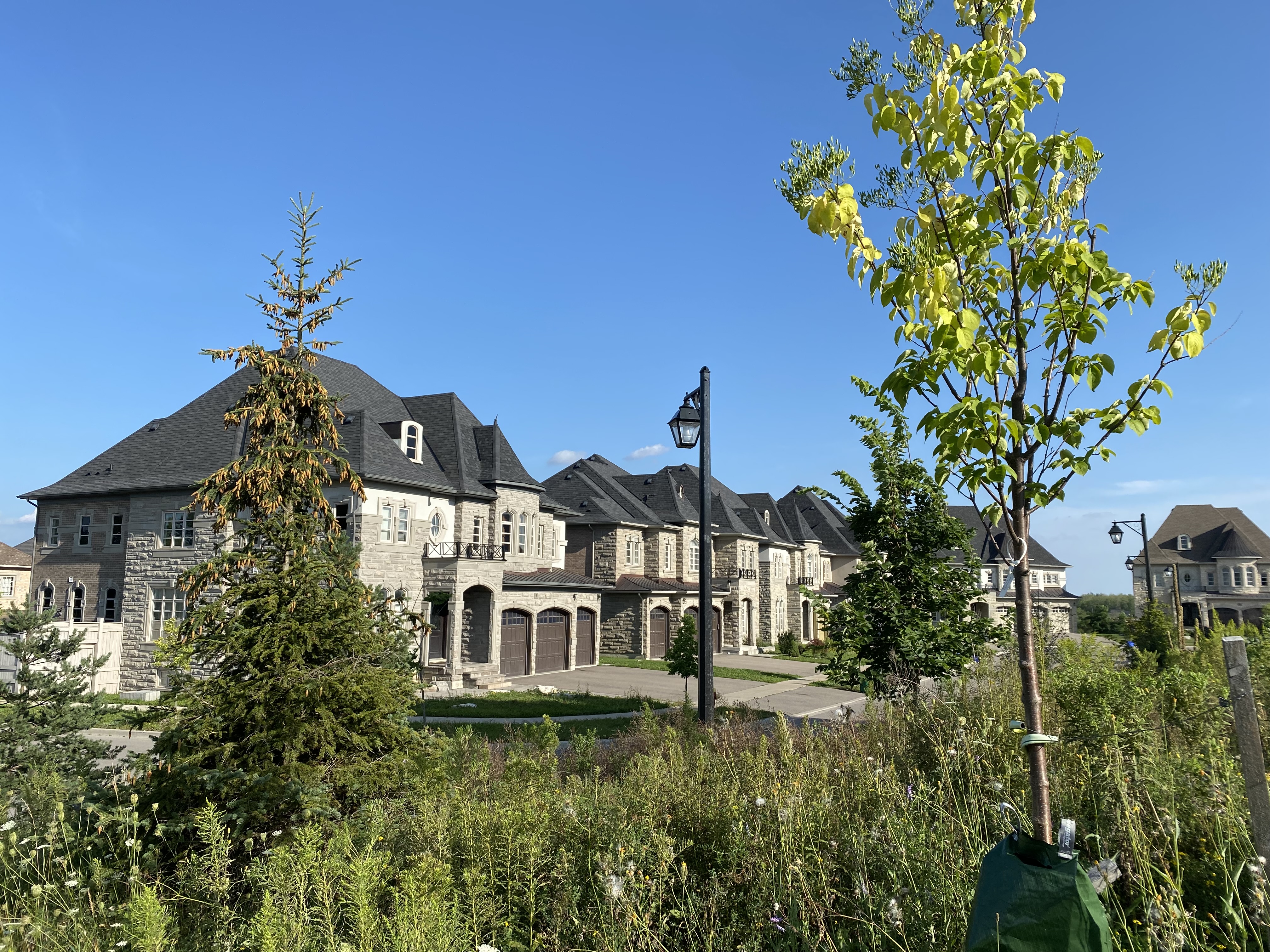
    New residential development along Bloomington Road featuring large houses with three-car garages was clearly designed for cars, rather than people

    As I was nearing Yonge Street, I noted that the new subdivisions were set back far from the road, with many of the houses built with three-car garages. Building enough transit ridership here to support even a limited service bus route is going to be very difficult.

    One hour and 8 minutes later, I arrived at the bus stop at Yonge Street, the closest place to Bloomington GO Station where I could get a bus to continue my journey.

    The end of a long walk from Bloomington GO Station

    Bloomington Station’s small footprint and environmental features might actually make it an ideal basic station design for more urbanized locations in the GTHA, where the compact design and logical layout could support easy bus connections and short walks to residential and employment areas. I liked the simplicity of the bus connections at Bloomington — if only there were any buses to connect to.

    But Bloomington’s LEED Gold certification means little when it does not support sustainable development or sustainable access to the station.

    Though its location adjacent to Highway 404 may entice some commuters to switch to parking at Bloomington and commuting downtown by train, Gormley, just one station to the south, already achieves a similar purpose.

    For now, Bloomington Station is just a Garage Mahal — a grand monument to the old way of doing things at GO Transit.

  • Stranded at Bramalea GO: Metrolinx’s missed connections

    Stranded at Bramalea GO: Metrolinx’s missed connections

    Temporary bus terminal, Bramalea GO Station
    The inhospitable temporary bus terminal at Bramalea GO Station

    On Tuesday, August 25, I paid a visit to Kitchener.

    Greyhound suspended all operations in Eastern Canada on May 13, 2020 due to low ridership during the COIVD-19 pandemic. Meanwhile VIA Rail reduced its operations, including Train 85, which departed Union Station at 10:55 AM for Guelph, Kitchener, Stratford, and London. Therefore, GO Transit became the only way to get between Toronto and Kitchener-Waterloo for a day trip without a car.

    From boarding the 11:53 Kitchener Line train from Union Station, it should have taken just under two hours to get to Downtown Kitchener. Instead, because of a minor train delay, and a failure of the connecting bus to hold for transferring passengers, it took me three and a half hours.

    If we value transit users, passengers must not be left behind when making these transfers, especially when connecting between posted connections.

    (more…)
  • A sudden drop in transit usage across the Toronto Region

    A sudden drop in transit usage across the Toronto Region

    IMG_6299-001Last week, I wrote about how several TTC routes were facing overcrowding, despite the COVID-19 pandemic, and a severe drop in system-wide ridership since early March. I shared this analysis on Spacing’s website, and Ben Spurr at the Toronto Star reported more about the story this week.

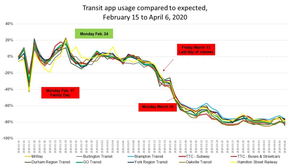
    Though detailed ridership data is not freely accessible, I wanted to see how ridership on the TTC, GO Transit, and other Greater Toronto and Hamilton Area transit agencies was faring. Helpfully, the team behind the Transit app, a trip-planning smartphone tool, made their usage data available to transit agencies, journalists, and data nerds to track transit demand during the pandemic. Although there are some limitations to using this data (more on that later), it’s an excellent metric for tracking transit ridership for dozens of major transit authorities across Canada and the United States, representing nearly every major metropolitan region.

    The numbers used to determine transit ridership demand is based on usage of the Transit app. (While Transit is one of several apps that can be used to plan trips, including Metrolinx’s own Triplinx app, Transit is my favourite). Normal usage is defined by Transit as app sessions observed on the same day of the week one year ago, averaged over three weeks and corrected for yearly growth in the corresponding transit agency. Hence, a rapidly-growing system, such as Brampton’s, can be represented accurately by the app.

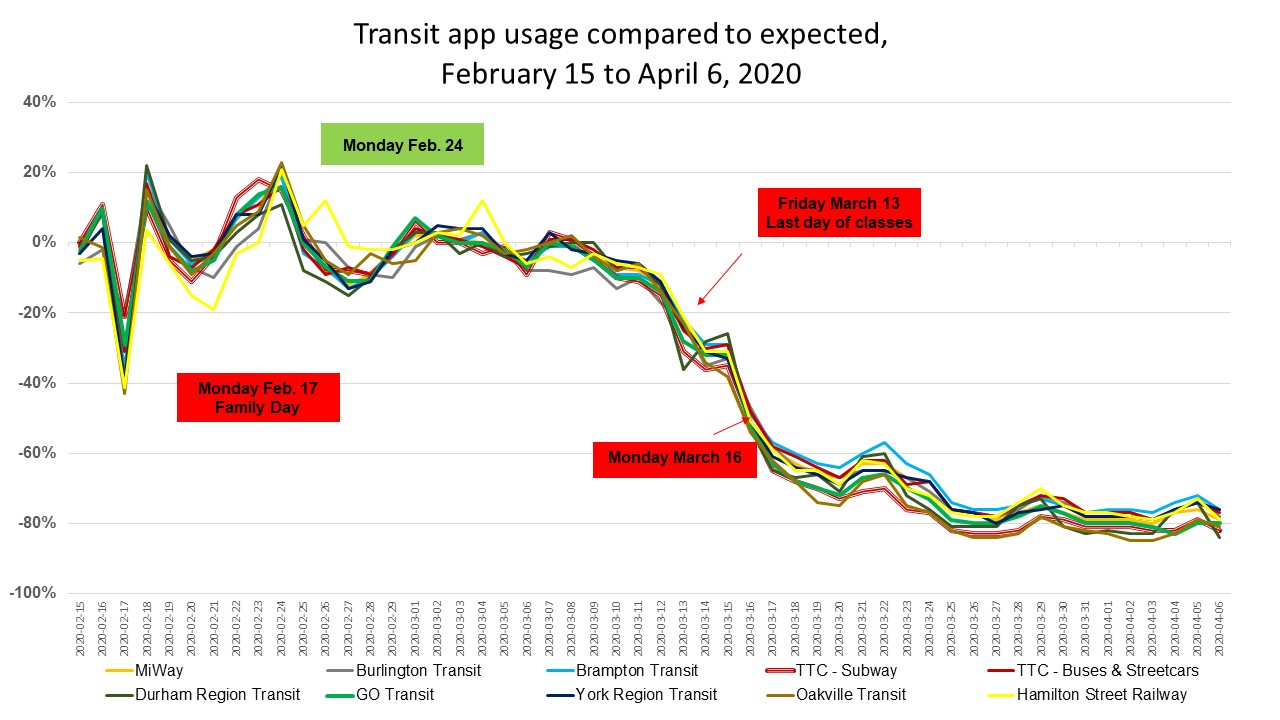
    Data was available for every transit agency in the Greater Toronto and Hamilton Area, apart from paratransit services (e.g. Wheel-Trans, Transhelp, DARTS, etc.) and Milton and Caledon Transit, the smallest fixed-route services. The graph below shows the how the usage of the Transit app fluctuated based upon the expected value, reflected as a percentage.

    GTHA Transit app usage from Feb 15 2020
    Transit app usage compared to expected for GTHA transit agencies, February 15 to April 6, 2020 (click for larger image)

    Note how the actual Transit app usage dropped by over 40% for every transit agency on Monday, February 17, which was Family Day, a provincial holiday in Ontario. Most transit services were operating on a weekend or holiday service, while students and many workers did not take transit. This was likely compared with normal Mondays, hence the one-day drop.

    It wasn’t until the second week of March that ridership began to decline as the number of COVID-19 cases began to surge in Canada and the United States, and governments began announcing new measures to reduce the rate of infection. On Thursday March 12, Ontario announced that public schools, scheduled to close for March Break, would stay closed for two additional weeks (the shutdown has since been extended). That day, the National Basketball League suspended the season, followed quickly by all other sports leagues. Employers began to implement contingency measures, such as work-from-home arrangements. By Monday the 16th, all restaurants were closed to sit-down clientele, and most entertainment venues closed.

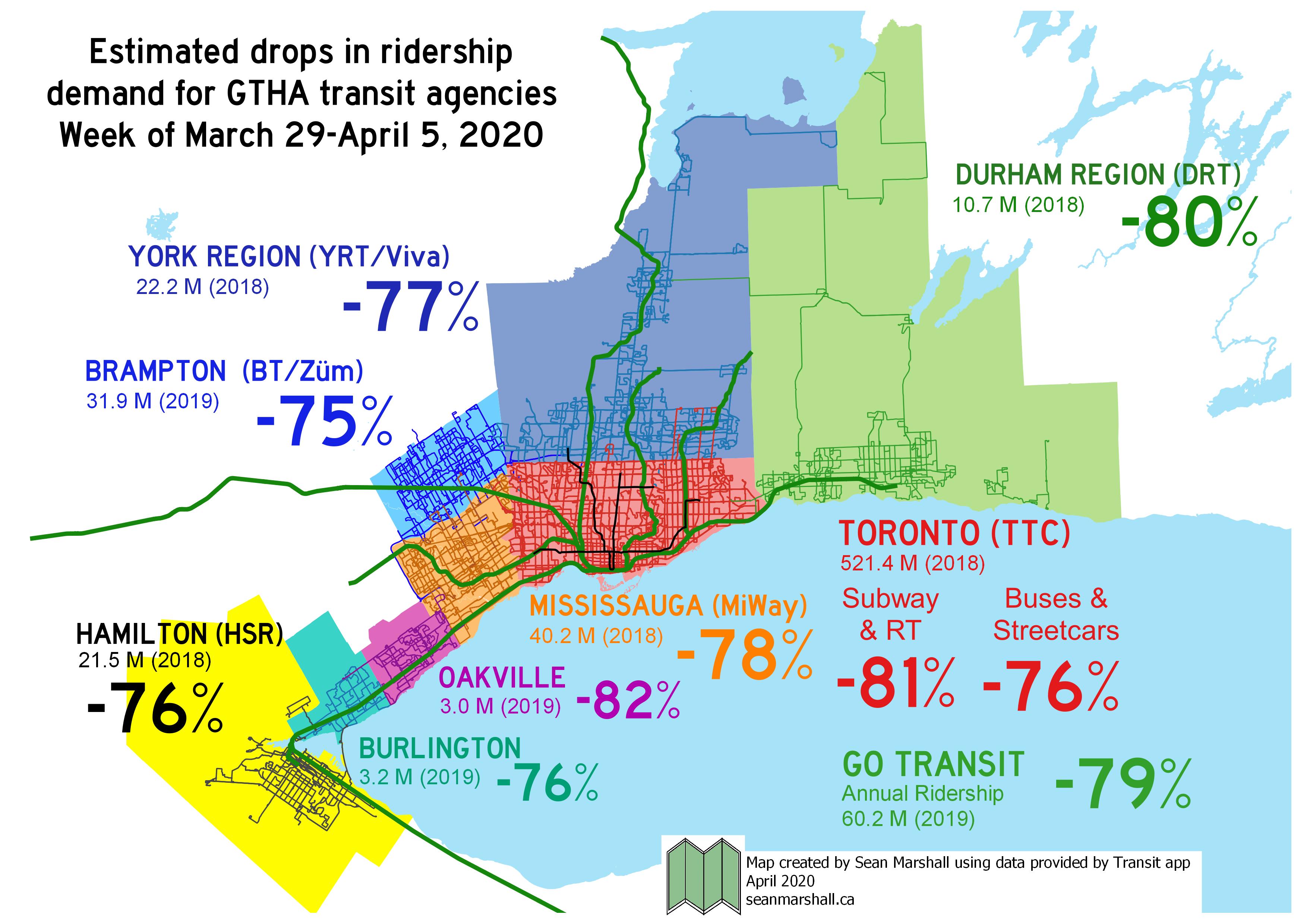
    By the week of March 29, transit demand was down by 75 to 82 percent across the Greater Toronto Area. Although many workers were either laid off or were sent home to work, employees in the healthcare, personal care, logistics, essential retail service (i.e. grocery workers), and food manufacturing industries remained on the job. This is evident in the difference between the demand for the subway (-81%) and the surface network (buses and streetcars, -76%) as they serve very different employment centres. Transit’s numbers are comparable to the TTC’s own ridership estimates.

    GTA_Ridership_COVID
    Map depicting estimated drops in transit demand for GTHA transit agencies compared to expected use for week of March 29 to April 5, 2020. Data from Transit app.

    Brampton Transit had the lowest estimated reduction in demand, at -75%. This could be for the same reasons that several bus routes in Toronto saw crowding despite a system-wide drop in ridership. Brampton’s population is relatively lower-income than many other suburban municipalities in Halton, Peel, and York Regions. Brampton also has many large food processing employers, such as Maple Lodge Farms, and many warehouses and distribution centres, including two major Amazon Fulfillment Centres. Brampton Transit connects to other major manufacturing and logistics employment areas in Mississauga, Vaughan and Toronto, including Pearson Airport.

    Oakville Transit had the greatest drop, which can be explained by two factors. The first is that Oakville, is a relatively more affluent municipality, with fewer logistics and food industry employers. Secondly, its bus network is designed entirely to connect with GO Transit’s Lakeshore Line, which feeds Downtown Toronto. Therefore, the ridership dependent on Oakville Transit is more likely to be working from home than Brampton’s.

    It must be noted that Transit’s figures are not the same as detailed ridership numbers collected by each transit agency. For example, Metrolinx cited a 90% drop in ridership across the GO Transit train and bus network, compared to Transit’s 79% estimate drop. Nonetheless, Transit’s data is a valuable metric.

    With the sudden drop in ridership, there’s also a sudden drop in revenue. While many systems, including Brampton Transit and GO Transit have made service reductions, they have been careful to ensure enough capacity remains to safely meet demand. Every system has also increased vehicle and station cleaning, and most have stopped collecting fares to protect both passengers and operators. Just like laid-off employees, students, and freelance workers, transit too will need a bailout of some kind to rebuild lost ridership and maintain safe and healthy services.

    Transit projects such as the Eglinton-Crosstown LRT, the new relief transit service for central Toronto (be it the Relief Line or Ontario Line), and GO Transit expansion must go on, as does the progress made in building ridership at suburban systems such as Brampton and Durham Region.

  • Mapping TTC crowding during a pandemic

    Mapping TTC crowding during a pandemic

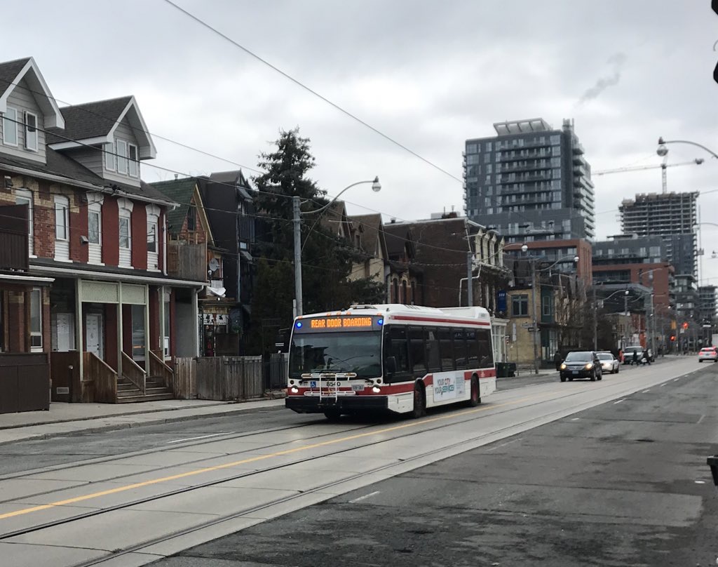
    IMG_6314Rear door boarding on TTC buses is just one measure the TTC has taken to address the COVID-19 crisis

    Note to readers: I have since written an updated version article (with a revised map) on Spacing’s website.


    While most people are urged to stay home as much as possible during the ongoing COVID-19 pandemic, there are those who must carry on. These include health care workers, staff at grocery stores, pharmacies, and other essential businesses, and others who can not work from home. There are also those who continue to require transit to undertake essential errands, such as medical appointments.

    Thankfully, most transit systems have carried on. Through GO Transit has experienced an 80% drop in ridership since the beginning of March, it continues to operate all rail lines and most bus routes, providing fewer trips, but maintaining the same span of service hours. The TTC discontinued most express routes, but it maintains a grid of frequent bus and streetcar services.

    However, the TTC and Brampton Transit continue to struggle with crowding on certain routes. Brampton Transit — which has resorted to an “enhanced Saturday service” level –will only carry half a bus’s seated capacity to enforce social distancing, which has resulted in “closed-door” situations where buses won’t stop for waiting passengers. As a result, several routes are now discontinued during peak periods so that buses are sent to address crowding elsewhere. Brampton Transit serves many shipping warehouses, including two Amazon fulfillment centres, which remain busy during this time.

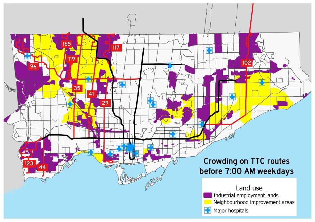
    Meanwhile, the TTC is struggling with morning rush hour crowding on ten bus routes:

    • 29 Dufferin
    • 35 Jane
    • 41 Keele
    • 44 Kipling South
    • 96 Wilson
    • 102 Markham Road
    • 117 Alness-Chesswood
    • 119 Torbarrie
    • 123 Sherway
    • 165 Weston Rd North

    These routes, mostly clustered in the city’s northwest, are illustrated below.

    TTC_COVID_CROWDSMap of overcrowded early morning TTC routes during the COVID-19 pandemic
    (click for larger version)

    Routes 117 and 119 are industrial services, connecting warehouses and food service plants. These industries — like the infamous Fiera Foods plants served by Route 119 — rely on low-paid, often temporary workers, with early morning starts. Certain warehouses and many food-service plants also have very early starts to the day. It would be tough for workers to accommodate the TTC’s request to travel at later times. Routes 96, 102, and 165 also extend into major industrial areas. Route 123 serves the Metro supermarket chain’s distribution centres on Dundas Street and The West Mall.

    Many of these routes run through Toronto’s neighbourhood improvement areas, which are identified by the city as those requiring additional investment due to issues such as poor access to services and higher concentrations of low-income families. In addition, routes 41, 96, 119, and 165 serve the Humber River Regional Hospital, one of Toronto’s largest health care facilities, while the 96 Wilson also directly serves Etobicoke General Hospital.

    Though it would be best for private essential employers to stagger shifts during this unprecedented time, there may be a need for the TTC to redirect some resources towards these parts of the city.

  • The consequences of losing the GO-TTC discount

    The consequences of losing the GO-TTC discount

    IMG_7846-001

    When the Toronto subway system was extended by six stops to York University and Vaughan, it marked the first time the TTC’s rapid transit system extended beyond the city’s boundaries. But it also exposed a major failing of the Golden Horseshoe’s transit structure: the complete lack of fare integration.

    In 2017, the provincial government announced a new fare discount between the TTC and GO Transit, which operates the region’s commuter rail and bus network. This $1.50 fare discount, available to Presto card users, was funded by the previous Liberal government’s fledgling cap-and-trade carbon pricing scheme, with the promise of further fare adjustments (such as discounts for transferring between the TTC and other suburban transit agencies, such as York Region Transit and Miway) to come.

    With the election of the Progressive Conservatives in 2018, the cap-and-trade scheme was cancelled, and with it, the continued funding for the GO-TTC fare discount. That discount is set to come to an end on March 31, 2020. Neither the cash-strapped TTC or Metrolinx, the provincial agency responsible for GO Transit and transit planning, will step up to make up the difference.

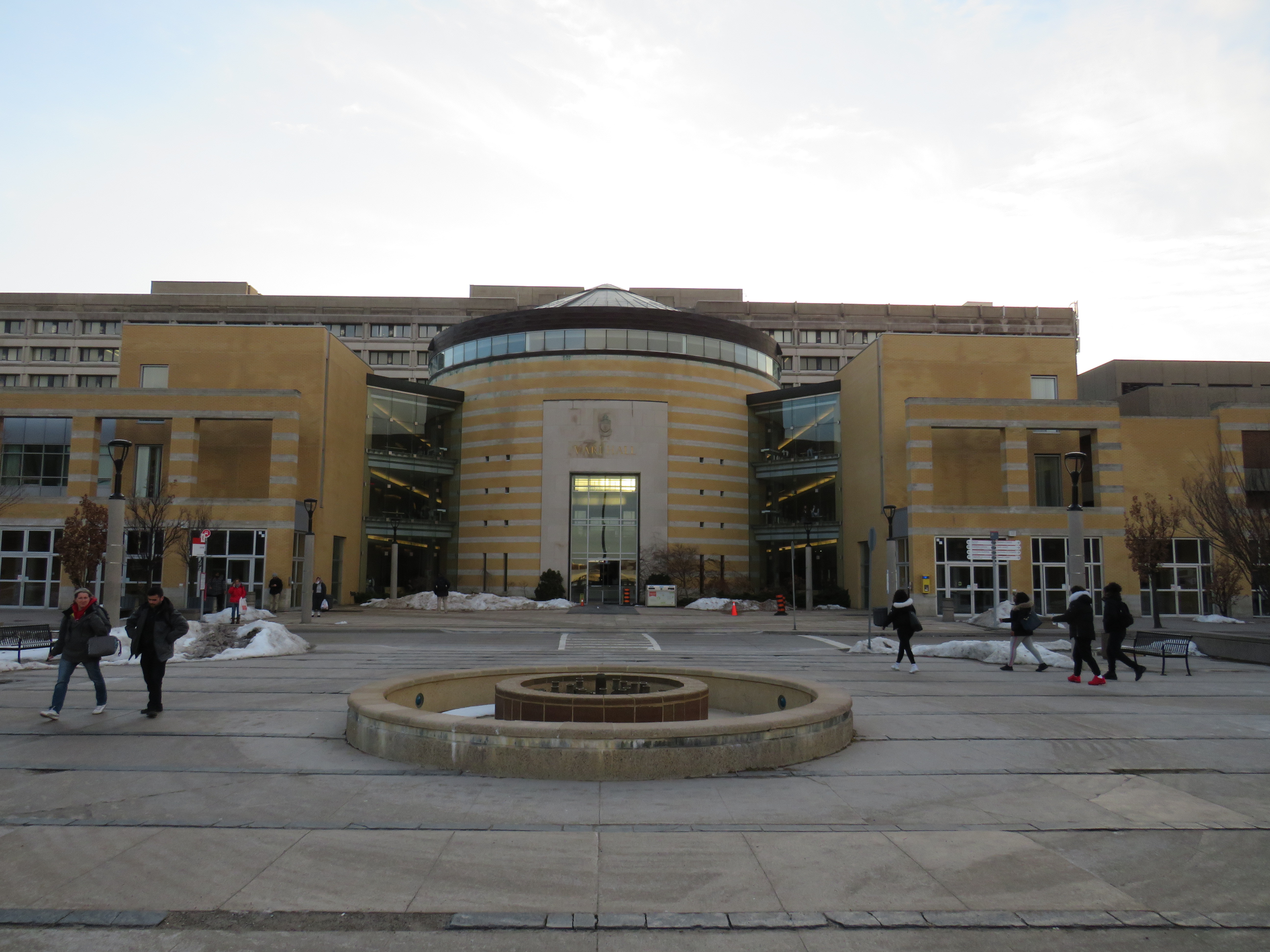
    IMG_7865-001GO Transit buses used to stop right in front of Vari Hall, in the heart of York University’s campus
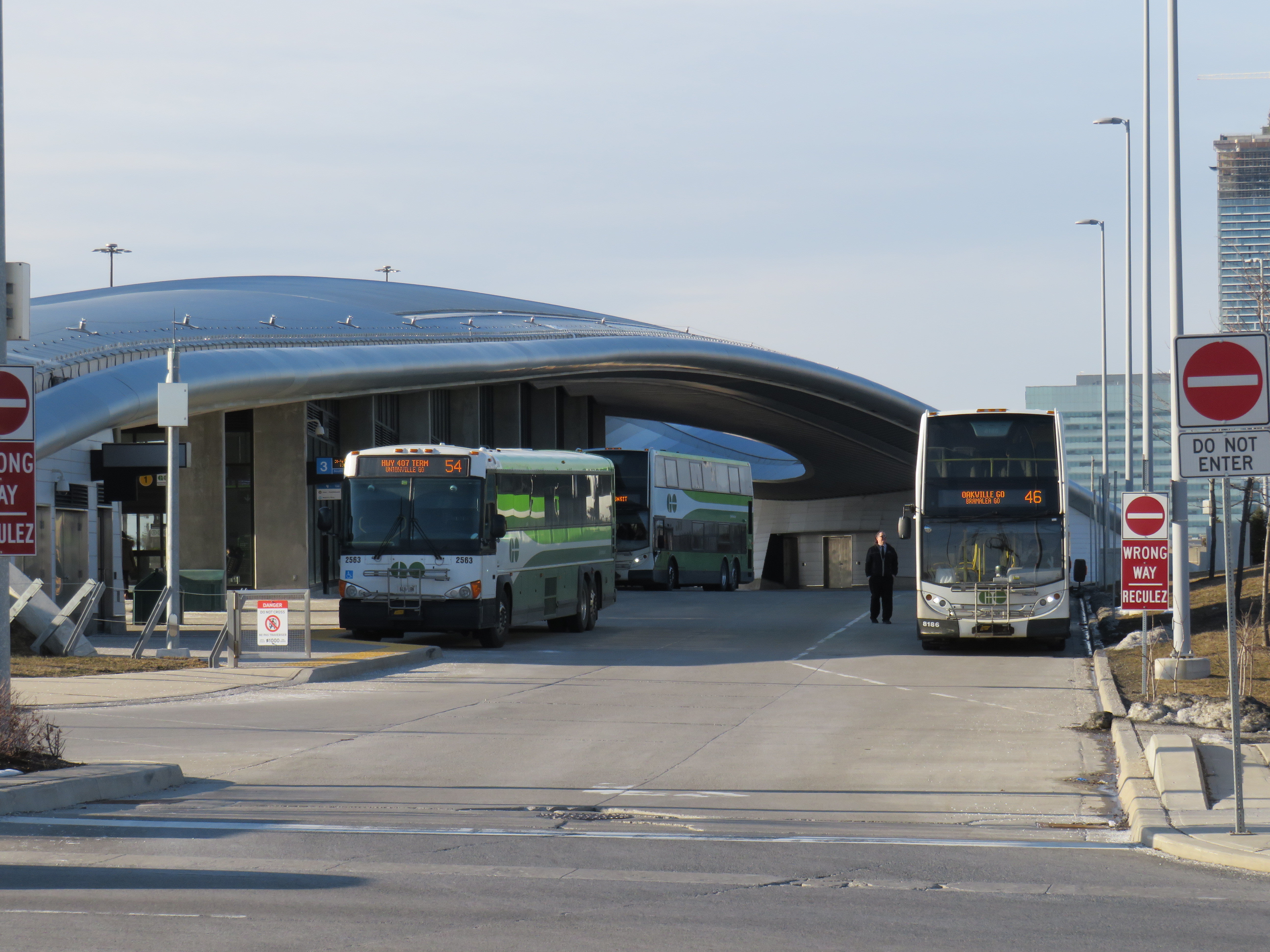
    Though many regular GO rail commuters will feel the impact of the loss of the fare discount, the impact on York University students and staff will be especially felt. That’s because the new subway extension was planned to remove GO Transit buses from the heart of the campus to a purpose-built terminal at a remote new subway station next to Highway 407. I recently wrote about the problematic fare structure on those GO buses serving Highway 407 Station. Now, those commuters going two more stops will pay $6.40 a day in TTC fares on top of those expensive GO fares.

    Unless they decide to walk to campus.

    On Thursday, March 5, I tried do just that. It was not a pleasant experience.

    https://twitter.com/Sean_YYZ/status/1235681892185206785?s=20

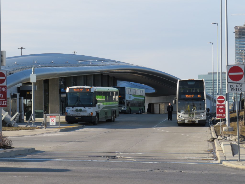
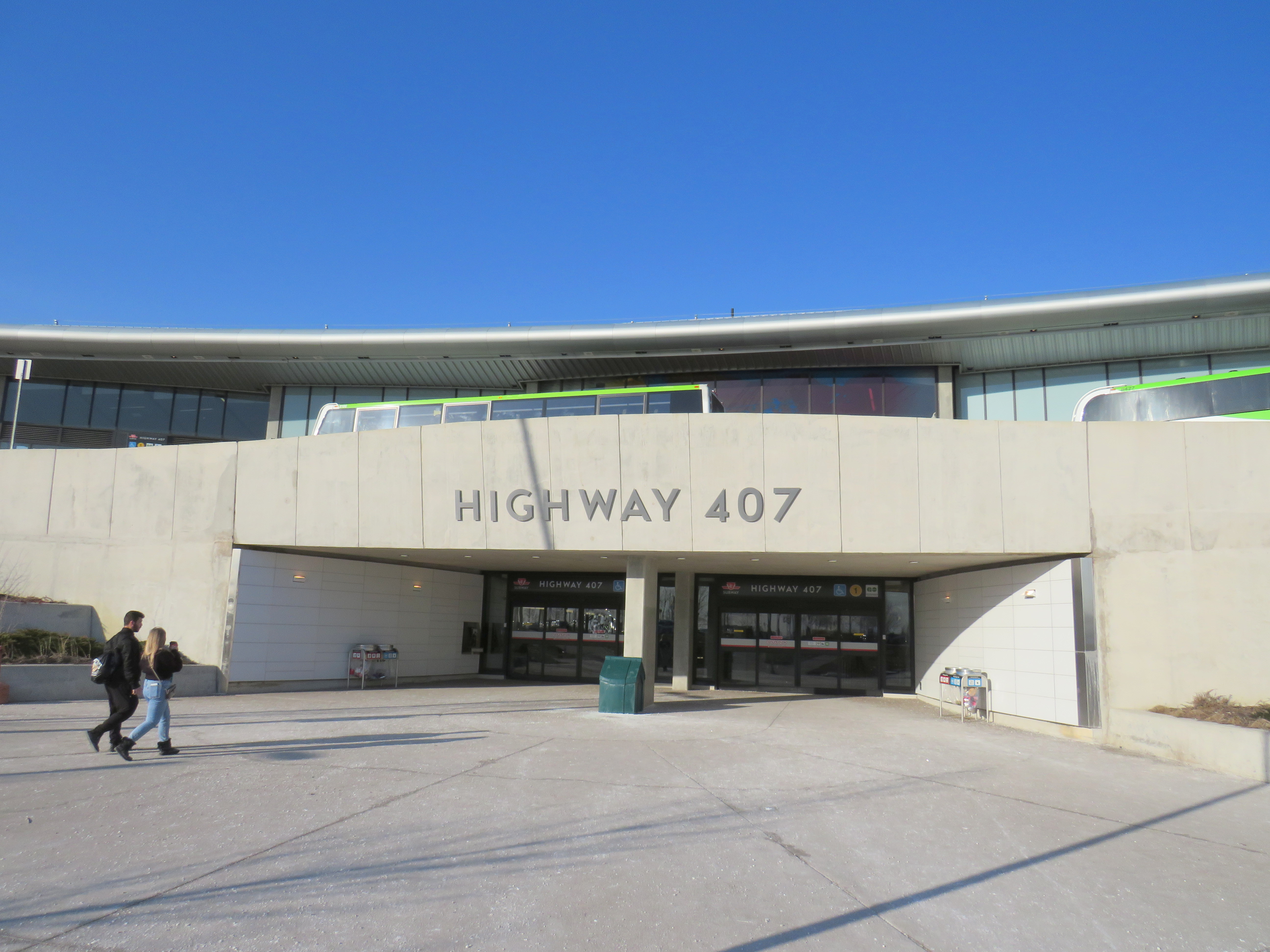
    Highway 407 Station features a large bus terminal for GO Transit and YRT buses, a passenger drop-off and pick-up area, and a commuter lot. But it was not built with pedestrians in mind. That’s understandable. The only places within a few minutes’ walk are Beechwood Cemetery across the street, a warehouse, and the employee entrance to a major UPS parcel centre.

    The main — and only authorized — entrance is on the opposite side of Jane Street, facing the passenger drop-off/pick-up area and the parking lot. It is quite clear in the design that most passengers would be transferring between bus and subway, perhaps with the idea that the fare boundary issue would be resolved by the time the station was open.

    IMG_7830-001
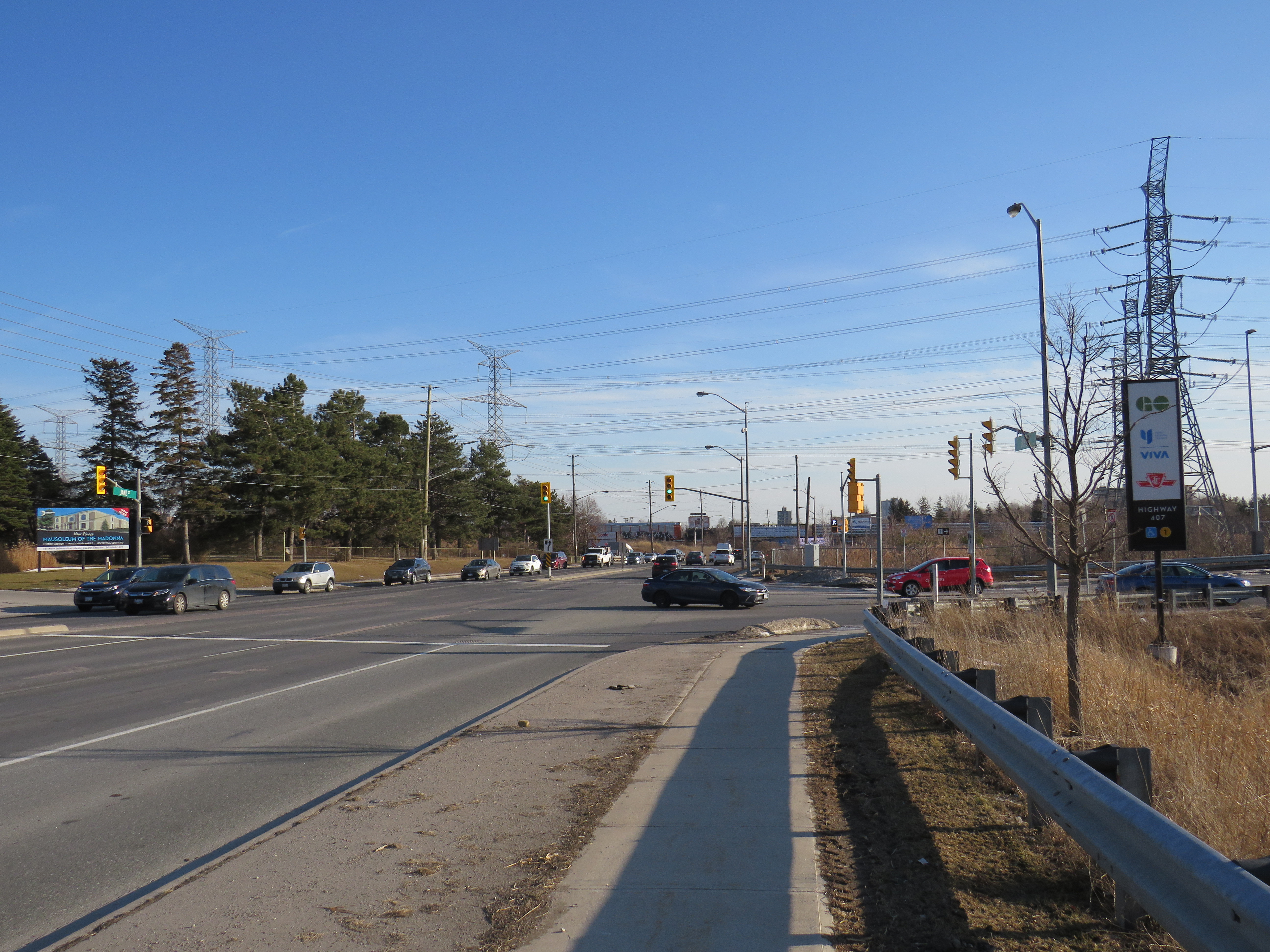
    Jane Street, with the entrance to Highway 407 on the right, and Beechwood Cemetery on the left

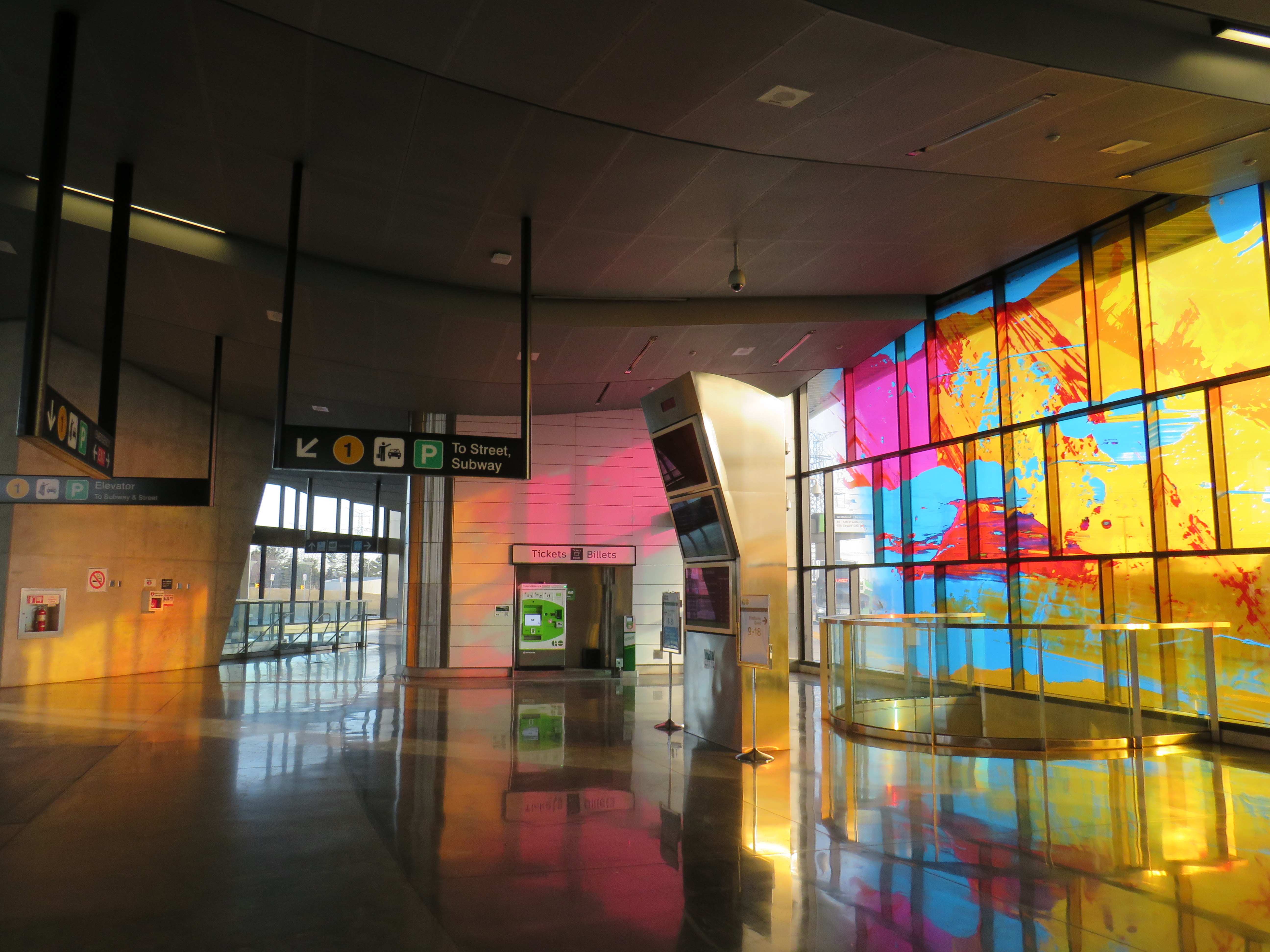
    The vertical circulation prioritizes bus-subway connections. At the bus platform level, I spotted a sign that said “to street, subway” leading to a downwards escalator. But it led me past the mezzanine level straight to the subway fare gates. I had to climb halfway up to get to the entrance doors.

    IMG_7848-001The stained glass at Highway 407 glows in the late afternoon sun. But it doesn’t take away from a poor user experience.

    Once outside, I noted that the pedestrian path between the parking lot and the passenger waiting area was completely covered by a giant dirty snow pile. It’s clear that pedestrians are not welcome here.

    Snow left on the only legal sidewalk leading out of Highway 407 Station

    The circuitous route is designed to keep pedestrians out of the way of the buses entering and exiting the station. But I was left wondering why a shorter, direct, and snow-free route was not designed into the station plan at the beginning. It would have cut a few minutes from my efforts in leaving the station.

    IMG_7835-001
    Pedestrians are barred from the more direct route into the station, even though the bus terminal is not a TTC fare-paid area.

    Eventually, I made it to Jane Street, and began walking south towards Steeles Avenue and campus. The narrow sidewalk hugs Jane Street, and right into a splash zone under the CN Railway underpass.

    IMG_7853-001
    An unpleasant walk along Jane Street

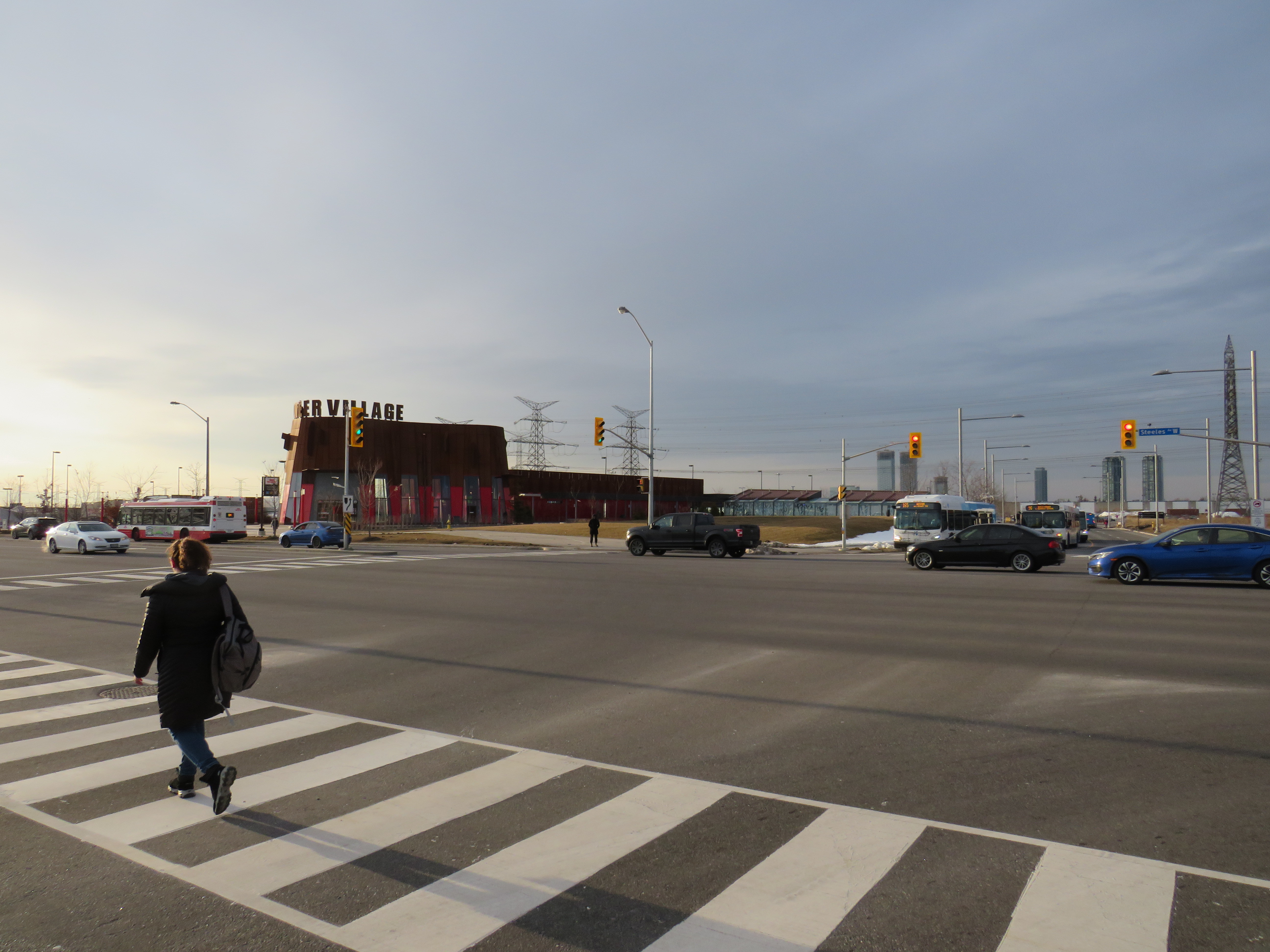
    After twenty-seven minutes, I made it to Pioneer Village Station, which was designed with two separate bus terminals. YRT buses use the smaller bus loop on the north side of Steeles Avenue, outside the fare-paid area. TTC buses use a larger terminal south of Steeles Avenue, on the York University lands. YRT passengers headed to campus must cross Steeles Avenue at grade as the mezzanine level underneath is fully within the TTC fare paid zone. Technically, one could transfer from GO to the YRT 20 Jane bus at Highway 407 Station (with a Presto card, it would cost only $1 each way with the YRT-GO co-fare). But it would still only get you part of the way to campus.

    IMG_7863-001

    After 35 minutes, I made it from the GO bus platform at Highway 407 Station to the Life Sciences Building at York University, on the northwest corner of the central campus, with another 5-10 minutes to major buildings such as Vari Hall or Scott Library. This was at a relatively quick pace (I’m an able-bodied thirty-something man), in quite pleasant weather. A rainy or bitterly cold day would be quite a different matter. Therefore, most will be forced to pay $3.20 each way (the current TTC Presto fare).

    The subway, with the major GO and YRT terminals off campus, was designed for a new fare structure where students and university staff wouldn’t be penalized for having to transfer one or two subway stops to get to the middle of campus. The most we got was a fare discount for GO Transit riders, with nothing for YRT commuters. (Only Brampton Transit continues to directly serve York University.) And now that meagre fare concession is going away, because no one wants to pay for it.

    Sadly, this is just further evidence of how we get transit so wrong in the Golden Horseshoe, despite it being the country’s economic heartland.


    Transit advocacy group TTC Riders, along with allies at York University, have been calling on Queen’s Park to continue to fund the fare discount. You can find out more here.

    I also expect that the opposition New Democrats will submit a motion in the legislature to maintain funding for the discount next week. I’ll update this post as necessary.

  • Disappearing GO-TTC fare discount a major blow to regional transit in Toronto

    4902983182_d89c675230_b

    Updated January 22, 2020

    The TTC-GO fare discount will officially come to an end on Tuesday March 31, 2020, with the TTC and Metrolinx unable to come to agreement to keep the fare subsidy going without provincial support.

    As I argue below, this is a major blow to any hopes for an integrated regional transit system throughout the Greater Toronto and Hamilton Area. Subsidized transfers reduce the need to build expensive parking lots and garages, encourage more passengers to ride transit, especially in off-peak periods, and reduce the potential of major GO Transit expansion projects planned or underway.


    Originally published July 12, 2019:

    Earlier this week, transit riders learned that the fare discount for connecting between GO Transit and the TTC would soon come to an end.

    The provincial Liberal government introduced the discounted double fare in 2017. It reduced the cost of a trip taken on both GO and TTC by $1.50 if the fare was paid on a Presto fare card. For many years, there were discounted transfers between GO and suburban transit agencies, but this was the first time such a discount was offered to TTC passengers.

    The Liberals also planned discounts for transferring between suburban bus systems such as York Region Transit and Miway, subsidies that would have been covered by the provincial carbon pricing scheme. This would have reduced the impact of another fare barrier. (A short bus trip across Steeles Avenue costs nearly $7.)

    When the Doug Ford-led Progressive Conservative government was elected, the provincial climate change plan was scrapped, along with those planned fare changes. Now, the province will not renew the $18.5 million annual subsidy for linked GO-TTC fares, though it did introduce free fares for children on GO Transit.

    This will especially affect commuters to York University, who previously enjoyed a one-seat ride to the heart of the campus on YRT and GO buses. When the subway extension opened, YRT retreated to terminals north of Steeles Avenue, forcing a transfer to the subway or a long walk across six lanes of traffic and campus parking lots. GO Transit, too, moved to a new terminal at Highway 407, two subway stops from campus. While GO commuters at least saved $3.00 a day with the discounted double fare, YRT commuters got nothing. (Of all the suburban agencies, only Brampton Transit continues to serve the campus.)

    This is also a blow to what’s left of SmartTrack, Mayor John Tory’s signature transit plan that was once pitched as “London-style surface rail.” At first, SmartTrack was a 53-kilometre heavy-rail line, mostly piggybacking on existing GO Transit corridors, but including a problematic western branch to the Airport Corporate Centre in Mississauga, all on an integrated TTC fare. Eventually SmartTrack just consisted of more frequent, electric GO service, along with additional station stops and fare integration. This was much more realistic, but it distracted from other needs such as the Relief Line and GO’s own RER regional rail plan.

    Lower GO fares for short trips and the TTC-GO fare discount were all part of this scaled-back version; as late as last year, Tory called additional fare integration a “critical component” of his pitch. Eliminating the fare discounts is yet another blow to SmartTrack.

    As Jonathan English points out in Urban Toronto, the GO rail network represents “tremendous infrastructure that could greatly improve the lives of hundreds of thousands of Torontonians.” But it lies “letting it lie mostly dormant because we won’t make the comparatively small operating funding investments required to improve the service and make the fares fair.”

    The $18.5 million annual cost is a small price to pay for improving transit accessibility and utilization of our existing corridors. Increasing that annual subsidy to reduce the cost of transfers between the TTC , York Region, Brampton, and Mississauga would, too be a worthwhile investment.

    Sadly, the current provincial government does not see the value in promoting fairer fare systems, nor regional transit in general. In response to budget cuts, Metrolinx reduced or eliminated service on five GO bus routes last month, and more may be to come. While there may be enthusiasm for building a new “Ontario Line” and a subway extension to Richmond Hill, there’s little regard for the actual transit rider.

  • Unfair GO fares on the Highway 407 Corridor

    GO bus with bicycle

    Since 1967, GO Transit’s primary focus has been its commuter rail lines radiating from Downtown Toronto, sometimes to the detriment of other transit needs in the Greater Golden Horseshoe, with bus routes complementing and supplementing that rail network. But twenty years ago, the regional transit service launched a new bus route that connected York University with suburban GO stations and bus terminals, filling in a gap and setting a precedent for expansion to other university and college campuses.

    Late last year, I analysed the GO Transit rail fare structure that centres on Toronto Union Station, following up on previous work. GO Transit claims to operate on a fare-by-distance structure, this is not quite the case. Generally, the longer one travels, the less the passenger pays per distance traveled. 

    Though the GO Transit fare structure was recently improved with new lower fares for short trips, there are still significant fare inequities and discrepancies, with Barrie and Richmond Hill Corridor passengers paying the least per kilometre traveled, and Kitchener Corridor passengers paying the most. 

    The fare discrepancies on the Highway 407 corridor — which is made up of eight bus routes that serve the Highway 407 bus terminal and TTC subway station in Vaughan — are even greater than that on the rail network. A passenger going from Markham GO Station, 27 kilometres from Highway 407 Station, will only pay $3.70 with a Presto card. A passenger from Bramalea GO Station, just 18.7 kilometres from Highway 407 Station, will pay over two dollars more. 

    (more…)

  • Going for a ride on the Bolton Bus

    IMG_6666-001.JPG

    Caledon, a town of 66,000 located northwest of Toronto, is known for charming villages, fall colours, and horse farms. Its most popular landmarks include the waterfall at Forks of the Credit Provincial Park, the unique Cheltenham Badlands, and the vast Albion Hills Conservation Area. Much of the municipality lies within Niagara Escarpment and Greenbelt protected areas, with lands set aside for farms, estates, parks, and golf. That’s how many Caledonians like it.

    Despite its green reputation, Caledon is urbanizing its southeastern quadrant, filling it up with warehouses, truck terminals, and low-density residential subdivisions, all adjacent to the built-up areas of Brampton and Vaughan. Bolton, once a small village, now has a population of 20,000. New subdivisions north of Mayfield Road are indistinguishable from Brampton’s residential development.

    Though two GO Transit bus routes ran through Caledon, it had no transit system of its own. This was becoming more of a problem as new warehouses employing thousands of workers opened. GO Transit’s buses were scheduled to connect with trains to and from Downtown Toronto, not to serve reverse commuters. Though Brampton Transit operated several routes close to Caledon’s borders, it could not extend north of Mayfield Road without an agreement with the town.

    Despite Caledon’s historical resistance to public transit, its attitude slowly changed for the better.

    In May 2010, Brampton Transit’s 30 Airport Road bus was extended to the AMB (now Prologis) warehouse complex just north of Mayfield Road. This was done at the request of AMB, though the Town of Caledon had to agree to the request for service.

    In 2015, Caledon began to study the need for a local transit system, retaining consultants from Steer Group to evaluate and develop options for new transit services, including routes, operators, and service hours. In April 2019, the report to council recommended starting with a route on Kennedy Road in Mayfield West (contracted by Brampton Transit) and a route connecting employment areas in Bolton with Brampton Transit and YRT at Highways 7 and 50 (contracted to a third party), with a demand-response service within Bolton and an extension of a future Brampton Transit route along Mayfield Road provided within a second phase.

    Meanwhile, GO Transit announced the abandonment of Route 38 in June, citing the planned new local transit service as justification for the cut, even though it wasn’t yet setup. Though GO partially restored the service (two daily round trips to Malton GO continue, for now), it remains a short-term solution.

    The Mayfield West service — Brampton Transit Route 81 — began in September, connecting with the 502 Züm at Sandalwood Parkway. On Monday, November 11, 2019, the Bolton Route began service, contracted to Voyago. Both routes operate on 30 minute frequencies, weekday peak hours only.

    IMG_4900-001.JPGNew Brampton Transit stop on Kennedy Road in Caledon

    The two separate agreements don’t work that well for creating a unified transit service.

    Though Route 81 and the Bolton Route both have a $4.00 cash fare, the Brampton Transit-contracted service operates on that agency’s fare structure. There’s a discount for Presto card users and a two-hour transfer valid on any other Brampton Transit route. The 80 cent co-fare to and from GO Transit also applies (Route 81 connects with the frequent 502 bus to Downtown Brampton). It’s a good deal for residents in west Caledon.

    However, the Voyago-contracted buses serving Bolton are only equipped with a fare box, and only accept $4.00 cash fares. There are no free transfers to or from connecting buses at Highways 7 and 50. (Brampton Transit routes 501 Züm, 1, 23, and 36 connect there, as does YRT route 77. It’s a few minutes’ walk to BT routes 31 and 50.)

    Last week, I took the new Bolton bus to get a feel for the new service. The Bolton line operates with two minibuses with twenty seats each and a spot for mobility devices at the rear. Within Bolton, the bus makes a long loop, primarily serving the industrial area in the southwestern quadrant.

    I boarded an afternoon bus from Highway 7 at 3:26 PM and rode to Downtown Bolton. I returned on the bus leaving Bolton at 4:30 PM. I was the only passenger each way; I was told by one driver that was typical. By riding the bus, I was able to learn about some of Caledon’s challenges.

    Transit options from Caledon council reportCaledon Transit high-priority route options from the April 2019 council report

    If the Bolton Line were integrated with York Region Transit and Brampton Transit and made more stops within Brampton, it’d be a useful service, attracting many more passengers. There are several major employers on the Vaughan side of Highway 50, including XPO Logistics, Home Depot, and the Canadian Pacific Intermodal Yard. Additional stops at Major Mackenzie/Coleraine, Rutherford/Castlemore, Trade Valley/Bellechase, and Zenway/Cortrelle would make the bus more accessible and useful to residents and employers. Another stop at Queen Street (Highway 7) and Gore Road would improve connections to Route 50, which serves Humber College.

    Those additional stops would likely require a third bus, but the current route struggles to maintain a 60-minute round trip even with the limited stops currently in place. But with fare integration and local service, it could then attract more passengers, defraying the cost of the additional vehicle and operator.

    In the long term, it would be good to see more cooperation with Brampton Transit, especially as Brampton continues to develop new subdivisions and industrial lands in the northeast, in the areas bordering Caledon and Vaughan. If GO Transit goes ahead and abandons the remnant of Route 38 an express route between Bolton and Malton GO will still be necessary; ideally, that would would be a partnership between Brampton and Caledon.

    Hopefully, Caledon will continue its commitment to building a transit service within its urbanized area. Despite very low ridership at present, the potential is there as population and employment continue to grow. It will take time to tweak the service, improve connections, and build ridership that can count on affordable, reliable transit.

    It’s also time for Halton Hills — now the last GTHA municipality without local transit — to step up and follow Caledon’s lead.