With ongoing COVID-19 restrictions, finding a washroom has become much more difficult. So I mapped Toronto’s park washrooms that will remain open this winter.
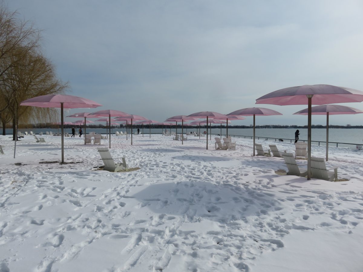
With ongoing COVID-19 restrictions, finding a washroom has become much more difficult. So I mapped Toronto’s park washrooms that will remain open this winter.
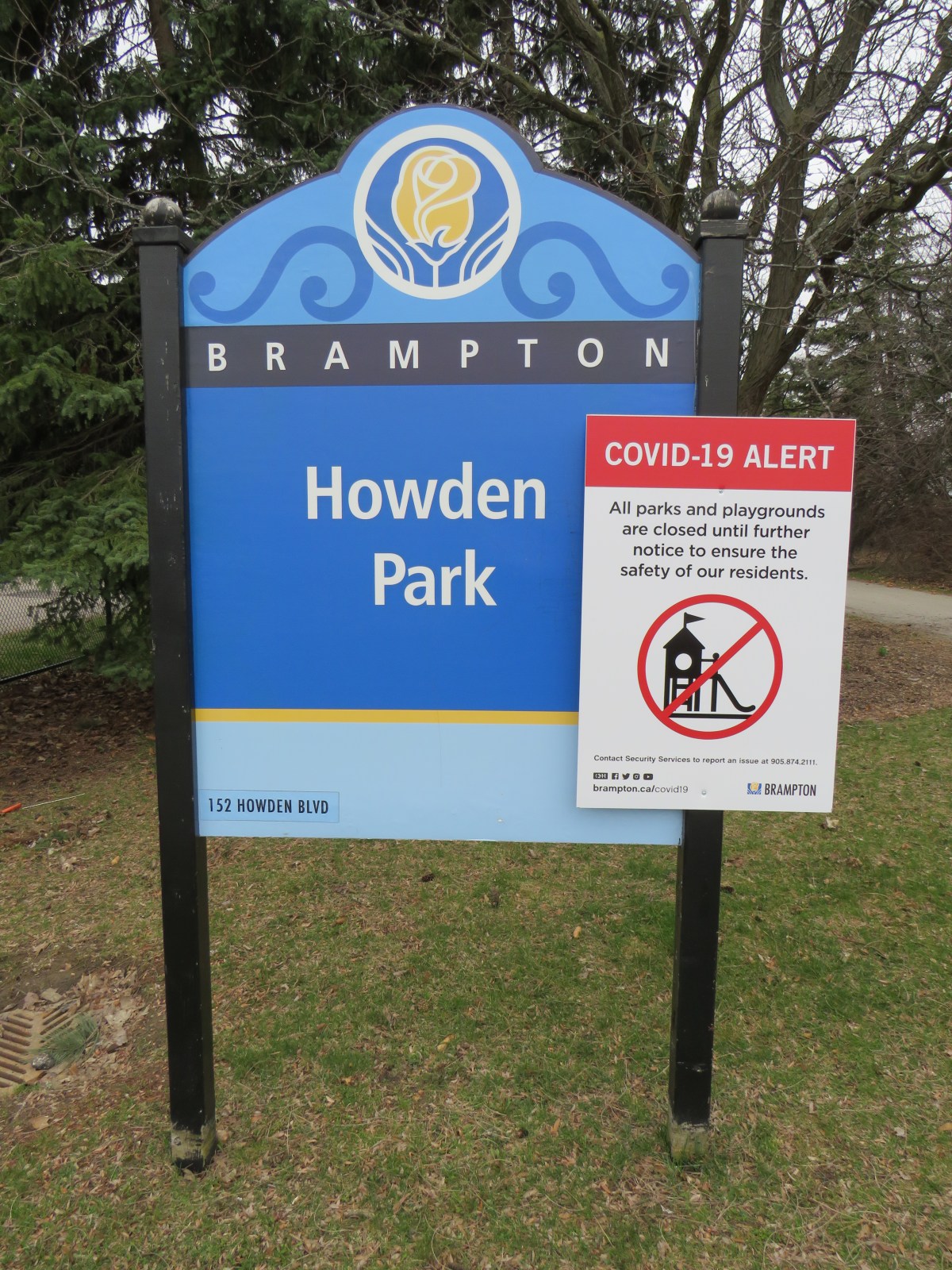
On Saturday April 11, during the Easter long weekend, the City of Toronto announced that a team of over 350 police officers and bylaw enforcement officers would shift from an education-based campaign of verbal and written warnings to people congregating and using closed amenities in parks to a zero-tolerance ticketing campaign. Tickets for violating orders […]
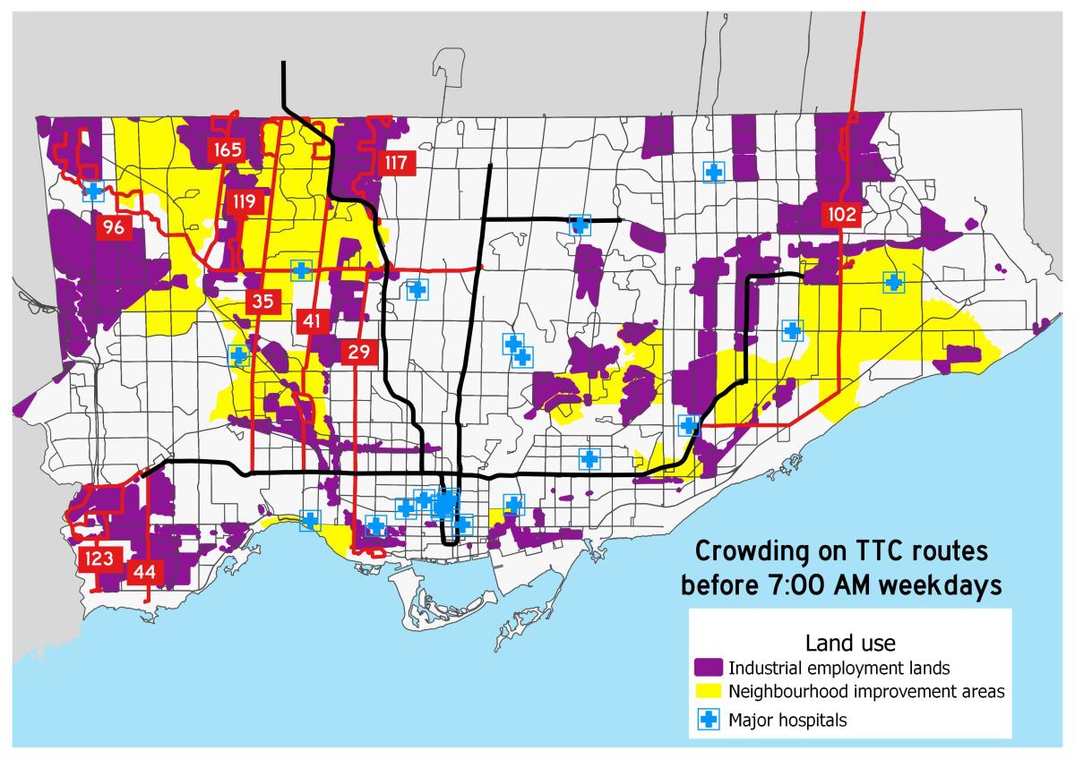
Rear door boarding on TTC buses is just one measure the TTC has taken to address the COVID-19 crisis Note to readers: I have since written an updated version article (with a revised map) on Spacing’s website. While most people are urged to stay home as much as possible during the ongoing COVID-19 pandemic, there […]

On February 26, 1920, Ontario’s provincial highway network was born. That year, 16 highways were established across southern Ontario, between the Ottawa and Detroit Rivers. These highways, previously maintained by townships and counties, connected the province’s largest cities and provided important links to Quebec and the United States. In 1925, these highways were assigned numbers […]
Since 2015, GO Transit’s fare structure has improved. However, fares continue to rise faster than the rate of inflation, and there are serious fare discrepancies across the network.
Despite many recent improvements to TTC design and wayfinding standards, two recent changes miss the mark.
2014 was a watershed year for municipal voter turnout in Toronto. After a disastrous four years of Rob Ford as mayor, 54.7 percent of all eligible voters went to the polls, electing John Tory. That was the highest voter turnout in decades, even higher than 1997, when Torontonians elected Mel Lastman to lead a newly […]
At the end of 2014, despite some disappointing results in that year’s municipal election, I was feeling optimistic about 2018. In 2014, there were a number of great candidates running for city council, and I expected many would try again in 2018. After council finally approved the recommended 47 ward model for the 2018 election, […]
In the penultimate post in my series examining the results of the 25 council races in the October 2018 municipal election here in Toronto, I take a look at the results in Ward 4, Parkdale-High Park and Ward 9, Davenport in Toronto’s west end. Neither of the two ward-level results were surprising. Ward 4 returned […]
Happy holidays! In this post, I take a look at the council races in Ward 15 Don Valley West and Ward 16 Don Valley East. The new two wards, introduced under Bill 5, encompass most of what used to be Wards 25, 26, and 34. Ward 25, Toronto’s most affluent under the 44 ward model, […]
